{
	"@context": "https://project-open-data.cio.gov/v1.1/schema/catalog.jsonld",
	"@type": "dcat:Catalog",
	"conformsTo": "https://project-open-data.cio.gov/v1.1/schema",
	"describedBy": "https://project-open-data.cio.gov/v1.1/schema/catalog.json",
	"dataset": [
		{
			"@type": "dcat:Dataset",
			"identifier": "https://www.arcgis.com/home/item.html?id=d1044dc425f5413692847766ac9a6723&sublayer=0",
			"landingPage": "https://www.nconemap.gov/maps/nconemap::category-5-hurricane-storm-surge-risk-maps-tile-layer",
			"title": "Category 5 Hurricane Storm Surge Risk Maps - Tile Layer",
			"description": "<div style='font-family:Consolas, &quot;Courier New&quot;, monospace; font-size:14px;'><font color='#000000'>National Hurricane Center - National Storm Surge Hazard Maps - </font><a href='https://www.nhc.noaa.gov/nationalsurge/' target='_blank' rel='nofollow ugc noopener noreferrer'>https://www.nhc.noaa.gov/nationalsurge/</a></div><font color='#000000' style='font-family:Consolas, &quot;Courier New&quot;, monospace; font-size:14px;'><br /></font><div style='font-family:Consolas, &quot;Courier New&quot;, monospace; font-size:14px;'><font color='#000000'>The SLOSH (Sea, Lake, and Overland Surges from Hurricanes) model is a numerical model used by NWS to compute storm surge. Storm surge is defined as the abnormal rise of water generated by a storm, over and above the predicted astronomical tides. Flooding from storm surge depends on many factors, such as the track, intensity, size, and forward speed of the hurricane and the characteristics of the coastline where it comes ashore or passes nearby. For planning purposes, the NHC uses a representative sample of hypothetical storms to estimate the near worst-case scenario of flooding for each hurricane category.</font></div><font color='#000000' style='font-family:Consolas, &quot;Courier New&quot;, monospace; font-size:14px;'><br /></font><div style='font-family:Consolas, &quot;Courier New&quot;, monospace; font-size:14px;'><font color='#000000'>This is version 3 of the NHC National Storm Surge Risk Maps.  The updates in this version include data mapped to 10m DEMs for the US Gulf and East Coast. The following new regions have been added: Southern California (hurricane wind category 1 and 2 storms), Guam, American Samoa, and the Yucatan Peninsula for parts of Mexico, Belize, and Honduras.  For simplicity, the tiled map services are published by hurricane wind category and all available mapped regions for that category are provided in that web map.</font></div><font color='#000000' style='font-family:Consolas, &quot;Courier New&quot;, monospace; font-size:14px;'><br /></font><div style='font-family:Consolas, &quot;Courier New&quot;, monospace; font-size:14px;'><font color='#000000'>The following areas are mapped in the hurricane wind Category 5 Maps:</font></div><div style='font-family:Consolas, &quot;Courier New&quot;, monospace; font-size:14px;'><font color='#000000'>US Gulf and East Coast (South of NC/VA border)</font></div><div style='font-family:Consolas, &quot;Courier New&quot;, monospace; font-size:14px;'><font color='#000000'>Puerto Rico and US Virgin Islands</font></div><div style='font-family:Consolas, &quot;Courier New&quot;, monospace; font-size:14px;'><font color='#000000'>Guam</font></div><div style='font-family:Consolas, &quot;Courier New&quot;, monospace; font-size:14px;'><font color='#000000'>American Samoa</font></div><div style='font-family:Consolas, &quot;Courier New&quot;, monospace; font-size:14px;'><font color='#000000'>Hispaniola</font></div><div style='font-family:Consolas, &quot;Courier New&quot;, monospace; font-size:14px;'><span style='color:rgb(0, 0, 0);'>Yucatan Peninsula- parts of Mexico, Belize, Guatemala, and western Honduras</span><br /></div><font color='#000000' style='font-family:Consolas, &quot;Courier New&quot;, monospace; font-size:14px;'><br /></font><div style='font-family:Consolas, &quot;Courier New&quot;, monospace; font-size:14px;'><font color='#000000'>SLOSH employs curvilinear polar, elliptical, and hyperbolic telescoping mesh grids to simulate the storm surge hazard. The spatial coverage for each SLOSH grid ranges from an area the size of a few counties to a few states. The resolution of individual grid cells within each basin ranges from tens to hundreds of meters to a kilometer or more. Sub-grid scale water features and topographic obstructions such as channels, rivers, and cuts and levees, barriers, and roads, respectively, are parameterized to improve the modeled water levels.</font></div><font color='#000000' style='font-family:Consolas, &quot;Courier New&quot;, monospace; font-size:14px;'><br /></font><div style='font-family:Consolas, &quot;Courier New&quot;, monospace; font-size:14px;'><font color='#000000'>The NHC provides two products based on hypothetical hurricanes: MEOWs and MOMs. MEOWs are created by computing the maximum storm surge resulting from up to 100,000 hypothetical storms simulated through each SLOSH grid of varying forward speed, radius of maximum wind, intensity (Categories 1-5), landfall location, tide level, and storm direction. A MEOW product is created for each combination of category, forward speed, storm direction, and tide level. SLOSH products exclude Category 5 storms north of the NC/VA border.  SLOSH products only include hurricane wind Category 1-4 scenarios for Hawaii and hurricane wind category 1-2 scenarios for Southern California. For each storm combination, parallel storms make landfall in 5 to 10 mile increments along the coast within the SLOSH grid, and the maximum storm surge footprint from each simulation is composited, retaining the maximum height of storm surge in a given basin grid cell. These are called MEOWs and no single hurricane will produce the regional flooding depicted in the MEOWs. SLOSH model MOMs are an ensemble product of maximum storm surge heights. SLOSH MOMs are created for each storm category by retaining the maximum storm surge value in each grid cell for all the MEOWs, regardless of the forward speed, storm trajectory, or landfall location. SLOSH MOMs are available for mean tide and high tide scenarios and represent the near worst-case scenario of flooding under ideal storm conditions. A high tide initial water level was used for the storm surge hazard maps.</font></div><font color='#000000' style='font-family:Consolas, &quot;Courier New&quot;, monospace; font-size:14px;'><br /></font><div style='font-family:Consolas, &quot;Courier New&quot;, monospace; font-size:14px;'><font color='#000000'>This product uses the expertise of the NHC Storm Surge Unit to merge the operational SLOSH grids to build a seamless map of storm surge hazard scenarios using the MOM product. Each individual SLOSH grid for the Category 1-5 MOMs are merged into a single, seamless grid. The seamless grid is then resampled, interpolated, and processed with a DEM (Digital Elevation Model, i.e. topography) to compute the storm surge hazard above ground for each hurricane wind category.  The SLOSH MOM storm surge hazard data used to create these maps are constrained by the extent of the SLOSH grids and users should be aware that risk due to storm surge flooding could extend beyond the areas depicted in these maps.</font></div><font color='#000000' style='font-family:Consolas, &quot;Courier New&quot;, monospace; font-size:14px;'><br /></font><div style='font-family:Consolas, &quot;Courier New&quot;, monospace; font-size:14px;'><font color='#000000'>Users of this hazard map should be aware that potential storm surge flooding is not depicted within some levee areas, such as the Hurricane &amp; Storm Damage Risk Reduction System in Louisiana. These areas are highly complex and water levels resulting from overtopping are difficult to predict. Users are urged to consult local officials for flood risk inside these leveed areas. If applicable to the region displayed by the map, these leveed areas will be depicted with a black and white diagonal hatch pattern. Not all levee areas are included in this analysis - in particular, local features such as construction walls, levees, berms, pumping systems, or other mitigation systems found at the local level may not be included in this analysis.  Additionally, some marshy or low lying areas are not mapped in this analysis.</font></div><font color='#000000' style='font-family:Consolas, &quot;Courier New&quot;, monospace; font-size:14px;'><br /></font><div style='font-family:Consolas, &quot;Courier New&quot;, monospace; font-size:14px;'><font color='#000000'>In locations that have a steep and narrow continental shelf, wave setup can be a substantial contributor to the total water level rise observed during a tropical cyclone. Wave setup is defined as the increase in mean water level due to momentum transfer to the water column by waves that are breaking or otherwise dissipating their energy. The following locations use SLOSH+Wave Setup simulations to create MEOW and MOM products that account for the increase in the mean water level due to wave setup: Puerto Rico, US Virgin Islands, Hawaii, Hispaniola, Guam, American Samoa, and Southern California. Through the USAID/WMO Coastal Inundation and Flooding Demonstration Project, these SLOSH storm surge risk products were created for the Island of Hispaniola.</font></div>",
			"keyword": [
				"storm surge",
				"inundation",
				"SLOSH",
				"hurricanes",
				"tropical cyclones",
				"National Hurricane Center",
				"NWS",
				"NOAA"
			],
			"issued": "2024-08-06T12:01:50.000Z",
			"modified": "2024-08-06T12:05:08.000Z",
			"publisher": {
				"name": "NC OneMap / State of North Carolina"
			},
			"contactPoint": {
				"@type": "vcard:Contact",
				"fn": "nconemap",
				"hasEmail": "mailto:nconemap@its.nc.gov"
			},
			"accessLevel": "public",
			"spatial": "-180.0000,-89.0000,180.0000,89.0000",
			"license": "",
			"distribution": [
				{
					"@type": "dcat:Distribution",
					"title": "ArcGIS Hub Dataset",
					"format": "Web Page",
					"mediaType": "text/html",
					"accessURL": "https://www.nconemap.gov/maps/nconemap::category-5-hurricane-storm-surge-risk-maps-tile-layer"
				},
				{
					"@type": "dcat:Distribution",
					"title": "ArcGIS GeoService",
					"format": "ArcGIS GeoServices REST API",
					"mediaType": "application/json",
					"accessURL": "https://tiles.arcgis.com/tiles/C8EMgrsFcRFL6LrL/arcgis/rest/services/Storm_Surge_HazardMaps_Category5_v3/MapServer/0"
				}
			],
			"theme": [
				"geospatial"
			]
		},
		{
			"@type": "dcat:Dataset",
			"identifier": "https://www.arcgis.com/home/item.html?id=581694d4077d4a14842a2a4795ad06a8",
			"landingPage": "https://www.nconemap.gov/apps/nconemap::nhc-storm-surge-risk-maps",
			"title": "NHC Storm Surge Risk Maps",
			"description": "<h4 style='font-weight:400; margin:0.375rem 0px 0.75rem; font-size:1.414rem; line-height:1.5; font-family:&quot;Avenir Next W01&quot;, &quot;Avenir Next W00&quot;, &quot;Avenir Next&quot;, Avenir, &quot;Helvetica Neue&quot;, sans-serif;'>Description</h4><div style='overflow:auto; padding-bottom:0.375rem; max-width:100%; display:inherit; font-family:&quot;Avenir Next W01&quot;, &quot;Avenir Next W00&quot;, &quot;Avenir Next&quot;, Avenir, &quot;Helvetica Neue&quot;, sans-serif; font-size:16px;'><div style='font-family:Consolas, &quot;Courier New&quot;, monospace; font-size:14px;'><div style='font-family:inherit;'><font color='#000000' style='font-family:inherit;'>National Hurricane Center - National Storm Surge Hazard Maps - </font><a href='https://www.nhc.noaa.gov/nationalsurge/' style='text-decoration-line:none; font-family:inherit; color:blue !important;' target='_blank' rel='nofollow ugc noopener noreferrer'>https://www.nhc.noaa.gov/nationalsurge/</a></div><font color='#000000' style='font-family:inherit;'><br /></font><div style='font-family:inherit;'><font color='#000000' style='font-family:inherit;'>The SLOSH (Sea, Lake, and Overland Surges from Hurricanes) model is a numerical model used by NWS to compute storm surge. Storm surge is defined as the abnormal rise of water generated by a storm, over and above the predicted astronomical tides. Flooding from storm surge depends on many factors, such as the track, intensity, size, and forward speed of the hurricane and the characteristics of the coastline where it comes ashore or passes nearby. For planning purposes, the NHC uses a representative sample of hypothetical storms to estimate the near worst-case scenario of flooding for each hurricane category.</font></div><font color='#000000' style='font-family:inherit;'><br /></font><div style='font-family:inherit;'><font color='#000000' style='font-family:inherit;'>This is version 3 of the NHC National Storm Surge Risk Maps.  The updates in this version include data mapped to 10m DEMs for the US Gulf and East Coast. The following new regions have been added: Southern California (hurricane wind category 1 and 2 storms), Guam, American Samoa, and the Yucatan Peninsula for parts of Mexico, Belize, and Honduras.  For simplicity, the tiled map services are published by hurricane wind category and all available mapped regions for that category are provided in that web map.</font></div><font color='#000000' style='font-family:inherit;'><br /></font><div style='font-family:inherit;'><font color='#000000' style='font-family:inherit;'>The following areas are mapped:</font></div><div style='font-family:inherit;'><font color='#000000' style='font-family:inherit;'>US Gulf and East Coast (Category 5 south of NC/VA border only)</font></div><div style='font-family:inherit;'><font color='#000000' style='font-family:inherit;'>Puerto Rico and US Virgin Islands</font></div><div style='font-family:inherit;'><font color='#000000' style='font-family:inherit;'>Southern California (Category 1-2 only)</font></div><div style='font-family:inherit;'><font color='#000000' style='font-family:inherit;'>Hawaii (Category 1-4 only)</font></div><div style='font-family:inherit;'><font color='#000000' style='font-family:inherit;'>Guam</font></div><div style='font-family:inherit;'><font color='#000000' style='font-family:inherit;'>American Samoa</font></div><div style='font-family:inherit;'><font color='#000000' style='font-family:inherit;'>Hispaniola</font></div><div style='font-family:inherit;'><font color='#000000' style='font-family:inherit;'>Yucatan Peninsula- parts of Mexico, Belize, Guatemala, and western Honduras</font></div><font color='#000000' style='font-family:inherit;'><br /></font><div style='font-family:inherit;'><font color='#000000' style='font-family:inherit;'>SLOSH employs curvilinear polar, elliptical, and hyperbolic telescoping mesh grids to simulate the storm surge hazard. The spatial coverage for each SLOSH grid ranges from an area the size of a few counties to a few states. The resolution of individual grid cells within each basin ranges from tens to hundreds of meters to a kilometer or more. Sub-grid scale water features and topographic obstructions such as channels, rivers, and cuts and levees, barriers, and roads, respectively, are parameterized to improve the modeled water levels.</font></div><font color='#000000' style='font-family:inherit;'><br /></font><div style='font-family:inherit;'><font color='#000000' style='font-family:inherit;'>The NHC provides two products based on hypothetical hurricanes: MEOWs and MOMs. MEOWs are created by computing the maximum storm surge resulting from up to 100,000 hypothetical storms simulated through each SLOSH grid of varying forward speed, radius of maximum wind, intensity (Categories 1-5), landfall location, tide level, and storm direction. A MEOW product is created for each combination of category, forward speed, storm direction, and tide level. SLOSH products exclude Category 5 storms north of the NC/VA border.  SLOSH products only include hurricane wind Category 1-4 scenarios for Hawaii and hurricane wind category 1-2 scenarios for Southern California. For each storm combination, parallel storms make landfall in 5 to 10 mile increments along the coast within the SLOSH grid, and the maximum storm surge footprint from each simulation is composited, retaining the maximum height of storm surge in a given basin grid cell. These are called MEOWs and no single hurricane will produce the regional flooding depicted in the MEOWs. SLOSH model MOMs are an ensemble product of maximum storm surge heights. SLOSH MOMs are created for each storm category by retaining the maximum storm surge value in each grid cell for all the MEOWs, regardless of the forward speed, storm trajectory, or landfall location. SLOSH MOMs are available for mean tide and high tide scenarios and represent the near worst-case scenario of flooding under ideal storm conditions. A high tide initial water level was used for the storm surge hazard maps.</font></div><font color='#000000' style='font-family:inherit;'><br /></font><div style='font-family:inherit;'><font color='#000000' style='font-family:inherit;'>This product uses the expertise of the NHC Storm Surge Unit to merge the operational SLOSH grids to build a seamless map of storm surge hazard scenarios using the MOM product. Each individual SLOSH grid for the Category 1-5 MOMs are merged into a single, seamless grid. The seamless grid is then resampled, interpolated, and processed with a DEM (Digital Elevation Model, i.e. topography) to compute the storm surge hazard above ground for each hurricane wind category.  The SLOSH MOM storm surge hazard data used to create these maps are constrained by the extent of the SLOSH grids and users should be aware that risk due to storm surge flooding could extend beyond the areas depicted in these maps.</font></div><font color='#000000' style='font-family:inherit;'><br /></font><div style='font-family:inherit;'><font color='#000000' style='font-family:inherit;'>Users of this hazard map should be aware that potential storm surge flooding is not depicted within some levee areas, such as the Hurricane &amp; Storm Damage Risk Reduction System in Louisiana. These areas are highly complex and water levels resulting from overtopping are difficult to predict. Users are urged to consult local officials for flood risk inside these leveed areas. If applicable to the region displayed by the map, these leveed areas will be depicted with a black and white diagonal hatch pattern. Not all levee areas are included in this analysis - in particular, local features such as construction walls, levees, berms, pumping systems, or other mitigation systems found at the local level may not be included in this analysis.  Additionally, some marshy or low lying areas are not mapped in this analysis.</font></div><font color='#000000' style='font-family:inherit;'><br /></font><div style='font-family:inherit;'><span style='font-family:inherit;'><font color='#000000' style='font-family:inherit;'>In locations that have a steep and narrow continental shelf, wave setup can be a substantial contributor to the total water level rise observed during a tropical cyclone. Wave setup is defined as the increase in mean water level due to momentum transfer to the water column by waves that are breaking or otherwise dissipating their energy. The following locations use SLOSH+Wave Setup simulations to create MEOW and MOM products that account for the increase in the mean water level due to wave setup: Puerto Rico, US Virgin Islands, Hawaii, Hispaniola, Guam, American Samoa, and Southern California. Through the USAID/WMO Coastal Inundation and Flooding Demonstration Project, these SLOSH storm surge risk products were created for the Island of Hispaniola.</font></span></div></div></div>",
			"keyword": [
				"storm surge",
				"inundation",
				"SLOSH",
				"hurricanes",
				"tropical cyclones",
				"National Hurricane Center",
				"NWS",
				"NOAA"
			],
			"issued": "2024-08-06T12:03:36.000Z",
			"modified": "2024-08-06T12:04:23.000Z",
			"publisher": {
				"name": "NC OneMap / State of North Carolina"
			},
			"contactPoint": {
				"@type": "vcard:Contact",
				"fn": "nconemap",
				"hasEmail": "mailto:nconemap@its.nc.gov"
			},
			"accessLevel": "public",
			"spatial": "",
			"license": "<span style='color:rgb(0, 0, 0); font-family:Consolas, &quot;Courier New&quot;, monospace; font-size:14px;'>The data and maps in this tool illustrate the extent and height of possible storm surge flooding under certain scenarios, and do not account for erosion, subsidence, sea-level change, or future construction. Water levels are based on storm surge scenarios in the referenced SLOSH MOM tide scenario. The data, maps, and information provided should only be used as a tool for general education/awareness of the storm surge hazard at a city/community level (not for a parcel level/grid cell assessment). This map should not be used to replace the maps used for hurricane evacuation zones. Hurricane evacuation zones are drawn at a local and state level and consider additional information and specific criteria for a particular region in addition to the storm surge hazard.  Users are urged to consult local officials for flood risk inside the hatched areas marked as leveed areas in the map. The data and maps in this tool are provided &quot;as is&quot;, without warranty to their performance, merchantable state, or fitness for any particular purpose.   The entire risk associated with the results and performance of these data is assumed by the user. This tool should be used strictly as a planning reference and storm surge risk awareness tool and not for navigation, permitting, legal, or regulatory purposes. Any conclusions drawn from the analysis of this information are not the responsibility of the National Weather Service, National Hurricane Center, or its partners.</span>",
			"distribution": [
				{
					"@type": "dcat:Distribution",
					"title": "ArcGIS Hub Dataset",
					"format": "Web Page",
					"mediaType": "text/html",
					"accessURL": "https://www.nconemap.gov/apps/nconemap::nhc-storm-surge-risk-maps"
				},
				{
					"@type": "dcat:Distribution",
					"title": "ArcGIS GeoService",
					"format": "ArcGIS GeoServices REST API",
					"mediaType": "application/json",
					"accessURL": "https://experience.arcgis.com/experience/203f772571cb48b1b8b50fdcc3272e2c/"
				}
			],
			"theme": ""
		},
		{
			"@type": "dcat:Dataset",
			"identifier": "https://www.arcgis.com/home/item.html?id=a56d9671249d4fc19241d5b78911a81a&sublayer=0",
			"landingPage": "https://www.nconemap.gov/datasets/a56d9671249d4fc19241d5b78911a81a_0",
			"title": "NCGA Senate 2022",
			"description": "<div style=\"text-align:Left;\"><div><div><p>North Carolina Senate district plan slated to be used for the 2022 election cycle.</p><p>Enacted by the NC General Assembly on February 17, 2022 as Senate Bill 744, becoming Session Law 2022-2.</p><p>District boundaries are based on 2020 census tabulation blocks, as represented in the 2020 TIGER/Line Shapefiles, published by the U.S. Census Bureau.</p></div></div></div>",
			"keyword": [
				"NC",
				"North Carolina",
				"General Assembly",
				"NCGA",
				"Legislature",
				"boundaries",
				"Districts",
				"Senate",
				"Elections",
				"Voting",
				"Vote",
				"Elected Officials"
			],
			"issued": "2022-02-23T16:09:16.000Z",
			"modified": "2024-12-04T18:52:37.122Z",
			"publisher": {
				"name": "North Carolina General Assembly"
			},
			"contactPoint": {
				"@type": "vcard:Contact",
				"fn": "ncleg.gov",
				"hasEmail": "{{orgContactEmail}}"
			},
			"accessLevel": "public",
			"spatial": "-84.3218,33.7529,-75.4001,36.5881",
			"license": "<DIV STYLE=\"text-align:Left;\"><DIV><DIV><P><SPAN>Information placed on this site by the NC General Assembly is not intended to replace any official source. Please be aware that some information is provisional. Although every attempt is made to ensure that the information is accurate and timely, the information is presented \"as is\" and without warranties, either express or implied. If you believe that information obtained from this service is inaccurate, garbled, or out-of-date, or you encounter technical or other problems when using or accessing this service, please contact </SPAN><A href=\"https://www.ncleg.gov:443/Help/ContactSupport\" STYLE=\"text-decoration:underline;\"><SPAN>NCGA website support</SPAN></A><SPAN>.</SPAN></P><P><SPAN>Note also that district boundaries reflect the spatial accuracy of the 2020 decennial census features upon which they are based. Boundaries are most appropriately interpreted within the census base geography context in which they were originally drawn. </SPAN></P></DIV></DIV></DIV>",
			"distribution": [
				{
					"@type": "dcat:Distribution",
					"title": "ArcGIS Hub Dataset",
					"format": "Web Page",
					"mediaType": "text/html",
					"accessURL": "https://www.nconemap.gov/datasets/a56d9671249d4fc19241d5b78911a81a_0"
				},
				{
					"@type": "dcat:Distribution",
					"title": "ArcGIS GeoService",
					"format": "ArcGIS GeoServices REST API",
					"mediaType": "application/json",
					"accessURL": "https://services5.arcgis.com/gRcZqepTaRC6tVZL/arcgis/rest/services/NCGA_Senate_2022/FeatureServer/0"
				},
				{
					"@type": "dcat:Distribution",
					"title": "CSV",
					"format": "CSV",
					"mediaType": "text/csv",
					"accessURL": "https://www.nconemap.gov/api/download/v1/items/a56d9671249d4fc19241d5b78911a81a/csv?layers=0"
				},
				{
					"@type": "dcat:Distribution",
					"title": "Shapefile",
					"format": "ZIP",
					"mediaType": "application/zip",
					"accessURL": "https://www.nconemap.gov/api/download/v1/items/a56d9671249d4fc19241d5b78911a81a/shapefile?layers=0"
				},
				{
					"@type": "dcat:Distribution",
					"title": "GeoJSON",
					"format": "GeoJSON",
					"mediaType": "application/vnd.geo+json",
					"accessURL": "https://www.nconemap.gov/api/download/v1/items/a56d9671249d4fc19241d5b78911a81a/geojson?layers=0"
				},
				{
					"@type": "dcat:Distribution",
					"title": "KML",
					"format": "KML",
					"mediaType": "application/vnd.google-earth.kml+xml",
					"accessURL": "https://www.nconemap.gov/api/download/v1/items/a56d9671249d4fc19241d5b78911a81a/kml?layers=0"
				}
			],
			"theme": [
				"geospatial"
			]
		},
		{
			"@type": "dcat:Dataset",
			"identifier": "https://www.arcgis.com/home/item.html?id=4036f19fe1f145f39189108060284ee4&sublayer=0",
			"landingPage": "https://www.nconemap.gov/datasets/ncdenr::inactive-hazardous-sites-2",
			"title": "Inactive Hazardous Sites",
			"description": "<div style='text-align:Left;'><div><p><span>This data set represents hazardous substance spill and disposal sites (as points) and includes active and inactive facilities and a variety of property types. The term “inactive” refers to the fact that cleanup was inactive at large numbers of sites at the time of program enactment. This data set includes closed remediation sites that have land use restrictions recorded as part of the remedy.</span></p></div></div>",
			"keyword": [
				"DEQ",
				"NC",
				"NC DEQ",
				"North Carolina",
				"Department of Environmental Quality",
				"DWM",
				"Division of Waste Management",
				"Official NCDEQ",
				"Feature Service",
				"Restoration",
				"IHSB",
				"Inactive Hazardous Sites Branch",
				"Inactive Hazardous Sites",
				"WPDT",
				"Well Permitting Decision Tool"
			],
			"issued": "2016-01-27T20:43:19.000Z",
			"modified": "2026-07-06T14:40:36.200Z",
			"publisher": {
				"name": "NC Dept. of Environmental Quality"
			},
			"contactPoint": {
				"@type": "vcard:Contact",
				"fn": "ktatum_ncdenr",
				"hasEmail": "mailto:kerry.hanko@deq.nc.gov; michael.griffin@deq.nc.gov"
			},
			"accessLevel": "public",
			"spatial": "-83.9658,33.9127,-75.5091,36.5482",
			"license": "<DIV STYLE=\"text-align:Left;\"><P STYLE=\"font-size:16ptmargin:0 0 0 0;\"><SPAN><SPAN>Notice of </SPAN></SPAN><SPAN><SPAN>Disclaimer</SPAN></SPAN><SPAN><SPAN>: </SPAN></SPAN><SPAN><SPAN>The North Carolina Department of </SPAN></SPAN><SPAN><SPAN>Environmental Quality</SPAN></SPAN><SPAN><SPAN> </SPAN></SPAN><SPAN><SPAN>(</SPAN></SPAN><SPAN><SPAN>NCDEQ</SPAN></SPAN><SPAN><SPAN>) </SPAN></SPAN><SPAN><SPAN>makes these documents avai</SPAN></SPAN><SPAN><SPAN>l</SPAN></SPAN><SPAN><SPAN>able </SPAN></SPAN><SPAN><SPAN>on an </SPAN></SPAN><SPAN><SPAN>\"</SPAN></SPAN><SPAN><SPAN>as </SPAN></SPAN><SPAN><SPAN>i</SPAN></SPAN><SPAN><SPAN>s\" bas</SPAN></SPAN><SPAN><SPAN>i</SPAN></SPAN><SPAN><SPAN>s</SPAN></SPAN><SPAN><SPAN>. </SPAN></SPAN><SPAN><SPAN>A</SPAN></SPAN><SPAN><SPAN>ll w</SPAN></SPAN><SPAN><SPAN>ar</SPAN></SPAN><SPAN><SPAN>r</SPAN></SPAN><SPAN><SPAN>ant</SPAN></SPAN><SPAN><SPAN>i</SPAN></SPAN><SPAN><SPAN>es </SPAN></SPAN><SPAN><SPAN>and</SPAN></SPAN><SPAN><SPAN> </SPAN></SPAN><SPAN><SPAN>representat</SPAN></SPAN><SPAN><SPAN>i</SPAN></SPAN><SPAN><SPAN>ons of any kind </SPAN></SPAN><SPAN><SPAN>wi</SPAN></SPAN><SPAN><SPAN>th </SPAN></SPAN><SPAN><SPAN>r</SPAN></SPAN><SPAN><SPAN>egard </SPAN></SPAN><SPAN><SPAN>t</SPAN></SPAN><SPAN><SPAN>o sa</SPAN></SPAN><SPAN><SPAN>i</SPAN></SPAN><SPAN><SPAN>d documents are disc</SPAN></SPAN><SPAN><SPAN>l</SPAN></SPAN><SPAN><SPAN>a</SPAN></SPAN><SPAN><SPAN>i</SPAN></SPAN><SPAN><SPAN>med</SPAN></SPAN><SPAN><SPAN>,</SPAN></SPAN><SPAN><SPAN> i</SPAN></SPAN><SPAN><SPAN>ncluding </SPAN></SPAN><SPAN><SPAN>the </SPAN></SPAN><SPAN><SPAN>i</SPAN></SPAN><SPAN><SPAN>mp</SPAN></SPAN><SPAN><SPAN>li</SPAN></SPAN><SPAN><SPAN>ed </SPAN></SPAN><SPAN><SPAN>w</SPAN></SPAN><SPAN><SPAN>arranties of merchantab</SPAN></SPAN><SPAN><SPAN>ili</SPAN></SPAN><SPAN><SPAN>ty and fitness </SPAN></SPAN><SPAN><SPAN>for </SPAN></SPAN><SPAN><SPAN>a</SPAN></SPAN><SPAN><SPAN> </SPAN></SPAN><SPAN><SPAN>part</SPAN></SPAN><SPAN><SPAN>i</SPAN></SPAN><SPAN><SPAN>cu</SPAN></SPAN><SPAN><SPAN>l</SPAN></SPAN><SPAN><SPAN>a</SPAN></SPAN><SPAN><SPAN>r </SPAN></SPAN><SPAN><SPAN>use</SPAN></SPAN><SPAN><SPAN>. </SPAN></SPAN><SPAN><SPAN>Under no c</SPAN></SPAN><SPAN><SPAN>i</SPAN></SPAN><SPAN><SPAN>rcumstances </SPAN></SPAN><SPAN><SPAN>will </SPAN></SPAN><SPAN><SPAN>the NCDEQ</SPAN></SPAN><SPAN><SPAN>, </SPAN></SPAN><SPAN><SPAN>or any of </SPAN></SPAN><SPAN><SPAN>i</SPAN></SPAN><SPAN><SPAN>ts officers</SPAN></SPAN><SPAN><SPAN> </SPAN></SPAN><SPAN><SPAN>or e</SPAN></SPAN><SPAN><SPAN>m</SPAN></SPAN><SPAN><SPAN>ployees be </SPAN></SPAN><SPAN><SPAN>l</SPAN></SPAN><SPAN><SPAN>iab</SPAN></SPAN><SPAN><SPAN>l</SPAN></SPAN><SPAN><SPAN>e for an</SPAN></SPAN><SPAN><SPAN>y </SPAN></SPAN><SPAN><SPAN>co</SPAN></SPAN><SPAN><SPAN>n</SPAN></SPAN><SPAN><SPAN>sequentia</SPAN></SPAN><SPAN><SPAN>l, i</SPAN></SPAN><SPAN><SPAN>nc</SPAN></SPAN><SPAN><SPAN>i</SPAN></SPAN><SPAN><SPAN>dental</SPAN></SPAN><SPAN><SPAN>, </SPAN></SPAN><SPAN><SPAN>spec</SPAN></SPAN><SPAN><SPAN>i</SPAN></SPAN><SPAN><SPAN>al or</SPAN></SPAN><SPAN><SPAN> </SPAN></SPAN><SPAN><SPAN>exemp</SPAN></SPAN><SPAN><SPAN>l</SPAN></SPAN><SPAN><SPAN>a</SPAN></SPAN><SPAN><SPAN>ry </SPAN></SPAN><SPAN><SPAN>damages even if appr</SPAN></SPAN><SPAN><SPAN>i</SPAN></SPAN><SPAN><SPAN>sed of </SPAN></SPAN><SPAN><SPAN>the </SPAN></SPAN><SPAN><SPAN>l</SPAN></SPAN><SPAN><SPAN>ike</SPAN></SPAN><SPAN><SPAN>li</SPAN></SPAN><SPAN><SPAN>hood of such damages</SPAN></SPAN><SPAN><SPAN> </SPAN></SPAN><SPAN><SPAN>occur</SPAN></SPAN><SPAN><SPAN>ri</SPAN></SPAN><SPAN><SPAN>ng</SPAN></SPAN><SPAN><SPAN>. </SPAN></SPAN><SPAN><SPAN>T</SPAN></SPAN><SPAN><SPAN>h</SPAN></SPAN><SPAN><SPAN>e NCDEQ does not </SPAN></SPAN><SPAN><SPAN>w</SPAN></SPAN><SPAN><SPAN>ar</SPAN></SPAN><SPAN><SPAN>r</SPAN></SPAN><SPAN><SPAN>ant the documents against de</SPAN></SPAN><SPAN><SPAN>fi</SPAN></SPAN><SPAN><SPAN>cienc</SPAN></SPAN><SPAN><SPAN>i</SPAN></SPAN><SPAN><SPAN>es</SPAN></SPAN><SPAN><SPAN> </SPAN></SPAN><SPAN><SPAN>of any k</SPAN></SPAN><SPAN><SPAN>i</SPAN></SPAN><SPAN><SPAN>nd</SPAN></SPAN><SPAN><SPAN>. </SPAN></SPAN><SPAN><SPAN>The use </SPAN></SPAN><SPAN><SPAN>of </SPAN></SPAN><SPAN><SPAN>any of these documen</SPAN></SPAN><SPAN><SPAN>t</SPAN></SPAN><SPAN><SPAN>s for </SPAN></SPAN><SPAN><SPAN>w</SPAN></SPAN><SPAN><SPAN>ork </SPAN></SPAN><SPAN><SPAN>w</SPAN></SPAN><SPAN><SPAN>hich </SPAN></SPAN><SPAN><SPAN>i</SPAN></SPAN><SPAN><SPAN>s under</SPAN></SPAN><SPAN><SPAN> </SPAN></SPAN><SPAN><SPAN>contract </SPAN></SPAN><SPAN><SPAN>wi</SPAN></SPAN><SPAN><SPAN>th the NCDEQ</SPAN></SPAN><SPAN><SPAN>, </SPAN></SPAN><SPAN><SPAN>does </SPAN></SPAN><SPAN><SPAN>not re</SPAN></SPAN><SPAN><SPAN>li</SPAN></SPAN><SPAN><SPAN>eve </SPAN></SPAN><SPAN><SPAN>the </SPAN></SPAN><SPAN><SPAN>contractor from a</SPAN></SPAN><SPAN><SPAN>n</SPAN></SPAN><SPAN><SPAN>y ob</SPAN></SPAN><SPAN><SPAN>li</SPAN></SPAN><SPAN><SPAN>gat</SPAN></SPAN><SPAN><SPAN>i</SPAN></SPAN><SPAN><SPAN>o</SPAN></SPAN><SPAN><SPAN>n</SPAN></SPAN><SPAN><SPAN>s</SPAN></SPAN><SPAN><SPAN> </SPAN></SPAN><SPAN><SPAN>assumed </SPAN></SPAN><SPAN><SPAN>b</SPAN></SPAN><SPAN><SPAN>y </SPAN></SPAN><SPAN><SPAN>the contract or </SPAN></SPAN><SPAN><SPAN>from </SPAN></SPAN><SPAN><SPAN>complete and proper fulfillment of </SPAN></SPAN><SPAN><SPAN>the</SPAN></SPAN><SPAN><SPAN> </SPAN></SPAN><SPAN><SPAN>terms of the contract</SPAN></SPAN><SPAN><SPAN>, </SPAN></SPAN><SPAN><SPAN>nor does </SPAN></SPAN><SPAN><SPAN>i</SPAN></SPAN><SPAN><SPAN>t entitle t</SPAN></SPAN><SPAN><SPAN>h</SPAN></SPAN><SPAN><SPAN>e contracto</SPAN></SPAN><SPAN><SPAN>r </SPAN></SPAN><SPAN><SPAN>to compensation for</SPAN></SPAN><SPAN><SPAN> </SPAN></SPAN><SPAN><SPAN>damages or loss </SPAN></SPAN><SPAN><SPAN>w</SPAN></SPAN><SPAN><SPAN>h</SPAN></SPAN><SPAN><SPAN>i</SPAN></SPAN><SPAN><SPAN>ch could be attributed to such </SPAN></SPAN><SPAN><SPAN>u</SPAN></SPAN><SPAN><SPAN>se</SPAN></SPAN><SPAN><SPAN>.</SPAN></SPAN></P><DIV><DIV><P><SPAN /></P></DIV></DIV></DIV>",
			"distribution": [
				{
					"@type": "dcat:Distribution",
					"title": "ArcGIS Hub Dataset",
					"format": "Web Page",
					"mediaType": "text/html",
					"accessURL": "https://www.nconemap.gov/datasets/ncdenr::inactive-hazardous-sites-2"
				},
				{
					"@type": "dcat:Distribution",
					"title": "ArcGIS GeoService",
					"format": "ArcGIS GeoServices REST API",
					"mediaType": "application/json",
					"accessURL": "https://services2.arcgis.com/kCu40SDxsCGcuUWO/arcgis/rest/services/Inactive_Hazardous_Sites/FeatureServer/0"
				},
				{
					"@type": "dcat:Distribution",
					"title": "CSV",
					"format": "CSV",
					"mediaType": "text/csv",
					"accessURL": "https://www.nconemap.gov/api/download/v1/items/4036f19fe1f145f39189108060284ee4/csv?layers=0"
				},
				{
					"@type": "dcat:Distribution",
					"title": "Shapefile",
					"format": "ZIP",
					"mediaType": "application/zip",
					"accessURL": "https://www.nconemap.gov/api/download/v1/items/4036f19fe1f145f39189108060284ee4/shapefile?layers=0"
				},
				{
					"@type": "dcat:Distribution",
					"title": "GeoJSON",
					"format": "GeoJSON",
					"mediaType": "application/vnd.geo+json",
					"accessURL": "https://www.nconemap.gov/api/download/v1/items/4036f19fe1f145f39189108060284ee4/geojson?layers=0"
				},
				{
					"@type": "dcat:Distribution",
					"title": "KML",
					"format": "KML",
					"mediaType": "application/vnd.google-earth.kml+xml",
					"accessURL": "https://www.nconemap.gov/api/download/v1/items/4036f19fe1f145f39189108060284ee4/kml?layers=0"
				},
				{
					"@type": "dcat:Distribution",
					"title": "File Geodatabase",
					"format": "ZIP",
					"mediaType": "application/zip",
					"accessURL": "https://www.nconemap.gov/api/download/v1/items/4036f19fe1f145f39189108060284ee4/filegdb?layers=0"
				},
				{
					"@type": "dcat:Distribution",
					"title": "Feature Collection",
					"format": "TXT",
					"mediaType": "text/plain",
					"accessURL": "https://www.nconemap.gov/api/download/v1/items/4036f19fe1f145f39189108060284ee4/featureCollection?layers=0"
				},
				{
					"@type": "dcat:Distribution",
					"title": "Excel",
					"format": "XLSX",
					"mediaType": "application/vnd.ms-excel",
					"accessURL": "https://www.nconemap.gov/api/download/v1/items/4036f19fe1f145f39189108060284ee4/excel?layers=0"
				},
				{
					"@type": "dcat:Distribution",
					"title": "GeoPackage",
					"format": "GPKG",
					"mediaType": "application/geopackage+sqlite3",
					"accessURL": "https://www.nconemap.gov/api/download/v1/items/4036f19fe1f145f39189108060284ee4/geoPackage?layers=0"
				},
				{
					"@type": "dcat:Distribution",
					"title": "SQLite Geodatabase",
					"format": "GDB",
					"mediaType": "application/geopackage+sqlite3",
					"accessURL": "https://www.nconemap.gov/api/download/v1/items/4036f19fe1f145f39189108060284ee4/sqlite?layers=0"
				}
			],
			"theme": [
				"geospatial"
			]
		},
		{
			"@type": "dcat:Dataset",
			"identifier": "https://www.arcgis.com/home/item.html?id=49e83258ae394fae8b22839977bd28ed&sublayer=0",
			"landingPage": "https://www.nconemap.gov/datasets/nconemap::cab-r1countypriorityareas-level8hexbins",
			"title": "CAB R1CountyPriorityAreas Level8Hexbins",
			"description": "Level 8 size Uber H3 hexagons, clipped along county boundaries, indicating county priority areas for North Carolina's CAB (Connecting Access to Broadband). Numeric labels, where present, indicate a priority ranking as assigned by counties that wish to rank some priority areas higher than others due to one or more relevant factors.  Broadband infrastructure project proposed under CAB will be evaluated by a team of NCBIO staff and county representatives, and proposals will evaluate more strongly when they align more closely with these county priority areas. Hexbins are used for map visualization, but for exact locations prioritized by the county, please see the CAB Eligible Locations Table download.",
			"keyword": [
				"NC",
				"North Carolina",
				"NCDIT",
				"NC Department of Information Technology",
				"NCDIT-BIO",
				"NC Broadband Infrastructure Office",
				"NCDIT-CGIA",
				"NC Center for Geographic Information and Analysis",
				"Broadband",
				"utilitiesCommunication",
				"CAB"
			],
			"issued": "2024-04-01T05:06:56.000Z",
			"modified": "2024-08-26T12:28:34.187Z",
			"publisher": {
				"name": "NC OneMap / State of North Carolina"
			},
			"contactPoint": {
				"@type": "vcard:Contact",
				"fn": "stephanie.edwards_nconemap",
				"hasEmail": "mailto:nconemap@its.nc.gov"
			},
			"accessLevel": "public",
			"spatial": "-83.7026,34.9986,-76.3480,36.5445",
			"license": "",
			"distribution": [
				{
					"@type": "dcat:Distribution",
					"title": "ArcGIS Hub Dataset",
					"format": "Web Page",
					"mediaType": "text/html",
					"accessURL": "https://www.nconemap.gov/datasets/nconemap::cab-r1countypriorityareas-level8hexbins"
				},
				{
					"@type": "dcat:Distribution",
					"title": "ArcGIS GeoService",
					"format": "ArcGIS GeoServices REST API",
					"mediaType": "application/json",
					"accessURL": "https://services5.arcgis.com/mSDBiLWaIfH92NqI/arcgis/rest/services/CAB_R1CountyPriorityAreas_Level8Hexbins/FeatureServer/0"
				},
				{
					"@type": "dcat:Distribution",
					"title": "CSV",
					"format": "CSV",
					"mediaType": "text/csv",
					"accessURL": "https://www.nconemap.gov/api/download/v1/items/49e83258ae394fae8b22839977bd28ed/csv?layers=0"
				},
				{
					"@type": "dcat:Distribution",
					"title": "Shapefile",
					"format": "ZIP",
					"mediaType": "application/zip",
					"accessURL": "https://www.nconemap.gov/api/download/v1/items/49e83258ae394fae8b22839977bd28ed/shapefile?layers=0"
				},
				{
					"@type": "dcat:Distribution",
					"title": "GeoJSON",
					"format": "GeoJSON",
					"mediaType": "application/vnd.geo+json",
					"accessURL": "https://www.nconemap.gov/api/download/v1/items/49e83258ae394fae8b22839977bd28ed/geojson?layers=0"
				},
				{
					"@type": "dcat:Distribution",
					"title": "KML",
					"format": "KML",
					"mediaType": "application/vnd.google-earth.kml+xml",
					"accessURL": "https://www.nconemap.gov/api/download/v1/items/49e83258ae394fae8b22839977bd28ed/kml?layers=0"
				}
			],
			"theme": [
				"geospatial"
			]
		},
		{
			"@type": "dcat:Dataset",
			"identifier": "https://www.arcgis.com/home/item.html?id=fa8a9d17e75a4629a33606223b128e98&sublayer=0",
			"landingPage": "https://www.nconemap.gov/datasets/nconemap::hiea-participants",
			"title": "HIEA Participants",
			"description": "Health Information Exchange (HIE) systems have been in development nationwide since a federal law was passed in 2009 to promote the use of electronic movement and use of health information among health care providers.  In 2015 the General Assembly of North Carolina established a state-managed Health Information Exchange Authority (NC HIEA) to oversee and administer the NC Health Information Exchange Network.  The NC HIEA operates North Carolina’s state-designated health information exchange, NC HealthConnex, a secure, standardized electronic system in which providers can share important patient health information. The use of this system promotes the access, exchange and analysis of health information. The goal of the program is to break down information silos between providers, achieve greater outcomes for patients and create efficiencies in state-funded programs such as Medicaid.<div><br /></div><div>As of February 1, 2019, data are updated on a monthly basis.<br /></div>",
			"keyword": [
				"North Carolina",
				"NC",
				"Health Information Exchange Authority",
				"HealthConnex",
				"HIEA",
				"Health"
			],
			"issued": "2020-08-21T20:27:58.000Z",
			"modified": "2026-09-22T12:39:14.330Z",
			"publisher": {
				"name": "NC OneMap / State of North Carolina"
			},
			"contactPoint": {
				"@type": "vcard:Contact",
				"fn": "nconemap",
				"hasEmail": "mailto:nconemap@its.nc.gov"
			},
			"accessLevel": "public",
			"spatial": "-123.0146,25.7521,-71.2429,47.5468",
			"license": "https://www.nconemap.gov/pages/terms",
			"distribution": [
				{
					"@type": "dcat:Distribution",
					"title": "ArcGIS Hub Dataset",
					"format": "Web Page",
					"mediaType": "text/html",
					"accessURL": "https://www.nconemap.gov/datasets/nconemap::hiea-participants"
				},
				{
					"@type": "dcat:Distribution",
					"title": "ArcGIS GeoService",
					"format": "ArcGIS GeoServices REST API",
					"mediaType": "application/json",
					"accessURL": "https://services5.arcgis.com/mSDBiLWaIfH92NqI/arcgis/rest/services/HIEA_Participants/FeatureServer/0"
				},
				{
					"@type": "dcat:Distribution",
					"title": "CSV",
					"format": "CSV",
					"mediaType": "text/csv",
					"accessURL": "https://www.nconemap.gov/api/download/v1/items/fa8a9d17e75a4629a33606223b128e98/csv?layers=0"
				},
				{
					"@type": "dcat:Distribution",
					"title": "Shapefile",
					"format": "ZIP",
					"mediaType": "application/zip",
					"accessURL": "https://www.nconemap.gov/api/download/v1/items/fa8a9d17e75a4629a33606223b128e98/shapefile?layers=0"
				},
				{
					"@type": "dcat:Distribution",
					"title": "GeoJSON",
					"format": "GeoJSON",
					"mediaType": "application/vnd.geo+json",
					"accessURL": "https://www.nconemap.gov/api/download/v1/items/fa8a9d17e75a4629a33606223b128e98/geojson?layers=0"
				},
				{
					"@type": "dcat:Distribution",
					"title": "KML",
					"format": "KML",
					"mediaType": "application/vnd.google-earth.kml+xml",
					"accessURL": "https://www.nconemap.gov/api/download/v1/items/fa8a9d17e75a4629a33606223b128e98/kml?layers=0"
				}
			],
			"theme": [
				"geospatial"
			]
		},
		{
			"@type": "dcat:Dataset",
			"identifier": "https://www.arcgis.com/home/item.html?id=d47b29e6369b4a0cb8bb996aa683e1cf&sublayer=1",
			"landingPage": "https://www.nconemap.gov/datasets/nconemap::major-hydrography-streams-rivers",
			"title": "Major Hydrography (Streams/Rivers)",
			"description": "<div style=\"text-align:Left;\"><div><p>The NC Center for Geographic Information and Analysis, developed this digital Major Hydrography data to enhance planning, siting and impact analysis in areas directly affecting surface waters consisting of streams and rivers, lakes, reservoirs, and shorelines. The data is a subset of the 1:24,000-scale detailed hydrography data.</p></div></div>",
			"keyword": [
				"inlandWaters",
				"Hydrography",
				"Surface waters",
				"North Carolina",
				"NC",
				"NC OneMap",
				"Department of Information Technology",
				"DIT",
				"Center for Geographic Information and Analysis",
				"CGIA",
				"small scale"
			],
			"issued": "2017-01-12T20:16:31.000Z",
			"modified": "2024-06-20T11:52:45.000Z",
			"publisher": {
				"name": "NCCGIA"
			},
			"contactPoint": {
				"@type": "vcard:Contact",
				"fn": "nconemap",
				"hasEmail": "mailto:nconemap@its.nc.gov"
			},
			"accessLevel": "public",
			"spatial": "-84.2074,33.7403,-75.4244,36.5630",
			"license": "https://www.nconemap.gov/pages/terms",
			"distribution": [
				{
					"@type": "dcat:Distribution",
					"title": "ArcGIS Hub Dataset",
					"format": "Web Page",
					"mediaType": "text/html",
					"accessURL": "https://www.nconemap.gov/datasets/nconemap::major-hydrography-streams-rivers"
				},
				{
					"@type": "dcat:Distribution",
					"title": "ArcGIS GeoService",
					"format": "ArcGIS GeoServices REST API",
					"mediaType": "application/json",
					"accessURL": "https://services.nconemap.gov/secure/rest/services/NC1Map_Hydrography/MapServer/1"
				},
				{
					"@type": "dcat:Distribution",
					"title": "OGC WFS",
					"format": "OGC WFS",
					"mediaType": "application/vnd.ogc.wfs_xml",
					"accessURL": "https://services.nconemap.gov/secure/services/NC1Map_Hydrography/MapServer/WFSServer?request=GetCapabilities&service=WFS"
				},
				{
					"@type": "dcat:Distribution",
					"title": "OGC WMS",
					"format": "OGC WMS",
					"mediaType": "application/vnd.ogc.wms_xml",
					"accessURL": "https://services.nconemap.gov/secure/services/NC1Map_Hydrography/MapServer/WMSServer?request=GetCapabilities&service=WMS"
				},
				{
					"@type": "dcat:Distribution",
					"title": "CSV",
					"format": "CSV",
					"mediaType": "text/csv",
					"accessURL": "https://www.nconemap.gov/api/download/v1/items/d47b29e6369b4a0cb8bb996aa683e1cf/csv?layers=1"
				},
				{
					"@type": "dcat:Distribution",
					"title": "Shapefile",
					"format": "ZIP",
					"mediaType": "application/zip",
					"accessURL": "https://www.nconemap.gov/api/download/v1/items/d47b29e6369b4a0cb8bb996aa683e1cf/shapefile?layers=1"
				},
				{
					"@type": "dcat:Distribution",
					"title": "GeoJSON",
					"format": "GeoJSON",
					"mediaType": "application/vnd.geo+json",
					"accessURL": "https://www.nconemap.gov/api/download/v1/items/d47b29e6369b4a0cb8bb996aa683e1cf/geojson?layers=1"
				},
				{
					"@type": "dcat:Distribution",
					"title": "KML",
					"format": "KML",
					"mediaType": "application/vnd.google-earth.kml+xml",
					"accessURL": "https://www.nconemap.gov/api/download/v1/items/d47b29e6369b4a0cb8bb996aa683e1cf/kml?layers=1"
				}
			],
			"theme": [
				"geospatial"
			]
		},
		{
			"@type": "dcat:Dataset",
			"identifier": "https://www.arcgis.com/home/item.html?id=c2f641dfffb74852835f6c733cc4d31a&sublayer=2",
			"landingPage": "https://www.nconemap.gov/datasets/nconemap::major-hydrography-waterbodies",
			"title": "Major Hydrography (Waterbodies)",
			"description": "<div style=\"text-align:Left;\"><div><div><p>The NC Center for Geographic Information and Analysis, developed this digital Major Hydrography data to enhance planning, siting and impact analysis in areas directly affecting surface waters consisting of streams and rivers, lakes, reservoirs, and shorelines. The data is a subset of the 1:24,000-scale detailed hydrography data.</p></div></div></div>",
			"keyword": [
				"inlandWaters",
				"Hydrography",
				"Surface waters",
				"North Carolina",
				"NC",
				"NC OneMap",
				"Department of Information Technology",
				"DIT",
				"Center for Geographic Information and Analysis",
				"CGIA",
				"small scale"
			],
			"issued": "2017-01-12T20:18:04.000Z",
			"modified": "2024-06-20T11:51:33.000Z",
			"publisher": {
				"name": "NCCGIA"
			},
			"contactPoint": {
				"@type": "vcard:Contact",
				"fn": "nconemap",
				"hasEmail": "mailto:nconemap@its.nc.gov"
			},
			"accessLevel": "public",
			"spatial": "-84.2074,33.7403,-75.4252,36.5450",
			"license": "https://www.nconemap.gov/pages/terms",
			"distribution": [
				{
					"@type": "dcat:Distribution",
					"title": "ArcGIS Hub Dataset",
					"format": "Web Page",
					"mediaType": "text/html",
					"accessURL": "https://www.nconemap.gov/datasets/nconemap::major-hydrography-waterbodies"
				},
				{
					"@type": "dcat:Distribution",
					"title": "ArcGIS GeoService",
					"format": "ArcGIS GeoServices REST API",
					"mediaType": "application/json",
					"accessURL": "https://services.nconemap.gov/secure/rest/services/NC1Map_Hydrography/MapServer/2"
				},
				{
					"@type": "dcat:Distribution",
					"title": "OGC WFS",
					"format": "OGC WFS",
					"mediaType": "application/vnd.ogc.wfs_xml",
					"accessURL": "https://services.nconemap.gov/secure/services/NC1Map_Hydrography/MapServer/WFSServer?request=GetCapabilities&service=WFS"
				},
				{
					"@type": "dcat:Distribution",
					"title": "OGC WMS",
					"format": "OGC WMS",
					"mediaType": "application/vnd.ogc.wms_xml",
					"accessURL": "https://services.nconemap.gov/secure/services/NC1Map_Hydrography/MapServer/WMSServer?request=GetCapabilities&service=WMS"
				},
				{
					"@type": "dcat:Distribution",
					"title": "CSV",
					"format": "CSV",
					"mediaType": "text/csv",
					"accessURL": "https://www.nconemap.gov/api/download/v1/items/c2f641dfffb74852835f6c733cc4d31a/csv?layers=2"
				},
				{
					"@type": "dcat:Distribution",
					"title": "Shapefile",
					"format": "ZIP",
					"mediaType": "application/zip",
					"accessURL": "https://www.nconemap.gov/api/download/v1/items/c2f641dfffb74852835f6c733cc4d31a/shapefile?layers=2"
				},
				{
					"@type": "dcat:Distribution",
					"title": "GeoJSON",
					"format": "GeoJSON",
					"mediaType": "application/vnd.geo+json",
					"accessURL": "https://www.nconemap.gov/api/download/v1/items/c2f641dfffb74852835f6c733cc4d31a/geojson?layers=2"
				},
				{
					"@type": "dcat:Distribution",
					"title": "KML",
					"format": "KML",
					"mediaType": "application/vnd.google-earth.kml+xml",
					"accessURL": "https://www.nconemap.gov/api/download/v1/items/c2f641dfffb74852835f6c733cc4d31a/kml?layers=2"
				}
			],
			"theme": [
				"geospatial"
			]
		},
		{
			"@type": "dcat:Dataset",
			"identifier": "https://www.arcgis.com/home/item.html?id=903ea871de274790812b113db2b0e8fd",
			"landingPage": "https://www.nconemap.gov/documents/nconemap::the-value-of-gis-in-north-carolina-1",
			"title": "The Value of GIS in North Carolina",
			"description": "Take a self-paced tour through interactive <a href='https://value-of-gis-nconemap.hub.arcgis.com/' target='_blank' rel='nofollow ugc noopener noreferrer'>presentations and maps</a> that highlight just how vital GIS is to providing clean water, safe communities, reliable transportation, and environmental responsibility to North Carolina citizens.",
			"keyword": [
				"NC",
				"North Carolina",
				"Department of Information Technology",
				"DIT",
				"Center for Geographic Information and Analysis",
				"CGIA",
				"water",
				"hydrography",
				"safety",
				"community",
				"roads",
				"transportation",
				"environment",
				"value of GIS"
			],
			"issued": "2024-06-11T15:09:34.000Z",
			"modified": "2024-06-11T15:39:38.000Z",
			"publisher": {
				"name": "NC OneMap / State of North Carolina"
			},
			"contactPoint": {
				"@type": "vcard:Contact",
				"fn": "nconemap",
				"hasEmail": "mailto:nconemap@its.nc.gov"
			},
			"accessLevel": "public",
			"spatial": "",
			"license": "https://www.nconemap.gov/pages/terms",
			"distribution": [
				{
					"@type": "dcat:Distribution",
					"title": "ArcGIS Hub Dataset",
					"format": "Web Page",
					"mediaType": "text/html",
					"accessURL": "https://www.nconemap.gov/documents/nconemap::the-value-of-gis-in-north-carolina-1"
				},
				{
					"@type": "dcat:Distribution",
					"title": "ArcGIS GeoService",
					"format": "ArcGIS GeoServices REST API",
					"mediaType": "application/json",
					"accessURL": "https://value-of-gis-nconemap.hub.arcgis.com"
				}
			],
			"theme": ""
		},
		{
			"@type": "dcat:Dataset",
			"identifier": "https://www.arcgis.com/home/item.html?id=718dc7cc3535405eaac6a88ce50f6c43",
			"landingPage": "https://www.nconemap.gov/documents/nconemap::log-into-north-carolina-linc",
			"title": "Log Into North Carolina (LINC)",
			"description": "<div>&quot;Log Into North Carolina&quot; or <a href='https://linc.osbm.nc.gov/pages/home/' target='_blank' rel='nofollow ugc noopener noreferrer'>LINC</a> is an interactive data retrieval service containing historical information for over 900 data items and a variety of geographic areas within the state. Topics include population, labor force, education, transportation, revenue, agriculture, vital statistics, energy and utilities, and other topics for a variety of geographic areas. Most data are available for all 100 counties. Some items are available for municipalities. Others, especially census data, may be retrieved for tracts and townships.</div><div><br /></div><div>LINC is evolving with new data and enhanced features to include data visualization, bulk data downloads, and mapping. The new version of LINC allows the public to view data but also allows registered users to save visualizations and receive notifications of dataset updates.</div><div><br /></div><div><br /></div>",
			"keyword": [
				"NC",
				"North Carolina",
				"NC OneMap",
				"NC Office of State Budget and Management",
				"NCOSBM",
				"State Demographer",
				"LINC",
				"population",
				"labor force",
				"education",
				"transportation",
				"revenue",
				"agriculture",
				"vital statistics",
				"energy",
				"utilities",
				"housing",
				"redistricting"
			],
			"issued": "2020-10-28T11:44:52.000Z",
			"modified": "2024-06-05T18:18:36.000Z",
			"publisher": {
				"name": "NC OneMap / State of North Carolina"
			},
			"contactPoint": {
				"@type": "vcard:Contact",
				"fn": "nconemap",
				"hasEmail": "mailto:nconemap@its.nc.gov"
			},
			"accessLevel": "public",
			"spatial": "",
			"license": "https://www.nconemap.gov/pages/terms",
			"distribution": [
				{
					"@type": "dcat:Distribution",
					"title": "ArcGIS Hub Dataset",
					"format": "Web Page",
					"mediaType": "text/html",
					"accessURL": "https://www.nconemap.gov/documents/nconemap::log-into-north-carolina-linc"
				},
				{
					"@type": "dcat:Distribution",
					"title": "ArcGIS GeoService",
					"format": "ArcGIS GeoServices REST API",
					"mediaType": "application/json",
					"accessURL": "https://linc.osbm.nc.gov/pages/home/"
				}
			],
			"theme": ""
		},
		{
			"@type": "dcat:Dataset",
			"identifier": "https://www.arcgis.com/home/item.html?id=df4f9e0a3b934d84932bde3f66c5a57e&sublayer=82",
			"landingPage": "https://www.nconemap.gov/datasets/nconemap::fcc-bdc-providerreportedservice-aggregated-1",
			"title": "FCC BDC ProviderReportedService Aggregated",
			"description": "",
			"keyword": [
				"NC",
				"North Carolina",
				"NCDIT",
				"NC Department of Information Technology",
				"NCDIT-BIO",
				"NC Broadband Infrastructure Office",
				"NCDIT-CGIA",
				"NC Center for Geographic Information and Analysis",
				"Broadband",
				"utilitiesCommunication"
			],
			"issued": "2024-02-20T13:06:28.000Z",
			"modified": "2025-01-27T20:33:02.740Z",
			"publisher": {
				"name": "NC OneMap / State of North Carolina"
			},
			"contactPoint": {
				"@type": "vcard:Contact",
				"fn": "bdshelton",
				"hasEmail": "mailto:nconemap@its.nc.gov"
			},
			"accessLevel": "public",
			"spatial": "-84.3218,33.8416,-75.4597,36.5878",
			"license": "",
			"distribution": [
				{
					"@type": "dcat:Distribution",
					"title": "ArcGIS Hub Dataset",
					"format": "Web Page",
					"mediaType": "text/html",
					"accessURL": "https://www.nconemap.gov/datasets/nconemap::fcc-bdc-providerreportedservice-aggregated-1"
				},
				{
					"@type": "dcat:Distribution",
					"title": "ArcGIS GeoService",
					"format": "ArcGIS GeoServices REST API",
					"mediaType": "application/json",
					"accessURL": "https://services5.arcgis.com/mSDBiLWaIfH92NqI/arcgis/rest/services/FCC_BDC_ProviderReportedService_Aggregated/FeatureServer/82"
				},
				{
					"@type": "dcat:Distribution",
					"title": "CSV",
					"format": "CSV",
					"mediaType": "text/csv",
					"accessURL": "https://www.nconemap.gov/api/download/v1/items/df4f9e0a3b934d84932bde3f66c5a57e/csv?layers=82"
				},
				{
					"@type": "dcat:Distribution",
					"title": "Shapefile",
					"format": "ZIP",
					"mediaType": "application/zip",
					"accessURL": "https://www.nconemap.gov/api/download/v1/items/df4f9e0a3b934d84932bde3f66c5a57e/shapefile?layers=82"
				},
				{
					"@type": "dcat:Distribution",
					"title": "GeoJSON",
					"format": "GeoJSON",
					"mediaType": "application/vnd.geo+json",
					"accessURL": "https://www.nconemap.gov/api/download/v1/items/df4f9e0a3b934d84932bde3f66c5a57e/geojson?layers=82"
				},
				{
					"@type": "dcat:Distribution",
					"title": "KML",
					"format": "KML",
					"mediaType": "application/vnd.google-earth.kml+xml",
					"accessURL": "https://www.nconemap.gov/api/download/v1/items/df4f9e0a3b934d84932bde3f66c5a57e/kml?layers=82"
				}
			],
			"theme": [
				"geospatial"
			]
		},
		{
			"@type": "dcat:Dataset",
			"identifier": "https://www.arcgis.com/home/item.html?id=4f16bc095df2496bbbb0b1b34abd03dd&sublayer=0",
			"landingPage": "https://www.nconemap.gov/datasets/ncdenr::other-permitted-solid-waste-facilities",
			"title": "Other Permitted Solid Waste Facilities",
			"description": "<div style='font-size:17px; font-family:&quot;Avenir Next W01&quot;, &quot;Avenir Next W00&quot;, &quot;Avenir Next&quot;, Avenir, &quot;Helvetica Neue&quot;, Helvetica, Arial, sans-serif !important;'><font size='3'>This maps active Solid Waste Section facilities that are not designated as landfills. <i>Please see the &quot;Permitted Solid Waste Landfills (Open and Closed)&quot; layer for more information on landfills.</i> The purpose of this map is to provide the public and other government entities a visual overview of facilities that renew a permit as part of facility management. Updated on an as-needed basis. </font></div><div style='font-size:17px; font-family:&quot;Avenir Next W01&quot;, &quot;Avenir Next W00&quot;, &quot;Avenir Next&quot;, Avenir, &quot;Helvetica Neue&quot;, Helvetica, Arial, sans-serif !important;'><font size='3'><br /></font></div><div><font size='3'><font><span style='font-size:17px;'>Included </span>facility<span style='font-size:17px;'> types: </span></font></font></div><div><font size='3'><font><span style='font-size:17px;'>Compost (COMPOST)</span></font></font></div><div><font><span style='font-size:17px;'>Household Hazardous Waste (HHW)</span></font></div><div><font><span style='font-size:17px;'>Incinerators (INCIN)</span></font></div><div><font><span style='font-size:17px;'>Medical Waste (MWP)</span></font></div><div><font><span style='font-size:17px;'>Tire Processing (TP)</span></font></div><div><font><span style='font-size:17px;'>Transfer Stations (TRANSFER)</span></font></div><div><font><span style='font-size:17px;'>There are some additional TIRETP and TIRELF facilities.</span></font></div><div><font><span style='font-size:17px;'><br /></span></font></div><div style='font-size:17px; font-family:&quot;Avenir Next W01&quot;, &quot;Avenir Next W00&quot;, &quot;Avenir Next&quot;, Avenir, &quot;Helvetica Neue&quot;, Helvetica, Arial, sans-serif !important;'><div><font size='3'><b>Attributes:</b></font></div><div><font size='3'>Permit_ID: Facility identification number (Varies depending on facility type)</font></div><div><font size='3'>Permit_Name: Facility name</font></div><div><font size='3'>Address</font></div><div><font size='3'>City</font></div><div><font size='3'>State</font></div><div><font size='3'>Zip</font></div><div><font size='3'>County</font></div><div><font size='3'>PrimaryWaste_Type: Type of waste that makes up the bulk of material at the facility</font></div><div><font size='3'>PrimaryOperation_Type: All listed as &quot;LF&quot; for regulatory purposes</font></div><div><font size='3'>PermitStatus: Active, InactiveClosed, or InactivePermitted</font></div><div><font size='3'>PermitExpDate: Date permit expires (if available) </font></div><div><font size='3'>Status: Open (if Active) or Closed (if InactiveClosed or InactivePermitted)</font></div><div><font size='3'><b><br /></b></font></div><div><font size='3'><b>Data Contact: </b></font></div><div><font size='3'>Dylan Friedenberg - dylan.friedenberg@ncdenr.gov ; (919) 707-8248</font></div></div>",
			"keyword": [
				"NC",
				"NC DEQ"
			],
			"issued": "2021-05-27T16:39:36.000Z",
			"modified": "2021-03-25T00:00:00.000Z",
			"publisher": {
				"name": "NC DEQ - Division of Waste Management - Solid Waste Section"
			},
			"contactPoint": {
				"@type": "vcard:Contact",
				"fn": "dfriedenberg_ncdenr",
				"hasEmail": "mailto:kerry.hanko@deq.nc.gov; michael.griffin@deq.nc.gov"
			},
			"accessLevel": "public",
			"spatial": "-83.8146,34.0440,-75.8172,36.4937",
			"license": "The North Carolina Department of Environmental Quality shall not be held liable for any errors in this metadata. This includes errors of omission, commission, errors concerning the content of the data, and relative and positional accuracy of the data. These data cannot be construed to be a legal document. Primary sources from which these data were compiled must be consulted for verification of information contained in these data.",
			"distribution": [
				{
					"@type": "dcat:Distribution",
					"title": "ArcGIS Hub Dataset",
					"format": "Web Page",
					"mediaType": "text/html",
					"accessURL": "https://www.nconemap.gov/datasets/ncdenr::other-permitted-solid-waste-facilities"
				},
				{
					"@type": "dcat:Distribution",
					"title": "ArcGIS GeoService",
					"format": "ArcGIS GeoServices REST API",
					"mediaType": "application/json",
					"accessURL": "https://services2.arcgis.com/kCu40SDxsCGcuUWO/arcgis/rest/services/Other_Permitted_Solid_Waste_Facilities/FeatureServer/0"
				},
				{
					"@type": "dcat:Distribution",
					"title": "CSV",
					"format": "CSV",
					"mediaType": "text/csv",
					"accessURL": "https://www.nconemap.gov/api/download/v1/items/4f16bc095df2496bbbb0b1b34abd03dd/csv?layers=0"
				},
				{
					"@type": "dcat:Distribution",
					"title": "Shapefile",
					"format": "ZIP",
					"mediaType": "application/zip",
					"accessURL": "https://www.nconemap.gov/api/download/v1/items/4f16bc095df2496bbbb0b1b34abd03dd/shapefile?layers=0"
				},
				{
					"@type": "dcat:Distribution",
					"title": "GeoJSON",
					"format": "GeoJSON",
					"mediaType": "application/vnd.geo+json",
					"accessURL": "https://www.nconemap.gov/api/download/v1/items/4f16bc095df2496bbbb0b1b34abd03dd/geojson?layers=0"
				},
				{
					"@type": "dcat:Distribution",
					"title": "KML",
					"format": "KML",
					"mediaType": "application/vnd.google-earth.kml+xml",
					"accessURL": "https://www.nconemap.gov/api/download/v1/items/4f16bc095df2496bbbb0b1b34abd03dd/kml?layers=0"
				},
				{
					"@type": "dcat:Distribution",
					"title": "File Geodatabase",
					"format": "ZIP",
					"mediaType": "application/zip",
					"accessURL": "https://www.nconemap.gov/api/download/v1/items/4f16bc095df2496bbbb0b1b34abd03dd/filegdb?layers=0"
				},
				{
					"@type": "dcat:Distribution",
					"title": "Feature Collection",
					"format": "TXT",
					"mediaType": "text/plain",
					"accessURL": "https://www.nconemap.gov/api/download/v1/items/4f16bc095df2496bbbb0b1b34abd03dd/featureCollection?layers=0"
				},
				{
					"@type": "dcat:Distribution",
					"title": "Excel",
					"format": "XLSX",
					"mediaType": "application/vnd.ms-excel",
					"accessURL": "https://www.nconemap.gov/api/download/v1/items/4f16bc095df2496bbbb0b1b34abd03dd/excel?layers=0"
				},
				{
					"@type": "dcat:Distribution",
					"title": "GeoPackage",
					"format": "GPKG",
					"mediaType": "application/geopackage+sqlite3",
					"accessURL": "https://www.nconemap.gov/api/download/v1/items/4f16bc095df2496bbbb0b1b34abd03dd/geoPackage?layers=0"
				},
				{
					"@type": "dcat:Distribution",
					"title": "SQLite Geodatabase",
					"format": "GDB",
					"mediaType": "application/geopackage+sqlite3",
					"accessURL": "https://www.nconemap.gov/api/download/v1/items/4f16bc095df2496bbbb0b1b34abd03dd/sqlite?layers=0"
				}
			],
			"theme": [
				"geospatial"
			]
		},
		{
			"@type": "dcat:Dataset",
			"identifier": "https://www.arcgis.com/home/item.html?id=34630ae5f24741caa50d5576ecf8dcf8&sublayer=0",
			"landingPage": "https://www.nconemap.gov/datasets/ncdenr::land-clearing-and-inert-debris-licd-notifications",
			"title": "Land Clearing and Inert Debris (LICD) Notifications",
			"description": "<div><span style='font-family: &quot;Avenir Next W01&quot;, &quot;Avenir Next W00&quot;, &quot;Avenir Next&quot;, Avenir, &quot;Helvetica Neue&quot;, sans-serif; font-size: 17px;'>T</span><span style='font-size: 17px; font-family: &quot;Avenir Next W01&quot;, &quot;Avenir Next W00&quot;, &quot;Avenir Next&quot;, Avenir, &quot;Helvetica Neue&quot;, Helvetica, Arial, sans-serif !important;'>his map reflects all of the Land-Clearing and Inert Debris (LCID) Landfill Notification facilities (under 2 acres in size) in North Carolina, in point data form. The purpose of this map is to provide the public and other government entities a visual overview of managed and notified Solid Waste section landfill facilities. Data on these facilities comes from an internal Solid Waste Section database, and this data is updated on an as-needed basis. </span></div><div><span style='font-size: 17px; font-family: &quot;Avenir Next W01&quot;, &quot;Avenir Next W00&quot;, &quot;Avenir Next&quot;, Avenir, &quot;Helvetica Neue&quot;, Helvetica, Arial, sans-serif !important;'><br /></span></div><div style='font-size: 17px; font-family: &quot;Avenir Next W01&quot;, &quot;Avenir Next W00&quot;, &quot;Avenir Next&quot;, Avenir, &quot;Helvetica Neue&quot;, Helvetica, Arial, sans-serif !important;'><b>Attributes:</b></div><div style='font-size: 17px; font-family: &quot;Avenir Next W01&quot;, &quot;Avenir Next W00&quot;, &quot;Avenir Next&quot;, Avenir, &quot;Helvetica Neue&quot;, Helvetica, Arial, sans-serif !important;'>Location_ID: Facility identification number (NXXXX)</div><div style='font-size: 17px; font-family: &quot;Avenir Next W01&quot;, &quot;Avenir Next W00&quot;, &quot;Avenir Next&quot;, Avenir, &quot;Helvetica Neue&quot;, Helvetica, Arial, sans-serif !important;'>Site_Name: Site name</div><div style='font-size: 17px; font-family: &quot;Avenir Next W01&quot;, &quot;Avenir Next W00&quot;, &quot;Avenir Next&quot;, Avenir, &quot;Helvetica Neue&quot;, Helvetica, Arial, sans-serif !important;'>Address1: Primary site address</div><div style='font-size: 17px; font-family: &quot;Avenir Next W01&quot;, &quot;Avenir Next W00&quot;, &quot;Avenir Next&quot;, Avenir, &quot;Helvetica Neue&quot;, Helvetica, Arial, sans-serif !important;'>Address2: <font size='3'>Mainly for additional directions, if site is not located off a major road</font></div><div style='font-size: 17px; font-family: &quot;Avenir Next W01&quot;, &quot;Avenir Next W00&quot;, &quot;Avenir Next&quot;, Avenir, &quot;Helvetica Neue&quot;, Helvetica, Arial, sans-serif !important;'><font size='3'>City</font></div><div style='font-size: 17px; font-family: &quot;Avenir Next W01&quot;, &quot;Avenir Next W00&quot;, &quot;Avenir Next&quot;, Avenir, &quot;Helvetica Neue&quot;, Helvetica, Arial, sans-serif !important;'><font size='3'>State</font></div><div style='font-size: 17px; font-family: &quot;Avenir Next W01&quot;, &quot;Avenir Next W00&quot;, &quot;Avenir Next&quot;, Avenir, &quot;Helvetica Neue&quot;, Helvetica, Arial, sans-serif !important;'><font size='3'>Zip</font></div><div style='font-size: 17px; font-family: &quot;Avenir Next W01&quot;, &quot;Avenir Next W00&quot;, &quot;Avenir Next&quot;, Avenir, &quot;Helvetica Neue&quot;, Helvetica, Arial, sans-serif !important;'><font size='3'>County</font></div><div style='font-size: 17px; font-family: &quot;Avenir Next W01&quot;, &quot;Avenir Next W00&quot;, &quot;Avenir Next&quot;, Avenir, &quot;Helvetica Neue&quot;, Helvetica, Arial, sans-serif !important;'><font size='3'>Status: Open or Closed</font></div><div style='font-size: 17px; font-family: &quot;Avenir Next W01&quot;, &quot;Avenir Next W00&quot;, &quot;Avenir Next&quot;, Avenir, &quot;Helvetica Neue&quot;, Helvetica, Arial, sans-serif !important;'><br /></div><div style='font-size: 17px; font-family: &quot;Avenir Next W01&quot;, &quot;Avenir Next W00&quot;, &quot;Avenir Next&quot;, Avenir, &quot;Helvetica Neue&quot;, Helvetica, Arial, sans-serif !important;'><b>Data Contact:</b></div><div style='font-size: 17px; font-family: &quot;Avenir Next W01&quot;, &quot;Avenir Next W00&quot;, &quot;Avenir Next&quot;, Avenir, &quot;Helvetica Neue&quot;, Helvetica, Arial, sans-serif !important;'>Dylan Friedenberg - dylan.friedenberg@ncdenr.gov ; (919) 707-8248</div>",
			"keyword": [
				"DWM",
				"Solid Waste Section",
				"Solid Waste",
				"LCID",
				"Notification"
			],
			"issued": "2021-05-10T15:07:38.000Z",
			"modified": "2023-12-01T00:00:00.000Z",
			"publisher": {
				"name": "NC DEQ - Division of Waste Management - Solid Waste Section"
			},
			"contactPoint": {
				"@type": "vcard:Contact",
				"fn": "dfriedenberg_ncdenr",
				"hasEmail": "mailto:kerry.hanko@deq.nc.gov; michael.griffin@deq.nc.gov"
			},
			"accessLevel": "public",
			"spatial": "-83.3669,33.8966,-75.8351,36.5277",
			"license": "<DIV STYLE=\"text-align:Left;\"><DIV><DIV><P><SPAN>The North Carolina Department of Environmental Quality shall not be held liable for any errors in this metadata. This includes errors of omission, commission, errors concerning the content of the data, and relative and positional accuracy of the data. These data cannot be construed to be a legal document. Primary sources from which these data were compiled must be consulted for verification of information contained in these data.</SPAN></P></DIV></DIV></DIV>",
			"distribution": [
				{
					"@type": "dcat:Distribution",
					"title": "ArcGIS Hub Dataset",
					"format": "Web Page",
					"mediaType": "text/html",
					"accessURL": "https://www.nconemap.gov/datasets/ncdenr::land-clearing-and-inert-debris-licd-notifications"
				},
				{
					"@type": "dcat:Distribution",
					"title": "ArcGIS GeoService",
					"format": "ArcGIS GeoServices REST API",
					"mediaType": "application/json",
					"accessURL": "https://services2.arcgis.com/kCu40SDxsCGcuUWO/arcgis/rest/services/Land_Clearing_and_Inert_Debris_(LICD)_Notifications/FeatureServer/0"
				},
				{
					"@type": "dcat:Distribution",
					"title": "CSV",
					"format": "CSV",
					"mediaType": "text/csv",
					"accessURL": "https://www.nconemap.gov/api/download/v1/items/34630ae5f24741caa50d5576ecf8dcf8/csv?layers=0"
				},
				{
					"@type": "dcat:Distribution",
					"title": "Shapefile",
					"format": "ZIP",
					"mediaType": "application/zip",
					"accessURL": "https://www.nconemap.gov/api/download/v1/items/34630ae5f24741caa50d5576ecf8dcf8/shapefile?layers=0"
				},
				{
					"@type": "dcat:Distribution",
					"title": "GeoJSON",
					"format": "GeoJSON",
					"mediaType": "application/vnd.geo+json",
					"accessURL": "https://www.nconemap.gov/api/download/v1/items/34630ae5f24741caa50d5576ecf8dcf8/geojson?layers=0"
				},
				{
					"@type": "dcat:Distribution",
					"title": "KML",
					"format": "KML",
					"mediaType": "application/vnd.google-earth.kml+xml",
					"accessURL": "https://www.nconemap.gov/api/download/v1/items/34630ae5f24741caa50d5576ecf8dcf8/kml?layers=0"
				},
				{
					"@type": "dcat:Distribution",
					"title": "File Geodatabase",
					"format": "ZIP",
					"mediaType": "application/zip",
					"accessURL": "https://www.nconemap.gov/api/download/v1/items/34630ae5f24741caa50d5576ecf8dcf8/filegdb?layers=0"
				},
				{
					"@type": "dcat:Distribution",
					"title": "Feature Collection",
					"format": "TXT",
					"mediaType": "text/plain",
					"accessURL": "https://www.nconemap.gov/api/download/v1/items/34630ae5f24741caa50d5576ecf8dcf8/featureCollection?layers=0"
				},
				{
					"@type": "dcat:Distribution",
					"title": "Excel",
					"format": "XLSX",
					"mediaType": "application/vnd.ms-excel",
					"accessURL": "https://www.nconemap.gov/api/download/v1/items/34630ae5f24741caa50d5576ecf8dcf8/excel?layers=0"
				},
				{
					"@type": "dcat:Distribution",
					"title": "GeoPackage",
					"format": "GPKG",
					"mediaType": "application/geopackage+sqlite3",
					"accessURL": "https://www.nconemap.gov/api/download/v1/items/34630ae5f24741caa50d5576ecf8dcf8/geoPackage?layers=0"
				},
				{
					"@type": "dcat:Distribution",
					"title": "SQLite Geodatabase",
					"format": "GDB",
					"mediaType": "application/geopackage+sqlite3",
					"accessURL": "https://www.nconemap.gov/api/download/v1/items/34630ae5f24741caa50d5576ecf8dcf8/sqlite?layers=0"
				}
			],
			"theme": [
				"geospatial"
			]
		},
		{
			"@type": "dcat:Dataset",
			"identifier": "https://www.arcgis.com/home/item.html?id=7981c2de27c64c69a9940687d382aa65&sublayer=0",
			"landingPage": "https://www.nconemap.gov/datasets/ncdenr::coal-ash-structural-fills-closed",
			"title": "Coal Ash Structural Fills (Closed)",
			"description": "<div><font size='3'>Disclaimer: <i>These are not permitted Coal Ash landfills. For more information on current North Carolina landfill operations, please see the &quot;Permitted Solid Waste Landfills (Open and Closed)&quot; layer. Please contact the Solid Waste section for more information about specific coal ash facilities and related legislation. </i></font></div><div><font size='3' style='font-family:&quot;Avenir Next W01&quot;, &quot;Avenir Next W00&quot;, &quot;Avenir Next&quot;, Avenir, &quot;Helvetica Neue&quot;, Helvetica, Arial, sans-serif !important;'><br /></font></div><font size='3' style='font-family:&quot;Avenir Next W01&quot;, &quot;Avenir Next W00&quot;, &quot;Avenir Next&quot;, Avenir, &quot;Helvetica Neue&quot;, Helvetica, Arial, sans-serif !important;'>This map reflects all of the known Solid Waste Coal Ash Structural Fills (CCB) in North Carolina, in point data form. <font>The purpose of this map is to provide the public and other government entities a visual overview of coal ash structural fills throughout the state and increase public awareness of their current locations. Data on these facilities comes from an internal Solid Waste Section database. Updated on an as-needed basis; however, these facilities have been permanently closed by law.</font></font><div style='font-size:17px; font-family:&quot;Avenir Next W01&quot;, &quot;Avenir Next W00&quot;, &quot;Avenir Next&quot;, Avenir, &quot;Helvetica Neue&quot;, Helvetica, Arial, sans-serif !important;'><font size='3'><br /></font></div><div style='font-size:17px; font-family:&quot;Avenir Next W01&quot;, &quot;Avenir Next W00&quot;, &quot;Avenir Next&quot;, Avenir, &quot;Helvetica Neue&quot;, Helvetica, Arial, sans-serif !important;'><font size='3'><b>Attributes:</b></font></div><div style='font-size:17px; font-family:&quot;Avenir Next W01&quot;, &quot;Avenir Next W00&quot;, &quot;Avenir Next&quot;, Avenir, &quot;Helvetica Neue&quot;, Helvetica, Arial, sans-serif !important;'><font size='3'>Location_ID: Facility identification number (CCBXXXX)</font></div><div style='font-size:17px; font-family:&quot;Avenir Next W01&quot;, &quot;Avenir Next W00&quot;, &quot;Avenir Next&quot;, Avenir, &quot;Helvetica Neue&quot;, Helvetica, Arial, sans-serif !important;'><font size='3'>Site_Name: Site name</font></div><div style='font-size:17px; font-family:&quot;Avenir Next W01&quot;, &quot;Avenir Next W00&quot;, &quot;Avenir Next&quot;, Avenir, &quot;Helvetica Neue&quot;, Helvetica, Arial, sans-serif !important;'><font size='3'>Address1: Primary site address</font></div><div style='font-size:17px; font-family:&quot;Avenir Next W01&quot;, &quot;Avenir Next W00&quot;, &quot;Avenir Next&quot;, Avenir, &quot;Helvetica Neue&quot;, Helvetica, Arial, sans-serif !important;'><font size='3'>Address2: Secondary address information</font></div><div style='font-size:17px; font-family:&quot;Avenir Next W01&quot;, &quot;Avenir Next W00&quot;, &quot;Avenir Next&quot;, Avenir, &quot;Helvetica Neue&quot;, Helvetica, Arial, sans-serif !important;'><font size='3'>City</font></div><div style='font-size:17px; font-family:&quot;Avenir Next W01&quot;, &quot;Avenir Next W00&quot;, &quot;Avenir Next&quot;, Avenir, &quot;Helvetica Neue&quot;, Helvetica, Arial, sans-serif !important;'><font size='3'>State</font></div><div style='font-size:17px; font-family:&quot;Avenir Next W01&quot;, &quot;Avenir Next W00&quot;, &quot;Avenir Next&quot;, Avenir, &quot;Helvetica Neue&quot;, Helvetica, Arial, sans-serif !important;'><font size='3'>Zip</font></div><div style='font-size:17px; font-family:&quot;Avenir Next W01&quot;, &quot;Avenir Next W00&quot;, &quot;Avenir Next&quot;, Avenir, &quot;Helvetica Neue&quot;, Helvetica, Arial, sans-serif !important;'><font size='3'>County</font></div><div style='font-size:17px; font-family:&quot;Avenir Next W01&quot;, &quot;Avenir Next W00&quot;, &quot;Avenir Next&quot;, Avenir, &quot;Helvetica Neue&quot;, Helvetica, Arial, sans-serif !important;'><font size='3'>Start Date: Date of original facility opening (if available)</font></div><div style='font-size:17px; font-family:&quot;Avenir Next W01&quot;, &quot;Avenir Next W00&quot;, &quot;Avenir Next&quot;, Avenir, &quot;Helvetica Neue&quot;, Helvetica, Arial, sans-serif !important;'><font size='3'><br /></font></div><div style='font-size:17px; font-family:&quot;Avenir Next W01&quot;, &quot;Avenir Next W00&quot;, &quot;Avenir Next&quot;, Avenir, &quot;Helvetica Neue&quot;, Helvetica, Arial, sans-serif !important;'><font size='3'><b>Data Contact:</b></font></div><div style='font-size:17px; font-family:&quot;Avenir Next W01&quot;, &quot;Avenir Next W00&quot;, &quot;Avenir Next&quot;, Avenir, &quot;Helvetica Neue&quot;, Helvetica, Arial, sans-serif !important;'><font size='3'>Dylan Friedenberg - dylan.friedenberg@ncdenr.gov ; (919) 707-8248</font></div>",
			"keyword": [
				"DWM",
				"Solid Waste Section",
				"Solid Waste",
				"Coal Ash",
				"Structural Fill"
			],
			"issued": "2021-04-20T17:43:15.000Z",
			"modified": "2023-12-01T12:00:00.000Z",
			"publisher": {
				"name": "NC DEQ - Division of Waste Management - Solid Waste Section"
			},
			"contactPoint": {
				"@type": "vcard:Contact",
				"fn": "dfriedenberg_ncdenr",
				"hasEmail": "mailto:kerry.hanko@deq.nc.gov; michael.griffin@deq.nc.gov"
			},
			"accessLevel": "public",
			"spatial": "-81.0095,33.9216,-76.7518,36.4867",
			"license": "<DIV STYLE=\"text-align:Left;\"><DIV><DIV><P><SPAN>The North Carolina Department of Environmental Quality shall not be held liable for any errors in this metadata. This includes errors of omission, commission, errors concerning the content of the data, and relative and positional accuracy of the data. These data cannot be construed to be a legal document. Primary sources from which these data were compiled must be consulted for verification of information contained in these data.</SPAN></P></DIV></DIV></DIV>",
			"distribution": [
				{
					"@type": "dcat:Distribution",
					"title": "ArcGIS Hub Dataset",
					"format": "Web Page",
					"mediaType": "text/html",
					"accessURL": "https://www.nconemap.gov/datasets/ncdenr::coal-ash-structural-fills-closed"
				},
				{
					"@type": "dcat:Distribution",
					"title": "ArcGIS GeoService",
					"format": "ArcGIS GeoServices REST API",
					"mediaType": "application/json",
					"accessURL": "https://services2.arcgis.com/kCu40SDxsCGcuUWO/arcgis/rest/services/SW_CoalAshStructuralFills_View/FeatureServer/0"
				},
				{
					"@type": "dcat:Distribution",
					"title": "CSV",
					"format": "CSV",
					"mediaType": "text/csv",
					"accessURL": "https://www.nconemap.gov/api/download/v1/items/7981c2de27c64c69a9940687d382aa65/csv?layers=0"
				},
				{
					"@type": "dcat:Distribution",
					"title": "Shapefile",
					"format": "ZIP",
					"mediaType": "application/zip",
					"accessURL": "https://www.nconemap.gov/api/download/v1/items/7981c2de27c64c69a9940687d382aa65/shapefile?layers=0"
				},
				{
					"@type": "dcat:Distribution",
					"title": "GeoJSON",
					"format": "GeoJSON",
					"mediaType": "application/vnd.geo+json",
					"accessURL": "https://www.nconemap.gov/api/download/v1/items/7981c2de27c64c69a9940687d382aa65/geojson?layers=0"
				},
				{
					"@type": "dcat:Distribution",
					"title": "KML",
					"format": "KML",
					"mediaType": "application/vnd.google-earth.kml+xml",
					"accessURL": "https://www.nconemap.gov/api/download/v1/items/7981c2de27c64c69a9940687d382aa65/kml?layers=0"
				},
				{
					"@type": "dcat:Distribution",
					"title": "File Geodatabase",
					"format": "ZIP",
					"mediaType": "application/zip",
					"accessURL": "https://www.nconemap.gov/api/download/v1/items/7981c2de27c64c69a9940687d382aa65/filegdb?layers=0"
				},
				{
					"@type": "dcat:Distribution",
					"title": "Feature Collection",
					"format": "TXT",
					"mediaType": "text/plain",
					"accessURL": "https://www.nconemap.gov/api/download/v1/items/7981c2de27c64c69a9940687d382aa65/featureCollection?layers=0"
				},
				{
					"@type": "dcat:Distribution",
					"title": "Excel",
					"format": "XLSX",
					"mediaType": "application/vnd.ms-excel",
					"accessURL": "https://www.nconemap.gov/api/download/v1/items/7981c2de27c64c69a9940687d382aa65/excel?layers=0"
				},
				{
					"@type": "dcat:Distribution",
					"title": "GeoPackage",
					"format": "GPKG",
					"mediaType": "application/geopackage+sqlite3",
					"accessURL": "https://www.nconemap.gov/api/download/v1/items/7981c2de27c64c69a9940687d382aa65/geoPackage?layers=0"
				},
				{
					"@type": "dcat:Distribution",
					"title": "SQLite Geodatabase",
					"format": "GDB",
					"mediaType": "application/geopackage+sqlite3",
					"accessURL": "https://www.nconemap.gov/api/download/v1/items/7981c2de27c64c69a9940687d382aa65/sqlite?layers=0"
				}
			],
			"theme": [
				"geospatial"
			]
		},
		{
			"@type": "dcat:Dataset",
			"identifier": "https://www.arcgis.com/home/item.html?id=41449591a66b49a89381d428912d1b41&sublayer=10",
			"landingPage": "https://www.nconemap.gov/datasets/nconemap::nc-broadband-grant-addresses",
			"title": "NC Broadband Grant Addresses",
			"description": "<div>This data reflects grant award locations for the Growing Rural Economies with Access to Technology (GREAT) Grant Program that were funded through the American Rescue Plan Act (ARPA) throughout 2022 and 2023. The GREAT Grant program is a competitive grant program that provides funding to private sector broadband providers to deploy last-mile broadband infrastructure to unserved areas of North Carolina. The program is administered by the NCDIT Broadband Infrastructure Office. </div><div><br /></div><div>This data also includes funded projects from the Completing Access to Broadband (CAB) program. Per legislation, projects applied for and not funded under the GREAT Grant Program can be considered for funding under the CAB program. This data includes projects that were not funded under GREAT, but passed into the CAB program. </div><div><br /></div><div>Data within this service displays the current grant award locations and current contracting status. Contingent project locations are not final until the contract has been fully executed.</div>",
			"keyword": [
				"NC",
				"North Carolina",
				"Broadband",
				"NCDIT",
				"NC Department of Information Technology",
				"NC BIO",
				"NC Broadband Infrastructure Office",
				"NCDIT-BIO",
				"NCDIT-CGIA",
				"NC Center for Geographic Information and Analysis",
				"GREAT",
				"CAB"
			],
			"issued": "2023-10-11T12:05:49.000Z",
			"modified": "2023-12-12T19:59:20.000Z",
			"publisher": {
				"name": "NC OneMap / State of North Carolina"
			},
			"contactPoint": {
				"@type": "vcard:Contact",
				"fn": "bdshelton",
				"hasEmail": "mailto:nconemap@its.nc.gov"
			},
			"accessLevel": "public",
			"spatial": "-84.2477,33.9720,-75.4268,36.5305",
			"license": "Grant award locations are for informational purposes only.  All locations are subject to change.",
			"distribution": [
				{
					"@type": "dcat:Distribution",
					"title": "ArcGIS Hub Dataset",
					"format": "Web Page",
					"mediaType": "text/html",
					"accessURL": "https://www.nconemap.gov/datasets/nconemap::nc-broadband-grant-addresses"
				},
				{
					"@type": "dcat:Distribution",
					"title": "ArcGIS GeoService",
					"format": "ArcGIS GeoServices REST API",
					"mediaType": "application/json",
					"accessURL": "https://services.nconemap.gov/secure/rest/services/Broadband/NC_Broadband_Grant_Addresses/MapServer/10"
				},
				{
					"@type": "dcat:Distribution",
					"title": "CSV",
					"format": "CSV",
					"mediaType": "text/csv",
					"accessURL": "https://www.nconemap.gov/api/download/v1/items/41449591a66b49a89381d428912d1b41/csv?layers=10"
				},
				{
					"@type": "dcat:Distribution",
					"title": "Shapefile",
					"format": "ZIP",
					"mediaType": "application/zip",
					"accessURL": "https://www.nconemap.gov/api/download/v1/items/41449591a66b49a89381d428912d1b41/shapefile?layers=10"
				},
				{
					"@type": "dcat:Distribution",
					"title": "GeoJSON",
					"format": "GeoJSON",
					"mediaType": "application/vnd.geo+json",
					"accessURL": "https://www.nconemap.gov/api/download/v1/items/41449591a66b49a89381d428912d1b41/geojson?layers=10"
				},
				{
					"@type": "dcat:Distribution",
					"title": "KML",
					"format": "KML",
					"mediaType": "application/vnd.google-earth.kml+xml",
					"accessURL": "https://www.nconemap.gov/api/download/v1/items/41449591a66b49a89381d428912d1b41/kml?layers=10"
				}
			],
			"theme": [
				"geospatial"
			]
		},
		{
			"@type": "dcat:Dataset",
			"identifier": "https://www.arcgis.com/home/item.html?id=ac19101c034a494bb3c245acd4849920&sublayer=0",
			"landingPage": "https://www.nconemap.gov/datasets/ncdenr::yard-waste-notification-ywn-facilities",
			"title": "Yard Waste Notification (YWN) Facilities",
			"description": "<span style='font-family:&quot;Avenir Next W01&quot;, &quot;Avenir Next W00&quot;, &quot;Avenir Next&quot;, Avenir, &quot;Helvetica Neue&quot;, sans-serif; font-size:17px;'>This map reflects all of the active Yard Waste Notification facilities in North Carolina in point data form. The purpose of this map is to provide the public and other government entities a visual overview of managed, non-landfill Solid Waste section facilities. Data on these facilities comes directly from Yard Waste Renewal forms, which are submitted by June 1st of each year. </span><div style='font-size:17px; font-family:&quot;Avenir Next W01&quot;, &quot;Avenir Next W00&quot;, &quot;Avenir Next&quot;, Avenir, &quot;Helvetica Neue&quot;, Helvetica, Arial, sans-serif !important;'><br /></div><div style='font-size:17px; font-family:&quot;Avenir Next W01&quot;, &quot;Avenir Next W00&quot;, &quot;Avenir Next&quot;, Avenir, &quot;Helvetica Neue&quot;, Helvetica, Arial, sans-serif !important;'><b>Attributes:</b></div><div style='font-size:17px; font-family:&quot;Avenir Next W01&quot;, &quot;Avenir Next W00&quot;, &quot;Avenir Next&quot;, Avenir, &quot;Helvetica Neue&quot;, Helvetica, Arial, sans-serif !important;'>Location_ID: Facility identification number (YWN-XX-XXX)</div><div style='font-size:17px; font-family:&quot;Avenir Next W01&quot;, &quot;Avenir Next W00&quot;, &quot;Avenir Next&quot;, Avenir, &quot;Helvetica Neue&quot;, Helvetica, Arial, sans-serif !important;'>Site_Name: Site name</div><div style='font-size:17px; font-family:&quot;Avenir Next W01&quot;, &quot;Avenir Next W00&quot;, &quot;Avenir Next&quot;, Avenir, &quot;Helvetica Neue&quot;, Helvetica, Arial, sans-serif !important;'>Address1: Primary site address</div><div style='font-size:17px; font-family:&quot;Avenir Next W01&quot;, &quot;Avenir Next W00&quot;, &quot;Avenir Next&quot;, Avenir, &quot;Helvetica Neue&quot;, Helvetica, Arial, sans-serif !important;'>Address2: Mainly for additional directions, if site is not located off a major road</div><div style='font-size:17px; font-family:&quot;Avenir Next W01&quot;, &quot;Avenir Next W00&quot;, &quot;Avenir Next&quot;, Avenir, &quot;Helvetica Neue&quot;, Helvetica, Arial, sans-serif !important;'>City</div><div style='font-size:17px; font-family:&quot;Avenir Next W01&quot;, &quot;Avenir Next W00&quot;, &quot;Avenir Next&quot;, Avenir, &quot;Helvetica Neue&quot;, Helvetica, Arial, sans-serif !important;'>State</div><div style='font-size:17px; font-family:&quot;Avenir Next W01&quot;, &quot;Avenir Next W00&quot;, &quot;Avenir Next&quot;, Avenir, &quot;Helvetica Neue&quot;, Helvetica, Arial, sans-serif !important;'>Zip</div><div style='font-size:17px; font-family:&quot;Avenir Next W01&quot;, &quot;Avenir Next W00&quot;, &quot;Avenir Next&quot;, Avenir, &quot;Helvetica Neue&quot;, Helvetica, Arial, sans-serif !important;'>County</div><div style='font-size:17px; font-family:&quot;Avenir Next W01&quot;, &quot;Avenir Next W00&quot;, &quot;Avenir Next&quot;, Avenir, &quot;Helvetica Neue&quot;, Helvetica, Arial, sans-serif !important;'>Start Date: Date of approval for a New Yard Waste Facility form</div><div style='font-size:17px; font-family:&quot;Avenir Next W01&quot;, &quot;Avenir Next W00&quot;, &quot;Avenir Next&quot;, Avenir, &quot;Helvetica Neue&quot;, Helvetica, Arial, sans-serif !important;'><br /></div><div style='font-size:17px; font-family:&quot;Avenir Next W01&quot;, &quot;Avenir Next W00&quot;, &quot;Avenir Next&quot;, Avenir, &quot;Helvetica Neue&quot;, Helvetica, Arial, sans-serif !important;'><b>Data Contact:</b></div><div style='font-size:17px; font-family:&quot;Avenir Next W01&quot;, &quot;Avenir Next W00&quot;, &quot;Avenir Next&quot;, Avenir, &quot;Helvetica Neue&quot;, Helvetica, Arial, sans-serif !important;'>Dylan Friedenberg (Yard Waste Facility Coordinator) - dylan.friedenberg@ncdenr.gov ; (919) 707-8248</div>",
			"keyword": [
				"NC",
				"NC DEQ",
				"Yard Waste"
			],
			"issued": "2021-05-11T16:38:10.000Z",
			"modified": "2021-03-25T00:00:00.000Z",
			"publisher": {
				"name": "NC DEQ - Division of Waste Management - Solid Waste Section"
			},
			"contactPoint": {
				"@type": "vcard:Contact",
				"fn": "dfriedenberg_ncdenr",
				"hasEmail": "mailto:kerry.hanko@deq.nc.gov; michael.griffin@deq.nc.gov"
			},
			"accessLevel": "public",
			"spatial": "-83.7848,33.8615,-75.6728,36.5268",
			"license": "<span style='color: rgb(0, 0, 0); font-family: &quot;Times New Roman&quot;; font-size: medium;'>The North Carolina Department of Environmental Quality shall not be held liable for any errors in this metadata. This includes errors of omission, commission, errors concerning the content of the data, and relative and positional accuracy of the data. These data cannot be construed to be a legal document. Primary sources from which these data were compiled must be consulted for verification of information contained in these data.</span>",
			"distribution": [
				{
					"@type": "dcat:Distribution",
					"title": "ArcGIS Hub Dataset",
					"format": "Web Page",
					"mediaType": "text/html",
					"accessURL": "https://www.nconemap.gov/datasets/ncdenr::yard-waste-notification-ywn-facilities"
				},
				{
					"@type": "dcat:Distribution",
					"title": "ArcGIS GeoService",
					"format": "ArcGIS GeoServices REST API",
					"mediaType": "application/json",
					"accessURL": "https://services2.arcgis.com/kCu40SDxsCGcuUWO/arcgis/rest/services/Solid_Waste_Yard_Waste_Notification_(YWN)_Facilities/FeatureServer/0"
				},
				{
					"@type": "dcat:Distribution",
					"title": "CSV",
					"format": "CSV",
					"mediaType": "text/csv",
					"accessURL": "https://www.nconemap.gov/api/download/v1/items/ac19101c034a494bb3c245acd4849920/csv?layers=0"
				},
				{
					"@type": "dcat:Distribution",
					"title": "Shapefile",
					"format": "ZIP",
					"mediaType": "application/zip",
					"accessURL": "https://www.nconemap.gov/api/download/v1/items/ac19101c034a494bb3c245acd4849920/shapefile?layers=0"
				},
				{
					"@type": "dcat:Distribution",
					"title": "GeoJSON",
					"format": "GeoJSON",
					"mediaType": "application/vnd.geo+json",
					"accessURL": "https://www.nconemap.gov/api/download/v1/items/ac19101c034a494bb3c245acd4849920/geojson?layers=0"
				},
				{
					"@type": "dcat:Distribution",
					"title": "KML",
					"format": "KML",
					"mediaType": "application/vnd.google-earth.kml+xml",
					"accessURL": "https://www.nconemap.gov/api/download/v1/items/ac19101c034a494bb3c245acd4849920/kml?layers=0"
				},
				{
					"@type": "dcat:Distribution",
					"title": "File Geodatabase",
					"format": "ZIP",
					"mediaType": "application/zip",
					"accessURL": "https://www.nconemap.gov/api/download/v1/items/ac19101c034a494bb3c245acd4849920/filegdb?layers=0"
				},
				{
					"@type": "dcat:Distribution",
					"title": "Feature Collection",
					"format": "TXT",
					"mediaType": "text/plain",
					"accessURL": "https://www.nconemap.gov/api/download/v1/items/ac19101c034a494bb3c245acd4849920/featureCollection?layers=0"
				},
				{
					"@type": "dcat:Distribution",
					"title": "Excel",
					"format": "XLSX",
					"mediaType": "application/vnd.ms-excel",
					"accessURL": "https://www.nconemap.gov/api/download/v1/items/ac19101c034a494bb3c245acd4849920/excel?layers=0"
				},
				{
					"@type": "dcat:Distribution",
					"title": "GeoPackage",
					"format": "GPKG",
					"mediaType": "application/geopackage+sqlite3",
					"accessURL": "https://www.nconemap.gov/api/download/v1/items/ac19101c034a494bb3c245acd4849920/geoPackage?layers=0"
				},
				{
					"@type": "dcat:Distribution",
					"title": "SQLite Geodatabase",
					"format": "GDB",
					"mediaType": "application/geopackage+sqlite3",
					"accessURL": "https://www.nconemap.gov/api/download/v1/items/ac19101c034a494bb3c245acd4849920/sqlite?layers=0"
				}
			],
			"theme": [
				"geospatial"
			]
		},
		{
			"@type": "dcat:Dataset",
			"identifier": "https://www.arcgis.com/home/item.html?id=3d79048de6a348d28187049551c1dd73&sublayer=0",
			"landingPage": "https://www.nconemap.gov/datasets/ncdenr::post-construction-stormwater-permitting-requirements-in-north-carolina",
			"title": "Post-Construction Stormwater Permitting Requirements in North Carolina",
			"description": "This reference layer represents permitting authority (local, state, multiple, or none) based on state post-construction stormwater legislation, as well as other state and local programs that impose stormwater requirements.  This GIS data set is based on the <span style='font-weight:bold;'>best available data sets as of December 31, 2012</span>.  This data set does not include the shoreline but instead uses boundaries of all North Carolina's counties as a base layer.  It incorporates some attribute corrections made in April 2015, but the data set has not been substantially updated since its original creation date on February 1, 2013.  In February 2018, some records were revised to reflect overlap of delineated MSIs around designated municipalities that have since gone into effect.  The contact is Bethany Georgoulias at bethany.georgoulias@ncdenr.gov or (919) 707-3641.",
			"keyword": [
				"DEMLR",
				"NC",
				"NCDEQ",
				"Stormwater",
				"North Carolina",
				"Regulatory",
				"NC OneMap",
				"Department of Environmental Quality",
				"environment"
			],
			"issued": "2018-01-24T19:51:17.000Z",
			"modified": "2020-08-11T14:14:18.992Z",
			"publisher": {
				"name": "NCDEQ - DEMLR"
			},
			"contactPoint": {
				"@type": "vcard:Contact",
				"fn": "bageorgoulias_ncdenr",
				"hasEmail": "mailto:kerry.hanko@deq.nc.gov; michael.griffin@deq.nc.gov"
			},
			"accessLevel": "public",
			"spatial": "-84.4221,33.7306,-75.4160,36.6173",
			"license": "<span style='overflow: auto;'><span>The North Carolina Department of  Environmental Quality shall not be held liable for any  errors in this metadata.  This includes errors of omission, commission,  errors concerning the content of the data, and relative and positional  accuracy of the data.  These data cannot be construed as a legal  document.  Primary sources from which these data were compiled must be  consulted for verification of information contained in these data.</span></span>",
			"distribution": [
				{
					"@type": "dcat:Distribution",
					"title": "ArcGIS Hub Dataset",
					"format": "Web Page",
					"mediaType": "text/html",
					"accessURL": "https://www.nconemap.gov/datasets/ncdenr::post-construction-stormwater-permitting-requirements-in-north-carolina"
				},
				{
					"@type": "dcat:Distribution",
					"title": "ArcGIS GeoService",
					"format": "ArcGIS GeoServices REST API",
					"mediaType": "application/json",
					"accessURL": "https://services2.arcgis.com/kCu40SDxsCGcuUWO/arcgis/rest/services/stormwater_ref20121231_corrected/FeatureServer/0"
				},
				{
					"@type": "dcat:Distribution",
					"title": "CSV",
					"format": "CSV",
					"mediaType": "text/csv",
					"accessURL": "https://www.nconemap.gov/api/download/v1/items/3d79048de6a348d28187049551c1dd73/csv?layers=0"
				},
				{
					"@type": "dcat:Distribution",
					"title": "Shapefile",
					"format": "ZIP",
					"mediaType": "application/zip",
					"accessURL": "https://www.nconemap.gov/api/download/v1/items/3d79048de6a348d28187049551c1dd73/shapefile?layers=0"
				},
				{
					"@type": "dcat:Distribution",
					"title": "GeoJSON",
					"format": "GeoJSON",
					"mediaType": "application/vnd.geo+json",
					"accessURL": "https://www.nconemap.gov/api/download/v1/items/3d79048de6a348d28187049551c1dd73/geojson?layers=0"
				},
				{
					"@type": "dcat:Distribution",
					"title": "KML",
					"format": "KML",
					"mediaType": "application/vnd.google-earth.kml+xml",
					"accessURL": "https://www.nconemap.gov/api/download/v1/items/3d79048de6a348d28187049551c1dd73/kml?layers=0"
				},
				{
					"@type": "dcat:Distribution",
					"title": "File Geodatabase",
					"format": "ZIP",
					"mediaType": "application/zip",
					"accessURL": "https://www.nconemap.gov/api/download/v1/items/3d79048de6a348d28187049551c1dd73/filegdb?layers=0"
				},
				{
					"@type": "dcat:Distribution",
					"title": "Feature Collection",
					"format": "TXT",
					"mediaType": "text/plain",
					"accessURL": "https://www.nconemap.gov/api/download/v1/items/3d79048de6a348d28187049551c1dd73/featureCollection?layers=0"
				},
				{
					"@type": "dcat:Distribution",
					"title": "Excel",
					"format": "XLSX",
					"mediaType": "application/vnd.ms-excel",
					"accessURL": "https://www.nconemap.gov/api/download/v1/items/3d79048de6a348d28187049551c1dd73/excel?layers=0"
				},
				{
					"@type": "dcat:Distribution",
					"title": "GeoPackage",
					"format": "GPKG",
					"mediaType": "application/geopackage+sqlite3",
					"accessURL": "https://www.nconemap.gov/api/download/v1/items/3d79048de6a348d28187049551c1dd73/geoPackage?layers=0"
				},
				{
					"@type": "dcat:Distribution",
					"title": "SQLite Geodatabase",
					"format": "GDB",
					"mediaType": "application/geopackage+sqlite3",
					"accessURL": "https://www.nconemap.gov/api/download/v1/items/3d79048de6a348d28187049551c1dd73/sqlite?layers=0"
				}
			],
			"theme": [
				"geospatial"
			]
		},
		{
			"@type": "dcat:Dataset",
			"identifier": "https://www.arcgis.com/home/item.html?id=f6cf4ca894f34026aeeec060570a62c5&sublayer=0",
			"landingPage": "https://www.nconemap.gov/datasets/ncdenr::submerged-aquatic-vegitation-sav-2006-2008-mapping-revised-",
			"title": "Submerged Aquatic Vegitation (SAV) 2006-2008 Mapping-Revised ",
			"description": "<div>Summary:<br /></div><div><ul><li>With funding from the Albemarle-Pamlico National Estuary Partnership (APNEP) and others [NC Division of Marine Fisheries (NC-DMF), National Oceanic and Atmospheric Administration (NOAA), and US Fish and Wildlife Service (US-FWS)], digital data of coastal submerged aquatic vegetation (SAV) was mapped by NC-DMF and Atkins for imagery years 2006-2008. In addition to its role as critical habitat for many aquatic fauna species, SAV is an important bio-indicator of environmental health because of its sensitivity to aquatic stressors. The ability to detect SAV is critical in understanding ecosystem health and effects of restoration and protection activities. Because SAV distribution, abundance, and density varies seasonally and annually in response to climatic variability, large-scale SAV changes may occur; thus, due to its dynamic nature, these data need to be continually updated as monitoring continues in the APNEP region.</li><li>This represents the second release of this product.  When compared to imagery flown in 2013 for the second large-scale SAV mapping effort, errors in the 2006-2008 map were noticed and corrected.  The errors were mostly from mis-labelled polygons or areas erroneously mapped as SAV.  The first set of errors were in high salinity areas along the sound side of the Outer Banks between Roanoke Island and Bogue Inlet.  In this area 102,553 acres of SAV were initially mapped.  After editing, that area decreased to 100,842 acres, a decrease of 1,698 acres or 1.66%.  The second set of errors were south of Fort Fisher, in the southernmost part of the mapped area.  Field investigations after the first SAV map release indicated that these areas were not SAV (some were benthic macroalgae).  Polygons totaling 316 acres were removed and are not included in this release. Finally, the SAV category “Dense” used in the first release of this map has been replaced by “Continuous” to define areas with 70% or greater SAV coverage.</li></ul></div><div>Purpose:</div><div><ul><li>These data were created to assist governmental agencies and others in making resource management decisions through use of a Geographic Information System (GIS).  These data are intended for research or planning projects that will contribute to better protection for the ecological features involved.  APNEP should be contacted prior to use of this dataset to ensure and confirm its currency.</li></ul></div><div>Mapping Extent:</div><div><ul><li>Visible SAV was mapped along the coast of North Carolina and northward into Back Bay, Virginia. This extent encompasses the coastal zone that lies within the APNEP regional boundary (Bogue Inlet north to Back Bay), as well as that which is outside of that boundary (Bogue Inlet south to Masonboro Inlet).</li></ul></div><div>Completeness Report:</div><div><ul><li>These data represent the locations of visible SAV, as could be digitized from remotely-sensed imagery. A substantial portion of SAV beds remain invisible from remote sensing due to environmental factors above (e.g., haze and clouds), on (e.g., white caps), and below (e.g., turbidity) the water's surface.</li><ul><li>Imagery Acquisition:</li><ul><li>All imagery was collected with Intergraphs Z/I Digital Mapping Camera (DMC).  Aircraft height for 2006 imagery was 3,048 m for a final imagery product with a 0.3 m pixel size.  Aircraft height for 2007 and 2008 imagery was 6,096 m for a final imagery product with a 1.0 m pixel size. <br /></li><li>The mainland and outer banks of Bogue Sound and Back Sound, and the mainland side of Core Sound north to Atlantic, North Carolina were collected on May 31 and June 1, 2006.</li><li>Pamlico River and Pungo River were collected on September 25 and 26, 2007.</li><li>All other areas were collected on October 12, 14, and 15, 2007 except for additional imagery for Bogue Sound, Back Sound, and Core Sound that were collected on May 26 and 27, 2008, and June 8, 2008.<br /></li></ul><li>Map Digitization:</li><ul><li>Imagery was loaded into ArcGIS for manual on-screen digitizing using procedures described in Rohman and Monaco (2005).  Digitizing scale was typically set to 1:1,500 except when larger homogeneous areas required zooming out to a greater extent that was usually accomplished at approximately 1:6,000.  Habitat boundaries were delineated around benthic habitat features (e.g., areas with visually discernible differences in color and texture patterns).  The scanned images were occasionally manipulated in terms of brightness, contrast and color balance to enhance interpretability of subtle features and boundaries. The minimum mapping unit (MMU) is generally defined as the smallest feature (e.g., an individual SAV bed) or aggregate of features (e.g., SAV patches) that is delineated using a given source of imagery.  For this study the MMU was approximately 0.2 ha, or in general patches that were at least 15 m across on their longest axis.<br /></li></ul></ul></ul></div><div><div>Attributes/Values:</div><div><ul><li>CLASS: Type of classification for SAV polygon</li><ul><li>CONTINUOUS: A polygon with 70-100% SAV coverage</li><li>CONTINUOUS_I: A polygon with 70-100% SAV coverage and is also a waterfowl impoundment<br /></li><li>PATCHY: A polygon with 5-70% SAV coverage</li><li>PATCHY_I: A polygon with 5-70% SAV coverage and is also a waterfowl impoundment</li><li>AQUACULTURE: A polygon that consists of aquaculture vegetation<br /></li></ul><li>ACRES: SAV polygon area in acres</li></ul>Credits:</div><div><ul><li>NCDEQ / APNEP / NCDMF / NCDOT / NOAA / Atkins / USFWS</li></ul></div></div><div><br /></div><div>For more information, please view the metadata and visit the <a href='https://apnep.nc.gov/our-work/monitoring/submerged-aquatic-vegetation-monitoring' target='_blank'>APNEP SAV monitoring website</a>.</div>",
			"keyword": [
				"APNEP",
				"DEQ",
				"NCDEQ",
				"NC",
				"submerged aquatic vegetation",
				"aquatic plants",
				"biota",
				"natural ecosystem",
				"natural community",
				"North Carolina",
				"Virginia",
				"seagrass",
				"aquatic habitat",
				"estuary",
				"estuarine",
				"fish habitat",
				"VA",
				"Monitoring",
				"Water",
				"coast",
				"Albemarle Sound",
				"Pamlico Sound",
				"coastal",
				"CHPP"
			],
			"issued": "2019-09-16T18:13:25.000Z",
			"modified": "2020-03-09T12:24:41.674Z",
			"publisher": {
				"name": "NCDEQ - APNEP"
			},
			"contactPoint": {
				"@type": "vcard:Contact",
				"fn": "taellis_ncdenr",
				"hasEmail": "mailto:kerry.hanko@deq.nc.gov; michael.griffin@deq.nc.gov"
			},
			"accessLevel": "public",
			"spatial": "-77.8836,34.0189,-75.4191,36.7441",
			"license": "<span style='color: rgb(68, 68, 68); font-family: Verdana, Helvetica, sans-serif; font-size: small;'>The North Carolina Department of Environmental Quality shall not be held liable for any errors in this metadata.  This includes errors of omission, commission, errors concerning the content of the data, and relative and positional accuracy of the data.  These data cannot be construed to be a legal document.  Primary sources from which these data were compiled must be consulted for verification of information contained in these data.</span>",
			"distribution": [
				{
					"@type": "dcat:Distribution",
					"title": "ArcGIS Hub Dataset",
					"format": "Web Page",
					"mediaType": "text/html",
					"accessURL": "https://www.nconemap.gov/datasets/ncdenr::submerged-aquatic-vegitation-sav-2006-2008-mapping-revised-"
				},
				{
					"@type": "dcat:Distribution",
					"title": "ArcGIS GeoService",
					"format": "ArcGIS GeoServices REST API",
					"mediaType": "application/json",
					"accessURL": "https://services2.arcgis.com/kCu40SDxsCGcuUWO/arcgis/rest/services/SAV_2006_2008_Mapping_Revised/FeatureServer/0"
				},
				{
					"@type": "dcat:Distribution",
					"title": "CSV",
					"format": "CSV",
					"mediaType": "text/csv",
					"accessURL": "https://www.nconemap.gov/api/download/v1/items/f6cf4ca894f34026aeeec060570a62c5/csv?layers=0"
				},
				{
					"@type": "dcat:Distribution",
					"title": "Shapefile",
					"format": "ZIP",
					"mediaType": "application/zip",
					"accessURL": "https://www.nconemap.gov/api/download/v1/items/f6cf4ca894f34026aeeec060570a62c5/shapefile?layers=0"
				},
				{
					"@type": "dcat:Distribution",
					"title": "GeoJSON",
					"format": "GeoJSON",
					"mediaType": "application/vnd.geo+json",
					"accessURL": "https://www.nconemap.gov/api/download/v1/items/f6cf4ca894f34026aeeec060570a62c5/geojson?layers=0"
				},
				{
					"@type": "dcat:Distribution",
					"title": "KML",
					"format": "KML",
					"mediaType": "application/vnd.google-earth.kml+xml",
					"accessURL": "https://www.nconemap.gov/api/download/v1/items/f6cf4ca894f34026aeeec060570a62c5/kml?layers=0"
				}
			],
			"theme": [
				"geospatial"
			]
		},
		{
			"@type": "dcat:Dataset",
			"identifier": "https://www.arcgis.com/home/item.html?id=988e14c594a74d49a22f1a1fb916d924&sublayer=0",
			"landingPage": "https://www.nconemap.gov/datasets/ncdenr::submerged-aquatic-vegitation-sav-2012-2014-mapping",
			"title": "Submerged Aquatic Vegitation (SAV) 2012-2014 Mapping",
			"description": "<div>Summary:<br /></div><div><ul><li>With funding from the Albemarle-Pamlico National Estuary Partnership (APNEP) and field and technical support from the NC Division of Marine Fisheries (NC-DMF) and the National Oceanic and Atmospheric Administration (NOAA) Beaufort Laboratory, digital data of coastal submerged aquatic vegetation (SAV) was mapped by APNEP and NOAA-Beaufort for imagery years 2012-2014. In addition to its role as critical habitat for many aquatic fauna species, SAV is an important bio-indicator of environmental health because of its sensitivity to aquatic stressors. The ability to detect SAV is critical in understanding ecosystem health and effects of restoration and protection activities. Because SAV distribution, abundance, and density varies seasonally and annually in response to climatic variability, large-scale SAV changes may occur; thus, due to its dynamic nature, these data need to be continually updated as monitoring continues in the APNEP region.</li><li>This is the second mapping effort led by APNEP to map the distribution, abundance, and change of SAV in North Carolina; the first effort was mapped for imagery years 2006-2008 (those data are also publicly available).</li></ul></div><div>Purpose:<br /></div><div><ul><li>These data were created to assist governmental agencies and others in making resource management decisions through use of a Geographic Information System (GIS) and are intended for research or planning projects that will contribute to better protection for the ecological features involved.  APNEP should be contacted prior to use of this dataset to ensure and confirm its currency.</li></ul></div><div>Mapping Extent:</div><div><ul><li>Visible SAV was mapped along the coast of North Carolina. This extent encompasses the high-salinity coastal zone that lies within the APNEP regional boundary (Hwy. 64 Bridge of Roanoke Sound south to Bogue Inlet).</li></ul></div><div>Completeness Report:<br /></div><div><ul><li>These data represent the locations of visible SAV, as could be digitized from remotely-sensed imagery. A substantial portion of SAV beds remain invisible from remote sensing due to environmental factors above (e.g., haze and clouds), on (e.g., white caps), and below (e.g., turbidity) the water's surface.</li><ul><li>Imagery Acquisition:</li><ul><li>All imagery was collected with Intergraphs Z/I Digital Mapping Camera (DMC).  Aircraft height was 3,048 m for a final imagery product with a 0.3 m pixel size.</li><li>Currituck Sound, North Carolina, and Back Bay, Virginia, were collected on October 12, 2012.</li><li>Bogue Sound and Back Sound were collected on May 27, 2013.</li><li>Pamlico Sound from the Hwy. 64 bridge at Roanoke Sound south to Ocracoke Inlet was collected on May 30, 2013.</li><li>Core Sound was collected on July 1, 2014.  <br /></li></ul><li>Map Digitization:</li><ul><li>The imagery was loaded into ArcGIS for manual on-screen digitizing using procedures described in Rohman and Monaco (2005).  Digitizing scale was set between 1:2,000 and 1:3,000.  Habitat boundaries were delineated around benthic habitat features (e.g., areas with visually discernible differences in color and texture patterns).  The scanned images were occasionally manipulated in terms of brightness, contrast and color balance to enhance interpretability of subtle features and boundaries.  The minimum mapping unit (MMU) is generally defined as the smallest feature (e.g., an individual SAV bed) or aggregate of features (e.g., SAV patches) that is delineated using a given source of imagery.  For this study the MMU was approximately 0.2 ha, or in general patches that were at least 15 m across on their longest axis.</li><li>Environmental conditions, including turbidity and cloud cover were determined to be insufficient for accurate delineation of 2012 imagery from Currituck Sound and Back Bay and 2014 imagery of Core Sound; thus, these areas are not included in this mapping project.<br /></li></ul></ul></ul></div><div>Attributes/Values:</div><div><ul><li>CLASS: Type of classification for SAV polygon</li><ul><li>CONTINUOUS: A polygon with 70-100% SAV coverage</li><li>PATCHY: A polygon with 5-70% SAV coverage<br /></li></ul><li>ACRES: SAV polygon area in acres<br /></li><li>HECTARES: SAV polygon area in hectares</li></ul>Credits:</div><div><ul><li>NCDEQ / APNEP / NCDMF / NCDOT / NOAA</li></ul></div><div><br /></div><div>For more information, please view the metadata and visit the <a href='https://apnep.nc.gov/our-work/monitoring/submerged-aquatic-vegetation-monitoring' target='_blank'>APNEP SAV Monitoring website</a>.<span style='color: rgb(0, 0, 238);'><span style='text-decoration: underline;'></span></span><br /></div>",
			"keyword": [
				"APNEP",
				"DEQ",
				"NCDEQ",
				"NC",
				"North Carolina",
				"submerged aquatic vegetation",
				"seagrass",
				"aquatic plants",
				"biota",
				"natural community",
				"natural ecosystem",
				"aquatic habitat",
				"estuary",
				"estuarine",
				"fish habitat",
				"coast",
				"coastal",
				"Albemarle Sound",
				"Pamlico Sound",
				"CHPP",
				"Monitoring",
				"Water"
			],
			"issued": "2019-09-16T18:14:13.000Z",
			"modified": "2019-09-18T19:09:33.446Z",
			"publisher": {
				"name": "NCDEQ - APNEP"
			},
			"contactPoint": {
				"@type": "vcard:Contact",
				"fn": "taellis_ncdenr",
				"hasEmail": "mailto:kerry.hanko@deq.nc.gov; michael.griffin@deq.nc.gov"
			},
			"accessLevel": "public",
			"spatial": "-77.0944,34.6084,-75.4549,35.9316",
			"license": "<span style='color: rgb(68, 68, 68); font-family: Verdana, Helvetica, sans-serif; font-size: small;'>The North Carolina Department of Environmental Quality shall not be held liable for any errors in this metadata.  This includes errors of omission, commission, errors concerning the content of the data, and relative and positional accuracy of the data.  These data cannot be construed to be a legal document.  Primary sources from which these data were compiled must be consulted for verification of information contained in these data.</span>",
			"distribution": [
				{
					"@type": "dcat:Distribution",
					"title": "ArcGIS Hub Dataset",
					"format": "Web Page",
					"mediaType": "text/html",
					"accessURL": "https://www.nconemap.gov/datasets/ncdenr::submerged-aquatic-vegitation-sav-2012-2014-mapping"
				},
				{
					"@type": "dcat:Distribution",
					"title": "ArcGIS GeoService",
					"format": "ArcGIS GeoServices REST API",
					"mediaType": "application/json",
					"accessURL": "https://services2.arcgis.com/kCu40SDxsCGcuUWO/arcgis/rest/services/SAV_2013_2014_Mapping/FeatureServer/0"
				},
				{
					"@type": "dcat:Distribution",
					"title": "CSV",
					"format": "CSV",
					"mediaType": "text/csv",
					"accessURL": "https://www.nconemap.gov/api/download/v1/items/988e14c594a74d49a22f1a1fb916d924/csv?layers=0"
				},
				{
					"@type": "dcat:Distribution",
					"title": "Shapefile",
					"format": "ZIP",
					"mediaType": "application/zip",
					"accessURL": "https://www.nconemap.gov/api/download/v1/items/988e14c594a74d49a22f1a1fb916d924/shapefile?layers=0"
				},
				{
					"@type": "dcat:Distribution",
					"title": "GeoJSON",
					"format": "GeoJSON",
					"mediaType": "application/vnd.geo+json",
					"accessURL": "https://www.nconemap.gov/api/download/v1/items/988e14c594a74d49a22f1a1fb916d924/geojson?layers=0"
				},
				{
					"@type": "dcat:Distribution",
					"title": "KML",
					"format": "KML",
					"mediaType": "application/vnd.google-earth.kml+xml",
					"accessURL": "https://www.nconemap.gov/api/download/v1/items/988e14c594a74d49a22f1a1fb916d924/kml?layers=0"
				}
			],
			"theme": [
				"geospatial"
			]
		},
		{
			"@type": "dcat:Dataset",
			"identifier": "https://www.arcgis.com/home/item.html?id=c22775cb78ac4da6b02ade497c992570&sublayer=0",
			"landingPage": "https://www.nconemap.gov/datasets/ncdenr::submerged-aquatic-vegetation-sav-2019-2020-mapping",
			"title": "Submerged Aquatic Vegetation (SAV) 2019-2020 Mapping",
			"description": "\n\n\n\n<p style='margin-bottom:0in; margin-bottom:0in; margin-top:0in;'>Summary:</p>\n\n<ul><li>With funding from the\n     Albemarle-Pamlico National Estuary Partnership (APNEP) and field and\n     technical support from the NC Division of Marine Fisheries (NCDMF),\n     digital data of coastal submerged aquatic vegetation (SAV) was mapped by\n     APNEP for imagery years 2019-2020. In addition to its role as critical\n     habitat for many aquatic fauna species, SAV is an important bio-indicator\n     of environmental health because of its sensitivity to aquatic stressors.\n     The ability to detect SAV is critical in understanding ecosystem health\n     and effects of restoration and protection activities. Because SAV\n     distribution, abundance, and density varies seasonally and annually in response\n     to climatic variability, large-scale SAV changes may occur; thus, due to\n     its dynamic nature, these data need to be continually updated as\n     monitoring continues in the APNEP region.</li><li>This is the third mapping\n     effort led by APNEP to map the distribution, abundance, and change of SAV\n     in North Carolina; the first and second efforts were mapped for imagery\n     years 2006-2008 and 2012-2014, respectively (those data are also publicly\n     available). Additional SAV mapping for NC coastal waters outside of the\n     APNEP region were led by NCDMF for 2015 and 2021 (those data are also\n     publicly available).</li></ul>\n\n<p style='margin-bottom:0in; margin-bottom:0in; margin-top:0in;'> Purpose:</p>\n\n<ul><li>These data were created to\n     assist governmental agencies and others in making resource management\n     decisions through use of a Geographic Information System (GIS) and are\n     intended for research or planning projects that will contribute to better\n     protection for the ecological features involved. APNEP should be contacted\n     prior to use of this dataset to ensure it is the most recent available.</li></ul>\n\n<p style='margin-bottom:0in; margin-bottom:0in; margin-top:0in;'> Mapping\nExtent:</p>\n\n<ul><li>Visible SAV was mapped along\n     the coast of North Carolina. This extent encompasses the high-salinity\n     coastal zone that lies within the APNEP regional boundary (Hwy. 64 Bridge\n     of Roanoke Sound south to Bogue Inlet).</li></ul>\n\n<p style='margin-bottom:0in; margin-bottom:0in; margin-top:0in;'> Completeness\nReport:</p>\n\n<ul><li>These data represent the\n     locations of visible SAV, as could be digitized from remotely-sensed\n     imagery. A substantial portion of SAV beds remain invisible from remote\n     sensing due to environmental factors above (e.g., haze and clouds), on\n     (e.g., white caps), and below (e.g., turbidity) the water's surface.</li><ul><li>Imagery Acquisition:</li><ul><li>All imagery was\n       collected with a Vexcel Ultracam Eagle (Mark 3).  Aircraft height\n       was 11,300 feet for a final imagery product with a 0.45-foot pixel size.</li><li>Bogue Sound and Back\n       Sound were collected on June 25, 2019 and May 16, 2020.</li><li>Core Sound was\n       collected on June 2, 2019 and May 16, 2020.</li><li>Pamlico Sound from\n       the Hwy. 64 bridge at Roanoke Sound south to Ocracoke Inlet was\n       collected on June 14 and 15, 2019 and June 1, 2020.</li><li>Onslow Bay, which is\n       outside of the APNEP region and lies between Bogue Inlet and Mason\n       Inlet, was collected on June 21, 2019.</li></ul><li>Map Digitization:</li><ul><li>The imagery was\n       loaded into ArcGIS for manual on-screen digitizing using procedures\n       described in Rohman and Monaco (2005).  Digitizing scale was set\n       between 1:1,500 and 1:3,000.  Habitat boundaries were delineated\n       around benthic habitat features (e.g., areas with visually discernible\n       differences in color and texture patterns).  The imagery was\n       occasionally manipulated in terms of brightness, contrast, and color\n       balance to enhance interpretability of subtle features and\n       boundaries.  The minimum mapping unit (MMU) is generally defined as\n       the smallest feature (e.g., an individual SAV bed) or aggregate of\n       features (e.g., SAV patches) that is delineated using a given source of\n       imagery.  For this study the MMU was approximately 0.2 ha, or in\n       general patches that were at least 15 m across on their longest axis.</li><li><span style='font-weight:bold;'>IMPORTANT</span> – Environmental\n       conditions, including turbidity and cloud cover were determined to be\n       insufficient for accurate delineation of 2019 imagery. Environmental\n       conditions were also insufficient for accurate delineation of some\n       imagery collected in 2020, specifically the mainland side of Core Sound from\n       Marshallberg north to and including Cedar Island and the following areas\n       of Pamlico Sound: Hatteras Island in the vicinity of Rollinson Channel\n       (604 acres of uninterpretable imagery) and Old Rollinson Channel and\n       Kings Channel (151 acres of uninterpretable imagery); Pea Island\n       National Wildlife Refuge (multiple areas totaling 1,156 acres of\n       uninterpretable imagery); spoil islands in the vicinity of Old House\n       Channel (83 acres of uninterpretable imagery); and Roanoke Sound in the\n       vicinity of Bodie Island Lighthouse (2,063 acres of uninterpretable\n       imagery) and just north of Duck Island (140 acres of uninterpretable\n       imagery). Thus, these areas are not included in this mapping project.</li></ul></ul></ul>\n\n<p style='margin-bottom:0in; margin-bottom:0in; margin-top:0in;'> Attributes/Values:</p>\n\n<ul><li>CLASS: Type of classification\n     for SAV polygon</li><ul><li>CONTINUOUS: A polygon\n      with 70-100% SAV coverage</li><li>PATCHY: A polygon with\n      5-70% SAV coverage</li></ul><li>ACRES: SAV polygon area in\n     acres</li><li>HECTARES: SAV polygon area in\n     hectares</li></ul>\n\n<p style='margin-bottom:0in; margin-bottom:0in; margin-top:0in;'> Credits:</p>\n\n<ul><li>APNEP / NCDEQ / NCDMF / NCDOT</li></ul>\n\n<p style='margin-bottom:0in; margin-bottom:0in; margin-top:0in;'> For more\ninformation, please view the metadata and visit the <span style='font-weight:bold;'><a href='https://apnep.nc.gov/our-work/monitoring/submerged-aquatic-vegetation-monitoring' target='_blank' rel='nofollow ugc noopener noreferrer'>APNEP SAV Monitoring website</a>.</span></p>",
			"keyword": [
				"APNEP",
				"SAV",
				"submerged aquatic vegetation",
				"seagrass",
				"estuary",
				"estuarine",
				"coast",
				"coastal",
				"NC",
				"North Carolina",
				"Pamlico Sound",
				"aquatic habitat",
				"aquatic plants",
				"fish habitat",
				"CHPP",
				"Monitoring",
				"biota",
				"natural ecosystem",
				"natural community",
				"Albemarle Sound",
				"Water",
				"NCDEQ",
				"DEQ",
				"NCDMF"
			],
			"issued": "2022-08-16T14:41:25.000Z",
			"modified": "2022-08-18T15:50:39.079Z",
			"publisher": {
				"name": "NCDEQ - APNEP"
			},
			"contactPoint": {
				"@type": "vcard:Contact",
				"fn": "taellis_ncdenr",
				"hasEmail": "mailto:kerry.hanko@deq.nc.gov; michael.griffin@deq.nc.gov"
			},
			"accessLevel": "public",
			"spatial": "-77.0952,34.5845,-75.4544,35.9360",
			"license": "The North Carolina Department of Environmental Quality shall not be held liable for any errors in this metadata.  This includes errors of omission, commission, errors concerning the content of the data, and relative and positional accuracy of the data.  These data cannot be construed to be a legal document.  Primary sources from which these data were compiled must be consulted for verification of information contained in these data.",
			"distribution": [
				{
					"@type": "dcat:Distribution",
					"title": "ArcGIS Hub Dataset",
					"format": "Web Page",
					"mediaType": "text/html",
					"accessURL": "https://www.nconemap.gov/datasets/ncdenr::submerged-aquatic-vegetation-sav-2019-2020-mapping"
				},
				{
					"@type": "dcat:Distribution",
					"title": "ArcGIS GeoService",
					"format": "ArcGIS GeoServices REST API",
					"mediaType": "application/json",
					"accessURL": "https://services2.arcgis.com/kCu40SDxsCGcuUWO/arcgis/rest/services/SAV_2019_2020_Mapping/FeatureServer/0"
				},
				{
					"@type": "dcat:Distribution",
					"title": "CSV",
					"format": "CSV",
					"mediaType": "text/csv",
					"accessURL": "https://www.nconemap.gov/api/download/v1/items/c22775cb78ac4da6b02ade497c992570/csv?layers=0"
				},
				{
					"@type": "dcat:Distribution",
					"title": "Shapefile",
					"format": "ZIP",
					"mediaType": "application/zip",
					"accessURL": "https://www.nconemap.gov/api/download/v1/items/c22775cb78ac4da6b02ade497c992570/shapefile?layers=0"
				},
				{
					"@type": "dcat:Distribution",
					"title": "GeoJSON",
					"format": "GeoJSON",
					"mediaType": "application/vnd.geo+json",
					"accessURL": "https://www.nconemap.gov/api/download/v1/items/c22775cb78ac4da6b02ade497c992570/geojson?layers=0"
				},
				{
					"@type": "dcat:Distribution",
					"title": "KML",
					"format": "KML",
					"mediaType": "application/vnd.google-earth.kml+xml",
					"accessURL": "https://www.nconemap.gov/api/download/v1/items/c22775cb78ac4da6b02ade497c992570/kml?layers=0"
				},
				{
					"@type": "dcat:Distribution",
					"title": "File Geodatabase",
					"format": "ZIP",
					"mediaType": "application/zip",
					"accessURL": "https://www.nconemap.gov/api/download/v1/items/c22775cb78ac4da6b02ade497c992570/filegdb?layers=0"
				},
				{
					"@type": "dcat:Distribution",
					"title": "Feature Collection",
					"format": "TXT",
					"mediaType": "text/plain",
					"accessURL": "https://www.nconemap.gov/api/download/v1/items/c22775cb78ac4da6b02ade497c992570/featureCollection?layers=0"
				},
				{
					"@type": "dcat:Distribution",
					"title": "Excel",
					"format": "XLSX",
					"mediaType": "application/vnd.ms-excel",
					"accessURL": "https://www.nconemap.gov/api/download/v1/items/c22775cb78ac4da6b02ade497c992570/excel?layers=0"
				},
				{
					"@type": "dcat:Distribution",
					"title": "GeoPackage",
					"format": "GPKG",
					"mediaType": "application/geopackage+sqlite3",
					"accessURL": "https://www.nconemap.gov/api/download/v1/items/c22775cb78ac4da6b02ade497c992570/geoPackage?layers=0"
				},
				{
					"@type": "dcat:Distribution",
					"title": "SQLite Geodatabase",
					"format": "GDB",
					"mediaType": "application/geopackage+sqlite3",
					"accessURL": "https://www.nconemap.gov/api/download/v1/items/c22775cb78ac4da6b02ade497c992570/sqlite?layers=0"
				}
			],
			"theme": [
				"geospatial"
			]
		},
		{
			"@type": "dcat:Dataset",
			"identifier": "https://www.arcgis.com/home/item.html?id=2c43cc525c05417e9bc78a93309cf1b7&sublayer=0",
			"landingPage": "https://www.nconemap.gov/datasets/2c43cc525c05417e9bc78a93309cf1b7_0",
			"title": "NCGA Congress 2022 Court",
			"description": "<div style='text-align:Left;'><div><div><p><span>North Carolina congressional district plan slated for use in the 2022 election cycle.</span></p><p><span>Imposed by order of the NC Courts in Harper v. Hall, February 23, 2022.</span></p><p><span>District boundaries are based on 2020 census tabulation blocks, as represented in the 2020 TIGER/Line Shapefiles, published by the U.S. Census Bureau.</span></p><p><span /></p></div></div></div>",
			"keyword": [
				"NC",
				"North Carolina",
				"General Assembly",
				"NCGA",
				"Legislature",
				"boundaries",
				"Districts",
				"Congress",
				"voting",
				"vote",
				"elections",
				"elected officials",
				"US",
				"House of Representatives"
			],
			"issued": "2022-02-25T14:16:26.000Z",
			"modified": "2023-01-03T20:19:14.441Z",
			"publisher": {
				"name": "North Carolina General Assembly"
			},
			"contactPoint": {
				"@type": "vcard:Contact",
				"fn": "ncleg.gov",
				"hasEmail": "{{orgContactEmail}}"
			},
			"accessLevel": "public",
			"spatial": "-84.3218,33.7529,-75.4001,36.5881",
			"license": "<DIV STYLE=\"text-align:Left;\"><DIV><DIV><P><SPAN>Information placed on this site by the NC General Assembly is not intended to replace any official source. Please be aware that some information is provisional. Although every attempt is made to ensure that the information is accurate and timely, the information is presented \"as is\" and without warranties, either express or implied. If you believe that information obtained from this site is inaccurate, garbled, or out-of-date, or you encounter technical or other problems when using or accessing this service, please contact </SPAN><A href=\"https://www.ncleg.gov:443/Help/ContactSupport\" STYLE=\"text-decoration:underline;\"><SPAN>NCGA website support</SPAN></A><SPAN>.</SPAN></P></DIV></DIV></DIV>",
			"distribution": [
				{
					"@type": "dcat:Distribution",
					"title": "ArcGIS Hub Dataset",
					"format": "Web Page",
					"mediaType": "text/html",
					"accessURL": "https://www.nconemap.gov/datasets/2c43cc525c05417e9bc78a93309cf1b7_0"
				},
				{
					"@type": "dcat:Distribution",
					"title": "ArcGIS GeoService",
					"format": "ArcGIS GeoServices REST API",
					"mediaType": "application/json",
					"accessURL": "https://services5.arcgis.com/gRcZqepTaRC6tVZL/arcgis/rest/services/NCGA_Congress_2022_Court/FeatureServer/0"
				},
				{
					"@type": "dcat:Distribution",
					"title": "CSV",
					"format": "CSV",
					"mediaType": "text/csv",
					"accessURL": "https://www.nconemap.gov/api/download/v1/items/2c43cc525c05417e9bc78a93309cf1b7/csv?layers=0"
				},
				{
					"@type": "dcat:Distribution",
					"title": "Shapefile",
					"format": "ZIP",
					"mediaType": "application/zip",
					"accessURL": "https://www.nconemap.gov/api/download/v1/items/2c43cc525c05417e9bc78a93309cf1b7/shapefile?layers=0"
				},
				{
					"@type": "dcat:Distribution",
					"title": "GeoJSON",
					"format": "GeoJSON",
					"mediaType": "application/vnd.geo+json",
					"accessURL": "https://www.nconemap.gov/api/download/v1/items/2c43cc525c05417e9bc78a93309cf1b7/geojson?layers=0"
				},
				{
					"@type": "dcat:Distribution",
					"title": "KML",
					"format": "KML",
					"mediaType": "application/vnd.google-earth.kml+xml",
					"accessURL": "https://www.nconemap.gov/api/download/v1/items/2c43cc525c05417e9bc78a93309cf1b7/kml?layers=0"
				},
				{
					"@type": "dcat:Distribution",
					"title": "File Geodatabase",
					"format": "ZIP",
					"mediaType": "application/zip",
					"accessURL": "https://www.nconemap.gov/api/download/v1/items/2c43cc525c05417e9bc78a93309cf1b7/filegdb?layers=0"
				},
				{
					"@type": "dcat:Distribution",
					"title": "Feature Collection",
					"format": "TXT",
					"mediaType": "text/plain",
					"accessURL": "https://www.nconemap.gov/api/download/v1/items/2c43cc525c05417e9bc78a93309cf1b7/featureCollection?layers=0"
				},
				{
					"@type": "dcat:Distribution",
					"title": "Excel",
					"format": "XLSX",
					"mediaType": "application/vnd.ms-excel",
					"accessURL": "https://www.nconemap.gov/api/download/v1/items/2c43cc525c05417e9bc78a93309cf1b7/excel?layers=0"
				},
				{
					"@type": "dcat:Distribution",
					"title": "GeoPackage",
					"format": "GPKG",
					"mediaType": "application/geopackage+sqlite3",
					"accessURL": "https://www.nconemap.gov/api/download/v1/items/2c43cc525c05417e9bc78a93309cf1b7/geoPackage?layers=0"
				},
				{
					"@type": "dcat:Distribution",
					"title": "SQLite Geodatabase",
					"format": "GDB",
					"mediaType": "application/geopackage+sqlite3",
					"accessURL": "https://www.nconemap.gov/api/download/v1/items/2c43cc525c05417e9bc78a93309cf1b7/sqlite?layers=0"
				}
			],
			"theme": [
				"geospatial"
			]
		},
		{
			"@type": "dcat:Dataset",
			"identifier": "https://www.arcgis.com/home/item.html?id=fd452dffc7f14d0aa9ac9d7283bc8577",
			"landingPage": "https://www.nconemap.gov/maps/fd452dffc7f14d0aa9ac9d7283bc8577",
			"title": "NCGA Senate 2023",
			"description": "<DIV STYLE=\"text-align:Left;\"><DIV><DIV><P><SPAN>North Carolina Senate district plan slated to be used for the 2024 election cycle.</SPAN></P><P><SPAN>Enacted by the NC General Assembly on October 25, 2023 as Senate Bill 757, becoming Session Law 2023-146. </SPAN></P><P><SPAN>District boundaries are based on 2020 census tabulation blocks, as represented in the 2020 TIGER/Line Shapefiles, published by the U.S. Census Bureau.</SPAN></P></DIV></DIV></DIV>",
			"keyword": [
				"NC",
				"North Carolina",
				"General Assembly",
				"NCGA",
				"Legislature",
				"boundaries",
				"Districts",
				"Senate",
				"Elections",
				"Voting",
				"Vote",
				"Elected Officials"
			],
			"issued": "2023-11-02T14:00:08.000Z",
			"modified": "2023-11-02T15:16:20.000Z",
			"publisher": {
				"name": "North Carolina General Assembly"
			},
			"contactPoint": {
				"@type": "vcard:Contact",
				"fn": "ncleg.gov",
				"hasEmail": "{{orgContactEmail}}"
			},
			"accessLevel": "public",
			"spatial": "-84.3218,33.7529,-75.4001,36.5881",
			"license": "<DIV STYLE=\"text-align:Left;\"><DIV><DIV><P><SPAN>Information placed on this site by the NC General Assembly is not intended to replace any official source. Please be aware that some information is provisional. Although every attempt is made to ensure that the information is accurate and timely, the information is presented \"as is\" and without warranties, either express or implied. If you believe that information obtained from this service is inaccurate, garbled, or out-of-date, or you encounter technical or other problems when using or accessing this service, please contact </SPAN><A href=\"https://www.ncleg.gov:443/Help/ContactSupport\" STYLE=\"text-decoration:underline;\"><SPAN>NCGA website support</SPAN></A><SPAN>.</SPAN></P><P><SPAN>Note also that district boundaries reflect the spatial accuracy of the 2020 decennial census features upon which they are based. Boundaries are most appropriately interpreted within the census base geography context in which they were originally drawn. </SPAN></P></DIV></DIV></DIV>",
			"distribution": [
				{
					"@type": "dcat:Distribution",
					"title": "ArcGIS Hub Dataset",
					"format": "Web Page",
					"mediaType": "text/html",
					"accessURL": "https://www.nconemap.gov/maps/fd452dffc7f14d0aa9ac9d7283bc8577"
				},
				{
					"@type": "dcat:Distribution",
					"title": "ArcGIS GeoService",
					"format": "ArcGIS GeoServices REST API",
					"mediaType": "application/json",
					"accessURL": "https://dservices5.arcgis.com/gRcZqepTaRC6tVZL/arcgis/services/NCGA_Senate_2023/WFSServer"
				}
			],
			"theme": [
				"geospatial"
			]
		},
		{
			"@type": "dcat:Dataset",
			"identifier": "https://www.arcgis.com/home/item.html?id=6e41b61043fa4fa8a40bed2ab26cb954",
			"landingPage": "https://www.nconemap.gov/maps/6e41b61043fa4fa8a40bed2ab26cb954",
			"title": "NCGA House 2023",
			"description": "<div style='text-align:Left;'><div><div><p><span>North Carolina House district plan slated to be used for the 2024 election cycle.</span></p><p><span>Enacted by the NC General Assembly on October 25, 2023 as House Bill 898, becoming Session Law 2023-149. </span></p><p><span>District boundaries are based on 2020 census tabulation blocks, as represented in the 2020 TIGER/Line Shapefiles, published by the U.S. Census Bureau.</span></p></div></div></div>",
			"keyword": [
				"NC",
				"North Carolina",
				"General Assembly",
				"NCGA",
				"Legislature",
				"boundaries",
				"Districts",
				"House",
				"Voting",
				"Vote",
				"Elections",
				"Elected Officials"
			],
			"issued": "2023-11-02T14:11:19.000Z",
			"modified": "2023-11-02T14:54:35.000Z",
			"publisher": {
				"name": "North Carolina General Assembly"
			},
			"contactPoint": {
				"@type": "vcard:Contact",
				"fn": "ncleg.gov",
				"hasEmail": "{{orgContactEmail}}"
			},
			"accessLevel": "public",
			"spatial": "-84.3218,33.7529,-75.4001,36.5881",
			"license": "<div style='text-align:Left;'><div><div><p><span>Information placed on this site by the NC General Assembly is not intended to replace any official source. Please be aware that some information is provisional. Although every attempt is made to ensure that the information is accurate and timely, the information is presented \"as is\" and without warranties, either express or implied. If you believe that information obtained from this service is inaccurate, garbled, or out-of-date, or you encounter technical or other problems when using or accessing this service, please contact </span><a href='https://www.ncleg.gov:443/Help/ContactSupport' style='text-decoration:underline;' rel='nofollow ugc'><span>NCGA website support</span></a><span>.</span></p><p><span>Note also that district boundaries reflect the spatial accuracy of the 2020 decennial census features upon which they are based. Boundaries are most appropriately interpreted within the census base geography context in which they were originally drawn. </span></p></div></div></div>",
			"distribution": [
				{
					"@type": "dcat:Distribution",
					"title": "ArcGIS Hub Dataset",
					"format": "Web Page",
					"mediaType": "text/html",
					"accessURL": "https://www.nconemap.gov/maps/6e41b61043fa4fa8a40bed2ab26cb954"
				},
				{
					"@type": "dcat:Distribution",
					"title": "ArcGIS GeoService",
					"format": "ArcGIS GeoServices REST API",
					"mediaType": "application/json",
					"accessURL": "https://dservices5.arcgis.com/gRcZqepTaRC6tVZL/arcgis/services/NCGA_House_2023/WFSServer"
				}
			],
			"theme": [
				"geospatial"
			]
		},
		{
			"@type": "dcat:Dataset",
			"identifier": "https://www.arcgis.com/home/item.html?id=2b559e9d3e114b89b1c5bef85c2ed0da",
			"landingPage": "https://www.nconemap.gov/maps/2b559e9d3e114b89b1c5bef85c2ed0da",
			"title": "NCGA Congress 2023",
			"description": "<div style='text-align:Left;'><div><div><p><span>North Carolina congressional district plan slated for use in the 2024 election cycle.</span></p><p><span>Enacted by the NC General Assembly on October 25, 2023 as Senate Bill 757, becoming Session Law 2023-145.</span></p><p><span>District boundaries are based on 2020 census blocks, as represented in the 2020 TIGER/Line Shapefiles, published by the U.S. Census Bureau.</span></p><p><span /></p></div></div></div>",
			"keyword": [
				"NC",
				"North Carolina",
				"General Assembly",
				"NCGA",
				"Legislature",
				"boundaries",
				"Districts",
				"Congress",
				"voting",
				"vote",
				"elections",
				"elected officials",
				"US",
				"House of Representatives"
			],
			"issued": "2023-11-02T14:09:08.000Z",
			"modified": "2023-11-02T14:43:40.000Z",
			"publisher": {
				"name": "North Carolina General Assembly"
			},
			"contactPoint": {
				"@type": "vcard:Contact",
				"fn": "ncleg.gov",
				"hasEmail": "{{orgContactEmail}}"
			},
			"accessLevel": "public",
			"spatial": "-84.3218,33.7529,-75.4001,36.5881",
			"license": "<div style='text-align:Left;'><div><div><p><span>Information placed on this site by the NC General Assembly is not intended to replace any official source. Please be aware that some information is provisional. Although every attempt is made to ensure that the information is accurate and timely, the information is presented \"as is\" and without warranties, either express or implied. If you believe that information obtained from this site is inaccurate, garbled, or out-of-date, or you encounter technical or other problems when using or accessing this service, please contact </span><a href='https://www.ncleg.gov:443/Help/ContactSupport' style='text-decoration:underline;' rel='nofollow ugc'><span>NCGA website support</span></a><span>.</span></p></div></div></div>",
			"distribution": [
				{
					"@type": "dcat:Distribution",
					"title": "ArcGIS Hub Dataset",
					"format": "Web Page",
					"mediaType": "text/html",
					"accessURL": "https://www.nconemap.gov/maps/2b559e9d3e114b89b1c5bef85c2ed0da"
				},
				{
					"@type": "dcat:Distribution",
					"title": "ArcGIS GeoService",
					"format": "ArcGIS GeoServices REST API",
					"mediaType": "application/json",
					"accessURL": "https://dservices5.arcgis.com/gRcZqepTaRC6tVZL/arcgis/services/NCGA_Congress_2023/WFSServer"
				}
			],
			"theme": [
				"geospatial"
			]
		},
		{
			"@type": "dcat:Dataset",
			"identifier": "https://www.arcgis.com/home/item.html?id=eb87a65fe966411b97dc06b13b5ec5c0&sublayer=0",
			"landingPage": "https://www.nconemap.gov/datasets/nconemap::percent-minority-only-no-computer",
			"title": "Percent Minority Only No Computer",
			"description": "",
			"keyword": [
				"Broadband",
				"digital equity",
				"computers",
				"devices"
			],
			"issued": "2023-09-13T20:45:50.000Z",
			"modified": "2023-09-13T20:45:52.469Z",
			"publisher": {
				"name": "NC OneMap / State of North Carolina"
			},
			"contactPoint": {
				"@type": "vcard:Contact",
				"fn": "stephanie.edwards_nconemap",
				"hasEmail": "mailto:nconemap@its.nc.gov"
			},
			"accessLevel": "public",
			"spatial": "-84.2404,33.7234,-75.4166,36.5654",
			"license": "",
			"distribution": [
				{
					"@type": "dcat:Distribution",
					"title": "ArcGIS Hub Dataset",
					"format": "Web Page",
					"mediaType": "text/html",
					"accessURL": "https://www.nconemap.gov/datasets/nconemap::percent-minority-only-no-computer"
				},
				{
					"@type": "dcat:Distribution",
					"title": "ArcGIS GeoService",
					"format": "ArcGIS GeoServices REST API",
					"mediaType": "application/json",
					"accessURL": "https://services5.arcgis.com/mSDBiLWaIfH92NqI/arcgis/rest/services/Percent_Minority_Only_No_Computer/FeatureServer/0"
				},
				{
					"@type": "dcat:Distribution",
					"title": "CSV",
					"format": "CSV",
					"mediaType": "text/csv",
					"accessURL": "https://www.nconemap.gov/api/download/v1/items/eb87a65fe966411b97dc06b13b5ec5c0/csv?layers=0"
				},
				{
					"@type": "dcat:Distribution",
					"title": "Shapefile",
					"format": "ZIP",
					"mediaType": "application/zip",
					"accessURL": "https://www.nconemap.gov/api/download/v1/items/eb87a65fe966411b97dc06b13b5ec5c0/shapefile?layers=0"
				},
				{
					"@type": "dcat:Distribution",
					"title": "GeoJSON",
					"format": "GeoJSON",
					"mediaType": "application/vnd.geo+json",
					"accessURL": "https://www.nconemap.gov/api/download/v1/items/eb87a65fe966411b97dc06b13b5ec5c0/geojson?layers=0"
				},
				{
					"@type": "dcat:Distribution",
					"title": "KML",
					"format": "KML",
					"mediaType": "application/vnd.google-earth.kml+xml",
					"accessURL": "https://www.nconemap.gov/api/download/v1/items/eb87a65fe966411b97dc06b13b5ec5c0/kml?layers=0"
				}
			],
			"theme": [
				"geospatial"
			]
		},
		{
			"@type": "dcat:Dataset",
			"identifier": "https://www.arcgis.com/home/item.html?id=6c08d708685c49a68abf859bfd6e122b",
			"landingPage": "https://www.nconemap.gov/maps/nconemap::nc-broadband-surveypts-general",
			"title": "NC Broadband SurveyPts General",
			"description": "",
			"keyword": [
				"CGIA",
				"NC",
				"Broadband",
				"Friday Institute"
			],
			"issued": "2020-11-09T17:25:43.000Z",
			"modified": "2023-10-11T15:24:05.000Z",
			"publisher": {
				"name": "NC OneMap / State of North Carolina"
			},
			"contactPoint": {
				"@type": "vcard:Contact",
				"fn": "elizabeth.daniel_nconemap",
				"hasEmail": "mailto:nconemap@its.nc.gov"
			},
			"accessLevel": "public",
			"spatial": "-82.0709,33.9402,-76.4624,36.7072",
			"license": "",
			"distribution": [
				{
					"@type": "dcat:Distribution",
					"title": "ArcGIS Hub Dataset",
					"format": "Web Page",
					"mediaType": "text/html",
					"accessURL": "https://www.nconemap.gov/maps/nconemap::nc-broadband-surveypts-general"
				}
			],
			"theme": [
				"geospatial"
			]
		},
		{
			"@type": "dcat:Dataset",
			"identifier": "https://www.arcgis.com/home/item.html?id=562ee129e0794315bf60d95a6daf5865",
			"landingPage": "https://www.nconemap.gov/pages/nconemap::imagery-education",
			"title": "Imagery-Education",
			"description": "{{description}}",
			"keyword": [
				""
			],
			"issued": "2021-01-06T20:17:54.000Z",
			"modified": "2023-09-26T20:11:26.000Z",
			"publisher": {
				"name": "NC OneMap / State of North Carolina"
			},
			"contactPoint": {
				"@type": "vcard:Contact",
				"fn": "nconemap",
				"hasEmail": "mailto:nconemap@its.nc.gov"
			},
			"accessLevel": "public",
			"spatial": "",
			"license": "https://www.nconemap.gov/pages/terms",
			"distribution": [
				{
					"@type": "dcat:Distribution",
					"title": "ArcGIS Hub Dataset",
					"format": "Web Page",
					"mediaType": "text/html",
					"accessURL": "https://www.nconemap.gov/pages/nconemap::imagery-education"
				}
			],
			"theme": ""
		},
		{
			"@type": "dcat:Dataset",
			"identifier": "https://www.arcgis.com/home/item.html?id=4ede1ee1ef98408ea71131b457c41af4",
			"landingPage": "https://www.nconemap.gov/documents/nconemap::data-access-viewer-noaa-office-of-coastal-management",
			"title": "Data Access Viewer - NOAA Office of Coastal Management",
			"description": "The <b>NOAA Data Access Viewer (DAV)</b> allows for the download of elevation data shared by the NC Emergency Management. Users can customize the free downloads according to needs - projection, datum, product output (raster, points, contours), format, etc.<div>\n\t<br />\n</div>\n<div>\n\t<a href='https://coast.noaa.gov/dataviewer/#/lidar/search/' target='_blank' rel='nofollow ugc noopener noreferrer'><b>Go to the NOAA Data Access Viewer</b></a>\n\t<br />\n\t<br /><b>\n\tFor more information:\n\t</b><br />\n\t<a href='https://geozoneblog.wordpress.com/2016/04/21/digital-coast-data-changes' target='_blank' rel='nofollow ugc noopener noreferrer'>Tips to use the NOAA DAV</a>\n\t<br />\n\t<a href='https://geozoneblog.wordpress.com/?s=DAV' target='_blank' rel='nofollow ugc noopener noreferrer'>NOAA blog posts about the DAV</a>\n\t<br />\n\t<a href='https://geozoneblog.wordpress.com/?s=lidar' target='_blank' rel='nofollow ugc noopener noreferrer'>NOAA blog posts about LiDAR</a>\n\t<br />\n</div>",
			"keyword": [
				"NC",
				"North Carolina",
				"Department of Information Technology",
				"DIT",
				"Center for Geographic Information and Analysis",
				"CGIA",
				"elevation",
				"DEM",
				"digital elevation model",
				"lidar",
				"contours",
				"point cloud"
			],
			"issued": "2023-08-30T18:36:29.000Z",
			"modified": "2023-08-30T19:10:27.000Z",
			"publisher": {
				"name": "NC OneMap / State of North Carolina"
			},
			"contactPoint": {
				"@type": "vcard:Contact",
				"fn": "nconemap",
				"hasEmail": "mailto:nconemap@its.nc.gov"
			},
			"accessLevel": "public",
			"spatial": "",
			"license": "<span style='font-family:&quot;Avenir Next W01&quot;, &quot;Avenir Next W00&quot;, &quot;Avenir Next&quot;, Avenir, &quot;Helvetica Neue&quot;, sans-serif; font-size:16px;'>https://www.nconemap.gov/pages/terms</span>",
			"distribution": [
				{
					"@type": "dcat:Distribution",
					"title": "ArcGIS Hub Dataset",
					"format": "Web Page",
					"mediaType": "text/html",
					"accessURL": "https://www.nconemap.gov/documents/nconemap::data-access-viewer-noaa-office-of-coastal-management"
				},
				{
					"@type": "dcat:Distribution",
					"title": "ArcGIS GeoService",
					"format": "ArcGIS GeoServices REST API",
					"mediaType": "application/json",
					"accessURL": "https://assets.nconemap.gov/pages/hub/noaadav/index.html"
				}
			],
			"theme": ""
		},
		{
			"@type": "dcat:Dataset",
			"identifier": "https://www.arcgis.com/home/item.html?id=ea2ec54ec4404e04892c1246d3a9741a&sublayer=1",
			"landingPage": "https://www.nconemap.gov/datasets/ncdenr::nc-2022-integrated-report-polygons-parameter-assessment",
			"title": "NC 2022 Integrated Report Polygons (Parameter Assessment)",
			"description": "<span style='font-family:&quot;Avenir Next W01&quot;, &quot;Avenir Next W00&quot;, &quot;Avenir Next&quot;, Avenir, &quot;Helvetica Neue&quot;, sans-serif; font-size:16px;'>NC 2022 Integrated Report Polygons. This is supplemental layer to the IR to help visualize large waterbody assessments. This is not the full Integrated Report. </span><span style='font-family:&quot;Avenir Next W01&quot;, &quot;Avenir Next W00&quot;, &quot;Avenir Next&quot;, Avenir, &quot;Helvetica Neue&quot;, sans-serif; font-size:16px;'>Assessments are stacked (each individual assessment has a polygon), highest IR category displays on top.</span><div><span style='font-family:&quot;Avenir Next W01&quot;, &quot;Avenir Next W00&quot;, &quot;Avenir Next&quot;, Avenir, &quot;Helvetica Neue&quot;, sans-serif; font-size:16px;'><br /></span></div><div><span style='font-family:&quot;Avenir Next W01&quot;, &quot;Avenir Next W00&quot;, &quot;Avenir Next&quot;, Avenir, &quot;Helvetica Neue&quot;, sans-serif; font-size:16px;'>This is an optional layer on the </span><a href='https://ncdenr.maps.arcgis.com/apps/dashboards/3fcab644130640b4bb80fcbbc91f917d' target='_blank' rel='nofollow ugc noopener noreferrer'>2022 IR dashboard</a><span style='font-family:&quot;Avenir Next W01&quot;, &quot;Avenir Next W00&quot;, &quot;Avenir Next&quot;, Avenir, &quot;Helvetica Neue&quot;, sans-serif; font-size:16px;'>. <br /></span></div><div><span style='font-family:&quot;Avenir Next W01&quot;, &quot;Avenir Next W00&quot;, &quot;Avenir Next&quot;, Avenir, &quot;Helvetica Neue&quot;, sans-serif; font-size:16px;'><br /></span></div><div><span style='font-family:&quot;Avenir Next W01&quot;, &quot;Avenir Next W00&quot;, &quot;Avenir Next&quot;, Avenir, &quot;Helvetica Neue&quot;, sans-serif; font-size:16px;'>The polyline layer that is pared with this polygon layer can be found here: <a href='https://ncdenr.maps.arcgis.com/home/item.html?id=37696e11dac34786bdc94db84d54ff70' target='_blank' rel='nofollow ugc noopener noreferrer'>https://ncdenr.maps.arcgis.com/home/item.html?id=37696e11dac34786bdc94db84d54ff70</a></span></div>",
			"keyword": [
				"2022 Integrated Report",
				"NC DEQ",
				"NC DWR",
				"DWR",
				"Water",
				"IR",
				"2022 IR"
			],
			"issued": "2023-04-04T16:34:47.000Z",
			"modified": "2023-04-04T19:59:16.855Z",
			"publisher": {
				"name": "NC Dept. of Environmental Quality"
			},
			"contactPoint": {
				"@type": "vcard:Contact",
				"fn": "capainter_ncdenr",
				"hasEmail": "mailto:kerry.hanko@deq.nc.gov; michael.griffin@deq.nc.gov"
			},
			"accessLevel": "public",
			"spatial": "-84.2883,33.7298,-75.3432,36.6320",
			"license": "The North Carolina Department of Environmental Quality shall not be held  liable for any errors in this metadata. This includes errors of  omission, commission, errors concerning the content of the data, and  relative and positional accuracy of the data. These data cannot be  construed to be a legal document. Primary sources from which these data  were compiled must be consulted for verification of information  contained in these data.",
			"distribution": [
				{
					"@type": "dcat:Distribution",
					"title": "ArcGIS Hub Dataset",
					"format": "Web Page",
					"mediaType": "text/html",
					"accessURL": "https://www.nconemap.gov/datasets/ncdenr::nc-2022-integrated-report-polygons-parameter-assessment"
				},
				{
					"@type": "dcat:Distribution",
					"title": "ArcGIS GeoService",
					"format": "ArcGIS GeoServices REST API",
					"mediaType": "application/json",
					"accessURL": "https://services2.arcgis.com/kCu40SDxsCGcuUWO/arcgis/rest/services/NC_2022_Integrated_Report_Polygons/FeatureServer/1"
				},
				{
					"@type": "dcat:Distribution",
					"title": "CSV",
					"format": "CSV",
					"mediaType": "text/csv",
					"accessURL": "https://www.nconemap.gov/api/download/v1/items/ea2ec54ec4404e04892c1246d3a9741a/csv?layers=1"
				},
				{
					"@type": "dcat:Distribution",
					"title": "Shapefile",
					"format": "ZIP",
					"mediaType": "application/zip",
					"accessURL": "https://www.nconemap.gov/api/download/v1/items/ea2ec54ec4404e04892c1246d3a9741a/shapefile?layers=1"
				},
				{
					"@type": "dcat:Distribution",
					"title": "GeoJSON",
					"format": "GeoJSON",
					"mediaType": "application/vnd.geo+json",
					"accessURL": "https://www.nconemap.gov/api/download/v1/items/ea2ec54ec4404e04892c1246d3a9741a/geojson?layers=1"
				},
				{
					"@type": "dcat:Distribution",
					"title": "KML",
					"format": "KML",
					"mediaType": "application/vnd.google-earth.kml+xml",
					"accessURL": "https://www.nconemap.gov/api/download/v1/items/ea2ec54ec4404e04892c1246d3a9741a/kml?layers=1"
				}
			],
			"theme": [
				"geospatial"
			]
		},
		{
			"@type": "dcat:Dataset",
			"identifier": "https://www.arcgis.com/home/item.html?id=37696e11dac34786bdc94db84d54ff70&sublayer=1",
			"landingPage": "https://www.nconemap.gov/datasets/ncdenr::nc-2022-integrated-report-parameter-assessments",
			"title": "NC 2022 Integrated Report (Parameter Assessments)",
			"description": "<div>North Carolina 2022 Integrated Report polyline layer. This layer contains the NC 2022 EPA Approved 303(d) list and all other water quality assessments. Each polyline feature represents a geographic assessment unit and the water quality assessment(s) attached to it. The assessments are stacked (each individual assessment has a polyline feature). This layer is the primary feature on the 2022 IR Dashboard.</div><div><br /></div><div>The polygon layer paired with this polyline layer can be found here: <a href='https://ncdenr.maps.arcgis.com/home/item.html?id=ea2ec54ec4404e04892c1246d3a9741a' target='_blank' rel='nofollow ugc noopener noreferrer'>https://ncdenr.maps.arcgis.com/home/item.html?id=ea2ec54ec4404e04892c1246d3a9741a</a></div>",
			"keyword": [
				"2022 Integrated Report",
				"NC",
				"NCDWR",
				"North Carolina",
				"2022 IR"
			],
			"issued": "2023-04-04T16:04:34.000Z",
			"modified": "2025-11-07T18:21:09.235Z",
			"publisher": {
				"name": "NC DEQ - Division of Water Resources Planning Section"
			},
			"contactPoint": {
				"@type": "vcard:Contact",
				"fn": "capainter_ncdenr",
				"hasEmail": "mailto:kerry.hanko@deq.nc.gov; michael.griffin@deq.nc.gov"
			},
			"accessLevel": "public",
			"spatial": "-84.2040,33.7304,-75.4166,36.5537",
			"license": "The North Carolina Department of Environmental Quality shall not be held liable for any errors in this metadata. This includes errors of omission, commission, errors concerning the content of the data, and relative and positional accuracy of the data. These data cannot be construed to be a legal document. Primary sources from which these data were compiled must be consulted for verification of information contained in these data.",
			"distribution": [
				{
					"@type": "dcat:Distribution",
					"title": "ArcGIS Hub Dataset",
					"format": "Web Page",
					"mediaType": "text/html",
					"accessURL": "https://www.nconemap.gov/datasets/ncdenr::nc-2022-integrated-report-parameter-assessments"
				},
				{
					"@type": "dcat:Distribution",
					"title": "ArcGIS GeoService",
					"format": "ArcGIS GeoServices REST API",
					"mediaType": "application/json",
					"accessURL": "https://services2.arcgis.com/kCu40SDxsCGcuUWO/arcgis/rest/services/NC_2022_Integrated_Report_Full_Resolution/FeatureServer/1"
				},
				{
					"@type": "dcat:Distribution",
					"title": "CSV",
					"format": "CSV",
					"mediaType": "text/csv",
					"accessURL": "https://www.nconemap.gov/api/download/v1/items/37696e11dac34786bdc94db84d54ff70/csv?layers=1"
				},
				{
					"@type": "dcat:Distribution",
					"title": "Shapefile",
					"format": "ZIP",
					"mediaType": "application/zip",
					"accessURL": "https://www.nconemap.gov/api/download/v1/items/37696e11dac34786bdc94db84d54ff70/shapefile?layers=1"
				},
				{
					"@type": "dcat:Distribution",
					"title": "GeoJSON",
					"format": "GeoJSON",
					"mediaType": "application/vnd.geo+json",
					"accessURL": "https://www.nconemap.gov/api/download/v1/items/37696e11dac34786bdc94db84d54ff70/geojson?layers=1"
				},
				{
					"@type": "dcat:Distribution",
					"title": "KML",
					"format": "KML",
					"mediaType": "application/vnd.google-earth.kml+xml",
					"accessURL": "https://www.nconemap.gov/api/download/v1/items/37696e11dac34786bdc94db84d54ff70/kml?layers=1"
				},
				{
					"@type": "dcat:Distribution",
					"title": "File Geodatabase",
					"format": "ZIP",
					"mediaType": "application/zip",
					"accessURL": "https://www.nconemap.gov/api/download/v1/items/37696e11dac34786bdc94db84d54ff70/filegdb?layers=1"
				},
				{
					"@type": "dcat:Distribution",
					"title": "Feature Collection",
					"format": "TXT",
					"mediaType": "text/plain",
					"accessURL": "https://www.nconemap.gov/api/download/v1/items/37696e11dac34786bdc94db84d54ff70/featureCollection?layers=1"
				},
				{
					"@type": "dcat:Distribution",
					"title": "Excel",
					"format": "XLSX",
					"mediaType": "application/vnd.ms-excel",
					"accessURL": "https://www.nconemap.gov/api/download/v1/items/37696e11dac34786bdc94db84d54ff70/excel?layers=1"
				},
				{
					"@type": "dcat:Distribution",
					"title": "GeoPackage",
					"format": "GPKG",
					"mediaType": "application/geopackage+sqlite3",
					"accessURL": "https://www.nconemap.gov/api/download/v1/items/37696e11dac34786bdc94db84d54ff70/geoPackage?layers=1"
				},
				{
					"@type": "dcat:Distribution",
					"title": "SQLite Geodatabase",
					"format": "GDB",
					"mediaType": "application/geopackage+sqlite3",
					"accessURL": "https://www.nconemap.gov/api/download/v1/items/37696e11dac34786bdc94db84d54ff70/sqlite?layers=1"
				}
			],
			"theme": [
				"geospatial"
			]
		},
		{
			"@type": "dcat:Dataset",
			"identifier": "https://www.arcgis.com/home/item.html?id=d3c00b66ce2d4163ab9030aaa651b7fa",
			"landingPage": "https://www.nconemap.gov/maps/nconemap::great-grant-awarded-areas-and-address-locations-pre-2022",
			"title": "GREAT Grant Awarded Areas and Address Locations Pre-2022",
			"description": "<p style='margin-top:0px; margin-bottom:1.875rem; font-size:16px; box-sizing:border-box; color:rgb(0, 0, 0); font-family:TransportNew, Helvetica, Arial, sans-serif;'>The N.C. Department of Information Technology’s Broadband Infrastructure Office, as authorized under S.L. 2018-5 and amended by S.L. 2019-230 and S.L. 2020-97, provides grants to private providers of broadband services to facilitate the deployment of broadband service to unserved areas of North Carolina.</p><p style='margin-top:0px; margin-bottom:1.875rem; font-size:16px; box-sizing:border-box; color:rgb(0, 0, 0); font-family:TransportNew, Helvetica, Arial, sans-serif;'>The Growing Rural Economies with Access to Technology (GREAT) Program funds the terrestrial deployment of broadband within unserved areas of economically distressed counties. </p><p style='margin-top:0px; margin-bottom:1.875rem; font-size:16px; box-sizing:border-box; color:rgb(0, 0, 0); font-family:TransportNew, Helvetica, Arial, sans-serif;'>The grants help bring high-speed internet to thousands of North Carolinians, businesses and farms in the most rural and remote areas of the state. These areas include both Tier 1 and Tier 2 counties as well as rural census tracts located in development Tier 3 areas that are currently served by less than 25 megabytes per second download and 3 megabytes per second upload speeds.</p><p style='margin-top:0px; margin-bottom:1.875rem; font-size:16px; box-sizing:border-box; color:rgb(0, 0, 0); font-family:TransportNew, Helvetica, Arial, sans-serif;'>The grants are available to private broadband service providers and are designed to connect these areas with broadband as quickly as possible.</p>",
			"keyword": [
				"Broadband",
				"CGIA",
				"Great Grant",
				"GREAT2022"
			],
			"issued": "2021-11-08T18:39:30.000Z",
			"modified": "2023-07-14T10:39:55.000Z",
			"publisher": {
				"name": "NC OneMap / State of North Carolina"
			},
			"contactPoint": {
				"@type": "vcard:Contact",
				"fn": "elizabeth.daniel_nconemap",
				"hasEmail": "mailto:nconemap@its.nc.gov"
			},
			"accessLevel": "public",
			"spatial": "-84.2512,33.9556,-76.5049,36.5448",
			"license": "",
			"distribution": [
				{
					"@type": "dcat:Distribution",
					"title": "ArcGIS Hub Dataset",
					"format": "Web Page",
					"mediaType": "text/html",
					"accessURL": "https://www.nconemap.gov/maps/nconemap::great-grant-awarded-areas-and-address-locations-pre-2022"
				},
				{
					"@type": "dcat:Distribution",
					"title": "ArcGIS GeoService",
					"format": "ArcGIS GeoServices REST API",
					"mediaType": "application/json",
					"accessURL": "https://services5.arcgis.com/mSDBiLWaIfH92NqI/arcgis/rest/services/Great_Grant_Awarded_Areas_and_Address_Locations/FeatureServer"
				}
			],
			"theme": [
				"geospatial"
			]
		},
		{
			"@type": "dcat:Dataset",
			"identifier": "https://www.arcgis.com/home/item.html?id=d3c00b66ce2d4163ab9030aaa651b7fa&sublayer=0",
			"landingPage": "https://www.nconemap.gov/datasets/nconemap::greatgrant-addresslocations",
			"title": "GreatGrant AddressLocations",
			"description": "<p style='margin-top:0px; margin-bottom:1.875rem; font-size:16px; box-sizing:border-box; color:rgb(0, 0, 0); font-family:TransportNew, Helvetica, Arial, sans-serif;'>The N.C. Department of Information Technology’s Broadband Infrastructure Office, as authorized under S.L. 2018-5 and amended by S.L. 2019-230 and S.L. 2020-97, provides grants to private providers of broadband services to facilitate the deployment of broadband service to unserved areas of North Carolina.</p><p style='margin-top:0px; margin-bottom:1.875rem; font-size:16px; box-sizing:border-box; color:rgb(0, 0, 0); font-family:TransportNew, Helvetica, Arial, sans-serif;'>The Growing Rural Economies with Access to Technology (GREAT) Program funds the terrestrial deployment of broadband within unserved areas of economically distressed counties. </p><p style='margin-top:0px; margin-bottom:1.875rem; font-size:16px; box-sizing:border-box; color:rgb(0, 0, 0); font-family:TransportNew, Helvetica, Arial, sans-serif;'>The grants help bring high-speed internet to thousands of North Carolinians, businesses and farms in the most rural and remote areas of the state. These areas include both Tier 1 and Tier 2 counties as well as rural census tracts located in development Tier 3 areas that are currently served by less than 25 megabytes per second download and 3 megabytes per second upload speeds.</p><p style='margin-top:0px; margin-bottom:1.875rem; font-size:16px; box-sizing:border-box; color:rgb(0, 0, 0); font-family:TransportNew, Helvetica, Arial, sans-serif;'>The grants are available to private broadband service providers and are designed to connect these areas with broadband as quickly as possible.</p>",
			"keyword": [
				"Broadband",
				"CGIA",
				"Great Grant",
				"GREAT2022"
			],
			"issued": "2021-11-08T18:39:30.000Z",
			"modified": "2022-04-05T18:16:03.248Z",
			"publisher": {
				"name": "NC OneMap / State of North Carolina"
			},
			"contactPoint": {
				"@type": "vcard:Contact",
				"fn": "elizabeth.daniel_nconemap",
				"hasEmail": "mailto:nconemap@its.nc.gov"
			},
			"accessLevel": "public",
			"spatial": "-84.2512,33.9556,-76.5691,36.2260",
			"license": "",
			"distribution": [
				{
					"@type": "dcat:Distribution",
					"title": "ArcGIS Hub Dataset",
					"format": "Web Page",
					"mediaType": "text/html",
					"accessURL": "https://www.nconemap.gov/datasets/nconemap::greatgrant-addresslocations"
				},
				{
					"@type": "dcat:Distribution",
					"title": "ArcGIS GeoService",
					"format": "ArcGIS GeoServices REST API",
					"mediaType": "application/json",
					"accessURL": "https://services5.arcgis.com/mSDBiLWaIfH92NqI/arcgis/rest/services/Great_Grant_Awarded_Areas_and_Address_Locations/FeatureServer/0"
				},
				{
					"@type": "dcat:Distribution",
					"title": "CSV",
					"format": "CSV",
					"mediaType": "text/csv",
					"accessURL": "https://www.nconemap.gov/api/download/v1/items/d3c00b66ce2d4163ab9030aaa651b7fa/csv?layers=0"
				},
				{
					"@type": "dcat:Distribution",
					"title": "Shapefile",
					"format": "ZIP",
					"mediaType": "application/zip",
					"accessURL": "https://www.nconemap.gov/api/download/v1/items/d3c00b66ce2d4163ab9030aaa651b7fa/shapefile?layers=0"
				},
				{
					"@type": "dcat:Distribution",
					"title": "GeoJSON",
					"format": "GeoJSON",
					"mediaType": "application/vnd.geo+json",
					"accessURL": "https://www.nconemap.gov/api/download/v1/items/d3c00b66ce2d4163ab9030aaa651b7fa/geojson?layers=0"
				},
				{
					"@type": "dcat:Distribution",
					"title": "KML",
					"format": "KML",
					"mediaType": "application/vnd.google-earth.kml+xml",
					"accessURL": "https://www.nconemap.gov/api/download/v1/items/d3c00b66ce2d4163ab9030aaa651b7fa/kml?layers=0"
				},
				{
					"@type": "dcat:Distribution",
					"title": "File Geodatabase",
					"format": "ZIP",
					"mediaType": "application/zip",
					"accessURL": "https://www.nconemap.gov/api/download/v1/items/d3c00b66ce2d4163ab9030aaa651b7fa/filegdb?layers=0"
				},
				{
					"@type": "dcat:Distribution",
					"title": "Feature Collection",
					"format": "TXT",
					"mediaType": "text/plain",
					"accessURL": "https://www.nconemap.gov/api/download/v1/items/d3c00b66ce2d4163ab9030aaa651b7fa/featureCollection?layers=0"
				},
				{
					"@type": "dcat:Distribution",
					"title": "Excel",
					"format": "XLSX",
					"mediaType": "application/vnd.ms-excel",
					"accessURL": "https://www.nconemap.gov/api/download/v1/items/d3c00b66ce2d4163ab9030aaa651b7fa/excel?layers=0"
				},
				{
					"@type": "dcat:Distribution",
					"title": "GeoPackage",
					"format": "GPKG",
					"mediaType": "application/geopackage+sqlite3",
					"accessURL": "https://www.nconemap.gov/api/download/v1/items/d3c00b66ce2d4163ab9030aaa651b7fa/geoPackage?layers=0"
				},
				{
					"@type": "dcat:Distribution",
					"title": "SQLite Geodatabase",
					"format": "GDB",
					"mediaType": "application/geopackage+sqlite3",
					"accessURL": "https://www.nconemap.gov/api/download/v1/items/d3c00b66ce2d4163ab9030aaa651b7fa/sqlite?layers=0"
				}
			],
			"theme": [
				"geospatial"
			]
		},
		{
			"@type": "dcat:Dataset",
			"identifier": "https://www.arcgis.com/home/item.html?id=d3c00b66ce2d4163ab9030aaa651b7fa&sublayer=5",
			"landingPage": "https://www.nconemap.gov/datasets/nconemap::greatgrant-polygonareas",
			"title": "GreatGrant PolygonAreas",
			"description": "<p style='margin-top:0px; margin-bottom:1.875rem; font-size:16px; box-sizing:border-box; color:rgb(0, 0, 0); font-family:TransportNew, Helvetica, Arial, sans-serif;'>The N.C. Department of Information Technology’s Broadband Infrastructure Office, as authorized under S.L. 2018-5 and amended by S.L. 2019-230 and S.L. 2020-97, provides grants to private providers of broadband services to facilitate the deployment of broadband service to unserved areas of North Carolina.</p><p style='margin-top:0px; margin-bottom:1.875rem; font-size:16px; box-sizing:border-box; color:rgb(0, 0, 0); font-family:TransportNew, Helvetica, Arial, sans-serif;'>The Growing Rural Economies with Access to Technology (GREAT) Program funds the terrestrial deployment of broadband within unserved areas of economically distressed counties. </p><p style='margin-top:0px; margin-bottom:1.875rem; font-size:16px; box-sizing:border-box; color:rgb(0, 0, 0); font-family:TransportNew, Helvetica, Arial, sans-serif;'>The grants help bring high-speed internet to thousands of North Carolinians, businesses and farms in the most rural and remote areas of the state. These areas include both Tier 1 and Tier 2 counties as well as rural census tracts located in development Tier 3 areas that are currently served by less than 25 megabytes per second download and 3 megabytes per second upload speeds.</p><p style='margin-top:0px; margin-bottom:1.875rem; font-size:16px; box-sizing:border-box; color:rgb(0, 0, 0); font-family:TransportNew, Helvetica, Arial, sans-serif;'>The grants are available to private broadband service providers and are designed to connect these areas with broadband as quickly as possible.</p>",
			"keyword": [
				"Broadband",
				"CGIA",
				"Great Grant",
				"GREAT2022"
			],
			"issued": "2021-11-08T18:39:30.000Z",
			"modified": "2022-04-05T18:16:03.248Z",
			"publisher": {
				"name": "NC OneMap / State of North Carolina"
			},
			"contactPoint": {
				"@type": "vcard:Contact",
				"fn": "elizabeth.daniel_nconemap",
				"hasEmail": "mailto:nconemap@its.nc.gov"
			},
			"accessLevel": "public",
			"spatial": "-83.9207,34.0982,-76.5049,36.5448",
			"license": "",
			"distribution": [
				{
					"@type": "dcat:Distribution",
					"title": "ArcGIS Hub Dataset",
					"format": "Web Page",
					"mediaType": "text/html",
					"accessURL": "https://www.nconemap.gov/datasets/nconemap::greatgrant-polygonareas"
				},
				{
					"@type": "dcat:Distribution",
					"title": "ArcGIS GeoService",
					"format": "ArcGIS GeoServices REST API",
					"mediaType": "application/json",
					"accessURL": "https://services5.arcgis.com/mSDBiLWaIfH92NqI/arcgis/rest/services/Great_Grant_Awarded_Areas_and_Address_Locations/FeatureServer/5"
				},
				{
					"@type": "dcat:Distribution",
					"title": "CSV",
					"format": "CSV",
					"mediaType": "text/csv",
					"accessURL": "https://www.nconemap.gov/api/download/v1/items/d3c00b66ce2d4163ab9030aaa651b7fa/csv?layers=5"
				},
				{
					"@type": "dcat:Distribution",
					"title": "Shapefile",
					"format": "ZIP",
					"mediaType": "application/zip",
					"accessURL": "https://www.nconemap.gov/api/download/v1/items/d3c00b66ce2d4163ab9030aaa651b7fa/shapefile?layers=5"
				},
				{
					"@type": "dcat:Distribution",
					"title": "GeoJSON",
					"format": "GeoJSON",
					"mediaType": "application/vnd.geo+json",
					"accessURL": "https://www.nconemap.gov/api/download/v1/items/d3c00b66ce2d4163ab9030aaa651b7fa/geojson?layers=5"
				},
				{
					"@type": "dcat:Distribution",
					"title": "KML",
					"format": "KML",
					"mediaType": "application/vnd.google-earth.kml+xml",
					"accessURL": "https://www.nconemap.gov/api/download/v1/items/d3c00b66ce2d4163ab9030aaa651b7fa/kml?layers=5"
				},
				{
					"@type": "dcat:Distribution",
					"title": "File Geodatabase",
					"format": "ZIP",
					"mediaType": "application/zip",
					"accessURL": "https://www.nconemap.gov/api/download/v1/items/d3c00b66ce2d4163ab9030aaa651b7fa/filegdb?layers=5"
				},
				{
					"@type": "dcat:Distribution",
					"title": "Feature Collection",
					"format": "TXT",
					"mediaType": "text/plain",
					"accessURL": "https://www.nconemap.gov/api/download/v1/items/d3c00b66ce2d4163ab9030aaa651b7fa/featureCollection?layers=5"
				},
				{
					"@type": "dcat:Distribution",
					"title": "Excel",
					"format": "XLSX",
					"mediaType": "application/vnd.ms-excel",
					"accessURL": "https://www.nconemap.gov/api/download/v1/items/d3c00b66ce2d4163ab9030aaa651b7fa/excel?layers=5"
				},
				{
					"@type": "dcat:Distribution",
					"title": "GeoPackage",
					"format": "GPKG",
					"mediaType": "application/geopackage+sqlite3",
					"accessURL": "https://www.nconemap.gov/api/download/v1/items/d3c00b66ce2d4163ab9030aaa651b7fa/geoPackage?layers=5"
				},
				{
					"@type": "dcat:Distribution",
					"title": "SQLite Geodatabase",
					"format": "GDB",
					"mediaType": "application/geopackage+sqlite3",
					"accessURL": "https://www.nconemap.gov/api/download/v1/items/d3c00b66ce2d4163ab9030aaa651b7fa/sqlite?layers=5"
				}
			],
			"theme": [
				"geospatial"
			]
		},
		{
			"@type": "dcat:Dataset",
			"identifier": "https://www.arcgis.com/home/item.html?id=c9d93dddd95b48ca9d315dca4c517add&sublayer=0",
			"landingPage": "https://www.nconemap.gov/datasets/ncdenr::2020-integrated-report-overall-ratings-for-nc-waters",
			"title": "2020 Integrated Report Overall Ratings for NC Waters",
			"description": "This dataset only includes the overall category for each Assessment Unit (AU) segment.  Please see the website listed below for full details.<div><br /></div><div>https://deq.nc.gov/about/divisions/water-resources/planning/modeling-assessment/water-quality-data-assessment/integrated-report-files</div>",
			"keyword": [
				"DWR",
				"NCDEQ",
				"Integrated Report",
				"AU",
				"Water",
				"2020 IR",
				"DWRLocatorMap",
				"IR"
			],
			"issued": "2021-10-04T18:32:22.000Z",
			"modified": "2021-11-05T17:54:58.387Z",
			"publisher": {
				"name": "NC Dept. of Environmental Quality"
			},
			"contactPoint": {
				"@type": "vcard:Contact",
				"fn": "DWR_GIS_Team",
				"hasEmail": "mailto:kerry.hanko@deq.nc.gov; michael.griffin@deq.nc.gov"
			},
			"accessLevel": "public",
			"spatial": "-84.3162,33.8398,-75.4596,36.5876",
			"license": "The North Carolina Department of Environmental Quality shall not be held liable for any errors in this metadata. This includes errors of omission, commission, errors concerning the content of the data, and relative and positional accuracy of the data. These data cannot be construed to be a legal document. Primary sources from which these data were compiled must be consulted for verification of information contained in these data.",
			"distribution": [
				{
					"@type": "dcat:Distribution",
					"title": "ArcGIS Hub Dataset",
					"format": "Web Page",
					"mediaType": "text/html",
					"accessURL": "https://www.nconemap.gov/datasets/ncdenr::2020-integrated-report-overall-ratings-for-nc-waters"
				},
				{
					"@type": "dcat:Distribution",
					"title": "ArcGIS GeoService",
					"format": "ArcGIS GeoServices REST API",
					"mediaType": "application/json",
					"accessURL": "https://services2.arcgis.com/kCu40SDxsCGcuUWO/arcgis/rest/services/ncWaterAUinfoAUrate/FeatureServer/0"
				},
				{
					"@type": "dcat:Distribution",
					"title": "CSV",
					"format": "CSV",
					"mediaType": "text/csv",
					"accessURL": "https://www.nconemap.gov/api/download/v1/items/c9d93dddd95b48ca9d315dca4c517add/csv?layers=0"
				},
				{
					"@type": "dcat:Distribution",
					"title": "Shapefile",
					"format": "ZIP",
					"mediaType": "application/zip",
					"accessURL": "https://www.nconemap.gov/api/download/v1/items/c9d93dddd95b48ca9d315dca4c517add/shapefile?layers=0"
				},
				{
					"@type": "dcat:Distribution",
					"title": "GeoJSON",
					"format": "GeoJSON",
					"mediaType": "application/vnd.geo+json",
					"accessURL": "https://www.nconemap.gov/api/download/v1/items/c9d93dddd95b48ca9d315dca4c517add/geojson?layers=0"
				},
				{
					"@type": "dcat:Distribution",
					"title": "KML",
					"format": "KML",
					"mediaType": "application/vnd.google-earth.kml+xml",
					"accessURL": "https://www.nconemap.gov/api/download/v1/items/c9d93dddd95b48ca9d315dca4c517add/kml?layers=0"
				}
			],
			"theme": [
				"geospatial"
			]
		},
		{
			"@type": "dcat:Dataset",
			"identifier": "https://www.arcgis.com/home/item.html?id=5529f5b1e32d4347b85c75327536dae4&sublayer=0",
			"landingPage": "https://www.nconemap.gov/datasets/ncdenr::dwr-fish-community-assessment-locations",
			"title": "DWR Fish Community Assessment Locations",
			"description": "Fish community collection sites are typically located at bridge crossings or other public access points on second, third, and fourth order streams where backpack electrofishing methods can be safely and efficiently applied. Historic NCIBI stations and ratings throughout NC are indicated on the map, representing a site's most recent fish community survey from the early 1990’s through 2022.<div><br /></div><div>Last Data Update: 04/26/23</div>",
			"keyword": [
				"Division of water Resources",
				"Fish Community",
				"Fish"
			],
			"issued": "2020-06-29T12:37:09.000Z",
			"modified": "2026-07-22T18:43:56.098Z",
			"publisher": {
				"name": "NC DEQ - Di. of Water Resources"
			},
			"contactPoint": {
				"@type": "vcard:Contact",
				"fn": "ejhaug_ncdenr",
				"hasEmail": "mailto:kerry.hanko@deq.nc.gov; michael.griffin@deq.nc.gov"
			},
			"accessLevel": "public",
			"spatial": "-84.2802,33.9500,-76.5339,36.5579",
			"license": "The North Carolina Department of Environmental Quality shall not be held liable for any errors in this metadata.  This includes errors of omission, commission, errors concerning the content of the data, and relative and positional accuracy of the data.  These data cannot be construed to be a legal document.  Primary sources from which these data were compiled must be consulted for verification of information contained in these data.",
			"distribution": [
				{
					"@type": "dcat:Distribution",
					"title": "ArcGIS Hub Dataset",
					"format": "Web Page",
					"mediaType": "text/html",
					"accessURL": "https://www.nconemap.gov/datasets/ncdenr::dwr-fish-community-assessment-locations"
				},
				{
					"@type": "dcat:Distribution",
					"title": "ArcGIS GeoService",
					"format": "ArcGIS GeoServices REST API",
					"mediaType": "application/json",
					"accessURL": "https://services2.arcgis.com/kCu40SDxsCGcuUWO/arcgis/rest/services/DWR_Fish_Community_Assessment_Locations/FeatureServer/0"
				},
				{
					"@type": "dcat:Distribution",
					"title": "CSV",
					"format": "CSV",
					"mediaType": "text/csv",
					"accessURL": "https://www.nconemap.gov/api/download/v1/items/5529f5b1e32d4347b85c75327536dae4/csv?layers=0"
				},
				{
					"@type": "dcat:Distribution",
					"title": "Shapefile",
					"format": "ZIP",
					"mediaType": "application/zip",
					"accessURL": "https://www.nconemap.gov/api/download/v1/items/5529f5b1e32d4347b85c75327536dae4/shapefile?layers=0"
				},
				{
					"@type": "dcat:Distribution",
					"title": "GeoJSON",
					"format": "GeoJSON",
					"mediaType": "application/vnd.geo+json",
					"accessURL": "https://www.nconemap.gov/api/download/v1/items/5529f5b1e32d4347b85c75327536dae4/geojson?layers=0"
				},
				{
					"@type": "dcat:Distribution",
					"title": "KML",
					"format": "KML",
					"mediaType": "application/vnd.google-earth.kml+xml",
					"accessURL": "https://www.nconemap.gov/api/download/v1/items/5529f5b1e32d4347b85c75327536dae4/kml?layers=0"
				}
			],
			"theme": [
				"geospatial"
			]
		},
		{
			"@type": "dcat:Dataset",
			"identifier": "https://www.arcgis.com/home/item.html?id=f06cb8adf3eb44fb9909e5b17ffec797&sublayer=5",
			"landingPage": "https://www.nconemap.gov/datasets/nconemap::ortho-seam-lines-with-photo-exposure-dates-2014-imagery",
			"title": "Ortho Seam Lines with Photo Exposure Dates - 2014 Imagery",
			"description": "<DIV STYLE=\"text-align:Left;\"><DIV><P><SPAN>In 2014, on behalf of the NC Center for Geographic Information and Analysis five contractors captured 6in pixel 3 band true color ortho imagery for the 24 counties centered on the Northern Piedmont &amp; Mountains Region in NC. This file documents the mosaic of imagery exposures and associated seamlines used to generate the collection of imagery for study areas 1 through 5 and the dates that each of these lines/exposures were flown. Where necessary additional polygons were merged into this final Shapefile from the other vendor's adjacent study areas.</SPAN></P></DIV></DIV>",
			"keyword": [
				"McDowell County",
				"flight lines",
				"Orthophotography",
				"Ashe County",
				"digital orthophoto",
				"flight line",
				"Alexander County",
				"North Carolina",
				"Burke County",
				"piedmont",
				"aerial image",
				"flight line",
				"Surry County",
				"Rowan County",
				"ortho",
				"basemap",
				"photo date",
				"Guilford County",
				"Davidson County",
				"mountain",
				"Stokes County",
				"natural color",
				"Forsyth County",
				"Randolph County",
				"image date",
				"imagery",
				"Iredell County",
				"Rockingham County",
				"orthoimagery",
				"imageryBaseMapsEarthCover",
				"010",
				"Catawba County",
				"flight lines",
				"Avery County",
				"exposure date",
				"Alleghany County",
				"Alamance County",
				"Wilkes County",
				"Yadkin County",
				"Madison County",
				"Davie County",
				"Watauga County",
				"leaf-off",
				"Caswell County",
				"Caldwell County",
				"orthoimagery date",
				"Mitchell County",
				"aerial photo date",
				"Yancey County"
			],
			"issued": "2017-01-12T20:43:56.000Z",
			"modified": "2023-04-28T14:48:19.000Z",
			"publisher": {
				"name": "NC Center for Geographic Information and Analysis, Office of Information Technology Services"
			},
			"contactPoint": {
				"@type": "vcard:Contact",
				"fn": "nconemap",
				"hasEmail": "mailto:nconemap@its.nc.gov"
			},
			"accessLevel": "public",
			"spatial": "-82.9623,35.4301,-79.1193,36.6347",
			"license": "https://www.nconemap.gov/pages/terms",
			"distribution": [
				{
					"@type": "dcat:Distribution",
					"title": "ArcGIS Hub Dataset",
					"format": "Web Page",
					"mediaType": "text/html",
					"accessURL": "https://www.nconemap.gov/datasets/nconemap::ortho-seam-lines-with-photo-exposure-dates-2014-imagery"
				},
				{
					"@type": "dcat:Distribution",
					"title": "ArcGIS GeoService",
					"format": "ArcGIS GeoServices REST API",
					"mediaType": "application/json",
					"accessURL": "https://services.nconemap.gov/secure/rest/services/NC1Map_Ortho_Acquisition_Related/MapServer/5"
				},
				{
					"@type": "dcat:Distribution",
					"title": "OGC WFS",
					"format": "OGC WFS",
					"mediaType": "application/vnd.ogc.wfs_xml",
					"accessURL": "https://services.nconemap.gov/secure/services/NC1Map_Ortho_Acquisition_Related/MapServer/WFSServer?request=GetCapabilities&service=WFS"
				},
				{
					"@type": "dcat:Distribution",
					"title": "OGC WMS",
					"format": "OGC WMS",
					"mediaType": "application/vnd.ogc.wms_xml",
					"accessURL": "https://services.nconemap.gov/secure/services/NC1Map_Ortho_Acquisition_Related/MapServer/WMSServer?request=GetCapabilities&service=WMS"
				},
				{
					"@type": "dcat:Distribution",
					"title": "CSV",
					"format": "CSV",
					"mediaType": "text/csv",
					"accessURL": "https://www.nconemap.gov/api/download/v1/items/f06cb8adf3eb44fb9909e5b17ffec797/csv?layers=5"
				},
				{
					"@type": "dcat:Distribution",
					"title": "Shapefile",
					"format": "ZIP",
					"mediaType": "application/zip",
					"accessURL": "https://www.nconemap.gov/api/download/v1/items/f06cb8adf3eb44fb9909e5b17ffec797/shapefile?layers=5"
				},
				{
					"@type": "dcat:Distribution",
					"title": "GeoJSON",
					"format": "GeoJSON",
					"mediaType": "application/vnd.geo+json",
					"accessURL": "https://www.nconemap.gov/api/download/v1/items/f06cb8adf3eb44fb9909e5b17ffec797/geojson?layers=5"
				},
				{
					"@type": "dcat:Distribution",
					"title": "KML",
					"format": "KML",
					"mediaType": "application/vnd.google-earth.kml+xml",
					"accessURL": "https://www.nconemap.gov/api/download/v1/items/f06cb8adf3eb44fb9909e5b17ffec797/kml?layers=5"
				}
			],
			"theme": [
				"geospatial"
			]
		},
		{
			"@type": "dcat:Dataset",
			"identifier": "https://www.arcgis.com/home/item.html?id=10f9f14aace64cd69eedc00224755c45",
			"landingPage": "https://www.nconemap.gov/apps/nconemap::orthoimagerycomparison-3in-vs-6in",
			"title": "OrthoimageryComparison 3in vs 6in",
			"description": "This map uses 3-inch orthoimagery products in High Point, NC to visually compare with the normal 6-inch orthoimagery products developed as part of the North Carolina Statewide Orthoimagery Program.  3-inch imagery is a buy-up product that county and local governments can fund on top of the NC 911 Board funded 6-inch orthoimagery product.",
			"keyword": [
				"NC",
				"North Carolina",
				"Orthoimagery"
			],
			"issued": "2021-08-30T14:43:50.000Z",
			"modified": "2023-03-22T15:44:43.000Z",
			"publisher": {
				"name": "NC OneMap / State of North Carolina"
			},
			"contactPoint": {
				"@type": "vcard:Contact",
				"fn": "nconemap",
				"hasEmail": "mailto:nconemap@its.nc.gov"
			},
			"accessLevel": "public",
			"spatial": "",
			"license": "https://www.nconemap.gov/pages/terms",
			"distribution": [
				{
					"@type": "dcat:Distribution",
					"title": "ArcGIS Hub Dataset",
					"format": "Web Page",
					"mediaType": "text/html",
					"accessURL": "https://www.nconemap.gov/apps/nconemap::orthoimagerycomparison-3in-vs-6in"
				},
				{
					"@type": "dcat:Distribution",
					"title": "ArcGIS GeoService",
					"format": "ArcGIS GeoServices REST API",
					"mediaType": "application/json",
					"accessURL": "https://nconemap.maps.arcgis.com/apps/webappviewer/index.html?id=10f9f14aace64cd69eedc00224755c45"
				}
			],
			"theme": ""
		},
		{
			"@type": "dcat:Dataset",
			"identifier": "https://www.arcgis.com/home/item.html?id=77544e356efd4e6fb3d561c1ede27fda",
			"landingPage": "https://www.nconemap.gov/documents/nconemap::-fws-hq-es-national-wetlands-inventory-wetlands",
			"title": " FWS HQ ES National Wetlands Inventory - Wetlands",
			"description": "<span style='font-family:&quot;Avenir Next W01&quot;, &quot;Avenir Next W00&quot;, &quot;Avenir Next&quot;, Avenir, &quot;Helvetica Neue&quot;, sans-serif;'>Note that due to the quantity and complexity of the data there is scale dependent rendering enabled. The vector data only draws when zoomed in to 1:250,000 map scale or larger. To view the wetlands data at a smaller scale utilize the Wetlands Raster service (</span><a href='https://www.fws.gov/wetlandsmapservice/rest/services/Wetlands_Raster/ImageServer' rel='nofollow ugc' target='_blank'>https://www.fws.gov/wetlandsmapservice/rest/services/Wetlands_Raster/ImageServer</a>) to display generalized wetlands at all scales.<span style='font-family:&quot;Avenir Next W01&quot;, &quot;Avenir Next W00&quot;, &quot;Avenir Next&quot;, Avenir, &quot;Helvetica Neue&quot;, sans-serif;'>. For specific questions or assistance please email wetlands_team@fws.gov.</span><div><span style='font-family:&quot;Avenir Next W01&quot;, &quot;Avenir Next W00&quot;, &quot;Avenir Next&quot;, Avenir, &quot;Helvetica Neue&quot;, sans-serif;'><br /></span></div><div><div><font>For more information visit: </font><a href='https://www.fws.gov/wetlands/index.html' rel='nofollow ugc' target='_blank'>https://www.fws.gov/wetlands/index.html</a></div><div><font>View Wetlands Data on the Wetlands Mapper at: </font><a href='https://www.fws.gov/wetlands/Data/Mapper.html' rel='nofollow ugc' target='_blank'>https://www.fws.gov/wetlands/Data/Mapper.html</a></div><div><font>Wetlands Web Services are available at: </font><a href='https://www.fws.gov/wetlands/Data/Web-Map-Services.html' rel='nofollow ugc' target='_blank'>https://www.fws.gov/wetlands/Data/Web-Map-Services.html</a></div><div><font>Wetlands Data available as a KML at: </font><a href='https://www.fws.gov/wetlands/Data/Google-Earth.html' rel='nofollow ugc' target='_blank'>https://www.fws.gov/wetlands/Data/Google-Earth.html</a></div><div><font>Wetlands Data Downloads available at: </font><a href='https://www.fws.gov/wetlands/Data/Data-Download.html' rel='nofollow ugc' target='_blank'>https://www.fws.gov/wetlands/Data/Data-Download.html</a></div><div><font>Wetland Data Standards available at: </font><a href='https://www.fws.gov/wetlands/Data/Data-Standards.html' rel='nofollow ugc' target='_blank'>https://www.fws.gov/wetlands/Data/Data-Standards.html</a></div><div><font>Wetland Codes available at: </font><a href='https://www.fws.gov/wetlands/Data/Wetland-Codes.htm' rel='nofollow ugc' target='_blank'>https://www.fws.gov/wetlands/Data/Wetland-Codes.htm</a></div></div>",
			"keyword": [
				"wetlands",
				"bogs",
				"fens",
				"fish and wildlife service",
				"fws",
				"hydrography",
				"marshes",
				"surface water",
				"swamps",
				"wildlife",
				"nwi",
				"national wetlands inventory",
				"usfws",
				"es",
				"inlandwaters",
				"marine",
				"NC",
				"North Carolina",
				"DIT",
				"Department of Information Technology",
				"GDAC",
				"Government Data Analytics Center",
				"CGIA",
				"Center for Geographic Information and Analysis",
				"NC OneMap"
			],
			"issued": "2021-07-12T20:12:49.000Z",
			"modified": "2023-03-22T15:44:43.000Z",
			"publisher": {
				"name": "NC OneMap / State of North Carolina"
			},
			"contactPoint": {
				"@type": "vcard:Contact",
				"fn": "nconemap",
				"hasEmail": "mailto:nconemap@its.nc.gov"
			},
			"accessLevel": "public",
			"spatial": "",
			"license": "https://www.nconemap.gov/pages/terms",
			"distribution": [
				{
					"@type": "dcat:Distribution",
					"title": "ArcGIS Hub Dataset",
					"format": "Web Page",
					"mediaType": "text/html",
					"accessURL": "https://www.nconemap.gov/documents/nconemap::-fws-hq-es-national-wetlands-inventory-wetlands"
				},
				{
					"@type": "dcat:Distribution",
					"title": "ArcGIS GeoService",
					"format": "ArcGIS GeoServices REST API",
					"mediaType": "application/json",
					"accessURL": "https://www.arcgis.com/home/item.html?id=4c0cbf1ab7d04dc1bc67be845c42339f"
				}
			],
			"theme": ""
		},
		{
			"@type": "dcat:Dataset",
			"identifier": "https://www.arcgis.com/home/item.html?id=84d8ff8d9b914b6e9d42fa7ff48992f6",
			"landingPage": "https://www.nconemap.gov/maps/nconemap::ncdpi-2020-21-studentsaggregated-hexbins",
			"title": "NCDPI 2020 21 StudentsAggregated Hexbins",
			"description": "",
			"keyword": [
				"NC",
				"North Carolina",
				"NCDIT",
				"NC Department of Information Technology",
				"NCDPI",
				"NC Department of Public Instruction",
				"NCDIT-CGIA",
				"NC Center for Geographic Information and Analysis"
			],
			"issued": "2021-08-12T13:31:06.000Z",
			"modified": "2023-03-22T15:44:43.000Z",
			"publisher": {
				"name": "NC OneMap / State of North Carolina"
			},
			"contactPoint": {
				"@type": "vcard:Contact",
				"fn": "nconemap",
				"hasEmail": "mailto:nconemap@its.nc.gov"
			},
			"accessLevel": "public",
			"spatial": "-84.3142,33.6339,-75.2699,36.6467",
			"license": "https://www.nconemap.gov/pages/terms",
			"distribution": [
				{
					"@type": "dcat:Distribution",
					"title": "ArcGIS Hub Dataset",
					"format": "Web Page",
					"mediaType": "text/html",
					"accessURL": "https://www.nconemap.gov/maps/nconemap::ncdpi-2020-21-studentsaggregated-hexbins"
				},
				{
					"@type": "dcat:Distribution",
					"title": "ArcGIS GeoService",
					"format": "ArcGIS GeoServices REST API",
					"mediaType": "application/json",
					"accessURL": "https://services5.arcgis.com/mSDBiLWaIfH92NqI/arcgis/rest/services/NCDPI_2020_21_StudentsAggregated_Hexbins/FeatureServer"
				}
			],
			"theme": [
				"geospatial"
			]
		},
		{
			"@type": "dcat:Dataset",
			"identifier": "https://www.arcgis.com/home/item.html?id=84d8ff8d9b914b6e9d42fa7ff48992f6&sublayer=0",
			"landingPage": "https://www.nconemap.gov/datasets/nconemap::dpi-2020-21-studentsaggregated-small-hexbins-merged",
			"title": "DPI 2020 21 StudentsAggregated Small Hexbins Merged",
			"description": "",
			"keyword": [
				"NC",
				"North Carolina",
				"NCDIT",
				"NC Department of Information Technology",
				"NCDPI",
				"NC Department of Public Instruction",
				"NCDIT-CGIA",
				"NC Center for Geographic Information and Analysis"
			],
			"issued": "2021-08-12T13:31:06.000Z",
			"modified": "2024-11-15T14:33:29.015Z",
			"publisher": {
				"name": "NC OneMap / State of North Carolina"
			},
			"contactPoint": {
				"@type": "vcard:Contact",
				"fn": "nconemap",
				"hasEmail": "mailto:nconemap@its.nc.gov"
			},
			"accessLevel": "public",
			"spatial": "-84.2394,33.7454,-75.4121,36.5653",
			"license": "https://www.nconemap.gov/pages/terms",
			"distribution": [
				{
					"@type": "dcat:Distribution",
					"title": "ArcGIS Hub Dataset",
					"format": "Web Page",
					"mediaType": "text/html",
					"accessURL": "https://www.nconemap.gov/datasets/nconemap::dpi-2020-21-studentsaggregated-small-hexbins-merged"
				},
				{
					"@type": "dcat:Distribution",
					"title": "ArcGIS GeoService",
					"format": "ArcGIS GeoServices REST API",
					"mediaType": "application/json",
					"accessURL": "https://services5.arcgis.com/mSDBiLWaIfH92NqI/arcgis/rest/services/NCDPI_2020_21_StudentsAggregated_Hexbins/FeatureServer/0"
				},
				{
					"@type": "dcat:Distribution",
					"title": "CSV",
					"format": "CSV",
					"mediaType": "text/csv",
					"accessURL": "https://www.nconemap.gov/api/download/v1/items/84d8ff8d9b914b6e9d42fa7ff48992f6/csv?layers=0"
				},
				{
					"@type": "dcat:Distribution",
					"title": "Shapefile",
					"format": "ZIP",
					"mediaType": "application/zip",
					"accessURL": "https://www.nconemap.gov/api/download/v1/items/84d8ff8d9b914b6e9d42fa7ff48992f6/shapefile?layers=0"
				},
				{
					"@type": "dcat:Distribution",
					"title": "GeoJSON",
					"format": "GeoJSON",
					"mediaType": "application/vnd.geo+json",
					"accessURL": "https://www.nconemap.gov/api/download/v1/items/84d8ff8d9b914b6e9d42fa7ff48992f6/geojson?layers=0"
				},
				{
					"@type": "dcat:Distribution",
					"title": "KML",
					"format": "KML",
					"mediaType": "application/vnd.google-earth.kml+xml",
					"accessURL": "https://www.nconemap.gov/api/download/v1/items/84d8ff8d9b914b6e9d42fa7ff48992f6/kml?layers=0"
				}
			],
			"theme": [
				"geospatial"
			]
		},
		{
			"@type": "dcat:Dataset",
			"identifier": "https://www.arcgis.com/home/item.html?id=84d8ff8d9b914b6e9d42fa7ff48992f6&sublayer=1",
			"landingPage": "https://www.nconemap.gov/datasets/nconemap::dpi-2020-21-studentsaggregated-large-hexbins-merged",
			"title": "DPI 2020 21 StudentsAggregated Large Hexbins Merged",
			"description": "",
			"keyword": [
				"NC",
				"North Carolina",
				"NCDIT",
				"NC Department of Information Technology",
				"NCDPI",
				"NC Department of Public Instruction",
				"NCDIT-CGIA",
				"NC Center for Geographic Information and Analysis"
			],
			"issued": "2021-08-12T13:31:06.000Z",
			"modified": "2024-11-15T14:33:28.939Z",
			"publisher": {
				"name": "NC OneMap / State of North Carolina"
			},
			"contactPoint": {
				"@type": "vcard:Contact",
				"fn": "nconemap",
				"hasEmail": "mailto:nconemap@its.nc.gov"
			},
			"accessLevel": "public",
			"spatial": "-84.2517,33.7375,-75.4146,36.5690",
			"license": "https://www.nconemap.gov/pages/terms",
			"distribution": [
				{
					"@type": "dcat:Distribution",
					"title": "ArcGIS Hub Dataset",
					"format": "Web Page",
					"mediaType": "text/html",
					"accessURL": "https://www.nconemap.gov/datasets/nconemap::dpi-2020-21-studentsaggregated-large-hexbins-merged"
				},
				{
					"@type": "dcat:Distribution",
					"title": "ArcGIS GeoService",
					"format": "ArcGIS GeoServices REST API",
					"mediaType": "application/json",
					"accessURL": "https://services5.arcgis.com/mSDBiLWaIfH92NqI/arcgis/rest/services/NCDPI_2020_21_StudentsAggregated_Hexbins/FeatureServer/1"
				},
				{
					"@type": "dcat:Distribution",
					"title": "CSV",
					"format": "CSV",
					"mediaType": "text/csv",
					"accessURL": "https://www.nconemap.gov/api/download/v1/items/84d8ff8d9b914b6e9d42fa7ff48992f6/csv?layers=1"
				},
				{
					"@type": "dcat:Distribution",
					"title": "Shapefile",
					"format": "ZIP",
					"mediaType": "application/zip",
					"accessURL": "https://www.nconemap.gov/api/download/v1/items/84d8ff8d9b914b6e9d42fa7ff48992f6/shapefile?layers=1"
				},
				{
					"@type": "dcat:Distribution",
					"title": "GeoJSON",
					"format": "GeoJSON",
					"mediaType": "application/vnd.geo+json",
					"accessURL": "https://www.nconemap.gov/api/download/v1/items/84d8ff8d9b914b6e9d42fa7ff48992f6/geojson?layers=1"
				},
				{
					"@type": "dcat:Distribution",
					"title": "KML",
					"format": "KML",
					"mediaType": "application/vnd.google-earth.kml+xml",
					"accessURL": "https://www.nconemap.gov/api/download/v1/items/84d8ff8d9b914b6e9d42fa7ff48992f6/kml?layers=1"
				}
			],
			"theme": [
				"geospatial"
			]
		},
		{
			"@type": "dcat:Dataset",
			"identifier": "https://www.arcgis.com/home/item.html?id=84d8ff8d9b914b6e9d42fa7ff48992f6&sublayer=2",
			"landingPage": "https://www.nconemap.gov/datasets/nconemap::dpi-2020-21-studentsaggregated-bylea",
			"title": "DPI 2020 21 StudentsAggregated byLEA",
			"description": "",
			"keyword": [
				"NC",
				"North Carolina",
				"NCDIT",
				"NC Department of Information Technology",
				"NCDPI",
				"NC Department of Public Instruction",
				"NCDIT-CGIA",
				"NC Center for Geographic Information and Analysis"
			],
			"issued": "2021-08-12T13:31:06.000Z",
			"modified": "2024-11-15T14:33:30.520Z",
			"publisher": {
				"name": "NC OneMap / State of North Carolina"
			},
			"contactPoint": {
				"@type": "vcard:Contact",
				"fn": "nconemap",
				"hasEmail": "mailto:nconemap@its.nc.gov"
			},
			"accessLevel": "public",
			"spatial": "-84.3142,33.6339,-75.2699,36.6467",
			"license": "https://www.nconemap.gov/pages/terms",
			"distribution": [
				{
					"@type": "dcat:Distribution",
					"title": "ArcGIS Hub Dataset",
					"format": "Web Page",
					"mediaType": "text/html",
					"accessURL": "https://www.nconemap.gov/datasets/nconemap::dpi-2020-21-studentsaggregated-bylea"
				},
				{
					"@type": "dcat:Distribution",
					"title": "ArcGIS GeoService",
					"format": "ArcGIS GeoServices REST API",
					"mediaType": "application/json",
					"accessURL": "https://services5.arcgis.com/mSDBiLWaIfH92NqI/arcgis/rest/services/NCDPI_2020_21_StudentsAggregated_Hexbins/FeatureServer/2"
				},
				{
					"@type": "dcat:Distribution",
					"title": "CSV",
					"format": "CSV",
					"mediaType": "text/csv",
					"accessURL": "https://www.nconemap.gov/api/download/v1/items/84d8ff8d9b914b6e9d42fa7ff48992f6/csv?layers=2"
				},
				{
					"@type": "dcat:Distribution",
					"title": "Shapefile",
					"format": "ZIP",
					"mediaType": "application/zip",
					"accessURL": "https://www.nconemap.gov/api/download/v1/items/84d8ff8d9b914b6e9d42fa7ff48992f6/shapefile?layers=2"
				},
				{
					"@type": "dcat:Distribution",
					"title": "GeoJSON",
					"format": "GeoJSON",
					"mediaType": "application/vnd.geo+json",
					"accessURL": "https://www.nconemap.gov/api/download/v1/items/84d8ff8d9b914b6e9d42fa7ff48992f6/geojson?layers=2"
				},
				{
					"@type": "dcat:Distribution",
					"title": "KML",
					"format": "KML",
					"mediaType": "application/vnd.google-earth.kml+xml",
					"accessURL": "https://www.nconemap.gov/api/download/v1/items/84d8ff8d9b914b6e9d42fa7ff48992f6/kml?layers=2"
				}
			],
			"theme": [
				"geospatial"
			]
		},
		{
			"@type": "dcat:Dataset",
			"identifier": "https://www.arcgis.com/home/item.html?id=d2d4d4e600704d4ebb7d29454f744293",
			"landingPage": "https://www.nconemap.gov/documents/nconemap::usa-zip-code-areas",
			"title": "USA ZIP Code Areas",
			"description": "This data represents five-digit ZIP Code areas used by the U.S. Postal Service. This is an ArcGIS Online item directly from Esri. For more information see <a href='https://www.arcgis.com/home/item.html?id=8d2012a2016e484dafaac0451f9aea24' rel='nofollow ugc' target='_blank'>https://www.arcgis.com/home/item.html?id=8d2012a2016e484dafaac0451f9aea24</a>.",
			"keyword": [
				"NC",
				"North Carolina",
				"DIT",
				"Department of Information Technology",
				"GDAC",
				"Government Data Analytics Center",
				"CGIA",
				"Center for Geographic Information and Analysis",
				"NC OneMap",
				"ZIP Codes",
				"Post Offices",
				"US Mail"
			],
			"issued": "2021-03-31T19:48:33.000Z",
			"modified": "2023-03-22T15:44:43.000Z",
			"publisher": {
				"name": "NC OneMap / State of North Carolina"
			},
			"contactPoint": {
				"@type": "vcard:Contact",
				"fn": "nconemap",
				"hasEmail": "mailto:nconemap@its.nc.gov"
			},
			"accessLevel": "public",
			"spatial": "",
			"license": "https://www.nconemap.gov/pages/terms",
			"distribution": [
				{
					"@type": "dcat:Distribution",
					"title": "ArcGIS Hub Dataset",
					"format": "Web Page",
					"mediaType": "text/html",
					"accessURL": "https://www.nconemap.gov/documents/nconemap::usa-zip-code-areas"
				},
				{
					"@type": "dcat:Distribution",
					"title": "ArcGIS GeoService",
					"format": "ArcGIS GeoServices REST API",
					"mediaType": "application/json",
					"accessURL": "https://www.arcgis.com/home/item.html?id=8d2012a2016e484dafaac0451f9aea24"
				}
			],
			"theme": ""
		},
		{
			"@type": "dcat:Dataset",
			"identifier": "https://www.arcgis.com/home/item.html?id=3e7321d33a0c4aee9d0bf6a22e9bd79f",
			"landingPage": "https://www.nconemap.gov/documents/nconemap::north-carolina-state-demographer-data",
			"title": "North Carolina State Demographer Data",
			"description": "<div>The North Carolina State Demographer data platform houses the latest data produced by the Office of the State Demographer.  The platform allows users to create visualizations, download full (or partial) datasets, and create maps. Registered users can save their visualizations and be notified of dataset updates. </div><div><br /></div><div>This new platform is a subdomain of OSBM’s Log In to North Carolina (<a href='https://www.nconemap.gov/datasets/log-into-north-carolina-linc' rel='nofollow ugc' target='_blank'>LINC</a>) – a service containing over 900 data items including items pertaining to population, labor force, education, transportation, etc. LINC includes topline statistics from the State Demographer’s population estimates and projections while the North Carolina State Demographer data platform includes more detailed datasets for users requiring more detailed demographic information.</div>",
			"keyword": [
				"NC",
				"North Carolina",
				"NC OneMap",
				"State Demographer",
				"society"
			],
			"issued": "2020-10-28T11:58:37.000Z",
			"modified": "2023-03-22T15:44:42.000Z",
			"publisher": {
				"name": "NC OneMap / State of North Carolina"
			},
			"contactPoint": {
				"@type": "vcard:Contact",
				"fn": "nconemap",
				"hasEmail": "mailto:nconemap@its.nc.gov"
			},
			"accessLevel": "public",
			"spatial": "",
			"license": "https://www.nconemap.gov/pages/terms",
			"distribution": [
				{
					"@type": "dcat:Distribution",
					"title": "ArcGIS Hub Dataset",
					"format": "Web Page",
					"mediaType": "text/html",
					"accessURL": "https://www.nconemap.gov/documents/nconemap::north-carolina-state-demographer-data"
				},
				{
					"@type": "dcat:Distribution",
					"title": "ArcGIS GeoService",
					"format": "ArcGIS GeoServices REST API",
					"mediaType": "application/json",
					"accessURL": "https://demography.osbm.nc.gov"
				}
			],
			"theme": ""
		},
		{
			"@type": "dcat:Dataset",
			"identifier": "https://www.arcgis.com/home/item.html?id=cd1c636deb7740f0bfefd17658717774",
			"landingPage": "https://www.nconemap.gov/documents/nconemap::about-surveydashboards",
			"title": "About SurveyDashboards",
			"description": "{{description}}",
			"keyword": [
				"Broadband",
				"CGIA"
			],
			"issued": "2021-01-05T18:08:06.000Z",
			"modified": "2023-03-22T15:44:42.000Z",
			"publisher": {
				"name": "NC OneMap / State of North Carolina"
			},
			"contactPoint": {
				"@type": "vcard:Contact",
				"fn": "nconemap",
				"hasEmail": "mailto:nconemap@its.nc.gov"
			},
			"accessLevel": "public",
			"spatial": "",
			"license": "https://www.nconemap.gov/pages/terms",
			"distribution": [
				{
					"@type": "dcat:Distribution",
					"title": "ArcGIS Hub Dataset",
					"format": "Web Page",
					"mediaType": "text/html",
					"accessURL": "https://www.nconemap.gov/documents/nconemap::about-surveydashboards"
				}
			],
			"theme": ""
		},
		{
			"@type": "dcat:Dataset",
			"identifier": "https://www.arcgis.com/home/item.html?id=d9214eb1af6d4f0ca3925b3ac4ace414",
			"landingPage": "https://www.nconemap.gov/documents/nconemap::informationsection-surveydashboards-updated20210104-2",
			"title": "InformationSection SurveyDashboards updated20210104 (2)",
			"description": "{{description}}",
			"keyword": [
				"Broadband",
				"CGIA"
			],
			"issued": "2021-01-04T16:44:32.000Z",
			"modified": "2023-03-22T15:44:42.000Z",
			"publisher": {
				"name": "NC OneMap / State of North Carolina"
			},
			"contactPoint": {
				"@type": "vcard:Contact",
				"fn": "nconemap",
				"hasEmail": "mailto:nconemap@its.nc.gov"
			},
			"accessLevel": "public",
			"spatial": "",
			"license": "https://www.nconemap.gov/pages/terms",
			"distribution": [
				{
					"@type": "dcat:Distribution",
					"title": "ArcGIS Hub Dataset",
					"format": "Web Page",
					"mediaType": "text/html",
					"accessURL": "https://www.nconemap.gov/documents/nconemap::informationsection-surveydashboards-updated20210104-2"
				}
			],
			"theme": ""
		},
		{
			"@type": "dcat:Dataset",
			"identifier": "https://www.arcgis.com/home/item.html?id=4536cc691ab24e49bf47e18e5b84f737",
			"landingPage": "https://www.nconemap.gov/maps/nconemap::north-carolina-one-stop-voting-sites",
			"title": "North Carolina One-Stop Voting Sites",
			"description": "These one-stop voting locations are from the North Carolina State Board of Elections at https://www.ncsbe.gov. It depicts one-stop voting sites for all 100 counties in NC.",
			"keyword": [
				"location",
				"DIT",
				"SBE",
				"electoral precincts",
				"boundaries",
				"voting districts",
				"precinct maps",
				"voting",
				"elected officials",
				"voting precincts",
				"CGIA",
				"Center for Geographic Information and Analysis",
				"elections",
				"vote",
				"NC OneMap",
				"State Board of Elections",
				"one-stop voting",
				"Department of Information Technology",
				"North Carolina",
				"NC"
			],
			"issued": "2020-10-07T19:26:37.000Z",
			"modified": "2023-03-22T15:44:41.000Z",
			"publisher": {
				"name": "Ballingam Chepuri, North Carolina State Board of Elections, Data Analyst"
			},
			"contactPoint": {
				"@type": "vcard:Contact",
				"fn": "nconemap",
				"hasEmail": "mailto:nconemap@its.nc.gov"
			},
			"accessLevel": "public",
			"spatial": "-84.1182,33.7883,-75.4996,36.5320",
			"license": "https://www.nconemap.gov/pages/terms",
			"distribution": [
				{
					"@type": "dcat:Distribution",
					"title": "ArcGIS Hub Dataset",
					"format": "Web Page",
					"mediaType": "text/html",
					"accessURL": "https://www.nconemap.gov/maps/nconemap::north-carolina-one-stop-voting-sites"
				},
				{
					"@type": "dcat:Distribution",
					"title": "ArcGIS GeoService",
					"format": "ArcGIS GeoServices REST API",
					"mediaType": "application/json",
					"accessURL": "https://services5.arcgis.com/mSDBiLWaIfH92NqI/arcgis/rest/services/one_stop_voting/FeatureServer"
				}
			],
			"theme": [
				"geospatial"
			]
		},
		{
			"@type": "dcat:Dataset",
			"identifier": "https://www.arcgis.com/home/item.html?id=4536cc691ab24e49bf47e18e5b84f737&sublayer=0",
			"landingPage": "https://www.nconemap.gov/datasets/nconemap::nc-one-stop-voting-sites-point-feature-class",
			"title": "NC One-Stop Voting Sites (point feature class)",
			"description": "These one-stop voting locations are from the North Carolina State Board of Elections at https://www.ncsbe.gov. It depicts one-stop voting sites for all 100 counties in NC.",
			"keyword": [
				"location",
				"DIT",
				"SBE",
				"electoral precincts",
				"boundaries",
				"voting districts",
				"precinct maps",
				"voting",
				"elected officials",
				"voting precincts",
				"CGIA",
				"Center for Geographic Information and Analysis",
				"elections",
				"vote",
				"NC OneMap",
				"State Board of Elections",
				"one-stop voting",
				"Department of Information Technology",
				"North Carolina",
				"NC"
			],
			"issued": "2020-10-07T19:26:37.000Z",
			"modified": "2020-10-08T11:44:17.717Z",
			"publisher": {
				"name": "Ballingam Chepuri, North Carolina State Board of Elections, Data Analyst"
			},
			"contactPoint": {
				"@type": "vcard:Contact",
				"fn": "nconemap",
				"hasEmail": "mailto:nconemap@its.nc.gov"
			},
			"accessLevel": "public",
			"spatial": "-84.1182,33.7883,-75.4996,36.5320",
			"license": "https://www.nconemap.gov/pages/terms",
			"distribution": [
				{
					"@type": "dcat:Distribution",
					"title": "ArcGIS Hub Dataset",
					"format": "Web Page",
					"mediaType": "text/html",
					"accessURL": "https://www.nconemap.gov/datasets/nconemap::nc-one-stop-voting-sites-point-feature-class"
				},
				{
					"@type": "dcat:Distribution",
					"title": "ArcGIS GeoService",
					"format": "ArcGIS GeoServices REST API",
					"mediaType": "application/json",
					"accessURL": "https://services5.arcgis.com/mSDBiLWaIfH92NqI/arcgis/rest/services/one_stop_voting/FeatureServer/0"
				},
				{
					"@type": "dcat:Distribution",
					"title": "CSV",
					"format": "CSV",
					"mediaType": "text/csv",
					"accessURL": "https://www.nconemap.gov/api/download/v1/items/4536cc691ab24e49bf47e18e5b84f737/csv?layers=0"
				},
				{
					"@type": "dcat:Distribution",
					"title": "Shapefile",
					"format": "ZIP",
					"mediaType": "application/zip",
					"accessURL": "https://www.nconemap.gov/api/download/v1/items/4536cc691ab24e49bf47e18e5b84f737/shapefile?layers=0"
				},
				{
					"@type": "dcat:Distribution",
					"title": "GeoJSON",
					"format": "GeoJSON",
					"mediaType": "application/vnd.geo+json",
					"accessURL": "https://www.nconemap.gov/api/download/v1/items/4536cc691ab24e49bf47e18e5b84f737/geojson?layers=0"
				},
				{
					"@type": "dcat:Distribution",
					"title": "KML",
					"format": "KML",
					"mediaType": "application/vnd.google-earth.kml+xml",
					"accessURL": "https://www.nconemap.gov/api/download/v1/items/4536cc691ab24e49bf47e18e5b84f737/kml?layers=0"
				},
				{
					"@type": "dcat:Distribution",
					"title": "File Geodatabase",
					"format": "ZIP",
					"mediaType": "application/zip",
					"accessURL": "https://www.nconemap.gov/api/download/v1/items/4536cc691ab24e49bf47e18e5b84f737/filegdb?layers=0"
				},
				{
					"@type": "dcat:Distribution",
					"title": "Feature Collection",
					"format": "TXT",
					"mediaType": "text/plain",
					"accessURL": "https://www.nconemap.gov/api/download/v1/items/4536cc691ab24e49bf47e18e5b84f737/featureCollection?layers=0"
				},
				{
					"@type": "dcat:Distribution",
					"title": "Excel",
					"format": "XLSX",
					"mediaType": "application/vnd.ms-excel",
					"accessURL": "https://www.nconemap.gov/api/download/v1/items/4536cc691ab24e49bf47e18e5b84f737/excel?layers=0"
				},
				{
					"@type": "dcat:Distribution",
					"title": "GeoPackage",
					"format": "GPKG",
					"mediaType": "application/geopackage+sqlite3",
					"accessURL": "https://www.nconemap.gov/api/download/v1/items/4536cc691ab24e49bf47e18e5b84f737/geoPackage?layers=0"
				},
				{
					"@type": "dcat:Distribution",
					"title": "SQLite Geodatabase",
					"format": "GDB",
					"mediaType": "application/geopackage+sqlite3",
					"accessURL": "https://www.nconemap.gov/api/download/v1/items/4536cc691ab24e49bf47e18e5b84f737/sqlite?layers=0"
				}
			],
			"theme": [
				"geospatial"
			]
		},
		{
			"@type": "dcat:Dataset",
			"identifier": "https://www.arcgis.com/home/item.html?id=4536cc691ab24e49bf47e18e5b84f737&sublayer=1",
			"landingPage": "https://www.nconemap.gov/datasets/nconemap::nc-one-stop-voting-sites-hours-of-operations-table",
			"title": "NC One-Stop Voting Sites - Hours of Operations (table)",
			"description": "These one-stop voting locations are from the North Carolina State Board of Elections at https://www.ncsbe.gov. It depicts one-stop voting sites for all 100 counties in NC.",
			"keyword": [
				"location",
				"DIT",
				"SBE",
				"electoral precincts",
				"boundaries",
				"voting districts",
				"precinct maps",
				"voting",
				"elected officials",
				"voting precincts",
				"CGIA",
				"Center for Geographic Information and Analysis",
				"elections",
				"vote",
				"NC OneMap",
				"State Board of Elections",
				"one-stop voting",
				"Department of Information Technology",
				"North Carolina",
				"NC"
			],
			"issued": "2020-10-07T19:26:37.000Z",
			"modified": "2020-10-08T11:44:17.717Z",
			"publisher": {
				"name": "Ballingam Chepuri, North Carolina State Board of Elections, Data Analyst"
			},
			"contactPoint": {
				"@type": "vcard:Contact",
				"fn": "nconemap",
				"hasEmail": "mailto:nconemap@its.nc.gov"
			},
			"accessLevel": "public",
			"spatial": "-84.1182,33.7883,-75.4996,36.5320",
			"license": "https://www.nconemap.gov/pages/terms",
			"distribution": [
				{
					"@type": "dcat:Distribution",
					"title": "ArcGIS Hub Dataset",
					"format": "Web Page",
					"mediaType": "text/html",
					"accessURL": "https://www.nconemap.gov/datasets/nconemap::nc-one-stop-voting-sites-hours-of-operations-table"
				},
				{
					"@type": "dcat:Distribution",
					"title": "ArcGIS GeoService",
					"format": "ArcGIS GeoServices REST API",
					"mediaType": "application/json",
					"accessURL": "https://services5.arcgis.com/mSDBiLWaIfH92NqI/arcgis/rest/services/one_stop_voting/FeatureServer/1"
				},
				{
					"@type": "dcat:Distribution",
					"title": "CSV",
					"format": "CSV",
					"mediaType": "text/csv",
					"accessURL": "https://www.nconemap.gov/api/download/v1/items/4536cc691ab24e49bf47e18e5b84f737/csv?layers=1"
				},
				{
					"@type": "dcat:Distribution",
					"title": "Shapefile",
					"format": "ZIP",
					"mediaType": "application/zip",
					"accessURL": "https://www.nconemap.gov/api/download/v1/items/4536cc691ab24e49bf47e18e5b84f737/shapefile?layers=1"
				},
				{
					"@type": "dcat:Distribution",
					"title": "GeoJSON",
					"format": "GeoJSON",
					"mediaType": "application/vnd.geo+json",
					"accessURL": "https://www.nconemap.gov/api/download/v1/items/4536cc691ab24e49bf47e18e5b84f737/geojson?layers=1"
				},
				{
					"@type": "dcat:Distribution",
					"title": "KML",
					"format": "KML",
					"mediaType": "application/vnd.google-earth.kml+xml",
					"accessURL": "https://www.nconemap.gov/api/download/v1/items/4536cc691ab24e49bf47e18e5b84f737/kml?layers=1"
				},
				{
					"@type": "dcat:Distribution",
					"title": "File Geodatabase",
					"format": "ZIP",
					"mediaType": "application/zip",
					"accessURL": "https://www.nconemap.gov/api/download/v1/items/4536cc691ab24e49bf47e18e5b84f737/filegdb?layers=1"
				},
				{
					"@type": "dcat:Distribution",
					"title": "Feature Collection",
					"format": "TXT",
					"mediaType": "text/plain",
					"accessURL": "https://www.nconemap.gov/api/download/v1/items/4536cc691ab24e49bf47e18e5b84f737/featureCollection?layers=1"
				},
				{
					"@type": "dcat:Distribution",
					"title": "Excel",
					"format": "XLSX",
					"mediaType": "application/vnd.ms-excel",
					"accessURL": "https://www.nconemap.gov/api/download/v1/items/4536cc691ab24e49bf47e18e5b84f737/excel?layers=1"
				},
				{
					"@type": "dcat:Distribution",
					"title": "GeoPackage",
					"format": "GPKG",
					"mediaType": "application/geopackage+sqlite3",
					"accessURL": "https://www.nconemap.gov/api/download/v1/items/4536cc691ab24e49bf47e18e5b84f737/geoPackage?layers=1"
				},
				{
					"@type": "dcat:Distribution",
					"title": "SQLite Geodatabase",
					"format": "GDB",
					"mediaType": "application/geopackage+sqlite3",
					"accessURL": "https://www.nconemap.gov/api/download/v1/items/4536cc691ab24e49bf47e18e5b84f737/sqlite?layers=1"
				}
			],
			"theme": [
				"geospatial"
			]
		},
		{
			"@type": "dcat:Dataset",
			"identifier": "https://www.arcgis.com/home/item.html?id=7a90fdd41bc44644acc638f74b1f62f0&sublayer=0",
			"landingPage": "https://www.nconemap.gov/datasets/nconemap::north-carolina-voting-polling-places",
			"title": "North Carolina Voting Polling Places",
			"description": "These polling place locations are from the North Carolina State Board of Elections at https://www.ncsbe.gov. It depicts polling places for all 100 counties in NC.",
			"keyword": [
				"DIT",
				"SBE",
				"electoral precincts",
				"voting locations",
				"boundaries",
				"voting districts",
				"precinct maps",
				"voting",
				"society",
				"elected officials",
				"voting precincts",
				"CGIA",
				"Center for Geographic Information and Analysis",
				"elections",
				"vote",
				"NC OneMap",
				"State Board of Elections",
				"polling places",
				"Department of Information Technology",
				"North Carolina",
				"NC"
			],
			"issued": "2020-10-08T19:11:21.000Z",
			"modified": "2020-10-08T19:13:19.145Z",
			"publisher": {
				"name": "Ballingam Chepuri, North Carolina State Board of Elections, Data Analyst"
			},
			"contactPoint": {
				"@type": "vcard:Contact",
				"fn": "nconemap",
				"hasEmail": "mailto:nconemap@its.nc.gov"
			},
			"accessLevel": "public",
			"spatial": "-84.3947,33.7770,-75.4261,36.5887",
			"license": "https://www.nconemap.gov/pages/terms",
			"distribution": [
				{
					"@type": "dcat:Distribution",
					"title": "ArcGIS Hub Dataset",
					"format": "Web Page",
					"mediaType": "text/html",
					"accessURL": "https://www.nconemap.gov/datasets/nconemap::north-carolina-voting-polling-places"
				},
				{
					"@type": "dcat:Distribution",
					"title": "ArcGIS GeoService",
					"format": "ArcGIS GeoServices REST API",
					"mediaType": "application/json",
					"accessURL": "https://services5.arcgis.com/mSDBiLWaIfH92NqI/arcgis/rest/services/polling_places/FeatureServer/0"
				},
				{
					"@type": "dcat:Distribution",
					"title": "CSV",
					"format": "CSV",
					"mediaType": "text/csv",
					"accessURL": "https://www.nconemap.gov/api/download/v1/items/7a90fdd41bc44644acc638f74b1f62f0/csv?layers=0"
				},
				{
					"@type": "dcat:Distribution",
					"title": "Shapefile",
					"format": "ZIP",
					"mediaType": "application/zip",
					"accessURL": "https://www.nconemap.gov/api/download/v1/items/7a90fdd41bc44644acc638f74b1f62f0/shapefile?layers=0"
				},
				{
					"@type": "dcat:Distribution",
					"title": "GeoJSON",
					"format": "GeoJSON",
					"mediaType": "application/vnd.geo+json",
					"accessURL": "https://www.nconemap.gov/api/download/v1/items/7a90fdd41bc44644acc638f74b1f62f0/geojson?layers=0"
				},
				{
					"@type": "dcat:Distribution",
					"title": "KML",
					"format": "KML",
					"mediaType": "application/vnd.google-earth.kml+xml",
					"accessURL": "https://www.nconemap.gov/api/download/v1/items/7a90fdd41bc44644acc638f74b1f62f0/kml?layers=0"
				}
			],
			"theme": [
				"geospatial"
			]
		},
		{
			"@type": "dcat:Dataset",
			"identifier": "https://www.arcgis.com/home/item.html?id=8b1d069fcf524fd880f8126ef30fe673",
			"landingPage": "https://www.nconemap.gov/datasets/nconemap::hurricane-matthew-flood-extent-across-the-piedmont-and-coastal-plain-of-north-carolina",
			"title": "Hurricane Matthew Flood Extent Across the Piedmont and Coastal Plain of North Carolina",
			"description": "<div style='text-align:Left;'><div><div><p><span>The data provide an estimate of flood extent following Hurricane Matthew (2016) across the Piedmont and Coastal Plain of North Carolina. Flooded and non-flooded regions were delineated using a random forest classification model leveraging pre- and post-storm synthetic aperture radar from the European Space Agency's Sentinel-1 sensor, in addition to topography, floodplain, and landcover data. The classification model was trained with USGS and NCDEMS high-water marks, in addition to flooded and non-flooded regions delineated from high-resolution NOAA aerial photography; the model achieved 92% accuracy against an independent withheld sample. This effort was aimed at identifying inland flooding and not storm surge. This dataset is not intended to replace North Carolina's Floodplain Mapping Program hazard projections. For additional details regarding the methods, please see the peer-reviewed publication and data and code archives referenced in the Credits below.</span></p><p><span>Note: Do not download this raster using the map at the top of the page. Instead, click Download then \"Download Matthew flood extent raster.\" The link will take you to a page where the raster can be downloaded.</span></p></div></div></div>",
			"keyword": [
				"NC",
				"The Nature Conservancy",
				"environment",
				"geoscientificInformation",
				"inlandWaters",
				"natural hazards",
				"flood",
				"hurricane",
				"remote sensing",
				"radar",
				"NC",
				"North Carolina",
				"Department of Information Technology",
				"DIT",
				"Center for Geographic Information and Analysis",
				"CGIA",
				"NC OneMap"
			],
			"issued": "2020-06-29T15:34:13.000Z",
			"modified": "2023-03-22T15:44:41.000Z",
			"publisher": {
				"name": "NC OneMap / State of North Carolina"
			},
			"contactPoint": {
				"@type": "vcard:Contact",
				"fn": "nconemap",
				"hasEmail": "mailto:nconemap@its.nc.gov"
			},
			"accessLevel": "public",
			"spatial": "-84.2355,33.6419,-75.3555,36.5633",
			"license": "https://www.nconemap.gov/pages/terms",
			"distribution": [
				{
					"@type": "dcat:Distribution",
					"title": "ArcGIS Hub Dataset",
					"format": "Web Page",
					"mediaType": "text/html",
					"accessURL": "https://www.nconemap.gov/datasets/nconemap::hurricane-matthew-flood-extent-across-the-piedmont-and-coastal-plain-of-north-carolina"
				},
				{
					"@type": "dcat:Distribution",
					"title": "ArcGIS GeoService",
					"format": "ArcGIS GeoServices REST API",
					"mediaType": "application/json",
					"accessURL": "https://services.nconemap.gov/secure/rest/services/Matthew_Flood_Extent/ImageServer"
				}
			],
			"theme": [
				"geospatial"
			]
		},
		{
			"@type": "dcat:Dataset",
			"identifier": "https://www.arcgis.com/home/item.html?id=8fa1880743cf46a9941330b62e698e76",
			"landingPage": "https://www.nconemap.gov/datasets/nconemap::intervention-opportunities-to-improve-floodplain-resilience",
			"title": "Intervention Opportunities to Improve Floodplain Resilience",
			"description": "<div style='text-align:Left;'><div><div><p style='margin:0 0 7 0;'><span>Flooded and non-flooded regions were delineated </span><span>from recent Hurricanes </span><span>using a random forest classification model leveraging pre- and post-storm synthetic aperture radar from the European Space Agency's Sentinel-1 sensor, in addition to topography, floodplain, and landcover data. The classification model was trained with USGS and NCDEMS high-water marks, in addition to flooded and non-flooded regions delineated from high-resolution NOAA aerial photography; the model achieved </span><span>&gt;91</span><span>% accuracy against an independent withheld sample </span><span>for each storm</span><span>. </span><span>Within regions where flooding was detected, opportunities for buyouts, conservation of forests and wetlands, or lands where restoration or easements could be implemented were identified using the National Land Cover Dataset (2011). </span><span>For additional details regarding the methods, please see the peer-reviewed publication and data and code archives referenced in the Credits below. </span></p><p><span>Note: Do not download this raster using the map at the top of the page. Instead, click Download then \"Download Floodplain Resilience raster.\" The link will take you to a page where the raster can be downloaded.</span></p></div></div></div>",
			"keyword": [
				"The Nature Conservancy",
				"environment",
				"geoscientificInformation",
				"inlandWaters",
				"flood",
				"hurricane",
				"nature-based solutions",
				"NC",
				"North Carolina",
				"Department of Information Technology",
				"DIT",
				"Center for Geographic Information and Analysis",
				"CGIA",
				"NC OneMap",
				"imagery",
				"orthoimagery",
				"aerial",
				"imageryBaseMapsEarthCover"
			],
			"issued": "2020-06-29T15:05:44.000Z",
			"modified": "2023-03-22T15:44:41.000Z",
			"publisher": {
				"name": "NC OneMap / State of North Carolina"
			},
			"contactPoint": {
				"@type": "vcard:Contact",
				"fn": "nconemap",
				"hasEmail": "mailto:nconemap@its.nc.gov"
			},
			"accessLevel": "public",
			"spatial": "-81.6614,33.8045,-75.3392,36.5590",
			"license": "https://www.nconemap.gov/pages/terms",
			"distribution": [
				{
					"@type": "dcat:Distribution",
					"title": "ArcGIS Hub Dataset",
					"format": "Web Page",
					"mediaType": "text/html",
					"accessURL": "https://www.nconemap.gov/datasets/nconemap::intervention-opportunities-to-improve-floodplain-resilience"
				},
				{
					"@type": "dcat:Distribution",
					"title": "ArcGIS GeoService",
					"format": "ArcGIS GeoServices REST API",
					"mediaType": "application/json",
					"accessURL": "https://services.nconemap.gov/secure/rest/services/Floodplain_Resilience/ImageServer"
				}
			],
			"theme": [
				"geospatial"
			]
		},
		{
			"@type": "dcat:Dataset",
			"identifier": "https://www.arcgis.com/home/item.html?id=bce624b1605646fbab22874c54bef074",
			"landingPage": "https://www.nconemap.gov/datasets/nconemap::hurricane-florence-flood-extent-across-the-piedmont-and-coastal-plain-of-north-carolina",
			"title": "Hurricane Florence Flood Extent Across the Piedmont and Coastal Plain of North Carolina",
			"description": "<div style='text-align:Left;'><div><div><p><span>The data provide an estimate of flood extent following Hurricane Florence (2018) across the Piedmont and Coastal Plain of North Carolina. Flooded and non-flooded regions were delineated using a random forest classification model leveraging pre- and post-storm synthetic aperture radar from the European Space Agency's Sentinel-1 sensor, in addition to topography, floodplain, and landcover data. The classification model was trained with USGS and NCDEMS high-water marks, in addition to flooded and non-flooded regions delineated from high-resolution NOAA aerial photography; the model achieved 92% accuracy against an independent withheld sample. This effort was aimed at identifying inland flooding and not storm surge. This dataset is not intended to replace North Carolina's Floodplain Mapping Program hazard projections. For additional details regarding the methods, please see the peer-reviewed publication and archive referenced in the Credits below.</span></p><p><span>Note: Do not download this raster using the map at the top of the page. Instead, click Download then \"Download Florence flood extent raster.\" The link will take you to a page where the raster can be downloaded.</span></p></div></div></div>",
			"keyword": [
				"hydrology",
				"natural hazards",
				"vulnerability",
				"remote sensing",
				"machine learning",
				"North Carolina",
				"Piedmont",
				"Coastal Plain",
				"2018",
				"flood",
				"hurricane",
				"remote sensing",
				"radar",
				"NC",
				"North Carolina",
				"Department of Information Technology",
				"DIT",
				"Center for Geographic Information and Analysis",
				"CGIA",
				"NC OneMap",
				"inlandWaters"
			],
			"issued": "2020-06-29T15:18:53.000Z",
			"modified": "2023-03-22T15:44:41.000Z",
			"publisher": {
				"name": "NC OneMap / State of North Carolina"
			},
			"contactPoint": {
				"@type": "vcard:Contact",
				"fn": "nconemap",
				"hasEmail": "mailto:nconemap@its.nc.gov"
			},
			"accessLevel": "public",
			"spatial": "-84.2355,33.6419,-75.3555,36.5633",
			"license": "https://www.nconemap.gov/pages/terms",
			"distribution": [
				{
					"@type": "dcat:Distribution",
					"title": "ArcGIS Hub Dataset",
					"format": "Web Page",
					"mediaType": "text/html",
					"accessURL": "https://www.nconemap.gov/datasets/nconemap::hurricane-florence-flood-extent-across-the-piedmont-and-coastal-plain-of-north-carolina"
				},
				{
					"@type": "dcat:Distribution",
					"title": "ArcGIS GeoService",
					"format": "ArcGIS GeoServices REST API",
					"mediaType": "application/json",
					"accessURL": "https://services.nconemap.gov/secure/rest/services/Florence_Flood_Extent/ImageServer"
				}
			],
			"theme": [
				"geospatial"
			]
		},
		{
			"@type": "dcat:Dataset",
			"identifier": "https://www.arcgis.com/home/item.html?id=48e5c4bc15a14d16bc38c4e47662d86f",
			"landingPage": "https://www.nconemap.gov/documents/nconemap::usgs-topoview-download-topo-maps",
			"title": "USGS topoView - Download Topo Maps",
			"description": "<div>Download US Geological Survey topographic maps in multiple formats, scales, and years, including 1:24,000-scale topo maps, using the USGS <a href='https://ngmdb.usgs.gov/topoview/viewer/#8/35.364/-79.829' rel='nofollow ugc' target='_blank'>topoView</a> web application.<br /></div><div><br /></div><div>Learn how to use topoView: <a href='https://youtu.be/UCTIvQqVr4E' rel='nofollow ugc' target='_blank'>https://youtu.be/UCTIvQqVr4E</a></div>",
			"keyword": [
				"US Geological Survey",
				"USGS",
				"topo",
				"topo map",
				"1:24000-scale",
				"geoPDF",
				"topographic",
				"topographic map"
			],
			"issued": "2020-05-28T17:02:15.000Z",
			"modified": "2023-03-22T15:44:38.000Z",
			"publisher": {
				"name": "NC OneMap / State of North Carolina"
			},
			"contactPoint": {
				"@type": "vcard:Contact",
				"fn": "nconemap",
				"hasEmail": "mailto:nconemap@its.nc.gov"
			},
			"accessLevel": "public",
			"spatial": "",
			"license": "https://www.nconemap.gov/pages/terms",
			"distribution": [
				{
					"@type": "dcat:Distribution",
					"title": "ArcGIS Hub Dataset",
					"format": "Web Page",
					"mediaType": "text/html",
					"accessURL": "https://www.nconemap.gov/documents/nconemap::usgs-topoview-download-topo-maps"
				},
				{
					"@type": "dcat:Distribution",
					"title": "ArcGIS GeoService",
					"format": "ArcGIS GeoServices REST API",
					"mediaType": "application/json",
					"accessURL": "https://ngmdb.usgs.gov/topoview/viewer/#8/35.364/-79.829"
				}
			],
			"theme": ""
		},
		{
			"@type": "dcat:Dataset",
			"identifier": "https://www.arcgis.com/home/item.html?id=15024c57c1464697b678f3a6bfeda5f8&sublayer=6",
			"landingPage": "https://www.nconemap.gov/datasets/nconemap::water-bodies-western-nc-local-res",
			"title": "Water Bodies (Western NC \"Local-Res\")",
			"description": "<DIV STYLE=\"text-align:Left;\"><DIV><DIV><P><SPAN>Water bodies such as estuaries, lakes, ponds, reservoirs, swamps, and marshes mapped for 19 western counties in North Carolina. For more information visit the NC Stream Mapping Program website at &lt;a href='https://www.nconemap.gov/pages/streams' rel='nofollow ugc' target='_blank'&gt;www.nconemap.gov/pages/streams&lt;/a&gt;.&lt;div&gt;&lt;br /&gt;&lt;/div&gt;&lt;div&gt;&lt;b&gt;NOTE&lt;/b&gt;: Do not download the data by using the map above. Download the shapefile by clicking the Download drop-down menu on the right side of this page.&lt;br /&gt;&lt;/div&gt;</SPAN></P></DIV></DIV></DIV>",
			"keyword": [
				"NC",
				"North Carolina",
				"Department of Information Technology",
				"DIT",
				"Center for Geographic Information and Analysis",
				"CGIA",
				"inlandWaters",
				"hydrography",
				"western nc",
				"local-resolution"
			],
			"issued": "2019-10-28T13:33:29.000Z",
			"modified": "2023-03-22T15:44:36.000Z",
			"publisher": {
				"name": "NCCGIA"
			},
			"contactPoint": {
				"@type": "vcard:Contact",
				"fn": "nconemap",
				"hasEmail": "mailto:nconemap@its.nc.gov"
			},
			"accessLevel": "public",
			"spatial": "-83.9005,34.9738,-80.9224,36.5966",
			"license": "https://www.nconemap.gov/pages/terms",
			"distribution": [
				{
					"@type": "dcat:Distribution",
					"title": "ArcGIS Hub Dataset",
					"format": "Web Page",
					"mediaType": "text/html",
					"accessURL": "https://www.nconemap.gov/datasets/nconemap::water-bodies-western-nc-local-res"
				},
				{
					"@type": "dcat:Distribution",
					"title": "ArcGIS GeoService",
					"format": "ArcGIS GeoServices REST API",
					"mediaType": "application/json",
					"accessURL": "https://services.nconemap.gov/secure/rest/services/NC1Map_Hydrography/MapServer/6"
				},
				{
					"@type": "dcat:Distribution",
					"title": "OGC WFS",
					"format": "OGC WFS",
					"mediaType": "application/vnd.ogc.wfs_xml",
					"accessURL": "https://services.nconemap.gov/secure/services/NC1Map_Hydrography/MapServer/WFSServer?request=GetCapabilities&service=WFS"
				},
				{
					"@type": "dcat:Distribution",
					"title": "OGC WMS",
					"format": "OGC WMS",
					"mediaType": "application/vnd.ogc.wms_xml",
					"accessURL": "https://services.nconemap.gov/secure/services/NC1Map_Hydrography/MapServer/WMSServer?request=GetCapabilities&service=WMS"
				},
				{
					"@type": "dcat:Distribution",
					"title": "CSV",
					"format": "CSV",
					"mediaType": "text/csv",
					"accessURL": "https://www.nconemap.gov/api/download/v1/items/15024c57c1464697b678f3a6bfeda5f8/csv?layers=6"
				},
				{
					"@type": "dcat:Distribution",
					"title": "Shapefile",
					"format": "ZIP",
					"mediaType": "application/zip",
					"accessURL": "https://www.nconemap.gov/api/download/v1/items/15024c57c1464697b678f3a6bfeda5f8/shapefile?layers=6"
				},
				{
					"@type": "dcat:Distribution",
					"title": "GeoJSON",
					"format": "GeoJSON",
					"mediaType": "application/vnd.geo+json",
					"accessURL": "https://www.nconemap.gov/api/download/v1/items/15024c57c1464697b678f3a6bfeda5f8/geojson?layers=6"
				},
				{
					"@type": "dcat:Distribution",
					"title": "KML",
					"format": "KML",
					"mediaType": "application/vnd.google-earth.kml+xml",
					"accessURL": "https://www.nconemap.gov/api/download/v1/items/15024c57c1464697b678f3a6bfeda5f8/kml?layers=6"
				},
				{
					"@type": "dcat:Distribution",
					"title": null,
					"format": null,
					"accessURL": "https://services.nconemap.gov/secure/rest/services/NC1Map_Hydrography/MapServer/7",
					"description": null
				},
				{
					"@type": "dcat:Distribution",
					"title": "Water Bodies shapefile",
					"format": null,
					"accessURL": "https://dit-cgia-gis-data.s3.amazonaws.com/NCOM-data/hydrography/hylocalrez_Waterbody_shape.zip",
					"description": "Water Bodies shapefile"
				}
			],
			"theme": [
				"geospatial"
			]
		},
		{
			"@type": "dcat:Dataset",
			"identifier": "https://www.arcgis.com/home/item.html?id=39a76c6e86a44c3f8d699c9fc0b8fc91",
			"landingPage": "https://www.nconemap.gov/documents/nconemap::north-carolina-reference-wall-map",
			"title": "North Carolina Reference Wall Map",
			"description": "A 60&quot; x 32&quot; general reference wall map containing roads, boundaries (state, county, and municipal), and major water bodies.",
			"keyword": [
				"North Carolina",
				"NC",
				"Department of Information Technology",
				"DIT",
				"Center for Geographic Information and Analysis",
				"CGIA",
				"wall map",
				"reference map",
				"NC OneMap"
			],
			"issued": "2019-09-23T15:29:39.000Z",
			"modified": "2023-03-22T15:44:36.000Z",
			"publisher": {
				"name": "NC OneMap / State of North Carolina"
			},
			"contactPoint": {
				"@type": "vcard:Contact",
				"fn": "nconemap",
				"hasEmail": "mailto:nconemap@its.nc.gov"
			},
			"accessLevel": "public",
			"spatial": "",
			"license": "https://www.nconemap.gov/pages/terms",
			"distribution": [
				{
					"@type": "dcat:Distribution",
					"title": "ArcGIS Hub Dataset",
					"format": "Web Page",
					"mediaType": "text/html",
					"accessURL": "https://www.nconemap.gov/documents/nconemap::north-carolina-reference-wall-map"
				}
			],
			"theme": ""
		},
		{
			"@type": "dcat:Dataset",
			"identifier": "https://www.arcgis.com/home/item.html?id=6ad241c95985415d819156c767938b9d&sublayer=4",
			"landingPage": "https://www.nconemap.gov/datasets/nconemap::hydrography-flowlines-western-nc-local-res",
			"title": "Hydrography Flowlines (Western NC \"Local-Res\")",
			"description": "<DIV STYLE=\"text-align:Left;\"><DIV><DIV><P><SPAN>Flowlines such as artificial paths, canals, ditches, streams, and rivers mapped for 19 western counties in North Carolina. For more information visit the NC Stream Mapping Program website at </SPAN><A href=\"https://www.nconemap.gov/pages/streams\" STYLE=\"text-decoration:underline;\"><SPAN>www.nconemap.gov/pages/streams</SPAN></A><SPAN>.</SPAN></P><P /><P><SPAN STYLE=\"font-weight:bold;\">NOTE</SPAN><SPAN>: Do not download the data by using the map above. Download the shapefile by clicking the Download drop-down menu on the right side of this page.</SPAN></P></DIV></DIV></DIV>",
			"keyword": [
				"NC",
				"North Carolina",
				"Department of Information Technology",
				"DIT",
				"Center for Geographic Information and Analysis",
				"CGIA",
				"inlandWaters",
				"hydrography",
				"western nc",
				"local-resolution"
			],
			"issued": "2019-10-28T13:28:48.000Z",
			"modified": "2023-03-22T15:44:36.000Z",
			"publisher": {
				"name": "NCCGIA"
			},
			"contactPoint": {
				"@type": "vcard:Contact",
				"fn": "nconemap",
				"hasEmail": "mailto:nconemap@its.nc.gov"
			},
			"accessLevel": "public",
			"spatial": "-83.9236,34.9702,-80.9039,36.6023",
			"license": "https://www.nconemap.gov/pages/terms",
			"distribution": [
				{
					"@type": "dcat:Distribution",
					"title": "ArcGIS Hub Dataset",
					"format": "Web Page",
					"mediaType": "text/html",
					"accessURL": "https://www.nconemap.gov/datasets/nconemap::hydrography-flowlines-western-nc-local-res"
				},
				{
					"@type": "dcat:Distribution",
					"title": "ArcGIS GeoService",
					"format": "ArcGIS GeoServices REST API",
					"mediaType": "application/json",
					"accessURL": "https://services.nconemap.gov/secure/rest/services/NC1Map_Hydrography/MapServer/4"
				},
				{
					"@type": "dcat:Distribution",
					"title": "OGC WFS",
					"format": "OGC WFS",
					"mediaType": "application/vnd.ogc.wfs_xml",
					"accessURL": "https://services.nconemap.gov/secure/services/NC1Map_Hydrography/MapServer/WFSServer?request=GetCapabilities&service=WFS"
				},
				{
					"@type": "dcat:Distribution",
					"title": "OGC WMS",
					"format": "OGC WMS",
					"mediaType": "application/vnd.ogc.wms_xml",
					"accessURL": "https://services.nconemap.gov/secure/services/NC1Map_Hydrography/MapServer/WMSServer?request=GetCapabilities&service=WMS"
				},
				{
					"@type": "dcat:Distribution",
					"title": "CSV",
					"format": "CSV",
					"mediaType": "text/csv",
					"accessURL": "https://www.nconemap.gov/api/download/v1/items/6ad241c95985415d819156c767938b9d/csv?layers=4"
				},
				{
					"@type": "dcat:Distribution",
					"title": "Shapefile",
					"format": "ZIP",
					"mediaType": "application/zip",
					"accessURL": "https://www.nconemap.gov/api/download/v1/items/6ad241c95985415d819156c767938b9d/shapefile?layers=4"
				},
				{
					"@type": "dcat:Distribution",
					"title": "GeoJSON",
					"format": "GeoJSON",
					"mediaType": "application/vnd.geo+json",
					"accessURL": "https://www.nconemap.gov/api/download/v1/items/6ad241c95985415d819156c767938b9d/geojson?layers=4"
				},
				{
					"@type": "dcat:Distribution",
					"title": "KML",
					"format": "KML",
					"mediaType": "application/vnd.google-earth.kml+xml",
					"accessURL": "https://www.nconemap.gov/api/download/v1/items/6ad241c95985415d819156c767938b9d/kml?layers=4"
				},
				{
					"@type": "dcat:Distribution",
					"title": null,
					"format": null,
					"accessURL": "https://services.nconemap.gov/secure/rest/services/NC1Map_Hydrography/MapServer/5",
					"description": null
				},
				{
					"@type": "dcat:Distribution",
					"title": "Hydrography Flowlines shapefile",
					"format": null,
					"accessURL": "https://dit-cgia-gis-data.s3.amazonaws.com/NCOM-data/hydrography/hylocalrez_Flowline_shape.zip",
					"description": "Hydrography Flowlines shapefile"
				}
			],
			"theme": [
				"geospatial"
			]
		},
		{
			"@type": "dcat:Dataset",
			"identifier": "https://www.arcgis.com/home/item.html?id=76be1c518c4e4027858fee89f265e0f2&sublayer=7",
			"landingPage": "https://www.nconemap.gov/datasets/nconemap::water-areas-western-nc-local-res",
			"title": "Water Areas (Western NC \"Local-Res\")",
			"description": "<DIV STYLE=\"text-align:Left;\"><DIV><DIV><P><SPAN>Water areas such as canals, ditches, dams, weirs, flumes, rapids, streams, and rivers mapped for 19 western counties in North Carolina. For more information visit the NC Stream Mapping Program website at &lt;a href='https://www.nconemap.gov/pages/streams' rel='nofollow ugc' target='_blank'&gt;www.nconmap.gov/pages/streams&lt;/a&gt;.&lt;div&gt;&lt;br /&gt;&lt;/div&gt;&lt;div&gt;&lt;b&gt;NOTE&lt;/b&gt;: Do not download the data by using the map above. Download the shapefile by clicking the Download drop-down menu on the right side of this page.&lt;/div&gt;</SPAN></P></DIV></DIV></DIV>",
			"keyword": [
				"NC",
				"North Carolina",
				"Department of Information Technology",
				"DIT",
				"Center for Geographic Information and Analysis",
				"CGIA",
				"inlandWaters",
				"western nc",
				"local-resolution"
			],
			"issued": "2019-10-28T13:35:47.000Z",
			"modified": "2023-03-22T15:44:36.000Z",
			"publisher": {
				"name": "NCCGIA"
			},
			"contactPoint": {
				"@type": "vcard:Contact",
				"fn": "nconemap",
				"hasEmail": "mailto:nconemap@its.nc.gov"
			},
			"accessLevel": "public",
			"spatial": "-83.9245,34.9701,-81.0059,36.5805",
			"license": "https://www.nconemap.gov/pages/terms",
			"distribution": [
				{
					"@type": "dcat:Distribution",
					"title": "ArcGIS Hub Dataset",
					"format": "Web Page",
					"mediaType": "text/html",
					"accessURL": "https://www.nconemap.gov/datasets/nconemap::water-areas-western-nc-local-res"
				},
				{
					"@type": "dcat:Distribution",
					"title": "ArcGIS GeoService",
					"format": "ArcGIS GeoServices REST API",
					"mediaType": "application/json",
					"accessURL": "https://services.nconemap.gov/secure/rest/services/NC1Map_Hydrography/MapServer/7"
				},
				{
					"@type": "dcat:Distribution",
					"title": "OGC WFS",
					"format": "OGC WFS",
					"mediaType": "application/vnd.ogc.wfs_xml",
					"accessURL": "https://services.nconemap.gov/secure/services/NC1Map_Hydrography/MapServer/WFSServer?request=GetCapabilities&service=WFS"
				},
				{
					"@type": "dcat:Distribution",
					"title": "OGC WMS",
					"format": "OGC WMS",
					"mediaType": "application/vnd.ogc.wms_xml",
					"accessURL": "https://services.nconemap.gov/secure/services/NC1Map_Hydrography/MapServer/WMSServer?request=GetCapabilities&service=WMS"
				},
				{
					"@type": "dcat:Distribution",
					"title": "CSV",
					"format": "CSV",
					"mediaType": "text/csv",
					"accessURL": "https://www.nconemap.gov/api/download/v1/items/76be1c518c4e4027858fee89f265e0f2/csv?layers=7"
				},
				{
					"@type": "dcat:Distribution",
					"title": "Shapefile",
					"format": "ZIP",
					"mediaType": "application/zip",
					"accessURL": "https://www.nconemap.gov/api/download/v1/items/76be1c518c4e4027858fee89f265e0f2/shapefile?layers=7"
				},
				{
					"@type": "dcat:Distribution",
					"title": "GeoJSON",
					"format": "GeoJSON",
					"mediaType": "application/vnd.geo+json",
					"accessURL": "https://www.nconemap.gov/api/download/v1/items/76be1c518c4e4027858fee89f265e0f2/geojson?layers=7"
				},
				{
					"@type": "dcat:Distribution",
					"title": "KML",
					"format": "KML",
					"mediaType": "application/vnd.google-earth.kml+xml",
					"accessURL": "https://www.nconemap.gov/api/download/v1/items/76be1c518c4e4027858fee89f265e0f2/kml?layers=7"
				},
				{
					"@type": "dcat:Distribution",
					"title": null,
					"format": null,
					"accessURL": "https://services.nconemap.gov/secure/rest/services/NC1Map_Hydrography/MapServer/8",
					"description": null
				},
				{
					"@type": "dcat:Distribution",
					"title": "Water Areas shapefile",
					"format": null,
					"accessURL": "https://dit-cgia-gis-data.s3.amazonaws.com/NCOM-data/hydrography/hylocalrez_Area_shape.zip",
					"description": "Water Areas shapefile"
				}
			],
			"theme": [
				"geospatial"
			]
		},
		{
			"@type": "dcat:Dataset",
			"identifier": "https://www.arcgis.com/home/item.html?id=872131059dcd475f915c521d156b1a6f",
			"landingPage": "https://www.nconemap.gov/apps/nconemap::od-orthoimagery-status",
			"title": "OD-Orthoimagery Status",
			"description": "{{description}}",
			"keyword": [
				"North Carolina",
				"NC",
				"NC OneMap",
				"Department of Information Technology",
				"DIT",
				"Center for Geographic Information and Analysis",
				"CGIA",
				"imageryBaseMapsEarthCover",
				"orthoimagery",
				"aerial dates",
				"aerial"
			],
			"issued": "2019-08-23T18:48:45.000Z",
			"modified": "2023-03-22T15:44:36.000Z",
			"publisher": {
				"name": "NC OneMap / State of North Carolina"
			},
			"contactPoint": {
				"@type": "vcard:Contact",
				"fn": "nconemap",
				"hasEmail": "mailto:nconemap@its.nc.gov"
			},
			"accessLevel": "public",
			"spatial": "",
			"license": "https://www.nconemap.gov/pages/terms",
			"distribution": [
				{
					"@type": "dcat:Distribution",
					"title": "ArcGIS Hub Dataset",
					"format": "Web Page",
					"mediaType": "text/html",
					"accessURL": "https://www.nconemap.gov/apps/nconemap::od-orthoimagery-status"
				},
				{
					"@type": "dcat:Distribution",
					"title": "ArcGIS GeoService",
					"format": "ArcGIS GeoServices REST API",
					"mediaType": "application/json",
					"accessURL": "https://nconemap.maps.arcgis.com/apps/webappviewer/index.html?id=872131059dcd475f915c521d156b1a6f"
				}
			],
			"theme": ""
		},
		{
			"@type": "dcat:Dataset",
			"identifier": "https://www.arcgis.com/home/item.html?id=b0a4216eb9414dd98962c2fd3910e6e4",
			"landingPage": "https://www.nconemap.gov/documents/nconemap::river-basins-reference-wall-map",
			"title": "River Basins Reference Wall Map",
			"description": "A 49&quot; x 23&quot; general reference river basin wall map containing river basin boundaries, county boundaries, roads, major water bodies, and cities.",
			"keyword": [
				"North Carolina",
				"NC",
				"Department of Information Technology",
				"DIT",
				"Center for Geographic Information and Analysis",
				"CGIA",
				"wall map",
				"river basins",
				"rivers",
				"NC OneMap"
			],
			"issued": "2019-09-23T15:28:28.000Z",
			"modified": "2023-03-22T15:44:36.000Z",
			"publisher": {
				"name": "NC OneMap / State of North Carolina"
			},
			"contactPoint": {
				"@type": "vcard:Contact",
				"fn": "nconemap",
				"hasEmail": "mailto:nconemap@its.nc.gov"
			},
			"accessLevel": "public",
			"spatial": "",
			"license": "https://www.nconemap.gov/pages/terms",
			"distribution": [
				{
					"@type": "dcat:Distribution",
					"title": "ArcGIS Hub Dataset",
					"format": "Web Page",
					"mediaType": "text/html",
					"accessURL": "https://www.nconemap.gov/documents/nconemap::river-basins-reference-wall-map"
				}
			],
			"theme": ""
		},
		{
			"@type": "dcat:Dataset",
			"identifier": "https://www.arcgis.com/home/item.html?id=c5af75556662400d87f455b24547a13a&sublayer=3",
			"landingPage": "https://www.nconemap.gov/datasets/nconemap::hydrography-points-western-nc-local-res",
			"title": "Hydrography Points (Western NC \"Local-Res\")",
			"description": "<DIV STYLE=\"text-align:Left;\"><DIV><DIV><P><SPAN>Hydrographic-related points such as gauging stations, gates, lock chambers, rapids, reservoirs, and water falls mapped for 19 western counties in North Carolina. For more information visit the NC Stream Mapping Program website at &lt;a href='https://www.nconemap.gov/pages/streams' rel='nofollow ugc' target='_blank'&gt;www.nconemap.gov/pages/streams&lt;/a&gt;.&lt;div&gt;&lt;br /&gt;&lt;/div&gt;&lt;div&gt;&lt;b&gt;NOTE&lt;/b&gt;: Do not download the data by using the map above. Download the shapefile by clicking the Download drop-down menu on the right side of this page.&lt;br /&gt;&lt;/div&gt;</SPAN></P></DIV></DIV></DIV>",
			"keyword": [
				"NC",
				"North Carolina",
				"Department of Information Technology",
				"DIT",
				"Center for Geographic Information and Analysis",
				"CGIA",
				"inlandWaters",
				"hydrography",
				"western nc",
				"local resolution"
			],
			"issued": "2019-10-28T13:25:27.000Z",
			"modified": "2023-03-22T15:44:36.000Z",
			"publisher": {
				"name": "NCCGIA"
			},
			"contactPoint": {
				"@type": "vcard:Contact",
				"fn": "nconemap",
				"hasEmail": "mailto:nconemap@its.nc.gov"
			},
			"accessLevel": "public",
			"spatial": "-83.7008,34.9992,-81.1042,36.5110",
			"license": "https://www.nconemap.gov/pages/terms",
			"distribution": [
				{
					"@type": "dcat:Distribution",
					"title": "ArcGIS Hub Dataset",
					"format": "Web Page",
					"mediaType": "text/html",
					"accessURL": "https://www.nconemap.gov/datasets/nconemap::hydrography-points-western-nc-local-res"
				},
				{
					"@type": "dcat:Distribution",
					"title": "ArcGIS GeoService",
					"format": "ArcGIS GeoServices REST API",
					"mediaType": "application/json",
					"accessURL": "https://services.nconemap.gov/secure/rest/services/NC1Map_Hydrography/MapServer/3"
				},
				{
					"@type": "dcat:Distribution",
					"title": "OGC WFS",
					"format": "OGC WFS",
					"mediaType": "application/vnd.ogc.wfs_xml",
					"accessURL": "https://services.nconemap.gov/secure/services/NC1Map_Hydrography/MapServer/WFSServer?request=GetCapabilities&service=WFS"
				},
				{
					"@type": "dcat:Distribution",
					"title": "OGC WMS",
					"format": "OGC WMS",
					"mediaType": "application/vnd.ogc.wms_xml",
					"accessURL": "https://services.nconemap.gov/secure/services/NC1Map_Hydrography/MapServer/WMSServer?request=GetCapabilities&service=WMS"
				},
				{
					"@type": "dcat:Distribution",
					"title": "CSV",
					"format": "CSV",
					"mediaType": "text/csv",
					"accessURL": "https://www.nconemap.gov/api/download/v1/items/c5af75556662400d87f455b24547a13a/csv?layers=3"
				},
				{
					"@type": "dcat:Distribution",
					"title": "Shapefile",
					"format": "ZIP",
					"mediaType": "application/zip",
					"accessURL": "https://www.nconemap.gov/api/download/v1/items/c5af75556662400d87f455b24547a13a/shapefile?layers=3"
				},
				{
					"@type": "dcat:Distribution",
					"title": "GeoJSON",
					"format": "GeoJSON",
					"mediaType": "application/vnd.geo+json",
					"accessURL": "https://www.nconemap.gov/api/download/v1/items/c5af75556662400d87f455b24547a13a/geojson?layers=3"
				},
				{
					"@type": "dcat:Distribution",
					"title": "KML",
					"format": "KML",
					"mediaType": "application/vnd.google-earth.kml+xml",
					"accessURL": "https://www.nconemap.gov/api/download/v1/items/c5af75556662400d87f455b24547a13a/kml?layers=3"
				},
				{
					"@type": "dcat:Distribution",
					"title": null,
					"format": null,
					"accessURL": "https://services.nconemap.gov/secure/rest/services/NC1Map_Hydrography/MapServer/4",
					"description": null
				},
				{
					"@type": "dcat:Distribution",
					"title": "Hydrography Points shapefile",
					"format": null,
					"accessURL": "https://dit-cgia-gis-data.s3.amazonaws.com/NCOM-data/hydrography/hylocalrez_Point_shape.zip",
					"description": "Hydrography Points shapefile"
				}
			],
			"theme": [
				"geospatial"
			]
		},
		{
			"@type": "dcat:Dataset",
			"identifier": "https://www.arcgis.com/home/item.html?id=c8795c1ed7c544d0b8a1c68624aa888e",
			"landingPage": "https://www.nconemap.gov/documents/nconemap::1996-landcover-final-report",
			"title": "1996 Landcover - Final Report",
			"description": "{{description}}",
			"keyword": [
				"landcover",
				"land cover",
				"report"
			],
			"issued": "2019-12-16T15:10:01.000Z",
			"modified": "2023-03-22T15:44:36.000Z",
			"publisher": {
				"name": "NC OneMap / State of North Carolina"
			},
			"contactPoint": {
				"@type": "vcard:Contact",
				"fn": "nconemap",
				"hasEmail": "mailto:nconemap@its.nc.gov"
			},
			"accessLevel": "public",
			"spatial": "",
			"license": "https://www.nconemap.gov/pages/terms",
			"distribution": [
				{
					"@type": "dcat:Distribution",
					"title": "ArcGIS Hub Dataset",
					"format": "Web Page",
					"mediaType": "text/html",
					"accessURL": "https://www.nconemap.gov/documents/nconemap::1996-landcover-final-report"
				}
			],
			"theme": ""
		},
		{
			"@type": "dcat:Dataset",
			"identifier": "https://www.arcgis.com/home/item.html?id=dff1af7106494f5ebdb62084443a63b4&sublayer=5",
			"landingPage": "https://www.nconemap.gov/datasets/nconemap::hydrography-lines-western-nc-local-res",
			"title": "Hydrography Lines (Western NC \"Local-Res\")",
			"description": "<DIV STYLE=\"text-align:Left;\"><DIV><DIV><P><SPAN>Hydrographic-related lines such as dams, weirs, flumes, lock chambers, rapids, and waterfalls mapped for 19 western counties in North Carolina. For more information visit the NC Stream Mapping Program website at &lt;a href='https://www.nconemap.gov/pages/streams' rel='nofollow ugc' target='_blank'&gt;www.nconemap.gov/pages/streams&lt;/a&gt;.&lt;div&gt;&lt;br /&gt;&lt;/div&gt;&lt;div&gt;&lt;b&gt;NOTE&lt;/b&gt;: Do not download the data by using the map above. Download the shapefile by clicking the Download drop-down menu on the right side of this page.&lt;br /&gt;&lt;/div&gt;</SPAN></P></DIV></DIV></DIV>",
			"keyword": [
				"NC",
				"North Carolina",
				"Department of Information Technology",
				"DIT",
				"Center for Geographic Information and Analysis",
				"CGIA",
				"inlandWaters",
				"hydrography",
				"western nc",
				"local-resolution"
			],
			"issued": "2019-10-28T13:30:50.000Z",
			"modified": "2023-03-22T15:44:36.000Z",
			"publisher": {
				"name": "NC OneMap / State of North Carolina"
			},
			"contactPoint": {
				"@type": "vcard:Contact",
				"fn": "nconemap",
				"hasEmail": "mailto:nconemap@its.nc.gov"
			},
			"accessLevel": "public",
			"spatial": "-83.9105,35.0116,-80.9799,36.5433",
			"license": "https://www.nconemap.gov/pages/terms",
			"distribution": [
				{
					"@type": "dcat:Distribution",
					"title": "ArcGIS Hub Dataset",
					"format": "Web Page",
					"mediaType": "text/html",
					"accessURL": "https://www.nconemap.gov/datasets/nconemap::hydrography-lines-western-nc-local-res"
				},
				{
					"@type": "dcat:Distribution",
					"title": "ArcGIS GeoService",
					"format": "ArcGIS GeoServices REST API",
					"mediaType": "application/json",
					"accessURL": "https://services.nconemap.gov/secure/rest/services/NC1Map_Hydrography/MapServer/5"
				},
				{
					"@type": "dcat:Distribution",
					"title": "OGC WFS",
					"format": "OGC WFS",
					"mediaType": "application/vnd.ogc.wfs_xml",
					"accessURL": "https://services.nconemap.gov/secure/services/NC1Map_Hydrography/MapServer/WFSServer?request=GetCapabilities&service=WFS"
				},
				{
					"@type": "dcat:Distribution",
					"title": "OGC WMS",
					"format": "OGC WMS",
					"mediaType": "application/vnd.ogc.wms_xml",
					"accessURL": "https://services.nconemap.gov/secure/services/NC1Map_Hydrography/MapServer/WMSServer?request=GetCapabilities&service=WMS"
				},
				{
					"@type": "dcat:Distribution",
					"title": "CSV",
					"format": "CSV",
					"mediaType": "text/csv",
					"accessURL": "https://www.nconemap.gov/api/download/v1/items/dff1af7106494f5ebdb62084443a63b4/csv?layers=5"
				},
				{
					"@type": "dcat:Distribution",
					"title": "Shapefile",
					"format": "ZIP",
					"mediaType": "application/zip",
					"accessURL": "https://www.nconemap.gov/api/download/v1/items/dff1af7106494f5ebdb62084443a63b4/shapefile?layers=5"
				},
				{
					"@type": "dcat:Distribution",
					"title": "GeoJSON",
					"format": "GeoJSON",
					"mediaType": "application/vnd.geo+json",
					"accessURL": "https://www.nconemap.gov/api/download/v1/items/dff1af7106494f5ebdb62084443a63b4/geojson?layers=5"
				},
				{
					"@type": "dcat:Distribution",
					"title": "KML",
					"format": "KML",
					"mediaType": "application/vnd.google-earth.kml+xml",
					"accessURL": "https://www.nconemap.gov/api/download/v1/items/dff1af7106494f5ebdb62084443a63b4/kml?layers=5"
				},
				{
					"@type": "dcat:Distribution",
					"title": null,
					"format": null,
					"accessURL": "https://services.nconemap.gov/secure/rest/services/NC1Map_Hydrography/MapServer/6",
					"description": null
				},
				{
					"@type": "dcat:Distribution",
					"title": "Hydrography Lines shapefile",
					"format": null,
					"accessURL": "https://dit-cgia-gis-data.s3.amazonaws.com/NCOM-data/hydrography/hylocalrez_Line_shape.zip",
					"description": "Hydrography Lines shapefile"
				}
			],
			"theme": [
				"geospatial"
			]
		},
		{
			"@type": "dcat:Dataset",
			"identifier": "https://www.arcgis.com/home/item.html?id=655c0fd130234605a8c5679685844c2c&sublayer=0",
			"landingPage": "https://www.nconemap.gov/datasets/nconemap::nc-pharmacies-2",
			"title": "NC Pharmacies",
			"description": "<span style='font-size:11.0pt;font-family:&quot;Calibri&quot;,sans-serif;\nmso-fareast-font-family:Calibri;mso-fareast-theme-font:minor-latin;mso-ansi-language:\nEN-US;mso-fareast-language:EN-US;mso-bidi-language:AR-SA'>This dataset includes\nall pharmacies that hold a permit with the North Carolina Board of\nPharmacy.  Out of state pharmacies that ship to patients in North Carolina\nare included.   The data is valid as of 09/03/19.</span>",
			"keyword": [
				"NC",
				"North Carolina",
				"NC OneMap",
				"Department of Heatlth and Human Services",
				"DHHS",
				"Health",
				"Pharmacy",
				"Drug Stores"
			],
			"issued": "2019-09-03T19:30:50.000Z",
			"modified": "2019-09-03T19:46:02.642Z",
			"publisher": {
				"name": "NC OneMap / State of North Carolina"
			},
			"contactPoint": {
				"@type": "vcard:Contact",
				"fn": "nconemap",
				"hasEmail": "mailto:nconemap@its.nc.gov"
			},
			"accessLevel": "public",
			"spatial": "-119.2517,17.8704,-65.6284,53.7021",
			"license": "https://www.nconemap.gov/pages/terms",
			"distribution": [
				{
					"@type": "dcat:Distribution",
					"title": "ArcGIS Hub Dataset",
					"format": "Web Page",
					"mediaType": "text/html",
					"accessURL": "https://www.nconemap.gov/datasets/nconemap::nc-pharmacies-2"
				},
				{
					"@type": "dcat:Distribution",
					"title": "ArcGIS GeoService",
					"format": "ArcGIS GeoServices REST API",
					"mediaType": "application/json",
					"accessURL": "https://services5.arcgis.com/mSDBiLWaIfH92NqI/arcgis/rest/services/NC%20Pharmacies/FeatureServer/0"
				},
				{
					"@type": "dcat:Distribution",
					"title": "CSV",
					"format": "CSV",
					"mediaType": "text/csv",
					"accessURL": "https://www.nconemap.gov/api/download/v1/items/655c0fd130234605a8c5679685844c2c/csv?layers=0"
				},
				{
					"@type": "dcat:Distribution",
					"title": "Shapefile",
					"format": "ZIP",
					"mediaType": "application/zip",
					"accessURL": "https://www.nconemap.gov/api/download/v1/items/655c0fd130234605a8c5679685844c2c/shapefile?layers=0"
				},
				{
					"@type": "dcat:Distribution",
					"title": "GeoJSON",
					"format": "GeoJSON",
					"mediaType": "application/vnd.geo+json",
					"accessURL": "https://www.nconemap.gov/api/download/v1/items/655c0fd130234605a8c5679685844c2c/geojson?layers=0"
				},
				{
					"@type": "dcat:Distribution",
					"title": "KML",
					"format": "KML",
					"mediaType": "application/vnd.google-earth.kml+xml",
					"accessURL": "https://www.nconemap.gov/api/download/v1/items/655c0fd130234605a8c5679685844c2c/kml?layers=0"
				},
				{
					"@type": "dcat:Distribution",
					"title": "File Geodatabase",
					"format": "ZIP",
					"mediaType": "application/zip",
					"accessURL": "https://www.nconemap.gov/api/download/v1/items/655c0fd130234605a8c5679685844c2c/filegdb?layers=0"
				},
				{
					"@type": "dcat:Distribution",
					"title": "Feature Collection",
					"format": "TXT",
					"mediaType": "text/plain",
					"accessURL": "https://www.nconemap.gov/api/download/v1/items/655c0fd130234605a8c5679685844c2c/featureCollection?layers=0"
				},
				{
					"@type": "dcat:Distribution",
					"title": "Excel",
					"format": "XLSX",
					"mediaType": "application/vnd.ms-excel",
					"accessURL": "https://www.nconemap.gov/api/download/v1/items/655c0fd130234605a8c5679685844c2c/excel?layers=0"
				},
				{
					"@type": "dcat:Distribution",
					"title": "GeoPackage",
					"format": "GPKG",
					"mediaType": "application/geopackage+sqlite3",
					"accessURL": "https://www.nconemap.gov/api/download/v1/items/655c0fd130234605a8c5679685844c2c/geoPackage?layers=0"
				},
				{
					"@type": "dcat:Distribution",
					"title": "SQLite Geodatabase",
					"format": "GDB",
					"mediaType": "application/geopackage+sqlite3",
					"accessURL": "https://www.nconemap.gov/api/download/v1/items/655c0fd130234605a8c5679685844c2c/sqlite?layers=0"
				}
			],
			"theme": [
				"geospatial"
			]
		},
		{
			"@type": "dcat:Dataset",
			"identifier": "https://www.arcgis.com/home/item.html?id=2e4446b89e1c4052a4f14bc7069d4d10&sublayer=10",
			"landingPage": "https://www.nconemap.gov/datasets/nconemap::1990-census-tiger-lines-arcs",
			"title": "1990 Census TIGER/Lines (arcs)",
			"description": "<DIV STYLE=\"text-align:Left;\"><DIV><DIV><P><SPAN>The NC Center for Geographic Information and Analysis,  using US Department of Commerce, Bureau of the Census data, developed  the GIS data set versions of the 1990 Census TIGER/Line files  for each of the 100 counties in North Carolina. This data is  stored in a county library under the layer name tiger90.  Associated attribute tables also reside in each tile workspace.</SPAN></P></DIV></DIV></DIV>",
			"keyword": [
				"1990 Census TIGER/Line",
				"1990 Census",
				"North Carolina",
				"Alamance",
				"Alexander",
				"Alleghany",
				"Anson",
				"Ashe",
				"Avery",
				"Beaufort",
				"Bertie",
				"Bladen",
				"Brunswick",
				"Buncombe",
				"Burke",
				"Cabarrus",
				"Caldwell",
				"Camden",
				"Carteret",
				"Caswell",
				"Catawba",
				"Chatham",
				"Cherokee",
				"Chowan",
				"Clay",
				"Cleveland",
				"Columbus",
				"Craven",
				"Cumberland",
				"Currituck",
				"Dare",
				"Davidson",
				"Davie",
				"Duplin",
				"Durham",
				"Edgecombe",
				"Forsyth",
				"Franklin",
				"Gaston",
				"Gates",
				"Graham",
				"Granville",
				"Greene",
				"Guilford",
				"Halifax",
				"Harnett",
				"Haywood",
				"Henderson",
				"Hertford",
				"Hoke",
				"Hyde",
				"Iredell",
				"Jackson",
				"Johnston",
				"Jones",
				"Lee",
				"Lenoir",
				"Lincoln",
				"McDowell",
				"Macon",
				"Madison",
				"Martin",
				"Mecklenburg",
				"Mitchell",
				"Montgomery",
				"Moore",
				"Nash",
				"New Hanover",
				"Northampton",
				"Onslow",
				"Orange",
				"Pamlico",
				"Pasquotank",
				"Pender",
				"Person",
				"Perquimans",
				"Pitt",
				"Polk",
				"Randolph",
				"Richmond",
				"Robeson",
				"Rockingham",
				"Rowan",
				"Rutherford",
				"Sampson",
				"Scotland",
				"Stanly",
				"Stokes",
				"Surry",
				"Swain",
				"Transylvania",
				"Tyrrell",
				"Union",
				"Vance",
				"Wake",
				"Warren",
				"Washington",
				"Watauga",
				"Wayne",
				"Wilkes",
				"Wilson",
				"Yadkin",
				"Yancy",
				"NC",
				"North Carolina",
				"Department of Information Technology",
				"DIT",
				"Center for Geographic Information and Analysis",
				"CGIA",
				"NC OneMap"
			],
			"issued": "2018-11-09T18:30:51.000Z",
			"modified": "2023-03-22T15:44:34.000Z",
			"publisher": {
				"name": "US Department of Commerce, Bureau of the\nCensus"
			},
			"contactPoint": {
				"@type": "vcard:Contact",
				"fn": "nconemap",
				"hasEmail": "mailto:nconemap@its.nc.gov"
			},
			"accessLevel": "public",
			"spatial": "-84.2355,33.6420,-75.3557,36.5633",
			"license": "https://www.nconemap.gov/pages/terms",
			"distribution": [
				{
					"@type": "dcat:Distribution",
					"title": "ArcGIS Hub Dataset",
					"format": "Web Page",
					"mediaType": "text/html",
					"accessURL": "https://www.nconemap.gov/datasets/nconemap::1990-census-tiger-lines-arcs"
				},
				{
					"@type": "dcat:Distribution",
					"title": "ArcGIS GeoService",
					"format": "ArcGIS GeoServices REST API",
					"mediaType": "application/json",
					"accessURL": "https://services.nconemap.gov/secure/rest/services/NC1Map_Census/MapServer/10"
				},
				{
					"@type": "dcat:Distribution",
					"title": "OGC WFS",
					"format": "OGC WFS",
					"mediaType": "application/vnd.ogc.wfs_xml",
					"accessURL": "https://services.nconemap.gov/secure/services/NC1Map_Census/MapServer/WFSServer?request=GetCapabilities&service=WFS"
				},
				{
					"@type": "dcat:Distribution",
					"title": "OGC WMS",
					"format": "OGC WMS",
					"mediaType": "application/vnd.ogc.wms_xml",
					"accessURL": "https://services.nconemap.gov/secure/services/NC1Map_Census/MapServer/WMSServer?request=GetCapabilities&service=WMS"
				},
				{
					"@type": "dcat:Distribution",
					"title": "CSV",
					"format": "CSV",
					"mediaType": "text/csv",
					"accessURL": "https://www.nconemap.gov/api/download/v1/items/2e4446b89e1c4052a4f14bc7069d4d10/csv?layers=10"
				},
				{
					"@type": "dcat:Distribution",
					"title": "Shapefile",
					"format": "ZIP",
					"mediaType": "application/zip",
					"accessURL": "https://www.nconemap.gov/api/download/v1/items/2e4446b89e1c4052a4f14bc7069d4d10/shapefile?layers=10"
				},
				{
					"@type": "dcat:Distribution",
					"title": "GeoJSON",
					"format": "GeoJSON",
					"mediaType": "application/vnd.geo+json",
					"accessURL": "https://www.nconemap.gov/api/download/v1/items/2e4446b89e1c4052a4f14bc7069d4d10/geojson?layers=10"
				},
				{
					"@type": "dcat:Distribution",
					"title": "KML",
					"format": "KML",
					"mediaType": "application/vnd.google-earth.kml+xml",
					"accessURL": "https://www.nconemap.gov/api/download/v1/items/2e4446b89e1c4052a4f14bc7069d4d10/kml?layers=10"
				}
			],
			"theme": [
				"geospatial"
			]
		},
		{
			"@type": "dcat:Dataset",
			"identifier": "https://www.arcgis.com/home/item.html?id=80effe8111554a869861fbbb44f01d28",
			"landingPage": "https://www.nconemap.gov/datasets/nconemap::1996-landcover-raster",
			"title": "1996 Landcover (Raster)",
			"description": "<DIV STYLE=\"text-align:Left;\"><DIV><DIV><P><SPAN>The North Carolina Center for Geographic Information and Analysis, in cooperation with the NC Department of Transportation and United States Environmental Protection Agency Region IV Wetlands Division, contracted Earth Satellite Corporation (EarthSat) of Rockville, Maryland to generate comprehensive land cover data for the entire state of North Carolina. EarthSat was awarded the base/municipal area deduct contract in response to request for proposal (RFP) number 503768, issued 12 July 1995. This data is the ERDAS raster file of filtered, classified, statewide land cover used to create the vectorized data.&lt;div&gt;&lt;br /&gt;&lt;/div&gt;&lt;div&gt;&lt;b&gt;NOTE: This is a large dataset and compiling the download using the map may take some time. The data is also available as an IMG file in a ZIP download, ready to go. Click &amp;quot;Download&amp;quot; then &amp;quot;Download as raster IMG file.&amp;quot;&lt;/b&gt;&lt;br /&gt;&lt;/div&gt;</SPAN></P></DIV></DIV></DIV>",
			"keyword": [
				"Satellite",
				"Comprehensive",
				"Classification",
				"Thematic Mapper",
				"Tar/Pamlico",
				"Mapping",
				"Statewide",
				"Neuse",
				"North Carolina",
				"Land use",
				"Land cover",
				"imageryBaseMapsEarthCover",
				"NC",
				"NC OneMap",
				"Department of Information Technology",
				"DIT",
				"Center for Geographic Information and Analysis",
				"CGIA"
			],
			"issued": "2018-11-09T18:58:04.000Z",
			"modified": "2022-05-26T20:52:09.000Z",
			"publisher": {
				"name": "NC Center for Geographic Information and Analysis"
			},
			"contactPoint": {
				"@type": "vcard:Contact",
				"fn": "nconemap",
				"hasEmail": "mailto:nconemap@its.nc.gov"
			},
			"accessLevel": "public",
			"spatial": "-85.0911,33.4908,-75.0799,36.8707",
			"license": "https://www.nconemap.gov/pages/terms",
			"distribution": [
				{
					"@type": "dcat:Distribution",
					"title": "ArcGIS Hub Dataset",
					"format": "Web Page",
					"mediaType": "text/html",
					"accessURL": "https://www.nconemap.gov/datasets/nconemap::1996-landcover-raster"
				},
				{
					"@type": "dcat:Distribution",
					"title": "ArcGIS GeoService",
					"format": "ArcGIS GeoServices REST API",
					"mediaType": "application/json",
					"accessURL": "https://services.nconemap.gov/secure/rest/services/NC1Map_Landcover_Raster/ImageServer"
				}
			],
			"theme": [
				"geospatial"
			]
		},
		{
			"@type": "dcat:Dataset",
			"identifier": "https://www.arcgis.com/home/item.html?id=85d3658d29364efc8b3417b877d57d3a&sublayer=0",
			"landingPage": "https://www.nconemap.gov/datasets/nconemap::statewide-ortho-tile-index-2010",
			"title": "Statewide Ortho Tile Index: 2010",
			"description": "<DIV STYLE=\"text-align:Left;\"><DIV><DIV><P><SPAN>The Statewide Orthoimagery 2010 project created a tile index for imagery delivered across the state. The tile index is 5,000 by 5,000-foot squares based on North Carolina Specifications for Digital Orthophotography (October 2009), NC State Plane Coordinates, NAD 1983 (NSRS 2007) feet, to accommodate orthoimgary with 6-inch ground resolution. The index has fields including tile name.</SPAN></P></DIV></DIV></DIV>",
			"keyword": [
				"tile",
				"color",
				"index",
				"aerial imagery",
				"ortho",
				"Orthoimagery",
				"ImageryBaseMapsEarthCover 010",
				"Imagery",
				"Orthophoto",
				"footprint",
				"North Carolina",
				"NC",
				"NC OneMap",
				"Department of Information Technology",
				"DIT"
			],
			"issued": "2018-09-06T23:56:00.000Z",
			"modified": "2023-03-22T15:44:34.000Z",
			"publisher": {
				"name": "Hope Morgan, GTM"
			},
			"contactPoint": {
				"@type": "vcard:Contact",
				"fn": "nconemap",
				"hasEmail": "mailto:nconemap@its.nc.gov"
			},
			"accessLevel": "public",
			"spatial": "-84.2626,33.7159,-75.4067,36.5823",
			"license": "https://www.nconemap.gov/pages/terms",
			"distribution": [
				{
					"@type": "dcat:Distribution",
					"title": "ArcGIS Hub Dataset",
					"format": "Web Page",
					"mediaType": "text/html",
					"accessURL": "https://www.nconemap.gov/datasets/nconemap::statewide-ortho-tile-index-2010"
				},
				{
					"@type": "dcat:Distribution",
					"title": "ArcGIS GeoService",
					"format": "ArcGIS GeoServices REST API",
					"mediaType": "application/json",
					"accessURL": "https://services.nconemap.gov/secure/rest/services/NC1Map_Ortho_Acquisition_Related/MapServer/0"
				},
				{
					"@type": "dcat:Distribution",
					"title": "OGC WFS",
					"format": "OGC WFS",
					"mediaType": "application/vnd.ogc.wfs_xml",
					"accessURL": "https://services.nconemap.gov/secure/services/NC1Map_Ortho_Acquisition_Related/MapServer/WFSServer?request=GetCapabilities&service=WFS"
				},
				{
					"@type": "dcat:Distribution",
					"title": "OGC WMS",
					"format": "OGC WMS",
					"mediaType": "application/vnd.ogc.wms_xml",
					"accessURL": "https://services.nconemap.gov/secure/services/NC1Map_Ortho_Acquisition_Related/MapServer/WMSServer?request=GetCapabilities&service=WMS"
				},
				{
					"@type": "dcat:Distribution",
					"title": "CSV",
					"format": "CSV",
					"mediaType": "text/csv",
					"accessURL": "https://www.nconemap.gov/api/download/v1/items/85d3658d29364efc8b3417b877d57d3a/csv?layers=0"
				},
				{
					"@type": "dcat:Distribution",
					"title": "Shapefile",
					"format": "ZIP",
					"mediaType": "application/zip",
					"accessURL": "https://www.nconemap.gov/api/download/v1/items/85d3658d29364efc8b3417b877d57d3a/shapefile?layers=0"
				},
				{
					"@type": "dcat:Distribution",
					"title": "GeoJSON",
					"format": "GeoJSON",
					"mediaType": "application/vnd.geo+json",
					"accessURL": "https://www.nconemap.gov/api/download/v1/items/85d3658d29364efc8b3417b877d57d3a/geojson?layers=0"
				},
				{
					"@type": "dcat:Distribution",
					"title": "KML",
					"format": "KML",
					"mediaType": "application/vnd.google-earth.kml+xml",
					"accessURL": "https://www.nconemap.gov/api/download/v1/items/85d3658d29364efc8b3417b877d57d3a/kml?layers=0"
				}
			],
			"theme": [
				"geospatial"
			]
		},
		{
			"@type": "dcat:Dataset",
			"identifier": "https://www.arcgis.com/home/item.html?id=a315a3ff1295439d82a202270d9344e8&sublayer=11",
			"landingPage": "https://www.nconemap.gov/datasets/nconemap::1990-census-tiger-lines-polys",
			"title": "1990 Census TIGER/Lines (polys)",
			"description": "<DIV STYLE=\"text-align:Left;\"><DIV><P><SPAN>The NC Center for Geographic Information and Analysis,  using US Department of Commerce, Bureau of the Census data, developed  the GIS data set versions of the 1990 Census TIGER/Line files  for each of the 100 counties in North Carolina. This data is  stored in a county library under the layer name tiger90.  Associated attribute tables also reside in each tile workspace.</SPAN></P></DIV></DIV>",
			"keyword": [
				"1990 Census TIGER/Line",
				"1990 Census",
				"North Carolina",
				"Alamance",
				"Alexander",
				"Alleghany",
				"Anson",
				"Ashe",
				"Avery",
				"Beaufort",
				"Bertie",
				"Bladen",
				"Brunswick",
				"Buncombe",
				"Burke",
				"Cabarrus",
				"Caldwell",
				"Camden",
				"Carteret",
				"Caswell",
				"Catawba",
				"Chatham",
				"Cherokee",
				"Chowan",
				"Clay",
				"Cleveland",
				"Columbus",
				"Craven",
				"Cumberland",
				"Currituck",
				"Dare",
				"Davidson",
				"Davie",
				"Duplin",
				"Durham",
				"Edgecombe",
				"Forsyth",
				"Franklin",
				"Gaston",
				"Gates",
				"Graham",
				"Granville",
				"Greene",
				"Guilford",
				"Halifax",
				"Harnett",
				"Haywood",
				"Henderson",
				"Hertford",
				"Hoke",
				"Hyde",
				"Iredell",
				"Jackson",
				"Johnston",
				"Jones",
				"Lee",
				"Lenoir",
				"Lincoln",
				"McDowell",
				"Macon",
				"Madison",
				"Martin",
				"Mecklenburg",
				"Mitchell",
				"Montgomery",
				"Moore",
				"Nash",
				"New Hanover",
				"Northampton",
				"Onslow",
				"Orange",
				"Pamlico",
				"Pasquotank",
				"Pender",
				"Person",
				"Perquimans",
				"Pitt",
				"Polk",
				"Randolph",
				"Richmond",
				"Robeson",
				"Rockingham",
				"Rowan",
				"Rutherford",
				"Sampson",
				"Scotland",
				"Stanly",
				"Stokes",
				"Surry",
				"Swain",
				"Transylvania",
				"Tyrrell",
				"Union",
				"Vance",
				"Wake",
				"Warren",
				"Washington",
				"Watauga",
				"Wayne",
				"Wilkes",
				"Wilson",
				"Yadkin",
				"Yancy",
				"NC",
				"North Carolina",
				"Department of Information Technology",
				"DIT",
				"Center for Geographic Information and Analysis",
				"CGIA",
				"NC OneMap"
			],
			"issued": "2018-11-09T18:33:22.000Z",
			"modified": "2023-03-22T15:44:34.000Z",
			"publisher": {
				"name": "US Department of Commerce, Bureau of the\nCensus"
			},
			"contactPoint": {
				"@type": "vcard:Contact",
				"fn": "nconemap",
				"hasEmail": "mailto:nconemap@its.nc.gov"
			},
			"accessLevel": "public",
			"spatial": "-84.2355,33.6420,-75.3557,36.5633",
			"license": "https://www.nconemap.gov/pages/terms",
			"distribution": [
				{
					"@type": "dcat:Distribution",
					"title": "ArcGIS Hub Dataset",
					"format": "Web Page",
					"mediaType": "text/html",
					"accessURL": "https://www.nconemap.gov/datasets/nconemap::1990-census-tiger-lines-polys"
				},
				{
					"@type": "dcat:Distribution",
					"title": "ArcGIS GeoService",
					"format": "ArcGIS GeoServices REST API",
					"mediaType": "application/json",
					"accessURL": "https://services.nconemap.gov/secure/rest/services/NC1Map_Census/MapServer/11"
				},
				{
					"@type": "dcat:Distribution",
					"title": "OGC WFS",
					"format": "OGC WFS",
					"mediaType": "application/vnd.ogc.wfs_xml",
					"accessURL": "https://services.nconemap.gov/secure/services/NC1Map_Census/MapServer/WFSServer?request=GetCapabilities&service=WFS"
				},
				{
					"@type": "dcat:Distribution",
					"title": "OGC WMS",
					"format": "OGC WMS",
					"mediaType": "application/vnd.ogc.wms_xml",
					"accessURL": "https://services.nconemap.gov/secure/services/NC1Map_Census/MapServer/WMSServer?request=GetCapabilities&service=WMS"
				},
				{
					"@type": "dcat:Distribution",
					"title": "CSV",
					"format": "CSV",
					"mediaType": "text/csv",
					"accessURL": "https://www.nconemap.gov/api/download/v1/items/a315a3ff1295439d82a202270d9344e8/csv?layers=11"
				},
				{
					"@type": "dcat:Distribution",
					"title": "Shapefile",
					"format": "ZIP",
					"mediaType": "application/zip",
					"accessURL": "https://www.nconemap.gov/api/download/v1/items/a315a3ff1295439d82a202270d9344e8/shapefile?layers=11"
				},
				{
					"@type": "dcat:Distribution",
					"title": "GeoJSON",
					"format": "GeoJSON",
					"mediaType": "application/vnd.geo+json",
					"accessURL": "https://www.nconemap.gov/api/download/v1/items/a315a3ff1295439d82a202270d9344e8/geojson?layers=11"
				},
				{
					"@type": "dcat:Distribution",
					"title": "KML",
					"format": "KML",
					"mediaType": "application/vnd.google-earth.kml+xml",
					"accessURL": "https://www.nconemap.gov/api/download/v1/items/a315a3ff1295439d82a202270d9344e8/kml?layers=11"
				}
			],
			"theme": [
				"geospatial"
			]
		},
		{
			"@type": "dcat:Dataset",
			"identifier": "https://www.arcgis.com/home/item.html?id=978258aae1a44779addb479514f34008&sublayer=3",
			"landingPage": "https://www.nconemap.gov/datasets/nconemap::nursing-homes",
			"title": "Nursing Homes",
			"description": "<DIV STYLE=\"text-align:Left;\"><DIV><DIV><P><SPAN>A nursing home is commonly referred to as a skilled nursing facility, long term care (LTC) facility, or rest home, and may have a different standardized name throughout the United States, but is most commonly referred to as a nursing home. A nursing home traditionally offers 24-hour (skilled) nursing to the elderly or to disabled patients having a variety of medical conditions who require personal care services above that of an assisted living but do not require hospitalization. The personal care services provided may or may not include, but are not limited to: skilled nursing, long term inpatient care, room and board, meals, laundry, and assistance with: dressing, grooming, getting in and out of bed, medications, bathing, and toileting. For purposes of this dataset, an assisted living facility is defined as a facility where the elderly, who are not related to the operator, reside and receive care, treatment, or services. Although not at the level of a nursing home, the services are above the level of an independent living community. They may include several hours per week of supportive care, personal care, or nursing care per resident. Generally, an assisted living facility offers help in daily living (laundry, cooking, cleaning, etc.) and personal assistance (bathing, eating, clothing, etc.). Many assisted living facilities offer assistance with medication and a lesser level of nursing care than what is offered at a nursing home. Assisted living facilities may be regulated by size restrictions depending on which type of assisted living facility it is considered to be in the state in which it exists. For example, Adult Family Homes in Wisconsin have between 3-4 elderly residents while Community Based Residential Facilities have 5 or more. Almost every state has different terminology to describe their version of the assisted living facility system. The structures in which assisted living facilities exist are varied as well. Depending on the type, an assisted living facility may operate out of a personal residence or a nursing home style structure, and it may be set up as apartment style living or as a campus setting in a continuing care retirement community. Multiple assisted living facilities may exist at one location or may be co-located with nursing homes and/or other similar health care facilities. If a facility is licensed by a state and holds multiple licenses, it is represented once in this dataset for each license, even if the licenses are for the same location. This dataset does not include retirement communities, adult daycare facilities, or rehabilitation facilities. Nursing Homes that are operated by and co-located with a hospital are also excluded because the locations are included in the hospital dataset. Records with &amp;quot;-DOD&amp;quot; appended to the end of the [NAME] value are located on a military base, as defined by the Defense Installation Spatial Data Infrastructure (DISDI) military installations and military range boundaries. &amp;quot;#&amp;quot; and &amp;quot;*&amp;quot; characters were automatically removed from standard fields populated by TechniGraphics. Double spaces were replaced by single spaces in these same fields. Text fields in this dataset have been set to all upper case to facilitate consistent database engine search results. All diacritics (e.g., the German umlaut or the Spanish tilde) have been replaced with their closest equivalent English character to facilitate use with database systems that may not support diacritics. The currentness of this dataset is indicated by the [CONTDATE] field. Based on this field, the oldest record dates from 09/22/2009 and the newest record dates from 01/08/2010.&lt;div&gt;&lt;br /&gt;&lt;/div&gt;&lt;div&gt;&lt;span style='font-family: &amp;quot;Avenir Next W01&amp;quot;, &amp;quot;Avenir Next W00&amp;quot;, &amp;quot;Avenir Next&amp;quot;, Avenir, &amp;quot;Helvetica Neue&amp;quot;, sans-serif; font-size: 17px; background-color: rgb(255, 255, 255);'&gt;Homeland Security Use Cases: Use cases describe how the data may be used and help to define and clarify requirements. 1. A resource for evacuation planning and emergency management in the event of an emergency. 2. A threat against nursing homes has been identified and measures must be taken to protect these types of facilities. 3. A disaster has occurred, or is in the process of occurring, and facilities in the vicinity with people needing evacuation assistance must be identified.&lt;/span&gt;&lt;br /&gt;&lt;/div&gt;</SPAN></P></DIV></DIV></DIV>",
			"keyword": [
				"NC",
				"North Carolina",
				"NC OneMap",
				"Department of Information Technology",
				"DIT",
				"Center",
				"CGIA",
				"Structure",
				"nursing home",
				"elderly",
				"sick",
				"assisted living",
				"caregiver"
			],
			"issued": "2018-04-25T19:20:11.000Z",
			"modified": "2023-03-22T15:44:33.000Z",
			"publisher": {
				"name": "NC Dept. of Information Technology, Government Data Analytics Center, Center for Geographic Information and Analysis"
			},
			"contactPoint": {
				"@type": "vcard:Contact",
				"fn": "nconemap",
				"hasEmail": "mailto:nconemap@its.nc.gov"
			},
			"accessLevel": "public",
			"spatial": "-83.7707,33.8375,-75.6273,36.4991",
			"license": "https://www.nconemap.gov/pages/terms",
			"distribution": [
				{
					"@type": "dcat:Distribution",
					"title": "ArcGIS Hub Dataset",
					"format": "Web Page",
					"mediaType": "text/html",
					"accessURL": "https://www.nconemap.gov/datasets/nconemap::nursing-homes"
				},
				{
					"@type": "dcat:Distribution",
					"title": "ArcGIS GeoService",
					"format": "ArcGIS GeoServices REST API",
					"mediaType": "application/json",
					"accessURL": "https://services.nconemap.gov/secure/rest/services/NC1Map_Health/MapServer/3"
				},
				{
					"@type": "dcat:Distribution",
					"title": "OGC WFS",
					"format": "OGC WFS",
					"mediaType": "application/vnd.ogc.wfs_xml",
					"accessURL": "https://services.nconemap.gov/secure/services/NC1Map_Health/MapServer/WFSServer?request=GetCapabilities&service=WFS"
				},
				{
					"@type": "dcat:Distribution",
					"title": "OGC WMS",
					"format": "OGC WMS",
					"mediaType": "application/vnd.ogc.wms_xml",
					"accessURL": "https://services.nconemap.gov/secure/services/NC1Map_Health/MapServer/WMSServer?request=GetCapabilities&service=WMS"
				},
				{
					"@type": "dcat:Distribution",
					"title": "CSV",
					"format": "CSV",
					"mediaType": "text/csv",
					"accessURL": "https://www.nconemap.gov/api/download/v1/items/978258aae1a44779addb479514f34008/csv?layers=3"
				},
				{
					"@type": "dcat:Distribution",
					"title": "Shapefile",
					"format": "ZIP",
					"mediaType": "application/zip",
					"accessURL": "https://www.nconemap.gov/api/download/v1/items/978258aae1a44779addb479514f34008/shapefile?layers=3"
				},
				{
					"@type": "dcat:Distribution",
					"title": "GeoJSON",
					"format": "GeoJSON",
					"mediaType": "application/vnd.geo+json",
					"accessURL": "https://www.nconemap.gov/api/download/v1/items/978258aae1a44779addb479514f34008/geojson?layers=3"
				},
				{
					"@type": "dcat:Distribution",
					"title": "KML",
					"format": "KML",
					"mediaType": "application/vnd.google-earth.kml+xml",
					"accessURL": "https://www.nconemap.gov/api/download/v1/items/978258aae1a44779addb479514f34008/kml?layers=3"
				}
			],
			"theme": [
				"geospatial"
			]
		},
		{
			"@type": "dcat:Dataset",
			"identifier": "https://www.arcgis.com/home/item.html?id=0993f3676a504e4a822969889ad6ee99&sublayer=0",
			"landingPage": "https://www.nconemap.gov/datasets/nconemap::public-municipal-stormwater-systems",
			"title": "Public Municipal Stormwater Systems",
			"description": "<DIV STYLE=\"text-align:Left;\"><DIV><DIV><P><SPAN>The NC Center for Geographic Information and Analysis developed the  GIS data set, Public Municipal Storm Water Systems, as mapped by contractors  to the NC Rural Center (engineering firms McGill &amp; Associates and  Hobbs, Upchurch &amp; Associates) during 2004, 2005, and 2006 to facilitate  planning, siting and impact analysis in the 100 individual counties of  North Carolina. This file enables the user to make various county-level  determinations when used in conjunction with other data layers.</SPAN></P></DIV></DIV></DIV>",
			"keyword": [
				"Storm Water System",
				"Public Storm Water",
				"Capital Improvement",
				"Bond Funding",
				"utilitiesCommunication",
				"NC",
				"North Carolina",
				"Department of Information Technology",
				"DIT",
				"Center for Geographic Information and Analysis",
				"CGIA",
				"NC OneMap"
			],
			"issued": "2017-01-12T21:25:43.000Z",
			"modified": "2023-03-22T15:44:31.000Z",
			"publisher": {
				"name": "NC CGIA"
			},
			"contactPoint": {
				"@type": "vcard:Contact",
				"fn": "nconemap",
				"hasEmail": "mailto:nconemap@its.nc.gov"
			},
			"accessLevel": "public",
			"spatial": "-83.9625,33.7441,-75.5345,36.5071",
			"license": "https://www.nconemap.gov/pages/terms",
			"distribution": [
				{
					"@type": "dcat:Distribution",
					"title": "ArcGIS Hub Dataset",
					"format": "Web Page",
					"mediaType": "text/html",
					"accessURL": "https://www.nconemap.gov/datasets/nconemap::public-municipal-stormwater-systems"
				},
				{
					"@type": "dcat:Distribution",
					"title": "ArcGIS GeoService",
					"format": "ArcGIS GeoServices REST API",
					"mediaType": "application/json",
					"accessURL": "https://services.nconemap.gov/secure/rest/services/NC1Map_Water_Sewer_2004/MapServer/0"
				},
				{
					"@type": "dcat:Distribution",
					"title": "OGC WFS",
					"format": "OGC WFS",
					"mediaType": "application/vnd.ogc.wfs_xml",
					"accessURL": "https://services.nconemap.gov/secure/services/NC1Map_Water_Sewer_2004/MapServer/WFSServer?request=GetCapabilities&service=WFS"
				},
				{
					"@type": "dcat:Distribution",
					"title": "OGC WMS",
					"format": "OGC WMS",
					"mediaType": "application/vnd.ogc.wms_xml",
					"accessURL": "https://services.nconemap.gov/secure/services/NC1Map_Water_Sewer_2004/MapServer/WMSServer?request=GetCapabilities&service=WMS"
				},
				{
					"@type": "dcat:Distribution",
					"title": "CSV",
					"format": "CSV",
					"mediaType": "text/csv",
					"accessURL": "https://www.nconemap.gov/api/download/v1/items/0993f3676a504e4a822969889ad6ee99/csv?layers=0"
				},
				{
					"@type": "dcat:Distribution",
					"title": "Shapefile",
					"format": "ZIP",
					"mediaType": "application/zip",
					"accessURL": "https://www.nconemap.gov/api/download/v1/items/0993f3676a504e4a822969889ad6ee99/shapefile?layers=0"
				},
				{
					"@type": "dcat:Distribution",
					"title": "GeoJSON",
					"format": "GeoJSON",
					"mediaType": "application/vnd.geo+json",
					"accessURL": "https://www.nconemap.gov/api/download/v1/items/0993f3676a504e4a822969889ad6ee99/geojson?layers=0"
				},
				{
					"@type": "dcat:Distribution",
					"title": "KML",
					"format": "KML",
					"mediaType": "application/vnd.google-earth.kml+xml",
					"accessURL": "https://www.nconemap.gov/api/download/v1/items/0993f3676a504e4a822969889ad6ee99/kml?layers=0"
				}
			],
			"theme": [
				"geospatial"
			]
		},
		{
			"@type": "dcat:Dataset",
			"identifier": "https://www.arcgis.com/home/item.html?id=0b5a8fe009144b9bbeb7c4cee9ab7fa9&sublayer=0",
			"landingPage": "https://www.nconemap.gov/datasets/nconemap::hospitals",
			"title": "Hospitals",
			"description": "The location of all hospitals in North Carolina including those licensed by the state, free standing emergency departments, Veteran's Administration (VA) hospitals, military hospitals, psychiatric and other specialty hospitals.",
			"keyword": [
				"health",
				"NC",
				"North Carolina",
				"NC OneMap",
				"Department of Information Technology",
				"DIT",
				"Center for Geographic Information and Analysis",
				"CGIA",
				"hospitals",
				"medical facilities",
				"emergency departments"
			],
			"issued": "2017-01-12T20:10:03.000Z",
			"modified": "2023-03-22T15:44:31.000Z",
			"publisher": {
				"name": "NC OneMap / State of North Carolina"
			},
			"contactPoint": {
				"@type": "vcard:Contact",
				"fn": "nconemap",
				"hasEmail": "mailto:nconemap@its.nc.gov"
			},
			"accessLevel": "public",
			"spatial": "-83.8918,33.8338,-75.5949,36.4803",
			"license": "https://www.nconemap.gov/pages/terms",
			"distribution": [
				{
					"@type": "dcat:Distribution",
					"title": "ArcGIS Hub Dataset",
					"format": "Web Page",
					"mediaType": "text/html",
					"accessURL": "https://www.nconemap.gov/datasets/nconemap::hospitals"
				},
				{
					"@type": "dcat:Distribution",
					"title": "ArcGIS GeoService",
					"format": "ArcGIS GeoServices REST API",
					"mediaType": "application/json",
					"accessURL": "https://services.nconemap.gov/secure/rest/services/NC1Map_Health/MapServer/0"
				},
				{
					"@type": "dcat:Distribution",
					"title": "OGC WFS",
					"format": "OGC WFS",
					"mediaType": "application/vnd.ogc.wfs_xml",
					"accessURL": "https://services.nconemap.gov/secure/services/NC1Map_Health/MapServer/WFSServer?request=GetCapabilities&service=WFS"
				},
				{
					"@type": "dcat:Distribution",
					"title": "OGC WMS",
					"format": "OGC WMS",
					"mediaType": "application/vnd.ogc.wms_xml",
					"accessURL": "https://services.nconemap.gov/secure/services/NC1Map_Health/MapServer/WMSServer?request=GetCapabilities&service=WMS"
				},
				{
					"@type": "dcat:Distribution",
					"title": "CSV",
					"format": "CSV",
					"mediaType": "text/csv",
					"accessURL": "https://www.nconemap.gov/api/download/v1/items/0b5a8fe009144b9bbeb7c4cee9ab7fa9/csv?layers=0"
				},
				{
					"@type": "dcat:Distribution",
					"title": "Shapefile",
					"format": "ZIP",
					"mediaType": "application/zip",
					"accessURL": "https://www.nconemap.gov/api/download/v1/items/0b5a8fe009144b9bbeb7c4cee9ab7fa9/shapefile?layers=0"
				},
				{
					"@type": "dcat:Distribution",
					"title": "GeoJSON",
					"format": "GeoJSON",
					"mediaType": "application/vnd.geo+json",
					"accessURL": "https://www.nconemap.gov/api/download/v1/items/0b5a8fe009144b9bbeb7c4cee9ab7fa9/geojson?layers=0"
				},
				{
					"@type": "dcat:Distribution",
					"title": "KML",
					"format": "KML",
					"mediaType": "application/vnd.google-earth.kml+xml",
					"accessURL": "https://www.nconemap.gov/api/download/v1/items/0b5a8fe009144b9bbeb7c4cee9ab7fa9/kml?layers=0"
				}
			],
			"theme": [
				"geospatial"
			]
		},
		{
			"@type": "dcat:Dataset",
			"identifier": "https://www.arcgis.com/home/item.html?id=1d85db11692a4869ba8d872e7217eb1f&sublayer=0",
			"landingPage": "https://www.nconemap.gov/datasets/nconemap::estuarine-benthic-habitat-mapping-areas-iteration-1",
			"title": "Estuarine Benthic Habitat Mapping Areas (Iteration 1)",
			"description": "<DIV STYLE=\"text-align:Left;\"><DIV><DIV><P><SPAN>The need for extensive shellfish management in North Carolina has been recognized since the 1947 North Carolina General Assembly authorized the Division of Commercial Fisheries to conduct a rehabilitation program to restore the declining oyster (Crassostrea virginica) fishery. More recently, rising prices and increased demand for hard clams (Mercenaria mercenaria) and Bay Scallops have spurred the implementation of new management techniques and philosophies toward this expanding fishery. Although the Fisheries Management Section of the N.C. Division of Marine Fisheries has been actively managing these shellfish resources since 1964, it has done so with limited resource base information. The most complete and accurate shellfish bottom survey in North Carolina waters was done by Lt. Francis Winslow, U.S. Navy, in 1889 and was limited to the larger estuaries. This survey was targeted solely toward oysters and potential oyster producing grounds, and although it was quite extensive in Pamlico Sound, it has long since become outdated. Beginning in 1978, the Division of Marine Fisheries has undertaken a shellfish bottom survey of the commercial shellfish-producing waters in the coastal area. The purpose of the survey is to locate and map shellfish-producing areas and to delineate potentially productive benthic shellfish habitats. Gross determinations of shellfish concentrations within productive bottom types are to be determined through a stratified random sampling program. The information generated from this survey is expected to update resource base data to a level from which information can be drawn for making management decisions. A preliminary survey of the Newport River system was conducted from November 1980 to April 1981. Newport River was selected as a testing ground for survey techniques because of its close proximity to sampling headquarters, its diverse fisheries and environmental characteristics, and the pressing need for resource base data in such a dynamic system. From this survey it was deemed that the mapping techniques and survey methods proved acceptable, and in 1987 the estuarine waters were divided into areas based on shellfish habitat suitability criteria. In 1989 the Shellfish Resource Mapping Proposal was introduced, which led to the creation of the Shellfish Mapping Program in 1990 MSA I2 is the second iteration of Shellfish Bottom Mapping. I2 is developed based on newer shoreline created from high resolution imagery. There are changes in mapping process with use of updated transect grid size (6\" * 6\") and also use of mapping grade GPS for ground truthing purposes. Iteration 2 (I2) data should be used when it is geographically available.</SPAN></P></DIV></DIV></DIV>",
			"keyword": [
				"Environment",
				"Marine",
				"Ecosystem",
				"Shellfish Mapping",
				"Substrate mapping",
				"Benthic Mapping",
				"Oysters",
				"Clams",
				"Mollusks",
				"Conservation",
				"Estuarine Benthic Habitat Mapping",
				"Water",
				"boundaries",
				"biota",
				"Natural Resources",
				"Ecology",
				"1989 to Current",
				"Estuary",
				"Subtidal/Intertidal Substrate",
				"environment",
				"Coastal/Eastern North Carolina",
				"Monitoring",
				"NC",
				"North Carolina",
				"Department of Information Technology",
				"DIT",
				"Center for Geographic Information and Analysis",
				"CGIA",
				"NC OneMap"
			],
			"issued": "2017-01-12T19:45:57.000Z",
			"modified": "2023-03-22T15:44:31.000Z",
			"publisher": {
				"name": "North Carolina Division of Marine Fisheries"
			},
			"contactPoint": {
				"@type": "vcard:Contact",
				"fn": "nconemap",
				"hasEmail": "mailto:nconemap@its.nc.gov"
			},
			"accessLevel": "public",
			"spatial": "-78.5743,33.8526,-75.4501,35.9672",
			"license": "https://www.nconemap.gov/pages/terms",
			"distribution": [
				{
					"@type": "dcat:Distribution",
					"title": "ArcGIS Hub Dataset",
					"format": "Web Page",
					"mediaType": "text/html",
					"accessURL": "https://www.nconemap.gov/datasets/nconemap::estuarine-benthic-habitat-mapping-areas-iteration-1"
				},
				{
					"@type": "dcat:Distribution",
					"title": "ArcGIS GeoService",
					"format": "ArcGIS GeoServices REST API",
					"mediaType": "application/json",
					"accessURL": "https://services.nconemap.gov/secure/rest/services/NC1Map_Environment/MapServer/0"
				},
				{
					"@type": "dcat:Distribution",
					"title": "OGC WMS",
					"format": "OGC WMS",
					"mediaType": "application/vnd.ogc.wms_xml",
					"accessURL": "https://services.nconemap.gov/secure/services/NC1Map_Environment/MapServer/WMSServer?request=GetCapabilities&service=WMS"
				},
				{
					"@type": "dcat:Distribution",
					"title": "CSV",
					"format": "CSV",
					"mediaType": "text/csv",
					"accessURL": "https://www.nconemap.gov/api/download/v1/items/1d85db11692a4869ba8d872e7217eb1f/csv?layers=0"
				},
				{
					"@type": "dcat:Distribution",
					"title": "Shapefile",
					"format": "ZIP",
					"mediaType": "application/zip",
					"accessURL": "https://www.nconemap.gov/api/download/v1/items/1d85db11692a4869ba8d872e7217eb1f/shapefile?layers=0"
				},
				{
					"@type": "dcat:Distribution",
					"title": "GeoJSON",
					"format": "GeoJSON",
					"mediaType": "application/vnd.geo+json",
					"accessURL": "https://www.nconemap.gov/api/download/v1/items/1d85db11692a4869ba8d872e7217eb1f/geojson?layers=0"
				},
				{
					"@type": "dcat:Distribution",
					"title": "KML",
					"format": "KML",
					"mediaType": "application/vnd.google-earth.kml+xml",
					"accessURL": "https://www.nconemap.gov/api/download/v1/items/1d85db11692a4869ba8d872e7217eb1f/kml?layers=0"
				}
			],
			"theme": [
				"geospatial"
			]
		},
		{
			"@type": "dcat:Dataset",
			"identifier": "https://www.arcgis.com/home/item.html?id=27e18a217501419b9758e0c297905952&sublayer=1",
			"landingPage": "https://www.nconemap.gov/datasets/nconemap::estuarine-benthic-habitat-mapping-areas-iteration-2",
			"title": "Estuarine Benthic Habitat Mapping Areas (Iteration 2)",
			"description": "<DIV STYLE=\"text-align:Left;\"><DIV><P><SPAN>The need for extensive shellfish management in North Carolina has been recognized since the 1947 North Carolina General Assembly authorized the Division of Commercial Fisheries to conduct a rehabilitation program to restore the declining oyster (Crassostrea virginica) fishery. More recently, rising prices and increased demand for hard clams (Mercenaria mercenaria) and Bay Scallops have spurred the implementation of new management techniques and philosophies toward this expanding fishery. Although the Fisheries Management Section of the N.C. Division of Marine Fisheries has been actively managing these shellfish resources since 1964, it has done so with limited resource base information. The most complete and accurate shellfish bottom survey in North Carolina waters was done by Lt. Francis Winslow, U.S. Navy, in 1889 and was limited to the larger estuaries. This survey was targeted solely toward oysters and potential oyster producing grounds, and although it was quite extensive in Pamlico Sound, it has long since become outdated. Beginning in 1978, the Division of Marine Fisheries has undertaken a shellfish bottom survey of the commercial shellfish-producing waters in the coastal area. The purpose of the survey is to locate and map shellfish-producing areas and to delineate potentially productive benthic shellfish habitats. Gross determinations of shellfish concentrations within productive bottom types are to be determined through a stratified random sampling program. The information generated from this survey is expected to update resource base data to a level from which information can be drawn for making management decisions. A preliminary survey of the Newport River system was conducted from November 1980 to April 1981. Newport River was selected as a testing ground for survey techniques because of its close proximity to sampling headquarters, its diverse fisheries and environmental characteristics, and the pressing need for resource base data in such a dynamic system. From this survey it was deemed that the mapping techniques and survey methods proved acceptable, and in 1987 the estuarine waters were divided into areas based on shellfish habitat suitability criteria. In 1989 the Shellfish Resource Mapping Proposal was introduced, which led to the creation of the Shellfish Mapping Program in 1990 MSA I2 is the second iteration of Shellfish Bottom Mapping. I2 is developed based on newer shoreline created from high resolution imagery. There are changes in mapping process with use of updated transect grid size (6\" * 6\") and also use of mapping grade GPS for ground truthing purposes. Iteration 2 (I2) data should be used when it is geographically available.</SPAN></P></DIV></DIV>",
			"keyword": [
				"Environment",
				"Marine",
				"Ecosystem",
				"Shellfish Mapping",
				"Substrate mapping",
				"Benthic Mapping",
				"Oysters",
				"Clams",
				"Mollusks",
				"Conservation",
				"Estuarine Benthic Habitat Mapping",
				"Water",
				"boundaries",
				"biota",
				"Natural Resources",
				"Ecology",
				"1989 to Current",
				"Estuary",
				"Subtidal/Intertidal Substrate",
				"environment",
				"Coastal/Eastern North Carolina",
				"Monitoring",
				"NC",
				"North Carolina",
				"Department of Information Technology",
				"DIT",
				"Center for Geographic Information and Analysis",
				"CGIA",
				"NC OneMap"
			],
			"issued": "2017-01-12T19:46:40.000Z",
			"modified": "2023-03-22T15:44:31.000Z",
			"publisher": {
				"name": "North Carolina Division of Marine Fisheries"
			},
			"contactPoint": {
				"@type": "vcard:Contact",
				"fn": "nconemap",
				"hasEmail": "mailto:nconemap@its.nc.gov"
			},
			"accessLevel": "public",
			"spatial": "-77.4400,34.5362,-75.9824,35.1220",
			"license": "https://www.nconemap.gov/pages/terms",
			"distribution": [
				{
					"@type": "dcat:Distribution",
					"title": "ArcGIS Hub Dataset",
					"format": "Web Page",
					"mediaType": "text/html",
					"accessURL": "https://www.nconemap.gov/datasets/nconemap::estuarine-benthic-habitat-mapping-areas-iteration-2"
				},
				{
					"@type": "dcat:Distribution",
					"title": "ArcGIS GeoService",
					"format": "ArcGIS GeoServices REST API",
					"mediaType": "application/json",
					"accessURL": "https://services.nconemap.gov/secure/rest/services/NC1Map_Environment/MapServer/1"
				},
				{
					"@type": "dcat:Distribution",
					"title": "OGC WMS",
					"format": "OGC WMS",
					"mediaType": "application/vnd.ogc.wms_xml",
					"accessURL": "https://services.nconemap.gov/secure/services/NC1Map_Environment/MapServer/WMSServer?request=GetCapabilities&service=WMS"
				},
				{
					"@type": "dcat:Distribution",
					"title": "CSV",
					"format": "CSV",
					"mediaType": "text/csv",
					"accessURL": "https://www.nconemap.gov/api/download/v1/items/27e18a217501419b9758e0c297905952/csv?layers=1"
				},
				{
					"@type": "dcat:Distribution",
					"title": "Shapefile",
					"format": "ZIP",
					"mediaType": "application/zip",
					"accessURL": "https://www.nconemap.gov/api/download/v1/items/27e18a217501419b9758e0c297905952/shapefile?layers=1"
				},
				{
					"@type": "dcat:Distribution",
					"title": "GeoJSON",
					"format": "GeoJSON",
					"mediaType": "application/vnd.geo+json",
					"accessURL": "https://www.nconemap.gov/api/download/v1/items/27e18a217501419b9758e0c297905952/geojson?layers=1"
				},
				{
					"@type": "dcat:Distribution",
					"title": "KML",
					"format": "KML",
					"mediaType": "application/vnd.google-earth.kml+xml",
					"accessURL": "https://www.nconemap.gov/api/download/v1/items/27e18a217501419b9758e0c297905952/kml?layers=1"
				}
			],
			"theme": [
				"geospatial"
			]
		},
		{
			"@type": "dcat:Dataset",
			"identifier": "https://www.arcgis.com/home/item.html?id=35d70d01c87842f7ba1ddfcb1ba384b0&sublayer=3",
			"landingPage": "https://www.nconemap.gov/datasets/nconemap::type-a-future-public-water-systems-2004",
			"title": "Type A Future Public Water Systems (2004)",
			"description": "<DIV STYLE=\"text-align:Left;\"><DIV><DIV><P><SPAN>The NC Center for Geographic Information and Analysis developed the GIS data set, Type A Future Public Water Systems, as mapped by contractors to the NC Rural Center (engineering firms McGill &amp; Associates and Hobbs, Upchurch &amp; Associates) during 2004, 2005, and 2006 to facilitate planning, siting and impact analysis in the 100 individual counties of North Carolina. This file enables the user to make various county-level determinations when used in conjunction with other data layers. \"Future\" in the title Type A Future Public Water Systems refers to system boundary the water system owner expects in 2010. The tabular data will be the same as it was for the current data.</SPAN></P></DIV></DIV></DIV>",
			"keyword": [
				"Capital Improvement",
				"Water demand",
				"Public Water",
				"Infrastructure",
				"Water usage",
				"Water need",
				"Service area",
				"Water service",
				"Rural economic development",
				"Water use",
				"Water System",
				"Type A",
				"utilitiesCommunication",
				"Water system owner",
				"Water 2030",
				"Rural Center",
				"Bond Funding",
				"NC",
				"North Carolina",
				"Department of Information Technology",
				"DIT",
				"Center for Geographic Information and Analysis",
				"CGIA",
				"NC OneMap"
			],
			"issued": "2017-01-12T21:28:15.000Z",
			"modified": "2023-03-22T15:44:31.000Z",
			"publisher": {
				"name": "North Carolina Center for Geographic Information and Analysis"
			},
			"contactPoint": {
				"@type": "vcard:Contact",
				"fn": "nconemap",
				"hasEmail": "mailto:nconemap@its.nc.gov"
			},
			"accessLevel": "public",
			"spatial": "-84.0327,33.7517,-75.4180,36.5342",
			"license": "https://www.nconemap.gov/pages/terms",
			"distribution": [
				{
					"@type": "dcat:Distribution",
					"title": "ArcGIS Hub Dataset",
					"format": "Web Page",
					"mediaType": "text/html",
					"accessURL": "https://www.nconemap.gov/datasets/nconemap::type-a-future-public-water-systems-2004"
				},
				{
					"@type": "dcat:Distribution",
					"title": "ArcGIS GeoService",
					"format": "ArcGIS GeoServices REST API",
					"mediaType": "application/json",
					"accessURL": "https://services.nconemap.gov/secure/rest/services/NC1Map_Water_Sewer_2004/MapServer/3"
				},
				{
					"@type": "dcat:Distribution",
					"title": "OGC WFS",
					"format": "OGC WFS",
					"mediaType": "application/vnd.ogc.wfs_xml",
					"accessURL": "https://services.nconemap.gov/secure/services/NC1Map_Water_Sewer_2004/MapServer/WFSServer?request=GetCapabilities&service=WFS"
				},
				{
					"@type": "dcat:Distribution",
					"title": "OGC WMS",
					"format": "OGC WMS",
					"mediaType": "application/vnd.ogc.wms_xml",
					"accessURL": "https://services.nconemap.gov/secure/services/NC1Map_Water_Sewer_2004/MapServer/WMSServer?request=GetCapabilities&service=WMS"
				},
				{
					"@type": "dcat:Distribution",
					"title": "CSV",
					"format": "CSV",
					"mediaType": "text/csv",
					"accessURL": "https://www.nconemap.gov/api/download/v1/items/35d70d01c87842f7ba1ddfcb1ba384b0/csv?layers=3"
				},
				{
					"@type": "dcat:Distribution",
					"title": "Shapefile",
					"format": "ZIP",
					"mediaType": "application/zip",
					"accessURL": "https://www.nconemap.gov/api/download/v1/items/35d70d01c87842f7ba1ddfcb1ba384b0/shapefile?layers=3"
				},
				{
					"@type": "dcat:Distribution",
					"title": "GeoJSON",
					"format": "GeoJSON",
					"mediaType": "application/vnd.geo+json",
					"accessURL": "https://www.nconemap.gov/api/download/v1/items/35d70d01c87842f7ba1ddfcb1ba384b0/geojson?layers=3"
				},
				{
					"@type": "dcat:Distribution",
					"title": "KML",
					"format": "KML",
					"mediaType": "application/vnd.google-earth.kml+xml",
					"accessURL": "https://www.nconemap.gov/api/download/v1/items/35d70d01c87842f7ba1ddfcb1ba384b0/kml?layers=3"
				}
			],
			"theme": [
				"geospatial"
			]
		},
		{
			"@type": "dcat:Dataset",
			"identifier": "https://www.arcgis.com/home/item.html?id=42e6278410b64e0d99083a3638ef80c6&sublayer=0",
			"landingPage": "https://www.nconemap.gov/datasets/nconemap::geodetic-control-points",
			"title": "Geodetic Control Points",
			"description": "<DIV STYLE=\"text-align:Left;\"><DIV><DIV><P><SPAN>This data contains a set of geodetic control stations maintained by the National Geodetic Survey. Each geodetic control station in this dataset has either a precise Latitude/Longitude used for horizontal control or a precise Orthometric Height used for vertical control, or both. The National Geodetic Survey (NGS) serves as the Nation's depository for geodetic data. The NGS distributes geodetic data worldwide to a variety of users. These geodetic data include the final results of geodetic surveys, software programs to format, compute, verify, and adjust original survey observations or to convert values from one geodetic datum to another, and publications that describe how to obtain and use Geodetic Data products and services.</SPAN></P></DIV></DIV></DIV>",
			"keyword": [
				"NC",
				"North Carolina",
				"NC OneMap",
				"Department of Public Safety",
				"DPS",
				"North Carolina Geodetic Survey",
				"NCGS",
				"elevation",
				"horizontal control",
				"orthometric height",
				"vertical control",
				"N/A",
				"benchmark",
				"geodetic",
				"location",
				"geodetic control",
				"ellipsoid height",
				"N/A",
				"longitude",
				"latitude",
				"NSRS"
			],
			"issued": "2017-01-12T19:52:58.000Z",
			"modified": "2023-03-22T15:44:31.000Z",
			"publisher": {
				"name": "NOAA, National Geodetic Survey"
			},
			"contactPoint": {
				"@type": "vcard:Contact",
				"fn": "nconemap",
				"hasEmail": "mailto:nconemap@its.nc.gov"
			},
			"accessLevel": "public",
			"spatial": "-84.2626,33.7055,-75.2299,36.6372",
			"license": "https://www.nconemap.gov/pages/terms",
			"distribution": [
				{
					"@type": "dcat:Distribution",
					"title": "ArcGIS Hub Dataset",
					"format": "Web Page",
					"mediaType": "text/html",
					"accessURL": "https://www.nconemap.gov/datasets/nconemap::geodetic-control-points"
				},
				{
					"@type": "dcat:Distribution",
					"title": "ArcGIS GeoService",
					"format": "ArcGIS GeoServices REST API",
					"mediaType": "application/json",
					"accessURL": "https://services.nconemap.gov/secure/rest/services/NC1Map_Geodetic_Control/MapServer/0"
				},
				{
					"@type": "dcat:Distribution",
					"title": "OGC WFS",
					"format": "OGC WFS",
					"mediaType": "application/vnd.ogc.wfs_xml",
					"accessURL": "https://services.nconemap.gov/secure/services/NC1Map_Geodetic_Control/MapServer/WFSServer?request=GetCapabilities&service=WFS"
				},
				{
					"@type": "dcat:Distribution",
					"title": "OGC WMS",
					"format": "OGC WMS",
					"mediaType": "application/vnd.ogc.wms_xml",
					"accessURL": "https://services.nconemap.gov/secure/services/NC1Map_Geodetic_Control/MapServer/WMSServer?request=GetCapabilities&service=WMS"
				},
				{
					"@type": "dcat:Distribution",
					"title": "CSV",
					"format": "CSV",
					"mediaType": "text/csv",
					"accessURL": "https://www.nconemap.gov/api/download/v1/items/42e6278410b64e0d99083a3638ef80c6/csv?layers=0"
				},
				{
					"@type": "dcat:Distribution",
					"title": "Shapefile",
					"format": "ZIP",
					"mediaType": "application/zip",
					"accessURL": "https://www.nconemap.gov/api/download/v1/items/42e6278410b64e0d99083a3638ef80c6/shapefile?layers=0"
				},
				{
					"@type": "dcat:Distribution",
					"title": "GeoJSON",
					"format": "GeoJSON",
					"mediaType": "application/vnd.geo+json",
					"accessURL": "https://www.nconemap.gov/api/download/v1/items/42e6278410b64e0d99083a3638ef80c6/geojson?layers=0"
				},
				{
					"@type": "dcat:Distribution",
					"title": "KML",
					"format": "KML",
					"mediaType": "application/vnd.google-earth.kml+xml",
					"accessURL": "https://www.nconemap.gov/api/download/v1/items/42e6278410b64e0d99083a3638ef80c6/kml?layers=0"
				}
			],
			"theme": [
				"geospatial"
			]
		},
		{
			"@type": "dcat:Dataset",
			"identifier": "https://www.arcgis.com/home/item.html?id=91c068363523484fa2221d0e27998f7c&sublayer=0",
			"landingPage": "https://www.nconemap.gov/datasets/ncdoa::nc-non-public-schools-latest-version",
			"title": "NC Non-Public Schools (Latest Version)",
			"description": "<p>The NC State Property Office developed the digital Non-Public Schools data from addresses provided by the NC Department of Administration, Division of Non-Public Education. This data was created to assist governmental agencies and others in education related decision-making and planning through the use of Geographic Information Systems (GIS). The data enables users to identify non-public school locations and covers the entire extent of North Carolina.</p><div>Where there were multiple addresses included, the location entered first is the mapped location.</div><div>&nbsp;</div><div>Private School Directory: <a target='_blank' href='https://www.doa.nc.gov/divisions/non-public-education/private-schools' rel='nofollow ugc noopener noreferrer'>https://www.doa.nc.gov/divisions/non-public-education/private-schools</a></div><div>&nbsp;</div>",
			"keyword": [
				"DOA",
				"Non-Public Education",
				"Private Schools",
				"North Carolina",
				"Private Education",
				"Department of Administration",
				"DNPE",
				"Division of Non-Public Education",
				"Education",
				"Charter School",
				"School",
				"Education Planning"
			],
			"issued": "2023-05-25T13:53:33.000Z",
			"modified": "2026-06-01T15:09:14.752Z",
			"publisher": {
				"name": "            North Carolina Department of Administration"
			},
			"contactPoint": {
				"@type": "vcard:Contact",
				"fn": "Jason.Brown@doa.nc.gov",
				"hasEmail": "mailto:John.Cox@doa.nc.gov"
			},
			"accessLevel": "public",
			"spatial": "-83.9782,33.7596,-75.6000,36.4813",
			"license": "<p> Although every effort has been made to ensure the accuracy of information, errors and conditions originating from sources used to develop the data may be reflected in the information supplied. The user must be aware of possible conditions and bear responsibility with respect to errors, collection methodologies, currency, and other conditions related to all data, web services or applications. While every effort has been made by data providers to ensure this information is accurate and reliable, there is no assumption of liability for any damages caused by inaccuracies in the data, web services or applications. There is no warranty, express or implied, nor does the fact of access or distribution constitute any such warranty. Written release agreements to authorize use of the geospatial data, web services, and applications provided by the State Property Office are not required and will not be issued. The use of trade names or commercial products does not constitute their endorsement by the Department of Administration or North Carolina State Government. Any sale of this data must not violate applicable state laws or regulations.</p>",
			"distribution": [
				{
					"@type": "dcat:Distribution",
					"title": "ArcGIS Hub Dataset",
					"format": "Web Page",
					"mediaType": "text/html",
					"accessURL": "https://www.nconemap.gov/datasets/ncdoa::nc-non-public-schools-latest-version"
				},
				{
					"@type": "dcat:Distribution",
					"title": "ArcGIS GeoService",
					"format": "ArcGIS GeoServices REST API",
					"mediaType": "application/json",
					"accessURL": "https://services3.arcgis.com/zMTrRjxZirPAKsKd/arcgis/rest/services/NC_Non_Public_Schools_Latest/FeatureServer/0"
				},
				{
					"@type": "dcat:Distribution",
					"title": "CSV",
					"format": "CSV",
					"mediaType": "text/csv",
					"accessURL": "https://www.nconemap.gov/api/download/v1/items/91c068363523484fa2221d0e27998f7c/csv?layers=0"
				},
				{
					"@type": "dcat:Distribution",
					"title": "Shapefile",
					"format": "ZIP",
					"mediaType": "application/zip",
					"accessURL": "https://www.nconemap.gov/api/download/v1/items/91c068363523484fa2221d0e27998f7c/shapefile?layers=0"
				},
				{
					"@type": "dcat:Distribution",
					"title": "GeoJSON",
					"format": "GeoJSON",
					"mediaType": "application/vnd.geo+json",
					"accessURL": "https://www.nconemap.gov/api/download/v1/items/91c068363523484fa2221d0e27998f7c/geojson?layers=0"
				},
				{
					"@type": "dcat:Distribution",
					"title": "KML",
					"format": "KML",
					"mediaType": "application/vnd.google-earth.kml+xml",
					"accessURL": "https://www.nconemap.gov/api/download/v1/items/91c068363523484fa2221d0e27998f7c/kml?layers=0"
				}
			],
			"theme": [
				"geospatial"
			]
		},
		{
			"@type": "dcat:Dataset",
			"identifier": "https://www.arcgis.com/home/item.html?id=c5818acef2974ce18e4a122ea59a2317",
			"landingPage": "https://www.nconemap.gov/datasets/nconemap::nc-orthoimagery-2006",
			"title": "NC Orthoimagery 2006",
			"description": "This service represents orthoimagery collected in 2006 for the state of North Carolina. The coverage area and pixel resolution varies for each year.  Individual pixel values have been altered during image processing. Therefore, this service should be used for general reference and viewing. Image analysis requiring examination of individual pixel values is discouraged. <div><br /></div><div>Counties included in this service are:</div><div><ul><li>Buncombe</li><li>Hyde</li><li>Lee</li><li>New Hanover</li><li>Onslow</li><li>Rowan</li><li>Swain</li><li>Wilson</li></ul><div><br /></div></div>",
			"keyword": [
				"imagery",
				"orthoimagery",
				"2006",
				"aerial",
				"NC",
				"North Carolina",
				"NC OneMap",
				"Department of Information Technology",
				"DIT",
				"Center for Geographic Information and Analysis",
				"CGIA",
				"imageryBaseMapsEarthCover",
				"photograph",
				"photo",
				"picture"
			],
			"issued": "2016-12-09T15:12:08.000Z",
			"modified": "2025-12-22T13:50:30.000Z",
			"publisher": {
				"name": "NC OneMap / State of North Carolina"
			},
			"contactPoint": {
				"@type": "vcard:Contact",
				"fn": "nconemap",
				"hasEmail": "mailto:nconemap@its.nc.gov"
			},
			"accessLevel": "public",
			"spatial": "-83.8570,33.8157,-75.6926,35.8483",
			"license": "<p>Please refer to <a target='_blank' href='https://www.nconemap.gov/pages/terms' rel='nofollow ugc noopener noreferrer'>https://www.nconemap.gov/pages/terms</a>.</p>",
			"distribution": [
				{
					"@type": "dcat:Distribution",
					"title": "ArcGIS Hub Dataset",
					"format": "Web Page",
					"mediaType": "text/html",
					"accessURL": "https://www.nconemap.gov/datasets/nconemap::nc-orthoimagery-2006"
				},
				{
					"@type": "dcat:Distribution",
					"title": "ArcGIS GeoService",
					"format": "ArcGIS GeoServices REST API",
					"mediaType": "application/json",
					"accessURL": "https://services.nconemap.gov/secure/rest/services/Imagery/Orthoimagery_2006/ImageServer"
				}
			],
			"theme": [
				"geospatial"
			]
		},
		{
			"@type": "dcat:Dataset",
			"identifier": "https://www.arcgis.com/home/item.html?id=441fa0845fb442f2a3b13ecfe54ea593&sublayer=0",
			"landingPage": "https://www.nconemap.gov/datasets/nconemap::national-atlas-state-boundaries-usgs",
			"title": "National Atlas State Boundaries (USGS)",
			"description": "{{description}}",
			"keyword": [
				"regional boundaries",
				"state boundaries",
				"NC",
				"North Carolina",
				"NC OneMap",
				"Department of Information Technology",
				"DIT",
				"Center for Geographic Information and Analysis",
				"CGIA",
				"boundaries",
				"reference"
			],
			"issued": "2017-01-12T21:00:32.000Z",
			"modified": "2023-03-22T15:44:31.000Z",
			"publisher": {
				"name": "NC OneMap / State of North Carolina"
			},
			"contactPoint": {
				"@type": "vcard:Contact",
				"fn": "nconemap",
				"hasEmail": "mailto:nconemap@its.nc.gov"
			},
			"accessLevel": "public",
			"spatial": "-139.9901,-1.2393,-33.1447,78.1598",
			"license": "https://www.nconemap.gov/pages/terms",
			"distribution": [
				{
					"@type": "dcat:Distribution",
					"title": "ArcGIS Hub Dataset",
					"format": "Web Page",
					"mediaType": "text/html",
					"accessURL": "https://www.nconemap.gov/datasets/nconemap::national-atlas-state-boundaries-usgs"
				},
				{
					"@type": "dcat:Distribution",
					"title": "ArcGIS GeoService",
					"format": "ArcGIS GeoServices REST API",
					"mediaType": "application/json",
					"accessURL": "https://services.nconemap.gov/secure/rest/services/NC1Map_Regional_Boundaries/MapServer/0"
				},
				{
					"@type": "dcat:Distribution",
					"title": "OGC WFS",
					"format": "OGC WFS",
					"mediaType": "application/vnd.ogc.wfs_xml",
					"accessURL": "https://services.nconemap.gov/secure/services/NC1Map_Regional_Boundaries/MapServer/WFSServer?request=GetCapabilities&service=WFS"
				},
				{
					"@type": "dcat:Distribution",
					"title": "OGC WMS",
					"format": "OGC WMS",
					"mediaType": "application/vnd.ogc.wms_xml",
					"accessURL": "https://services.nconemap.gov/secure/services/NC1Map_Regional_Boundaries/MapServer/WMSServer?request=GetCapabilities&service=WMS"
				},
				{
					"@type": "dcat:Distribution",
					"title": "CSV",
					"format": "CSV",
					"mediaType": "text/csv",
					"accessURL": "https://www.nconemap.gov/api/download/v1/items/441fa0845fb442f2a3b13ecfe54ea593/csv?layers=0"
				},
				{
					"@type": "dcat:Distribution",
					"title": "Shapefile",
					"format": "ZIP",
					"mediaType": "application/zip",
					"accessURL": "https://www.nconemap.gov/api/download/v1/items/441fa0845fb442f2a3b13ecfe54ea593/shapefile?layers=0"
				},
				{
					"@type": "dcat:Distribution",
					"title": "GeoJSON",
					"format": "GeoJSON",
					"mediaType": "application/vnd.geo+json",
					"accessURL": "https://www.nconemap.gov/api/download/v1/items/441fa0845fb442f2a3b13ecfe54ea593/geojson?layers=0"
				},
				{
					"@type": "dcat:Distribution",
					"title": "KML",
					"format": "KML",
					"mediaType": "application/vnd.google-earth.kml+xml",
					"accessURL": "https://www.nconemap.gov/api/download/v1/items/441fa0845fb442f2a3b13ecfe54ea593/kml?layers=0"
				}
			],
			"theme": [
				"geospatial"
			]
		},
		{
			"@type": "dcat:Dataset",
			"identifier": "https://www.arcgis.com/home/item.html?id=58548b90bdfd4148829103ac7f4db9ce&sublayer=4",
			"landingPage": "https://www.nconemap.gov/datasets/nconemap::type-a-current-public-water-systems-2004",
			"title": "Type A Current Public Water Systems (2004)",
			"description": "<DIV STYLE=\"text-align:Left;\"><DIV><DIV><P><SPAN>The NC Center for Geographic Information and Analysis developed the GIS data set, Type A Current Public Water Systems, as mapped by contractors to the NC Rural Center (engineering firms McGill &amp; Associates and Hobbs, Upchurch &amp; Associates) during 2004, 2005, and 2006 to facilitate planning, siting and impact analysis in the 100 individual counties of North Carolina. This file enables the user to make various county-level determinations when used in conjunction with other data layers. \"Current\" in the title Type A Current Public Water Systems refers to the most recent year of data the water system owner had that represented a full year. The survey was in 2004, so this data would normally have been for calendar year 2003.</SPAN></P></DIV></DIV></DIV>",
			"keyword": [
				"Capital Improvement",
				"Water demand",
				"Public Water",
				"Infrastructure",
				"Water usage",
				"Water need",
				"Service area",
				"Water service",
				"Rural economic development",
				"Water use",
				"Water System",
				"Type A",
				"utilitiesCommunication",
				"Water system owner",
				"Water 2030",
				"Rural Center",
				"Bond Funding",
				"NC",
				"North Carolina",
				"Department of Information Technology",
				"DIT",
				"Center for Geographic Information and Analysis",
				"CGIA",
				"NC OneMap"
			],
			"issued": "2017-01-12T21:29:02.000Z",
			"modified": "2023-03-22T15:44:31.000Z",
			"publisher": {
				"name": "North Carolina Center for Geographic Information and Analysis"
			},
			"contactPoint": {
				"@type": "vcard:Contact",
				"fn": "nconemap",
				"hasEmail": "mailto:nconemap@its.nc.gov"
			},
			"accessLevel": "public",
			"spatial": "-84.0327,33.7517,-75.4180,36.5342",
			"license": "https://www.nconemap.gov/pages/terms",
			"distribution": [
				{
					"@type": "dcat:Distribution",
					"title": "ArcGIS Hub Dataset",
					"format": "Web Page",
					"mediaType": "text/html",
					"accessURL": "https://www.nconemap.gov/datasets/nconemap::type-a-current-public-water-systems-2004"
				},
				{
					"@type": "dcat:Distribution",
					"title": "ArcGIS GeoService",
					"format": "ArcGIS GeoServices REST API",
					"mediaType": "application/json",
					"accessURL": "https://services.nconemap.gov/secure/rest/services/NC1Map_Water_Sewer_2004/MapServer/4"
				},
				{
					"@type": "dcat:Distribution",
					"title": "OGC WFS",
					"format": "OGC WFS",
					"mediaType": "application/vnd.ogc.wfs_xml",
					"accessURL": "https://services.nconemap.gov/secure/services/NC1Map_Water_Sewer_2004/MapServer/WFSServer?request=GetCapabilities&service=WFS"
				},
				{
					"@type": "dcat:Distribution",
					"title": "OGC WMS",
					"format": "OGC WMS",
					"mediaType": "application/vnd.ogc.wms_xml",
					"accessURL": "https://services.nconemap.gov/secure/services/NC1Map_Water_Sewer_2004/MapServer/WMSServer?request=GetCapabilities&service=WMS"
				},
				{
					"@type": "dcat:Distribution",
					"title": "CSV",
					"format": "CSV",
					"mediaType": "text/csv",
					"accessURL": "https://www.nconemap.gov/api/download/v1/items/58548b90bdfd4148829103ac7f4db9ce/csv?layers=4"
				},
				{
					"@type": "dcat:Distribution",
					"title": "Shapefile",
					"format": "ZIP",
					"mediaType": "application/zip",
					"accessURL": "https://www.nconemap.gov/api/download/v1/items/58548b90bdfd4148829103ac7f4db9ce/shapefile?layers=4"
				},
				{
					"@type": "dcat:Distribution",
					"title": "GeoJSON",
					"format": "GeoJSON",
					"mediaType": "application/vnd.geo+json",
					"accessURL": "https://www.nconemap.gov/api/download/v1/items/58548b90bdfd4148829103ac7f4db9ce/geojson?layers=4"
				},
				{
					"@type": "dcat:Distribution",
					"title": "KML",
					"format": "KML",
					"mediaType": "application/vnd.google-earth.kml+xml",
					"accessURL": "https://www.nconemap.gov/api/download/v1/items/58548b90bdfd4148829103ac7f4db9ce/kml?layers=4"
				}
			],
			"theme": [
				"geospatial"
			]
		},
		{
			"@type": "dcat:Dataset",
			"identifier": "https://www.arcgis.com/home/item.html?id=5e50708b9f4d4af49dbc91d3972bc6fb&sublayer=2",
			"landingPage": "https://www.nconemap.gov/datasets/nconemap::public-safety-answering-point-boundaries",
			"title": "Public Safety Answering Point Boundaries",
			"description": "<DIV STYLE=\"text-align:Left;\"><DIV><DIV><P><SPAN>911 Public Safety Answering Point (PSAP) service area boundaries in North Carolina    According to the National Emergency Number Association (NENA), a Public Safety Answering Point (PSAP) is a facility equipped and staffed to receive 9-1-1 calls. The service area is the geographic area within which a 911 call placed using a landline is answered at the associated PSAP.    This dataset only includes primary PSAPs. Secondary PSAPs, backup PSAPs, and wireless PSAPs have been excluded from this dataset. Primary PSAPs receive calls directly, whereas secondary PSAPs receive calls that have been transferred by a primary PSAP. Backup PSAPs provide service in cases where another PSAP is inoperable.    Most military bases have their own emergency telephone systems. To connect to such system from within a military base it may be necessary to dial a number other than 9 1 1. Due to the sensitive nature of military installations, TGS did not actively research these systems. If civilian authorities in surrounding areas volunteered information about these systems or if adding a military PSAP was necessary to fill a hole in civilian provided data, TGS included it in this dataset. Otherwise military installations are depicted as being covered by one or more adjoining civilian emergency telephone systems.    In some cases areas are covered by more than one PSAP boundary. In these cases, any of the applicable PSAPs may take a 911 call. Where a specific call is routed may depend on how busy the applicable PSAPS are (i.e. load balancing), operational status (i.e. redundancy), or time of date / day of week.    If an area does not have 911 service, TGS included that area in the dataset along with the address and phone number of their dispatch center. These are areas where someone must dial a 7 or 10 digit number to get emergency services. These records can be identified by a \"Y\" in the [NON911EMNO] field. This indicates that dialing 911 inside one of these areas does not connect one with emergency services.    This dataset was constructed by gathering information about PSAPs from state level officials. In some cases this was geospatial information, in others it was tabular. This information was supplemented with a list of PSAPs from the Federal Communications Commission (FCC). Each PSAP was researched to verify its tabular information. In cases where the source data was not geospatial, each PSAP was researched to determine its service area in terms of existing boundaries (e.g. city and county boundaries). In some cases existing boundaries had to be modified to reflect coverage areas (e.g. entire county north of Country Road 30). However, there may be cases where minor deviations from existing boundaries are not reflected in this dataset, such as the case where a particular PSAPs coverage area includes an entire county, and the homes and businesses along a road which is partly in another county.    Text fields in this dataset have been set to all upper case to facilitate consistent database engine search results.    All diacritics (e.g., the German umlaut or the Spanish tilde) have been replaced with their closest equivalent English character to facilitate use with database systems that may not support diacritics.</SPAN></P></DIV></DIV></DIV>",
			"keyword": [
				"Telephone Emergency reporting systems",
				"Boundaries",
				"location",
				"NC",
				"North Carolina",
				"Department of Information Technology",
				"DIT",
				"Center for Geographic Information and Analysis",
				"CGIA",
				"NC OneMap"
			],
			"issued": "2017-01-12T19:38:47.000Z",
			"modified": "2023-03-22T15:44:31.000Z",
			"publisher": {
				"name": "TechniGraphics, Inc."
			},
			"contactPoint": {
				"@type": "vcard:Contact",
				"fn": "nconemap",
				"hasEmail": "mailto:nconemap@its.nc.gov"
			},
			"accessLevel": "public",
			"spatial": "-84.2406,33.7234,-75.4166,36.5651",
			"license": "https://www.nconemap.gov/pages/terms",
			"distribution": [
				{
					"@type": "dcat:Distribution",
					"title": "ArcGIS Hub Dataset",
					"format": "Web Page",
					"mediaType": "text/html",
					"accessURL": "https://www.nconemap.gov/datasets/nconemap::public-safety-answering-point-boundaries"
				},
				{
					"@type": "dcat:Distribution",
					"title": "ArcGIS GeoService",
					"format": "ArcGIS GeoServices REST API",
					"mediaType": "application/json",
					"accessURL": "https://services.nconemap.gov/secure/rest/services/NC1Map_Emergency_Services/MapServer/2"
				},
				{
					"@type": "dcat:Distribution",
					"title": "OGC WFS",
					"format": "OGC WFS",
					"mediaType": "application/vnd.ogc.wfs_xml",
					"accessURL": "https://services.nconemap.gov/secure/services/NC1Map_Emergency_Services/MapServer/WFSServer?request=GetCapabilities&service=WFS"
				},
				{
					"@type": "dcat:Distribution",
					"title": "OGC WMS",
					"format": "OGC WMS",
					"mediaType": "application/vnd.ogc.wms_xml",
					"accessURL": "https://services.nconemap.gov/secure/services/NC1Map_Emergency_Services/MapServer/WMSServer?request=GetCapabilities&service=WMS"
				},
				{
					"@type": "dcat:Distribution",
					"title": "CSV",
					"format": "CSV",
					"mediaType": "text/csv",
					"accessURL": "https://www.nconemap.gov/api/download/v1/items/5e50708b9f4d4af49dbc91d3972bc6fb/csv?layers=2"
				},
				{
					"@type": "dcat:Distribution",
					"title": "Shapefile",
					"format": "ZIP",
					"mediaType": "application/zip",
					"accessURL": "https://www.nconemap.gov/api/download/v1/items/5e50708b9f4d4af49dbc91d3972bc6fb/shapefile?layers=2"
				},
				{
					"@type": "dcat:Distribution",
					"title": "GeoJSON",
					"format": "GeoJSON",
					"mediaType": "application/vnd.geo+json",
					"accessURL": "https://www.nconemap.gov/api/download/v1/items/5e50708b9f4d4af49dbc91d3972bc6fb/geojson?layers=2"
				},
				{
					"@type": "dcat:Distribution",
					"title": "KML",
					"format": "KML",
					"mediaType": "application/vnd.google-earth.kml+xml",
					"accessURL": "https://www.nconemap.gov/api/download/v1/items/5e50708b9f4d4af49dbc91d3972bc6fb/kml?layers=2"
				}
			],
			"theme": [
				"geospatial"
			]
		},
		{
			"@type": "dcat:Dataset",
			"identifier": "https://www.arcgis.com/home/item.html?id=797c2cca114e46858428012ed4df7000&sublayer=1",
			"landingPage": "https://www.nconemap.gov/datasets/nconemap::nc-master-address-dataset-2009",
			"title": "NC Master Address Dataset - 2009",
			"description": "<DIV STYLE=\"text-align:Left;\"><DIV><DIV><P><SPAN>The NC Master Address Dataset represents a compilation of the best available representation of situs addresses and their location. The Center for Geographic Information and Analysis contacted county and municipal governments to acquire this information, and insight on how each local jurisdiction manages address assignment and maintenance. In addition to the direct support to the decennial census, the NC Master Address Dataset will provide a foundation for adapting the process used for compiling the dataset for other business processes and applications at the state and local level. The data flow and processing steps provide a framework for evaluating business cases and application requirements. With modifications to the types of input data, identifying additional processing steps, and integrating specific data fields through the data flow, the NC Master Address Dataset processing data flow is capable of meeting the needs of a diverse range of public sector applications. More information about the NC Master Address Dataset can be found in the final report. This report is in the ZIP file available download (Esri shapefile - ftp://ftp.nconemap.com/outgoing/vector/NCMasterAddress09_shp.zip; Census master address format - ftp://ftp.nconemap.com/outgoing/vector/NCMasterAddress09_maf.zip)</SPAN></P></DIV></DIV></DIV>",
			"keyword": [
				"location",
				"addresses",
				"address points",
				"North Carolina",
				"NC",
				"North Carolina",
				"NC OneMap",
				"Department of Information Technology",
				"DIT",
				"address",
				"LUCA",
				"master address",
				"Census"
			],
			"issued": "2017-01-12T20:26:18.000Z",
			"modified": "2023-03-22T15:44:31.000Z",
			"publisher": {
				"name": "NC Center for Geographic Information and Analysis"
			},
			"contactPoint": {
				"@type": "vcard:Contact",
				"fn": "nconemap",
				"hasEmail": "mailto:nconemap@its.nc.gov"
			},
			"accessLevel": "public",
			"spatial": "-84.2371,33.7326,-75.4183,36.5624",
			"license": "https://www.nconemap.gov/pages/terms",
			"distribution": [
				{
					"@type": "dcat:Distribution",
					"title": "ArcGIS Hub Dataset",
					"format": "Web Page",
					"mediaType": "text/html",
					"accessURL": "https://www.nconemap.gov/datasets/nconemap::nc-master-address-dataset-2009"
				},
				{
					"@type": "dcat:Distribution",
					"title": "ArcGIS GeoService",
					"format": "ArcGIS GeoServices REST API",
					"mediaType": "application/json",
					"accessURL": "https://services.nconemap.gov/secure/rest/services/NC1Map_Location/MapServer/1"
				},
				{
					"@type": "dcat:Distribution",
					"title": "OGC WFS",
					"format": "OGC WFS",
					"mediaType": "application/vnd.ogc.wfs_xml",
					"accessURL": "https://services.nconemap.gov/secure/services/NC1Map_Location/MapServer/WFSServer?request=GetCapabilities&service=WFS"
				},
				{
					"@type": "dcat:Distribution",
					"title": "OGC WMS",
					"format": "OGC WMS",
					"mediaType": "application/vnd.ogc.wms_xml",
					"accessURL": "https://services.nconemap.gov/secure/services/NC1Map_Location/MapServer/WMSServer?request=GetCapabilities&service=WMS"
				},
				{
					"@type": "dcat:Distribution",
					"title": "CSV",
					"format": "CSV",
					"mediaType": "text/csv",
					"accessURL": "https://www.nconemap.gov/api/download/v1/items/797c2cca114e46858428012ed4df7000/csv?layers=1"
				},
				{
					"@type": "dcat:Distribution",
					"title": "Shapefile",
					"format": "ZIP",
					"mediaType": "application/zip",
					"accessURL": "https://www.nconemap.gov/api/download/v1/items/797c2cca114e46858428012ed4df7000/shapefile?layers=1"
				},
				{
					"@type": "dcat:Distribution",
					"title": "GeoJSON",
					"format": "GeoJSON",
					"mediaType": "application/vnd.geo+json",
					"accessURL": "https://www.nconemap.gov/api/download/v1/items/797c2cca114e46858428012ed4df7000/geojson?layers=1"
				},
				{
					"@type": "dcat:Distribution",
					"title": "KML",
					"format": "KML",
					"mediaType": "application/vnd.google-earth.kml+xml",
					"accessURL": "https://www.nconemap.gov/api/download/v1/items/797c2cca114e46858428012ed4df7000/kml?layers=1"
				}
			],
			"theme": [
				"geospatial"
			]
		},
		{
			"@type": "dcat:Dataset",
			"identifier": "https://www.arcgis.com/home/item.html?id=909e8b7d03e04aecaf7a1afc03376074&sublayer=0",
			"landingPage": "https://www.nconemap.gov/datasets/nconemap::nc-master-address-dataset-2014",
			"title": "NC Master Address Dataset - 2014",
			"description": "<DIV STYLE=\"text-align:Left;\"><DIV><DIV><P><SPAN>The NC Master Address Dataset represents a compilation of the best available representation of situs addresses and their location. The Center for Geographic Information and Analysis contacted county and municipal governments to acquire this information, and insight on how each local jurisdiction manages address assignment and maintenance. In addition to the direct support to the decennial census, the NC Master Address Dataset will provide a foundation for adapting the process used for compiling the dataset for other business processes and applications at the state and local level. The data flow and processing steps provide a framework for evaluating business cases and application requirements. With modifications to the types of input data, identifying additional processing steps, and integrating specific data fields through the data flow, the NC Master Address Dataset processing data flow can be extended to meet the needs of a diverse range of public sector applications. More information about the NC Master Address Dataset can be found in the final report.</SPAN></P></DIV></DIV></DIV>",
			"keyword": [
				"location",
				"addresses",
				"address points",
				"North Carolina",
				"NC",
				"North Carolina",
				"NC OneMap",
				"Department of Information Technology",
				"DIT",
				"address",
				"LUCA",
				"master address",
				"Census"
			],
			"issued": "2017-01-12T20:25:33.000Z",
			"modified": "2014-10-31T00:00:00.000Z",
			"publisher": {
				"name": "NC Center for Geographic Information and Analysis"
			},
			"contactPoint": {
				"@type": "vcard:Contact",
				"fn": "nconemap",
				"hasEmail": "mailto:nconemap@its.nc.gov"
			},
			"accessLevel": "public",
			"spatial": "-84.2385,33.7330,-75.5030,36.5648",
			"license": "https://www.nconemap.gov/pages/terms",
			"distribution": [
				{
					"@type": "dcat:Distribution",
					"title": "ArcGIS Hub Dataset",
					"format": "Web Page",
					"mediaType": "text/html",
					"accessURL": "https://www.nconemap.gov/datasets/nconemap::nc-master-address-dataset-2014"
				},
				{
					"@type": "dcat:Distribution",
					"title": "ArcGIS GeoService",
					"format": "ArcGIS GeoServices REST API",
					"mediaType": "application/json",
					"accessURL": "https://services.nconemap.gov/secure/rest/services/NC1Map_Location/MapServer/0"
				},
				{
					"@type": "dcat:Distribution",
					"title": "OGC WFS",
					"format": "OGC WFS",
					"mediaType": "application/vnd.ogc.wfs_xml",
					"accessURL": "https://services.nconemap.gov/secure/services/NC1Map_Location/MapServer/WFSServer?request=GetCapabilities&service=WFS"
				},
				{
					"@type": "dcat:Distribution",
					"title": "OGC WMS",
					"format": "OGC WMS",
					"mediaType": "application/vnd.ogc.wms_xml",
					"accessURL": "https://services.nconemap.gov/secure/services/NC1Map_Location/MapServer/WMSServer?request=GetCapabilities&service=WMS"
				},
				{
					"@type": "dcat:Distribution",
					"title": "CSV",
					"format": "CSV",
					"mediaType": "text/csv",
					"accessURL": "https://www.nconemap.gov/api/download/v1/items/909e8b7d03e04aecaf7a1afc03376074/csv?layers=0"
				},
				{
					"@type": "dcat:Distribution",
					"title": "Shapefile",
					"format": "ZIP",
					"mediaType": "application/zip",
					"accessURL": "https://www.nconemap.gov/api/download/v1/items/909e8b7d03e04aecaf7a1afc03376074/shapefile?layers=0"
				},
				{
					"@type": "dcat:Distribution",
					"title": "GeoJSON",
					"format": "GeoJSON",
					"mediaType": "application/vnd.geo+json",
					"accessURL": "https://www.nconemap.gov/api/download/v1/items/909e8b7d03e04aecaf7a1afc03376074/geojson?layers=0"
				},
				{
					"@type": "dcat:Distribution",
					"title": "KML",
					"format": "KML",
					"mediaType": "application/vnd.google-earth.kml+xml",
					"accessURL": "https://www.nconemap.gov/api/download/v1/items/909e8b7d03e04aecaf7a1afc03376074/kml?layers=0"
				}
			],
			"theme": [
				"geospatial"
			]
		},
		{
			"@type": "dcat:Dataset",
			"identifier": "https://www.arcgis.com/home/item.html?id=a0722062315143a7980cebb79a204781&sublayer=4",
			"landingPage": "https://www.nconemap.gov/datasets/nconemap::manufactured-gas-plant-sites",
			"title": "Manufactured Gas Plant Sites",
			"description": "<DIV STYLE=\"text-align:Left;\"><DIV><DIV><P><SPAN>This data set represents the location of Manufactured Gas Plant (MGP) sites participating in the MGP Assessment and Remediation Program as described in the Administrative Order on Consent 00-SF-192.</SPAN></P></DIV></DIV></DIV>",
			"keyword": [
				"hazardous waste",
				"manufactured gas plant sites",
				"gas plants",
				"NC",
				"North Carolina",
				"NC OneMap",
				"Department of Environmental Quality",
				"DEQ",
				"Center for Geographic Information and Analysis",
				"CGIA",
				"pollution",
				"environment"
			],
			"issued": "2017-01-12T20:08:40.000Z",
			"modified": "2023-03-22T15:44:31.000Z",
			"publisher": {
				"name": "NC OneMap / State of North Carolina"
			},
			"contactPoint": {
				"@type": "vcard:Contact",
				"fn": "nconemap",
				"hasEmail": "mailto:nconemap@its.nc.gov"
			},
			"accessLevel": "public",
			"spatial": "-82.5066,34.1803,-76.2170,36.3191",
			"license": "https://www.nconemap.gov/pages/terms",
			"distribution": [
				{
					"@type": "dcat:Distribution",
					"title": "ArcGIS Hub Dataset",
					"format": "Web Page",
					"mediaType": "text/html",
					"accessURL": "https://www.nconemap.gov/datasets/nconemap::manufactured-gas-plant-sites"
				},
				{
					"@type": "dcat:Distribution",
					"title": "ArcGIS GeoService",
					"format": "ArcGIS GeoServices REST API",
					"mediaType": "application/json",
					"accessURL": "https://services.nconemap.gov/secure/rest/services/NC1Map_Hazardous_Waste/MapServer/4"
				},
				{
					"@type": "dcat:Distribution",
					"title": "OGC WFS",
					"format": "OGC WFS",
					"mediaType": "application/vnd.ogc.wfs_xml",
					"accessURL": "https://services.nconemap.gov/secure/services/NC1Map_Hazardous_Waste/MapServer/WFSServer?request=GetCapabilities&service=WFS"
				},
				{
					"@type": "dcat:Distribution",
					"title": "OGC WMS",
					"format": "OGC WMS",
					"mediaType": "application/vnd.ogc.wms_xml",
					"accessURL": "https://services.nconemap.gov/secure/services/NC1Map_Hazardous_Waste/MapServer/WMSServer?request=GetCapabilities&service=WMS"
				},
				{
					"@type": "dcat:Distribution",
					"title": "CSV",
					"format": "CSV",
					"mediaType": "text/csv",
					"accessURL": "https://www.nconemap.gov/api/download/v1/items/a0722062315143a7980cebb79a204781/csv?layers=4"
				},
				{
					"@type": "dcat:Distribution",
					"title": "Shapefile",
					"format": "ZIP",
					"mediaType": "application/zip",
					"accessURL": "https://www.nconemap.gov/api/download/v1/items/a0722062315143a7980cebb79a204781/shapefile?layers=4"
				},
				{
					"@type": "dcat:Distribution",
					"title": "GeoJSON",
					"format": "GeoJSON",
					"mediaType": "application/vnd.geo+json",
					"accessURL": "https://www.nconemap.gov/api/download/v1/items/a0722062315143a7980cebb79a204781/geojson?layers=4"
				},
				{
					"@type": "dcat:Distribution",
					"title": "KML",
					"format": "KML",
					"mediaType": "application/vnd.google-earth.kml+xml",
					"accessURL": "https://www.nconemap.gov/api/download/v1/items/a0722062315143a7980cebb79a204781/kml?layers=4"
				}
			],
			"theme": [
				"geospatial"
			]
		},
		{
			"@type": "dcat:Dataset",
			"identifier": "https://www.arcgis.com/home/item.html?id=bb3150b20e3b40749fe509ed4d10e0ba&sublayer=2",
			"landingPage": "https://www.nconemap.gov/datasets/nconemap::medical-facilities",
			"title": "Medical Facilities",
			"description": "<DIV STYLE=\"text-align:Left;\"><DIV><DIV><P><SPAN>The North Carolina State Center for Health Statistics in cooperation with the Division of Facility Services in the Department of Health and Human Services, developed the GIS data set, Medical Facility Point Locations, to identify locations of health and medical facilities for the entire State of North Carolina. Point locations were geocoded from the facilities database provided by the Division of Facility Services.</SPAN></P></DIV></DIV></DIV>",
			"keyword": [
				"health facilities",
				"facility locations",
				"transportation",
				"North Carolina",
				"medical facilities",
				"NC",
				"NC OneMap",
				"Department of Health and Human Services",
				"DHHS",
				"health"
			],
			"issued": "2017-01-12T20:12:25.000Z",
			"modified": "2023-03-22T15:44:31.000Z",
			"publisher": {
				"name": "NC State Center for Health Statistics, Division of Public Health, Department of Health & Human Services"
			},
			"contactPoint": {
				"@type": "vcard:Contact",
				"fn": "nconemap",
				"hasEmail": "mailto:nconemap@its.nc.gov"
			},
			"accessLevel": "public",
			"spatial": "-84.1304,33.8028,-75.5730,36.5177",
			"license": "https://www.nconemap.gov/pages/terms",
			"distribution": [
				{
					"@type": "dcat:Distribution",
					"title": "ArcGIS Hub Dataset",
					"format": "Web Page",
					"mediaType": "text/html",
					"accessURL": "https://www.nconemap.gov/datasets/nconemap::medical-facilities"
				},
				{
					"@type": "dcat:Distribution",
					"title": "ArcGIS GeoService",
					"format": "ArcGIS GeoServices REST API",
					"mediaType": "application/json",
					"accessURL": "https://services.nconemap.gov/secure/rest/services/NC1Map_Health/MapServer/2"
				},
				{
					"@type": "dcat:Distribution",
					"title": "OGC WFS",
					"format": "OGC WFS",
					"mediaType": "application/vnd.ogc.wfs_xml",
					"accessURL": "https://services.nconemap.gov/secure/services/NC1Map_Health/MapServer/WFSServer?request=GetCapabilities&service=WFS"
				},
				{
					"@type": "dcat:Distribution",
					"title": "OGC WMS",
					"format": "OGC WMS",
					"mediaType": "application/vnd.ogc.wms_xml",
					"accessURL": "https://services.nconemap.gov/secure/services/NC1Map_Health/MapServer/WMSServer?request=GetCapabilities&service=WMS"
				},
				{
					"@type": "dcat:Distribution",
					"title": "CSV",
					"format": "CSV",
					"mediaType": "text/csv",
					"accessURL": "https://www.nconemap.gov/api/download/v1/items/bb3150b20e3b40749fe509ed4d10e0ba/csv?layers=2"
				},
				{
					"@type": "dcat:Distribution",
					"title": "Shapefile",
					"format": "ZIP",
					"mediaType": "application/zip",
					"accessURL": "https://www.nconemap.gov/api/download/v1/items/bb3150b20e3b40749fe509ed4d10e0ba/shapefile?layers=2"
				},
				{
					"@type": "dcat:Distribution",
					"title": "GeoJSON",
					"format": "GeoJSON",
					"mediaType": "application/vnd.geo+json",
					"accessURL": "https://www.nconemap.gov/api/download/v1/items/bb3150b20e3b40749fe509ed4d10e0ba/geojson?layers=2"
				},
				{
					"@type": "dcat:Distribution",
					"title": "KML",
					"format": "KML",
					"mediaType": "application/vnd.google-earth.kml+xml",
					"accessURL": "https://www.nconemap.gov/api/download/v1/items/bb3150b20e3b40749fe509ed4d10e0ba/kml?layers=2"
				}
			],
			"theme": [
				"geospatial"
			]
		},
		{
			"@type": "dcat:Dataset",
			"identifier": "https://www.arcgis.com/home/item.html?id=bb69362a09614f6897e9a3a83d3c4650&sublayer=0",
			"landingPage": "https://www.nconemap.gov/maps/nconemap::biodiversity-wildlife-habitat-assessment-areas",
			"title": "Biodiversity/Wildlife Habitat Assessment Areas",
			"description": "<DIV STYLE=\"text-align:Left;\"><DIV><DIV><P><SPAN>This dataset shows the states conservation priorities for aquatic and terrestrial species and habitats, and landscape functions and connectivity. The relative conservation values displayed by this dataset focus on (1) the biodiversity of aquatic and terrestrial species and communities, (2) large-scale landscapes, including core wildlife habitats and habitat connectors, and (3) lands important to ecosystem processes, such as riparian buffers and wetlands.</SPAN></P></DIV></DIV></DIV>",
			"keyword": [
				"conservation value",
				"conservation planning",
				"Environment",
				"wetlands",
				"hardbottom",
				"important bird areas",
				"green infrastructure",
				"anadromous fish spawning areas",
				"fish nursery areas",
				"ecosystems",
				"wildlife habitat",
				"shellfish growing areas",
				"significant natural heritage areas",
				"core habitat",
				"priority watersheds",
				"NC Natural Heritage Program",
				"threatened and endangered species",
				"conservation priorities",
				"streams",
				"terrestrial and aquatic resources",
				"connectivity",
				"wild brook trout",
				"NCDNCR",
				"submerged aquatic vegetation",
				"Biota",
				"landscape habitat indicator guilds",
				"shellbottom",
				"One NC Naturally",
				"oyster sanctuaries",
				"natural resources",
				"biodiversity",
				"rare species",
				"NCNHP",
				"NC",
				"North Carolina",
				"NC Department of Natural and Cultural Resources",
				"DNCR"
			],
			"issued": "2017-01-12T20:00:13.000Z",
			"modified": "2023-03-22T15:44:31.000Z",
			"publisher": {
				"name": "NC OneMap / State of North Carolina"
			},
			"contactPoint": {
				"@type": "vcard:Contact",
				"fn": "nconemap",
				"hasEmail": "mailto:nconemap@its.nc.gov"
			},
			"accessLevel": "public",
			"spatial": "-84.2575,33.2694,-74.8799,36.5896",
			"license": "https://www.nconemap.gov/pages/terms",
			"distribution": [
				{
					"@type": "dcat:Distribution",
					"title": "ArcGIS Hub Dataset",
					"format": "Web Page",
					"mediaType": "text/html",
					"accessURL": "https://www.nconemap.gov/maps/nconemap::biodiversity-wildlife-habitat-assessment-areas"
				},
				{
					"@type": "dcat:Distribution",
					"title": "ArcGIS GeoService",
					"format": "ArcGIS GeoServices REST API",
					"mediaType": "application/json",
					"accessURL": "https://services.nconemap.gov/secure/rest/services/NC1Map_Habitat/MapServer/0"
				},
				{
					"@type": "dcat:Distribution",
					"title": "OGC WMS",
					"format": "OGC WMS",
					"mediaType": "application/vnd.ogc.wms_xml",
					"accessURL": "https://services.nconemap.gov/secure/services/NC1Map_Habitat/MapServer/WMSServer?request=GetCapabilities&service=WMS"
				},
				{
					"@type": "dcat:Distribution",
					"title": "CSV",
					"format": "CSV",
					"mediaType": "text/csv",
					"accessURL": "https://www.nconemap.gov/api/download/v1/items/bb69362a09614f6897e9a3a83d3c4650/csv?layers=0"
				},
				{
					"@type": "dcat:Distribution",
					"title": "Shapefile",
					"format": "ZIP",
					"mediaType": "application/zip",
					"accessURL": "https://www.nconemap.gov/api/download/v1/items/bb69362a09614f6897e9a3a83d3c4650/shapefile?layers=0"
				},
				{
					"@type": "dcat:Distribution",
					"title": "GeoJSON",
					"format": "GeoJSON",
					"mediaType": "application/vnd.geo+json",
					"accessURL": "https://www.nconemap.gov/api/download/v1/items/bb69362a09614f6897e9a3a83d3c4650/geojson?layers=0"
				},
				{
					"@type": "dcat:Distribution",
					"title": "KML",
					"format": "KML",
					"mediaType": "application/vnd.google-earth.kml+xml",
					"accessURL": "https://www.nconemap.gov/api/download/v1/items/bb69362a09614f6897e9a3a83d3c4650/kml?layers=0"
				}
			],
			"theme": [
				"geospatial"
			]
		},
		{
			"@type": "dcat:Dataset",
			"identifier": "https://www.arcgis.com/home/item.html?id=c9098ae8f472468fa0020a8a67447eea&sublayer=0",
			"landingPage": "https://www.nconemap.gov/datasets/nconemap::wild-and-scenic-rivers",
			"title": "Wild and Scenic Rivers",
			"description": "<DIV STYLE=\"text-align:Left;\"><DIV><DIV><P><SPAN>The NC-CGIA developed the digital GIS Wild and Scenic Rivers data set from the National Wild and Scenic Rivers System website information (http://www.rivers.gov). The Wild and Scenic Rivers Act established a method for providing Federal protection for certain of our country's remaining free-flowing rivers, preserving them and their immediate environments for the use and enjoyment of present and future generations. Rivers are included in the system so that they may benefit from the protective management and control of development for which the Act provides.</SPAN></P></DIV></DIV></DIV>",
			"keyword": [
				"Scenic",
				"Wild",
				"InlandWaters",
				"Rivers",
				"Protected",
				"North Carolina",
				"NC",
				"NC OneMap",
				"Department of Information Technology",
				"DIT",
				"Center for Geographic Information and Analysis",
				"CGIA"
			],
			"issued": "2017-01-12T20:15:51.000Z",
			"modified": "2023-03-22T15:44:31.000Z",
			"publisher": {
				"name": "US Fish and Wildlife Service"
			},
			"contactPoint": {
				"@type": "vcard:Contact",
				"fn": "nconemap",
				"hasEmail": "mailto:nconemap@its.nc.gov"
			},
			"accessLevel": "public",
			"spatial": "-83.0911,34.2293,-78.9255,36.5969",
			"license": "https://www.nconemap.gov/pages/terms",
			"distribution": [
				{
					"@type": "dcat:Distribution",
					"title": "ArcGIS Hub Dataset",
					"format": "Web Page",
					"mediaType": "text/html",
					"accessURL": "https://www.nconemap.gov/datasets/nconemap::wild-and-scenic-rivers"
				},
				{
					"@type": "dcat:Distribution",
					"title": "ArcGIS GeoService",
					"format": "ArcGIS GeoServices REST API",
					"mediaType": "application/json",
					"accessURL": "https://services.nconemap.gov/secure/rest/services/NC1Map_Hydrography/MapServer/0"
				},
				{
					"@type": "dcat:Distribution",
					"title": "OGC WFS",
					"format": "OGC WFS",
					"mediaType": "application/vnd.ogc.wfs_xml",
					"accessURL": "https://services.nconemap.gov/secure/services/NC1Map_Hydrography/MapServer/WFSServer?request=GetCapabilities&service=WFS"
				},
				{
					"@type": "dcat:Distribution",
					"title": "OGC WMS",
					"format": "OGC WMS",
					"mediaType": "application/vnd.ogc.wms_xml",
					"accessURL": "https://services.nconemap.gov/secure/services/NC1Map_Hydrography/MapServer/WMSServer?request=GetCapabilities&service=WMS"
				},
				{
					"@type": "dcat:Distribution",
					"title": "CSV",
					"format": "CSV",
					"mediaType": "text/csv",
					"accessURL": "https://www.nconemap.gov/api/download/v1/items/c9098ae8f472468fa0020a8a67447eea/csv?layers=0"
				},
				{
					"@type": "dcat:Distribution",
					"title": "Shapefile",
					"format": "ZIP",
					"mediaType": "application/zip",
					"accessURL": "https://www.nconemap.gov/api/download/v1/items/c9098ae8f472468fa0020a8a67447eea/shapefile?layers=0"
				},
				{
					"@type": "dcat:Distribution",
					"title": "GeoJSON",
					"format": "GeoJSON",
					"mediaType": "application/vnd.geo+json",
					"accessURL": "https://www.nconemap.gov/api/download/v1/items/c9098ae8f472468fa0020a8a67447eea/geojson?layers=0"
				},
				{
					"@type": "dcat:Distribution",
					"title": "KML",
					"format": "KML",
					"mediaType": "application/vnd.google-earth.kml+xml",
					"accessURL": "https://www.nconemap.gov/api/download/v1/items/c9098ae8f472468fa0020a8a67447eea/kml?layers=0"
				}
			],
			"theme": [
				"geospatial"
			]
		},
		{
			"@type": "dcat:Dataset",
			"identifier": "https://www.arcgis.com/home/item.html?id=e43a159e4f584a3b8d5ffb797abc48a9&sublayer=0",
			"landingPage": "https://www.nconemap.gov/datasets/nconemap::emergency-medical-services",
			"title": "Emergency Medical Services",
			"description": "<DIV STYLE=\"text-align:Left;\"><DIV><DIV><P><SPAN>EMS Locations in North Carolina    The EMS stations dataset consists of any location where emergency medical services (EMS) personnel are stationed or based out of, or where equipment that such personnel use in carrying out their jobs is stored for ready use. Ambulance services are included even if they only provide transportation services, but not if they are located at, and operated by, a hospital. If an independent ambulance service or EMS provider happens to be collocated with a hospital, it will be included in this dataset. The dataset includes both private and governmental entities.    This dataset is comprised completely of license free data.    The Fire Station dataset and the EMS dataset were merged into one working file. TGS processed as one file and then separated for delivery purposes.    Records with \"-DOD\" appended to the end of the [NAME] value are located on a military base, as defined by the Defense Installation Spatial Data Infrastructure (DISDI) military installations and military range boundaries.    Text fields in this dataset have been set to all upper case to facilitate consistent database engine search results.    All diacritics (e.g., the German umlaut or the Spanish tilde) have been replaced with their closest equivalent English character to facilitate use with database systems that may not support diacritics.    The currentness of this dataset is indicated by the [CONTDATE] field. Based upon this field, the oldest record dates from 01/05/2005 and the newest record dates from 08/15/2008</SPAN></P></DIV></DIV></DIV>",
			"keyword": [
				"Airplane ambulances",
				"Ambulances",
				"Ambulance service.",
				"Emergency medical services.",
				"Emergency medical personnel.",
				"Fire departments.",
				"Fire stations.",
				"Helicopter ambulances",
				"Search and rescue operations.",
				"structure",
				"NC",
				"North Carolina",
				"Department of Information Technology",
				"DIT",
				"Center for Geographic Information and Analysis",
				"CGIA",
				"NC OneMap"
			],
			"issued": "2017-01-12T19:36:12.000Z",
			"modified": "2023-03-22T15:44:31.000Z",
			"publisher": {
				"name": "TechniGraphics, Inc."
			},
			"contactPoint": {
				"@type": "vcard:Contact",
				"fn": "nconemap",
				"hasEmail": "mailto:nconemap@its.nc.gov"
			},
			"accessLevel": "public",
			"spatial": "-84.1381,33.7517,-75.4245,36.5280",
			"license": "https://www.nconemap.gov/pages/terms",
			"distribution": [
				{
					"@type": "dcat:Distribution",
					"title": "ArcGIS Hub Dataset",
					"format": "Web Page",
					"mediaType": "text/html",
					"accessURL": "https://www.nconemap.gov/datasets/nconemap::emergency-medical-services"
				},
				{
					"@type": "dcat:Distribution",
					"title": "ArcGIS GeoService",
					"format": "ArcGIS GeoServices REST API",
					"mediaType": "application/json",
					"accessURL": "https://services.nconemap.gov/secure/rest/services/NC1Map_Emergency_Services/MapServer/0"
				},
				{
					"@type": "dcat:Distribution",
					"title": "OGC WFS",
					"format": "OGC WFS",
					"mediaType": "application/vnd.ogc.wfs_xml",
					"accessURL": "https://services.nconemap.gov/secure/services/NC1Map_Emergency_Services/MapServer/WFSServer?request=GetCapabilities&service=WFS"
				},
				{
					"@type": "dcat:Distribution",
					"title": "OGC WMS",
					"format": "OGC WMS",
					"mediaType": "application/vnd.ogc.wms_xml",
					"accessURL": "https://services.nconemap.gov/secure/services/NC1Map_Emergency_Services/MapServer/WMSServer?request=GetCapabilities&service=WMS"
				},
				{
					"@type": "dcat:Distribution",
					"title": "CSV",
					"format": "CSV",
					"mediaType": "text/csv",
					"accessURL": "https://www.nconemap.gov/api/download/v1/items/e43a159e4f584a3b8d5ffb797abc48a9/csv?layers=0"
				},
				{
					"@type": "dcat:Distribution",
					"title": "Shapefile",
					"format": "ZIP",
					"mediaType": "application/zip",
					"accessURL": "https://www.nconemap.gov/api/download/v1/items/e43a159e4f584a3b8d5ffb797abc48a9/shapefile?layers=0"
				},
				{
					"@type": "dcat:Distribution",
					"title": "GeoJSON",
					"format": "GeoJSON",
					"mediaType": "application/vnd.geo+json",
					"accessURL": "https://www.nconemap.gov/api/download/v1/items/e43a159e4f584a3b8d5ffb797abc48a9/geojson?layers=0"
				},
				{
					"@type": "dcat:Distribution",
					"title": "KML",
					"format": "KML",
					"mediaType": "application/vnd.google-earth.kml+xml",
					"accessURL": "https://www.nconemap.gov/api/download/v1/items/e43a159e4f584a3b8d5ffb797abc48a9/kml?layers=0"
				}
			],
			"theme": [
				"geospatial"
			]
		},
		{
			"@type": "dcat:Dataset",
			"identifier": "https://www.arcgis.com/home/item.html?id=e504423033674533a0e0da7672a9c541&sublayer=0",
			"landingPage": "https://www.nconemap.gov/datasets/nconemap::coastal-plain-paddle-trails-points",
			"title": "Coastal Plain Paddle Trails - (Points)",
			"description": "<DIV STYLE=\"text-align:Left;\"><DIV><DIV><P><SPAN>North Carolina Sea Grant and the North Carolina Department of Environment and Natural Resources, Division of Parks and Recreation, in cooperation with the NC Center for Geographic Information and Analysis, developed the digital geographic information system (GIS) Paddle Trails, Coastal Plain data to as part of an ongoing effort to inventory and publicize water trails through DPR's trails programs. This data contains the trail locations and access points for the inventoried trails in the coastal plain of North Carolina. Other trails in the coastal plain and in other portions of the state are to be inventoried as resources allow.</SPAN></P></DIV></DIV></DIV>",
			"keyword": [
				"canoeing",
				"inlandWaters",
				"paddle trails",
				"water trails",
				"coastal recreation",
				"trails",
				"North Carolina",
				"kayaking",
				"ecotourism",
				"vacation",
				"coastal plain",
				"NC",
				"NC OneMap",
				"Department of Information Technology",
				"DIT",
				"Center for Geographic Information and Analysis",
				"CGIA"
			],
			"issued": "2017-01-12T20:54:59.000Z",
			"modified": "2023-03-22T15:44:31.000Z",
			"publisher": {
				"name": "North Carolina Sea Grant"
			},
			"contactPoint": {
				"@type": "vcard:Contact",
				"fn": "nconemap",
				"hasEmail": "mailto:nconemap@its.nc.gov"
			},
			"accessLevel": "public",
			"spatial": "-79.4364,33.8573,-75.8348,36.5376",
			"license": "https://www.nconemap.gov/pages/terms",
			"distribution": [
				{
					"@type": "dcat:Distribution",
					"title": "ArcGIS Hub Dataset",
					"format": "Web Page",
					"mediaType": "text/html",
					"accessURL": "https://www.nconemap.gov/datasets/nconemap::coastal-plain-paddle-trails-points"
				},
				{
					"@type": "dcat:Distribution",
					"title": "ArcGIS GeoService",
					"format": "ArcGIS GeoServices REST API",
					"mediaType": "application/json",
					"accessURL": "https://services.nconemap.gov/secure/rest/services/NC1Map_Recreation/MapServer/0"
				},
				{
					"@type": "dcat:Distribution",
					"title": "OGC WFS",
					"format": "OGC WFS",
					"mediaType": "application/vnd.ogc.wfs_xml",
					"accessURL": "https://services.nconemap.gov/secure/services/NC1Map_Recreation/MapServer/WFSServer?request=GetCapabilities&service=WFS"
				},
				{
					"@type": "dcat:Distribution",
					"title": "OGC WMS",
					"format": "OGC WMS",
					"mediaType": "application/vnd.ogc.wms_xml",
					"accessURL": "https://services.nconemap.gov/secure/services/NC1Map_Recreation/MapServer/WMSServer?request=GetCapabilities&service=WMS"
				},
				{
					"@type": "dcat:Distribution",
					"title": "CSV",
					"format": "CSV",
					"mediaType": "text/csv",
					"accessURL": "https://www.nconemap.gov/api/download/v1/items/e504423033674533a0e0da7672a9c541/csv?layers=0"
				},
				{
					"@type": "dcat:Distribution",
					"title": "Shapefile",
					"format": "ZIP",
					"mediaType": "application/zip",
					"accessURL": "https://www.nconemap.gov/api/download/v1/items/e504423033674533a0e0da7672a9c541/shapefile?layers=0"
				},
				{
					"@type": "dcat:Distribution",
					"title": "GeoJSON",
					"format": "GeoJSON",
					"mediaType": "application/vnd.geo+json",
					"accessURL": "https://www.nconemap.gov/api/download/v1/items/e504423033674533a0e0da7672a9c541/geojson?layers=0"
				},
				{
					"@type": "dcat:Distribution",
					"title": "KML",
					"format": "KML",
					"mediaType": "application/vnd.google-earth.kml+xml",
					"accessURL": "https://www.nconemap.gov/api/download/v1/items/e504423033674533a0e0da7672a9c541/kml?layers=0"
				}
			],
			"theme": [
				"geospatial"
			]
		},
		{
			"@type": "dcat:Dataset",
			"identifier": "https://www.arcgis.com/home/item.html?id=ecf371bcb7e24d2d99d20b6ba8d9d1a7&sublayer=2",
			"landingPage": "https://www.nconemap.gov/datasets/nconemap::type-a-current-public-sewer-systems-2004",
			"title": "Type A Current Public Sewer Systems (2004)",
			"description": "<DIV STYLE=\"text-align:Left;\"><DIV><DIV><P><SPAN>The NC Center for Geographic Information and Analysis developed the GIS data set, Type A Current Public Sewer Systems, as mapped by contractors to the NC Rural Center (engineering firms McGill &amp; Associates and Hobbs, Upchurch &amp; Associates) during 2004, 2005, and 2006 to facilitate planning, siting and impact analysis in the 100 individual counties of North Carolina. This file enables the user to make various county-level determinations when used in conjunction with other data layers. \"Current\" in Type A Current Public Sewer Systems refers to the most recent year of data the sewer system owner had that represented a full year. The survey was in 2004, so this data would normally have been for calendar year 2003.</SPAN></P></DIV></DIV></DIV>",
			"keyword": [
				"Capital Improvement",
				"Infrastructure",
				"Wastewater system",
				"Wastewater flow",
				"Service area",
				"Sewer service",
				"Wastewater system owner",
				"Public Sewer",
				"Sewer system owner",
				"Rural economic development",
				"Waste treatment",
				"Sewer System",
				"Type A",
				"utilitiesCommunication",
				"Wastewater inflow",
				"Sewage flow",
				"Water 2030",
				"Rural Center",
				"Bond Funding",
				"Sewage treatment",
				"Wastewater",
				"NC",
				"North Carolina",
				"Department of Information Technology",
				"DIT",
				"Center for Geographic Information and Analysis",
				"CGIA",
				"NC OneMap"
			],
			"issued": "2017-01-12T21:27:36.000Z",
			"modified": "2023-03-22T15:44:31.000Z",
			"publisher": {
				"name": "North Carolina Center for Geographic Information and Analysis"
			},
			"contactPoint": {
				"@type": "vcard:Contact",
				"fn": "nconemap",
				"hasEmail": "mailto:nconemap@its.nc.gov"
			},
			"accessLevel": "public",
			"spatial": "-84.0281,33.7703,-75.6119,36.5098",
			"license": "https://www.nconemap.gov/pages/terms",
			"distribution": [
				{
					"@type": "dcat:Distribution",
					"title": "ArcGIS Hub Dataset",
					"format": "Web Page",
					"mediaType": "text/html",
					"accessURL": "https://www.nconemap.gov/datasets/nconemap::type-a-current-public-sewer-systems-2004"
				},
				{
					"@type": "dcat:Distribution",
					"title": "ArcGIS GeoService",
					"format": "ArcGIS GeoServices REST API",
					"mediaType": "application/json",
					"accessURL": "https://services.nconemap.gov/secure/rest/services/NC1Map_Water_Sewer_2004/MapServer/2"
				},
				{
					"@type": "dcat:Distribution",
					"title": "OGC WFS",
					"format": "OGC WFS",
					"mediaType": "application/vnd.ogc.wfs_xml",
					"accessURL": "https://services.nconemap.gov/secure/services/NC1Map_Water_Sewer_2004/MapServer/WFSServer?request=GetCapabilities&service=WFS"
				},
				{
					"@type": "dcat:Distribution",
					"title": "OGC WMS",
					"format": "OGC WMS",
					"mediaType": "application/vnd.ogc.wms_xml",
					"accessURL": "https://services.nconemap.gov/secure/services/NC1Map_Water_Sewer_2004/MapServer/WMSServer?request=GetCapabilities&service=WMS"
				},
				{
					"@type": "dcat:Distribution",
					"title": "CSV",
					"format": "CSV",
					"mediaType": "text/csv",
					"accessURL": "https://www.nconemap.gov/api/download/v1/items/ecf371bcb7e24d2d99d20b6ba8d9d1a7/csv?layers=2"
				},
				{
					"@type": "dcat:Distribution",
					"title": "Shapefile",
					"format": "ZIP",
					"mediaType": "application/zip",
					"accessURL": "https://www.nconemap.gov/api/download/v1/items/ecf371bcb7e24d2d99d20b6ba8d9d1a7/shapefile?layers=2"
				},
				{
					"@type": "dcat:Distribution",
					"title": "GeoJSON",
					"format": "GeoJSON",
					"mediaType": "application/vnd.geo+json",
					"accessURL": "https://www.nconemap.gov/api/download/v1/items/ecf371bcb7e24d2d99d20b6ba8d9d1a7/geojson?layers=2"
				},
				{
					"@type": "dcat:Distribution",
					"title": "KML",
					"format": "KML",
					"mediaType": "application/vnd.google-earth.kml+xml",
					"accessURL": "https://www.nconemap.gov/api/download/v1/items/ecf371bcb7e24d2d99d20b6ba8d9d1a7/kml?layers=2"
				}
			],
			"theme": [
				"geospatial"
			]
		},
		{
			"@type": "dcat:Dataset",
			"identifier": "https://www.arcgis.com/home/item.html?id=fb494670db2144e691c223702ecb30b7&sublayer=1",
			"landingPage": "https://www.nconemap.gov/datasets/nconemap::national-atlas-county-boundaries-usgs",
			"title": "National Atlas County Boundaries (USGS)",
			"description": "{{description}}",
			"keyword": [
				"regional boundaries",
				"county boundaries",
				"NC",
				"North Carolina",
				"NC OneMap",
				"Department of Information Technology",
				"DIT",
				"Center for Geographic Information and Analysis",
				"CGIA",
				"boundaries",
				"reference"
			],
			"issued": "2017-01-12T21:01:35.000Z",
			"modified": "2023-03-22T15:44:31.000Z",
			"publisher": {
				"name": "NC OneMap / State of North Carolina"
			},
			"contactPoint": {
				"@type": "vcard:Contact",
				"fn": "nconemap",
				"hasEmail": "mailto:nconemap@its.nc.gov"
			},
			"accessLevel": "public",
			"spatial": "-139.9901,-1.2393,-33.1447,78.1598",
			"license": "https://www.nconemap.gov/pages/terms",
			"distribution": [
				{
					"@type": "dcat:Distribution",
					"title": "ArcGIS Hub Dataset",
					"format": "Web Page",
					"mediaType": "text/html",
					"accessURL": "https://www.nconemap.gov/datasets/nconemap::national-atlas-county-boundaries-usgs"
				},
				{
					"@type": "dcat:Distribution",
					"title": "ArcGIS GeoService",
					"format": "ArcGIS GeoServices REST API",
					"mediaType": "application/json",
					"accessURL": "https://services.nconemap.gov/secure/rest/services/NC1Map_Regional_Boundaries/MapServer/1"
				},
				{
					"@type": "dcat:Distribution",
					"title": "OGC WFS",
					"format": "OGC WFS",
					"mediaType": "application/vnd.ogc.wfs_xml",
					"accessURL": "https://services.nconemap.gov/secure/services/NC1Map_Regional_Boundaries/MapServer/WFSServer?request=GetCapabilities&service=WFS"
				},
				{
					"@type": "dcat:Distribution",
					"title": "OGC WMS",
					"format": "OGC WMS",
					"mediaType": "application/vnd.ogc.wms_xml",
					"accessURL": "https://services.nconemap.gov/secure/services/NC1Map_Regional_Boundaries/MapServer/WMSServer?request=GetCapabilities&service=WMS"
				},
				{
					"@type": "dcat:Distribution",
					"title": "CSV",
					"format": "CSV",
					"mediaType": "text/csv",
					"accessURL": "https://www.nconemap.gov/api/download/v1/items/fb494670db2144e691c223702ecb30b7/csv?layers=1"
				},
				{
					"@type": "dcat:Distribution",
					"title": "Shapefile",
					"format": "ZIP",
					"mediaType": "application/zip",
					"accessURL": "https://www.nconemap.gov/api/download/v1/items/fb494670db2144e691c223702ecb30b7/shapefile?layers=1"
				},
				{
					"@type": "dcat:Distribution",
					"title": "GeoJSON",
					"format": "GeoJSON",
					"mediaType": "application/vnd.geo+json",
					"accessURL": "https://www.nconemap.gov/api/download/v1/items/fb494670db2144e691c223702ecb30b7/geojson?layers=1"
				},
				{
					"@type": "dcat:Distribution",
					"title": "KML",
					"format": "KML",
					"mediaType": "application/vnd.google-earth.kml+xml",
					"accessURL": "https://www.nconemap.gov/api/download/v1/items/fb494670db2144e691c223702ecb30b7/kml?layers=1"
				}
			],
			"theme": [
				"geospatial"
			]
		},
		{
			"@type": "dcat:Dataset",
			"identifier": "https://www.arcgis.com/home/item.html?id=0028cf77418744dbb39b367a1264ce2f&sublayer=4",
			"landingPage": "https://www.nconemap.gov/datasets/nconemap::2000-census-blocks",
			"title": "2000 Census Blocks",
			"description": "<DIV STYLE=\"text-align:Left;\"><DIV><DIV><P><SPAN>The NC Center for Geographic Information and Analysis, using TIGER/line  2000 files and statistics from the US Department of Commerce/Bureau of  the Census, developed the GIS 2000 Census Block data sets for each of  the 100 counties in North Carolina and combined the data into one  statewide coverage.</SPAN></P></DIV></DIV></DIV>",
			"keyword": [
				"2000 Census",
				"Block",
				"society",
				"North Carolina",
				"NC",
				"NC OneMap",
				"Department of Information Technology",
				"DIT",
				"Center for Geographic Information and Analysis",
				"CGIA",
				"population",
				"boundaries"
			],
			"issued": "2017-01-12T19:01:07.000Z",
			"modified": "2023-03-22T15:44:30.000Z",
			"publisher": {
				"name": "US Department of Commerce, Bureau of the Census"
			},
			"contactPoint": {
				"@type": "vcard:Contact",
				"fn": "nconemap",
				"hasEmail": "mailto:nconemap@its.nc.gov"
			},
			"accessLevel": "public",
			"spatial": "-84.2355,33.6420,-75.3557,36.5633",
			"license": "https://www.nconemap.gov/pages/terms",
			"distribution": [
				{
					"@type": "dcat:Distribution",
					"title": "ArcGIS Hub Dataset",
					"format": "Web Page",
					"mediaType": "text/html",
					"accessURL": "https://www.nconemap.gov/datasets/nconemap::2000-census-blocks"
				},
				{
					"@type": "dcat:Distribution",
					"title": "ArcGIS GeoService",
					"format": "ArcGIS GeoServices REST API",
					"mediaType": "application/json",
					"accessURL": "https://services.nconemap.gov/secure/rest/services/NC1Map_Census/MapServer/4"
				},
				{
					"@type": "dcat:Distribution",
					"title": "OGC WFS",
					"format": "OGC WFS",
					"mediaType": "application/vnd.ogc.wfs_xml",
					"accessURL": "https://services.nconemap.gov/secure/services/NC1Map_Census/MapServer/WFSServer?request=GetCapabilities&service=WFS"
				},
				{
					"@type": "dcat:Distribution",
					"title": "OGC WMS",
					"format": "OGC WMS",
					"mediaType": "application/vnd.ogc.wms_xml",
					"accessURL": "https://services.nconemap.gov/secure/services/NC1Map_Census/MapServer/WMSServer?request=GetCapabilities&service=WMS"
				},
				{
					"@type": "dcat:Distribution",
					"title": "CSV",
					"format": "CSV",
					"mediaType": "text/csv",
					"accessURL": "https://www.nconemap.gov/api/download/v1/items/0028cf77418744dbb39b367a1264ce2f/csv?layers=4"
				},
				{
					"@type": "dcat:Distribution",
					"title": "Shapefile",
					"format": "ZIP",
					"mediaType": "application/zip",
					"accessURL": "https://www.nconemap.gov/api/download/v1/items/0028cf77418744dbb39b367a1264ce2f/shapefile?layers=4"
				},
				{
					"@type": "dcat:Distribution",
					"title": "GeoJSON",
					"format": "GeoJSON",
					"mediaType": "application/vnd.geo+json",
					"accessURL": "https://www.nconemap.gov/api/download/v1/items/0028cf77418744dbb39b367a1264ce2f/geojson?layers=4"
				},
				{
					"@type": "dcat:Distribution",
					"title": "KML",
					"format": "KML",
					"mediaType": "application/vnd.google-earth.kml+xml",
					"accessURL": "https://www.nconemap.gov/api/download/v1/items/0028cf77418744dbb39b367a1264ce2f/kml?layers=4"
				}
			],
			"theme": [
				"geospatial"
			]
		},
		{
			"@type": "dcat:Dataset",
			"identifier": "https://www.arcgis.com/home/item.html?id=1ba93d868aa142118a8ef451e80e2468&sublayer=3",
			"landingPage": "https://www.nconemap.gov/datasets/nconemap::1990-census-block-groups",
			"title": "1990 Census Block Groups",
			"description": "<DIV STYLE=\"text-align:Left;\"><DIV><P><SPAN>The NC Center for Geographic Information and Analysis, using US Department of Commerce, Bureau of the Census data, developed the GIS data set versions of the 1990 Census TIGER/Line files for each of the 100 counties in North Carolina. This data is stored in a county library under the layer name tiger90. Associated attribute tables also reside in each tile workspace.</SPAN></P></DIV></DIV>",
			"keyword": [
				"1990 Census TIGER/Line",
				"society",
				"1990 Census",
				"North Carolina",
				"NC",
				"NC OneMap",
				"Department of Information Technology",
				"DIT",
				"Center for Geographic Information and Analysis",
				"CGIA",
				"population",
				"boundaries"
			],
			"issued": "2017-01-12T19:00:10.000Z",
			"modified": "2023-03-22T15:44:30.000Z",
			"publisher": {
				"name": "US Department of Commerce, Bureau of the Census"
			},
			"contactPoint": {
				"@type": "vcard:Contact",
				"fn": "nconemap",
				"hasEmail": "mailto:nconemap@its.nc.gov"
			},
			"accessLevel": "public",
			"spatial": "-84.2355,33.6420,-75.3557,36.5633",
			"license": "https://www.nconemap.gov/pages/terms",
			"distribution": [
				{
					"@type": "dcat:Distribution",
					"title": "ArcGIS Hub Dataset",
					"format": "Web Page",
					"mediaType": "text/html",
					"accessURL": "https://www.nconemap.gov/datasets/nconemap::1990-census-block-groups"
				},
				{
					"@type": "dcat:Distribution",
					"title": "ArcGIS GeoService",
					"format": "ArcGIS GeoServices REST API",
					"mediaType": "application/json",
					"accessURL": "https://services.nconemap.gov/secure/rest/services/NC1Map_Census/MapServer/3"
				},
				{
					"@type": "dcat:Distribution",
					"title": "OGC WFS",
					"format": "OGC WFS",
					"mediaType": "application/vnd.ogc.wfs_xml",
					"accessURL": "https://services.nconemap.gov/secure/services/NC1Map_Census/MapServer/WFSServer?request=GetCapabilities&service=WFS"
				},
				{
					"@type": "dcat:Distribution",
					"title": "OGC WMS",
					"format": "OGC WMS",
					"mediaType": "application/vnd.ogc.wms_xml",
					"accessURL": "https://services.nconemap.gov/secure/services/NC1Map_Census/MapServer/WMSServer?request=GetCapabilities&service=WMS"
				},
				{
					"@type": "dcat:Distribution",
					"title": "CSV",
					"format": "CSV",
					"mediaType": "text/csv",
					"accessURL": "https://www.nconemap.gov/api/download/v1/items/1ba93d868aa142118a8ef451e80e2468/csv?layers=3"
				},
				{
					"@type": "dcat:Distribution",
					"title": "Shapefile",
					"format": "ZIP",
					"mediaType": "application/zip",
					"accessURL": "https://www.nconemap.gov/api/download/v1/items/1ba93d868aa142118a8ef451e80e2468/shapefile?layers=3"
				},
				{
					"@type": "dcat:Distribution",
					"title": "GeoJSON",
					"format": "GeoJSON",
					"mediaType": "application/vnd.geo+json",
					"accessURL": "https://www.nconemap.gov/api/download/v1/items/1ba93d868aa142118a8ef451e80e2468/geojson?layers=3"
				},
				{
					"@type": "dcat:Distribution",
					"title": "KML",
					"format": "KML",
					"mediaType": "application/vnd.google-earth.kml+xml",
					"accessURL": "https://www.nconemap.gov/api/download/v1/items/1ba93d868aa142118a8ef451e80e2468/kml?layers=3"
				}
			],
			"theme": [
				"geospatial"
			]
		},
		{
			"@type": "dcat:Dataset",
			"identifier": "https://www.arcgis.com/home/item.html?id=21dfae736c23406d84c2b79a03162bf1&sublayer=7",
			"landingPage": "https://www.nconemap.gov/datasets/nconemap::2010-census-blocks",
			"title": "2010 Census Blocks",
			"description": "<DIV STYLE=\"text-align:Left;\"><DIV><P><SPAN>The TIGER/Line Files are shapefiles and related database files (.dbf) that are an extract of selected geographic and cartographic information from the U.S. Census Bureau's Master Address File / Topologically Integrated Geographic Encoding and Referencing (MAF/TIGER) Database (MTDB). The MTDB represents a seamless national file with no overlaps or gaps between parts, however, each TIGER/Line File is designed to stand alone as an independent data set, or they can be combined to cover the entire nation. Census Blocks are statistical areas bounded on all sides by visible features, such as streets, roads, streams, and railroad tracks, and/or by nonvisible boundaries such as city, town, township, and county limits, and short line-of-sight extensions of streets and roads. Census blocks are relatively small in area; for example, a block in a city bounded by streets. However, census blocks in remote areas are often large and irregular and may even be many square miles in area. A common misunderstanding is that data users think census blocks are used geographically to build all other census geographic areas, rather all other census geographic areas are updated and then used as the primary constraints, along with roads and water features, to delineate the tabulation blocks. As a result, all 2010 Census blocks nest within every other 2010 Census geographic area, so that Census Bureau statistical data can be tabulated at the block level and aggregated up to the appropriate geographic areas. Census blocks cover all territory in the United States, Puerto Rico, and the Island Areas (American Samoa, Guam, the Commonwealth of the Northern Mariana Islands, and the U.S. Virgin Islands). Blocks are the smallest geographic areas for which the Census Bureau publishes data from the decennial census. A block may consist of one or more faces.</SPAN></P></DIV></DIV>",
			"keyword": [
				"boundaries",
				"State or equivalent entity",
				"Census Block",
				"Block",
				"Polygon",
				"State or Equivalent Entity",
				"U.S.",
				"United States",
				"NC",
				"North Carolina",
				"Department of Information Technology",
				"DIT",
				"Center for Geographic Information and Analysis",
				"CGIA",
				"NC OneMap"
			],
			"issued": "2017-01-12T19:10:03.000Z",
			"modified": "2023-03-22T15:44:30.000Z",
			"publisher": {
				"name": "U.S. Department of Commerce, U.S. Census Bureau, Geography Division"
			},
			"contactPoint": {
				"@type": "vcard:Contact",
				"fn": "nconemap",
				"hasEmail": "mailto:nconemap@its.nc.gov"
			},
			"accessLevel": "public",
			"spatial": "-84.2355,33.6420,-75.3557,36.5633",
			"license": "https://www.nconemap.gov/pages/terms",
			"distribution": [
				{
					"@type": "dcat:Distribution",
					"title": "ArcGIS Hub Dataset",
					"format": "Web Page",
					"mediaType": "text/html",
					"accessURL": "https://www.nconemap.gov/datasets/nconemap::2010-census-blocks"
				},
				{
					"@type": "dcat:Distribution",
					"title": "ArcGIS GeoService",
					"format": "ArcGIS GeoServices REST API",
					"mediaType": "application/json",
					"accessURL": "https://services.nconemap.gov/secure/rest/services/NC1Map_Census/MapServer/7"
				},
				{
					"@type": "dcat:Distribution",
					"title": "OGC WFS",
					"format": "OGC WFS",
					"mediaType": "application/vnd.ogc.wfs_xml",
					"accessURL": "https://services.nconemap.gov/secure/services/NC1Map_Census/MapServer/WFSServer?request=GetCapabilities&service=WFS"
				},
				{
					"@type": "dcat:Distribution",
					"title": "OGC WMS",
					"format": "OGC WMS",
					"mediaType": "application/vnd.ogc.wms_xml",
					"accessURL": "https://services.nconemap.gov/secure/services/NC1Map_Census/MapServer/WMSServer?request=GetCapabilities&service=WMS"
				},
				{
					"@type": "dcat:Distribution",
					"title": "CSV",
					"format": "CSV",
					"mediaType": "text/csv",
					"accessURL": "https://www.nconemap.gov/api/download/v1/items/21dfae736c23406d84c2b79a03162bf1/csv?layers=7"
				},
				{
					"@type": "dcat:Distribution",
					"title": "Shapefile",
					"format": "ZIP",
					"mediaType": "application/zip",
					"accessURL": "https://www.nconemap.gov/api/download/v1/items/21dfae736c23406d84c2b79a03162bf1/shapefile?layers=7"
				},
				{
					"@type": "dcat:Distribution",
					"title": "GeoJSON",
					"format": "GeoJSON",
					"mediaType": "application/vnd.geo+json",
					"accessURL": "https://www.nconemap.gov/api/download/v1/items/21dfae736c23406d84c2b79a03162bf1/geojson?layers=7"
				},
				{
					"@type": "dcat:Distribution",
					"title": "KML",
					"format": "KML",
					"mediaType": "application/vnd.google-earth.kml+xml",
					"accessURL": "https://www.nconemap.gov/api/download/v1/items/21dfae736c23406d84c2b79a03162bf1/kml?layers=7"
				}
			],
			"theme": [
				"geospatial"
			]
		},
		{
			"@type": "dcat:Dataset",
			"identifier": "https://www.arcgis.com/home/item.html?id=2cf215c490b547a98d014fe6b8b4bc11&sublayer=2",
			"landingPage": "https://www.nconemap.gov/datasets/nconemap::potential-emergency-shelters",
			"title": "Potential Emergency Shelters",
			"description": "<DIV STYLE=\"text-align:Left;\"><DIV><P><SPAN>CGIA developed this set of point locations for potential emergency shelters in North Carolina as part of a project for the Flood Innundation and Forecast Mapping System.  Structures selected to serve as shelters in disaster response will vary.  This set represent structures of the type that may be selected by local emergency managers, the Red Cross, or other disaster response agencies.</SPAN></P></DIV></DIV>",
			"keyword": [
				"emergency shelters",
				"shelters",
				"schools",
				"NC",
				"North Carolina",
				"Department of Information Technology",
				"DIT",
				"Center for Geographic Information and Analysis",
				"CGIA",
				"NC OneMap",
				"structures"
			],
			"issued": "2017-01-12T19:35:07.000Z",
			"modified": "2023-03-22T15:44:30.000Z",
			"publisher": {
				"name": "NC Center for Geographic Information and Analysis"
			},
			"contactPoint": {
				"@type": "vcard:Contact",
				"fn": "nconemap",
				"hasEmail": "mailto:nconemap@its.nc.gov"
			},
			"accessLevel": "public",
			"spatial": "-84.1421,33.8181,-75.4975,36.5073",
			"license": "https://www.nconemap.gov/pages/terms",
			"distribution": [
				{
					"@type": "dcat:Distribution",
					"title": "ArcGIS Hub Dataset",
					"format": "Web Page",
					"mediaType": "text/html",
					"accessURL": "https://www.nconemap.gov/datasets/nconemap::potential-emergency-shelters"
				},
				{
					"@type": "dcat:Distribution",
					"title": "ArcGIS GeoService",
					"format": "ArcGIS GeoServices REST API",
					"mediaType": "application/json",
					"accessURL": "https://services.nconemap.gov/secure/rest/services/NC1Map_Emergency_Law_Enforcement/MapServer/2"
				},
				{
					"@type": "dcat:Distribution",
					"title": "OGC WFS",
					"format": "OGC WFS",
					"mediaType": "application/vnd.ogc.wfs_xml",
					"accessURL": "https://services.nconemap.gov/secure/services/NC1Map_Emergency_Law_Enforcement/MapServer/WFSServer?request=GetCapabilities&service=WFS"
				},
				{
					"@type": "dcat:Distribution",
					"title": "OGC WMS",
					"format": "OGC WMS",
					"mediaType": "application/vnd.ogc.wms_xml",
					"accessURL": "https://services.nconemap.gov/secure/services/NC1Map_Emergency_Law_Enforcement/MapServer/WMSServer?request=GetCapabilities&service=WMS"
				},
				{
					"@type": "dcat:Distribution",
					"title": "CSV",
					"format": "CSV",
					"mediaType": "text/csv",
					"accessURL": "https://www.nconemap.gov/api/download/v1/items/2cf215c490b547a98d014fe6b8b4bc11/csv?layers=2"
				},
				{
					"@type": "dcat:Distribution",
					"title": "Shapefile",
					"format": "ZIP",
					"mediaType": "application/zip",
					"accessURL": "https://www.nconemap.gov/api/download/v1/items/2cf215c490b547a98d014fe6b8b4bc11/shapefile?layers=2"
				},
				{
					"@type": "dcat:Distribution",
					"title": "GeoJSON",
					"format": "GeoJSON",
					"mediaType": "application/vnd.geo+json",
					"accessURL": "https://www.nconemap.gov/api/download/v1/items/2cf215c490b547a98d014fe6b8b4bc11/geojson?layers=2"
				},
				{
					"@type": "dcat:Distribution",
					"title": "KML",
					"format": "KML",
					"mediaType": "application/vnd.google-earth.kml+xml",
					"accessURL": "https://www.nconemap.gov/api/download/v1/items/2cf215c490b547a98d014fe6b8b4bc11/kml?layers=2"
				}
			],
			"theme": [
				"geospatial"
			]
		},
		{
			"@type": "dcat:Dataset",
			"identifier": "https://www.arcgis.com/home/item.html?id=45700033dccc434e9bb8c8782cd60e82&sublayer=5",
			"landingPage": "https://www.nconemap.gov/datasets/nconemap::2000-census-block-groups",
			"title": "2000 Census Block Groups",
			"description": "<DIV STYLE=\"text-align:Left;\"><DIV><DIV><P><SPAN>The NC Center for Geographic Information and Analysis, using TIGER/line  2000 files and statistics from the US Department of Commerce/Bureau of  the Census, developed the GIS 2000 Census Block Group data sets for each of  the 100 counties in North Carolina and combined the data into one  statewide coverage.</SPAN></P></DIV></DIV></DIV>",
			"keyword": [
				"2000 Census",
				"Block Group",
				"NC",
				"North Carolina",
				"Department of Information Technology",
				"DIT",
				"Center for Geographic Information and Analysis",
				"CGIA",
				"NC OneMap"
			],
			"issued": "2017-01-12T19:08:50.000Z",
			"modified": "2023-03-22T15:44:30.000Z",
			"publisher": {
				"name": "US Department of Commerce, Bureau of the Census"
			},
			"contactPoint": {
				"@type": "vcard:Contact",
				"fn": "nconemap",
				"hasEmail": "mailto:nconemap@its.nc.gov"
			},
			"accessLevel": "public",
			"spatial": "-84.2355,33.6420,-75.3557,36.5633",
			"license": "https://www.nconemap.gov/pages/terms",
			"distribution": [
				{
					"@type": "dcat:Distribution",
					"title": "ArcGIS Hub Dataset",
					"format": "Web Page",
					"mediaType": "text/html",
					"accessURL": "https://www.nconemap.gov/datasets/nconemap::2000-census-block-groups"
				},
				{
					"@type": "dcat:Distribution",
					"title": "ArcGIS GeoService",
					"format": "ArcGIS GeoServices REST API",
					"mediaType": "application/json",
					"accessURL": "https://services.nconemap.gov/secure/rest/services/NC1Map_Census/MapServer/5"
				},
				{
					"@type": "dcat:Distribution",
					"title": "OGC WFS",
					"format": "OGC WFS",
					"mediaType": "application/vnd.ogc.wfs_xml",
					"accessURL": "https://services.nconemap.gov/secure/services/NC1Map_Census/MapServer/WFSServer?request=GetCapabilities&service=WFS"
				},
				{
					"@type": "dcat:Distribution",
					"title": "OGC WMS",
					"format": "OGC WMS",
					"mediaType": "application/vnd.ogc.wms_xml",
					"accessURL": "https://services.nconemap.gov/secure/services/NC1Map_Census/MapServer/WMSServer?request=GetCapabilities&service=WMS"
				},
				{
					"@type": "dcat:Distribution",
					"title": "CSV",
					"format": "CSV",
					"mediaType": "text/csv",
					"accessURL": "https://www.nconemap.gov/api/download/v1/items/45700033dccc434e9bb8c8782cd60e82/csv?layers=5"
				},
				{
					"@type": "dcat:Distribution",
					"title": "Shapefile",
					"format": "ZIP",
					"mediaType": "application/zip",
					"accessURL": "https://www.nconemap.gov/api/download/v1/items/45700033dccc434e9bb8c8782cd60e82/shapefile?layers=5"
				},
				{
					"@type": "dcat:Distribution",
					"title": "GeoJSON",
					"format": "GeoJSON",
					"mediaType": "application/vnd.geo+json",
					"accessURL": "https://www.nconemap.gov/api/download/v1/items/45700033dccc434e9bb8c8782cd60e82/geojson?layers=5"
				},
				{
					"@type": "dcat:Distribution",
					"title": "KML",
					"format": "KML",
					"mediaType": "application/vnd.google-earth.kml+xml",
					"accessURL": "https://www.nconemap.gov/api/download/v1/items/45700033dccc434e9bb8c8782cd60e82/kml?layers=5"
				}
			],
			"theme": [
				"geospatial"
			]
		},
		{
			"@type": "dcat:Dataset",
			"identifier": "https://www.arcgis.com/home/item.html?id=4b5f3f5c54b14339b81d8ff1a841dc2e&sublayer=9",
			"landingPage": "https://www.nconemap.gov/datasets/nconemap::2010-census-tracts",
			"title": "2010 Census Tracts",
			"description": "<DIV STYLE=\"text-align:Left;\"><DIV><DIV><P><SPAN>The TIGER/Line Files are shapefiles and related database files (.dbf) that are an extract of selected geographic and cartographic information from the U.S. Census Bureau's Master Address File / Topologically Integrated Geographic Encoding and Referencing (MAF/TIGER) Database (MTDB). The MTDB represents a seamless national file with no overlaps or gaps between parts, however, each TIGER/Line File is designed to stand alone as an independent data set, or they can be combined to cover the entire nation. Census tracts are small, relatively permanent statistical subdivisions of a county or equivalent entity, and were defined by local participants as part of the 2010 Census Participant Statistical Areas Program. The Census Bureau delineated the census tracts in situations where no local participant existed or where all the potential participants declined to participate. The primary purpose of census tracts is to provide a stable set of geographic units for the presentation of census data and comparison back to previous decennial censuses. Census tracts generally have a population size between 1,200 and 8,000 people, with an optimum size of 4,000 people. When first delineated, census tracts were designed to be homogeneous with respect to population characteristics, economic status, and living conditions. The spatial size of census tracts varies widely depending on the density of settlement. Physical changes in street patterns caused by highway construction, new development, and so forth, may require boundary revisions. In addition, census tracts occasionally are split due to population growth, or combined as a result of substantial population decline. Census tract boundaries generally follow visible and identifiable features. They may follow legal boundaries such as minor civil division (MCD) or incorporated place boundaries in some States and situations to allow for census tract-to-governmental unit relationships where the governmental boundaries tend to remain unchanged between censuses. State and county boundaries always are census tract boundaries in the standard census geographic hierarchy. In a few rare instances, a census tract may consist of noncontiguous areas. These noncontiguous areas may occur where the census tracts are coextensive with all or parts of legal entities that are themselves noncontiguous. For the 2010 Census, the census tract code range of 9400 through 9499 was enforced for census tracts that include a majority American Indian population according to Census 2000 data and/or their area was primarily covered by federally recognized American Indian reservations and/or off-reservation trust lands; the code range 9800 through 9899 was enforced for those census tracts that contained little or no population and represented a relatively large special land use area such as a National Park, military installation, or a business/industrial park; and the code range 9900 through 9998 was enforced for those census tracts that contained only water area, no land area.</SPAN></P></DIV></DIV></DIV>",
			"keyword": [
				"boundaries",
				"Tract",
				"Census Tract",
				"State or equivalent entity",
				"Polygon",
				"State or Equivalent Entity",
				"U.S.",
				"United States",
				"NC",
				"North Carolina",
				"Department of Information Technology",
				"DIT",
				"Center for Geographic Information and Analysis",
				"CGIA",
				"NC OneMap"
			],
			"issued": "2017-01-12T19:12:07.000Z",
			"modified": "2023-03-22T15:44:30.000Z",
			"publisher": {
				"name": "U.S. Department of Commerce, U.S. Census Bureau, Geography Division"
			},
			"contactPoint": {
				"@type": "vcard:Contact",
				"fn": "nconemap",
				"hasEmail": "mailto:nconemap@its.nc.gov"
			},
			"accessLevel": "public",
			"spatial": "-84.2355,33.6420,-75.3557,36.5633",
			"license": "https://www.nconemap.gov/pages/terms",
			"distribution": [
				{
					"@type": "dcat:Distribution",
					"title": "ArcGIS Hub Dataset",
					"format": "Web Page",
					"mediaType": "text/html",
					"accessURL": "https://www.nconemap.gov/datasets/nconemap::2010-census-tracts"
				},
				{
					"@type": "dcat:Distribution",
					"title": "ArcGIS GeoService",
					"format": "ArcGIS GeoServices REST API",
					"mediaType": "application/json",
					"accessURL": "https://services.nconemap.gov/secure/rest/services/NC1Map_Census/MapServer/9"
				},
				{
					"@type": "dcat:Distribution",
					"title": "OGC WFS",
					"format": "OGC WFS",
					"mediaType": "application/vnd.ogc.wfs_xml",
					"accessURL": "https://services.nconemap.gov/secure/services/NC1Map_Census/MapServer/WFSServer?request=GetCapabilities&service=WFS"
				},
				{
					"@type": "dcat:Distribution",
					"title": "OGC WMS",
					"format": "OGC WMS",
					"mediaType": "application/vnd.ogc.wms_xml",
					"accessURL": "https://services.nconemap.gov/secure/services/NC1Map_Census/MapServer/WMSServer?request=GetCapabilities&service=WMS"
				},
				{
					"@type": "dcat:Distribution",
					"title": "CSV",
					"format": "CSV",
					"mediaType": "text/csv",
					"accessURL": "https://www.nconemap.gov/api/download/v1/items/4b5f3f5c54b14339b81d8ff1a841dc2e/csv?layers=9"
				},
				{
					"@type": "dcat:Distribution",
					"title": "Shapefile",
					"format": "ZIP",
					"mediaType": "application/zip",
					"accessURL": "https://www.nconemap.gov/api/download/v1/items/4b5f3f5c54b14339b81d8ff1a841dc2e/shapefile?layers=9"
				},
				{
					"@type": "dcat:Distribution",
					"title": "GeoJSON",
					"format": "GeoJSON",
					"mediaType": "application/vnd.geo+json",
					"accessURL": "https://www.nconemap.gov/api/download/v1/items/4b5f3f5c54b14339b81d8ff1a841dc2e/geojson?layers=9"
				},
				{
					"@type": "dcat:Distribution",
					"title": "KML",
					"format": "KML",
					"mediaType": "application/vnd.google-earth.kml+xml",
					"accessURL": "https://www.nconemap.gov/api/download/v1/items/4b5f3f5c54b14339b81d8ff1a841dc2e/kml?layers=9"
				}
			],
			"theme": [
				"geospatial"
			]
		},
		{
			"@type": "dcat:Dataset",
			"identifier": "https://www.arcgis.com/home/item.html?id=7d3c48062ffc4cf781835bfa530497e4&sublayer=8",
			"landingPage": "https://www.nconemap.gov/datasets/nconemap::2010-census-block-groups",
			"title": "2010 Census Block Groups",
			"description": "<DIV STYLE=\"text-align:Left;\"><DIV><P><SPAN>The TIGER/Line Files are shapefiles and related database files (.dbf) that are an extract of selected geographic and cartographic information from the U.S. Census Bureau's Master Address File / Topologically Integrated Geographic Encoding and Referencing (MAF/TIGER) Database (MTDB). The MTDB represents a seamless national file with no overlaps or gaps between parts, however, each TIGER/Line File is designed to stand alone as an independent data set, or they can be combined to cover the entire nation. Block Groups (BGs) are defined before tabulation block delineation and numbering, but are clusters of blocks within the same census tract that have the same first digit of their 4-digit census block number from the same decennial census. For example, Census 2000 tabulation blocks 3001, 3002, 3003,.., 3999 within Census 2000 tract 1210.02 are also within BG 3 within that census tract. Census 2000 BGs generally contained between 600 and 3,000 people, with an optimum size of 1,500 people. Most BGs were delineated by local participants in the Census Bureau's Participant Statistical Areas Program (PSAP). The Census Bureau delineated BGs only where the PSAP participant declined to delineate BGs or where the Census Bureau could not identify any local PSAP participant. A BG usually covers a contiguous area. Each census tract contains at least one BG, and BGs are uniquely numbered within census tract. Within the standard census geographic hierarchy, BGs never cross county or census tract boundaries, but may cross the boundaries of other geographic entities like county subdivisions, places, urban areas, voting districts, congressional districts, and American Indian / Alaska Native / Native Hawaiian areas. BGs have a valid code range of 0 through 9. BGs coded 0 were intended to only include water area, no land area, and they are generally in territorial seas, coastal water, and Great Lakes water areas. For Census 2000, rather than extending a census tract boundary into the Great Lakes or out to the U.S. nautical three-mile limit, the Census Bureau delineated some census tract boundaries along the shoreline or just offshore. The Census Bureau assigned a default census tract number of 0 and BG of 0 to these offshore, water-only areas not included in regularly numbered census tract areas.</SPAN></P></DIV></DIV>",
			"keyword": [
				"boundaries",
				"BG",
				"Block Group",
				"State or equivalent entity",
				"Polygon",
				"State or Equivalent Entity",
				"U.S.",
				"United States",
				"NC",
				"North Carolina",
				"Department of Information Technology",
				"DIT",
				"Center for Geographic Information and Analysis",
				"CGIA",
				"NC OneMap"
			],
			"issued": "2017-01-12T19:11:14.000Z",
			"modified": "2023-03-22T15:44:30.000Z",
			"publisher": {
				"name": "U.S. Department of Commerce, U.S. Census Bureau, Geography Division"
			},
			"contactPoint": {
				"@type": "vcard:Contact",
				"fn": "nconemap",
				"hasEmail": "mailto:nconemap@its.nc.gov"
			},
			"accessLevel": "public",
			"spatial": "-84.2355,33.6420,-75.3557,36.5633",
			"license": "https://www.nconemap.gov/pages/terms",
			"distribution": [
				{
					"@type": "dcat:Distribution",
					"title": "ArcGIS Hub Dataset",
					"format": "Web Page",
					"mediaType": "text/html",
					"accessURL": "https://www.nconemap.gov/datasets/nconemap::2010-census-block-groups"
				},
				{
					"@type": "dcat:Distribution",
					"title": "ArcGIS GeoService",
					"format": "ArcGIS GeoServices REST API",
					"mediaType": "application/json",
					"accessURL": "https://services.nconemap.gov/secure/rest/services/NC1Map_Census/MapServer/8"
				},
				{
					"@type": "dcat:Distribution",
					"title": "OGC WFS",
					"format": "OGC WFS",
					"mediaType": "application/vnd.ogc.wfs_xml",
					"accessURL": "https://services.nconemap.gov/secure/services/NC1Map_Census/MapServer/WFSServer?request=GetCapabilities&service=WFS"
				},
				{
					"@type": "dcat:Distribution",
					"title": "OGC WMS",
					"format": "OGC WMS",
					"mediaType": "application/vnd.ogc.wms_xml",
					"accessURL": "https://services.nconemap.gov/secure/services/NC1Map_Census/MapServer/WMSServer?request=GetCapabilities&service=WMS"
				},
				{
					"@type": "dcat:Distribution",
					"title": "CSV",
					"format": "CSV",
					"mediaType": "text/csv",
					"accessURL": "https://www.nconemap.gov/api/download/v1/items/7d3c48062ffc4cf781835bfa530497e4/csv?layers=8"
				},
				{
					"@type": "dcat:Distribution",
					"title": "Shapefile",
					"format": "ZIP",
					"mediaType": "application/zip",
					"accessURL": "https://www.nconemap.gov/api/download/v1/items/7d3c48062ffc4cf781835bfa530497e4/shapefile?layers=8"
				},
				{
					"@type": "dcat:Distribution",
					"title": "GeoJSON",
					"format": "GeoJSON",
					"mediaType": "application/vnd.geo+json",
					"accessURL": "https://www.nconemap.gov/api/download/v1/items/7d3c48062ffc4cf781835bfa530497e4/geojson?layers=8"
				},
				{
					"@type": "dcat:Distribution",
					"title": "KML",
					"format": "KML",
					"mediaType": "application/vnd.google-earth.kml+xml",
					"accessURL": "https://www.nconemap.gov/api/download/v1/items/7d3c48062ffc4cf781835bfa530497e4/kml?layers=8"
				}
			],
			"theme": [
				"geospatial"
			]
		},
		{
			"@type": "dcat:Dataset",
			"identifier": "https://www.arcgis.com/home/item.html?id=9228018218564e70b45c385b34ca36d8&sublayer=0",
			"landingPage": "https://www.nconemap.gov/datasets/nconemap::correctional-institutions",
			"title": "Correctional Institutions",
			"description": "<DIV STYLE=\"text-align:Left;\"><DIV><DIV><P><SPAN>Jails and Prisons (Correctional Institutions).    The Jails and Prisons sub-layer is part of the Emergency Law Enforcement Sector and the Critical Infrastructure Category. A Jail or Prison consists of any facility or location where individuals are regularly and lawfully detained against their will. This includes Federal and State prisons, local jails, and juvenile detention facilities, as well as law enforcement temporary holding facilities. Work camps, including camps operated seasonally, are included if they otherwise meet the definition. A Federal Prison is a facility operated by the Federal Bureau of Prisons for the incarceration of individuals. A State Prison is a facility operated by a state, commonwealth, or territory of the US for the incarceration of individuals for a term usually longer than 1 year. A Juvenile Detention Facility is a facility for the incarceration of those who have not yet reached the age of majority (usually 18 years). A Local Jail is a locally administered facility that holds inmates beyond arraignment (usually 72 hours) and is staffed by municipal or county employees. A temporary holding facility, sometimes referred to as a \"police lock up\" or \"drunk tank\", is a facility used to detain people prior to arraignment. Locations that are administrative offices only are excluded from the dataset. This definition of Jails is consistent with that used by the Department of Justice (DOJ) in their \"National Jail Census\", with the exception of \"temporary holding facilities\", which the DOJ excludes.    Locations which function primarily as law enforcement offices are included in this dataset if they have holding cells.    If the facility is enclosed with a fence, wall, or structure with a gate around the buildings only, the locations were depicted as \"on entity\" at the center of the facility. If the facility's buildings are not enclosed, the locations were depicted as \"on entity\" on the main building or \"block face\" on the correct street segment.    Personal homes, administrative offices, and temporary locations are intended to be excluded from this dataset; however, some personal homes of constables are included due to the fact that many constables work out of their homes.    TGS has made a concerted effort to include all correctional institutions.    This dataset includes non license restricted data from the following federal agencies: Bureau of Indian Affairs; Bureau of Reclamation; U.S. Park Police; Federal Bureau of Prisons; Bureau of Alcohol, Tobacco, Firearms and Explosives; U.S. Marshals Service; U.S. Fish and Wildlife Service; National Park Service; U.S. Immigration and Customs Enforcement; and U.S. Customs and Border Protection.    This dataset is comprised completely of license free data.    The Law Enforcement dataset and the Correctional Institutions dataset were merged into one working file. TGS processed as one file and then separated for delivery purposes.    With the merge of the Law Enforcement and the Correctional Institutions datasets, NAICS Codes &amp; Descriptions were assigned based on the facility's main function which was determined by the entity's name, facility type, web research, and state supplied data. In instances where the entity's primary function is both law enforcement and corrections, the NAICS Codes and Descriptions are assigned based on the dataset in which the record is located (i.e., a facility that serves as both a Sheriff's Office and as a jail is designated as [NAICSDESCR]=\"SHERIFFS' OFFICES (EXCEPT COURT FUNCTIONS ONLY)\" in the Law Enforcement layer and as [NAICSDESCR]=\"JAILS (EXCEPT PRIVATE OPERATION OF)\" in the Correctional Institutions layer).    Records with \"-DOD\" appended to the end of the [NAME] value are located on a military base, as defined by the Defense Installation Spatial Data Infrastructure (DISDI) military installations and military range boundaries.    \"#\" and \"*\" characters were automatically removed from standard fields that TGS populated. Double spaces were replaced by single spaces in these same fields.    Text fields in this dataset have been set to all upper case to facilitate consistent database engine search results.    All diacritics (e.g., the German umlaut or the Spanish tilde) have been replaced with their closest equivalent English character to facilitate use with database systems that may not support diacritics.    The currentness of this dataset is indicated by the [CONTDATE] field. Based on the values in this field, the oldest record dates from 12/07/2004 and the newest record dates from 10/22/2009</SPAN></P></DIV></DIV></DIV>",
			"keyword": [
				"Airport police",
				"Border patrols.",
				"Campus police",
				"Community policing.",
				"Constables",
				"Correctional institutions.",
				"Criminal investigation.",
				"Drug enforcement agents",
				"Fire marshals",
				"Indian reservation police",
				"Jails",
				"Juvenile detention",
				"Law enforcement.",
				"Military police",
				"Peace officers",
				"Police stations",
				"Police",
				"State.",
				"Police.",
				"Prisons.",
				"Railroad police",
				"School police",
				"Secret service.",
				"Sheriffs",
				"Traffic police.",
				"Transit police",
				"U.S. Customs and Border Protection.",
				"U.S. Fish and Wildlife Service.",
				"U.S. Immigration and Customs Enforcement.",
				"United States marshals.",
				"United States. Bureau of Alcohol",
				"Tobacco",
				"Firearms",
				"and Explosives",
				"United States. Bureau of Indian Affairs.",
				"United States. Bureau of Reclamation.",
				"United States. National Park Service.",
				"Work camps",
				"structure",
				"NC",
				"North Carolina",
				"Department of Information Technology",
				"DIT",
				"Center for Geographic Information and Analysis",
				"CGIA",
				"NC OneMap"
			],
			"issued": "2017-01-12T19:21:05.000Z",
			"modified": "2023-03-22T15:44:30.000Z",
			"publisher": {
				"name": "TechniGraphics, Inc."
			},
			"contactPoint": {
				"@type": "vcard:Contact",
				"fn": "nconemap",
				"hasEmail": "mailto:nconemap@its.nc.gov"
			},
			"accessLevel": "public",
			"spatial": "-83.9634,33.9469,-75.6446,36.4792",
			"license": "https://www.nconemap.gov/pages/terms",
			"distribution": [
				{
					"@type": "dcat:Distribution",
					"title": "ArcGIS Hub Dataset",
					"format": "Web Page",
					"mediaType": "text/html",
					"accessURL": "https://www.nconemap.gov/datasets/nconemap::correctional-institutions"
				},
				{
					"@type": "dcat:Distribution",
					"title": "ArcGIS GeoService",
					"format": "ArcGIS GeoServices REST API",
					"mediaType": "application/json",
					"accessURL": "https://services.nconemap.gov/secure/rest/services/NC1Map_Emergency_Law_Enforcement/MapServer/0"
				},
				{
					"@type": "dcat:Distribution",
					"title": "OGC WFS",
					"format": "OGC WFS",
					"mediaType": "application/vnd.ogc.wfs_xml",
					"accessURL": "https://services.nconemap.gov/secure/services/NC1Map_Emergency_Law_Enforcement/MapServer/WFSServer?request=GetCapabilities&service=WFS"
				},
				{
					"@type": "dcat:Distribution",
					"title": "OGC WMS",
					"format": "OGC WMS",
					"mediaType": "application/vnd.ogc.wms_xml",
					"accessURL": "https://services.nconemap.gov/secure/services/NC1Map_Emergency_Law_Enforcement/MapServer/WMSServer?request=GetCapabilities&service=WMS"
				},
				{
					"@type": "dcat:Distribution",
					"title": "CSV",
					"format": "CSV",
					"mediaType": "text/csv",
					"accessURL": "https://www.nconemap.gov/api/download/v1/items/9228018218564e70b45c385b34ca36d8/csv?layers=0"
				},
				{
					"@type": "dcat:Distribution",
					"title": "Shapefile",
					"format": "ZIP",
					"mediaType": "application/zip",
					"accessURL": "https://www.nconemap.gov/api/download/v1/items/9228018218564e70b45c385b34ca36d8/shapefile?layers=0"
				},
				{
					"@type": "dcat:Distribution",
					"title": "GeoJSON",
					"format": "GeoJSON",
					"mediaType": "application/vnd.geo+json",
					"accessURL": "https://www.nconemap.gov/api/download/v1/items/9228018218564e70b45c385b34ca36d8/geojson?layers=0"
				},
				{
					"@type": "dcat:Distribution",
					"title": "KML",
					"format": "KML",
					"mediaType": "application/vnd.google-earth.kml+xml",
					"accessURL": "https://www.nconemap.gov/api/download/v1/items/9228018218564e70b45c385b34ca36d8/kml?layers=0"
				}
			],
			"theme": [
				"geospatial"
			]
		},
		{
			"@type": "dcat:Dataset",
			"identifier": "https://www.arcgis.com/home/item.html?id=99618bd65ab04dd2b0a6b0cd896e7113&sublayer=1",
			"landingPage": "https://www.nconemap.gov/datasets/nconemap::law-enforcement-locations",
			"title": "Law Enforcement Locations",
			"description": "<DIV STYLE=\"text-align:Left;\"><DIV><DIV><P><SPAN>Law Enforcement Locations    Any location where sworn officers of a law enforcement agency are regularly based or stationed. Law Enforcement agencies \"are publicly funded and employ at least one full-time or part-time sworn officer with general arrest powers\". This is the definition used by the US Department of Justice - Bureau of Justice Statistics (DOJ-BJS) for their Law Enforcement Management and Administrative Statistics (LEMAS) survey. Although LEMAS only includes non Federal Agencies, this dataset includes locations for federal, state, local, and special jurisdiction law enforcement agencies.    Law enforcement agencies include, but are not limited to, municipal police, county sheriffs, state police, school police, park police, railroad police, federal law enforcement agencies, departments within non law enforcement federal agencies charged with law enforcement (e.g., US Postal Inspectors), and cross jurisdictional authorities (e.g., Port Authority Police).    In general, the requirements and training for becoming a sworn law enforcement officer are set by each state. Law Enforcement agencies themselves are not chartered or licensed by their state. County, city, and other government authorities within each state are usually empowered by their state law to setup or disband Law Enforcement agencies. Generally, sworn Law Enforcement officers must report which agency they are employed by to the state.    Although TGS's intention is to only include locations associated with agencies that meet the above definition, TGS has discovered a few locations that are associated with agencies that are not publicly funded. TGS deleted these locations as we became aware of them, but some may still exist in this dataset.    Personal homes, administrative offices, and temporary locations are intended to be excluded from this dataset; however, some personal homes of constables are included due to the fact that many constables work out of their homes.    TGS has made a concerted effort to include all local police; county sheriffs; state police and/or highway patrol; Bureau of Indian Affairs; Bureau of Land Management; Bureau of Reclamation; U.S. Park Police; Bureau of Alcohol, Tobacco, Firearms, and Explosives; U.S. Marshals Service; U.S. Fish and Wildlife Service; National Park Service; U.S. Immigration and Customs Enforcement; and U.S. Customs and Border Protection.    This dataset is comprised completely of license free data.    FBI entities are intended to be excluded from this dataset, but a few may be included.    The Law Enforcement dataset and the Correctional Institutions dataset were merged into one working file. TGS processed as one file and then separated for delivery purposes.    With the merge of the Law Enforcement and the Correctional Institutions datasets, the NAICS Codes &amp; Descriptions were assigned based on the facility's main function which was determined by the entity's name, facility type, web research, and state supplied data. In instances where the entity's primary function is both law enforcement and corrections, the NAICS Codes and Descriptions are assigned based on the dataset in which the record is located (i.e., a facility that serves as both a Sheriff's Office and as a jail is designated as [NAICSDESCR]=\"SHERIFFS' OFFICES (EXCEPT COURT FUNCTIONS ONLY)\" in the Law Enforcement layer and as [NAICSDESCR]=\"JAILS (EXCEPT PRIVATE OPERATION OF)\" in the Correctional Institutions layer).    Records with \"-DOD\" appended to the end of the [NAME] value are located on a military base, as defined by the Defense Installation Spatial Data Infrastructure (DISDI) military installations and military range boundaries.    \"#\" and \"*\" characters were automatically removed from standard fields that TGS populated. Double spaces were replaced by single spaces in these same fields.    Text fields in this dataset have been set to all upper case to facilitate consistent database engine search results.    All diacritics (e.g., the German umlaut or the Spanish tilde) have been replaced with their closest equivalent English character to facilitate use with database systems that may not support diacritics.    The currentness of this dataset is indicated by the [CONTDATE] field. Based on the values in this field, the oldest record dates from 08/10/2006 and the newest record dates from 10/22/2009</SPAN></P></DIV></DIV></DIV>",
			"keyword": [
				"Airport police",
				"Border patrols.",
				"Campus police",
				"Community policing.",
				"Constables",
				"Correctional institutions.",
				"Criminal investigation.",
				"Drug enforcement agents",
				"Fire marshals",
				"Indian reservation police",
				"Jails",
				"Juvenile detention",
				"Law enforcement.",
				"Military police",
				"Peace officers",
				"Police stations",
				"Police",
				"State.",
				"Police.",
				"Prisons.",
				"Railroad police",
				"School police",
				"Secret service.",
				"Sheriffs",
				"Traffic police.",
				"Transit police",
				"U.S. Customs and Border Protection.",
				"U.S. Fish and Wildlife Service.",
				"U.S. Immigration and Customs Enforcement.",
				"United States marshals.",
				"United States. Bureau of Alcohol",
				"Tobacco",
				"Firearms",
				"and Explosives",
				"United States. Bureau of Indian Affairs.",
				"United States. Bureau of Reclamation.",
				"United States. National Park Service.",
				"Work camps",
				"structure",
				"NC",
				"North Carolina",
				"Department of Information Technology",
				"DIT",
				"Center for Geographic Information and Analysis",
				"CGIA",
				"NC OneMap"
			],
			"issued": "2017-01-12T19:34:10.000Z",
			"modified": "2023-03-22T15:44:30.000Z",
			"publisher": {
				"name": "TechniGraphics, Inc."
			},
			"contactPoint": {
				"@type": "vcard:Contact",
				"fn": "nconemap",
				"hasEmail": "mailto:nconemap@its.nc.gov"
			},
			"accessLevel": "public",
			"spatial": "-84.0129,33.7569,-75.4791,36.4892",
			"license": "https://www.nconemap.gov/pages/terms",
			"distribution": [
				{
					"@type": "dcat:Distribution",
					"title": "ArcGIS Hub Dataset",
					"format": "Web Page",
					"mediaType": "text/html",
					"accessURL": "https://www.nconemap.gov/datasets/nconemap::law-enforcement-locations"
				},
				{
					"@type": "dcat:Distribution",
					"title": "ArcGIS GeoService",
					"format": "ArcGIS GeoServices REST API",
					"mediaType": "application/json",
					"accessURL": "https://services.nconemap.gov/secure/rest/services/NC1Map_Emergency_Law_Enforcement/MapServer/1"
				},
				{
					"@type": "dcat:Distribution",
					"title": "OGC WFS",
					"format": "OGC WFS",
					"mediaType": "application/vnd.ogc.wfs_xml",
					"accessURL": "https://services.nconemap.gov/secure/services/NC1Map_Emergency_Law_Enforcement/MapServer/WFSServer?request=GetCapabilities&service=WFS"
				},
				{
					"@type": "dcat:Distribution",
					"title": "OGC WMS",
					"format": "OGC WMS",
					"mediaType": "application/vnd.ogc.wms_xml",
					"accessURL": "https://services.nconemap.gov/secure/services/NC1Map_Emergency_Law_Enforcement/MapServer/WMSServer?request=GetCapabilities&service=WMS"
				},
				{
					"@type": "dcat:Distribution",
					"title": "CSV",
					"format": "CSV",
					"mediaType": "text/csv",
					"accessURL": "https://www.nconemap.gov/api/download/v1/items/99618bd65ab04dd2b0a6b0cd896e7113/csv?layers=1"
				},
				{
					"@type": "dcat:Distribution",
					"title": "Shapefile",
					"format": "ZIP",
					"mediaType": "application/zip",
					"accessURL": "https://www.nconemap.gov/api/download/v1/items/99618bd65ab04dd2b0a6b0cd896e7113/shapefile?layers=1"
				},
				{
					"@type": "dcat:Distribution",
					"title": "GeoJSON",
					"format": "GeoJSON",
					"mediaType": "application/vnd.geo+json",
					"accessURL": "https://www.nconemap.gov/api/download/v1/items/99618bd65ab04dd2b0a6b0cd896e7113/geojson?layers=1"
				},
				{
					"@type": "dcat:Distribution",
					"title": "KML",
					"format": "KML",
					"mediaType": "application/vnd.google-earth.kml+xml",
					"accessURL": "https://www.nconemap.gov/api/download/v1/items/99618bd65ab04dd2b0a6b0cd896e7113/kml?layers=1"
				}
			],
			"theme": [
				"geospatial"
			]
		},
		{
			"@type": "dcat:Dataset",
			"identifier": "https://www.arcgis.com/home/item.html?id=c3b6c6397aa14ac89c52d26a7dd1d2b4&sublayer=2",
			"landingPage": "https://www.nconemap.gov/datasets/nconemap::1990-census-blocks",
			"title": "1990 Census Blocks",
			"description": "<DIV STYLE=\"text-align:Left;\"><DIV><DIV><P><SPAN>The NC Center for Geographic Information and Analysis, using US Department of Commerce, Bureau of the Census data, developed the GIS data set versions of the 1990 Census TIGER/Line files for each of the 100 counties in North Carolina. This data is stored in a county library under the layer name tiger90. Associated attribute tables also reside in each tile workspace.&lt;br /&gt;&lt;br /&gt;&lt;div&gt;&lt;br /&gt;&lt;/div&gt;&lt;div&gt;NOTE: This is a large dataset and compiling the download using the map above may take some time. The data is also available as an Esri shapefile in a ZIP download, ready to go. At right, click &amp;quot;Download&amp;quot; then &amp;quot;Download as shapefile.&amp;quot;&lt;br /&gt;&lt;/div&gt;</SPAN></P></DIV></DIV></DIV>",
			"keyword": [
				"1990 Census TIGER/Line",
				"society",
				"1990 Census",
				"North Carolina",
				"NC",
				"NC OneMap",
				"Department of Information Technology",
				"DIT",
				"Center for Geographic Information and Analysis",
				"CGIA",
				"population",
				"boundaries"
			],
			"issued": "2017-01-12T18:59:02.000Z",
			"modified": "2023-03-22T15:44:30.000Z",
			"publisher": {
				"name": "US Department of Commerce, Bureau of the Census"
			},
			"contactPoint": {
				"@type": "vcard:Contact",
				"fn": "nconemap",
				"hasEmail": "mailto:nconemap@its.nc.gov"
			},
			"accessLevel": "public",
			"spatial": "-84.2355,33.6420,-75.3557,36.5633",
			"license": "https://www.nconemap.gov/pages/terms",
			"distribution": [
				{
					"@type": "dcat:Distribution",
					"title": "ArcGIS Hub Dataset",
					"format": "Web Page",
					"mediaType": "text/html",
					"accessURL": "https://www.nconemap.gov/datasets/nconemap::1990-census-blocks"
				},
				{
					"@type": "dcat:Distribution",
					"title": "ArcGIS GeoService",
					"format": "ArcGIS GeoServices REST API",
					"mediaType": "application/json",
					"accessURL": "https://services.nconemap.gov/secure/rest/services/NC1Map_Census/MapServer/2"
				},
				{
					"@type": "dcat:Distribution",
					"title": "OGC WFS",
					"format": "OGC WFS",
					"mediaType": "application/vnd.ogc.wfs_xml",
					"accessURL": "https://services.nconemap.gov/secure/services/NC1Map_Census/MapServer/WFSServer?request=GetCapabilities&service=WFS"
				},
				{
					"@type": "dcat:Distribution",
					"title": "OGC WMS",
					"format": "OGC WMS",
					"mediaType": "application/vnd.ogc.wms_xml",
					"accessURL": "https://services.nconemap.gov/secure/services/NC1Map_Census/MapServer/WMSServer?request=GetCapabilities&service=WMS"
				},
				{
					"@type": "dcat:Distribution",
					"title": "CSV",
					"format": "CSV",
					"mediaType": "text/csv",
					"accessURL": "https://www.nconemap.gov/api/download/v1/items/c3b6c6397aa14ac89c52d26a7dd1d2b4/csv?layers=2"
				},
				{
					"@type": "dcat:Distribution",
					"title": "Shapefile",
					"format": "ZIP",
					"mediaType": "application/zip",
					"accessURL": "https://www.nconemap.gov/api/download/v1/items/c3b6c6397aa14ac89c52d26a7dd1d2b4/shapefile?layers=2"
				},
				{
					"@type": "dcat:Distribution",
					"title": "GeoJSON",
					"format": "GeoJSON",
					"mediaType": "application/vnd.geo+json",
					"accessURL": "https://www.nconemap.gov/api/download/v1/items/c3b6c6397aa14ac89c52d26a7dd1d2b4/geojson?layers=2"
				},
				{
					"@type": "dcat:Distribution",
					"title": "KML",
					"format": "KML",
					"mediaType": "application/vnd.google-earth.kml+xml",
					"accessURL": "https://www.nconemap.gov/api/download/v1/items/c3b6c6397aa14ac89c52d26a7dd1d2b4/kml?layers=2"
				}
			],
			"theme": [
				"geospatial"
			]
		},
		{
			"@type": "dcat:Dataset",
			"identifier": "https://www.arcgis.com/home/item.html?id=ce5bbbe0c8194778859df0d3e02be3e7&sublayer=0",
			"landingPage": "https://www.nconemap.gov/datasets/nconemap::colleges-and-universities",
			"title": "Colleges and Universities",
			"description": "<DIV STYLE=\"text-align:Left;\"><DIV><DIV><P><SPAN>The Colleges and Universities dataset is composed of any type of Post Secondary Education such as: colleges, universities, technical schools, trade schools, business schools, satellite (branch) campuses, etc. that grant First Professional, Associate, Bachelors, Masters, or Doctoral degrees.    Text fields in this dataset have been set to all upper case to facilitate consistent database engine search results.    All diacritics (e.g. the German umlaut or the Spanish tilde) have been replaced with their closest equivalent English character to facilitate use with database systems that may not support diacritics.    The currentness of this dataset is indicated by the [CONTDATE] attribute. Based upon this attribute, the oldest record dates from 07/09/2007 and the newest record dates from 07/26/2007.</SPAN></P></DIV></DIV></DIV>",
			"keyword": [
				"Universities and colleges",
				"Community colleges",
				"Junior colleges",
				"Cooking schools",
				"Business schools",
				"Medical colleges",
				"Trade schools",
				"Law schools",
				"Dental schools",
				"Military education",
				"Sports camps",
				"Conservatories of music",
				"Art Study and teaching",
				"Massage therapy",
				"Aviation technician training course.",
				"Theological seminaries",
				"Executives Training of",
				"Bible colleges",
				"Technical institutes",
				"Church and college",
				"Health occupations schools",
				"Islamic universities and colleges",
				"Private universities and colleges",
				"Public universities and colleges",
				"Universities and colleges Religion",
				"structure",
				"NC",
				"North Carolina",
				"Department of Information Technology",
				"DIT",
				"Center for Geographic Information and Analysis",
				"CGIA",
				"NC OneMap"
			],
			"issued": "2017-01-12T19:14:14.000Z",
			"modified": "2023-03-22T15:44:30.000Z",
			"publisher": {
				"name": "Techni Graphic Systems, Inc."
			},
			"contactPoint": {
				"@type": "vcard:Contact",
				"fn": "nconemap",
				"hasEmail": "mailto:nconemap@its.nc.gov"
			},
			"accessLevel": "public",
			"spatial": "-83.8973,33.9402,-76.1891,36.4191",
			"license": "https://www.nconemap.gov/pages/terms",
			"distribution": [
				{
					"@type": "dcat:Distribution",
					"title": "ArcGIS Hub Dataset",
					"format": "Web Page",
					"mediaType": "text/html",
					"accessURL": "https://www.nconemap.gov/datasets/nconemap::colleges-and-universities"
				},
				{
					"@type": "dcat:Distribution",
					"title": "ArcGIS GeoService",
					"format": "ArcGIS GeoServices REST API",
					"mediaType": "application/json",
					"accessURL": "https://services.nconemap.gov/secure/rest/services/NC1Map_Education/MapServer/0"
				},
				{
					"@type": "dcat:Distribution",
					"title": "OGC WFS",
					"format": "OGC WFS",
					"mediaType": "application/vnd.ogc.wfs_xml",
					"accessURL": "https://services.nconemap.gov/secure/services/NC1Map_Education/MapServer/WFSServer?request=GetCapabilities&service=WFS"
				},
				{
					"@type": "dcat:Distribution",
					"title": "OGC WMS",
					"format": "OGC WMS",
					"mediaType": "application/vnd.ogc.wms_xml",
					"accessURL": "https://services.nconemap.gov/secure/services/NC1Map_Education/MapServer/WMSServer?request=GetCapabilities&service=WMS"
				},
				{
					"@type": "dcat:Distribution",
					"title": "CSV",
					"format": "CSV",
					"mediaType": "text/csv",
					"accessURL": "https://www.nconemap.gov/api/download/v1/items/ce5bbbe0c8194778859df0d3e02be3e7/csv?layers=0"
				},
				{
					"@type": "dcat:Distribution",
					"title": "Shapefile",
					"format": "ZIP",
					"mediaType": "application/zip",
					"accessURL": "https://www.nconemap.gov/api/download/v1/items/ce5bbbe0c8194778859df0d3e02be3e7/shapefile?layers=0"
				},
				{
					"@type": "dcat:Distribution",
					"title": "GeoJSON",
					"format": "GeoJSON",
					"mediaType": "application/vnd.geo+json",
					"accessURL": "https://www.nconemap.gov/api/download/v1/items/ce5bbbe0c8194778859df0d3e02be3e7/geojson?layers=0"
				},
				{
					"@type": "dcat:Distribution",
					"title": "KML",
					"format": "KML",
					"mediaType": "application/vnd.google-earth.kml+xml",
					"accessURL": "https://www.nconemap.gov/api/download/v1/items/ce5bbbe0c8194778859df0d3e02be3e7/kml?layers=0"
				}
			],
			"theme": [
				"geospatial"
			]
		},
		{
			"@type": "dcat:Dataset",
			"identifier": "https://www.arcgis.com/home/item.html?id=dea6ff0e8b4743a0ba361e13a85a4c70&sublayer=3",
			"landingPage": "https://www.nconemap.gov/datasets/nconemap::public-schools",
			"title": "Public Schools",
			"description": "<DIV STYLE=\"text-align:Left;\"><DIV><DIV><P><SPAN>This dataset is an updated version of the 2008 dataset containing all public school locations in North Carolina. New schools were geocoded in ArcGIS 10 and merged with the existing dataset. Closed schools were removed,and existing attribute information was updated with current data. Some new fields were added, including designations for Pre-K, Elementary, Middle, High, and Early College schools. A review process was performed to move incorrect existing school points to new correct locations. Not all points were able to be individually reviewed,and may represent approximate school locations. This update was a collaborative effort among the Center for Geographic Information and Analysis, Institute for Transportation Research and Education, and NC Department of Public Instruction. Current school data was provided by NC DPI, using the Educational Directory and Demographical Information Exchange (EDDIE), found at http://apps.schools.nc.gov/eddie. ITRE used this dataset to conduct the update process, which included all steps of GIS analysis listed above. CGIA consulted on processing steps, lineage, and quality control to prepare the dataset for the NC OneMap Geospatial Portal.</SPAN></P></DIV></DIV></DIV>",
			"keyword": [
				"Middle school",
				"High school",
				"Instruction",
				"Public",
				"Education",
				"Elementary school",
				"School",
				"Educational",
				"Public Schools",
				"Structure",
				"Schools",
				"NC",
				"North Carolina",
				"Department of Information Technology",
				"DIT",
				"Center for Geographic Information and Analysis",
				"CGIA",
				"NC OneMap"
			],
			"issued": "2017-01-12T19:17:39.000Z",
			"modified": "2023-03-22T15:44:30.000Z",
			"publisher": {
				"name": "NC Department of Public Instruction"
			},
			"contactPoint": {
				"@type": "vcard:Contact",
				"fn": "nconemap",
				"hasEmail": "mailto:nconemap@its.nc.gov"
			},
			"accessLevel": "public",
			"spatial": "-84.1424,33.8181,-75.4969,36.5198",
			"license": "https://www.nconemap.gov/pages/terms",
			"distribution": [
				{
					"@type": "dcat:Distribution",
					"title": "ArcGIS Hub Dataset",
					"format": "Web Page",
					"mediaType": "text/html",
					"accessURL": "https://www.nconemap.gov/datasets/nconemap::public-schools"
				},
				{
					"@type": "dcat:Distribution",
					"title": "ArcGIS GeoService",
					"format": "ArcGIS GeoServices REST API",
					"mediaType": "application/json",
					"accessURL": "https://services.nconemap.gov/secure/rest/services/NC1Map_Education/MapServer/3"
				},
				{
					"@type": "dcat:Distribution",
					"title": "OGC WFS",
					"format": "OGC WFS",
					"mediaType": "application/vnd.ogc.wfs_xml",
					"accessURL": "https://services.nconemap.gov/secure/services/NC1Map_Education/MapServer/WFSServer?request=GetCapabilities&service=WFS"
				},
				{
					"@type": "dcat:Distribution",
					"title": "OGC WMS",
					"format": "OGC WMS",
					"mediaType": "application/vnd.ogc.wms_xml",
					"accessURL": "https://services.nconemap.gov/secure/services/NC1Map_Education/MapServer/WMSServer?request=GetCapabilities&service=WMS"
				},
				{
					"@type": "dcat:Distribution",
					"title": "CSV",
					"format": "CSV",
					"mediaType": "text/csv",
					"accessURL": "https://www.nconemap.gov/api/download/v1/items/dea6ff0e8b4743a0ba361e13a85a4c70/csv?layers=3"
				},
				{
					"@type": "dcat:Distribution",
					"title": "Shapefile",
					"format": "ZIP",
					"mediaType": "application/zip",
					"accessURL": "https://www.nconemap.gov/api/download/v1/items/dea6ff0e8b4743a0ba361e13a85a4c70/shapefile?layers=3"
				},
				{
					"@type": "dcat:Distribution",
					"title": "GeoJSON",
					"format": "GeoJSON",
					"mediaType": "application/vnd.geo+json",
					"accessURL": "https://www.nconemap.gov/api/download/v1/items/dea6ff0e8b4743a0ba361e13a85a4c70/geojson?layers=3"
				},
				{
					"@type": "dcat:Distribution",
					"title": "KML",
					"format": "KML",
					"mediaType": "application/vnd.google-earth.kml+xml",
					"accessURL": "https://www.nconemap.gov/api/download/v1/items/dea6ff0e8b4743a0ba361e13a85a4c70/kml?layers=3"
				}
			],
			"theme": [
				"geospatial"
			]
		},
		{
			"@type": "dcat:Dataset",
			"identifier": "https://www.arcgis.com/home/item.html?id=7073e9122ab74588b8c48ded34c3df55",
			"landingPage": "https://www.nconemap.gov/apps/ncdenr::nc-surface-water-classifications-3",
			"title": "NC Surface Water Classifications",
			"description": "<div>This application is intended to be used to find surface water classifications of all named streams in North Carolina.<br />&nbsp;</div><div><div style='background-color:rgb(255, 255, 255); border:0px solid currentcolor; box-sizing:border-box; color:rgb(74, 74, 74); font-family:&quot;Avenir Next&quot;, Avenir, &quot;Helvetica Neue&quot;, sans-serif; font-size:16px; font-style:normal; font-variant-caps:normal; font-variant-ligatures:normal; font-weight:400; letter-spacing:normal; line-height:1.5; text-align:start; text-decoration-color:initial; text-decoration-style:initial; text-indent:0px; text-transform:none; word-spacing:0px;'>To Learn More:</div><ul><li><a style='border:0px solid currentcolor; box-sizing:border-box; color:rgb(0, 97, 155); font-family:inherit; line-height:1.5; text-decoration:none;' target='_blank' href='https://deq.nc.gov/about/divisions/water-resources/planning/classification-standards/classifications' rel='nofollow ugc noopener noreferrer'>Classifications and Standards</a></li><li><a style='border:0px solid currentcolor; box-sizing:border-box; color:rgb(0, 97, 155); font-family:inherit; line-height:1.38462; text-decoration:none;' target='_blank' href='https://www.deq.nc.gov/about/divisions/energy-mineral-and-land-resources/stormwater/stormwater-program/water-supply-watershed-program' rel='nofollow ugc noopener noreferrer'>Water Supply Watershed Program</a></li><li><a style='border:0px solid currentcolor; box-sizing:border-box; color:rgb(0, 97, 155); font-family:inherit; line-height:1.5; text-decoration:none;' target='_blank' href='https://www.deq.nc.gov/about/divisions/water-resources/water-planning/classifications-standards#Contacts' rel='nofollow ugc noopener noreferrer'>Contact Classifications &amp; Standards Staff</a>&nbsp;</li></ul></div>",
			"keyword": [
				"Classification",
				"Surface Water",
				"Surface Water Classification",
				"DWR",
				"NCDEQ",
				"DWRApp"
			],
			"issued": "2022-03-31T15:14:17.000Z",
			"modified": "2026-05-28T13:57:09.000Z",
			"publisher": {
				"name": "NC Dept. of Environmental Quality"
			},
			"contactPoint": {
				"@type": "vcard:Contact",
				"fn": "DWR_GIS_Team",
				"hasEmail": "mailto:kerry.hanko@deq.nc.gov; michael.griffin@deq.nc.gov"
			},
			"accessLevel": "public",
			"spatial": "",
			"license": "<p>The NC Department of Environmental Quality (DEQ) is committed to offering access to current State geospatial information developed and maintained by DEQ at no charge. By sharing this content, all partner organizations understand this free and unrestricted use policy of public data. Although every effort has been made to ensure the accuracy of information, errors and conditions originating from sources used to develop the data may be reflected in the information supplied. The user must be aware of possible conditions and bear responsibility with respect to errors, collection methodologies, currency, and other conditions related to all data, web services or applications. While every effort has been made by data providers to ensure this information is accurate and reliable, there is no assumption of liability for any damages caused by inaccuracies in the data, web services or applications. There is no warranty, express or implied, nor does the fact of access or distribution constitute any such warranty. Written release agreements to authorize use of the geospatial data, web services, and applications found on the NC DEQ website are not required and will not be issued. The use of trade names or commercial products does not constitute their endorsement by DEQ or North Carolina State Government. Any sale of this data must not violate applicable state laws or regulations.</p>",
			"distribution": [
				{
					"@type": "dcat:Distribution",
					"title": "ArcGIS Hub Dataset",
					"format": "Web Page",
					"mediaType": "text/html",
					"accessURL": "https://www.nconemap.gov/apps/ncdenr::nc-surface-water-classifications-3"
				},
				{
					"@type": "dcat:Distribution",
					"title": "ArcGIS GeoService",
					"format": "ArcGIS GeoServices REST API",
					"mediaType": "application/json",
					"accessURL": "https://experience.arcgis.com/experience/7073e9122ab74588b8c48ded34c3df55"
				}
			],
			"theme": ""
		},
		{
			"@type": "dcat:Dataset",
			"identifier": "https://www.arcgis.com/home/item.html?id=8f95684ae6ad4f6f95532100c6e41b79&sublayer=0",
			"landingPage": "https://www.nconemap.gov/datasets/ncwrc::ncwrc-public-fishing-areas",
			"title": "NCWRC Public Fishing Areas",
			"description": "<span style='font-family:&quot;Avenir Next W01&quot;, &quot;Avenir Next W00&quot;, &quot;Avenir Next&quot;, Avenir, &quot;Helvetica Neue&quot;, sans-serif; font-size:16px;'>Point locations of Public Fishing Areas (PFA) constructed and maintained by the North Carolina Wildlife Resources Commission (NCWRC) and in partnership with other entities. These areas provide free access to public waters in North Carolina for fishing-related activities.</span>",
			"keyword": [
				"fishing",
				"public water access",
				"NCWRC",
				"Wildlife Resources Commission",
				"NC"
			],
			"issued": "2024-07-29T22:02:20.000Z",
			"modified": "2026-05-26T18:55:05.000Z",
			"publisher": {
				"name": "North Carolina Wildlife Resources Commission"
			},
			"contactPoint": {
				"@type": "vcard:Contact",
				"fn": "anna.stefanowicz@ncwildlife.gov",
				"hasEmail": "{{orgContactEmail}}"
			},
			"accessLevel": "public",
			"spatial": "-84.0839,33.7745,-75.6112,36.5240",
			"license": "",
			"distribution": [
				{
					"@type": "dcat:Distribution",
					"title": "ArcGIS Hub Dataset",
					"format": "Web Page",
					"mediaType": "text/html",
					"accessURL": "https://www.nconemap.gov/datasets/ncwrc::ncwrc-public-fishing-areas"
				},
				{
					"@type": "dcat:Distribution",
					"title": "ArcGIS GeoService",
					"format": "ArcGIS GeoServices REST API",
					"mediaType": "application/json",
					"accessURL": "https://services1.arcgis.com/YfqBAUM5nWR3yhGP/arcgis/rest/services/NCWRC_Public_Fishing_Areas_view/FeatureServer/0"
				},
				{
					"@type": "dcat:Distribution",
					"title": "CSV",
					"format": "CSV",
					"mediaType": "text/csv",
					"accessURL": "https://www.nconemap.gov/api/download/v1/items/8f95684ae6ad4f6f95532100c6e41b79/csv?layers=0"
				},
				{
					"@type": "dcat:Distribution",
					"title": "Shapefile",
					"format": "ZIP",
					"mediaType": "application/zip",
					"accessURL": "https://www.nconemap.gov/api/download/v1/items/8f95684ae6ad4f6f95532100c6e41b79/shapefile?layers=0"
				},
				{
					"@type": "dcat:Distribution",
					"title": "GeoJSON",
					"format": "GeoJSON",
					"mediaType": "application/vnd.geo+json",
					"accessURL": "https://www.nconemap.gov/api/download/v1/items/8f95684ae6ad4f6f95532100c6e41b79/geojson?layers=0"
				},
				{
					"@type": "dcat:Distribution",
					"title": "KML",
					"format": "KML",
					"mediaType": "application/vnd.google-earth.kml+xml",
					"accessURL": "https://www.nconemap.gov/api/download/v1/items/8f95684ae6ad4f6f95532100c6e41b79/kml?layers=0"
				},
				{
					"@type": "dcat:Distribution",
					"title": "File Geodatabase",
					"format": "ZIP",
					"mediaType": "application/zip",
					"accessURL": "https://www.nconemap.gov/api/download/v1/items/8f95684ae6ad4f6f95532100c6e41b79/filegdb?layers=0"
				},
				{
					"@type": "dcat:Distribution",
					"title": "Feature Collection",
					"format": "TXT",
					"mediaType": "text/plain",
					"accessURL": "https://www.nconemap.gov/api/download/v1/items/8f95684ae6ad4f6f95532100c6e41b79/featureCollection?layers=0"
				},
				{
					"@type": "dcat:Distribution",
					"title": "Excel",
					"format": "XLSX",
					"mediaType": "application/vnd.ms-excel",
					"accessURL": "https://www.nconemap.gov/api/download/v1/items/8f95684ae6ad4f6f95532100c6e41b79/excel?layers=0"
				},
				{
					"@type": "dcat:Distribution",
					"title": "GeoPackage",
					"format": "GPKG",
					"mediaType": "application/geopackage+sqlite3",
					"accessURL": "https://www.nconemap.gov/api/download/v1/items/8f95684ae6ad4f6f95532100c6e41b79/geoPackage?layers=0"
				},
				{
					"@type": "dcat:Distribution",
					"title": "SQLite Geodatabase",
					"format": "GDB",
					"mediaType": "application/geopackage+sqlite3",
					"accessURL": "https://www.nconemap.gov/api/download/v1/items/8f95684ae6ad4f6f95532100c6e41b79/sqlite?layers=0"
				}
			],
			"theme": [
				"geospatial"
			]
		},
		{
			"@type": "dcat:Dataset",
			"identifier": "https://www.arcgis.com/home/item.html?id=eb3efbc587a145e1a81c624859975c45&sublayer=0",
			"landingPage": "https://www.nconemap.gov/datasets/nconemap::north-carolina-municipalities",
			"title": "North Carolina Municipalities",
			"description": "<p><span style='background-color:rgb(255,255,255); color:rgb(74,74,74); font-family:&quot;Avenir Next&quot;, Avenir, &quot;Helvetica Neue&quot;, sans-serif; font-size:16px;'><span style='display:inline !important; float:none; font-style:normal; font-variant-caps:normal; font-variant-ligatures:normal; font-weight:400; letter-spacing:normal; text-align:start; text-decoration-color:initial; text-decoration-style:initial; text-indent:0px; text-transform:none; word-spacing:0px;'>The North Carolina Municipal Boundary layer was created to support the state and federal need for a statewide single source of data for municipal boundaries. &nbsp;It is updated as municipalities share annexation data with the state. &nbsp;Since sharing of annexations is a voluntary process, the local data source will always remain the authoritative source. &nbsp;Consult local data for most up to date and accurate dataset. &nbsp; CGIA works throughout the year to collect updates from local governments, and users can consult the data attributes to view the most recent date the data was edited. &nbsp;</span></span></p>",
			"keyword": [
				"Administrative Boundaries",
				"Annexations",
				"ETJ",
				"Municipal Boundaries",
				"NC One Map",
				"CGIA",
				"NC",
				"North Carolina",
				"Boundaries",
				"boundaries",
				"Department of Information Technology",
				"DIT",
				"Center for Geographic Information and Analysis"
			],
			"issued": "2026-05-15T13:16:30.000Z",
			"modified": "2026-09-29T17:15:19.368Z",
			"publisher": {
				"name": "NC OneMap / State of North Carolina"
			},
			"contactPoint": {
				"@type": "vcard:Contact",
				"fn": "Colleen.Kiley_nconemap",
				"hasEmail": "mailto:nconemap@its.nc.gov"
			},
			"accessLevel": "public",
			"spatial": "-84.0103,33.7399,-75.5334,36.5324",
			"license": "<p><span style='background-color:rgb(255,255,255); color:rgb(74,74,74); font-family:&quot;Avenir Next&quot;, Avenir, &quot;Helvetica Neue&quot;, sans-serif; font-size:16px;'><span style='display:inline !important; float:none; font-style:normal; font-variant-caps:normal; font-variant-ligatures:normal; font-weight:400; letter-spacing:normal; text-align:start; text-decoration-color:initial; text-decoration-style:initial; text-indent:0px; text-transform:none; word-spacing:0px;'>https://www.nconemap.gov/pages/terms</span></span></p>",
			"distribution": [
				{
					"@type": "dcat:Distribution",
					"title": "ArcGIS Hub Dataset",
					"format": "Web Page",
					"mediaType": "text/html",
					"accessURL": "https://www.nconemap.gov/datasets/nconemap::north-carolina-municipalities"
				},
				{
					"@type": "dcat:Distribution",
					"title": "ArcGIS GeoService",
					"format": "ArcGIS GeoServices REST API",
					"mediaType": "application/json",
					"accessURL": "https://services5.arcgis.com/mSDBiLWaIfH92NqI/arcgis/rest/services/North_Carolina_Municipalities/FeatureServer/0"
				},
				{
					"@type": "dcat:Distribution",
					"title": "CSV",
					"format": "CSV",
					"mediaType": "text/csv",
					"accessURL": "https://www.nconemap.gov/api/download/v1/items/eb3efbc587a145e1a81c624859975c45/csv?layers=0"
				},
				{
					"@type": "dcat:Distribution",
					"title": "Shapefile",
					"format": "ZIP",
					"mediaType": "application/zip",
					"accessURL": "https://www.nconemap.gov/api/download/v1/items/eb3efbc587a145e1a81c624859975c45/shapefile?layers=0"
				},
				{
					"@type": "dcat:Distribution",
					"title": "GeoJSON",
					"format": "GeoJSON",
					"mediaType": "application/vnd.geo+json",
					"accessURL": "https://www.nconemap.gov/api/download/v1/items/eb3efbc587a145e1a81c624859975c45/geojson?layers=0"
				},
				{
					"@type": "dcat:Distribution",
					"title": "KML",
					"format": "KML",
					"mediaType": "application/vnd.google-earth.kml+xml",
					"accessURL": "https://www.nconemap.gov/api/download/v1/items/eb3efbc587a145e1a81c624859975c45/kml?layers=0"
				},
				{
					"@type": "dcat:Distribution",
					"title": "File Geodatabase",
					"format": "ZIP",
					"mediaType": "application/zip",
					"accessURL": "https://www.nconemap.gov/api/download/v1/items/eb3efbc587a145e1a81c624859975c45/filegdb?layers=0"
				},
				{
					"@type": "dcat:Distribution",
					"title": "Feature Collection",
					"format": "TXT",
					"mediaType": "text/plain",
					"accessURL": "https://www.nconemap.gov/api/download/v1/items/eb3efbc587a145e1a81c624859975c45/featureCollection?layers=0"
				},
				{
					"@type": "dcat:Distribution",
					"title": "Excel",
					"format": "XLSX",
					"mediaType": "application/vnd.ms-excel",
					"accessURL": "https://www.nconemap.gov/api/download/v1/items/eb3efbc587a145e1a81c624859975c45/excel?layers=0"
				},
				{
					"@type": "dcat:Distribution",
					"title": "GeoPackage",
					"format": "GPKG",
					"mediaType": "application/geopackage+sqlite3",
					"accessURL": "https://www.nconemap.gov/api/download/v1/items/eb3efbc587a145e1a81c624859975c45/geoPackage?layers=0"
				},
				{
					"@type": "dcat:Distribution",
					"title": "SQLite Geodatabase",
					"format": "GDB",
					"mediaType": "application/geopackage+sqlite3",
					"accessURL": "https://www.nconemap.gov/api/download/v1/items/eb3efbc587a145e1a81c624859975c45/sqlite?layers=0"
				}
			],
			"theme": [
				"geospatial"
			]
		},
		{
			"@type": "dcat:Dataset",
			"identifier": "https://www.arcgis.com/home/item.html?id=211297e045b24a40bedb8476c490c23b&sublayer=1",
			"landingPage": "https://www.nconemap.gov/datasets/nconemap::north-carolina-annexations",
			"title": "North Carolina Annexations",
			"description": "<p><span style='background-color:rgb(255,255,255); color:rgb(74,74,74); font-family:&quot;Avenir Next&quot;, Avenir, &quot;Helvetica Neue&quot;, sans-serif; font-size:16px;'><span style='display:inline !important; float:none; font-style:normal; font-variant-caps:normal; font-variant-ligatures:normal; font-weight:400; letter-spacing:normal; text-align:start; text-decoration-color:initial; text-decoration-style:initial; text-indent:0px; text-transform:none; word-spacing:0px;'>The North Carolina Municipal Annexations layer was created to support the state and federal need for a statewide single source of data for annexations. &nbsp;It is updated as municipalities share annexation data with the state. &nbsp;Since sharing of annexations is a voluntary process, the local data source will always remain the authoritative source. &nbsp;Consult local data for most up to date and accurate dataset. &nbsp; CGIA works throughout the year to collect updates from local governments, and users can consult the data attributes to view the most recent date the data was edited. &nbsp;Data collection began in 2025. &nbsp;For annexations prior to 2025, local data sources must be consulted. &nbsp;</span></span></p>",
			"keyword": [
				"Administrative Boundaries",
				"Annexations",
				"ETJ",
				"Municipal Boundaries",
				"NC One Map",
				"CGIA",
				"NC",
				"North Carolina",
				"Boundaries",
				"boundaries",
				"Department of Information Technology",
				"DIT",
				"Center for Geographic Information and Analysis"
			],
			"issued": "2026-05-15T13:49:47.000Z",
			"modified": "2026-09-29T17:15:19.368Z",
			"publisher": {
				"name": "NC OneMap / State of North Carolina"
			},
			"contactPoint": {
				"@type": "vcard:Contact",
				"fn": "Colleen.Kiley_nconemap",
				"hasEmail": "mailto:nconemap@its.nc.gov"
			},
			"accessLevel": "public",
			"spatial": "-83.7602,33.7897,-76.1741,36.5124",
			"license": "<p><span style='background-color:rgb(255,255,255); color:rgb(74,74,74); font-family:&quot;Avenir Next&quot;, Avenir, &quot;Helvetica Neue&quot;, sans-serif; font-size:16px;'><span style='display:inline !important; float:none; font-style:normal; font-variant-caps:normal; font-variant-ligatures:normal; font-weight:400; letter-spacing:normal; text-align:start; text-decoration-color:initial; text-decoration-style:initial; text-indent:0px; text-transform:none; word-spacing:0px;'>https://www.nconemap.gov/pages/terms</span></span></p>",
			"distribution": [
				{
					"@type": "dcat:Distribution",
					"title": "ArcGIS Hub Dataset",
					"format": "Web Page",
					"mediaType": "text/html",
					"accessURL": "https://www.nconemap.gov/datasets/nconemap::north-carolina-annexations"
				},
				{
					"@type": "dcat:Distribution",
					"title": "ArcGIS GeoService",
					"format": "ArcGIS GeoServices REST API",
					"mediaType": "application/json",
					"accessURL": "https://services5.arcgis.com/mSDBiLWaIfH92NqI/arcgis/rest/services/North_Carolina_Annexations/FeatureServer/1"
				},
				{
					"@type": "dcat:Distribution",
					"title": "CSV",
					"format": "CSV",
					"mediaType": "text/csv",
					"accessURL": "https://www.nconemap.gov/api/download/v1/items/211297e045b24a40bedb8476c490c23b/csv?layers=1"
				},
				{
					"@type": "dcat:Distribution",
					"title": "Shapefile",
					"format": "ZIP",
					"mediaType": "application/zip",
					"accessURL": "https://www.nconemap.gov/api/download/v1/items/211297e045b24a40bedb8476c490c23b/shapefile?layers=1"
				},
				{
					"@type": "dcat:Distribution",
					"title": "GeoJSON",
					"format": "GeoJSON",
					"mediaType": "application/vnd.geo+json",
					"accessURL": "https://www.nconemap.gov/api/download/v1/items/211297e045b24a40bedb8476c490c23b/geojson?layers=1"
				},
				{
					"@type": "dcat:Distribution",
					"title": "KML",
					"format": "KML",
					"mediaType": "application/vnd.google-earth.kml+xml",
					"accessURL": "https://www.nconemap.gov/api/download/v1/items/211297e045b24a40bedb8476c490c23b/kml?layers=1"
				},
				{
					"@type": "dcat:Distribution",
					"title": "File Geodatabase",
					"format": "ZIP",
					"mediaType": "application/zip",
					"accessURL": "https://www.nconemap.gov/api/download/v1/items/211297e045b24a40bedb8476c490c23b/filegdb?layers=1"
				},
				{
					"@type": "dcat:Distribution",
					"title": "Feature Collection",
					"format": "TXT",
					"mediaType": "text/plain",
					"accessURL": "https://www.nconemap.gov/api/download/v1/items/211297e045b24a40bedb8476c490c23b/featureCollection?layers=1"
				},
				{
					"@type": "dcat:Distribution",
					"title": "Excel",
					"format": "XLSX",
					"mediaType": "application/vnd.ms-excel",
					"accessURL": "https://www.nconemap.gov/api/download/v1/items/211297e045b24a40bedb8476c490c23b/excel?layers=1"
				},
				{
					"@type": "dcat:Distribution",
					"title": "GeoPackage",
					"format": "GPKG",
					"mediaType": "application/geopackage+sqlite3",
					"accessURL": "https://www.nconemap.gov/api/download/v1/items/211297e045b24a40bedb8476c490c23b/geoPackage?layers=1"
				},
				{
					"@type": "dcat:Distribution",
					"title": "SQLite Geodatabase",
					"format": "GDB",
					"mediaType": "application/geopackage+sqlite3",
					"accessURL": "https://www.nconemap.gov/api/download/v1/items/211297e045b24a40bedb8476c490c23b/sqlite?layers=1"
				}
			],
			"theme": [
				"geospatial"
			]
		},
		{
			"@type": "dcat:Dataset",
			"identifier": "https://www.arcgis.com/home/item.html?id=bc083ee7390f4dcb84f32ad874b19ea8",
			"landingPage": "https://www.nconemap.gov/pages/nconemap::announcements",
			"title": "Announcements",
			"description": "{{description}}",
			"keyword": [
				""
			],
			"issued": "2020-06-12T11:50:49.000Z",
			"modified": "2026-05-04T12:58:01.000Z",
			"publisher": {
				"name": "NC OneMap / State of North Carolina"
			},
			"contactPoint": {
				"@type": "vcard:Contact",
				"fn": "nconemap",
				"hasEmail": "mailto:nconemap@its.nc.gov"
			},
			"accessLevel": "public",
			"spatial": "",
			"license": "https://www.nconemap.gov/pages/terms",
			"distribution": [
				{
					"@type": "dcat:Distribution",
					"title": "ArcGIS Hub Dataset",
					"format": "Web Page",
					"mediaType": "text/html",
					"accessURL": "https://www.nconemap.gov/pages/nconemap::announcements"
				}
			],
			"theme": ""
		},
		{
			"@type": "dcat:Dataset",
			"identifier": "https://www.arcgis.com/home/item.html?id=252b1819fc034b0aad02658e06711738",
			"landingPage": "https://www.nconemap.gov/maps/nconemap::nc-orthoimagery-2009-wms",
			"title": "NC Orthoimagery 2009 (WMS)",
			"description": "This service is a collection of orthoimagery in North Carolina that was flown in 2009.  Individual pixel values may have been altered during image processing. Therefore, this service should be used for general reference and viewing. <div><br /></div><div>Counties in this service include:</div><div><div><ul><li>Bertie</li><li>Burke</li><li>Cabarrus</li><li>Chowan</li><li>Davidson</li><li>Gaston</li><li>Gates</li><li>Hertford</li><li>Lincoln</li><li>Martin</li><li>Vance</li><li>Washington</li></ul></div></div>",
			"keyword": [
				"imagery",
				"orthoimagery",
				"2009",
				"aerial",
				"NC",
				"North Carolina",
				"NC OneMap",
				"Department of Information Technology",
				"DIT",
				"Center for Geographic Information and Analysis",
				"CGIA",
				"imageryBaseMapsEarthCover",
				"photograph",
				"photo",
				"picture"
			],
			"issued": "2025-04-09T16:32:18.000Z",
			"modified": "2025-12-19T20:08:07.000Z",
			"publisher": {
				"name": "NC OneMap / State of North Carolina"
			},
			"contactPoint": {
				"@type": "vcard:Contact",
				"fn": "nconemap",
				"hasEmail": "mailto:nconemap@its.nc.gov"
			},
			"accessLevel": "public",
			"spatial": "0.0000,0.0000,0.0000,0.0000",
			"license": "https://nconemap.gov/pages/terms",
			"distribution": [
				{
					"@type": "dcat:Distribution",
					"title": "ArcGIS Hub Dataset",
					"format": "Web Page",
					"mediaType": "text/html",
					"accessURL": "https://www.nconemap.gov/maps/nconemap::nc-orthoimagery-2009-wms"
				},
				{
					"@type": "dcat:Distribution",
					"title": "ArcGIS GeoService",
					"format": "ArcGIS GeoServices REST API",
					"mediaType": "application/json",
					"accessURL": "https://services.gis.nc.gov/secure/services/Imagery/Orthoimagery_2009/ImageServer/WMSServer"
				}
			],
			"theme": [
				"geospatial"
			]
		},
		{
			"@type": "dcat:Dataset",
			"identifier": "https://www.arcgis.com/home/item.html?id=e1cf28ce6a5740d498301db9c98154b9&sublayer=1",
			"landingPage": "https://www.nconemap.gov/datasets/nconemap::public-libraries",
			"title": "Public Libraries",
			"description": "<DIV STYLE=\"text-align:Left;\"><DIV><P><SPAN>NC Center for Geographic Information and Analysis developed the digital  Public Libraries data from addresses provided by the State Library  of North Carolina on 3/20/03.  This file enables users to identify public  library locations. This data covers the entire extent of North Carolina.</SPAN></P></DIV></DIV>",
			"keyword": [
				"Public Library",
				"NC",
				"North Carolina",
				"Department of Information Technology",
				"DIT",
				"Center for Geographic Information and Analysis",
				"CGIA",
				"NC OneMap",
				"structures",
				"learning",
				"education"
			],
			"issued": "2017-01-12T19:15:49.000Z",
			"modified": "2023-03-22T15:44:30.000Z",
			"publisher": {
				"name": "State Library of North Carolina"
			},
			"contactPoint": {
				"@type": "vcard:Contact",
				"fn": "nconemap",
				"hasEmail": "mailto:nconemap@its.nc.gov"
			},
			"accessLevel": "public",
			"spatial": "-83.9547,33.8091,-75.6365,36.4936",
			"license": "https://www.nconemap.gov/pages/terms",
			"distribution": [
				{
					"@type": "dcat:Distribution",
					"title": "ArcGIS Hub Dataset",
					"format": "Web Page",
					"mediaType": "text/html",
					"accessURL": "https://www.nconemap.gov/datasets/nconemap::public-libraries"
				},
				{
					"@type": "dcat:Distribution",
					"title": "ArcGIS GeoService",
					"format": "ArcGIS GeoServices REST API",
					"mediaType": "application/json",
					"accessURL": "https://services.nconemap.gov/secure/rest/services/NC1Map_Education/MapServer/1"
				},
				{
					"@type": "dcat:Distribution",
					"title": "OGC WFS",
					"format": "OGC WFS",
					"mediaType": "application/vnd.ogc.wfs_xml",
					"accessURL": "https://services.nconemap.gov/secure/services/NC1Map_Education/MapServer/WFSServer?request=GetCapabilities&service=WFS"
				},
				{
					"@type": "dcat:Distribution",
					"title": "OGC WMS",
					"format": "OGC WMS",
					"mediaType": "application/vnd.ogc.wms_xml",
					"accessURL": "https://services.nconemap.gov/secure/services/NC1Map_Education/MapServer/WMSServer?request=GetCapabilities&service=WMS"
				},
				{
					"@type": "dcat:Distribution",
					"title": "CSV",
					"format": "CSV",
					"mediaType": "text/csv",
					"accessURL": "https://www.nconemap.gov/api/download/v1/items/e1cf28ce6a5740d498301db9c98154b9/csv?layers=1"
				},
				{
					"@type": "dcat:Distribution",
					"title": "Shapefile",
					"format": "ZIP",
					"mediaType": "application/zip",
					"accessURL": "https://www.nconemap.gov/api/download/v1/items/e1cf28ce6a5740d498301db9c98154b9/shapefile?layers=1"
				},
				{
					"@type": "dcat:Distribution",
					"title": "GeoJSON",
					"format": "GeoJSON",
					"mediaType": "application/vnd.geo+json",
					"accessURL": "https://www.nconemap.gov/api/download/v1/items/e1cf28ce6a5740d498301db9c98154b9/geojson?layers=1"
				},
				{
					"@type": "dcat:Distribution",
					"title": "KML",
					"format": "KML",
					"mediaType": "application/vnd.google-earth.kml+xml",
					"accessURL": "https://www.nconemap.gov/api/download/v1/items/e1cf28ce6a5740d498301db9c98154b9/kml?layers=1"
				}
			],
			"theme": [
				"geospatial"
			]
		},
		{
			"@type": "dcat:Dataset",
			"identifier": "https://www.arcgis.com/home/item.html?id=c6f5e4bb74fc4b89974f050a577348de",
			"landingPage": "https://www.nconemap.gov/apps/nconemap::north-carolina-authoritative-badge-best-practices",
			"title": "North Carolina Authoritative Badge Best Practices",
			"description": "<p>Authoritative badges are a tag that organizations can add to their ArcGIS Online resources.   Users seeking authoritative data can search for the badge to find data from trusted sources. </p><p><span><strong>Not everyone can mark a resource as authoritative.  Your organization must first be verified, and typically only organization administrators or those given special permissions can mark content authoritative. </strong></span><span> </span></p>",
			"keyword": [
				"NC OneMap",
				"Authoritative",
				"Best Practices",
				"Data Management",
				"North Carolina",
				"NC",
				"Department of Information Technology",
				"DIT",
				"Center for Geographic Information and Analysis",
				"CGIA",
				"SGUC",
				"Statwide Government GIS Users Committee"
			],
			"issued": "2024-08-27T19:23:05.000Z",
			"modified": "2026-05-01T18:30:08.000Z",
			"publisher": {
				"name": "NC OneMap / State of North Carolina"
			},
			"contactPoint": {
				"@type": "vcard:Contact",
				"fn": "Colleen.Kiley_nconemap",
				"hasEmail": "mailto:nconemap@its.nc.gov"
			},
			"accessLevel": "public",
			"spatial": "",
			"license": "",
			"distribution": [
				{
					"@type": "dcat:Distribution",
					"title": "ArcGIS Hub Dataset",
					"format": "Web Page",
					"mediaType": "text/html",
					"accessURL": "https://www.nconemap.gov/apps/nconemap::north-carolina-authoritative-badge-best-practices"
				},
				{
					"@type": "dcat:Distribution",
					"title": "ArcGIS GeoService",
					"format": "ArcGIS GeoServices REST API",
					"mediaType": "application/json",
					"accessURL": "https://storymaps.arcgis.com/stories/c6f5e4bb74fc4b89974f050a577348de"
				}
			],
			"theme": ""
		},
		{
			"@type": "dcat:Dataset",
			"identifier": "https://www.arcgis.com/home/item.html?id=18ef543c15be47b4b3711d87c99054ea",
			"landingPage": "https://www.nconemap.gov/apps/ncdenr::nc-drought-monitor",
			"title": "NC Drought Monitor",
			"description": "<b>System Conservation Status:</b><div>The conservation status for each system is set by the system itself.  The water system is responsible for updating this data on a volunteer basis within the NC DEQ-DWR database.  That database is what is used in this map to indicate the conservation status.  The map data is updated on a daily bases.  All changes water systems make to their status in DWR's database, those will be reflected on this map the next morning.  Please contact your water system if you have any question about your water conservation status.  <br /><div><br /></div><div><b>Drought Monitor:</b></div><div><div style='font-family:&quot;Avenir Next W01&quot;, &quot;Avenir Next W00&quot;, &quot;Avenir Next&quot;, Avenir, &quot;Helvetica Neue&quot;, sans-serif; font-size:16px;'><span style='font-family:inherit; font-weight:bold;'>Data Source:</span> <a href='https://droughtmonitor.unl.edu/' style='color:rgb(0, 97, 155); text-decoration-line:none; font-family:inherit;' target='_blank' rel='nofollow ugc noopener noreferrer'>U.S. Drought Monitor</a>, National Drought Mitigation Center, <a href='https://droughtmonitor.unl.edu/DmData/GISData.aspx' style='color:rgb(0, 97, 155); text-decoration-line:none; font-family:inherit;' target='_blank' rel='nofollow ugc noopener noreferrer'>GISData Download</a></div><div style='font-family:&quot;Avenir Next W01&quot;, &quot;Avenir Next W00&quot;, &quot;Avenir Next&quot;, Avenir, &quot;Helvetica Neue&quot;, sans-serif; font-size:16px;'><br /></div><div style='font-family:&quot;Avenir Next W01&quot;, &quot;Avenir Next W00&quot;, &quot;Avenir Next&quot;, Avenir, &quot;Helvetica Neue&quot;, sans-serif; font-size:16px;'><div style='font-family:inherit;'><b>Update Frequency:</b>  Weekly, typically on Friday around 10:00AM <a href='https://en.wikipedia.org/wiki/Coordinated_Universal_Time' style='color:rgb(0, 97, 155); text-decoration-line:none; font-family:inherit;' target='_blank' rel='nofollow ugc noopener noreferrer'>UTC</a>. Using the <a href='https://www.esriurl.com/LiveFeed' style='color:rgb(0, 97, 155); text-decoration-line:none; font-family:inherit;' target='_blank' rel='nofollow ugc noopener noreferrer'>Aggregated Live Feed Methodology</a></div><div style='font-family:inherit;'><br /></div></div><div style='font-family:&quot;Avenir Next W01&quot;, &quot;Avenir Next W00&quot;, &quot;Avenir Next&quot;, Avenir, &quot;Helvetica Neue&quot;, sans-serif; font-size:16px;'><span style='font-family:inherit; font-weight:bold;'>For Full Historical data:</span> See <a href='https://www.arcgis.com/home/item.html?id=9731f9062afd45f2be7b3bf2e050fbfa' style='color:rgb(0, 97, 155); text-decoration-line:none; font-family:inherit;' target='_blank' rel='nofollow ugc noopener noreferrer'>USA Drought Intensity 2000 - Present</a> Online Item!</div><div style='font-family:&quot;Avenir Next W01&quot;, &quot;Avenir Next W00&quot;, &quot;Avenir Next&quot;, Avenir, &quot;Helvetica Neue&quot;, sans-serif; font-size:16px;'><span style='font-family:inherit; font-weight:bold;'>For Standard Symbology Style</span>: See <a href='https://www.arcgis.com/home/item.html?id=c4f3367697ee4d30bc65b5290d9a83e1' style='color:rgb(0, 97, 155); text-decoration-line:none; font-family:inherit;' target='_blank' rel='nofollow ugc noopener noreferrer'>USA Drought Intensity - Current Conditions - Standard Color Scheme</a> Online Item!</div></div></div>",
			"keyword": [
				"Water Conservation Status",
				"Water Supply",
				"Drought",
				"Water Supply Planning",
				"DWR",
				"NCDEQ",
				"DEQ",
				"NC",
				"Water"
			],
			"issued": "2023-11-16T19:40:56.000Z",
			"modified": "2026-04-30T16:42:46.000Z",
			"publisher": {
				"name": "NC Dept. of Environmental Quality"
			},
			"contactPoint": {
				"@type": "vcard:Contact",
				"fn": "DWR_GIS_Team",
				"hasEmail": "mailto:kerry.hanko@deq.nc.gov; michael.griffin@deq.nc.gov"
			},
			"accessLevel": "public",
			"spatial": "",
			"license": "<p>The NC Department of Environmental Quality (DEQ) is committed to offering access to current State geospatial information developed and maintained by DEQ at no charge. By sharing this content, all partner organizations understand this free and unrestricted use policy of public data. Although every effort has been made to ensure the accuracy of information, errors and conditions originating from sources used to develop the data may be reflected in the information supplied. The user must be aware of possible conditions and bear responsibility with respect to errors, collection methodologies, currency, and other conditions related to all data, web services or applications. While every effort has been made by data providers to ensure this information is accurate and reliable, there is no assumption of liability for any damages caused by inaccuracies in the data, web services or applications. There is no warranty, express or implied, nor does the fact of access or distribution constitute any such warranty. Written release agreements to authorize use of the geospatial data, web services, and applications found on the NC DEQ website are not required and will not be issued. The use of trade names or commercial products does not constitute their endorsement by DEQ or North Carolina State Government. Any sale of this data must not violate applicable state laws or regulations.</p>",
			"distribution": [
				{
					"@type": "dcat:Distribution",
					"title": "ArcGIS Hub Dataset",
					"format": "Web Page",
					"mediaType": "text/html",
					"accessURL": "https://www.nconemap.gov/apps/ncdenr::nc-drought-monitor"
				},
				{
					"@type": "dcat:Distribution",
					"title": "ArcGIS GeoService",
					"format": "ArcGIS GeoServices REST API",
					"mediaType": "application/json",
					"accessURL": "https://experience.arcgis.com/experience/18ef543c15be47b4b3711d87c99054ea"
				}
			],
			"theme": ""
		},
		{
			"@type": "dcat:Dataset",
			"identifier": "https://www.arcgis.com/home/item.html?id=ee18249566be4b518bc299f0545c463a",
			"landingPage": "https://www.nconemap.gov/datasets/nconemap::nc-digital-elevation-model-hillshade",
			"title": "NC Digital Elevation Model - Hillshade",
			"description": "<p>A hillshade relief map that provides a clear picture of the topography of the State using Digital Elevation Models (DEMs) with a 3ft. grid cell size. The DEM's were created by the NC Floodplain Mapping Program and processed by NC Department of Public Safety - Division of Emergency Management. More information about the data and the methods used to create it can be found by reading about &nbsp;<a target='_blank' href='https://storymaps.arcgis.com/stories/dc7044c9c8db4839a1b0d3dd56f40034' rel='nofollow ugc noopener noreferrer'>North Carolina's Lidar collection program</a>.&nbsp;</p><div>County mosaic DEM's can be downloaded from NC OneMap's&nbsp;<a target='_blank' href='https://www.nconemap.gov/#directdatadownloads' rel='nofollow ugc noopener noreferrer'>Direct Data Downloads</a>. Data should not be downloaded using the map on the dataset's item page.</div>",
			"keyword": [
				"NC",
				"North Carolina",
				"Department of Information Technology",
				"NCDIT",
				"Center for Geographic Information and Analysis",
				"CGIA",
				"elevation",
				"dem",
				"model",
				"digital elevation model",
				"hillshade",
				"3_ft"
			],
			"issued": "2023-08-14T20:01:47.000Z",
			"modified": "2026-04-29T16:45:54.000Z",
			"publisher": {
				"name": "NC OneMap / State of North Carolina"
			},
			"contactPoint": {
				"@type": "vcard:Contact",
				"fn": "nconemap",
				"hasEmail": "mailto:nconemap@its.nc.gov"
			},
			"accessLevel": "public",
			"spatial": "-84.2580,33.7037,-75.3880,36.5836",
			"license": "<p><a target='_blank' href='https://www.nconemap.gov/pages/terms' rel='nofollow ugc noopener noreferrer'>https://www.nconemap.gov/pages/terms</a>.</p>",
			"distribution": [
				{
					"@type": "dcat:Distribution",
					"title": "ArcGIS Hub Dataset",
					"format": "Web Page",
					"mediaType": "text/html",
					"accessURL": "https://www.nconemap.gov/datasets/nconemap::nc-digital-elevation-model-hillshade"
				},
				{
					"@type": "dcat:Distribution",
					"title": "ArcGIS GeoService",
					"format": "ArcGIS GeoServices REST API",
					"mediaType": "application/json",
					"accessURL": "https://services.gis.nc.gov/secure/rest/services/Elevation/DEM03_hillshade/ImageServer"
				},
				{
					"@type": "dcat:Distribution",
					"title": null,
					"format": null,
					"accessURL": "https://services.gis.nc.gov/secure/rest/services/Elevation/DEM03_hillshade/ImageServer",
					"description": null
				},
				{
					"@type": "dcat:Distribution",
					"title": "Use this link to download county-based DEMs from the NC OneMap Direct Data Downloads",
					"format": null,
					"accessURL": "https://www.nconemap.gov/#directdatadownloads",
					"description": "Use this link to download county-based DEMs from the NC OneMap Direct Data Downloads"
				}
			],
			"theme": [
				"geospatial"
			]
		},
		{
			"@type": "dcat:Dataset",
			"identifier": "https://www.arcgis.com/home/item.html?id=256e627cad74407dadfa623e2e4a65b8",
			"landingPage": "https://www.nconemap.gov/datasets/nconemap::nc-digital-elevation-model-aspect-slope-direction",
			"title": "NC Digital Elevation Model - Aspect (Slope Direction)",
			"description": "<p>An aspect map (slope direction) derived from Digital Elevation Models (DEMs) with a 3ft. grid cell size. Compass direction is rendered using the following colors: red (north), magenta (northwest), blue (west), cyan (southwest), light cyan (south), light green (southeast), light orange (east), orange (northeast). The DEM's were created by the NC Floodplain Mapping Program and processed by the NC Department of Public Safety - Division of Emergency Management. More information about the data and the methods used to create it can be found by reading about &nbsp;<a target='_blank' href='https://storymaps.arcgis.com/stories/dc7044c9c8db4839a1b0d3dd56f40034' rel='nofollow ugc noopener noreferrer'>North Carolina's Lidar collection program</a>.&nbsp;</p><div>County mosaic DEM's can be downloaded from NC OneMap's&nbsp;<a target='_blank' href='https://www.nconemap.gov/#directdatadownloads' rel='nofollow ugc noopener noreferrer'>Direct Data Downloads</a>. Data should not be downloaded using the map on the dataset's item page.</div>",
			"keyword": [
				"NC",
				"North Carolina",
				"Department of Information Technology",
				"NCDIT",
				"Center for Geographic Information and Analysis",
				"CGIA",
				"elevation",
				"dem",
				"model",
				"digital elevation model",
				"slope direction",
				"aspect",
				"3_ft"
			],
			"issued": "2023-08-14T19:58:05.000Z",
			"modified": "2026-04-29T16:37:27.000Z",
			"publisher": {
				"name": "NC OneMap / State of North Carolina"
			},
			"contactPoint": {
				"@type": "vcard:Contact",
				"fn": "nconemap",
				"hasEmail": "mailto:nconemap@its.nc.gov"
			},
			"accessLevel": "public",
			"spatial": "-84.2580,33.7037,-75.3880,36.5836",
			"license": "https://www.nconemap.gov/pages/terms",
			"distribution": [
				{
					"@type": "dcat:Distribution",
					"title": "ArcGIS Hub Dataset",
					"format": "Web Page",
					"mediaType": "text/html",
					"accessURL": "https://www.nconemap.gov/datasets/nconemap::nc-digital-elevation-model-aspect-slope-direction"
				},
				{
					"@type": "dcat:Distribution",
					"title": "ArcGIS GeoService",
					"format": "ArcGIS GeoServices REST API",
					"mediaType": "application/json",
					"accessURL": "https://services.gis.nc.gov/secure/rest/services/Elevation/DEM03_aspect/ImageServer"
				},
				{
					"@type": "dcat:Distribution",
					"title": null,
					"format": null,
					"accessURL": "https://services.gis.nc.gov/secure/rest/services/Elevation/DEM03_aspect/ImageServer",
					"description": null
				},
				{
					"@type": "dcat:Distribution",
					"title": "Use this link to download county-based DEMs from the NC OneMap Direct Data Downloads",
					"format": null,
					"accessURL": "https://www.nconemap.gov/#directdatadownloads",
					"description": "Use this link to download county-based DEMs from the NC OneMap Direct Data Downloads"
				}
			],
			"theme": [
				"geospatial"
			]
		},
		{
			"@type": "dcat:Dataset",
			"identifier": "https://www.arcgis.com/home/item.html?id=def7079c23624ba7bdd8057b7603dc1e",
			"landingPage": "https://www.nconemap.gov/datasets/nconemap::nc-digital-elevation-model-shaded-elevation",
			"title": "NC Digital Elevation Model - Shaded Elevation",
			"description": "<p>A shaded elevation map derived from Digital Elevation Models (DEMs) with a 3ft. grid cell size. A vertical exaggeration factor of 3 used for visual effect. The DEM's were created by the NC Floodplain Mapping Program and processed by NC Department of Public Safety - Division of Emergency Management. More information about the data and the methods used to create it can be found by reading about &nbsp;<a target='_blank' href='https://storymaps.arcgis.com/stories/dc7044c9c8db4839a1b0d3dd56f40034' rel='nofollow ugc noopener noreferrer'>North Carolina's Lidar collection program</a>.&nbsp;</p><div>County mosaic DEM's can be downloaded from NC OneMap's&nbsp;<a target='_blank' href='https://www.nconemap.gov/#directdatadownloads' rel='nofollow ugc noopener noreferrer'>Direct Data Downloads</a>. Data should not be downloaded using the map on the dataset's item page.</div>",
			"keyword": [
				"NC",
				"North Carolina",
				"Department of Information Technology",
				"NCDIT",
				"Center for Geographic Information and Analysis",
				"CGIA",
				"elevation",
				"dem",
				"model",
				"digital elevation model",
				"shaded elevation",
				"3_ft"
			],
			"issued": "2023-08-14T20:04:14.000Z",
			"modified": "2026-04-29T16:32:49.000Z",
			"publisher": {
				"name": "NC OneMap / State of North Carolina"
			},
			"contactPoint": {
				"@type": "vcard:Contact",
				"fn": "nconemap",
				"hasEmail": "mailto:nconemap@its.nc.gov"
			},
			"accessLevel": "public",
			"spatial": "-84.2580,33.7037,-75.3880,36.5836",
			"license": "https://www.nconemap.gov/pages/terms",
			"distribution": [
				{
					"@type": "dcat:Distribution",
					"title": "ArcGIS Hub Dataset",
					"format": "Web Page",
					"mediaType": "text/html",
					"accessURL": "https://www.nconemap.gov/datasets/nconemap::nc-digital-elevation-model-shaded-elevation"
				},
				{
					"@type": "dcat:Distribution",
					"title": "ArcGIS GeoService",
					"format": "ArcGIS GeoServices REST API",
					"mediaType": "application/json",
					"accessURL": "https://services.gis.nc.gov/secure/rest/services/Elevation/DEM03_shaded_elevation/ImageServer"
				},
				{
					"@type": "dcat:Distribution",
					"title": null,
					"format": null,
					"accessURL": "https://services.gis.nc.gov/secure/rest/services/Elevation/DEM03_shaded_elevation/ImageServer",
					"description": null
				},
				{
					"@type": "dcat:Distribution",
					"title": "Use this link to download county-based DEMs from the NC OneMap Direct Data Downloads",
					"format": null,
					"accessURL": "https://www.nconemap.gov/#directdatadownloads",
					"description": "Use this link to download county-based DEMs from the NC OneMap Direct Data Downloads"
				}
			],
			"theme": [
				"geospatial"
			]
		},
		{
			"@type": "dcat:Dataset",
			"identifier": "https://www.arcgis.com/home/item.html?id=0ad98f623b2a445eab81f593379c1216",
			"landingPage": "https://www.nconemap.gov/content/nconemap::nc-digital-elevation-model-wcs",
			"title": "NC Digital Elevation Model (WCS)",
			"description": "<p><span style='font-family:&quot;Avenir Next W01&quot;, &quot;Avenir Next W00&quot;, &quot;Avenir Next&quot;, Avenir, &quot;Helvetica Neue&quot;, sans-serif; font-size:16px;'>A digital elevation model (DEM) for North Carolina. The grid cell size is 3 feet. </span>The DEM's were created by the NC Floodplain Mapping Program and processed by NC Department of Public Safety - Division of Emergency Management. More information about the data and the methods used to create it can be found by reading about &nbsp;<a target='_blank' href='https://storymaps.arcgis.com/stories/dc7044c9c8db4839a1b0d3dd56f40034' rel='nofollow ugc noopener noreferrer'>North Carolina's Lidar collection program</a>.&nbsp;</p><div>County mosaic DEM's can be downloaded from NC OneMap's&nbsp;<a target='_blank' href='https://www.nconemap.gov/#directdatadownloads' rel='nofollow ugc noopener noreferrer'>Direct Data Downloads</a>. Data should not be downloaded using the map on the dataset's item page.</div>",
			"keyword": [
				"NC",
				"North Carolina",
				"Department of Information Technology",
				"NCDIT",
				"Center for Geographic Information and Analysis",
				"CGIA",
				"elevation",
				"dem",
				"model",
				"digital elevation model"
			],
			"issued": "2025-04-15T12:38:47.000Z",
			"modified": "2026-04-29T16:20:47.000Z",
			"publisher": {
				"name": "NC OneMap / State of North Carolina"
			},
			"contactPoint": {
				"@type": "vcard:Contact",
				"fn": "nconemap",
				"hasEmail": "mailto:nconemap@its.nc.gov"
			},
			"accessLevel": "public",
			"spatial": "-84.4376,33.7039,-75.3880,36.6366",
			"license": "https://www.nconemap.gov/pages/terms",
			"distribution": [
				{
					"@type": "dcat:Distribution",
					"title": "ArcGIS Hub Dataset",
					"format": "Web Page",
					"mediaType": "text/html",
					"accessURL": "https://www.nconemap.gov/content/nconemap::nc-digital-elevation-model-wcs"
				},
				{
					"@type": "dcat:Distribution",
					"title": "ArcGIS GeoService",
					"format": "ArcGIS GeoServices REST API",
					"mediaType": "application/json",
					"accessURL": "https://services.gis.nc.gov/secure/services/Elevation/DEM03/ImageServer/WCSServer"
				}
			],
			"theme": [
				"geospatial"
			]
		},
		{
			"@type": "dcat:Dataset",
			"identifier": "https://www.arcgis.com/home/item.html?id=ccd5761d49e940b58823873bf4c5b852",
			"landingPage": "https://www.nconemap.gov/maps/nconemap::nc-digital-elevation-model-wms",
			"title": "NC Digital Elevation Model (WMS)",
			"description": "<p><span style='font-family:&quot;Avenir Next W01&quot;, &quot;Avenir Next W00&quot;, &quot;Avenir Next&quot;, Avenir, &quot;Helvetica Neue&quot;, sans-serif; font-size:16px;'>A digital elevation model (DEM) for North Carolina. The grid cell size is 3 feet. </span>The DEM's were created by the NC Floodplain Mapping Program and processed by NC Department of Public Safety - Division of Emergency Management. More information about the data and the methods used to create it can be found by reading about &nbsp;<a target='_blank' href='https://storymaps.arcgis.com/stories/dc7044c9c8db4839a1b0d3dd56f40034' rel='nofollow ugc noopener noreferrer'>North Carolina's Lidar collection program</a>.&nbsp;</p><div>County mosaic DEM's can be downloaded from NC OneMap's&nbsp;<a target='_blank' href='https://www.nconemap.gov/#directdatadownloads' rel='nofollow ugc noopener noreferrer'>Direct Data Downloads</a>. Data should not be downloaded using the map on the dataset's item page.</div>",
			"keyword": [
				"NC",
				"North Carolina",
				"Department of Information Technology",
				"NCDIT",
				"Center for Geographic Information and Analysis",
				"CGIA",
				"elevation",
				"dem",
				"model",
				"digital elevation model"
			],
			"issued": "2025-04-15T12:36:17.000Z",
			"modified": "2026-04-29T16:20:27.000Z",
			"publisher": {
				"name": "NC OneMap / State of North Carolina"
			},
			"contactPoint": {
				"@type": "vcard:Contact",
				"fn": "nconemap",
				"hasEmail": "mailto:nconemap@its.nc.gov"
			},
			"accessLevel": "public",
			"spatial": "0.0000,0.0000,0.0000,0.0000",
			"license": "https://www.nconemap.gov/pages/terms",
			"distribution": [
				{
					"@type": "dcat:Distribution",
					"title": "ArcGIS Hub Dataset",
					"format": "Web Page",
					"mediaType": "text/html",
					"accessURL": "https://www.nconemap.gov/maps/nconemap::nc-digital-elevation-model-wms"
				},
				{
					"@type": "dcat:Distribution",
					"title": "ArcGIS GeoService",
					"format": "ArcGIS GeoServices REST API",
					"mediaType": "application/json",
					"accessURL": "https://services.gis.nc.gov/secure/services/Elevation/DEM03/ImageServer/WMSServer"
				}
			],
			"theme": [
				"geospatial"
			]
		},
		{
			"@type": "dcat:Dataset",
			"identifier": "https://www.arcgis.com/home/item.html?id=0d39aa8e95404d5993046ac43b084999",
			"landingPage": "https://www.nconemap.gov/datasets/nconemap::nc-digital-elevation-model-visual",
			"title": "NC Digital Elevation Model (visual)",
			"description": "<p><span style='font-family:&quot;Avenir Next W01&quot;, &quot;Avenir Next W00&quot;, &quot;Avenir Next&quot;, Avenir, &quot;Helvetica Neue&quot;, sans-serif; font-size:16px;'>A digital elevation model (DEM) for North Carolina with a grid cell size of 3 feet. This is a version of the <i>NC Digital Elevation Model&nbsp;</i>resource that has been optimized for viewing purposes. This is achieved by applying an equalized stretch to the data so that differences in elevation are easier to see. However, this results in a 3-band image which means that the data values only range from 0-255 rather than the actual elevation values. Therefore, this service should not be used for any type of analysis. If analysis is desired, use the aforementioned&nbsp;</span><a target='_blank' href='https://www.nconemap.gov/datasets/nconemap::digital-elevation-model-3-ft-grid-cells/about' rel='nofollow ugc noopener noreferrer'>NC Digital Elevation Model</a><span style='font-family:&quot;Avenir Next W01&quot;, &quot;Avenir Next W00&quot;, &quot;Avenir Next&quot;, Avenir, &quot;Helvetica Neue&quot;, sans-serif; font-size:16px;'><i>&nbsp;</i>resource.</span><br /><br />The DEM's were created by the NC Floodplain Mapping Program and processed by NC Department of Public Safety - Division of Emergency Management. More information about the data and the methods used to create it can be found by reading about &nbsp;<a target='_blank' href='https://storymaps.arcgis.com/stories/dc7044c9c8db4839a1b0d3dd56f40034' rel='nofollow ugc noopener noreferrer'>North Carolina's Lidar collection program</a>.&nbsp;</p><div>County mosaic DEM's can be downloaded from NC OneMap's&nbsp;<a target='_blank' href='https://www.nconemap.gov/#directdatadownloads' rel='nofollow ugc noopener noreferrer'>Direct Data Downloads</a>. Data should not be downloaded using the map on the dataset's item page.</div>",
			"keyword": [
				"NC",
				"North Carolina",
				"Department of Information Technology",
				"NCDIT",
				"Center for Geographic Information and Analysis",
				"CGIA",
				"elevation",
				"dem",
				"model",
				"digital elevation model"
			],
			"issued": "2025-04-14T20:05:06.000Z",
			"modified": "2026-04-29T16:20:05.000Z",
			"publisher": {
				"name": "NC OneMap / State of North Carolina"
			},
			"contactPoint": {
				"@type": "vcard:Contact",
				"fn": "nconemap",
				"hasEmail": "mailto:nconemap@its.nc.gov"
			},
			"accessLevel": "public",
			"spatial": "-84.2580,33.7037,-75.3880,36.5836",
			"license": "https://nconemap.gov/pages/terms",
			"distribution": [
				{
					"@type": "dcat:Distribution",
					"title": "ArcGIS Hub Dataset",
					"format": "Web Page",
					"mediaType": "text/html",
					"accessURL": "https://www.nconemap.gov/datasets/nconemap::nc-digital-elevation-model-visual"
				},
				{
					"@type": "dcat:Distribution",
					"title": "ArcGIS GeoService",
					"format": "ArcGIS GeoServices REST API",
					"mediaType": "application/json",
					"accessURL": "https://services.gis.nc.gov/secure/rest/services/Elevation/DEM03_visual/ImageServer"
				}
			],
			"theme": [
				"geospatial"
			]
		},
		{
			"@type": "dcat:Dataset",
			"identifier": "https://www.arcgis.com/home/item.html?id=3c6e09e20af84a4f8b97a97224885bca",
			"landingPage": "https://www.nconemap.gov/maps/nconemap::nc-digital-elevation-model-visual-wms",
			"title": "NC Digital Elevation Model (visual) (WMS)",
			"description": "<p><span style='font-family:&quot;Avenir Next W01&quot;, &quot;Avenir Next W00&quot;, &quot;Avenir Next&quot;, Avenir, &quot;Helvetica Neue&quot;, sans-serif; font-size:16px;'>A digital elevation model (DEM) for North Carolina with a grid cell size of 3 feet. This is a version of the&nbsp;<i>NC Digital Elevation Model&nbsp;</i>resource that has been optimized for viewing purposes. This is achieved by applying an equalized stretch to the data so that differences in elevation are easier to see. However, this results in a 3-band image which means that the data values only range from 0-255 rather than the actual elevation values. Therefore, this service should not be used for any type of analysis. If analysis is desired, use the aforementioned&nbsp;</span><a style='color:rgb(0, 97, 155); font-family:&quot;Avenir Next W01&quot;, &quot;Avenir Next W00&quot;, &quot;Avenir Next&quot;, Avenir, &quot;Helvetica Neue&quot;, sans-serif; font-size:16px; text-decoration-line:none;' target='_blank' href='https://www.nconemap.gov/datasets/nconemap::digital-elevation-model-3-ft-grid-cells/about' rel='nofollow ugc noopener noreferrer'>NC Digital Elevation Model</a><span style='font-family:&quot;Avenir Next W01&quot;, &quot;Avenir Next W00&quot;, &quot;Avenir Next&quot;, Avenir, &quot;Helvetica Neue&quot;, sans-serif; font-size:16px;'><i>&nbsp;</i>resource.</span><br /><br />The DEM's were created by the NC Floodplain Mapping Program and processed by NC Department of Public Safety - Division of Emergency Management. More information about the data and the methods used to create it can be found by reading about &nbsp;<a target='_blank' href='https://storymaps.arcgis.com/stories/dc7044c9c8db4839a1b0d3dd56f40034' rel='nofollow ugc noopener noreferrer'>North Carolina's Lidar collection program</a>.&nbsp;</p><div>County mosaic DEM's can be downloaded from NC OneMap's&nbsp;<a target='_blank' href='https://www.nconemap.gov/#directdatadownloads' rel='nofollow ugc noopener noreferrer'>Direct Data Downloads</a>. Data should not be downloaded using the map on the dataset's item page.</div>",
			"keyword": [
				"NC",
				"North Carolina",
				"Department of Information Technology",
				"NCDIT",
				"Center for Geographic Information and Analysis",
				"CGIA",
				"elevation",
				"dem",
				"model",
				"digital elevation model"
			],
			"issued": "2025-04-15T12:41:52.000Z",
			"modified": "2026-04-29T16:19:44.000Z",
			"publisher": {
				"name": "NC OneMap / State of North Carolina"
			},
			"contactPoint": {
				"@type": "vcard:Contact",
				"fn": "nconemap",
				"hasEmail": "mailto:nconemap@its.nc.gov"
			},
			"accessLevel": "public",
			"spatial": "0.0000,0.0000,0.0000,0.0000",
			"license": "https://nconemap.gov/pages/terms",
			"distribution": [
				{
					"@type": "dcat:Distribution",
					"title": "ArcGIS Hub Dataset",
					"format": "Web Page",
					"mediaType": "text/html",
					"accessURL": "https://www.nconemap.gov/maps/nconemap::nc-digital-elevation-model-visual-wms"
				},
				{
					"@type": "dcat:Distribution",
					"title": "ArcGIS GeoService",
					"format": "ArcGIS GeoServices REST API",
					"mediaType": "application/json",
					"accessURL": "https://services.gis.nc.gov/secure/services/Elevation/DEM03_visual/ImageServer/WMSServer"
				}
			],
			"theme": [
				"geospatial"
			]
		},
		{
			"@type": "dcat:Dataset",
			"identifier": "https://www.arcgis.com/home/item.html?id=d0416b6d7b994575b2b60ce7491e02c6",
			"landingPage": "https://www.nconemap.gov/datasets/nconemap::nc-digital-elevation-model",
			"title": "NC Digital Elevation Model",
			"description": "<p>A digital elevation model (DEM) for North Carolina using county mosaic DEM's created by the NC Floodplain Mapping Program and processed by NC Department of Public Safety - Division of Emergency Management. The grid cell size if 3 feet. More information about the data and the methods used to create it can be found by reading about <a target='_blank' href='https://storymaps.arcgis.com/stories/dc7044c9c8db4839a1b0d3dd56f40034' rel='nofollow ugc noopener noreferrer'>North Carolina's Lidar collection program</a>.&nbsp;</p><div>County mosaic DEM's can be downloaded from NC OneMap's&nbsp;<a target='_blank' href='https://www.nconemap.gov/#directdatadownloads' rel='nofollow ugc noopener noreferrer'>Direct Data Downloads</a>. Data should not be downloaded using the map on the dataset's item page.</div>",
			"keyword": [
				"NC",
				"North Carolina",
				"Department of Information Technology",
				"NCDIT",
				"Center for Geographic Information and Analysis",
				"CGIA",
				"elevation",
				"dem",
				"model",
				"digital elevation model"
			],
			"issued": "2023-08-14T19:48:44.000Z",
			"modified": "2026-04-29T16:16:20.000Z",
			"publisher": {
				"name": "NC OneMap / State of North Carolina"
			},
			"contactPoint": {
				"@type": "vcard:Contact",
				"fn": "nconemap",
				"hasEmail": "mailto:nconemap@its.nc.gov"
			},
			"accessLevel": "public",
			"spatial": "-84.2580,33.7037,-75.3880,36.5836",
			"license": "<p><a target='_blank' href='https://www.nconemap.gov/pages/terms' rel='nofollow ugc noopener noreferrer'>https://www.nconemap.gov/pages/terms</a>.</p>",
			"distribution": [
				{
					"@type": "dcat:Distribution",
					"title": "ArcGIS Hub Dataset",
					"format": "Web Page",
					"mediaType": "text/html",
					"accessURL": "https://www.nconemap.gov/datasets/nconemap::nc-digital-elevation-model"
				},
				{
					"@type": "dcat:Distribution",
					"title": "ArcGIS GeoService",
					"format": "ArcGIS GeoServices REST API",
					"mediaType": "application/json",
					"accessURL": "https://services.nconemap.gov/secure/rest/services/Elevation/DEM03/ImageServer"
				},
				{
					"@type": "dcat:Distribution",
					"title": null,
					"format": null,
					"accessURL": "https://services.nconemap.gov/secure/rest/services/Elevation/DEM03/ImageServer",
					"description": null
				},
				{
					"@type": "dcat:Distribution",
					"title": "Use this link to download county-based DEMs from the NC OneMap Direct Data Downloads",
					"format": null,
					"accessURL": "https://www.nconemap.gov/#directdatadownloads",
					"description": "Use this link to download county-based DEMs from the NC OneMap Direct Data Downloads"
				}
			],
			"theme": [
				"geospatial"
			]
		},
		{
			"@type": "dcat:Dataset",
			"identifier": "https://www.arcgis.com/home/item.html?id=1a34a2d9b60d4826956322af8a810c0e",
			"landingPage": "https://www.nconemap.gov/datasets/nconemap::nc-digital-elevation-model-slope",
			"title": "NC Digital Elevation Model - Slope",
			"description": "<p>A layer showing degrees of slope derived from Digital Elevation Models (DEMs) with a 3ft. grid cell size. Steepness is represented in degrees. The range of values is 0 degrees (flat) to 90 degrees (vertical). The DEM's were created by the NC Floodplain Mapping Program and processed by NC Department of Public Safety - Division of Emergency Management. More information about the data and the methods used to create it can be found by reading about <a target='_blank' href='https://storymaps.arcgis.com/stories/dc7044c9c8db4839a1b0d3dd56f40034' rel='nofollow ugc noopener noreferrer'>North Carolina's Lidar collection program</a>.&nbsp;</p><div>County mosaic DEM's can be downloaded from NC OneMap's&nbsp;<a target='_blank' href='https://www.nconemap.gov/#directdatadownloads' rel='nofollow ugc noopener noreferrer'>Direct Data Downloads</a>. Data should not be downloaded using the map on the dataset's item page.</div>",
			"keyword": [
				"NC",
				"North Carolina",
				"Department of Information Technology",
				"NCDIT",
				"Center for Geographic Information and Analysis",
				"CGIA",
				"elevation",
				"dem",
				"model",
				"digital elevation model",
				"slope",
				"3_ft"
			],
			"issued": "2023-08-14T20:14:45.000Z",
			"modified": "2026-04-29T16:16:02.000Z",
			"publisher": {
				"name": "NC OneMap / State of North Carolina"
			},
			"contactPoint": {
				"@type": "vcard:Contact",
				"fn": "nconemap",
				"hasEmail": "mailto:nconemap@its.nc.gov"
			},
			"accessLevel": "public",
			"spatial": "-84.2580,33.7037,-75.3880,36.5836",
			"license": "<p><a target='_blank' href='https://www.nconemap.gov/pages/terms' rel='nofollow ugc noopener noreferrer'>https://www.nconemap.gov/pages/terms</a>.</p>",
			"distribution": [
				{
					"@type": "dcat:Distribution",
					"title": "ArcGIS Hub Dataset",
					"format": "Web Page",
					"mediaType": "text/html",
					"accessURL": "https://www.nconemap.gov/datasets/nconemap::nc-digital-elevation-model-slope"
				},
				{
					"@type": "dcat:Distribution",
					"title": "ArcGIS GeoService",
					"format": "ArcGIS GeoServices REST API",
					"mediaType": "application/json",
					"accessURL": "https://services.gis.nc.gov/secure/rest/services/Elevation/DEM03_slope/ImageServer"
				},
				{
					"@type": "dcat:Distribution",
					"title": null,
					"format": null,
					"accessURL": "https://services.gis.nc.gov/secure/rest/services/Elevation/DEM03_slope/ImageServer",
					"description": null
				},
				{
					"@type": "dcat:Distribution",
					"title": "Use this link to download county-based DEMs from the NC OneMap Direct Data Downloads",
					"format": null,
					"accessURL": "https://www.nconemap.gov/#directdatadownloads",
					"description": "Use this link to download county-based DEMs from the NC OneMap Direct Data Downloads"
				}
			],
			"theme": [
				"geospatial"
			]
		},
		{
			"@type": "dcat:Dataset",
			"identifier": "https://www.arcgis.com/home/item.html?id=ff399a22d0de478bafa72ec0d7d1a4f0",
			"landingPage": "https://www.nconemap.gov/datasets/nconemap::nc-digital-elevation-model-shaded-relief",
			"title": "NC Digital Elevation Model - Shaded Relief",
			"description": "<p>A shaded relief map derived from Digital Elevation Models (DEMs) with a 3ft. grid cell size. A vertical exaggeration factor of 3 used for visual effect. The DEM's were created by the NC Floodplain Mapping Program and processed by NC Department of Public Safety - Division of Emergency Management. More information about the data and the methods used to create it can be found by reading about <a target='_blank' href='https://storymaps.arcgis.com/stories/dc7044c9c8db4839a1b0d3dd56f40034' rel='nofollow ugc noopener noreferrer'>North Carolina's Lidar collection program</a>.&nbsp;</p><div>County mosaic DEM's can be downloaded from NC OneMap's&nbsp;<a target='_blank' href='https://www.nconemap.gov/#directdatadownloads' rel='nofollow ugc noopener noreferrer'>Direct Data Downloads</a>. Data should not be downloaded using the map on the dataset's item page.</div>",
			"keyword": [
				"NC",
				"North Carolina",
				"Department of Information Technology",
				"NCDIT",
				"Center for Geographic Information and Analysis",
				"CGIA",
				"elevation",
				"dem",
				"model",
				"digital elevation model",
				"relief",
				"shaded relief",
				"3_ft"
			],
			"issued": "2023-08-14T20:07:24.000Z",
			"modified": "2026-04-29T16:15:42.000Z",
			"publisher": {
				"name": "NC OneMap / State of North Carolina"
			},
			"contactPoint": {
				"@type": "vcard:Contact",
				"fn": "nconemap",
				"hasEmail": "mailto:nconemap@its.nc.gov"
			},
			"accessLevel": "public",
			"spatial": "-84.2580,33.7037,-75.3880,36.5836",
			"license": "https://www.nconemap.gov/pages/terms",
			"distribution": [
				{
					"@type": "dcat:Distribution",
					"title": "ArcGIS Hub Dataset",
					"format": "Web Page",
					"mediaType": "text/html",
					"accessURL": "https://www.nconemap.gov/datasets/nconemap::nc-digital-elevation-model-shaded-relief"
				},
				{
					"@type": "dcat:Distribution",
					"title": "ArcGIS GeoService",
					"format": "ArcGIS GeoServices REST API",
					"mediaType": "application/json",
					"accessURL": "https://services.gis.nc.gov/secure/rest/services/Elevation/DEM03_shaded_relief/ImageServer"
				},
				{
					"@type": "dcat:Distribution",
					"title": null,
					"format": null,
					"accessURL": "https://services.gis.nc.gov/secure/rest/services/Elevation/DEM03_shaded_relief/ImageServer",
					"description": null
				},
				{
					"@type": "dcat:Distribution",
					"title": "Use this link to download county-based DEMs from the NC OneMap Direct Data Downloads",
					"format": null,
					"accessURL": "https://www.nconemap.gov/#directdatadownloads",
					"description": "Use this link to download county-based DEMs from the NC OneMap Direct Data Downloads"
				}
			],
			"theme": [
				"geospatial"
			]
		},
		{
			"@type": "dcat:Dataset",
			"identifier": "https://www.arcgis.com/home/item.html?id=05d6aaf702864b08aa7f0aae7c8901ce",
			"landingPage": "https://www.nconemap.gov/maps/nconemap::nc-orthoimagery-2020-2023-ndvi-wms",
			"title": "NC Orthoimagery 2020-2023 - NDVI (WMS)",
			"description": "<div><strong><u>NOTE:</u></strong>&nbsp;DO NOT DOWNLOAD THE IMAGERY BY USING THE MAP OR DOWNLOAD TOOLS ON THIS ARCGIS HUB ITEM PAGE. IT WILL RESULT IN A PIXELATED ORTHOIMAGE. INSTEAD, DOWNLOAD THE IMAGERY BY&nbsp;<a target='_blank' href='https://nconemap.maps.arcgis.com/apps/webappviewer/index.html?id=2c8a9b366c4841f1be2b464347d04a2b' rel='nofollow ugc noopener noreferrer'><strong>TILE</strong></a>&nbsp;OR BY&nbsp;<a target='_blank' href='https://www.nconemap.gov/#directdatadownloads' rel='nofollow ugc noopener noreferrer'>COUNTY&nbsp;MOSAIC</a>&nbsp;(2010 - current year).</div><div style='margin:0 auto; padding-bottom:2em; padding-top:2em; text-align:center; width:40%;'><p><img style='box-shadow:0 4px 10px rgba(0, 0, 0, 0.25); height:auto; max-width:100%;' src='https://assets.nconemap.gov/img/orthoimagery-cycles-2020-2023.gif' alt='State map showing image project areas between 2020 and 2023' /></p><p>2020-2023 project areas</p></div><p>The <a target='_blank' href='https://nconemap.gov/pages/imagery' rel='nofollow ugc noopener noreferrer'>NC Orthoimagery Program</a> collects and produces 6-inch (15cm) orthoimagery on a 4-year cycle. Approximately a quarter of the state is flown each year to develop streaming imagery services, 5,000' by 5,000' tiles, and compressed single-file county mosaics. Beginning in 2020, the State started collecting a&nbsp;fourth band (near infrared) of imagery which, when combined with the other 3 bands of red, green, and blue, opens new possibilities for exploration and analysis.</p><p>This service contains 4-band (RGB+NIR) imagery collected by the&nbsp;<a target='_blank' href='https://www.nconemap.gov/pages/imagery' rel='nofollow ugc noopener noreferrer'>NC Orthoimagery Program</a>&nbsp;for any given area of North Carolina between 2020 and 2023 and is depicted using the Normalized Difference Vegetation Index (NDVI). The imagery has a pixel resolution of 6 inches with an RMSE of 1.0 ft X and Y.&nbsp;The compression method (DEFLATE) used for this imagery maintains the individual pixel values so that this data is suitable for analyses. This data is also available as <a target='_blank' href='https://www.nconemap.gov/datasets/nconemap::nc-orthoimagery-2020-2023-ndvi/about' rel='nofollow ugc noopener noreferrer'>ArcGIS REST</a> and <a target='_blank' href='https://www.nconemap.gov/content/ff5a0259954c42eda386eb457420ad00/about' rel='nofollow ugc noopener noreferrer'>WCS</a> services.</p><div><strong>About NDVI</strong><br />NDVI is useful for measuring the quality, density, and amount of vegetation in a particular area.&nbsp;It is a single band dataset that represents vegetation health, based on the difference between the red and near infrared bands. Red and orange pixels represent areas with no vegetation. Yellow pixels represent areas with low to moderate vegetation. Green pixels represent areas with high vegetation density and health.&nbsp;This data is provided as a web service only (no download).<br />&nbsp;</div><p>For those not requiring support for analysis, the&nbsp;<a target='_blank' href='https://www.nconemap.gov/datasets/7544cf659fce4ffcb6276103bf05b38c/explore' rel='nofollow ugc noopener noreferrer'>NC Orthoimagery 2020-2023</a>&nbsp;image service may offer better appearance and performance.&nbsp;</p><p>To find specific dates the images were captured use the&nbsp;<a target='_blank' href='https://nconemap.maps.arcgis.com/apps/webappviewer/index.html?id=888ed175c17744228f43d3b9107fdc5f' rel='nofollow ugc noopener noreferrer'>imagery dates&nbsp;app</a>&nbsp;or&nbsp;<a target='_blank' href='https://www.nconemap.gov/search?q=imagery%20seamlines' rel='nofollow ugc noopener noreferrer'>download the data</a>.</p><p><strong>Viewing the latest imagery</strong><br />Several web services are also available that depict the latest imagery for any location in the state.&nbsp; These support general viewing and raster analysis and are offered in various protocols including Esri (e.g. REST, SOAP) and OGC (e.g., WMS, WFS, WCS). These can be found by searching using the terms \"orthoimagery\" and \"latest.\" To help determine which is most suitable, refer to <a target='_blank' href='https://www.nconemap.gov/pages/announcements#post20251209' rel='nofollow ugc noopener noreferrer'>this guide</a>.</p>",
			"keyword": [
				"imagery",
				"orthoimagery",
				"aerial",
				"NC",
				"North Carolina",
				"NC OneMap",
				"Department of Information Technology",
				"DIT",
				"Center for Geographic Information and Analysis",
				"CGIA",
				"imageryBaseMapsEarthCover",
				"photograph",
				"photo",
				"picture",
				"tiles",
				"mosaics",
				"2020",
				"2021",
				"2022",
				"2023",
				"NDVI"
			],
			"issued": "2026-01-26T19:53:16.000Z",
			"modified": "2026-04-27T11:47:48.000Z",
			"publisher": {
				"name": "NC OneMap / State of North Carolina"
			},
			"contactPoint": {
				"@type": "vcard:Contact",
				"fn": "nconemap",
				"hasEmail": "mailto:nconemap@its.nc.gov"
			},
			"accessLevel": "public",
			"spatial": "-84.4465,33.7022,-75.4067,36.6348",
			"license": "<p>Please refer to https://www.nconemap.gov/pages/terms.</p>",
			"distribution": [
				{
					"@type": "dcat:Distribution",
					"title": "ArcGIS Hub Dataset",
					"format": "Web Page",
					"mediaType": "text/html",
					"accessURL": "https://www.nconemap.gov/maps/nconemap::nc-orthoimagery-2020-2023-ndvi-wms"
				},
				{
					"@type": "dcat:Distribution",
					"title": "ArcGIS GeoService",
					"format": "ArcGIS GeoServices REST API",
					"mediaType": "application/json",
					"accessURL": "https://services.nconemap.gov/secure/services/Imagery/Orthoimagery_20202023_NDVI/ImageServer/WMSServer"
				}
			],
			"theme": [
				"geospatial"
			]
		},
		{
			"@type": "dcat:Dataset",
			"identifier": "https://www.arcgis.com/home/item.html?id=66707ed653ea41c6bcb487b810618373",
			"landingPage": "https://www.nconemap.gov/maps/nconemap::nc-orthoimagery-2024-2027-wms",
			"title": "NC Orthoimagery 2024-2027 (WMS)",
			"description": "<div><strong><u>NOTE:</u></strong>&nbsp;DO NOT DOWNLOAD THE IMAGERY BY USING THE MAP OR DOWNLOAD TOOLS ON THIS ARCGIS HUB ITEM PAGE. IT WILL RESULT IN A PIXELATED ORTHOIMAGE. INSTEAD, DOWNLOAD THE IMAGERY BY&nbsp;<a target='_blank' href='https://nconemap.maps.arcgis.com/apps/webappviewer/index.html?id=2c8a9b366c4841f1be2b464347d04a2b' rel='nofollow ugc noopener noreferrer'><strong>TILE</strong></a>&nbsp;OR BY&nbsp;<a target='_blank' href='https://www.nconemap.gov/#directdatadownloads' rel='nofollow ugc noopener noreferrer'>COUNTY&nbsp;MOSAIC</a>&nbsp;(2010 - current year).</div><div style='margin:0 auto; padding-bottom:2em; padding-top:2em; text-align:center; width:40%;'><p><img style='box-shadow:0 4px 10px rgba(0, 0, 0, 0.25); height:auto; max-width:100%;' src='https://assets.nconemap.gov/img/orthoimagery-cycles-2024-2027.gif' alt='State map showing image project areas between 2024 and 2027' /></p><p>2024-2027 project areas</p></div><p>The <a target='_blank' href='https://nconemap.gov/pages/imagery' rel='nofollow ugc noopener noreferrer'>NC Orthoimagery Program</a> collects and produces 6-inch (15cm) orthoimagery on a 4-year cycle. Approximately a quarter of the state is flown each year to develop streaming imagery services, 5,000' by 5,000' tiles, and compressed single-file county mosaics. Beginning in 2020, the State started collecting a&nbsp;fourth band (near infrared) of imagery which, when combined with the other 3 bands of red, green, and blue, opens new possibilities for exploration and analysis.</p><p>This service contains 3-band, natural color imagery collected by the&nbsp;<a target='_blank' href='https://www.nconemap.gov/pages/imagery' rel='nofollow ugc noopener noreferrer'>NC Orthoimagery Program</a>&nbsp;for any given area of North Carolina between 2024 and 2027. The imagery has a pixel resolution of 6 inches with an RMSE of 1.0 ft X and Y.&nbsp;Individual pixel values may have been altered during image processing. Therefore, this service should be used for general reference and viewing. This data is also available as a <a target='_blank' href='https://www.nconemap.gov/datasets/nconemap::nc-orthoimagery-2024-2027/about' rel='nofollow ugc noopener noreferrer'>REST</a> service. Image analysis requiring examination of individual pixel values is discouraged. However, those needing analysis capability for this same time period can take advantage of the “analysis” versions of this service which are available in <a target='_blank' href='https://www.nconemap.gov/datasets/b437ad5e65584963bcbd7ac1fe0137c0/explore' rel='nofollow ugc noopener noreferrer'>REST</a>, <a target='_blank' href='https://www.nconemap.gov/maps/73a26a1c15c84570aed0dc64a13475b6/explore' rel='nofollow ugc noopener noreferrer'>WMS</a>, and <a target='_blank' href='https://www.nconemap.gov/content/e88079f261d044d88bcf547e24a0c09f/about' rel='nofollow ugc noopener noreferrer'>WCS</a> formats. &nbsp;</p><p>To find specific dates the images were captured use the&nbsp;<a target='_blank' href='https://nconemap.maps.arcgis.com/apps/webappviewer/index.html?id=888ed175c17744228f43d3b9107fdc5f' rel='nofollow ugc noopener noreferrer'>imagery dates&nbsp;app</a>&nbsp;or&nbsp;<a target='_blank' href='https://www.nconemap.gov/search?q=imagery%20seamlines' rel='nofollow ugc noopener noreferrer'>download the data</a>.</p><p><strong>Viewing the latest imagery</strong><br />Several web services are also available that depict the latest imagery for any location in the state.&nbsp; These support general viewing and raster analysis and are offered in various protocols including Esri (e.g. REST, SOAP) and OGC (e.g., WMS, WFS, WCS). These can be found by searching using the terms \"orthoimagery\" and \"latest.\" To help determine which is most suitable, refer to <a target='_blank' href='https://www.nconemap.gov/pages/announcements#post20251209' rel='nofollow ugc noopener noreferrer'>this guide</a>.</p>",
			"keyword": [
				"orthoimagery",
				"aerial",
				"NC",
				"North Carolina",
				"NC OneMap",
				"Department of Information Technology",
				"DIT",
				"Center for Geographic Information and Analysis",
				"CGIA",
				"imageryBaseMapsEarthCover",
				"photograph",
				"photo",
				"picture",
				"tiles",
				"mosaics",
				"2024",
				"2025",
				"2026",
				"2027",
				"imagery"
			],
			"issued": "2026-04-14T15:21:27.000Z",
			"modified": "2026-04-21T14:12:22.000Z",
			"publisher": {
				"name": "NC OneMap / State of North Carolina"
			},
			"contactPoint": {
				"@type": "vcard:Contact",
				"fn": "nconemap",
				"hasEmail": "mailto:nconemap@its.nc.gov"
			},
			"accessLevel": "public",
			"spatial": "-80.1070,33.7680,-75.4079,36.6073",
			"license": "<div style='text-align:Left;'><div><div><p><span>Please refer to </span><a target='_blank' href='https://www.nconemap.gov:443/pages/terms' rel='nofollow ugc noopener noreferrer'><span><u>https://www.nconemap.gov/pages/terms</u></span></a>.</p><p>&nbsp;</p></div></div></div>",
			"distribution": [
				{
					"@type": "dcat:Distribution",
					"title": "ArcGIS Hub Dataset",
					"format": "Web Page",
					"mediaType": "text/html",
					"accessURL": "https://www.nconemap.gov/maps/nconemap::nc-orthoimagery-2024-2027-wms"
				},
				{
					"@type": "dcat:Distribution",
					"title": "ArcGIS GeoService",
					"format": "ArcGIS GeoServices REST API",
					"mediaType": "application/json",
					"accessURL": "https://services.nconemap.gov/secure/services/Imagery/Orthoimagery_20242027/ImageServer/WMSServer"
				}
			],
			"theme": [
				"geospatial"
			]
		},
		{
			"@type": "dcat:Dataset",
			"identifier": "https://www.arcgis.com/home/item.html?id=b437ad5e65584963bcbd7ac1fe0137c0",
			"landingPage": "https://www.nconemap.gov/datasets/nconemap::nc-orthoimagery-2024-2027-analysis",
			"title": "NC Orthoimagery 2024-2027 - Analysis",
			"description": "<div><strong><u>NOTE:</u></strong>&nbsp;DO NOT DOWNLOAD THE IMAGERY BY USING THE MAP OR DOWNLOAD TOOLS ON THIS ARCGIS HUB ITEM PAGE. IT WILL RESULT IN A PIXELATED ORTHOIMAGE. INSTEAD, DOWNLOAD THE IMAGERY BY&nbsp;<a target='_blank' href='https://nconemap.maps.arcgis.com/apps/webappviewer/index.html?id=2c8a9b366c4841f1be2b464347d04a2b' rel='nofollow ugc noopener noreferrer'><strong>TILE</strong></a>&nbsp;OR BY&nbsp;<a target='_blank' href='https://www.nconemap.gov/#directdatadownloads' rel='nofollow ugc noopener noreferrer'>COUNTY&nbsp;MOSAIC</a>&nbsp;(2010 - current year).</div><div style='margin:0 auto; padding-bottom:2em; padding-top:2em; text-align:center; width:40%;'><p><img style='box-shadow:0 4px 10px rgba(0, 0, 0, 0.25); height:auto; max-width:100%;' src='https://assets.nconemap.gov/img/orthoimagery-cycles-2024-2027.gif' alt='State map showing image project areas between 2024 and 2027' /></p><p>2024-2027 project areas</p></div><p>The <a target='_blank' href='https://nconemap.gov/pages/imagery' rel='nofollow ugc noopener noreferrer'>NC Orthoimagery Program</a> collects and produces 6-inch (15cm) orthoimagery on a 4-year cycle. Approximately a quarter of the state is flown each year to develop streaming imagery services, 5,000' by 5,000' tiles, and compressed single-file county mosaics. Beginning in 2020, the State started collecting a&nbsp;fourth band (near infrared) of imagery which, when combined with the other 3 bands of red, green, and blue, opens new possibilities for exploration and analysis.</p><p>This service contains 4-band (RGB+NIR) imagery collected by the&nbsp;<a target='_blank' href='https://www.nconemap.gov/pages/imagery' rel='nofollow ugc noopener noreferrer'>NC Orthoimagery Program</a>&nbsp;for any given area of North Carolina between 2024 and 2027. The imagery has a pixel resolution of 6 inches with an RMSE of 1.0 ft X and Y.&nbsp;The compression method (DEFLATE) used for this imagery maintains the individual pixel values so that this data is suitable for analyses. This data is also available as <a target='_blank' href='https://www.nconemap.gov/content/e88079f261d044d88bcf547e24a0c09f/about' rel='nofollow ugc noopener noreferrer'>WCS</a> and <a target='_blank' href='https://www.nconemap.gov/maps/73a26a1c15c84570aed0dc64a13475b6/explore' rel='nofollow ugc noopener noreferrer'>WMS</a> services.</p><p><strong>Other Types of Analyses and General Viewing</strong><br />Other services are available for this same data that are pre-configured for <a target='_blank' href='https://www.nconemap.gov/search?q=2024-2027%20CIR' rel='nofollow ugc noopener noreferrer'>CIR</a> and <a target='_blank' href='https://www.nconemap.gov/search?q=2024-2027%20NDVI' rel='nofollow ugc noopener noreferrer'>NDVI</a> and are available in a variety of formats. For general viewing, the 3-band NC Orthoimagery 2024-2027 image service may offer better appearance and performance.&nbsp;This is available in <a target='_blank' href='https://www.nconemap.gov/datasets/a0175aad54134fe583da9fe0078d792e/explore' rel='nofollow ugc noopener noreferrer'>REST</a> and <a target='_blank' href='https://www.nconemap.gov/maps/66707ed653ea41c6bcb487b810618373/explore' rel='nofollow ugc noopener noreferrer'>WMS</a> formats.</p><p>To find specific dates the images were captured use the&nbsp;<a target='_blank' href='https://nconemap.maps.arcgis.com/apps/webappviewer/index.html?id=888ed175c17744228f43d3b9107fdc5f' rel='nofollow ugc noopener noreferrer'>imagery dates&nbsp;app</a>&nbsp;or&nbsp;<a target='_blank' href='https://www.nconemap.gov/search?q=imagery%20seamlines' rel='nofollow ugc noopener noreferrer'>download the data</a>.</p><p><strong>Viewing the latest imagery</strong><br />Several web services are also available that depict the latest imagery for any location in the state.&nbsp; These support general viewing and raster analysis and are offered in various protocols including Esri (e.g. REST, SOAP) and OGC (e.g., WMS, WFS, WCS). These can be found by searching using the terms \"orthoimagery\" and \"latest.\" To help determine which is most suitable, refer to <a target='_blank' href='https://www.nconemap.gov/pages/announcements#post20251209' rel='nofollow ugc noopener noreferrer'>this guide</a>.</p>",
			"keyword": [
				"orthoimagery",
				"aerial",
				"NC",
				"North Carolina",
				"NC OneMap",
				"Department of Information Technology",
				"DIT",
				"Center for Geographic Information and Analysis",
				"CGIA",
				"imageryBaseMapsEarthCover",
				"photograph",
				"photo",
				"picture",
				"tiles",
				"mosaics",
				"2024",
				"2025",
				"2026",
				"2027",
				"imagery"
			],
			"issued": "2026-04-14T14:52:54.000Z",
			"modified": "2026-04-21T14:12:01.000Z",
			"publisher": {
				"name": "NC OneMap / State of North Carolina"
			},
			"contactPoint": {
				"@type": "vcard:Contact",
				"fn": "nconemap",
				"hasEmail": "mailto:nconemap@its.nc.gov"
			},
			"accessLevel": "public",
			"spatial": "-80.0698,33.8139,-75.4079,36.5549",
			"license": "<div style='text-align:Left;'><div><div><p><span>Please refer to </span><a target='_blank' href='https://www.nconemap.gov:443/pages/terms' rel='nofollow ugc noopener noreferrer'><span><u>https://www.nconemap.gov/pages/terms</u></span></a>.</p><p>&nbsp;</p></div></div></div>",
			"distribution": [
				{
					"@type": "dcat:Distribution",
					"title": "ArcGIS Hub Dataset",
					"format": "Web Page",
					"mediaType": "text/html",
					"accessURL": "https://www.nconemap.gov/datasets/nconemap::nc-orthoimagery-2024-2027-analysis"
				},
				{
					"@type": "dcat:Distribution",
					"title": "ArcGIS GeoService",
					"format": "ArcGIS GeoServices REST API",
					"mediaType": "application/json",
					"accessURL": "https://services.nconemap.gov/secure/rest/services/Imagery/Orthoimagery_20242027_analysis/ImageServer"
				}
			],
			"theme": [
				"geospatial"
			]
		},
		{
			"@type": "dcat:Dataset",
			"identifier": "https://www.arcgis.com/home/item.html?id=73a26a1c15c84570aed0dc64a13475b6",
			"landingPage": "https://www.nconemap.gov/maps/nconemap::nc-orthoimagery-2024-2027-analysis-wms",
			"title": "NC Orthoimagery 2024-2027 - Analysis (WMS)",
			"description": "<div><strong><u>NOTE:</u></strong>&nbsp;DO NOT DOWNLOAD THE IMAGERY BY USING THE MAP OR DOWNLOAD TOOLS ON THIS ARCGIS HUB ITEM PAGE. IT WILL RESULT IN A PIXELATED ORTHOIMAGE. INSTEAD, DOWNLOAD THE IMAGERY BY&nbsp;<a target='_blank' href='https://nconemap.maps.arcgis.com/apps/webappviewer/index.html?id=2c8a9b366c4841f1be2b464347d04a2b' rel='nofollow ugc noopener noreferrer'><strong>TILE</strong></a>&nbsp;OR BY&nbsp;<a target='_blank' href='https://www.nconemap.gov/#directdatadownloads' rel='nofollow ugc noopener noreferrer'>COUNTY&nbsp;MOSAIC</a>&nbsp;(2010 - current year).</div><div style='margin:0 auto; padding-bottom:2em; padding-top:2em; text-align:center; width:40%;'><p><img style='box-shadow:0 4px 10px rgba(0, 0, 0, 0.25); height:auto; max-width:100%;' src='https://assets.nconemap.gov/img/orthoimagery-cycles-2024-2027.gif' alt='State map showing image project areas between 2024 and 2027' /></p><p>2024-2027 project areas</p></div><p>The <a target='_blank' href='https://nconemap.gov/pages/imagery' rel='nofollow ugc noopener noreferrer'>NC Orthoimagery Program</a> collects and produces 6-inch (15cm) orthoimagery on a 4-year cycle. Approximately a quarter of the state is flown each year to develop streaming imagery services, 5,000' by 5,000' tiles, and compressed single-file county mosaics. Beginning in 2020, the State started collecting a&nbsp;fourth band (near infrared) of imagery which, when combined with the other 3 bands of red, green, and blue, opens new possibilities for exploration and analysis.</p><p>This service contains 4-band (RGB+NIR) imagery collected by the&nbsp;<a target='_blank' href='https://www.nconemap.gov/pages/imagery' rel='nofollow ugc noopener noreferrer'>NC Orthoimagery Program</a>&nbsp;for any given area of North Carolina between 2024 and 2027. The imagery has a pixel resolution of 6 inches with an RMSE of 1.0 ft X and Y.&nbsp;The compression method (DEFLATE) used for this imagery maintains the individual pixel values so that this data is suitable for analyses. This data is also available as <a target='_blank' href='https://www.nconemap.gov/datasets/b437ad5e65584963bcbd7ac1fe0137c0/explore' rel='nofollow ugc noopener noreferrer'>REST</a> and <a target='_blank' href='https://www.nconemap.gov/content/e88079f261d044d88bcf547e24a0c09f/about' rel='nofollow ugc noopener noreferrer'>WCS</a> services.</p><p><strong>Other Types of Analyses and General Viewing</strong><br />Other services are available for this same data that are pre-configured for <a target='_blank' href='https://www.nconemap.gov/search?q=2024-2027%20CIR' rel='nofollow ugc noopener noreferrer'>CIR</a> and <a target='_blank' href='https://www.nconemap.gov/search?q=2024-2027%20NDVI' rel='nofollow ugc noopener noreferrer'>NDVI</a> and are available in a variety of formats. For general viewing, the 3-band NC Orthoimagery 2024-2027 image service may offer better appearance and performance.&nbsp;This is available in <a target='_blank' href='https://www.nconemap.gov/datasets/a0175aad54134fe583da9fe0078d792e/explore' rel='nofollow ugc noopener noreferrer'>REST</a> and <a target='_blank' href='https://www.nconemap.gov/maps/66707ed653ea41c6bcb487b810618373/explore' rel='nofollow ugc noopener noreferrer'>WMS</a> formats.</p><p>To find specific dates the images were captured use the&nbsp;<a target='_blank' href='https://nconemap.maps.arcgis.com/apps/webappviewer/index.html?id=888ed175c17744228f43d3b9107fdc5f' rel='nofollow ugc noopener noreferrer'>imagery dates&nbsp;app</a>&nbsp;or&nbsp;<a target='_blank' href='https://www.nconemap.gov/search?q=imagery%20seamlines' rel='nofollow ugc noopener noreferrer'>download the data</a>.</p><p><strong>Viewing the latest imagery</strong><br />Several web services are also available that depict the latest imagery for any location in the state.&nbsp; These support general viewing and raster analysis and are offered in various protocols including Esri (e.g. REST, SOAP) and OGC (e.g., WMS, WFS, WCS). These can be found by searching using the terms \"orthoimagery\" and \"latest.\" To help determine which is most suitable, refer to <a target='_blank' href='https://www.nconemap.gov/pages/announcements#post20251209' rel='nofollow ugc noopener noreferrer'>this guide</a>.</p>",
			"keyword": [
				"orthoimagery",
				"aerial",
				"NC",
				"North Carolina",
				"NC OneMap",
				"Department of Information Technology",
				"DIT",
				"Center for Geographic Information and Analysis",
				"CGIA",
				"imageryBaseMapsEarthCover",
				"photograph",
				"photo",
				"picture",
				"tiles",
				"mosaics",
				"2024",
				"2025",
				"2026",
				"2027",
				"imagery"
			],
			"issued": "2026-04-14T15:26:58.000Z",
			"modified": "2026-04-21T14:11:41.000Z",
			"publisher": {
				"name": "NC OneMap / State of North Carolina"
			},
			"contactPoint": {
				"@type": "vcard:Contact",
				"fn": "nconemap",
				"hasEmail": "mailto:nconemap@its.nc.gov"
			},
			"accessLevel": "public",
			"spatial": "-80.1070,33.7680,-75.4079,36.6073",
			"license": "<div style='text-align:Left;'><div><div><p><span>Please refer to </span><a target='_blank' href='https://www.nconemap.gov:443/pages/terms' rel='nofollow ugc noopener noreferrer'><span><u>https://www.nconemap.gov/pages/terms</u></span></a>.</p><p>&nbsp;</p></div></div></div>",
			"distribution": [
				{
					"@type": "dcat:Distribution",
					"title": "ArcGIS Hub Dataset",
					"format": "Web Page",
					"mediaType": "text/html",
					"accessURL": "https://www.nconemap.gov/maps/nconemap::nc-orthoimagery-2024-2027-analysis-wms"
				},
				{
					"@type": "dcat:Distribution",
					"title": "ArcGIS GeoService",
					"format": "ArcGIS GeoServices REST API",
					"mediaType": "application/json",
					"accessURL": "https://services.nconemap.gov/secure/services/Imagery/Orthoimagery_20242027_analysis/ImageServer/WMSServer"
				}
			],
			"theme": [
				"geospatial"
			]
		},
		{
			"@type": "dcat:Dataset",
			"identifier": "https://www.arcgis.com/home/item.html?id=e88079f261d044d88bcf547e24a0c09f",
			"landingPage": "https://www.nconemap.gov/content/nconemap::nc-orthoimagery-2024-2027-analysis-wcs",
			"title": "NC Orthoimagery 2024-2027 - Analysis (WCS)",
			"description": "<div><strong><u>NOTE:</u></strong>&nbsp;DO NOT DOWNLOAD THE IMAGERY BY USING THE MAP OR DOWNLOAD TOOLS ON THIS ARCGIS HUB ITEM PAGE. IT WILL RESULT IN A PIXELATED ORTHOIMAGE. INSTEAD, DOWNLOAD THE IMAGERY BY&nbsp;<a target='_blank' href='https://nconemap.maps.arcgis.com/apps/webappviewer/index.html?id=2c8a9b366c4841f1be2b464347d04a2b' rel='nofollow ugc noopener noreferrer'><strong>TILE</strong></a>&nbsp;OR BY&nbsp;<a target='_blank' href='https://www.nconemap.gov/#directdatadownloads' rel='nofollow ugc noopener noreferrer'>COUNTY&nbsp;MOSAIC</a>&nbsp;(2010 - current year).</div><div style='margin:0 auto; padding-bottom:2em; padding-top:2em; text-align:center; width:40%;'><p><img style='box-shadow:0 4px 10px rgba(0, 0, 0, 0.25); height:auto; max-width:100%;' src='https://assets.nconemap.gov/img/orthoimagery-cycles-2024-2027.gif' alt='State map showing image project areas between 2024 and 2027' /></p><p>2024-2027 project areas</p></div><p>The <a target='_blank' href='https://nconemap.gov/pages/imagery' rel='nofollow ugc noopener noreferrer'>NC Orthoimagery Program</a> collects and produces 6-inch (15cm) orthoimagery on a 4-year cycle. Approximately a quarter of the state is flown each year to develop streaming imagery services, 5,000' by 5,000' tiles, and compressed single-file county mosaics. Beginning in 2020, the State started collecting a&nbsp;fourth band (near infrared) of imagery which, when combined with the other 3 bands of red, green, and blue, opens new possibilities for exploration and analysis.</p><p>This service contains 4-band (RGB+NIR) imagery collected by the&nbsp;<a target='_blank' href='https://www.nconemap.gov/pages/imagery' rel='nofollow ugc noopener noreferrer'>NC Orthoimagery Program</a>&nbsp;for any given area of North Carolina between 2024 and 2027. The imagery has a pixel resolution of 6 inches with an RMSE of 1.0 ft X and Y.&nbsp;The compression method (DEFLATE) used for this imagery maintains the individual pixel values so that this data is suitable for analyses. This data is also available as <a target='_blank' href='https://www.nconemap.gov/datasets/b437ad5e65584963bcbd7ac1fe0137c0/explore' rel='nofollow ugc noopener noreferrer'>REST</a> and <a target='_blank' href='https://www.nconemap.gov/maps/73a26a1c15c84570aed0dc64a13475b6/explore' rel='nofollow ugc noopener noreferrer'>WMS</a> services.</p><p><strong>Other Types of Analyses and General Viewing</strong><br />Other services are available for this same data that are pre-configured for <a target='_blank' href='https://www.nconemap.gov/search?q=2024-2027%20CIR' rel='nofollow ugc noopener noreferrer'>CIR</a> and <a target='_blank' href='https://www.nconemap.gov/search?q=2024-2027%20NDVI' rel='nofollow ugc noopener noreferrer'>NDVI</a> and are available in a variety of formats. For general viewing, the 3-band NC Orthoimagery 2024-2027 image service may offer better appearance and performance.&nbsp;This is available in <a target='_blank' href='https://www.nconemap.gov/datasets/a0175aad54134fe583da9fe0078d792e/explore' rel='nofollow ugc noopener noreferrer'>REST</a> and <a target='_blank' href='https://www.nconemap.gov/maps/66707ed653ea41c6bcb487b810618373/explore' rel='nofollow ugc noopener noreferrer'>WMS</a> formats.</p><p>To find specific dates the images were captured use the&nbsp;<a target='_blank' href='https://nconemap.maps.arcgis.com/apps/webappviewer/index.html?id=888ed175c17744228f43d3b9107fdc5f' rel='nofollow ugc noopener noreferrer'>imagery dates&nbsp;app</a>&nbsp;or&nbsp;<a target='_blank' href='https://www.nconemap.gov/search?q=imagery%20seamlines' rel='nofollow ugc noopener noreferrer'>download the data</a>.</p><p><strong>Viewing the latest imagery</strong><br />Several web services are also available that depict the latest imagery for any location in the state.&nbsp; These support general viewing and raster analysis and are offered in various protocols including Esri (e.g. REST, SOAP) and OGC (e.g., WMS, WFS, WCS). These can be found by searching using the terms \"orthoimagery\" and \"latest.\" To help determine which is most suitable, refer to <a target='_blank' href='https://www.nconemap.gov/pages/announcements#post20251209' rel='nofollow ugc noopener noreferrer'>this guide</a>.</p>",
			"keyword": [
				"orthoimagery",
				"aerial",
				"NC",
				"North Carolina",
				"NC OneMap",
				"Department of Information Technology",
				"DIT",
				"Center for Geographic Information and Analysis",
				"CGIA",
				"imageryBaseMapsEarthCover",
				"photograph",
				"photo",
				"picture",
				"tiles",
				"mosaics",
				"2024",
				"2025",
				"2026",
				"2027",
				"imagery"
			],
			"issued": "2026-04-14T15:28:25.000Z",
			"modified": "2026-04-21T14:11:22.000Z",
			"publisher": {
				"name": "NC OneMap / State of North Carolina"
			},
			"contactPoint": {
				"@type": "vcard:Contact",
				"fn": "nconemap",
				"hasEmail": "mailto:nconemap@its.nc.gov"
			},
			"accessLevel": "public",
			"spatial": "-80.1070,33.7680,-75.4079,36.6073",
			"license": "<div style='text-align:Left;'><div><div><p><span>Please refer to </span><a target='_blank' href='https://www.nconemap.gov:443/pages/terms' rel='nofollow ugc noopener noreferrer'><span><u>https://www.nconemap.gov/pages/terms</u></span></a>.</p><p>&nbsp;</p></div></div></div>",
			"distribution": [
				{
					"@type": "dcat:Distribution",
					"title": "ArcGIS Hub Dataset",
					"format": "Web Page",
					"mediaType": "text/html",
					"accessURL": "https://www.nconemap.gov/content/nconemap::nc-orthoimagery-2024-2027-analysis-wcs"
				},
				{
					"@type": "dcat:Distribution",
					"title": "ArcGIS GeoService",
					"format": "ArcGIS GeoServices REST API",
					"mediaType": "application/json",
					"accessURL": "https://services.nconemap.gov/secure/services/Imagery/Orthoimagery_20242027_analysis/ImageServer/WCSServer"
				}
			],
			"theme": [
				"geospatial"
			]
		},
		{
			"@type": "dcat:Dataset",
			"identifier": "https://www.arcgis.com/home/item.html?id=7485946d09b249c98a4d05736e08a669",
			"landingPage": "https://www.nconemap.gov/datasets/nconemap::nc-orthoimagery-2024-2027-cir",
			"title": "NC Orthoimagery 2024-2027 - CIR",
			"description": "<div><strong><u>NOTE:</u></strong>&nbsp;DO NOT DOWNLOAD THE IMAGERY BY USING THE MAP OR DOWNLOAD TOOLS ON THIS ARCGIS HUB ITEM PAGE. IT WILL RESULT IN A PIXELATED ORTHOIMAGE. INSTEAD, DOWNLOAD THE IMAGERY BY&nbsp;<a target='_blank' href='https://nconemap.maps.arcgis.com/apps/webappviewer/index.html?id=2c8a9b366c4841f1be2b464347d04a2b' rel='nofollow ugc noopener noreferrer'><strong>TILE</strong></a>&nbsp;OR BY&nbsp;<a target='_blank' href='https://www.nconemap.gov/#directdatadownloads' rel='nofollow ugc noopener noreferrer'>COUNTY&nbsp;MOSAIC</a>&nbsp;(2010 - current year).</div><div style='margin:0 auto; padding-bottom:2em; padding-top:2em; text-align:center; width:40%;'><p><img style='box-shadow:0 4px 10px rgba(0, 0, 0, 0.25); height:auto; max-width:100%;' src='https://assets.nconemap.gov/img/orthoimagery-cycles-2024-2027.gif' alt='State map showing image project areas between 2020 and 2023' /></p><p>2024-2027 project areas</p></div><p>The <a target='_blank' href='https://nconemap.gov/pages/imagery' rel='nofollow ugc noopener noreferrer'>NC Orthoimagery Program</a> collects and produces 6-inch (15cm) orthoimagery on a 4-year cycle. Approximately a quarter of the state is flown each year to develop streaming imagery services, 5,000' by 5,000' tiles, and compressed single-file county mosaics. Beginning in 2020, the State started collecting a&nbsp;fourth band (near infrared) of imagery which, when combined with the other 3 bands of red, green, and blue, opens new possibilities for exploration and analysis.</p><p>This service contains 4-band (RGB+NIR) imagery collected by the&nbsp;<a target='_blank' href='https://www.nconemap.gov/pages/imagery' rel='nofollow ugc noopener noreferrer'>NC Orthoimagery Program</a>&nbsp;for any given area of North Carolina between 2024 and 2027 and is depicted using color-infrared (CIR). The imagery has a pixel resolution of 6 inches with an RMSE of 1.0 ft X and Y.&nbsp;The compression method (DEFLATE) used for this imagery maintains the individual pixel values so that this data is suitable for analyses. This data is also available as <a target='_blank' href='https://www.nconemap.gov/content/01ba67995fb04810a5e14877a744feba/about' rel='nofollow ugc noopener noreferrer'>WCS</a> and <a target='_blank' href='https://www.nconemap.gov/maps/nconemap::nc-orthoimagery-2024-2027-cir-wms/about' rel='nofollow ugc noopener noreferrer'>WMS </a>and services.</p><p><strong>Other Types of Analyses and General Viewing</strong><br />Other services are available for this same data that support <a target='_blank' href='https://www.nconemap.gov/datasets/nconemap::nc-orthoimagery-2024-2027-analysis/about' rel='nofollow ugc noopener noreferrer'>custom analyses</a> or are pre-configured for <a target='_blank' href='https://www.nconemap.gov/search?q=2024-2027%20NDVI' rel='nofollow ugc noopener noreferrer'>NDVI</a> and are available in a variety of formats. For general viewing, the 3-band NC Orthoimagery 2024-2027 image service may offer better appearance and performance.&nbsp;This is available in <a target='_blank' href='https://www.nconemap.gov/datasets/a0175aad54134fe583da9fe0078d792e/explore' rel='nofollow ugc noopener noreferrer'>REST</a> and <a target='_blank' href='https://www.nconemap.gov/maps/66707ed653ea41c6bcb487b810618373/explore' rel='nofollow ugc noopener noreferrer'>WMS</a> formats.</p><p>To find specific dates the images were captured use the&nbsp;<a target='_blank' href='https://nconemap.maps.arcgis.com/apps/webappviewer/index.html?id=888ed175c17744228f43d3b9107fdc5f' rel='nofollow ugc noopener noreferrer'>imagery dates&nbsp;app</a>&nbsp;or&nbsp;<a target='_blank' href='https://www.nconemap.gov/search?q=imagery%20seamlines' rel='nofollow ugc noopener noreferrer'>download the data</a>.</p><div><strong>About CIR</strong><br />CIR is useful for environmental and land use monitoring because they can highlight features that are not as easily visible in standard visible light photographs. Some examples include assessing the health of vegetation, assessing soil moisture, determining water quality, and identifying man-made features.<br />&nbsp;</div><p><strong>Viewing the latest imagery</strong><br />Several web services are also available that depict the latest imagery for any location in the state.&nbsp; These support general viewing and raster analysis and are offered in various protocols including Esri (e.g. REST, SOAP) and OGC (e.g., WMS, WFS, WCS). These can be found by searching using the terms \"orthoimagery\" and \"latest.\" To help determine which is most suitable, refer to <a target='_blank' href='https://www.nconemap.gov/pages/announcements#post20251209' rel='nofollow ugc noopener noreferrer'>this guide</a>.</p>",
			"keyword": [
				"North Carolina",
				"NC",
				"Department of Information Technology",
				"NCDIT",
				"Center for Geographic Information and Analysis",
				"NCCGIA",
				"NC OneMap",
				"imagery",
				"aerial",
				"orthoimagery",
				"photograph",
				"imageryBaseMapsEarthCover",
				"CIR",
				"infrared",
				"false color",
				"vegetation",
				"2024",
				"2025",
				"2026",
				"2027"
			],
			"issued": "2026-04-15T12:04:59.000Z",
			"modified": "2026-04-21T14:10:47.000Z",
			"publisher": {
				"name": "NC OneMap / State of North Carolina"
			},
			"contactPoint": {
				"@type": "vcard:Contact",
				"fn": "nconemap",
				"hasEmail": "mailto:nconemap@its.nc.gov"
			},
			"accessLevel": "public",
			"spatial": "-80.0698,33.8139,-75.4079,36.5549",
			"license": "<div style='text-align:Left;'><div><div><p><span>Please refer to </span><a target='_blank' href='https://www.nconemap.gov:443/pages/terms' rel='nofollow ugc noopener noreferrer'><span><u>https://www.nconemap.gov/pages/terms</u></span></a>.</p><p>&nbsp;</p></div></div></div>",
			"distribution": [
				{
					"@type": "dcat:Distribution",
					"title": "ArcGIS Hub Dataset",
					"format": "Web Page",
					"mediaType": "text/html",
					"accessURL": "https://www.nconemap.gov/datasets/nconemap::nc-orthoimagery-2024-2027-cir"
				},
				{
					"@type": "dcat:Distribution",
					"title": "ArcGIS GeoService",
					"format": "ArcGIS GeoServices REST API",
					"mediaType": "application/json",
					"accessURL": "https://services.nconemap.gov/secure/rest/services/Imagery/Orthoimagery_20242027_CIR/ImageServer"
				}
			],
			"theme": [
				"geospatial"
			]
		},
		{
			"@type": "dcat:Dataset",
			"identifier": "https://www.arcgis.com/home/item.html?id=d783957241da4ee4b4c5998ad3379084",
			"landingPage": "https://www.nconemap.gov/maps/nconemap::nc-orthoimagery-2024-2027-cir-wms",
			"title": "NC Orthoimagery 2024-2027 - CIR (WMS)",
			"description": "<div><strong><u>NOTE:</u></strong>&nbsp;DO NOT DOWNLOAD THE IMAGERY BY USING THE MAP OR DOWNLOAD TOOLS ON THIS ARCGIS HUB ITEM PAGE. IT WILL RESULT IN A PIXELATED ORTHOIMAGE. INSTEAD, DOWNLOAD THE IMAGERY BY&nbsp;<a target='_blank' href='https://nconemap.maps.arcgis.com/apps/webappviewer/index.html?id=2c8a9b366c4841f1be2b464347d04a2b' rel='nofollow ugc noopener noreferrer'><strong>TILE</strong></a>&nbsp;OR BY&nbsp;<a target='_blank' href='https://www.nconemap.gov/#directdatadownloads' rel='nofollow ugc noopener noreferrer'>COUNTY&nbsp;MOSAIC</a>&nbsp;(2010 - current year).</div><div style='margin:0 auto; padding-bottom:2em; padding-top:2em; text-align:center; width:40%;'><p><img style='box-shadow:0 4px 10px rgba(0, 0, 0, 0.25); height:auto; max-width:100%;' src='https://assets.nconemap.gov/img/orthoimagery-cycles-2024-2027.gif' alt='State map showing image project areas between 2020 and 2023' /></p><p>2024-2027 project areas</p></div><p>The <a target='_blank' href='https://nconemap.gov/pages/imagery' rel='nofollow ugc noopener noreferrer'>NC Orthoimagery Program</a> collects and produces 6-inch (15cm) orthoimagery on a 4-year cycle. Approximately a quarter of the state is flown each year to develop streaming imagery services, 5,000' by 5,000' tiles, and compressed single-file county mosaics. Beginning in 2020, the State started collecting a&nbsp;fourth band (near infrared) of imagery which, when combined with the other 3 bands of red, green, and blue, opens new possibilities for exploration and analysis.</p><p>This service contains 4-band (RGB+NIR) imagery collected by the&nbsp;<a target='_blank' href='https://www.nconemap.gov/pages/imagery' rel='nofollow ugc noopener noreferrer'>NC Orthoimagery Program</a>&nbsp;for any given area of North Carolina between 2024 and 2027 and is depicted using color-infrared (CIR). The imagery has a pixel resolution of 6 inches with an RMSE of 1.0 ft X and Y.&nbsp;The compression method (DEFLATE) used for this imagery maintains the individual pixel values so that this data is suitable for analyses. This data is also available as <a target='_blank' href='https://www.nconemap.gov/datasets/nconemap::nc-orthoimagery-2024-2027-cir/about' rel='nofollow ugc noopener noreferrer'>REST</a> and <a target='_blank' href='https://www.nconemap.gov/content/01ba67995fb04810a5e14877a744feba/about' rel='nofollow ugc noopener noreferrer'>WCS </a>and services.</p><p><strong>Other Types of Analyses and General Viewing</strong><br />Other services are available for this same data that support <a target='_blank' href='https://www.nconemap.gov/datasets/nconemap::nc-orthoimagery-2024-2027-analysis/about' rel='nofollow ugc noopener noreferrer'>custom analyses</a> or are pre-configured for <a target='_blank' href='https://www.nconemap.gov/search?q=2024-2027%20NDVI' rel='nofollow ugc noopener noreferrer'>NDVI</a> and are available in a variety of formats. For general viewing, the 3-band NC Orthoimagery 2024-2027 image service may offer better appearance and performance.&nbsp;This is available in <a target='_blank' href='https://www.nconemap.gov/datasets/a0175aad54134fe583da9fe0078d792e/explore' rel='nofollow ugc noopener noreferrer'>REST</a> and <a target='_blank' href='https://www.nconemap.gov/maps/66707ed653ea41c6bcb487b810618373/explore' rel='nofollow ugc noopener noreferrer'>WMS</a> formats.</p><p>To find specific dates the images were captured use the&nbsp;<a target='_blank' href='https://nconemap.maps.arcgis.com/apps/webappviewer/index.html?id=888ed175c17744228f43d3b9107fdc5f' rel='nofollow ugc noopener noreferrer'>imagery dates&nbsp;app</a>&nbsp;or&nbsp;<a target='_blank' href='https://www.nconemap.gov/search?q=imagery%20seamlines' rel='nofollow ugc noopener noreferrer'>download the data</a>.</p><div><strong>About CIR</strong><br />CIR is useful for environmental and land use monitoring because they can highlight features that are not as easily visible in standard visible light photographs. Some examples include assessing the health of vegetation, assessing soil moisture, determining water quality, and identifying man-made features.<br />&nbsp;</div><p><strong>Viewing the latest imagery</strong><br />Several web services are also available that depict the latest imagery for any location in the state.&nbsp; These support general viewing and raster analysis and are offered in various protocols including Esri (e.g. REST, SOAP) and OGC (e.g., WMS, WFS, WCS). These can be found by searching using the terms \"orthoimagery\" and \"latest.\" To help determine which is most suitable, refer to <a target='_blank' href='https://www.nconemap.gov/pages/announcements#post20251209' rel='nofollow ugc noopener noreferrer'>this guide</a>.</p>",
			"keyword": [
				"North Carolina",
				"NC",
				"Department of Information Technology",
				"NCDIT",
				"Center for Geographic Information and Analysis",
				"NCCGIA",
				"NC OneMap",
				"imagery",
				"aerial",
				"orthoimagery",
				"photograph",
				"imageryBaseMapsEarthCover",
				"CIR",
				"infrared",
				"false color",
				"vegetation",
				"2024",
				"2025",
				"2026",
				"2027"
			],
			"issued": "2026-04-15T12:17:07.000Z",
			"modified": "2026-04-21T14:10:28.000Z",
			"publisher": {
				"name": "NC OneMap / State of North Carolina"
			},
			"contactPoint": {
				"@type": "vcard:Contact",
				"fn": "nconemap",
				"hasEmail": "mailto:nconemap@its.nc.gov"
			},
			"accessLevel": "public",
			"spatial": "-84.4465,33.7022,-75.4067,36.6348",
			"license": "<div style='text-align:Left;'><div><div><p><span>Please refer to </span><a target='_blank' href='https://www.nconemap.gov:443/pages/terms' rel='nofollow ugc noopener noreferrer'><span><u>https://www.nconemap.gov/pages/terms</u></span></a>.</p><p>&nbsp;</p></div></div></div>",
			"distribution": [
				{
					"@type": "dcat:Distribution",
					"title": "ArcGIS Hub Dataset",
					"format": "Web Page",
					"mediaType": "text/html",
					"accessURL": "https://www.nconemap.gov/maps/nconemap::nc-orthoimagery-2024-2027-cir-wms"
				},
				{
					"@type": "dcat:Distribution",
					"title": "ArcGIS GeoService",
					"format": "ArcGIS GeoServices REST API",
					"mediaType": "application/json",
					"accessURL": "https://services.nconemap.gov/secure/services/Imagery/Orthoimagery_Latest_CIR/ImageServer/WMSServer"
				}
			],
			"theme": [
				"geospatial"
			]
		},
		{
			"@type": "dcat:Dataset",
			"identifier": "https://www.arcgis.com/home/item.html?id=01ba67995fb04810a5e14877a744feba",
			"landingPage": "https://www.nconemap.gov/content/nconemap::nc-orthoimagery-2024-2027-cir-wcs",
			"title": "NC Orthoimagery 2024-2027 - CIR (WCS)",
			"description": "<div><strong><u>NOTE:</u></strong>&nbsp;DO NOT DOWNLOAD THE IMAGERY BY USING THE MAP OR DOWNLOAD TOOLS ON THIS ARCGIS HUB ITEM PAGE. IT WILL RESULT IN A PIXELATED ORTHOIMAGE. INSTEAD, DOWNLOAD THE IMAGERY BY&nbsp;<a target='_blank' href='https://nconemap.maps.arcgis.com/apps/webappviewer/index.html?id=2c8a9b366c4841f1be2b464347d04a2b' rel='nofollow ugc noopener noreferrer'><strong>TILE</strong></a>&nbsp;OR BY&nbsp;<a target='_blank' href='https://www.nconemap.gov/#directdatadownloads' rel='nofollow ugc noopener noreferrer'>COUNTY&nbsp;MOSAIC</a>&nbsp;(2010 - current year).</div><div style='margin:0 auto; padding-bottom:2em; padding-top:2em; text-align:center; width:40%;'><p><img style='box-shadow:0 4px 10px rgba(0, 0, 0, 0.25); height:auto; max-width:100%;' src='https://assets.nconemap.gov/img/orthoimagery-cycles-2024-2027.gif' alt='State map showing image project areas between 2020 and 2023' /></p><p>2024-2027 project areas</p></div><p>The <a target='_blank' href='https://nconemap.gov/pages/imagery' rel='nofollow ugc noopener noreferrer'>NC Orthoimagery Program</a> collects and produces 6-inch (15cm) orthoimagery on a 4-year cycle. Approximately a quarter of the state is flown each year to develop streaming imagery services, 5,000' by 5,000' tiles, and compressed single-file county mosaics. Beginning in 2020, the State started collecting a&nbsp;fourth band (near infrared) of imagery which, when combined with the other 3 bands of red, green, and blue, opens new possibilities for exploration and analysis.</p><p>This service contains 4-band (RGB+NIR) imagery collected by the&nbsp;<a target='_blank' href='https://www.nconemap.gov/pages/imagery' rel='nofollow ugc noopener noreferrer'>NC Orthoimagery Program</a>&nbsp;for any given area of North Carolina between 2024 and 2027 and is depicted using color-infrared (CIR). The imagery has a pixel resolution of 6 inches with an RMSE of 1.0 ft X and Y.&nbsp;The compression method (DEFLATE) used for this imagery maintains the individual pixel values so that this data is suitable for analyses. This data is also available as <a target='_blank' href='https://www.nconemap.gov/datasets/nconemap::nc-orthoimagery-2024-2027-cir/about' rel='nofollow ugc noopener noreferrer'>REST</a> and <a target='_blank' href='https://www.nconemap.gov/maps/nconemap::nc-orthoimagery-2024-2027-cir-wms/about' rel='nofollow ugc noopener noreferrer'>WMS </a>and services.</p><p><strong>Other Types of Analyses and General Viewing</strong><br />Other services are available for this same data that support <a target='_blank' href='https://www.nconemap.gov/datasets/nconemap::nc-orthoimagery-2024-2027-analysis/about' rel='nofollow ugc noopener noreferrer'>custom analyses</a> or are pre-configured for <a target='_blank' href='https://www.nconemap.gov/search?q=2024-2027%20NDVI' rel='nofollow ugc noopener noreferrer'>NDVI</a> and are available in a variety of formats. For general viewing, the 3-band NC Orthoimagery 2024-2027 image service may offer better appearance and performance.&nbsp;This is available in <a target='_blank' href='https://www.nconemap.gov/datasets/a0175aad54134fe583da9fe0078d792e/explore' rel='nofollow ugc noopener noreferrer'>REST</a> and <a target='_blank' href='https://www.nconemap.gov/maps/66707ed653ea41c6bcb487b810618373/explore' rel='nofollow ugc noopener noreferrer'>WMS</a> formats.</p><p>To find specific dates the images were captured use the&nbsp;<a target='_blank' href='https://nconemap.maps.arcgis.com/apps/webappviewer/index.html?id=888ed175c17744228f43d3b9107fdc5f' rel='nofollow ugc noopener noreferrer'>imagery dates&nbsp;app</a>&nbsp;or&nbsp;<a target='_blank' href='https://www.nconemap.gov/search?q=imagery%20seamlines' rel='nofollow ugc noopener noreferrer'>download the data</a>.</p><div><strong>About CIR</strong><br />CIR is useful for environmental and land use monitoring because they can highlight features that are not as easily visible in standard visible light photographs. Some examples include assessing the health of vegetation, assessing soil moisture, determining water quality, and identifying man-made features.<br />&nbsp;</div><p><strong>Viewing the latest imagery</strong><br />Several web services are also available that depict the latest imagery for any location in the state.&nbsp; These support general viewing and raster analysis and are offered in various protocols including Esri (e.g. REST, SOAP) and OGC (e.g., WMS, WFS, WCS). These can be found by searching using the terms \"orthoimagery\" and \"latest.\" To help determine which is most suitable, refer to <a target='_blank' href='https://www.nconemap.gov/pages/announcements#post20251209' rel='nofollow ugc noopener noreferrer'>this guide</a>.</p>",
			"keyword": [
				"North Carolina",
				"NC",
				"Department of Information Technology",
				"NCDIT",
				"Center for Geographic Information and Analysis",
				"NCCGIA",
				"NC OneMap",
				"imagery",
				"aerial",
				"orthoimagery",
				"photograph",
				"imageryBaseMapsEarthCover",
				"CIR",
				"infrared",
				"false color",
				"vegetation",
				"2024",
				"2025",
				"2026",
				"2027"
			],
			"issued": "2026-04-15T12:18:43.000Z",
			"modified": "2026-04-21T14:10:11.000Z",
			"publisher": {
				"name": "NC OneMap / State of North Carolina"
			},
			"contactPoint": {
				"@type": "vcard:Contact",
				"fn": "nconemap",
				"hasEmail": "mailto:nconemap@its.nc.gov"
			},
			"accessLevel": "public",
			"spatial": "-84.4465,33.7022,-75.4067,36.6348",
			"license": "<div style='text-align:Left;'><div><div><p><span>Please refer to </span><a target='_blank' href='https://www.nconemap.gov:443/pages/terms' rel='nofollow ugc noopener noreferrer'><span><u>https://www.nconemap.gov/pages/terms</u></span></a>.</p><p>&nbsp;</p></div></div></div>",
			"distribution": [
				{
					"@type": "dcat:Distribution",
					"title": "ArcGIS Hub Dataset",
					"format": "Web Page",
					"mediaType": "text/html",
					"accessURL": "https://www.nconemap.gov/content/nconemap::nc-orthoimagery-2024-2027-cir-wcs"
				},
				{
					"@type": "dcat:Distribution",
					"title": "ArcGIS GeoService",
					"format": "ArcGIS GeoServices REST API",
					"mediaType": "application/json",
					"accessURL": "https://services.nconemap.gov/secure/services/Imagery/Orthoimagery_Latest_CIR/ImageServer/WCSServer"
				}
			],
			"theme": [
				"geospatial"
			]
		},
		{
			"@type": "dcat:Dataset",
			"identifier": "https://www.arcgis.com/home/item.html?id=fcb28ff054824ea0a5391d3cb99459d0",
			"landingPage": "https://www.nconemap.gov/datasets/nconemap::nc-orthoimagery-2009",
			"title": "NC Orthoimagery 2009",
			"description": "This service is a collection of orthoimagery in North Carolina that was flown in 2009.  Individual pixel values may have been altered during image processing. Therefore, this service should be used for general reference and viewing. <div><br /></div><div>Counties in this service include:</div><div><div><ul><li>Bertie</li><li>Burke</li><li>Cabarrus</li><li>Chowan</li><li>Davidson</li><li>Gaston</li><li>Gates</li><li>Hertford</li><li>Lincoln</li><li>Martin</li><li>Vance</li><li>Washington</li></ul></div></div>",
			"keyword": [
				"imagery",
				"orthoimagery",
				"2009",
				"aerial",
				"NC",
				"North Carolina",
				"NC OneMap",
				"Department of Information Technology",
				"DIT",
				"Center for Geographic Information and Analysis",
				"CGIA",
				"imageryBaseMapsEarthCover",
				"photograph",
				"photo",
				"picture"
			],
			"issued": "2016-12-09T15:13:39.000Z",
			"modified": "2025-12-19T20:06:18.000Z",
			"publisher": {
				"name": "NC OneMap / State of North Carolina"
			},
			"contactPoint": {
				"@type": "vcard:Contact",
				"fn": "nconemap",
				"hasEmail": "mailto:nconemap@its.nc.gov"
			},
			"accessLevel": "public",
			"spatial": "-81.9711,34.9636,-76.3106,36.5504",
			"license": "<p>Please refer to <a target='_blank' href='https://www.nconemap.gov/pages/terms' rel='nofollow ugc noopener noreferrer'>https://www.nconemap.gov/pages/terms</a>.</p>",
			"distribution": [
				{
					"@type": "dcat:Distribution",
					"title": "ArcGIS Hub Dataset",
					"format": "Web Page",
					"mediaType": "text/html",
					"accessURL": "https://www.nconemap.gov/datasets/nconemap::nc-orthoimagery-2009"
				},
				{
					"@type": "dcat:Distribution",
					"title": "ArcGIS GeoService",
					"format": "ArcGIS GeoServices REST API",
					"mediaType": "application/json",
					"accessURL": "https://services.nconemap.gov/secure/rest/services/Imagery/Orthoimagery_2009/ImageServer"
				}
			],
			"theme": [
				"geospatial"
			]
		},
		{
			"@type": "dcat:Dataset",
			"identifier": "https://www.arcgis.com/home/item.html?id=f4cf94d4537141938113bd7f884ec531&sublayer=6",
			"landingPage": "https://www.nconemap.gov/datasets/nconemap::2000-census-tracts",
			"title": "2000 Census Tracts",
			"description": "<DIV STYLE=\"text-align:Left;\"><DIV><DIV><P><SPAN>The NC Center for Geographic Information and Analysis, using TIGER/line  2000 files and statistics from the US Department of Commerce/Bureau of  the Census, developed the GIS 2000 Census Tract data sets for each of  the 100 counties in North Carolina and combined the data into one  statewide coverage.</SPAN></P></DIV></DIV></DIV>",
			"keyword": [
				"2000 Census",
				"Tract",
				"NC",
				"North Carolina",
				"Department of Information Technology",
				"DIT",
				"Center for Geographic Information and Analysis",
				"CGIA",
				"NC OneMap"
			],
			"issued": "2017-01-12T19:09:32.000Z",
			"modified": "2023-03-22T15:44:30.000Z",
			"publisher": {
				"name": "US Department of Commerce, Bureau of the Census"
			},
			"contactPoint": {
				"@type": "vcard:Contact",
				"fn": "nconemap",
				"hasEmail": "mailto:nconemap@its.nc.gov"
			},
			"accessLevel": "public",
			"spatial": "-84.2355,33.6420,-75.3557,36.5633",
			"license": "https://www.nconemap.gov/pages/terms",
			"distribution": [
				{
					"@type": "dcat:Distribution",
					"title": "ArcGIS Hub Dataset",
					"format": "Web Page",
					"mediaType": "text/html",
					"accessURL": "https://www.nconemap.gov/datasets/nconemap::2000-census-tracts"
				},
				{
					"@type": "dcat:Distribution",
					"title": "ArcGIS GeoService",
					"format": "ArcGIS GeoServices REST API",
					"mediaType": "application/json",
					"accessURL": "https://services.nconemap.gov/secure/rest/services/NC1Map_Census/MapServer/6"
				},
				{
					"@type": "dcat:Distribution",
					"title": "OGC WFS",
					"format": "OGC WFS",
					"mediaType": "application/vnd.ogc.wfs_xml",
					"accessURL": "https://services.nconemap.gov/secure/services/NC1Map_Census/MapServer/WFSServer?request=GetCapabilities&service=WFS"
				},
				{
					"@type": "dcat:Distribution",
					"title": "OGC WMS",
					"format": "OGC WMS",
					"mediaType": "application/vnd.ogc.wms_xml",
					"accessURL": "https://services.nconemap.gov/secure/services/NC1Map_Census/MapServer/WMSServer?request=GetCapabilities&service=WMS"
				},
				{
					"@type": "dcat:Distribution",
					"title": "CSV",
					"format": "CSV",
					"mediaType": "text/csv",
					"accessURL": "https://www.nconemap.gov/api/download/v1/items/f4cf94d4537141938113bd7f884ec531/csv?layers=6"
				},
				{
					"@type": "dcat:Distribution",
					"title": "Shapefile",
					"format": "ZIP",
					"mediaType": "application/zip",
					"accessURL": "https://www.nconemap.gov/api/download/v1/items/f4cf94d4537141938113bd7f884ec531/shapefile?layers=6"
				},
				{
					"@type": "dcat:Distribution",
					"title": "GeoJSON",
					"format": "GeoJSON",
					"mediaType": "application/vnd.geo+json",
					"accessURL": "https://www.nconemap.gov/api/download/v1/items/f4cf94d4537141938113bd7f884ec531/geojson?layers=6"
				},
				{
					"@type": "dcat:Distribution",
					"title": "KML",
					"format": "KML",
					"mediaType": "application/vnd.google-earth.kml+xml",
					"accessURL": "https://www.nconemap.gov/api/download/v1/items/f4cf94d4537141938113bd7f884ec531/kml?layers=6"
				}
			],
			"theme": [
				"geospatial"
			]
		},
		{
			"@type": "dcat:Dataset",
			"identifier": "https://www.arcgis.com/home/item.html?id=547978726d0e4b40b4ff17d70113d8d7",
			"landingPage": "https://www.nconemap.gov/datasets/nconemap::nc-orthoimagery-2024-2027-ndvi",
			"title": "NC Orthoimagery 2024-2027 - NDVI",
			"description": "<div><strong><u>NOTE:</u></strong>&nbsp;DO NOT DOWNLOAD THE IMAGERY BY USING THE MAP OR DOWNLOAD TOOLS ON THIS ARCGIS HUB ITEM PAGE. IT WILL RESULT IN A PIXELATED ORTHOIMAGE. INSTEAD, DOWNLOAD THE IMAGERY BY&nbsp;<a target='_blank' href='https://nconemap.maps.arcgis.com/apps/webappviewer/index.html?id=2c8a9b366c4841f1be2b464347d04a2b' rel='nofollow ugc noopener noreferrer'><strong>TILE</strong></a>&nbsp;OR BY&nbsp;<a target='_blank' href='https://www.nconemap.gov/#directdatadownloads' rel='nofollow ugc noopener noreferrer'>COUNTY&nbsp;MOSAIC</a>&nbsp;(2010 - current year).</div><div style='margin:0 auto; padding-bottom:2em; padding-top:2em; text-align:center; width:40%;'><p><img style='box-shadow:0 4px 10px rgba(0, 0, 0, 0.25); height:auto; max-width:100%;' src='https://assets.nconemap.gov/img/orthoimagery-cycles-2024-2027.gif' alt='State map showing image project areas between 2020 and 2023' /></p><p>2024-2027 project areas</p></div><p>The <a target='_blank' href='https://nconemap.gov/pages/imagery' rel='nofollow ugc noopener noreferrer'>NC Orthoimagery Program</a> collects and produces 6-inch (15cm) orthoimagery on a 4-year cycle. Approximately a quarter of the state is flown each year to develop streaming imagery services, 5,000' by 5,000' tiles, and compressed single-file county mosaics. Beginning in 2020, the State started collecting a&nbsp;fourth band (near infrared) of imagery which, when combined with the other 3 bands of red, green, and blue, opens new possibilities for exploration and analysis.</p><p>This service contains 4-band (RGB+NIR) imagery collected by the&nbsp;<a target='_blank' href='https://www.nconemap.gov/pages/imagery' rel='nofollow ugc noopener noreferrer'>NC Orthoimagery Program</a>&nbsp;for any given area of North Carolina between 2020 and 2023 and is depicted using the Normalized Difference Vegetation Index (NDVI). The imagery has a pixel resolution of 6 inches with an RMSE of 1.0 ft X and Y.&nbsp;The compression method (DEFLATE) used for this imagery maintains the individual pixel values so that this data is suitable for analyses. This data is also available as <a target='_blank' href='https://www.nconemap.gov/content/0aba290258cb4c29aee51e2278bc47f1/about' rel='nofollow ugc noopener noreferrer'>WCS</a> and <a target='_blank' href='https://www.nconemap.gov/maps/58d273be5a954b4faa3110e601adbfad/about' rel='nofollow ugc noopener noreferrer'>WMS</a> services.</p><div><strong>About NDVI</strong><br />NDVI is useful for measuring the quality, density, and amount of vegetation in a particular area.&nbsp;It is a single band dataset that represents vegetation health, based on the difference between the red and near infrared bands. Red and orange pixels represent areas with no vegetation. Yellow pixels represent areas with low to moderate vegetation. Green pixels represent areas with high vegetation density and health.&nbsp;This data is provided as a web service only (no download).<br />&nbsp;</div><p><strong>Other Types of Analyses and General Viewing</strong><br />Other services are available for this same data that support <a target='_blank' href='https://www.nconemap.gov/datasets/nconemap::nc-orthoimagery-2024-2027-analysis/about' rel='nofollow ugc noopener noreferrer'>custom analyses</a> or are pre-configured for <a target='_blank' href='https://www.nconemap.gov/search?q=2024-2027%20CIR' rel='nofollow ugc noopener noreferrer'>CIR</a> and are available in a variety of formats. For general viewing, the 3-band NC Orthoimagery 2024-2027 image service may offer better appearance and performance.&nbsp;This is available in <a target='_blank' href='https://www.nconemap.gov/datasets/a0175aad54134fe583da9fe0078d792e/explore' rel='nofollow ugc noopener noreferrer'>REST</a> and <a target='_blank' href='https://www.nconemap.gov/maps/66707ed653ea41c6bcb487b810618373/explore' rel='nofollow ugc noopener noreferrer'>WMS</a> formats.</p><p>To find specific dates the images were captured use the&nbsp;<a target='_blank' href='https://nconemap.maps.arcgis.com/apps/webappviewer/index.html?id=888ed175c17744228f43d3b9107fdc5f' rel='nofollow ugc noopener noreferrer'>imagery dates&nbsp;app</a>&nbsp;or&nbsp;<a target='_blank' href='https://www.nconemap.gov/search?q=imagery%20seamlines' rel='nofollow ugc noopener noreferrer'>download the data</a>.</p><p><strong>Viewing the latest imagery</strong><br />Several web services are also available that depict the latest imagery for any location in the state.&nbsp; These support general viewing and raster analysis and are offered in various protocols including Esri (e.g. REST, SOAP) and OGC (e.g., WMS, WFS, WCS). These can be found by searching using the terms \"orthoimagery\" and \"latest.\" To help determine which is most suitable, refer to <a target='_blank' href='https://www.nconemap.gov/pages/announcements#post20251209' rel='nofollow ugc noopener noreferrer'>this guide</a>.</p>",
			"keyword": [
				"imagery",
				"orthoimagery",
				"aerial",
				"NC",
				"North Carolina",
				"NC OneMap",
				"Department of Information Technology",
				"DIT",
				"Center for Geographic Information and Analysis",
				"CGIA",
				"imageryBaseMapsEarthCover",
				"photograph",
				"photo",
				"picture",
				"mosaics",
				"NDVI",
				"tiles",
				"2024",
				"2025",
				"2026",
				"2027"
			],
			"issued": "2026-04-15T12:20:40.000Z",
			"modified": "2026-04-21T14:09:56.000Z",
			"publisher": {
				"name": "NC OneMap / State of North Carolina"
			},
			"contactPoint": {
				"@type": "vcard:Contact",
				"fn": "nconemap",
				"hasEmail": "mailto:nconemap@its.nc.gov"
			},
			"accessLevel": "public",
			"spatial": "-80.0698,33.8139,-75.4079,36.5549",
			"license": "<div style='text-align:Left;'><div><div><p><span>Please refer to </span><a target='_blank' href='https://www.nconemap.gov:443/pages/terms' rel='nofollow ugc noopener noreferrer'><span><u>https://www.nconemap.gov/pages/terms</u></span></a>.</p><p>&nbsp;</p></div></div></div>",
			"distribution": [
				{
					"@type": "dcat:Distribution",
					"title": "ArcGIS Hub Dataset",
					"format": "Web Page",
					"mediaType": "text/html",
					"accessURL": "https://www.nconemap.gov/datasets/nconemap::nc-orthoimagery-2024-2027-ndvi"
				},
				{
					"@type": "dcat:Distribution",
					"title": "ArcGIS GeoService",
					"format": "ArcGIS GeoServices REST API",
					"mediaType": "application/json",
					"accessURL": "https://services.nconemap.gov/secure/rest/services/Imagery/Orthoimagery_20242027_NDVI/ImageServer"
				}
			],
			"theme": [
				"geospatial"
			]
		},
		{
			"@type": "dcat:Dataset",
			"identifier": "https://www.arcgis.com/home/item.html?id=58d273be5a954b4faa3110e601adbfad",
			"landingPage": "https://www.nconemap.gov/maps/nconemap::nc-orthoimagery-2024-2027-ndvi-wms",
			"title": "NC Orthoimagery 2024-2027 - NDVI (WMS)",
			"description": "<div><strong><u>NOTE:</u></strong>&nbsp;DO NOT DOWNLOAD THE IMAGERY BY USING THE MAP OR DOWNLOAD TOOLS ON THIS ARCGIS HUB ITEM PAGE. IT WILL RESULT IN A PIXELATED ORTHOIMAGE. INSTEAD, DOWNLOAD THE IMAGERY BY&nbsp;<a target='_blank' href='https://nconemap.maps.arcgis.com/apps/webappviewer/index.html?id=2c8a9b366c4841f1be2b464347d04a2b' rel='nofollow ugc noopener noreferrer'><strong>TILE</strong></a>&nbsp;OR BY&nbsp;<a target='_blank' href='https://www.nconemap.gov/#directdatadownloads' rel='nofollow ugc noopener noreferrer'>COUNTY&nbsp;MOSAIC</a>&nbsp;(2010 - current year).</div><div style='margin:0 auto; padding-bottom:2em; padding-top:2em; text-align:center; width:40%;'><p><img style='box-shadow:0 4px 10px rgba(0, 0, 0, 0.25); height:auto; max-width:100%;' src='https://assets.nconemap.gov/img/orthoimagery-cycles-2024-2027.gif' alt='State map showing image project areas between 2020 and 2023' /></p><p>2024-2027 project areas</p></div><p>The <a target='_blank' href='https://nconemap.gov/pages/imagery' rel='nofollow ugc noopener noreferrer'>NC Orthoimagery Program</a> collects and produces 6-inch (15cm) orthoimagery on a 4-year cycle. Approximately a quarter of the state is flown each year to develop streaming imagery services, 5,000' by 5,000' tiles, and compressed single-file county mosaics. Beginning in 2020, the State started collecting a&nbsp;fourth band (near infrared) of imagery which, when combined with the other 3 bands of red, green, and blue, opens new possibilities for exploration and analysis.</p><p>This service contains 4-band (RGB+NIR) imagery collected by the&nbsp;<a target='_blank' href='https://www.nconemap.gov/pages/imagery' rel='nofollow ugc noopener noreferrer'>NC Orthoimagery Program</a>&nbsp;for any given area of North Carolina between 2020 and 2023 and is depicted using the Normalized Difference Vegetation Index (NDVI). The imagery has a pixel resolution of 6 inches with an RMSE of 1.0 ft X and Y.&nbsp;The compression method (DEFLATE) used for this imagery maintains the individual pixel values so that this data is suitable for analyses. This data is also available as <a target='_blank' href='https://www.nconemap.gov/datasets/547978726d0e4b40b4ff17d70113d8d7/about' rel='nofollow ugc noopener noreferrer'>REST</a> and <a target='_blank' href='https://www.nconemap.gov/content/0aba290258cb4c29aee51e2278bc47f1/about' rel='nofollow ugc noopener noreferrer'>WCS</a> services.</p><div><strong>About NDVI</strong><br />NDVI is useful for measuring the quality, density, and amount of vegetation in a particular area.&nbsp;It is a single band dataset that represents vegetation health, based on the difference between the red and near infrared bands. Red and orange pixels represent areas with no vegetation. Yellow pixels represent areas with low to moderate vegetation. Green pixels represent areas with high vegetation density and health.&nbsp;This data is provided as a web service only (no download).<br />&nbsp;</div><p><strong>Other Types of Analyses and General Viewing</strong><br />Other services are available for this same data that support <a target='_blank' href='https://www.nconemap.gov/datasets/nconemap::nc-orthoimagery-2024-2027-analysis/about' rel='nofollow ugc noopener noreferrer'>custom analyses</a> or are pre-configured for <a target='_blank' href='https://www.nconemap.gov/search?q=2024-2027%20CIR' rel='nofollow ugc noopener noreferrer'>CIR</a> and are available in a variety of formats. For general viewing, the 3-band NC Orthoimagery 2024-2027 image service may offer better appearance and performance.&nbsp;This is available in <a target='_blank' href='https://www.nconemap.gov/datasets/a0175aad54134fe583da9fe0078d792e/explore' rel='nofollow ugc noopener noreferrer'>REST</a> and <a target='_blank' href='https://www.nconemap.gov/maps/66707ed653ea41c6bcb487b810618373/explore' rel='nofollow ugc noopener noreferrer'>WMS</a> formats.</p><p>To find specific dates the images were captured use the&nbsp;<a target='_blank' href='https://nconemap.maps.arcgis.com/apps/webappviewer/index.html?id=888ed175c17744228f43d3b9107fdc5f' rel='nofollow ugc noopener noreferrer'>imagery dates&nbsp;app</a>&nbsp;or&nbsp;<a target='_blank' href='https://www.nconemap.gov/search?q=imagery%20seamlines' rel='nofollow ugc noopener noreferrer'>download the data</a>.</p><p><strong>Viewing the latest imagery</strong><br />Several web services are also available that depict the latest imagery for any location in the state.&nbsp; These support general viewing and raster analysis and are offered in various protocols including Esri (e.g. REST, SOAP) and OGC (e.g., WMS, WFS, WCS). These can be found by searching using the terms \"orthoimagery\" and \"latest.\" To help determine which is most suitable, refer to <a target='_blank' href='https://www.nconemap.gov/pages/announcements#post20251209' rel='nofollow ugc noopener noreferrer'>this guide</a>.</p>",
			"keyword": [
				"imagery",
				"orthoimagery",
				"aerial",
				"NC",
				"North Carolina",
				"NC OneMap",
				"Department of Information Technology",
				"DIT",
				"Center for Geographic Information and Analysis",
				"CGIA",
				"imageryBaseMapsEarthCover",
				"photograph",
				"photo",
				"picture",
				"mosaics",
				"NDVI",
				"tiles",
				"2024",
				"2025",
				"2026",
				"2027"
			],
			"issued": "2026-04-15T12:22:08.000Z",
			"modified": "2026-04-21T14:09:32.000Z",
			"publisher": {
				"name": "NC OneMap / State of North Carolina"
			},
			"contactPoint": {
				"@type": "vcard:Contact",
				"fn": "nconemap",
				"hasEmail": "mailto:nconemap@its.nc.gov"
			},
			"accessLevel": "public",
			"spatial": "-84.4465,33.7022,-75.4067,36.6348",
			"license": "<p><span>Please refer to </span><a target='_blank' href='https://www.nconemap.gov:443/pages/terms' rel='nofollow ugc noopener noreferrer'><span><u>https://www.nconemap.gov/pages/terms</u></span></a>.</p>",
			"distribution": [
				{
					"@type": "dcat:Distribution",
					"title": "ArcGIS Hub Dataset",
					"format": "Web Page",
					"mediaType": "text/html",
					"accessURL": "https://www.nconemap.gov/maps/nconemap::nc-orthoimagery-2024-2027-ndvi-wms"
				},
				{
					"@type": "dcat:Distribution",
					"title": "ArcGIS GeoService",
					"format": "ArcGIS GeoServices REST API",
					"mediaType": "application/json",
					"accessURL": "https://services.nconemap.gov/secure/services/Imagery/Orthoimagery_20242027_NDVI/ImageServer/WMSServer"
				}
			],
			"theme": [
				"geospatial"
			]
		},
		{
			"@type": "dcat:Dataset",
			"identifier": "https://www.arcgis.com/home/item.html?id=0aba290258cb4c29aee51e2278bc47f1",
			"landingPage": "https://www.nconemap.gov/content/nconemap::nc-orthoimagery-2024-2027-ndvi-wcs",
			"title": "NC Orthoimagery 2024-2027 - NDVI (WCS)",
			"description": "<div><strong><u>NOTE:</u></strong>&nbsp;DO NOT DOWNLOAD THE IMAGERY BY USING THE MAP OR DOWNLOAD TOOLS ON THIS ARCGIS HUB ITEM PAGE. IT WILL RESULT IN A PIXELATED ORTHOIMAGE. INSTEAD, DOWNLOAD THE IMAGERY BY&nbsp;<a target='_blank' href='https://nconemap.maps.arcgis.com/apps/webappviewer/index.html?id=2c8a9b366c4841f1be2b464347d04a2b' rel='nofollow ugc noopener noreferrer'><strong>TILE</strong></a>&nbsp;OR BY&nbsp;<a target='_blank' href='https://www.nconemap.gov/#directdatadownloads' rel='nofollow ugc noopener noreferrer'>COUNTY&nbsp;MOSAIC</a>&nbsp;(2010 - current year).</div><div style='margin:0 auto; padding-bottom:2em; padding-top:2em; text-align:center; width:40%;'><p><img style='box-shadow:0 4px 10px rgba(0, 0, 0, 0.25); height:auto; max-width:100%;' src='https://assets.nconemap.gov/img/orthoimagery-cycles-2024-2027.gif' alt='State map showing image project areas between 2020 and 2023' /></p><p>2024-2027 project areas</p></div><p>The <a target='_blank' href='https://nconemap.gov/pages/imagery' rel='nofollow ugc noopener noreferrer'>NC Orthoimagery Program</a> collects and produces 6-inch (15cm) orthoimagery on a 4-year cycle. Approximately a quarter of the state is flown each year to develop streaming imagery services, 5,000' by 5,000' tiles, and compressed single-file county mosaics. Beginning in 2020, the State started collecting a&nbsp;fourth band (near infrared) of imagery which, when combined with the other 3 bands of red, green, and blue, opens new possibilities for exploration and analysis.</p><p>This service contains 4-band (RGB+NIR) imagery collected by the&nbsp;<a target='_blank' href='https://www.nconemap.gov/pages/imagery' rel='nofollow ugc noopener noreferrer'>NC Orthoimagery Program</a>&nbsp;for any given area of North Carolina between 2020 and 2023 and is depicted using the Normalized Difference Vegetation Index (NDVI). The imagery has a pixel resolution of 6 inches with an RMSE of 1.0 ft X and Y.&nbsp;The compression method (DEFLATE) used for this imagery maintains the individual pixel values so that this data is suitable for analyses. This data is also available as <a target='_blank' href='https://www.nconemap.gov/datasets/547978726d0e4b40b4ff17d70113d8d7/about' rel='nofollow ugc noopener noreferrer'>REST</a> and <a target='_blank' href='https://www.nconemap.gov/maps/58d273be5a954b4faa3110e601adbfad/about' rel='nofollow ugc noopener noreferrer'>WMS</a> services.</p><div><strong>About NDVI</strong><br />NDVI is useful for measuring the quality, density, and amount of vegetation in a particular area.&nbsp;It is a single band dataset that represents vegetation health, based on the difference between the red and near infrared bands. Red and orange pixels represent areas with no vegetation. Yellow pixels represent areas with low to moderate vegetation. Green pixels represent areas with high vegetation density and health.&nbsp;This data is provided as a web service only (no download).<br />&nbsp;</div><p><strong>Other Types of Analyses and General Viewing</strong><br />Other services are available for this same data that support <a target='_blank' href='https://www.nconemap.gov/datasets/nconemap::nc-orthoimagery-2024-2027-analysis/about' rel='nofollow ugc noopener noreferrer'>custom analyses</a> or are pre-configured for <a target='_blank' href='https://www.nconemap.gov/search?q=2024-2027%20CIR' rel='nofollow ugc noopener noreferrer'>CIR</a> and are available in a variety of formats. For general viewing, the 3-band NC Orthoimagery 2024-2027 image service may offer better appearance and performance.&nbsp;This is available in <a target='_blank' href='https://www.nconemap.gov/datasets/a0175aad54134fe583da9fe0078d792e/explore' rel='nofollow ugc noopener noreferrer'>REST</a> and <a target='_blank' href='https://www.nconemap.gov/maps/66707ed653ea41c6bcb487b810618373/explore' rel='nofollow ugc noopener noreferrer'>WMS</a> formats.</p><p>To find specific dates the images were captured use the&nbsp;<a target='_blank' href='https://nconemap.maps.arcgis.com/apps/webappviewer/index.html?id=888ed175c17744228f43d3b9107fdc5f' rel='nofollow ugc noopener noreferrer'>imagery dates&nbsp;app</a>&nbsp;or&nbsp;<a target='_blank' href='https://www.nconemap.gov/search?q=imagery%20seamlines' rel='nofollow ugc noopener noreferrer'>download the data</a>.</p><p><strong>Viewing the latest imagery</strong><br />Several web services are also available that depict the latest imagery for any location in the state.&nbsp; These support general viewing and raster analysis and are offered in various protocols including Esri (e.g. REST, SOAP) and OGC (e.g., WMS, WFS, WCS). These can be found by searching using the terms \"orthoimagery\" and \"latest.\" To help determine which is most suitable, refer to <a target='_blank' href='https://www.nconemap.gov/pages/announcements#post20251209' rel='nofollow ugc noopener noreferrer'>this guide</a>.</p>",
			"keyword": [
				"imagery",
				"orthoimagery",
				"aerial",
				"NC",
				"North Carolina",
				"NC OneMap",
				"Department of Information Technology",
				"DIT",
				"Center for Geographic Information and Analysis",
				"CGIA",
				"imageryBaseMapsEarthCover",
				"photograph",
				"photo",
				"picture",
				"mosaics",
				"NDVI",
				"tiles",
				"2024",
				"2025",
				"2026",
				"2027"
			],
			"issued": "2026-04-15T12:23:26.000Z",
			"modified": "2026-04-21T14:09:14.000Z",
			"publisher": {
				"name": "NC OneMap / State of North Carolina"
			},
			"contactPoint": {
				"@type": "vcard:Contact",
				"fn": "nconemap",
				"hasEmail": "mailto:nconemap@its.nc.gov"
			},
			"accessLevel": "public",
			"spatial": "-84.4465,33.7022,-75.4067,36.6348",
			"license": "<div style='text-align:Left;'><div><div><p><span>Please refer to </span><a target='_blank' href='https://www.nconemap.gov:443/pages/terms' rel='nofollow ugc noopener noreferrer'><span><u>https://www.nconemap.gov/pages/terms</u></span></a>.</p><p>&nbsp;</p></div></div></div>",
			"distribution": [
				{
					"@type": "dcat:Distribution",
					"title": "ArcGIS Hub Dataset",
					"format": "Web Page",
					"mediaType": "text/html",
					"accessURL": "https://www.nconemap.gov/content/nconemap::nc-orthoimagery-2024-2027-ndvi-wcs"
				},
				{
					"@type": "dcat:Distribution",
					"title": "ArcGIS GeoService",
					"format": "ArcGIS GeoServices REST API",
					"mediaType": "application/json",
					"accessURL": "https://services.nconemap.gov/secure/services/Imagery/Orthoimagery_20242027_NDVI/ImageServer/WCSServer"
				}
			],
			"theme": [
				"geospatial"
			]
		},
		{
			"@type": "dcat:Dataset",
			"identifier": "https://www.arcgis.com/home/item.html?id=a0175aad54134fe583da9fe0078d792e",
			"landingPage": "https://www.nconemap.gov/datasets/nconemap::nc-orthoimagery-2024-2027",
			"title": "NC Orthoimagery 2024-2027",
			"description": "<div><strong><u>NOTE:</u></strong>&nbsp;DO NOT DOWNLOAD THE IMAGERY BY USING THE MAP OR DOWNLOAD TOOLS ON THIS ARCGIS HUB ITEM PAGE. IT WILL RESULT IN A PIXELATED ORTHOIMAGE. INSTEAD, DOWNLOAD THE IMAGERY BY&nbsp;<a target='_blank' href='https://nconemap.maps.arcgis.com/apps/webappviewer/index.html?id=2c8a9b366c4841f1be2b464347d04a2b' rel='nofollow ugc noopener noreferrer'><strong>TILE</strong></a>&nbsp;OR BY&nbsp;<a target='_blank' href='https://www.nconemap.gov/#directdatadownloads' rel='nofollow ugc noopener noreferrer'>COUNTY&nbsp;MOSAIC</a>&nbsp;(2010 - current year).</div><div style='margin:0 auto; padding-bottom:2em; padding-top:2em; text-align:center; width:40%;'><p><img style='box-shadow:0 4px 10px rgba(0, 0, 0, 0.25); height:auto; max-width:100%;' src='https://assets.nconemap.gov/img/orthoimagery-cycles-2024-2027.gif' alt='State map showing image project areas between 2020 and 2023' /></p><p>2024-2027 Project Areas</p></div><p>The <a target='_blank' href='https://nconemap.gov/pages/imagery' rel='nofollow ugc noopener noreferrer'>NC Orthoimagery Program</a> collects and produces 6-inch (15cm) orthoimagery on a 4-year cycle. Approximately a quarter of the state is flown each year to develop streaming imagery services, 5,000' by 5,000' tiles, and compressed single-file county mosaics. Beginning in 2020, the State started collecting a&nbsp;fourth band (near infrared) of imagery which, when combined with the other 3 bands of red, green, and blue, opens new possibilities for exploration and analysis.</p><p>This service contains 3-band, natural color imagery collected by the&nbsp;<a target='_blank' href='https://www.nconemap.gov/pages/imagery' rel='nofollow ugc noopener noreferrer'>NC Orthoimagery Program</a>&nbsp;for any given area of North Carolina between 2024 and 2027. The imagery has a pixel resolution of 6 inches with an RMSE of 1.0 ft X and Y.&nbsp;Individual pixel values may have been altered during image processing. Therefore, this service should be used for general reference and viewing. This data is also available as a <a target='_blank' href='https://www.nconemap.gov/maps/66707ed653ea41c6bcb487b810618373/explore' rel='nofollow ugc noopener noreferrer'>WMS</a> service. Image analysis requiring examination of individual pixel values is discouraged. However, those needing analysis capability for this same time period can take advantage of the “analysis” versions of this service which are available in <a target='_blank' href='https://www.nconemap.gov/datasets/b437ad5e65584963bcbd7ac1fe0137c0/explore' rel='nofollow ugc noopener noreferrer'>REST</a>, <a target='_blank' href='https://www.nconemap.gov/maps/73a26a1c15c84570aed0dc64a13475b6/explore' rel='nofollow ugc noopener noreferrer'>WMS</a>, and <a target='_blank' href='https://www.nconemap.gov/content/e88079f261d044d88bcf547e24a0c09f/about' rel='nofollow ugc noopener noreferrer'>WCS</a> formats. &nbsp;</p><p>To find specific dates the images were captured use the&nbsp;<a target='_blank' href='https://nconemap.maps.arcgis.com/apps/webappviewer/index.html?id=888ed175c17744228f43d3b9107fdc5f' rel='nofollow ugc noopener noreferrer'>imagery dates&nbsp;app</a>&nbsp;or&nbsp;<a target='_blank' href='https://www.nconemap.gov/search?q=imagery%20seamlines' rel='nofollow ugc noopener noreferrer'>download the data</a>.</p><p><strong>Viewing the latest imagery</strong><br />Several web services are also available that depict the latest imagery for any location in the state.&nbsp; These support general viewing and raster analysis and are offered in various protocols including Esri (e.g. REST, SOAP) and OGC (e.g., WMS, WFS, WCS). These can be found by searching using the terms \"orthoimagery\" and \"latest.\" To help determine which is most suitable, refer to <a target='_blank' href='https://www.nconemap.gov/pages/announcements#post20251209' rel='nofollow ugc noopener noreferrer'>this guide</a>.</p>",
			"keyword": [
				"orthoimagery",
				"aerial",
				"NC",
				"North Carolina",
				"NC OneMap",
				"Department of Information Technology",
				"DIT",
				"Center for Geographic Information and Analysis",
				"CGIA",
				"imageryBaseMapsEarthCover",
				"photograph",
				"photo",
				"picture",
				"tiles",
				"mosaics",
				"2024",
				"2025",
				"2026",
				"2027",
				"imagery"
			],
			"issued": "2026-04-13T17:18:20.000Z",
			"modified": "2026-04-20T14:05:34.000Z",
			"publisher": {
				"name": "NC OneMap / State of North Carolina"
			},
			"contactPoint": {
				"@type": "vcard:Contact",
				"fn": "nconemap",
				"hasEmail": "mailto:nconemap@its.nc.gov"
			},
			"accessLevel": "public",
			"spatial": "-80.0698,33.8139,-75.4079,36.5549",
			"license": "<div style='text-align:Left;'><div><div><p><span>Please refer to </span><a target='_blank' href='https://www.nconemap.gov:443/pages/terms' rel='nofollow ugc noopener noreferrer'><span><u>https://www.nconemap.gov/pages/terms</u></span></a>.</p><p>&nbsp;</p></div></div></div>",
			"distribution": [
				{
					"@type": "dcat:Distribution",
					"title": "ArcGIS Hub Dataset",
					"format": "Web Page",
					"mediaType": "text/html",
					"accessURL": "https://www.nconemap.gov/datasets/nconemap::nc-orthoimagery-2024-2027"
				},
				{
					"@type": "dcat:Distribution",
					"title": "ArcGIS GeoService",
					"format": "ArcGIS GeoServices REST API",
					"mediaType": "application/json",
					"accessURL": "https://services.nconemap.gov/secure/rest/services/Imagery/Orthoimagery_20242027/ImageServer"
				}
			],
			"theme": [
				"geospatial"
			]
		},
		{
			"@type": "dcat:Dataset",
			"identifier": "https://www.arcgis.com/home/item.html?id=e121a8d083914861ad9742591a625621",
			"landingPage": "https://www.nconemap.gov/apps/nconemap::nc-onemap-orthoimagery-image-tile-downloads-1",
			"title": "NC OneMap Orthoimagery - Image Tile Downloads",
			"description": "<span style='font-family:&quot;Avenir Next W01&quot;, &quot;Avenir Next W00&quot;, &quot;Avenir Next&quot;, Avenir, &quot;Helvetica Neue&quot;, sans-serif; font-size:16px;'>This application allows for the download of 5,000 x 5,000-foot tiles of true-color imagery dating back to 2010, and CIR as of 2020, as collected for the North Carolina Orthoimagery Program. The imagery is projected to the NC Stateplane Coordinate System in US survey feet. The imagery is in MrSID format.</span>",
			"keyword": [
				"NC",
				"North Carolina",
				"NC OneMap",
				"Department of Information Technology",
				"DIT",
				"Center for Geographic Information and Analysis",
				"CGIA",
				"imageryBaseMapsEarthCover",
				"ortho",
				"imagery",
				"aerial",
				"image download",
				"download imagery",
				"download",
				"aerials",
				"photographs",
				"image tile",
				"tile download"
			],
			"issued": "2025-05-22T14:10:13.000Z",
			"modified": "2026-04-15T16:13:04.000Z",
			"publisher": {
				"name": "NC OneMap / State of North Carolina"
			},
			"contactPoint": {
				"@type": "vcard:Contact",
				"fn": "nconemap",
				"hasEmail": "mailto:nconemap@its.nc.gov"
			},
			"accessLevel": "public",
			"spatial": "",
			"license": "<span style='font-family:&quot;Avenir Next W01&quot;, &quot;Avenir Next W00&quot;, &quot;Avenir Next&quot;, Avenir, &quot;Helvetica Neue&quot;, sans-serif; font-size:16px;'>https://www.nconemap.gov/pages/terms</span>",
			"distribution": [
				{
					"@type": "dcat:Distribution",
					"title": "ArcGIS Hub Dataset",
					"format": "Web Page",
					"mediaType": "text/html",
					"accessURL": "https://www.nconemap.gov/apps/nconemap::nc-onemap-orthoimagery-image-tile-downloads-1"
				},
				{
					"@type": "dcat:Distribution",
					"title": "ArcGIS GeoService",
					"format": "ArcGIS GeoServices REST API",
					"mediaType": "application/json",
					"accessURL": "https://experience.arcgis.com/experience/e121a8d083914861ad9742591a625621"
				}
			],
			"theme": ""
		},
		{
			"@type": "dcat:Dataset",
			"identifier": "https://www.arcgis.com/home/item.html?id=ff5a0259954c42eda386eb457420ad00",
			"landingPage": "https://www.nconemap.gov/content/nconemap::nc-orthoimagery-2020-2023-ndvi-wcs",
			"title": "NC Orthoimagery 2020-2023 - NDVI (WCS)",
			"description": "<div><strong><u>NOTE:</u></strong>&nbsp;DO NOT DOWNLOAD THE IMAGERY BY USING THE MAP OR DOWNLOAD TOOLS ON THIS ARCGIS HUB ITEM PAGE. IT WILL RESULT IN A PIXELATED ORTHOIMAGE. INSTEAD, DOWNLOAD THE IMAGERY BY&nbsp;<a target='_blank' href='https://nconemap.maps.arcgis.com/apps/webappviewer/index.html?id=2c8a9b366c4841f1be2b464347d04a2b' rel='nofollow ugc noopener noreferrer'><strong>TILE</strong></a>&nbsp;OR BY&nbsp;<a target='_blank' href='https://www.nconemap.gov/#directdatadownloads' rel='nofollow ugc noopener noreferrer'>COUNTY&nbsp;MOSAIC</a>&nbsp;(2010 - current year).</div><div style='margin:0 auto; padding-bottom:2em; padding-top:2em; text-align:center; width:40%;'><p><img style='box-shadow:0 4px 10px rgba(0, 0, 0, 0.25); height:auto; max-width:100%;' src='https://assets.nconemap.gov/img/orthoimagery-cycles-2020-2023.gif' alt='State map showing image project areas between 2020 and 2023' /></p><p>2020-2023 project areas</p></div><p>The <a target='_blank' href='https://nconemap.gov/pages/imagery' rel='nofollow ugc noopener noreferrer'>NC Orthoimagery Program</a> collects and produces 6-inch (15cm) orthoimagery on a 4-year cycle. Approximately a quarter of the state is flown each year to develop streaming imagery services, 5,000' by 5,000' tiles, and compressed single-file county mosaics. Beginning in 2020, the State started collecting a&nbsp;fourth band (near infrared) of imagery which, when combined with the other 3 bands of red, green, and blue, opens new possibilities for exploration and analysis.</p><p>This service contains 4-band (RGB+NIR) imagery collected by the&nbsp;<a target='_blank' href='https://www.nconemap.gov/pages/imagery' rel='nofollow ugc noopener noreferrer'>NC Orthoimagery Program</a>&nbsp;for any given area of North Carolina between 2020 and 2023 and is depicted using the Normalized Difference Vegetation Index (NDVI). The imagery has a pixel resolution of 6 inches with an RMSE of 1.0 ft X and Y.&nbsp;The compression method (DEFLATE) used for this imagery maintains the individual pixel values so that this data is suitable for analyses. This data is also available as <a target='_blank' href='https://www.nconemap.gov/datasets/nconemap::nc-orthoimagery-2020-2023-ndvi/about' rel='nofollow ugc noopener noreferrer'>ArcGIS REST</a> and <a target='_blank' href='https://www.nconemap.gov/maps/nconemap::nc-orthoimagery-2020-2023-ndvi-wms/about' rel='nofollow ugc noopener noreferrer'>WMS</a> services.</p><div><strong>About NDVI</strong><br />NDVI is useful for measuring the quality, density, and amount of vegetation in a particular area.&nbsp;It is a single band dataset that represents vegetation health, based on the difference between the red and near infrared bands. Red and orange pixels represent areas with no vegetation. Yellow pixels represent areas with low to moderate vegetation. Green pixels represent areas with high vegetation density and health.&nbsp;This data is provided as a web service only (no download).<br />&nbsp;</div><p>For those not requiring support for analysis, the&nbsp;<a target='_blank' href='https://www.nconemap.gov/datasets/7544cf659fce4ffcb6276103bf05b38c/explore' rel='nofollow ugc noopener noreferrer'>NC Orthoimagery 2020-2023</a>&nbsp;image service may offer better appearance and performance.&nbsp;</p><p>To find specific dates the images were captured use the&nbsp;<a target='_blank' href='https://nconemap.maps.arcgis.com/apps/webappviewer/index.html?id=888ed175c17744228f43d3b9107fdc5f' rel='nofollow ugc noopener noreferrer'>imagery dates&nbsp;app</a>&nbsp;or&nbsp;<a target='_blank' href='https://www.nconemap.gov/search?q=imagery%20seamlines' rel='nofollow ugc noopener noreferrer'>download the data</a>.</p><p><strong>Viewing the latest imagery</strong><br />Several web services are also available that depict the latest imagery for any location in the state.&nbsp; These support general viewing and raster analysis and are offered in various protocols including Esri (e.g. REST, SOAP) and OGC (e.g., WMS, WFS, WCS). These can be found by searching using the terms \"orthoimagery\" and \"latest.\" To help determine which is most suitable, refer to <a target='_blank' href='https://www.nconemap.gov/pages/announcements#post20251209' rel='nofollow ugc noopener noreferrer'>this guide</a>.</p>",
			"keyword": [
				"imagery",
				"orthoimagery",
				"aerial",
				"North Carolina",
				"NC",
				"OneMap",
				"Department of Information Technology",
				"NCDIT",
				"Center for Geographic Information and Analysis",
				"CGIA",
				"imageryBaseMapsEarthCover",
				"photograph",
				"2020",
				"2021",
				"2022",
				"2023",
				"NDVI"
			],
			"issued": "2026-01-26T19:56:53.000Z",
			"modified": "2026-04-14T14:36:02.000Z",
			"publisher": {
				"name": "NC OneMap / State of North Carolina"
			},
			"contactPoint": {
				"@type": "vcard:Contact",
				"fn": "nconemap",
				"hasEmail": "mailto:nconemap@its.nc.gov"
			},
			"accessLevel": "public",
			"spatial": "-84.4465,33.7022,-75.4067,36.6348",
			"license": "<p><span style='background-color:rgb(255,255,255); color:rgb(76,76,76); font-family:&quot;Avenir Next W01&quot;, &quot;Avenir Next W00&quot;, &quot;Avenir Next&quot;, Avenir, &quot;Helvetica Neue&quot;, sans-serif; font-size:16px;'><span style='font-style:normal; font-variant-caps:normal; font-variant-ligatures:normal; font-weight:400; letter-spacing:normal; text-align:left; text-decoration-color:initial; text-decoration-style:initial; text-indent:0px; text-transform:none; word-spacing:0px;'>Please refer to </span></span><a style='background-color:rgb(255, 255, 255); color:rgb(0, 121, 193); font-family:&quot;Avenir Next W01&quot;, &quot;Avenir Next W00&quot;, &quot;Avenir Next&quot;, Avenir, &quot;Helvetica Neue&quot;, sans-serif; font-size:16px; font-style:normal; font-variant-caps:normal; font-variant-ligatures:normal; font-weight:400; letter-spacing:normal; text-align:left; text-indent:0px; text-transform:none; word-spacing:0px;' target='_blank' href='https://www.nconemap.gov/pages/terms' rel='nofollow ugc noopener noreferrer'><span><u>https://www.nconemap.gov/pages/terms</u></span></a><span style='background-color:rgb(255,255,255); color:rgb(76,76,76); font-family:&quot;Avenir Next W01&quot;, &quot;Avenir Next W00&quot;, &quot;Avenir Next&quot;, Avenir, &quot;Helvetica Neue&quot;, sans-serif; font-size:16px;'><span style='display:inline !important; float:none; font-style:normal; font-variant-caps:normal; font-variant-ligatures:normal; font-weight:400; letter-spacing:normal; text-align:left; text-decoration-color:initial; text-decoration-style:initial; text-indent:0px; text-transform:none; word-spacing:0px;'>.</span></span></p>",
			"distribution": [
				{
					"@type": "dcat:Distribution",
					"title": "ArcGIS Hub Dataset",
					"format": "Web Page",
					"mediaType": "text/html",
					"accessURL": "https://www.nconemap.gov/content/nconemap::nc-orthoimagery-2020-2023-ndvi-wcs"
				},
				{
					"@type": "dcat:Distribution",
					"title": "ArcGIS GeoService",
					"format": "ArcGIS GeoServices REST API",
					"mediaType": "application/json",
					"accessURL": "https://services.nconemap.gov/secure/services/Imagery/Orthoimagery_20202023_NDVI/ImageServer/WCSServer"
				}
			],
			"theme": [
				"geospatial"
			]
		},
		{
			"@type": "dcat:Dataset",
			"identifier": "https://www.arcgis.com/home/item.html?id=545176faec6e46a5a4abee4337f873cf",
			"landingPage": "https://www.nconemap.gov/datasets/nconemap::nc-orthoimagery-2020-2023-ndvi",
			"title": "NC Orthoimagery 2020-2023 - NDVI",
			"description": "<div><strong><u>NOTE:</u></strong>&nbsp;DO NOT DOWNLOAD THE IMAGERY BY USING THE MAP OR DOWNLOAD TOOLS ON THIS ARCGIS HUB ITEM PAGE. IT WILL RESULT IN A PIXELATED ORTHOIMAGE. INSTEAD, DOWNLOAD THE IMAGERY BY&nbsp;<a target='_blank' href='https://nconemap.maps.arcgis.com/apps/webappviewer/index.html?id=2c8a9b366c4841f1be2b464347d04a2b' rel='nofollow ugc noopener noreferrer'><strong>TILE</strong></a>&nbsp;OR BY&nbsp;<a target='_blank' href='https://www.nconemap.gov/#directdatadownloads' rel='nofollow ugc noopener noreferrer'>COUNTY&nbsp;MOSAIC</a>&nbsp;(2010 - current year).</div><div style='margin:0 auto; padding-bottom:2em; padding-top:2em; text-align:center; width:40%;'><p><img style='box-shadow:0 4px 10px rgba(0, 0, 0, 0.25); height:auto; max-width:100%;' src='https://assets.nconemap.gov/img/orthoimagery-cycles-2020-2023.gif' alt='State map showing image project areas between 2020 and 2023' /></p><p>2020-2023 project areas</p></div><p>The <a target='_blank' href='https://nconemap.gov/pages/imagery' rel='nofollow ugc noopener noreferrer'>NC Orthoimagery Program</a> collects and produces 6-inch (15cm) orthoimagery on a 4-year cycle. Approximately a quarter of the state is flown each year to develop streaming imagery services, 5,000' by 5,000' tiles, and compressed single-file county mosaics. Beginning in 2020, the State started collecting a&nbsp;fourth band (near infrared) of imagery which, when combined with the other 3 bands of red, green, and blue, opens new possibilities for exploration and analysis.</p><p>This service contains 4-band (RGB+NIR) imagery collected by the&nbsp;<a target='_blank' href='https://www.nconemap.gov/pages/imagery' rel='nofollow ugc noopener noreferrer'>NC Orthoimagery Program</a>&nbsp;for any given area of North Carolina between 2020 and 2023 and is depicted using the Normalized Difference Vegetation Index (NDVI). The imagery has a pixel resolution of 6 inches with an RMSE of 1.0 ft X and Y.&nbsp;The compression method (DEFLATE) used for this imagery maintains the individual pixel values so that this data is suitable for analyses. This data is also available as <a target='_blank' href='https://www.nconemap.gov/content/143d02c375c3471798b0d03742cc3b9a/about' rel='nofollow ugc noopener noreferrer'>WCS</a> and <a target='_blank' href='https://www.nconemap.gov/maps/nconemap::nc-orthoimagery-2020-2023-ndvi-wms/about' rel='nofollow ugc noopener noreferrer'>WMS</a> services.</p><div><strong>About NDVI</strong><br />NDVI is useful for measuring the quality, density, and amount of vegetation in a particular area.&nbsp;It is a single band dataset that represents vegetation health, based on the difference between the red and near infrared bands. Red and orange pixels represent areas with no vegetation. Yellow pixels represent areas with low to moderate vegetation. Green pixels represent areas with high vegetation density and health.&nbsp;This data is provided as a web service only (no download).<br />&nbsp;</div><p>For those not requiring support for analysis, the&nbsp;<a target='_blank' href='https://www.nconemap.gov/datasets/7544cf659fce4ffcb6276103bf05b38c/explore' rel='nofollow ugc noopener noreferrer'>NC Orthoimagery 2020-2023</a>&nbsp;image service may offer better appearance and performance.&nbsp;</p><p>To find specific dates the images were captured use the&nbsp;<a target='_blank' href='https://nconemap.maps.arcgis.com/apps/webappviewer/index.html?id=888ed175c17744228f43d3b9107fdc5f' rel='nofollow ugc noopener noreferrer'>imagery dates&nbsp;app</a>&nbsp;or&nbsp;<a target='_blank' href='https://www.nconemap.gov/search?q=imagery%20seamlines' rel='nofollow ugc noopener noreferrer'>download the data</a>.</p><p><strong>Viewing the latest imagery</strong><br />Several web services are also available that depict the latest imagery for any location in the state.&nbsp; These support general viewing and raster analysis and are offered in various protocols including Esri (e.g. REST, SOAP) and OGC (e.g., WMS, WFS, WCS). These can be found by searching using the terms \"orthoimagery\" and \"latest.\" To help determine which is most suitable, refer to <a target='_blank' href='https://www.nconemap.gov/pages/announcements#post20251209' rel='nofollow ugc noopener noreferrer'>this guide</a>.</p>",
			"keyword": [
				"imagery",
				"orthoimagery",
				"aerial",
				"NC",
				"North Carolina",
				"NC OneMap",
				"Department of Information Technology",
				"DIT",
				"Center for Geographic Information and Analysis",
				"CGIA",
				"imageryBaseMapsEarthCover",
				"photograph",
				"photo",
				"picture",
				"tiles",
				"mosaics",
				"NDVI"
			],
			"issued": "2026-01-26T19:50:25.000Z",
			"modified": "2026-04-22T14:07:55.932Z",
			"publisher": {
				"name": "NC OneMap / State of North Carolina"
			},
			"contactPoint": {
				"@type": "vcard:Contact",
				"fn": "nconemap",
				"hasEmail": "mailto:nconemap@its.nc.gov"
			},
			"accessLevel": "public",
			"spatial": "-84.2617,33.7022,-75.4067,36.5823",
			"license": "<div style='text-align:Left;'><div><div><p><span>Please refer to </span><a target='_blank' href='https://www.nconemap.gov:443/pages/terms' rel='nofollow ugc noopener noreferrer'><span><u>https://www.nconemap.gov/pages/terms</u></span></a>.</p><p>&nbsp;</p></div></div></div>",
			"distribution": [
				{
					"@type": "dcat:Distribution",
					"title": "ArcGIS Hub Dataset",
					"format": "Web Page",
					"mediaType": "text/html",
					"accessURL": "https://www.nconemap.gov/datasets/nconemap::nc-orthoimagery-2020-2023-ndvi"
				},
				{
					"@type": "dcat:Distribution",
					"title": "ArcGIS GeoService",
					"format": "ArcGIS GeoServices REST API",
					"mediaType": "application/json",
					"accessURL": "https://services.nconemap.gov/secure/rest/services/Imagery/Orthoimagery_20202023_NDVI/ImageServer"
				}
			],
			"theme": [
				"geospatial"
			]
		},
		{
			"@type": "dcat:Dataset",
			"identifier": "https://www.arcgis.com/home/item.html?id=5097fe75a09e4ee7ae18dd392c221910",
			"landingPage": "https://www.nconemap.gov/datasets/nconemap::nc-orthoimagery-2020-2023-cir-wcs",
			"title": "NC Orthoimagery 2020-2023 - CIR (WCS)",
			"description": "<div><strong><u>NOTE:</u></strong>&nbsp;DO NOT DOWNLOAD THE IMAGERY BY USING THE MAP OR DOWNLOAD TOOLS ON THIS ARCGIS HUB ITEM PAGE. IT WILL RESULT IN A PIXELATED ORTHOIMAGE. INSTEAD, DOWNLOAD THE IMAGERY BY&nbsp;<a target='_blank' href='https://nconemap.maps.arcgis.com/apps/webappviewer/index.html?id=2c8a9b366c4841f1be2b464347d04a2b' rel='nofollow ugc noopener noreferrer'><strong>TILE</strong></a>&nbsp;OR BY&nbsp;<a target='_blank' href='https://www.nconemap.gov/#directdatadownloads' rel='nofollow ugc noopener noreferrer'>COUNTY&nbsp;MOSAIC</a>&nbsp;(2010 - current year).</div><div style='margin:0 auto; padding-bottom:2em; padding-top:2em; text-align:center; width:40%;'><p><img style='box-shadow:0 4px 10px rgba(0, 0, 0, 0.25); height:auto; max-width:100%;' src='https://assets.nconemap.gov/img/orthoimagery-cycles-2020-2023.gif' alt='State map showing image project areas between 2020 and 2023' /></p><p>2020-2023 project areas</p></div><p>The <a target='_blank' href='https://nconemap.gov/pages/imagery' rel='nofollow ugc noopener noreferrer'>NC Orthoimagery Program</a> collects and produces 6-inch (15cm) orthoimagery on a 4-year cycle. Approximately a quarter of the state is flown each year to develop streaming imagery services, 5,000' by 5,000' tiles, and compressed single-file county mosaics. Beginning in 2020, the State started collecting a&nbsp;fourth band (near infrared) of imagery which, when combined with the other 3 bands of red, green, and blue, opens new possibilities for exploration and analysis.</p><p>This service contains 4-band (RGB+NIR) imagery collected by the&nbsp;<a target='_blank' href='https://www.nconemap.gov/pages/imagery' rel='nofollow ugc noopener noreferrer'>NC Orthoimagery Program</a>&nbsp;for any given area of North Carolina between 2020 and 2023 and is depicted using color-infrared (CIR). The imagery has a pixel resolution of 6 inches with an RMSE of 1.0 ft X and Y.&nbsp;The compression method (DEFLATE) used for this imagery maintains the individual pixel values so that this data is suitable for analyses. This data is also available as <a target='_blank' href='https://www.nconemap.gov/datasets/nconemap::nc-orthoimagery-2020-2023-cir/about' rel='nofollow ugc noopener noreferrer'>ArcGIS REST</a> and <a target='_blank' href='https://www.nconemap.gov/maps/nconemap::nc-orthoimagery-2020-2023-ndvi-wms/about' rel='nofollow ugc noopener noreferrer'>WMS</a> services.</p><div><strong>About CIR</strong><br />CIR is useful for environmental and land use monitoring because they can highlight features that are not as easily visible in standard visible light photographs. Some examples include assessing the health of vegetation, assessing soil moisture, determining water quality, and identifying man-made features.<br />&nbsp;</div><p>For those not requiring support for analysis, the&nbsp;<a target='_blank' href='https://www.nconemap.gov/datasets/7544cf659fce4ffcb6276103bf05b38c/explore' rel='nofollow ugc noopener noreferrer'>NC Orthoimagery 2020-2023</a>&nbsp;image service may offer better appearance and performance.&nbsp;</p><p>To find specific dates the images were captured use the&nbsp;<a target='_blank' href='https://nconemap.maps.arcgis.com/apps/webappviewer/index.html?id=888ed175c17744228f43d3b9107fdc5f' rel='nofollow ugc noopener noreferrer'>imagery dates&nbsp;app</a>&nbsp;or&nbsp;<a target='_blank' href='https://www.nconemap.gov/search?q=imagery%20seamlines' rel='nofollow ugc noopener noreferrer'>download the data</a>.</p><p><strong>Viewing the latest imagery</strong><br />Several web services are also available that depict the latest imagery for any location in the state.&nbsp; These support general viewing and raster analysis and are offered in various protocols including Esri (e.g. REST, SOAP) and OGC (e.g., WMS, WFS, WCS). These can be found by searching using the terms \"orthoimagery\" and \"latest.\" To help determine which is most suitable, refer to <a target='_blank' href='https://www.nconemap.gov/pages/announcements#post20251209' rel='nofollow ugc noopener noreferrer'>this guide</a>.</p>",
			"keyword": [
				"North Carolina",
				"NC",
				"Department of Information Technology",
				"NCDIT",
				"Center for Geographic Information and Analysis",
				"NCCGIA",
				"NC OneMap",
				"imagery",
				"aerial",
				"orthoimagery",
				"photograph",
				"imageryBaseMapsEarthCover",
				"CIR",
				"infrared",
				"false color",
				"vegetation"
			],
			"issued": "2026-01-26T19:02:24.000Z",
			"modified": "2026-04-14T14:34:22.000Z",
			"publisher": {
				"name": "NC OneMap / State of North Carolina"
			},
			"contactPoint": {
				"@type": "vcard:Contact",
				"fn": "nconemap",
				"hasEmail": "mailto:nconemap@its.nc.gov"
			},
			"accessLevel": "public",
			"spatial": "-84.2617,33.7022,-75.4067,36.5823",
			"license": "<p><span style='background-color:rgb(255,255,255); color:rgb(76,76,76); font-family:&quot;Avenir Next W01&quot;, &quot;Avenir Next W00&quot;, &quot;Avenir Next&quot;, Avenir, &quot;Helvetica Neue&quot;, sans-serif; font-size:16px;'><span style='font-style:normal; font-variant-caps:normal; font-variant-ligatures:normal; font-weight:400; letter-spacing:normal; text-align:start; text-decoration-color:initial; text-decoration-style:initial; text-indent:0px; text-transform:none; word-spacing:0px;'>Please refer to&nbsp;</span></span><a style='background-color:rgb(255, 255, 255); color:rgb(0, 121, 193); font-family:&quot;Avenir Next W01&quot;, &quot;Avenir Next W00&quot;, &quot;Avenir Next&quot;, Avenir, &quot;Helvetica Neue&quot;, sans-serif; font-size:16px; font-style:normal; font-variant-caps:normal; font-variant-ligatures:normal; font-weight:400; letter-spacing:normal; text-align:start; text-decoration:none; text-indent:0px; text-transform:none; word-spacing:0px;' target='_blank' href='https://www.nconemap.gov/pages/terms' rel='nofollow ugc noopener noreferrer'>https://www.nconemap.gov/pages/terms</a><span style='background-color:rgb(255,255,255); color:rgb(76,76,76); font-family:&quot;Avenir Next W01&quot;, &quot;Avenir Next W00&quot;, &quot;Avenir Next&quot;, Avenir, &quot;Helvetica Neue&quot;, sans-serif; font-size:16px;'><span style='font-style:normal; font-variant-caps:normal; font-variant-ligatures:normal; font-weight:400; letter-spacing:normal; text-align:start; text-decoration-color:initial; text-decoration-style:initial; text-indent:0px; text-transform:none; word-spacing:0px;'>.</span></span></p>",
			"distribution": [
				{
					"@type": "dcat:Distribution",
					"title": "ArcGIS Hub Dataset",
					"format": "Web Page",
					"mediaType": "text/html",
					"accessURL": "https://www.nconemap.gov/datasets/nconemap::nc-orthoimagery-2020-2023-cir-wcs"
				},
				{
					"@type": "dcat:Distribution",
					"title": "ArcGIS GeoService",
					"format": "ArcGIS GeoServices REST API",
					"mediaType": "application/json",
					"accessURL": "https://services.nconemap.gov/secure/rest/services/Imagery/Orthoimagery_20202023_CIR/ImageServer"
				}
			],
			"theme": [
				"geospatial"
			]
		},
		{
			"@type": "dcat:Dataset",
			"identifier": "https://www.arcgis.com/home/item.html?id=e65a9ed0ba2e4178b7ae7668611b12b7",
			"landingPage": "https://www.nconemap.gov/maps/nconemap::nc-orthoimagery-2020-2023-cir-wms",
			"title": "NC Orthoimagery 2020-2023 - CIR (WMS)",
			"description": "<div><strong><u>NOTE:</u></strong>&nbsp;DO NOT DOWNLOAD THE IMAGERY BY USING THE MAP OR DOWNLOAD TOOLS ON THIS ARCGIS HUB ITEM PAGE. IT WILL RESULT IN A PIXELATED ORTHOIMAGE. INSTEAD, DOWNLOAD THE IMAGERY BY&nbsp;<a target='_blank' href='https://nconemap.maps.arcgis.com/apps/webappviewer/index.html?id=2c8a9b366c4841f1be2b464347d04a2b' rel='nofollow ugc noopener noreferrer'><strong>TILE</strong></a>&nbsp;OR BY&nbsp;<a target='_blank' href='https://www.nconemap.gov/#directdatadownloads' rel='nofollow ugc noopener noreferrer'>COUNTY&nbsp;MOSAIC</a>&nbsp;(2010 - current year).</div><div style='margin:0 auto; padding-bottom:2em; padding-top:2em; text-align:center; width:40%;'><p><img style='box-shadow:0 4px 10px rgba(0, 0, 0, 0.25); height:auto; max-width:100%;' src='https://assets.nconemap.gov/img/orthoimagery-cycles-2020-2023.gif' alt='State map showing image project areas between 2020 and 2023' /></p><p>2020-2023 project areas</p></div><p>The <a target='_blank' href='https://nconemap.gov/pages/imagery' rel='nofollow ugc noopener noreferrer'>NC Orthoimagery Program</a> collects and produces 6-inch (15cm) orthoimagery on a 4-year cycle. Approximately a quarter of the state is flown each year to develop streaming imagery services, 5,000' by 5,000' tiles, and compressed single-file county mosaics. Beginning in 2020, the State started collecting a&nbsp;fourth band (near infrared) of imagery which, when combined with the other 3 bands of red, green, and blue, opens new possibilities for exploration and analysis.</p><p>This service contains 4-band (RGB+NIR) imagery collected by the&nbsp;<a target='_blank' href='https://www.nconemap.gov/pages/imagery' rel='nofollow ugc noopener noreferrer'>NC Orthoimagery Program</a>&nbsp;for any given area of North Carolina between 2020 and 2023 and is depicted using color-infrared (CIR). The imagery has a pixel resolution of 6 inches with an RMSE of 1.0 ft X and Y.&nbsp;The compression method (DEFLATE) used for this imagery maintains the individual pixel values so that this data is suitable for analyses. This data is also available as <a target='_blank' href='https://www.nconemap.gov/datasets/nconemap::nc-orthoimagery-2020-2023-cir/about' rel='nofollow ugc noopener noreferrer'>ArcGIS REST</a> and <a target='_blank' href='https://www.nconemap.gov/maps/nconemap::nc-orthoimagery-2020-2023-ndvi-wms/about' rel='nofollow ugc noopener noreferrer'>WMS</a> services.</p><div><strong>About CIR</strong><br />CIR is useful for environmental and land use monitoring because they can highlight features that are not as easily visible in standard visible light photographs. Some examples include assessing the health of vegetation, assessing soil moisture, determining water quality, and identifying man-made features.<br />&nbsp;</div><p>For those not requiring support for analysis, the&nbsp;<a target='_blank' href='https://www.nconemap.gov/datasets/7544cf659fce4ffcb6276103bf05b38c/explore' rel='nofollow ugc noopener noreferrer'>NC Orthoimagery 2020-2023</a>&nbsp;image service may offer better appearance and performance.&nbsp;</p><p>To find specific dates the images were captured use the&nbsp;<a target='_blank' href='https://nconemap.maps.arcgis.com/apps/webappviewer/index.html?id=888ed175c17744228f43d3b9107fdc5f' rel='nofollow ugc noopener noreferrer'>imagery dates&nbsp;app</a>&nbsp;or&nbsp;<a target='_blank' href='https://www.nconemap.gov/search?q=imagery%20seamlines' rel='nofollow ugc noopener noreferrer'>download the data</a>.</p><p><strong>Viewing the latest imagery</strong><br />Several web services are also available that depict the latest imagery for any location in the state.&nbsp; These support general viewing and raster analysis and are offered in various protocols including Esri (e.g. REST, SOAP) and OGC (e.g., WMS, WFS, WCS). These can be found by searching using the terms \"orthoimagery\" and \"latest.\" To help determine which is most suitable, refer to <a target='_blank' href='https://www.nconemap.gov/pages/announcements#post20251209' rel='nofollow ugc noopener noreferrer'>this guide</a>.</p>",
			"keyword": [
				"North Carolina",
				"NC",
				"Department of Information Technology",
				"NCDIT",
				"Center for Geographic Information and Analysis",
				"NCCGIA",
				"NC OneMap",
				"imagery",
				"aerial",
				"orthoimagery",
				"photograph",
				"imageryBaseMapsEarthCover",
				"CIR",
				"infrared",
				"false color",
				"vegetation"
			],
			"issued": "2026-01-26T19:06:08.000Z",
			"modified": "2026-04-14T14:33:54.000Z",
			"publisher": {
				"name": "NC OneMap / State of North Carolina"
			},
			"contactPoint": {
				"@type": "vcard:Contact",
				"fn": "nconemap",
				"hasEmail": "mailto:nconemap@its.nc.gov"
			},
			"accessLevel": "public",
			"spatial": "-84.4465,33.7022,-75.4067,36.6348",
			"license": "<p><span style='background-color:rgb(255,255,255); color:rgb(76,76,76); font-family:&quot;Avenir Next W01&quot;, &quot;Avenir Next W00&quot;, &quot;Avenir Next&quot;, Avenir, &quot;Helvetica Neue&quot;, sans-serif; font-size:16px;'><span style='font-style:normal; font-variant-caps:normal; font-variant-ligatures:normal; font-weight:400; letter-spacing:normal; text-align:start; text-decoration-color:initial; text-decoration-style:initial; text-indent:0px; text-transform:none; word-spacing:0px;'>Please refer to&nbsp;</span></span><a style='background-color:rgb(255, 255, 255); color:rgb(0, 121, 193); font-family:&quot;Avenir Next W01&quot;, &quot;Avenir Next W00&quot;, &quot;Avenir Next&quot;, Avenir, &quot;Helvetica Neue&quot;, sans-serif; font-size:16px; font-style:normal; font-variant-caps:normal; font-variant-ligatures:normal; font-weight:400; letter-spacing:normal; text-align:start; text-decoration:none; text-indent:0px; text-transform:none; word-spacing:0px;' target='_blank' href='https://www.nconemap.gov/pages/terms' rel='nofollow ugc noopener noreferrer'>https://www.nconemap.gov/pages/terms</a><span style='background-color:rgb(255,255,255); color:rgb(76,76,76); font-family:&quot;Avenir Next W01&quot;, &quot;Avenir Next W00&quot;, &quot;Avenir Next&quot;, Avenir, &quot;Helvetica Neue&quot;, sans-serif; font-size:16px;'><span style='font-style:normal; font-variant-caps:normal; font-variant-ligatures:normal; font-weight:400; letter-spacing:normal; text-align:start; text-decoration-color:initial; text-decoration-style:initial; text-indent:0px; text-transform:none; word-spacing:0px;'>.</span></span></p>",
			"distribution": [
				{
					"@type": "dcat:Distribution",
					"title": "ArcGIS Hub Dataset",
					"format": "Web Page",
					"mediaType": "text/html",
					"accessURL": "https://www.nconemap.gov/maps/nconemap::nc-orthoimagery-2020-2023-cir-wms"
				},
				{
					"@type": "dcat:Distribution",
					"title": "ArcGIS GeoService",
					"format": "ArcGIS GeoServices REST API",
					"mediaType": "application/json",
					"accessURL": "https://services.nconemap.gov/secure/services/Imagery/Orthoimagery_20202023_CIR/ImageServer/WMSServer"
				}
			],
			"theme": [
				"geospatial"
			]
		},
		{
			"@type": "dcat:Dataset",
			"identifier": "https://www.arcgis.com/home/item.html?id=b4e13abfc7dd443a8f7f0dc5c58d46c0",
			"landingPage": "https://www.nconemap.gov/datasets/nconemap::nc-orthoimagery-2020-2023-cir",
			"title": "NC Orthoimagery 2020-2023 - CIR",
			"description": "<div><strong><u>NOTE:</u></strong>&nbsp;DO NOT DOWNLOAD THE IMAGERY BY USING THE MAP OR DOWNLOAD TOOLS ON THIS ARCGIS HUB ITEM PAGE. IT WILL RESULT IN A PIXELATED ORTHOIMAGE. INSTEAD, DOWNLOAD THE IMAGERY BY&nbsp;<a target='_blank' href='https://nconemap.maps.arcgis.com/apps/webappviewer/index.html?id=2c8a9b366c4841f1be2b464347d04a2b' rel='nofollow ugc noopener noreferrer'><strong>TILE</strong></a>&nbsp;OR BY&nbsp;<a target='_blank' href='https://www.nconemap.gov/#directdatadownloads' rel='nofollow ugc noopener noreferrer'>COUNTY&nbsp;MOSAIC</a>&nbsp;(2010 - current year).</div><div style='margin:0 auto; padding-bottom:2em; padding-top:2em; text-align:center; width:40%;'><p><img style='box-shadow:0 4px 10px rgba(0, 0, 0, 0.25); height:auto; max-width:100%;' src='https://assets.nconemap.gov/img/orthoimagery-cycles-2020-2023.gif' alt='State map showing image project areas between 2020 and 2023' /></p><p>2020-2023 project areas</p></div><p>The <a target='_blank' href='https://nconemap.gov/pages/imagery' rel='nofollow ugc noopener noreferrer'>NC Orthoimagery Program</a> collects and produces 6-inch (15cm) orthoimagery on a 4-year cycle. Approximately a quarter of the state is flown each year to develop streaming imagery services, 5,000' by 5,000' tiles, and compressed single-file county mosaics. Beginning in 2020, the State started collecting a&nbsp;fourth band (near infrared) of imagery which, when combined with the other 3 bands of red, green, and blue, opens new possibilities for exploration and analysis.</p><p>This service contains 4-band (RGB+NIR) imagery collected by the&nbsp;<a target='_blank' href='https://www.nconemap.gov/pages/imagery' rel='nofollow ugc noopener noreferrer'>NC Orthoimagery Program</a>&nbsp;for any given area of North Carolina between 2020 and 2023 and is depicted using color-infrared (CIR). The imagery has a pixel resolution of 6 inches with an RMSE of 1.0 ft X and Y.&nbsp;The compression method (DEFLATE) used for this imagery maintains the individual pixel values so that this data is suitable for analyses. This data is also available as <a target='_blank' href='https://www.nconemap.gov/datasets/nconemap::nc-orthoimagery-2020-2023-cir-wcs/about' rel='nofollow ugc noopener noreferrer'>WCS</a> and <a target='_blank' href='https://www.nconemap.gov/maps/nconemap::nc-orthoimagery-2020-2023-cir-wms/about' rel='nofollow ugc noopener noreferrer'>WMS</a> services.</p><p>For those not requiring support for analysis, the&nbsp;<a target='_blank' href='https://www.nconemap.gov/datasets/7544cf659fce4ffcb6276103bf05b38c/explore' rel='nofollow ugc noopener noreferrer'>NC Orthoimagery 2020-2023</a>&nbsp;image service may offer better appearance and performance.&nbsp;</p><p>To find specific dates the images were captured use the&nbsp;<a target='_blank' href='https://nconemap.maps.arcgis.com/apps/webappviewer/index.html?id=888ed175c17744228f43d3b9107fdc5f' rel='nofollow ugc noopener noreferrer'>imagery dates&nbsp;app</a>&nbsp;or&nbsp;<a target='_blank' href='https://www.nconemap.gov/search?q=imagery%20seamlines' rel='nofollow ugc noopener noreferrer'>download the data</a>.</p><div><strong>About CIR</strong><br />CIR is useful for environmental and land use monitoring because they can highlight features that are not as easily visible in standard visible light photographs. Some examples include assessing the health of vegetation, assessing soil moisture, determining water quality, and identifying man-made features.<br />&nbsp;</div><p><strong>Viewing the latest imagery</strong><br />Several web services are also available that depict the latest imagery for any location in the state.&nbsp; These support general viewing and raster analysis and are offered in various protocols including Esri (e.g. REST, SOAP) and OGC (e.g., WMS, WFS, WCS). These can be found by searching using the terms \"orthoimagery\" and \"latest.\" To help determine which is most suitable, refer to <a target='_blank' href='https://www.nconemap.gov/pages/announcements#post20251209' rel='nofollow ugc noopener noreferrer'>this guide</a>.</p>",
			"keyword": [
				"North Carolina",
				"NC",
				"Department of Information Technology",
				"NCDIT",
				"NCCGIA",
				"Center for Geographic Information and Analysis",
				"NC OneMap",
				"imagery",
				"aerial",
				"orthoimagery",
				"photograph",
				"imageryBaseMapsEarthCover",
				"CIR",
				"infrared",
				"false color",
				"vegetation"
			],
			"issued": "2026-01-27T13:34:22.000Z",
			"modified": "2026-04-14T14:33:22.000Z",
			"publisher": {
				"name": "NC OneMap / State of North Carolina"
			},
			"contactPoint": {
				"@type": "vcard:Contact",
				"fn": "nconemap",
				"hasEmail": "mailto:nconemap@its.nc.gov"
			},
			"accessLevel": "public",
			"spatial": "-84.2617,33.7022,-75.4067,36.5823",
			"license": "<p><span style='background-color:rgb(255,255,255); color:rgb(76,76,76); font-family:&quot;Avenir Next W01&quot;, &quot;Avenir Next W00&quot;, &quot;Avenir Next&quot;, Avenir, &quot;Helvetica Neue&quot;, sans-serif; font-size:16px;'><span style='border:0px solid currentcolor; box-sizing:border-box; font-style:normal; font-variant-caps:normal; font-variant-ligatures:normal; font-weight:400; letter-spacing:normal; text-align:start; text-decoration-color:initial; text-decoration-style:initial; text-indent:0px; text-transform:none; word-spacing:0px;'>Please refer to&nbsp;</span></span><a style='background-color:rgb(255, 255, 255); border:0px solid currentcolor; box-sizing:border-box; color:rgb(0, 121, 193); font-family:&quot;Avenir Next W01&quot;, &quot;Avenir Next W00&quot;, &quot;Avenir Next&quot;, Avenir, &quot;Helvetica Neue&quot;, sans-serif; font-size:16px; font-style:normal; font-variant-caps:normal; font-variant-ligatures:normal; font-weight:400; letter-spacing:normal; text-align:start; text-decoration:none; text-indent:0px; text-transform:none; word-spacing:0px;' target='_blank' href='https://www.nconemap.gov/pages/terms' rel='nofollow ugc noopener noreferrer'>https://www.nconemap.gov/pages/terms</a><span style='background-color:rgb(255,255,255); color:rgb(76,76,76); font-family:&quot;Avenir Next W01&quot;, &quot;Avenir Next W00&quot;, &quot;Avenir Next&quot;, Avenir, &quot;Helvetica Neue&quot;, sans-serif; font-size:16px;'><span style='border:0px solid currentcolor; box-sizing:border-box; font-style:normal; font-variant-caps:normal; font-variant-ligatures:normal; font-weight:400; letter-spacing:normal; text-align:start; text-decoration-color:initial; text-decoration-style:initial; text-indent:0px; text-transform:none; word-spacing:0px;'>.</span></span></p>",
			"distribution": [
				{
					"@type": "dcat:Distribution",
					"title": "ArcGIS Hub Dataset",
					"format": "Web Page",
					"mediaType": "text/html",
					"accessURL": "https://www.nconemap.gov/datasets/nconemap::nc-orthoimagery-2020-2023-cir"
				},
				{
					"@type": "dcat:Distribution",
					"title": "ArcGIS GeoService",
					"format": "ArcGIS GeoServices REST API",
					"mediaType": "application/json",
					"accessURL": "https://services.nconemap.gov/secure/rest/services/Imagery/Orthoimagery_20202023_CIR/ImageServer"
				}
			],
			"theme": [
				"geospatial"
			]
		},
		{
			"@type": "dcat:Dataset",
			"identifier": "https://www.arcgis.com/home/item.html?id=143d02c375c3471798b0d03742cc3b9a",
			"landingPage": "https://www.nconemap.gov/content/nconemap::nc-orthoimagery-2020-2023-analysis-wcs",
			"title": "NC Orthoimagery 2020-2023 - Analysis (WCS)",
			"description": "<div><strong><u>NOTE:</u></strong>&nbsp;DO NOT DOWNLOAD THE IMAGERY BY USING THE MAP OR DOWNLOAD TOOLS ON THIS ARCGIS HUB ITEM PAGE. IT WILL RESULT IN A PIXELATED ORTHOIMAGE. INSTEAD, DOWNLOAD THE IMAGERY BY&nbsp;<a target='_blank' href='https://nconemap.maps.arcgis.com/apps/webappviewer/index.html?id=2c8a9b366c4841f1be2b464347d04a2b' rel='nofollow ugc noopener noreferrer'><strong>TILE</strong></a>&nbsp;OR BY&nbsp;<a target='_blank' href='https://www.nconemap.gov/#directdatadownloads' rel='nofollow ugc noopener noreferrer'>COUNTY&nbsp;MOSAIC</a>&nbsp;(2010 - current year).</div><div style='margin:0 auto; padding-bottom:2em; padding-top:2em; text-align:center; width:40%;'><p><img style='box-shadow:0 4px 10px rgba(0, 0, 0, 0.25); height:auto; max-width:100%;' src='https://assets.nconemap.gov/img/orthoimagery-cycles-2020-2023.gif' alt='State map showing image project areas between 2020 and 2023' /></p><p>2020-2023 project areas</p></div><p>The <a target='_blank' href='https://nconemap.gov/pages/imagery' rel='nofollow ugc noopener noreferrer'>NC Orthoimagery Program</a> collects and produces 6-inch (15cm) orthoimagery on a 4-year cycle. Approximately a quarter of the state is flown each year to develop streaming imagery services, 5,000' by 5,000' tiles, and compressed single-file county mosaics. Beginning in 2020, the State started collecting a&nbsp;fourth band (near infrared) of imagery which, when combined with the other 3 bands of red, green, and blue, opens new possibilities for exploration and analysis.</p><p>This service contains 4-band (RGB+NIR) imagery collected by the&nbsp;<a target='_blank' href='https://www.nconemap.gov/pages/imagery' rel='nofollow ugc noopener noreferrer'>NC Orthoimagery Program</a>&nbsp;for any given area of North Carolina between 2020 and 2023. The imagery has a pixel resolution of 6 inches with an RMSE of 1.0 ft X and Y.&nbsp;The compression method (DEFLATE) used for this imagery maintains the individual pixel values so that this data is suitable for analyses. This data is also available as <a target='_blank' href='https://www.nconemap.gov/datasets/nconemap::nc-orthoimagery-2020-2023-analysis/about' rel='nofollow ugc noopener noreferrer'>ArcGIS REST</a> and <a target='_blank' href='https://www.nconemap.gov/maps/nconemap::nc-orthoimagery-2020-2023-wms/about' rel='nofollow ugc noopener noreferrer'>WMS</a> services.</p><p>For those not requiring support for analysis, the&nbsp;<a target='_blank' href='https://www.nconemap.gov/datasets/7544cf659fce4ffcb6276103bf05b38c/explore' rel='nofollow ugc noopener noreferrer'>NC Orthoimagery 2020-2023</a>&nbsp;image service may offer better appearance and performance.&nbsp;</p><p>To find specific dates the images were captured use the&nbsp;<a target='_blank' href='https://nconemap.maps.arcgis.com/apps/webappviewer/index.html?id=888ed175c17744228f43d3b9107fdc5f' rel='nofollow ugc noopener noreferrer'>imagery dates&nbsp;app</a>&nbsp;or&nbsp;<a target='_blank' href='https://www.nconemap.gov/search?q=imagery%20seamlines' rel='nofollow ugc noopener noreferrer'>download the data</a>.</p><p><strong>Viewing the latest imagery</strong><br />Several web services are also available that depict the latest imagery for any location in the state.&nbsp; These support general viewing and raster analysis and are offered in various protocols including Esri (e.g. REST, SOAP) and OGC (e.g., WMS, WFS, WCS). These can be found by searching using the terms \"orthoimagery\" and \"latest.\" To help determine which is most suitable, refer to <a target='_blank' href='https://www.nconemap.gov/pages/announcements#post20251209' rel='nofollow ugc noopener noreferrer'>this guide</a>.</p>",
			"keyword": [
				"imagery",
				"orthoimagery",
				"aerial",
				"NC",
				"North Carolina",
				"NC OneMap",
				"Department of Information Technology",
				"DIT",
				"Center for Geographic Information and Analysis",
				"CGIA",
				"imageryBaseMapsEarthCover",
				"photograph",
				"photo",
				"2020",
				"2021",
				"2022",
				"2023"
			],
			"issued": "2026-01-26T14:26:14.000Z",
			"modified": "2026-04-14T14:32:43.000Z",
			"publisher": {
				"name": "NC OneMap / State of North Carolina"
			},
			"contactPoint": {
				"@type": "vcard:Contact",
				"fn": "nconemap",
				"hasEmail": "mailto:nconemap@its.nc.gov"
			},
			"accessLevel": "public",
			"spatial": "-84.4465,33.7022,-75.4067,36.6348",
			"license": "<div style='text-align:Left;'><div><div><p><span>Please refer to </span><a target='_blank' href='https://www.nconemap.gov:443/pages/terms' rel='nofollow ugc noopener noreferrer'><span><u>https://www.nconemap.gov/pages/terms</u></span></a>.</p><p>&nbsp;</p></div></div></div>",
			"distribution": [
				{
					"@type": "dcat:Distribution",
					"title": "ArcGIS Hub Dataset",
					"format": "Web Page",
					"mediaType": "text/html",
					"accessURL": "https://www.nconemap.gov/content/nconemap::nc-orthoimagery-2020-2023-analysis-wcs"
				},
				{
					"@type": "dcat:Distribution",
					"title": "ArcGIS GeoService",
					"format": "ArcGIS GeoServices REST API",
					"mediaType": "application/json",
					"accessURL": "https://services.nconemap.gov/secure/services/Imagery/Orthoimagery_2020_2023_4band_analysis/ImageServer/WCSServer"
				}
			],
			"theme": [
				"geospatial"
			]
		},
		{
			"@type": "dcat:Dataset",
			"identifier": "https://www.arcgis.com/home/item.html?id=d917acaedc7040459e4319bbe2cbaa02",
			"landingPage": "https://www.nconemap.gov/maps/nconemap::nc-orthoimagery-2020-2023-analysis-wms",
			"title": "NC Orthoimagery 2020-2023 - Analysis (WMS)",
			"description": "<div><strong><u>NOTE:</u></strong>&nbsp;DO NOT DOWNLOAD THE IMAGERY BY USING THE MAP OR DOWNLOAD TOOLS ON THIS ARCGIS HUB ITEM PAGE. IT WILL RESULT IN A PIXELATED ORTHOIMAGE. INSTEAD, DOWNLOAD THE IMAGERY BY&nbsp;<a target='_blank' href='https://nconemap.maps.arcgis.com/apps/webappviewer/index.html?id=2c8a9b366c4841f1be2b464347d04a2b' rel='nofollow ugc noopener noreferrer'><strong>TILE</strong></a>&nbsp;OR BY&nbsp;<a target='_blank' href='https://www.nconemap.gov/#directdatadownloads' rel='nofollow ugc noopener noreferrer'>COUNTY&nbsp;MOSAIC</a>&nbsp;(2010 - current year).</div><div style='margin:0 auto; padding-bottom:2em; padding-top:2em; text-align:center; width:40%;'><p><img style='box-shadow:0 4px 10px rgba(0, 0, 0, 0.25); height:auto; max-width:100%;' src='https://assets.nconemap.gov/img/orthoimagery-cycles-2020-2023.gif' alt='State map showing image project areas between 2020 and 2023' /></p><p>2020-2023 project areas</p></div><p>The <a target='_blank' href='https://nconemap.gov/pages/imagery' rel='nofollow ugc noopener noreferrer'>NC Orthoimagery Program</a> collects and produces 6-inch (15cm) orthoimagery on a 4-year cycle. Approximately a quarter of the state is flown each year to develop streaming imagery services, 5,000' by 5,000' tiles, and compressed single-file county mosaics. Beginning in 2020, the State started collecting a&nbsp;fourth band (near infrared) of imagery which, when combined with the other 3 bands of red, green, and blue, opens new possibilities for exploration and analysis.</p><p>This service contains 4-band (RGB+NIR) imagery collected by the&nbsp;<a target='_blank' href='https://www.nconemap.gov/pages/imagery' rel='nofollow ugc noopener noreferrer'>NC Orthoimagery Program</a>&nbsp;for any given area of North Carolina between 2020 and 2023. The imagery has a pixel resolution of 6 inches with an RMSE of 1.0 ft X and Y.&nbsp;The compression method (DEFLATE) used for this imagery maintains the individual pixel values so that this data is suitable for analyses. This data is also available as <a target='_blank' href='https://www.nconemap.gov/datasets/nconemap::nc-orthoimagery-2020-2023/about' rel='nofollow ugc noopener noreferrer'>ArcGIS REST </a>and <a target='_blank' href='https://www.nconemap.gov/maps/nconemap::nc-orthoimagery-2020-2023-wms/about' rel='nofollow ugc noopener noreferrer'>WCS</a> services.</p><p>For those not requiring support for analysis, the&nbsp;<a target='_blank' href='https://www.nconemap.gov/datasets/7544cf659fce4ffcb6276103bf05b38c/explore' rel='nofollow ugc noopener noreferrer'>NC Orthoimagery 2020-2023</a>&nbsp;image service may offer better appearance and performance.&nbsp;</p><p>To find specific dates the images were captured use the&nbsp;<a target='_blank' href='https://nconemap.maps.arcgis.com/apps/webappviewer/index.html?id=888ed175c17744228f43d3b9107fdc5f' rel='nofollow ugc noopener noreferrer'>imagery dates&nbsp;app</a>&nbsp;or&nbsp;<a target='_blank' href='https://www.nconemap.gov/search?q=imagery%20seamlines' rel='nofollow ugc noopener noreferrer'>download the data</a>.</p><p><strong>Viewing the latest imagery</strong><br />Several web services are also available that depict the latest imagery for any location in the state.&nbsp; These support general viewing and raster analysis and are offered in various protocols including Esri (e.g. REST, SOAP) and OGC (e.g., WMS, WFS, WCS). These can be found by searching using the terms \"orthoimagery\" and \"latest.\"</p>",
			"keyword": [
				"imagery",
				"orthoimagery",
				"aerial",
				"NC",
				"North Carolina",
				"NC OneMap",
				"Department of Information Technology",
				"DIT",
				"Center for Geographic Information and Analysis",
				"CGIA",
				"imageryBaseMapsEarthCover",
				"photograph",
				"photo",
				"2020",
				"2021",
				"2022",
				"2023"
			],
			"issued": "2026-01-26T14:22:25.000Z",
			"modified": "2026-04-14T14:32:06.000Z",
			"publisher": {
				"name": "NC OneMap / State of North Carolina"
			},
			"contactPoint": {
				"@type": "vcard:Contact",
				"fn": "nconemap",
				"hasEmail": "mailto:nconemap@its.nc.gov"
			},
			"accessLevel": "public",
			"spatial": "-84.4465,33.7022,-75.4067,36.6348",
			"license": "<div style='text-align:Left;'><div><div><p><span>Please refer to </span><a target='_blank' href='https://www.nconemap.gov:443/pages/terms' rel='nofollow ugc noopener noreferrer'><span><u>https://www.nconemap.gov/pages/terms</u></span></a>.</p><p>&nbsp;</p></div></div></div>",
			"distribution": [
				{
					"@type": "dcat:Distribution",
					"title": "ArcGIS Hub Dataset",
					"format": "Web Page",
					"mediaType": "text/html",
					"accessURL": "https://www.nconemap.gov/maps/nconemap::nc-orthoimagery-2020-2023-analysis-wms"
				},
				{
					"@type": "dcat:Distribution",
					"title": "ArcGIS GeoService",
					"format": "ArcGIS GeoServices REST API",
					"mediaType": "application/json",
					"accessURL": "https://services.nconemap.gov/secure/services/Imagery/Orthoimagery_2020_2023_4band_analysis/ImageServer/WMSServer"
				}
			],
			"theme": [
				"geospatial"
			]
		},
		{
			"@type": "dcat:Dataset",
			"identifier": "https://www.arcgis.com/home/item.html?id=3329c92b57854398b8161ff3dc25f025",
			"landingPage": "https://www.nconemap.gov/datasets/nconemap::nc-orthoimagery-2020-2023-analysis",
			"title": "NC Orthoimagery 2020-2023 - Analysis",
			"description": "<div><strong><u>NOTE:</u></strong>&nbsp;DO NOT DOWNLOAD THE IMAGERY BY USING THE MAP OR DOWNLOAD TOOLS ON THIS ARCGIS HUB ITEM PAGE. IT WILL RESULT IN A PIXELATED ORTHOIMAGE. INSTEAD, DOWNLOAD THE IMAGERY BY&nbsp;<a target='_blank' href='https://nconemap.maps.arcgis.com/apps/webappviewer/index.html?id=2c8a9b366c4841f1be2b464347d04a2b' rel='nofollow ugc noopener noreferrer'><strong>TILE</strong></a>&nbsp;OR BY&nbsp;<a target='_blank' href='https://www.nconemap.gov/#directdatadownloads' rel='nofollow ugc noopener noreferrer'>COUNTY&nbsp;MOSAIC</a>&nbsp;(2010 - current year).</div><div style='margin:0 auto; padding-bottom:2em; padding-top:2em; text-align:center; width:40%;'><p><img style='box-shadow:0 4px 10px rgba(0, 0, 0, 0.25); height:auto; max-width:100%;' src='https://assets.nconemap.gov/img/orthoimagery-cycles-2020-2023.gif' alt='State map showing image project areas between 2020 and 2023' /></p><p>2020-2023 project areas</p></div><p>The <a target='_blank' href='https://nconemap.gov/pages/imagery' rel='nofollow ugc noopener noreferrer'>NC Orthoimagery Program</a> collects and produces 6-inch (15cm) orthoimagery on a 4-year cycle. Approximately a quarter of the state is flown each year to develop streaming imagery services, 5,000' by 5,000' tiles, and compressed single-file county mosaics. Beginning in 2020, the State started collecting a&nbsp;fourth band (near infrared) of imagery which, when combined with the other 3 bands of red, green, and blue, opens new possibilities for exploration and analysis.</p><p>This service contains 4-band (RGB+NIR) imagery collected by the&nbsp;<a target='_blank' href='https://www.nconemap.gov/pages/imagery' rel='nofollow ugc noopener noreferrer'>NC Orthoimagery Program</a>&nbsp;for any given area of North Carolina between 2020 and 2023. The imagery has a pixel resolution of 6 inches with an RMSE of 1.0 ft X and Y.&nbsp;The compression method (DEFLATE) used for this imagery maintains the individual pixel values so that this data is suitable for analyses. This data is also available as <a target='_blank' href='https://www.nconemap.gov/content/143d02c375c3471798b0d03742cc3b9a/about' rel='nofollow ugc noopener noreferrer'>WCS</a> and <a target='_blank' href='https://www.nconemap.gov/maps/nconemap::nc-orthoimagery-2020-2023-wms/about' rel='nofollow ugc noopener noreferrer'>WMS</a> services.</p><p>For those not requiring support for analysis, the&nbsp;<a target='_blank' href='https://www.nconemap.gov/datasets/7544cf659fce4ffcb6276103bf05b38c/explore' rel='nofollow ugc noopener noreferrer'>NC Orthoimagery 2020-2023</a>&nbsp;image service may offer better appearance and performance.&nbsp;</p><p>To find specific dates the images were captured use the&nbsp;<a target='_blank' href='https://nconemap.maps.arcgis.com/apps/webappviewer/index.html?id=888ed175c17744228f43d3b9107fdc5f' rel='nofollow ugc noopener noreferrer'>imagery dates&nbsp;app</a>&nbsp;or&nbsp;<a target='_blank' href='https://www.nconemap.gov/search?q=imagery%20seamlines' rel='nofollow ugc noopener noreferrer'>download the data</a>.</p><p><strong>Viewing the latest imagery</strong><br />Several web services are also available that depict the latest imagery for any location in the state.&nbsp; These support general viewing and raster analysis and are offered in various protocols including Esri (e.g. REST, SOAP) and OGC (e.g., WMS, WFS, WCS). These can be found by searching using the terms \"orthoimagery\" and \"latest.\" To help determine which is most suitable, refer to <a target='_blank' href='https://www.nconemap.gov/pages/announcements#post20251209' rel='nofollow ugc noopener noreferrer'>this guide</a>.</p>",
			"keyword": [
				"imagery",
				"orthoimagery",
				"aerial",
				"NC",
				"North Carolina",
				"NC OneMap",
				"Department of Information Technology",
				"DIT",
				"Center for Geographic Information and Analysis",
				"CGIA",
				"imageryBaseMapsEarthCover",
				"photograph",
				"photo",
				"picture",
				"tiles",
				"mosaics",
				"2020",
				"2021",
				"2022",
				"2023"
			],
			"issued": "2026-01-23T21:26:08.000Z",
			"modified": "2026-04-14T14:31:36.000Z",
			"publisher": {
				"name": "NC OneMap / State of North Carolina"
			},
			"contactPoint": {
				"@type": "vcard:Contact",
				"fn": "nconemap",
				"hasEmail": "mailto:nconemap@its.nc.gov"
			},
			"accessLevel": "public",
			"spatial": "-84.2617,33.7022,-75.4067,36.5823",
			"license": "<div style='text-align:Left;'><div><div><p><span>Please refer to </span><a target='_blank' href='https://www.nconemap.gov:443/pages/terms' rel='nofollow ugc noopener noreferrer'><span><u>https://www.nconemap.gov/pages/terms</u></span></a>.</p><p>&nbsp;</p></div></div></div>",
			"distribution": [
				{
					"@type": "dcat:Distribution",
					"title": "ArcGIS Hub Dataset",
					"format": "Web Page",
					"mediaType": "text/html",
					"accessURL": "https://www.nconemap.gov/datasets/nconemap::nc-orthoimagery-2020-2023-analysis"
				},
				{
					"@type": "dcat:Distribution",
					"title": "ArcGIS GeoService",
					"format": "ArcGIS GeoServices REST API",
					"mediaType": "application/json",
					"accessURL": "https://services.nconemap.gov/secure/rest/services/Imagery/Orthoimagery_2020_2023_4band_analysis/ImageServer"
				}
			],
			"theme": [
				"geospatial"
			]
		},
		{
			"@type": "dcat:Dataset",
			"identifier": "https://www.arcgis.com/home/item.html?id=48680e7afe684eca8b9c4f15886c9d42",
			"landingPage": "https://www.nconemap.gov/maps/nconemap::nc-broadband-funded-locations-table",
			"title": "NC Broadband Funded Locations Table",
			"description": "{{description}}",
			"keyword": [
				"Broadband",
				"NC",
				"NC Broadband Infrastructure Office",
				"NC Center for Geographic Information and Analysis",
				"NC Department of Information Technology",
				"NCDIT",
				"NCDIT-BIO",
				"utilitiesCommunication",
				"North Carolina",
				"NCDIT-CGIA",
				"broadband funding"
			],
			"issued": "2024-02-21T16:17:53.000Z",
			"modified": "2026-04-13T20:13:20.000Z",
			"publisher": {
				"name": "NC OneMap / State of North Carolina"
			},
			"contactPoint": {
				"@type": "vcard:Contact",
				"fn": "daniel.turner_cgia",
				"hasEmail": "mailto:nconemap@its.nc.gov"
			},
			"accessLevel": "public",
			"spatial": "",
			"license": "",
			"distribution": [
				{
					"@type": "dcat:Distribution",
					"title": "ArcGIS Hub Dataset",
					"format": "Web Page",
					"mediaType": "text/html",
					"accessURL": "https://www.nconemap.gov/maps/nconemap::nc-broadband-funded-locations-table"
				},
				{
					"@type": "dcat:Distribution",
					"title": "ArcGIS GeoService",
					"format": "ArcGIS GeoServices REST API",
					"mediaType": "application/json",
					"accessURL": "https://services.gis.nc.gov/secure/rest/services/Broadband/NC_Broadband_Funded_Locations_Table/MapServer"
				}
			],
			"theme": ""
		},
		{
			"@type": "dcat:Dataset",
			"identifier": "https://www.arcgis.com/home/item.html?id=48680e7afe684eca8b9c4f15886c9d42&sublayer=2",
			"landingPage": "https://www.nconemap.gov/datasets/nconemap::nc-state-funded-bsls",
			"title": "NC State Funded BSLs",
			"description": "{{description}}",
			"keyword": [
				"Broadband",
				"NC",
				"NC Broadband Infrastructure Office",
				"NC Center for Geographic Information and Analysis",
				"NC Department of Information Technology",
				"NCDIT",
				"NCDIT-BIO",
				"utilitiesCommunication",
				"North Carolina",
				"NCDIT-CGIA",
				"broadband funding"
			],
			"issued": "2024-02-21T16:17:53.000Z",
			"modified": "2026-04-13T20:13:20.000Z",
			"publisher": {
				"name": "NC OneMap / State of North Carolina"
			},
			"contactPoint": {
				"@type": "vcard:Contact",
				"fn": "daniel.turner_cgia",
				"hasEmail": "mailto:nconemap@its.nc.gov"
			},
			"accessLevel": "public",
			"spatial": "",
			"license": "",
			"distribution": [
				{
					"@type": "dcat:Distribution",
					"title": "ArcGIS Hub Dataset",
					"format": "Web Page",
					"mediaType": "text/html",
					"accessURL": "https://www.nconemap.gov/datasets/nconemap::nc-state-funded-bsls"
				},
				{
					"@type": "dcat:Distribution",
					"title": "ArcGIS GeoService",
					"format": "ArcGIS GeoServices REST API",
					"mediaType": "application/json",
					"accessURL": "https://services.gis.nc.gov/secure/rest/services/Broadband/NC_Broadband_Funded_Locations_Table/MapServer/2"
				},
				{
					"@type": "dcat:Distribution",
					"title": "CSV",
					"format": "CSV",
					"mediaType": "text/csv",
					"accessURL": "https://www.nconemap.gov/api/download/v1/items/48680e7afe684eca8b9c4f15886c9d42/csv?layers=2"
				},
				{
					"@type": "dcat:Distribution",
					"title": "Shapefile",
					"format": "ZIP",
					"mediaType": "application/zip",
					"accessURL": "https://www.nconemap.gov/api/download/v1/items/48680e7afe684eca8b9c4f15886c9d42/shapefile?layers=2"
				},
				{
					"@type": "dcat:Distribution",
					"title": "GeoJSON",
					"format": "GeoJSON",
					"mediaType": "application/vnd.geo+json",
					"accessURL": "https://www.nconemap.gov/api/download/v1/items/48680e7afe684eca8b9c4f15886c9d42/geojson?layers=2"
				},
				{
					"@type": "dcat:Distribution",
					"title": "KML",
					"format": "KML",
					"mediaType": "application/vnd.google-earth.kml+xml",
					"accessURL": "https://www.nconemap.gov/api/download/v1/items/48680e7afe684eca8b9c4f15886c9d42/kml?layers=2"
				}
			],
			"theme": ""
		},
		{
			"@type": "dcat:Dataset",
			"identifier": "https://www.arcgis.com/home/item.html?id=48680e7afe684eca8b9c4f15886c9d42&sublayer=3",
			"landingPage": "https://www.nconemap.gov/datasets/nconemap::nc-federal-funded-bsls",
			"title": "NC Federal Funded BSLs",
			"description": "{{description}}",
			"keyword": [
				"Broadband",
				"NC",
				"NC Broadband Infrastructure Office",
				"NC Center for Geographic Information and Analysis",
				"NC Department of Information Technology",
				"NCDIT",
				"NCDIT-BIO",
				"utilitiesCommunication",
				"North Carolina",
				"NCDIT-CGIA",
				"broadband funding"
			],
			"issued": "2024-02-21T16:17:53.000Z",
			"modified": "2026-04-13T20:13:20.000Z",
			"publisher": {
				"name": "NC OneMap / State of North Carolina"
			},
			"contactPoint": {
				"@type": "vcard:Contact",
				"fn": "daniel.turner_cgia",
				"hasEmail": "mailto:nconemap@its.nc.gov"
			},
			"accessLevel": "public",
			"spatial": "",
			"license": "",
			"distribution": [
				{
					"@type": "dcat:Distribution",
					"title": "ArcGIS Hub Dataset",
					"format": "Web Page",
					"mediaType": "text/html",
					"accessURL": "https://www.nconemap.gov/datasets/nconemap::nc-federal-funded-bsls"
				},
				{
					"@type": "dcat:Distribution",
					"title": "ArcGIS GeoService",
					"format": "ArcGIS GeoServices REST API",
					"mediaType": "application/json",
					"accessURL": "https://services.gis.nc.gov/secure/rest/services/Broadband/NC_Broadband_Funded_Locations_Table/MapServer/3"
				},
				{
					"@type": "dcat:Distribution",
					"title": "CSV",
					"format": "CSV",
					"mediaType": "text/csv",
					"accessURL": "https://www.nconemap.gov/api/download/v1/items/48680e7afe684eca8b9c4f15886c9d42/csv?layers=3"
				},
				{
					"@type": "dcat:Distribution",
					"title": "Shapefile",
					"format": "ZIP",
					"mediaType": "application/zip",
					"accessURL": "https://www.nconemap.gov/api/download/v1/items/48680e7afe684eca8b9c4f15886c9d42/shapefile?layers=3"
				},
				{
					"@type": "dcat:Distribution",
					"title": "GeoJSON",
					"format": "GeoJSON",
					"mediaType": "application/vnd.geo+json",
					"accessURL": "https://www.nconemap.gov/api/download/v1/items/48680e7afe684eca8b9c4f15886c9d42/geojson?layers=3"
				},
				{
					"@type": "dcat:Distribution",
					"title": "KML",
					"format": "KML",
					"mediaType": "application/vnd.google-earth.kml+xml",
					"accessURL": "https://www.nconemap.gov/api/download/v1/items/48680e7afe684eca8b9c4f15886c9d42/kml?layers=3"
				}
			],
			"theme": ""
		},
		{
			"@type": "dcat:Dataset",
			"identifier": "https://www.arcgis.com/home/item.html?id=48680e7afe684eca8b9c4f15886c9d42&sublayer=4",
			"landingPage": "https://www.nconemap.gov/datasets/nconemap::nc-local-funded-bsls",
			"title": "NC Local Funded BSLs",
			"description": "{{description}}",
			"keyword": [
				"Broadband",
				"NC",
				"NC Broadband Infrastructure Office",
				"NC Center for Geographic Information and Analysis",
				"NC Department of Information Technology",
				"NCDIT",
				"NCDIT-BIO",
				"utilitiesCommunication",
				"North Carolina",
				"NCDIT-CGIA",
				"broadband funding"
			],
			"issued": "2024-02-21T16:17:53.000Z",
			"modified": "2026-04-13T20:13:20.000Z",
			"publisher": {
				"name": "NC OneMap / State of North Carolina"
			},
			"contactPoint": {
				"@type": "vcard:Contact",
				"fn": "daniel.turner_cgia",
				"hasEmail": "mailto:nconemap@its.nc.gov"
			},
			"accessLevel": "public",
			"spatial": "",
			"license": "",
			"distribution": [
				{
					"@type": "dcat:Distribution",
					"title": "ArcGIS Hub Dataset",
					"format": "Web Page",
					"mediaType": "text/html",
					"accessURL": "https://www.nconemap.gov/datasets/nconemap::nc-local-funded-bsls"
				},
				{
					"@type": "dcat:Distribution",
					"title": "ArcGIS GeoService",
					"format": "ArcGIS GeoServices REST API",
					"mediaType": "application/json",
					"accessURL": "https://services.gis.nc.gov/secure/rest/services/Broadband/NC_Broadband_Funded_Locations_Table/MapServer/4"
				},
				{
					"@type": "dcat:Distribution",
					"title": "CSV",
					"format": "CSV",
					"mediaType": "text/csv",
					"accessURL": "https://www.nconemap.gov/api/download/v1/items/48680e7afe684eca8b9c4f15886c9d42/csv?layers=4"
				},
				{
					"@type": "dcat:Distribution",
					"title": "Shapefile",
					"format": "ZIP",
					"mediaType": "application/zip",
					"accessURL": "https://www.nconemap.gov/api/download/v1/items/48680e7afe684eca8b9c4f15886c9d42/shapefile?layers=4"
				},
				{
					"@type": "dcat:Distribution",
					"title": "GeoJSON",
					"format": "GeoJSON",
					"mediaType": "application/vnd.geo+json",
					"accessURL": "https://www.nconemap.gov/api/download/v1/items/48680e7afe684eca8b9c4f15886c9d42/geojson?layers=4"
				},
				{
					"@type": "dcat:Distribution",
					"title": "KML",
					"format": "KML",
					"mediaType": "application/vnd.google-earth.kml+xml",
					"accessURL": "https://www.nconemap.gov/api/download/v1/items/48680e7afe684eca8b9c4f15886c9d42/kml?layers=4"
				}
			],
			"theme": ""
		},
		{
			"@type": "dcat:Dataset",
			"identifier": "https://www.arcgis.com/home/item.html?id=85e0d89562714faa87ce03c8e36f8aba",
			"landingPage": "https://www.nconemap.gov/apps/nconemap::nc-broadband-status-app",
			"title": "NC Broadband Status app",
			"description": "<p><span style='color:#000000; font-family:&quot;Avenir Next&quot;, &quot;Helvetica Neue&quot;, sans-serif, &quot;PingFang SC&quot;, &quot;Microsoft YaHei&quot;;'>This application is meant to allow North Carolina citizens to search their home or business to see reported internet service level, as well as status of active broadband funding programs.</span></p><div><br />&nbsp;</div><div><span style='color:#000000; font-family:&quot;Avenir Next&quot;, &quot;Helvetica Neue&quot;, sans-serif, &quot;PingFang SC&quot;, &quot;Microsoft YaHei&quot;;'>Location data used in this map is from the FCC National Broadband Data collection (BDC), for more information see the&nbsp;</span><a target='_blank' href='https://broadbandmap.fcc.gov/home?version=dec2023' rel='nofollow ugc noopener noreferrer'>National Broadband Map</a>. The BDC data is provider reported service availability at each location and is current as of 12/31/2024 (version 6 of the BDC).</div><div>&nbsp;</div><div>Funding data for federal programs is compiled from the&nbsp;<a target='_blank' href='https://fundingmap.fcc.gov/home?theme=l1-70_f%233F51B5' rel='nofollow ugc noopener noreferrer'>FCC National Broadband Funding Map</a>.&nbsp; Funding data for State programs comes from the NC Division of Broadband and Digital Equity.</div><div>&nbsp;</div><div>&nbsp;</div>",
			"keyword": [
				"NC",
				"North Carolina",
				"NCDIT",
				"NC Department of Information Technology",
				"NCDIT-BIO",
				"NC Broadband Infrastructure Office",
				"NCDIT-CGIA",
				"NC Center for Geographic Information and Analysis",
				"Broadband",
				"utilitiesCommunication"
			],
			"issued": "2024-08-01T12:39:56.000Z",
			"modified": "2026-04-10T12:32:57.000Z",
			"publisher": {
				"name": "NC OneMap / State of North Carolina"
			},
			"contactPoint": {
				"@type": "vcard:Contact",
				"fn": "bdshelton",
				"hasEmail": "mailto:nconemap@its.nc.gov"
			},
			"accessLevel": "public",
			"spatial": "",
			"license": "",
			"distribution": [
				{
					"@type": "dcat:Distribution",
					"title": "ArcGIS Hub Dataset",
					"format": "Web Page",
					"mediaType": "text/html",
					"accessURL": "https://www.nconemap.gov/apps/nconemap::nc-broadband-status-app"
				},
				{
					"@type": "dcat:Distribution",
					"title": "ArcGIS GeoService",
					"format": "ArcGIS GeoServices REST API",
					"mediaType": "application/json",
					"accessURL": "https://experience.arcgis.com/experience/85e0d89562714faa87ce03c8e36f8aba"
				}
			],
			"theme": ""
		},
		{
			"@type": "dcat:Dataset",
			"identifier": "https://www.arcgis.com/home/item.html?id=a10ef8b799be4393ac9d2eebce40c4c5",
			"landingPage": "https://www.nconemap.gov/apps/nconemap::post-helene-imagery-swipe-comparison",
			"title": "Post Helene Imagery Swipe Comparison",
			"description": "<p style='background-color:rgb(255, 255, 255); border:0px solid currentcolor; box-sizing:border-box; color:rgb(74, 74, 74); font-family:&quot;Avenir Next&quot;, Avenir, &quot;Helvetica Neue&quot;, sans-serif; font-size:16px; font-style:normal; font-variant-caps:normal; font-variant-ligatures:normal; font-weight:400; letter-spacing:normal; margin:0px 0px 1.5rem; text-align:start; text-decoration-color:initial; text-decoration-style:initial; text-indent:0px; text-transform:none; word-spacing:0px;'>This app displays data that were acquired by the NC Collaboratory at UNC Chapel Hill utilizing funds appropriated by the NC General Assembly. &nbsp;Imagery was collected in spring 2025, and includes 13 counties in North Carolina, covering approximately 5,323 total square miles. Counties covered in their entirety for this project included: Alexander, Ashe, Watauga, Avery, Mitchell, Burke, Yancey, McDowell, Rutherford, Buncombe, Henderson, Haywood, and Jackson. &nbsp;Seamline editing and photoshop adjustments were focused on major transportation features due to the rapid response nature of the project and the need for damage analysis. Areas outside of major transportation features may exhibit seamline displacement and other anomalies such as smears. &nbsp;<br />The data were developed based on a horizontal projection/datum of NAD 1983 2011 State Plane North Carolina FIPS 3200 US Survey Foot.&nbsp;</p><p style='background-color:rgb(255, 255, 255); border:0px solid currentcolor; box-sizing:border-box; color:rgb(74, 74, 74); font-family:&quot;Avenir Next&quot;, Avenir, &quot;Helvetica Neue&quot;, sans-serif; font-size:16px; font-style:normal; font-variant-caps:normal; font-variant-ligatures:normal; font-weight:400; letter-spacing:normal; margin:0px 0px 1.5rem; text-align:start; text-decoration-color:initial; text-decoration-style:initial; text-indent:0px; text-transform:none; word-spacing:0px;'>The NC Collaboratory imagery is displayed with imagery collected in the spring of 2022 and 2023 by the NC Orthoimagery Program, the latest imagery collected pre-Helene. &nbsp;This map is intended to support visual comparison of pre and post Helene conditions. &nbsp;&nbsp;</p>",
			"keyword": [
				"NC Collaboratory",
				"NC OneMap",
				"Imagery",
				"Orthoimagery",
				"Helene",
				"Post-Disaster",
				"NC",
				"North Carolina",
				"Department of Information Technology",
				"DIT",
				"CGIA",
				"aerial",
				"orthoimagery",
				"imageryBaseMapsEarthCover",
				"photograph",
				"photo",
				"picture",
				"tiles",
				"mosaics",
				"Center for Geographic Information and Analysis",
				"compare"
			],
			"issued": "2025-10-16T18:52:14.000Z",
			"modified": "2026-04-09T15:40:53.000Z",
			"publisher": {
				"name": "NC OneMap / State of North Carolina"
			},
			"contactPoint": {
				"@type": "vcard:Contact",
				"fn": "Colleen.Kiley_nconemap",
				"hasEmail": "mailto:nconemap@its.nc.gov"
			},
			"accessLevel": "public",
			"spatial": "",
			"license": "<p>https://www.nconemap.gov/pages/terms</p>",
			"distribution": [
				{
					"@type": "dcat:Distribution",
					"title": "ArcGIS Hub Dataset",
					"format": "Web Page",
					"mediaType": "text/html",
					"accessURL": "https://www.nconemap.gov/apps/nconemap::post-helene-imagery-swipe-comparison"
				},
				{
					"@type": "dcat:Distribution",
					"title": "ArcGIS GeoService",
					"format": "ArcGIS GeoServices REST API",
					"mediaType": "application/json",
					"accessURL": "https://nconemap.maps.arcgis.com/apps/instant/basic/index.html?appid=a10ef8b799be4393ac9d2eebce40c4c5"
				}
			],
			"theme": ""
		},
		{
			"@type": "dcat:Dataset",
			"identifier": "https://www.arcgis.com/home/item.html?id=6c9a740f143b49f5bfcffe59c082b1c2&sublayer=0",
			"landingPage": "https://www.nconemap.gov/datasets/6c9a740f143b49f5bfcffe59c082b1c2_0",
			"title": "DukeTransmissionEasements",
			"description": "<div style='text-align:Left;'><div><div><p><span style='color:#000000; font-family:Verdana; font-size:14px;'><span>This polygon service represents easements acquired by Duke Energy and Piedmont Natural Gas, either directly or from legacy companies, for purposes of energy transmission throughout North Carolina. The layer is updated monthly.</span></span><br /><span style='color:#000000; font-family:Verdana; font-size:14px;'><span style='display:inline !important; float:none; font-style:normal; font-variant-caps:normal; font-variant-ligatures:normal; font-weight:400; letter-spacing:normal; text-align:start; text-decoration-color:initial; text-decoration-style:initial; text-indent:0px; text-transform:none; word-spacing:0px;'>This service is provided for general informational purposes only. Duke Energy does not provide detailed easement information, property research, or legal advice regarding individual properties through this service. Please reach out to Customer Service at 800-777-9898 (residential) or 800-653-5307 (business) or visit </span></span><a target='_blank' href='https://www.duke-energy.com/customer-service' rel='nofollow ugc noopener noreferrer'>our Customer Service website</a><span style='color:#000000; font-family:Verdana; font-size:14px;'><span style='display:inline !important; float:none; font-style:normal; font-variant-caps:normal; font-variant-ligatures:normal; font-weight:400; letter-spacing:normal; text-align:start; text-decoration-color:initial; text-decoration-style:initial; text-indent:0px; text-transform:none; word-spacing:0px;'> with questions.</span></span></p></div></div></div>",
			"keyword": [
				"Duke Energy",
				"Piedmont Natural Gas",
				"PNG",
				"Easements",
				"Right of Way",
				"ROW",
				"Utility",
				"Transmission",
				"Electric",
				"Gas",
				"Land Rights",
				"Encumbrances",
				"NC",
				"North Carolina",
				"NC OneMap",
				"PlanningCadastre"
			],
			"issued": "2020-09-29T18:13:55.000Z",
			"modified": "2026-08-12T12:05:52.139Z",
			"publisher": {
				"name": "{{source}}"
			},
			"contactPoint": {
				"@type": "vcard:Contact",
				"fn": "Kirsten.Huntley1",
				"hasEmail": "{{orgContactEmail}}"
			},
			"accessLevel": "public",
			"spatial": "-83.8337,33.8441,-75.7135,36.5395",
			"license": "<div style='text-align:Left;'><div><div><p><span><span>All information provided by Duke Energy is for general informational purposes only. Duke Energy makes no representation or warranty whatsoever regarding the completeness or accuracy of this information </span></span><span><span>and assumes no responsibility or liability for any damages arising out of recipient’s use of or reliance upon this information</span></span><span><span>.  This information shall not be used or relied upon by recipient to </span></span><span><span>relieve it of complying with or undertaking any necessary or prudent acts, diligence or obligations in connection with the subject matter addressed herein or </span></span><span><span>recipient’s intended purposes, including, without limitation, use of 811 before performing any digging and obtaining an encroachment permit from Piedmont Natural Gas</span></span></p></div></div></div>",
			"distribution": [
				{
					"@type": "dcat:Distribution",
					"title": "ArcGIS Hub Dataset",
					"format": "Web Page",
					"mediaType": "text/html",
					"accessURL": "https://www.nconemap.gov/datasets/6c9a740f143b49f5bfcffe59c082b1c2_0"
				},
				{
					"@type": "dcat:Distribution",
					"title": "ArcGIS GeoService",
					"format": "ArcGIS GeoServices REST API",
					"mediaType": "application/json",
					"accessURL": "https://services3.arcgis.com/oX5r75R7mapdoI2F/arcgis/rest/services/DukeTransmission/FeatureServer/0"
				},
				{
					"@type": "dcat:Distribution",
					"title": "CSV",
					"format": "CSV",
					"mediaType": "text/csv",
					"accessURL": "https://www.nconemap.gov/api/download/v1/items/6c9a740f143b49f5bfcffe59c082b1c2/csv?layers=0"
				},
				{
					"@type": "dcat:Distribution",
					"title": "Shapefile",
					"format": "ZIP",
					"mediaType": "application/zip",
					"accessURL": "https://www.nconemap.gov/api/download/v1/items/6c9a740f143b49f5bfcffe59c082b1c2/shapefile?layers=0"
				},
				{
					"@type": "dcat:Distribution",
					"title": "GeoJSON",
					"format": "GeoJSON",
					"mediaType": "application/vnd.geo+json",
					"accessURL": "https://www.nconemap.gov/api/download/v1/items/6c9a740f143b49f5bfcffe59c082b1c2/geojson?layers=0"
				},
				{
					"@type": "dcat:Distribution",
					"title": "KML",
					"format": "KML",
					"mediaType": "application/vnd.google-earth.kml+xml",
					"accessURL": "https://www.nconemap.gov/api/download/v1/items/6c9a740f143b49f5bfcffe59c082b1c2/kml?layers=0"
				}
			],
			"theme": [
				"geospatial"
			]
		},
		{
			"@type": "dcat:Dataset",
			"identifier": "https://www.arcgis.com/home/item.html?id=bc1be4898ecf45caa624315a7c60f91a&sublayer=3",
			"landingPage": "https://www.nconemap.gov/datasets/nconemap::nc-bead-awards-table-cai",
			"title": "NC BEAD Awards table CAI",
			"description": "{{description}}",
			"keyword": [
				"CGIA",
				"Broadband",
				"NC Broadband Infrastructure Office",
				"NC Center for Geographic Information and Analysis",
				"NC Department of Information Technology",
				"NCDIT",
				"NCDIT-BIO",
				"NCDIT-CGIA",
				"North Carolina",
				"utilitiesCommunication",
				"BEAD"
			],
			"issued": "2026-03-20T18:12:19.000Z",
			"modified": "2026-03-20T18:12:21.000Z",
			"publisher": {
				"name": "NC OneMap / State of North Carolina"
			},
			"contactPoint": {
				"@type": "vcard:Contact",
				"fn": "bdshelton",
				"hasEmail": "mailto:nconemap@its.nc.gov"
			},
			"accessLevel": "public",
			"spatial": "",
			"license": "",
			"distribution": [
				{
					"@type": "dcat:Distribution",
					"title": "ArcGIS Hub Dataset",
					"format": "Web Page",
					"mediaType": "text/html",
					"accessURL": "https://www.nconemap.gov/datasets/nconemap::nc-bead-awards-table-cai"
				},
				{
					"@type": "dcat:Distribution",
					"title": "ArcGIS GeoService",
					"format": "ArcGIS GeoServices REST API",
					"mediaType": "application/json",
					"accessURL": "https://services.gis.nc.gov/secure/rest/services/Broadband/NC_BEAD_Awards_table_cai/MapServer/3"
				},
				{
					"@type": "dcat:Distribution",
					"title": "CSV",
					"format": "CSV",
					"mediaType": "text/csv",
					"accessURL": "https://www.nconemap.gov/api/download/v1/items/bc1be4898ecf45caa624315a7c60f91a/csv?layers=3"
				},
				{
					"@type": "dcat:Distribution",
					"title": "Shapefile",
					"format": "ZIP",
					"mediaType": "application/zip",
					"accessURL": "https://www.nconemap.gov/api/download/v1/items/bc1be4898ecf45caa624315a7c60f91a/shapefile?layers=3"
				},
				{
					"@type": "dcat:Distribution",
					"title": "GeoJSON",
					"format": "GeoJSON",
					"mediaType": "application/vnd.geo+json",
					"accessURL": "https://www.nconemap.gov/api/download/v1/items/bc1be4898ecf45caa624315a7c60f91a/geojson?layers=3"
				},
				{
					"@type": "dcat:Distribution",
					"title": "KML",
					"format": "KML",
					"mediaType": "application/vnd.google-earth.kml+xml",
					"accessURL": "https://www.nconemap.gov/api/download/v1/items/bc1be4898ecf45caa624315a7c60f91a/kml?layers=3"
				}
			],
			"theme": ""
		},
		{
			"@type": "dcat:Dataset",
			"identifier": "https://www.arcgis.com/home/item.html?id=58ae6937cb634a188c9f842516c1d796&sublayer=15",
			"landingPage": "https://www.nconemap.gov/datasets/58ae6937cb634a188c9f842516c1d796_15",
			"title": "NCLocalHealthDepts2025",
			"description": "<div style='text-align:Left;'><div><div><div style='font-size:12pt;'><p><span>North Carolina point layer of Local Health Department Locations, the main location if there are multiple locations or </span><i>the main clinical location</i><span>, updated in January 2026. &nbsp;It includes local health department website addresses, and also clinic hours of operation.</span></p></div></div></div></div>",
			"keyword": [
				"NC",
				"North Carolina",
				"Department of Health and Human Services",
				"DHHS",
				"State Center for Health Statistics",
				"SCHS",
				"health",
				"Local Health Departments",
				"LHD"
			],
			"issued": "2025-11-13T16:57:25.000Z",
			"modified": "2026-03-18T14:18:31.326Z",
			"publisher": {
				"name": "{{source}}"
			},
			"contactPoint": {
				"@type": "vcard:Contact",
				"fn": "dianne.enright@dhhs.nc.gov_nc_dhhs",
				"hasEmail": "{{orgContactEmail}}"
			},
			"accessLevel": "public",
			"spatial": "-83.9631,33.9559,-75.7767,36.4689",
			"license": "<div style='text-align:Left;'><div><div><div style='font-size:12pt'><p><span>Owner would like to be informed of use, to continue to serve needs.</span></p></div></div></div></div>",
			"distribution": [
				{
					"@type": "dcat:Distribution",
					"title": "ArcGIS Hub Dataset",
					"format": "Web Page",
					"mediaType": "text/html",
					"accessURL": "https://www.nconemap.gov/datasets/58ae6937cb634a188c9f842516c1d796_15"
				},
				{
					"@type": "dcat:Distribution",
					"title": "ArcGIS GeoService",
					"format": "ArcGIS GeoServices REST API",
					"mediaType": "application/json",
					"accessURL": "https://services8.arcgis.com/y1VBnajFd9h5BjUc/arcgis/rest/services/NCLocalHealthDepts2025/FeatureServer/15"
				},
				{
					"@type": "dcat:Distribution",
					"title": "CSV",
					"format": "CSV",
					"mediaType": "text/csv",
					"accessURL": "https://www.nconemap.gov/api/download/v1/items/58ae6937cb634a188c9f842516c1d796/csv?layers=15"
				},
				{
					"@type": "dcat:Distribution",
					"title": "Shapefile",
					"format": "ZIP",
					"mediaType": "application/zip",
					"accessURL": "https://www.nconemap.gov/api/download/v1/items/58ae6937cb634a188c9f842516c1d796/shapefile?layers=15"
				},
				{
					"@type": "dcat:Distribution",
					"title": "GeoJSON",
					"format": "GeoJSON",
					"mediaType": "application/vnd.geo+json",
					"accessURL": "https://www.nconemap.gov/api/download/v1/items/58ae6937cb634a188c9f842516c1d796/geojson?layers=15"
				},
				{
					"@type": "dcat:Distribution",
					"title": "KML",
					"format": "KML",
					"mediaType": "application/vnd.google-earth.kml+xml",
					"accessURL": "https://www.nconemap.gov/api/download/v1/items/58ae6937cb634a188c9f842516c1d796/kml?layers=15"
				},
				{
					"@type": "dcat:Distribution",
					"title": "File Geodatabase",
					"format": "ZIP",
					"mediaType": "application/zip",
					"accessURL": "https://www.nconemap.gov/api/download/v1/items/58ae6937cb634a188c9f842516c1d796/filegdb?layers=15"
				},
				{
					"@type": "dcat:Distribution",
					"title": "Feature Collection",
					"format": "TXT",
					"mediaType": "text/plain",
					"accessURL": "https://www.nconemap.gov/api/download/v1/items/58ae6937cb634a188c9f842516c1d796/featureCollection?layers=15"
				},
				{
					"@type": "dcat:Distribution",
					"title": "Excel",
					"format": "XLSX",
					"mediaType": "application/vnd.ms-excel",
					"accessURL": "https://www.nconemap.gov/api/download/v1/items/58ae6937cb634a188c9f842516c1d796/excel?layers=15"
				},
				{
					"@type": "dcat:Distribution",
					"title": "GeoPackage",
					"format": "GPKG",
					"mediaType": "application/geopackage+sqlite3",
					"accessURL": "https://www.nconemap.gov/api/download/v1/items/58ae6937cb634a188c9f842516c1d796/geoPackage?layers=15"
				},
				{
					"@type": "dcat:Distribution",
					"title": "SQLite Geodatabase",
					"format": "GDB",
					"mediaType": "application/geopackage+sqlite3",
					"accessURL": "https://www.nconemap.gov/api/download/v1/items/58ae6937cb634a188c9f842516c1d796/sqlite?layers=15"
				}
			],
			"theme": [
				"geospatial"
			]
		},
		{
			"@type": "dcat:Dataset",
			"identifier": "https://www.arcgis.com/home/item.html?id=5df6fe8d14c94766802dd1a56f370c05",
			"landingPage": "https://www.nconemap.gov/maps/ncdenr::geologic-map-of-north-carolina-1985",
			"title": "Geologic Map of North Carolina 1985",
			"description": "<div style='font-size:12pt; text-align:Left;'><p><span style='font-size:12pt;'>The North Carolina Geological Survey (NCGS) within the&nbsp;</span><span>Department of Environmental Quality (DEQ), in cooperation with the North Carolina Center for Geographic Information and Analysis (CGIA), developed the GIS feature service version of the Geologic Map of North Carolina 1985. The data represents the digital equivalent of the official State Geology map (1:500,000- scale), but was digitized from (1:250,000-scale) base maps. This feature service consists of four layers: Unit Examples, Structure, Dikes, and Map Units. &nbsp;These layers are also accompanied by two tables: Age References and Structure References.</span></p><p><span style='color:#b22222;'><span>This geology is deprecated. There is currently no replacement for it that covers the whole state. We are working on a replacement that will be made available to the public in the near future (late 2026). This new data set will be in the United States Geological Survey (USGS) Geologic Map Schema (GeMS). When first released this data set will only cover a portion of the State at a scale of 1:100,000. This dataset will be dynamic and expand to cover the whole state by as early as 2032.&nbsp;</span></span></p></div>",
			"keyword": [
				"Bedrock",
				"Department of Environmental Quality",
				"DEQ",
				"Geologic Map",
				"Geological Survey",
				"NC",
				"NCGS",
				"North Carolina",
				"Geology",
				"Dikes",
				"Structure"
			],
			"issued": "2023-10-10T18:54:11.000Z",
			"modified": "2026-03-12T18:47:16.000Z",
			"publisher": {
				"name": "NC Dept. of Environmental Quality"
			},
			"contactPoint": {
				"@type": "vcard:Contact",
				"fn": "gnbozdog_ncdenr",
				"hasEmail": "mailto:kerry.hanko@deq.nc.gov; michael.griffin@deq.nc.gov"
			},
			"accessLevel": "public",
			"spatial": "-84.6241,32.9030,-74.9239,37.3608",
			"license": "<div style='text-align:left;'><p><span style='font-size:16px;'>The NC Department of Environmental Quality (DEQ) is committed to offering access to current State geospatial information developed and maintained by DEQ at no charge. Although every effort has been made to ensure the accuracy of information, errors and conditions originating from sources used to develop the data may be reflected in the information supplied. The user must be aware of possible conditions and bear responsibility with respect to errors, collection methodologies, currency, and other conditions related to all data, web services or applications. While every effort has been made by data providers to ensure this information is accurate and reliable, there is no assumption of liability for any damages caused by inaccuracies in the data, web services or applications. There is no warranty, express or implied, nor does the fact of access or distribution constitute any such warranty. Written release agreements to authorize use of the geospatial data, web services, and applications found on the NC DEQ website are not required and will not be issued. The use of trade names or commercial products does not constitute their endorsement by DEQ or North Carolina State Government. Any sale of this data must not violate applicable state laws or regulations. </span></p></div>",
			"distribution": [
				{
					"@type": "dcat:Distribution",
					"title": "ArcGIS Hub Dataset",
					"format": "Web Page",
					"mediaType": "text/html",
					"accessURL": "https://www.nconemap.gov/maps/ncdenr::geologic-map-of-north-carolina-1985"
				},
				{
					"@type": "dcat:Distribution",
					"title": "ArcGIS GeoService",
					"format": "ArcGIS GeoServices REST API",
					"mediaType": "application/json",
					"accessURL": "https://services2.arcgis.com/kCu40SDxsCGcuUWO/arcgis/rest/services/Geologic_Map_of_North_Carolina/FeatureServer"
				}
			],
			"theme": [
				"geospatial"
			]
		},
		{
			"@type": "dcat:Dataset",
			"identifier": "https://www.arcgis.com/home/item.html?id=5df6fe8d14c94766802dd1a56f370c05&sublayer=0",
			"landingPage": "https://www.nconemap.gov/datasets/ncdenr::unit-examples",
			"title": "Unit Examples",
			"description": "<div style='font-size:12pt; text-align:Left;'><p><span style='font-size:12pt;'>The North Carolina Geological Survey (NCGS) within the&nbsp;</span><span>Department of Environmental Quality (DEQ), in cooperation with the North Carolina Center for Geographic Information and Analysis (CGIA), developed the GIS feature service version of the Geologic Map of North Carolina 1985. The data represents the digital equivalent of the official State Geology map (1:500,000- scale), but was digitized from (1:250,000-scale) base maps. This feature service consists of four layers: Unit Examples, Structure, Dikes, and Map Units. &nbsp;These layers are also accompanied by two tables: Age References and Structure References.</span></p><p><span style='color:#b22222;'><span>This geology is deprecated. There is currently no replacement for it that covers the whole state. We are working on a replacement that will be made available to the public in the near future (late 2026). This new data set will be in the United States Geological Survey (USGS) Geologic Map Schema (GeMS). When first released this data set will only cover a portion of the State at a scale of 1:100,000. This dataset will be dynamic and expand to cover the whole state by as early as 2032.&nbsp;</span></span></p></div>",
			"keyword": [
				"Bedrock",
				"Department of Environmental Quality",
				"DEQ",
				"Geologic Map",
				"Geological Survey",
				"NC",
				"NCGS",
				"North Carolina",
				"Geology",
				"Dikes",
				"Structure"
			],
			"issued": "2023-10-10T18:54:11.000Z",
			"modified": "2026-03-12T18:41:50.969Z",
			"publisher": {
				"name": "NC Dept. of Environmental Quality"
			},
			"contactPoint": {
				"@type": "vcard:Contact",
				"fn": "gnbozdog_ncdenr",
				"hasEmail": "mailto:kerry.hanko@deq.nc.gov; michael.griffin@deq.nc.gov"
			},
			"accessLevel": "public",
			"spatial": "-84.2625,34.1984,-75.6039,36.5579",
			"license": "<div style='text-align:left;'><p><span style='font-size:16px;'>The NC Department of Environmental Quality (DEQ) is committed to offering access to current State geospatial information developed and maintained by DEQ at no charge. Although every effort has been made to ensure the accuracy of information, errors and conditions originating from sources used to develop the data may be reflected in the information supplied. The user must be aware of possible conditions and bear responsibility with respect to errors, collection methodologies, currency, and other conditions related to all data, web services or applications. While every effort has been made by data providers to ensure this information is accurate and reliable, there is no assumption of liability for any damages caused by inaccuracies in the data, web services or applications. There is no warranty, express or implied, nor does the fact of access or distribution constitute any such warranty. Written release agreements to authorize use of the geospatial data, web services, and applications found on the NC DEQ website are not required and will not be issued. The use of trade names or commercial products does not constitute their endorsement by DEQ or North Carolina State Government. Any sale of this data must not violate applicable state laws or regulations. </span></p></div>",
			"distribution": [
				{
					"@type": "dcat:Distribution",
					"title": "ArcGIS Hub Dataset",
					"format": "Web Page",
					"mediaType": "text/html",
					"accessURL": "https://www.nconemap.gov/datasets/ncdenr::unit-examples"
				},
				{
					"@type": "dcat:Distribution",
					"title": "ArcGIS GeoService",
					"format": "ArcGIS GeoServices REST API",
					"mediaType": "application/json",
					"accessURL": "https://services2.arcgis.com/kCu40SDxsCGcuUWO/arcgis/rest/services/Geologic_Map_of_North_Carolina/FeatureServer/0"
				},
				{
					"@type": "dcat:Distribution",
					"title": "CSV",
					"format": "CSV",
					"mediaType": "text/csv",
					"accessURL": "https://www.nconemap.gov/api/download/v1/items/5df6fe8d14c94766802dd1a56f370c05/csv?layers=0"
				},
				{
					"@type": "dcat:Distribution",
					"title": "Shapefile",
					"format": "ZIP",
					"mediaType": "application/zip",
					"accessURL": "https://www.nconemap.gov/api/download/v1/items/5df6fe8d14c94766802dd1a56f370c05/shapefile?layers=0"
				},
				{
					"@type": "dcat:Distribution",
					"title": "GeoJSON",
					"format": "GeoJSON",
					"mediaType": "application/vnd.geo+json",
					"accessURL": "https://www.nconemap.gov/api/download/v1/items/5df6fe8d14c94766802dd1a56f370c05/geojson?layers=0"
				},
				{
					"@type": "dcat:Distribution",
					"title": "KML",
					"format": "KML",
					"mediaType": "application/vnd.google-earth.kml+xml",
					"accessURL": "https://www.nconemap.gov/api/download/v1/items/5df6fe8d14c94766802dd1a56f370c05/kml?layers=0"
				}
			],
			"theme": [
				"geospatial"
			]
		},
		{
			"@type": "dcat:Dataset",
			"identifier": "https://www.arcgis.com/home/item.html?id=5df6fe8d14c94766802dd1a56f370c05&sublayer=1",
			"landingPage": "https://www.nconemap.gov/datasets/ncdenr::structure",
			"title": "Structure",
			"description": "<div style='font-size:12pt; text-align:Left;'><p><span style='font-size:12pt;'>The North Carolina Geological Survey (NCGS) within the&nbsp;</span><span>Department of Environmental Quality (DEQ), in cooperation with the North Carolina Center for Geographic Information and Analysis (CGIA), developed the GIS feature service version of the Geologic Map of North Carolina 1985. The data represents the digital equivalent of the official State Geology map (1:500,000- scale), but was digitized from (1:250,000-scale) base maps. This feature service consists of four layers: Unit Examples, Structure, Dikes, and Map Units. &nbsp;These layers are also accompanied by two tables: Age References and Structure References.</span></p><p><span style='color:#b22222;'><span>This geology is deprecated. There is currently no replacement for it that covers the whole state. We are working on a replacement that will be made available to the public in the near future (late 2026). This new data set will be in the United States Geological Survey (USGS) Geologic Map Schema (GeMS). When first released this data set will only cover a portion of the State at a scale of 1:100,000. This dataset will be dynamic and expand to cover the whole state by as early as 2032.&nbsp;</span></span></p></div>",
			"keyword": [
				"Bedrock",
				"Department of Environmental Quality",
				"DEQ",
				"Geologic Map",
				"Geological Survey",
				"NC",
				"NCGS",
				"North Carolina",
				"Geology",
				"Dikes",
				"Structure"
			],
			"issued": "2023-10-10T18:54:11.000Z",
			"modified": "2026-03-12T18:41:53.210Z",
			"publisher": {
				"name": "NC Dept. of Environmental Quality"
			},
			"contactPoint": {
				"@type": "vcard:Contact",
				"fn": "gnbozdog_ncdenr",
				"hasEmail": "mailto:kerry.hanko@deq.nc.gov; michael.griffin@deq.nc.gov"
			},
			"accessLevel": "public",
			"spatial": "-84.2433,33.9148,-76.5308,36.5888",
			"license": "<div style='text-align:left;'><p><span style='font-size:16px;'>The NC Department of Environmental Quality (DEQ) is committed to offering access to current State geospatial information developed and maintained by DEQ at no charge. Although every effort has been made to ensure the accuracy of information, errors and conditions originating from sources used to develop the data may be reflected in the information supplied. The user must be aware of possible conditions and bear responsibility with respect to errors, collection methodologies, currency, and other conditions related to all data, web services or applications. While every effort has been made by data providers to ensure this information is accurate and reliable, there is no assumption of liability for any damages caused by inaccuracies in the data, web services or applications. There is no warranty, express or implied, nor does the fact of access or distribution constitute any such warranty. Written release agreements to authorize use of the geospatial data, web services, and applications found on the NC DEQ website are not required and will not be issued. The use of trade names or commercial products does not constitute their endorsement by DEQ or North Carolina State Government. Any sale of this data must not violate applicable state laws or regulations. </span></p></div>",
			"distribution": [
				{
					"@type": "dcat:Distribution",
					"title": "ArcGIS Hub Dataset",
					"format": "Web Page",
					"mediaType": "text/html",
					"accessURL": "https://www.nconemap.gov/datasets/ncdenr::structure"
				},
				{
					"@type": "dcat:Distribution",
					"title": "ArcGIS GeoService",
					"format": "ArcGIS GeoServices REST API",
					"mediaType": "application/json",
					"accessURL": "https://services2.arcgis.com/kCu40SDxsCGcuUWO/arcgis/rest/services/Geologic_Map_of_North_Carolina/FeatureServer/1"
				},
				{
					"@type": "dcat:Distribution",
					"title": "CSV",
					"format": "CSV",
					"mediaType": "text/csv",
					"accessURL": "https://www.nconemap.gov/api/download/v1/items/5df6fe8d14c94766802dd1a56f370c05/csv?layers=1"
				},
				{
					"@type": "dcat:Distribution",
					"title": "Shapefile",
					"format": "ZIP",
					"mediaType": "application/zip",
					"accessURL": "https://www.nconemap.gov/api/download/v1/items/5df6fe8d14c94766802dd1a56f370c05/shapefile?layers=1"
				},
				{
					"@type": "dcat:Distribution",
					"title": "GeoJSON",
					"format": "GeoJSON",
					"mediaType": "application/vnd.geo+json",
					"accessURL": "https://www.nconemap.gov/api/download/v1/items/5df6fe8d14c94766802dd1a56f370c05/geojson?layers=1"
				},
				{
					"@type": "dcat:Distribution",
					"title": "KML",
					"format": "KML",
					"mediaType": "application/vnd.google-earth.kml+xml",
					"accessURL": "https://www.nconemap.gov/api/download/v1/items/5df6fe8d14c94766802dd1a56f370c05/kml?layers=1"
				}
			],
			"theme": [
				"geospatial"
			]
		},
		{
			"@type": "dcat:Dataset",
			"identifier": "https://www.arcgis.com/home/item.html?id=5df6fe8d14c94766802dd1a56f370c05&sublayer=2",
			"landingPage": "https://www.nconemap.gov/datasets/ncdenr::dikes-2",
			"title": "Dikes",
			"description": "<div style='font-size:12pt; text-align:Left;'><p><span style='font-size:12pt;'>The North Carolina Geological Survey (NCGS) within the&nbsp;</span><span>Department of Environmental Quality (DEQ), in cooperation with the North Carolina Center for Geographic Information and Analysis (CGIA), developed the GIS feature service version of the Geologic Map of North Carolina 1985. The data represents the digital equivalent of the official State Geology map (1:500,000- scale), but was digitized from (1:250,000-scale) base maps. This feature service consists of four layers: Unit Examples, Structure, Dikes, and Map Units. &nbsp;These layers are also accompanied by two tables: Age References and Structure References.</span></p><p><span style='color:#b22222;'><span>This geology is deprecated. There is currently no replacement for it that covers the whole state. We are working on a replacement that will be made available to the public in the near future (late 2026). This new data set will be in the United States Geological Survey (USGS) Geologic Map Schema (GeMS). When first released this data set will only cover a portion of the State at a scale of 1:100,000. This dataset will be dynamic and expand to cover the whole state by as early as 2032.&nbsp;</span></span></p></div>",
			"keyword": [
				"Bedrock",
				"Department of Environmental Quality",
				"DEQ",
				"Geologic Map",
				"Geological Survey",
				"NC",
				"NCGS",
				"North Carolina",
				"Geology",
				"Dikes",
				"Structure"
			],
			"issued": "2023-10-10T18:54:11.000Z",
			"modified": "2026-03-12T18:41:52.647Z",
			"publisher": {
				"name": "NC Dept. of Environmental Quality"
			},
			"contactPoint": {
				"@type": "vcard:Contact",
				"fn": "gnbozdog_ncdenr",
				"hasEmail": "mailto:kerry.hanko@deq.nc.gov; michael.griffin@deq.nc.gov"
			},
			"accessLevel": "public",
			"spatial": "-81.7006,34.8291,-77.8503,36.5440",
			"license": "<div style='text-align:left;'><p><span style='font-size:16px;'>The NC Department of Environmental Quality (DEQ) is committed to offering access to current State geospatial information developed and maintained by DEQ at no charge. Although every effort has been made to ensure the accuracy of information, errors and conditions originating from sources used to develop the data may be reflected in the information supplied. The user must be aware of possible conditions and bear responsibility with respect to errors, collection methodologies, currency, and other conditions related to all data, web services or applications. While every effort has been made by data providers to ensure this information is accurate and reliable, there is no assumption of liability for any damages caused by inaccuracies in the data, web services or applications. There is no warranty, express or implied, nor does the fact of access or distribution constitute any such warranty. Written release agreements to authorize use of the geospatial data, web services, and applications found on the NC DEQ website are not required and will not be issued. The use of trade names or commercial products does not constitute their endorsement by DEQ or North Carolina State Government. Any sale of this data must not violate applicable state laws or regulations. </span></p></div>",
			"distribution": [
				{
					"@type": "dcat:Distribution",
					"title": "ArcGIS Hub Dataset",
					"format": "Web Page",
					"mediaType": "text/html",
					"accessURL": "https://www.nconemap.gov/datasets/ncdenr::dikes-2"
				},
				{
					"@type": "dcat:Distribution",
					"title": "ArcGIS GeoService",
					"format": "ArcGIS GeoServices REST API",
					"mediaType": "application/json",
					"accessURL": "https://services2.arcgis.com/kCu40SDxsCGcuUWO/arcgis/rest/services/Geologic_Map_of_North_Carolina/FeatureServer/2"
				},
				{
					"@type": "dcat:Distribution",
					"title": "CSV",
					"format": "CSV",
					"mediaType": "text/csv",
					"accessURL": "https://www.nconemap.gov/api/download/v1/items/5df6fe8d14c94766802dd1a56f370c05/csv?layers=2"
				},
				{
					"@type": "dcat:Distribution",
					"title": "Shapefile",
					"format": "ZIP",
					"mediaType": "application/zip",
					"accessURL": "https://www.nconemap.gov/api/download/v1/items/5df6fe8d14c94766802dd1a56f370c05/shapefile?layers=2"
				},
				{
					"@type": "dcat:Distribution",
					"title": "GeoJSON",
					"format": "GeoJSON",
					"mediaType": "application/vnd.geo+json",
					"accessURL": "https://www.nconemap.gov/api/download/v1/items/5df6fe8d14c94766802dd1a56f370c05/geojson?layers=2"
				},
				{
					"@type": "dcat:Distribution",
					"title": "KML",
					"format": "KML",
					"mediaType": "application/vnd.google-earth.kml+xml",
					"accessURL": "https://www.nconemap.gov/api/download/v1/items/5df6fe8d14c94766802dd1a56f370c05/kml?layers=2"
				}
			],
			"theme": [
				"geospatial"
			]
		},
		{
			"@type": "dcat:Dataset",
			"identifier": "https://www.arcgis.com/home/item.html?id=5df6fe8d14c94766802dd1a56f370c05&sublayer=3",
			"landingPage": "https://www.nconemap.gov/datasets/ncdenr::map-units-1",
			"title": "Map Units",
			"description": "<div style='font-size:12pt; text-align:Left;'><p><span style='font-size:12pt;'>The North Carolina Geological Survey (NCGS) within the&nbsp;</span><span>Department of Environmental Quality (DEQ), in cooperation with the North Carolina Center for Geographic Information and Analysis (CGIA), developed the GIS feature service version of the Geologic Map of North Carolina 1985. The data represents the digital equivalent of the official State Geology map (1:500,000- scale), but was digitized from (1:250,000-scale) base maps. This feature service consists of four layers: Unit Examples, Structure, Dikes, and Map Units. &nbsp;These layers are also accompanied by two tables: Age References and Structure References.</span></p><p><span style='color:#b22222;'><span>This geology is deprecated. There is currently no replacement for it that covers the whole state. We are working on a replacement that will be made available to the public in the near future (late 2026). This new data set will be in the United States Geological Survey (USGS) Geologic Map Schema (GeMS). When first released this data set will only cover a portion of the State at a scale of 1:100,000. This dataset will be dynamic and expand to cover the whole state by as early as 2032.&nbsp;</span></span></p></div>",
			"keyword": [
				"Bedrock",
				"Department of Environmental Quality",
				"DEQ",
				"Geologic Map",
				"Geological Survey",
				"NC",
				"NCGS",
				"North Carolina",
				"Geology",
				"Dikes",
				"Structure"
			],
			"issued": "2023-10-10T18:54:11.000Z",
			"modified": "2026-03-12T18:41:53.664Z",
			"publisher": {
				"name": "NC Dept. of Environmental Quality"
			},
			"contactPoint": {
				"@type": "vcard:Contact",
				"fn": "gnbozdog_ncdenr",
				"hasEmail": "mailto:kerry.hanko@deq.nc.gov; michael.griffin@deq.nc.gov"
			},
			"accessLevel": "public",
			"spatial": "-84.2415,33.7324,-75.4185,36.5653",
			"license": "<div style='text-align:left;'><p><span style='font-size:16px;'>The NC Department of Environmental Quality (DEQ) is committed to offering access to current State geospatial information developed and maintained by DEQ at no charge. Although every effort has been made to ensure the accuracy of information, errors and conditions originating from sources used to develop the data may be reflected in the information supplied. The user must be aware of possible conditions and bear responsibility with respect to errors, collection methodologies, currency, and other conditions related to all data, web services or applications. While every effort has been made by data providers to ensure this information is accurate and reliable, there is no assumption of liability for any damages caused by inaccuracies in the data, web services or applications. There is no warranty, express or implied, nor does the fact of access or distribution constitute any such warranty. Written release agreements to authorize use of the geospatial data, web services, and applications found on the NC DEQ website are not required and will not be issued. The use of trade names or commercial products does not constitute their endorsement by DEQ or North Carolina State Government. Any sale of this data must not violate applicable state laws or regulations. </span></p></div>",
			"distribution": [
				{
					"@type": "dcat:Distribution",
					"title": "ArcGIS Hub Dataset",
					"format": "Web Page",
					"mediaType": "text/html",
					"accessURL": "https://www.nconemap.gov/datasets/ncdenr::map-units-1"
				},
				{
					"@type": "dcat:Distribution",
					"title": "ArcGIS GeoService",
					"format": "ArcGIS GeoServices REST API",
					"mediaType": "application/json",
					"accessURL": "https://services2.arcgis.com/kCu40SDxsCGcuUWO/arcgis/rest/services/Geologic_Map_of_North_Carolina/FeatureServer/3"
				},
				{
					"@type": "dcat:Distribution",
					"title": "CSV",
					"format": "CSV",
					"mediaType": "text/csv",
					"accessURL": "https://www.nconemap.gov/api/download/v1/items/5df6fe8d14c94766802dd1a56f370c05/csv?layers=3"
				},
				{
					"@type": "dcat:Distribution",
					"title": "Shapefile",
					"format": "ZIP",
					"mediaType": "application/zip",
					"accessURL": "https://www.nconemap.gov/api/download/v1/items/5df6fe8d14c94766802dd1a56f370c05/shapefile?layers=3"
				},
				{
					"@type": "dcat:Distribution",
					"title": "GeoJSON",
					"format": "GeoJSON",
					"mediaType": "application/vnd.geo+json",
					"accessURL": "https://www.nconemap.gov/api/download/v1/items/5df6fe8d14c94766802dd1a56f370c05/geojson?layers=3"
				},
				{
					"@type": "dcat:Distribution",
					"title": "KML",
					"format": "KML",
					"mediaType": "application/vnd.google-earth.kml+xml",
					"accessURL": "https://www.nconemap.gov/api/download/v1/items/5df6fe8d14c94766802dd1a56f370c05/kml?layers=3"
				}
			],
			"theme": [
				"geospatial"
			]
		},
		{
			"@type": "dcat:Dataset",
			"identifier": "https://www.arcgis.com/home/item.html?id=5df6fe8d14c94766802dd1a56f370c05&sublayer=4",
			"landingPage": "https://www.nconemap.gov/datasets/ncdenr::age-references",
			"title": "Age References",
			"description": "<div style='font-size:12pt; text-align:Left;'><p><span style='font-size:12pt;'>The North Carolina Geological Survey (NCGS) within the&nbsp;</span><span>Department of Environmental Quality (DEQ), in cooperation with the North Carolina Center for Geographic Information and Analysis (CGIA), developed the GIS feature service version of the Geologic Map of North Carolina 1985. The data represents the digital equivalent of the official State Geology map (1:500,000- scale), but was digitized from (1:250,000-scale) base maps. This feature service consists of four layers: Unit Examples, Structure, Dikes, and Map Units. &nbsp;These layers are also accompanied by two tables: Age References and Structure References.</span></p><p><span style='color:#b22222;'><span>This geology is deprecated. There is currently no replacement for it that covers the whole state. We are working on a replacement that will be made available to the public in the near future (late 2026). This new data set will be in the United States Geological Survey (USGS) Geologic Map Schema (GeMS). When first released this data set will only cover a portion of the State at a scale of 1:100,000. This dataset will be dynamic and expand to cover the whole state by as early as 2032.&nbsp;</span></span></p></div>",
			"keyword": [
				"Bedrock",
				"Department of Environmental Quality",
				"DEQ",
				"Geologic Map",
				"Geological Survey",
				"NC",
				"NCGS",
				"North Carolina",
				"Geology",
				"Dikes",
				"Structure"
			],
			"issued": "2023-10-10T18:54:11.000Z",
			"modified": "2025-08-06T17:52:55.851Z",
			"publisher": {
				"name": "NC Dept. of Environmental Quality"
			},
			"contactPoint": {
				"@type": "vcard:Contact",
				"fn": "gnbozdog_ncdenr",
				"hasEmail": "mailto:kerry.hanko@deq.nc.gov; michael.griffin@deq.nc.gov"
			},
			"accessLevel": "public",
			"spatial": "-84.6241,32.9030,-74.9239,37.3608",
			"license": "<div style='text-align:left;'><p><span style='font-size:16px;'>The NC Department of Environmental Quality (DEQ) is committed to offering access to current State geospatial information developed and maintained by DEQ at no charge. Although every effort has been made to ensure the accuracy of information, errors and conditions originating from sources used to develop the data may be reflected in the information supplied. The user must be aware of possible conditions and bear responsibility with respect to errors, collection methodologies, currency, and other conditions related to all data, web services or applications. While every effort has been made by data providers to ensure this information is accurate and reliable, there is no assumption of liability for any damages caused by inaccuracies in the data, web services or applications. There is no warranty, express or implied, nor does the fact of access or distribution constitute any such warranty. Written release agreements to authorize use of the geospatial data, web services, and applications found on the NC DEQ website are not required and will not be issued. The use of trade names or commercial products does not constitute their endorsement by DEQ or North Carolina State Government. Any sale of this data must not violate applicable state laws or regulations. </span></p></div>",
			"distribution": [
				{
					"@type": "dcat:Distribution",
					"title": "ArcGIS Hub Dataset",
					"format": "Web Page",
					"mediaType": "text/html",
					"accessURL": "https://www.nconemap.gov/datasets/ncdenr::age-references"
				},
				{
					"@type": "dcat:Distribution",
					"title": "ArcGIS GeoService",
					"format": "ArcGIS GeoServices REST API",
					"mediaType": "application/json",
					"accessURL": "https://services2.arcgis.com/kCu40SDxsCGcuUWO/arcgis/rest/services/Geologic_Map_of_North_Carolina/FeatureServer/4"
				},
				{
					"@type": "dcat:Distribution",
					"title": "CSV",
					"format": "CSV",
					"mediaType": "text/csv",
					"accessURL": "https://www.nconemap.gov/api/download/v1/items/5df6fe8d14c94766802dd1a56f370c05/csv?layers=4"
				},
				{
					"@type": "dcat:Distribution",
					"title": "Shapefile",
					"format": "ZIP",
					"mediaType": "application/zip",
					"accessURL": "https://www.nconemap.gov/api/download/v1/items/5df6fe8d14c94766802dd1a56f370c05/shapefile?layers=4"
				},
				{
					"@type": "dcat:Distribution",
					"title": "GeoJSON",
					"format": "GeoJSON",
					"mediaType": "application/vnd.geo+json",
					"accessURL": "https://www.nconemap.gov/api/download/v1/items/5df6fe8d14c94766802dd1a56f370c05/geojson?layers=4"
				},
				{
					"@type": "dcat:Distribution",
					"title": "KML",
					"format": "KML",
					"mediaType": "application/vnd.google-earth.kml+xml",
					"accessURL": "https://www.nconemap.gov/api/download/v1/items/5df6fe8d14c94766802dd1a56f370c05/kml?layers=4"
				}
			],
			"theme": [
				"geospatial"
			]
		},
		{
			"@type": "dcat:Dataset",
			"identifier": "https://www.arcgis.com/home/item.html?id=73085bd908f54a6abb0813457f5e348e",
			"landingPage": "https://www.nconemap.gov/datasets/nconemap::nc-orthoimagery-2008",
			"title": "NC Orthoimagery 2008",
			"description": "This service represents orthoimagery collected in 2008 for the state of North Carolina. The coverage area and pixel resolution varies for each year.  Individual pixel values have been altered during image processing. Therefore, this service should be used for general reference and viewing. Image analysis requiring examination of individual pixel values is discouraged. <div><br /></div><div>Counties included in this service are:</div><div><div><ul><li>Bladen</li><li>Brunswick</li><li>Caldwell</li><li>Camden</li><li>Caswell</li><li>Chowan</li><li>Cumberland</li><li>Currituck</li><li>Edgecombe</li><li>Guilford</li><li>Harnett</li><li>Jones</li><li>Lenoir</li><li>Nash</li><li>Orange</li><li>Pamlico</li><li>Pender</li><li>Perquimans</li><li>Person</li><li>Robeson</li><li>Sampson</li><li>Scotland</li><li>Stokes</li><li>Surry</li><li>Wayne</li><li>Wilkes</li></ul><div><br /></div></div></div>",
			"keyword": [
				"imagery",
				"orthoimagery",
				"2008",
				"aerial",
				"NC",
				"North Carolina",
				"NC OneMap",
				"Department of Information Technology",
				"DIT",
				"Center for Geographic Information and Analysis",
				"CGIA",
				"imageryBaseMapsEarthCover",
				"photograph",
				"photo",
				"picture"
			],
			"issued": "2016-12-09T15:13:08.000Z",
			"modified": "2025-12-19T20:02:54.000Z",
			"publisher": {
				"name": "NC OneMap / State of North Carolina"
			},
			"contactPoint": {
				"@type": "vcard:Contact",
				"fn": "nconemap",
				"hasEmail": "mailto:nconemap@its.nc.gov"
			},
			"accessLevel": "public",
			"spatial": "-84.2626,33.7159,-75.7487,36.5506",
			"license": "<div style='text-align:Left;'><div><div><p><span>Please refer to&nbsp;</span><a target='_blank' href='https://www.nconemap.gov/pages/terms' rel='nofollow ugc noopener noreferrer'>https://www.nconemap.gov/pages/terms</a>.</p><p>&nbsp;</p></div></div></div>",
			"distribution": [
				{
					"@type": "dcat:Distribution",
					"title": "ArcGIS Hub Dataset",
					"format": "Web Page",
					"mediaType": "text/html",
					"accessURL": "https://www.nconemap.gov/datasets/nconemap::nc-orthoimagery-2008"
				},
				{
					"@type": "dcat:Distribution",
					"title": "ArcGIS GeoService",
					"format": "ArcGIS GeoServices REST API",
					"mediaType": "application/json",
					"accessURL": "https://services.nconemap.gov/secure/rest/services/Imagery/Orthoimagery_2008/ImageServer"
				}
			],
			"theme": [
				"geospatial"
			]
		},
		{
			"@type": "dcat:Dataset",
			"identifier": "https://www.arcgis.com/home/item.html?id=5a4fbdd6df8c417ca388afcb05eb715b&sublayer=0",
			"landingPage": "https://www.nconemap.gov/datasets/nconemap::1970-census-boundary-population",
			"title": "1970 Census Boundary/Population",
			"description": "<DIV STYLE=\"text-align:Left;\"><DIV><DIV><P><SPAN>The NC Center for Geographic Information and Analysis,  using US Department of Commerce, Bureau of the Census data,  developed the digital 1970 Census Boundaries/Population data file  containing easily accessible population and housing counts for the  state of North Carolina.</SPAN></P></DIV></DIV></DIV>",
			"keyword": [
				"1970 Census",
				"1970 population",
				"TIGER/Line",
				"NC",
				"North Carolina",
				"Department of Information Technology",
				"DIT",
				"Center for Geographic Information and Analysis",
				"CGIA",
				"NC OneMap",
				"boundaries"
			],
			"issued": "2017-01-12T18:56:17.000Z",
			"modified": "2023-03-22T15:44:29.000Z",
			"publisher": {
				"name": "NC Center for Geographic Information and Analysis"
			},
			"contactPoint": {
				"@type": "vcard:Contact",
				"fn": "nconemap",
				"hasEmail": "mailto:nconemap@its.nc.gov"
			},
			"accessLevel": "public",
			"spatial": "-84.2419,33.7270,-75.4141,36.5657",
			"license": "https://www.nconemap.gov/pages/terms",
			"distribution": [
				{
					"@type": "dcat:Distribution",
					"title": "ArcGIS Hub Dataset",
					"format": "Web Page",
					"mediaType": "text/html",
					"accessURL": "https://www.nconemap.gov/datasets/nconemap::1970-census-boundary-population"
				},
				{
					"@type": "dcat:Distribution",
					"title": "ArcGIS GeoService",
					"format": "ArcGIS GeoServices REST API",
					"mediaType": "application/json",
					"accessURL": "https://services.nconemap.gov/secure/rest/services/NC1Map_Census/MapServer/0"
				},
				{
					"@type": "dcat:Distribution",
					"title": "OGC WFS",
					"format": "OGC WFS",
					"mediaType": "application/vnd.ogc.wfs_xml",
					"accessURL": "https://services.nconemap.gov/secure/services/NC1Map_Census/MapServer/WFSServer?request=GetCapabilities&service=WFS"
				},
				{
					"@type": "dcat:Distribution",
					"title": "OGC WMS",
					"format": "OGC WMS",
					"mediaType": "application/vnd.ogc.wms_xml",
					"accessURL": "https://services.nconemap.gov/secure/services/NC1Map_Census/MapServer/WMSServer?request=GetCapabilities&service=WMS"
				},
				{
					"@type": "dcat:Distribution",
					"title": "CSV",
					"format": "CSV",
					"mediaType": "text/csv",
					"accessURL": "https://www.nconemap.gov/api/download/v1/items/5a4fbdd6df8c417ca388afcb05eb715b/csv?layers=0"
				},
				{
					"@type": "dcat:Distribution",
					"title": "Shapefile",
					"format": "ZIP",
					"mediaType": "application/zip",
					"accessURL": "https://www.nconemap.gov/api/download/v1/items/5a4fbdd6df8c417ca388afcb05eb715b/shapefile?layers=0"
				},
				{
					"@type": "dcat:Distribution",
					"title": "GeoJSON",
					"format": "GeoJSON",
					"mediaType": "application/vnd.geo+json",
					"accessURL": "https://www.nconemap.gov/api/download/v1/items/5a4fbdd6df8c417ca388afcb05eb715b/geojson?layers=0"
				},
				{
					"@type": "dcat:Distribution",
					"title": "KML",
					"format": "KML",
					"mediaType": "application/vnd.google-earth.kml+xml",
					"accessURL": "https://www.nconemap.gov/api/download/v1/items/5a4fbdd6df8c417ca388afcb05eb715b/kml?layers=0"
				}
			],
			"theme": [
				"geospatial"
			]
		},
		{
			"@type": "dcat:Dataset",
			"identifier": "https://www.arcgis.com/home/item.html?id=5df6fe8d14c94766802dd1a56f370c05&sublayer=5",
			"landingPage": "https://www.nconemap.gov/datasets/ncdenr::structure-references",
			"title": "Structure References",
			"description": "<div style='font-size:12pt; text-align:Left;'><p><span style='font-size:12pt;'>The North Carolina Geological Survey (NCGS) within the&nbsp;</span><span>Department of Environmental Quality (DEQ), in cooperation with the North Carolina Center for Geographic Information and Analysis (CGIA), developed the GIS feature service version of the Geologic Map of North Carolina 1985. The data represents the digital equivalent of the official State Geology map (1:500,000- scale), but was digitized from (1:250,000-scale) base maps. This feature service consists of four layers: Unit Examples, Structure, Dikes, and Map Units. &nbsp;These layers are also accompanied by two tables: Age References and Structure References.</span></p><p><span style='color:#b22222;'><span>This geology is deprecated. There is currently no replacement for it that covers the whole state. We are working on a replacement that will be made available to the public in the near future (late 2026). This new data set will be in the United States Geological Survey (USGS) Geologic Map Schema (GeMS). When first released this data set will only cover a portion of the State at a scale of 1:100,000. This dataset will be dynamic and expand to cover the whole state by as early as 2032.&nbsp;</span></span></p></div>",
			"keyword": [
				"Bedrock",
				"Department of Environmental Quality",
				"DEQ",
				"Geologic Map",
				"Geological Survey",
				"NC",
				"NCGS",
				"North Carolina",
				"Geology",
				"Dikes",
				"Structure"
			],
			"issued": "2023-10-10T18:54:11.000Z",
			"modified": "2025-08-06T17:52:55.899Z",
			"publisher": {
				"name": "NC Dept. of Environmental Quality"
			},
			"contactPoint": {
				"@type": "vcard:Contact",
				"fn": "gnbozdog_ncdenr",
				"hasEmail": "mailto:kerry.hanko@deq.nc.gov; michael.griffin@deq.nc.gov"
			},
			"accessLevel": "public",
			"spatial": "-84.6241,32.9030,-74.9239,37.3608",
			"license": "<div style='text-align:left;'><p><span style='font-size:16px;'>The NC Department of Environmental Quality (DEQ) is committed to offering access to current State geospatial information developed and maintained by DEQ at no charge. Although every effort has been made to ensure the accuracy of information, errors and conditions originating from sources used to develop the data may be reflected in the information supplied. The user must be aware of possible conditions and bear responsibility with respect to errors, collection methodologies, currency, and other conditions related to all data, web services or applications. While every effort has been made by data providers to ensure this information is accurate and reliable, there is no assumption of liability for any damages caused by inaccuracies in the data, web services or applications. There is no warranty, express or implied, nor does the fact of access or distribution constitute any such warranty. Written release agreements to authorize use of the geospatial data, web services, and applications found on the NC DEQ website are not required and will not be issued. The use of trade names or commercial products does not constitute their endorsement by DEQ or North Carolina State Government. Any sale of this data must not violate applicable state laws or regulations. </span></p></div>",
			"distribution": [
				{
					"@type": "dcat:Distribution",
					"title": "ArcGIS Hub Dataset",
					"format": "Web Page",
					"mediaType": "text/html",
					"accessURL": "https://www.nconemap.gov/datasets/ncdenr::structure-references"
				},
				{
					"@type": "dcat:Distribution",
					"title": "ArcGIS GeoService",
					"format": "ArcGIS GeoServices REST API",
					"mediaType": "application/json",
					"accessURL": "https://services2.arcgis.com/kCu40SDxsCGcuUWO/arcgis/rest/services/Geologic_Map_of_North_Carolina/FeatureServer/5"
				},
				{
					"@type": "dcat:Distribution",
					"title": "CSV",
					"format": "CSV",
					"mediaType": "text/csv",
					"accessURL": "https://www.nconemap.gov/api/download/v1/items/5df6fe8d14c94766802dd1a56f370c05/csv?layers=5"
				},
				{
					"@type": "dcat:Distribution",
					"title": "Shapefile",
					"format": "ZIP",
					"mediaType": "application/zip",
					"accessURL": "https://www.nconemap.gov/api/download/v1/items/5df6fe8d14c94766802dd1a56f370c05/shapefile?layers=5"
				},
				{
					"@type": "dcat:Distribution",
					"title": "GeoJSON",
					"format": "GeoJSON",
					"mediaType": "application/vnd.geo+json",
					"accessURL": "https://www.nconemap.gov/api/download/v1/items/5df6fe8d14c94766802dd1a56f370c05/geojson?layers=5"
				},
				{
					"@type": "dcat:Distribution",
					"title": "KML",
					"format": "KML",
					"mediaType": "application/vnd.google-earth.kml+xml",
					"accessURL": "https://www.nconemap.gov/api/download/v1/items/5df6fe8d14c94766802dd1a56f370c05/kml?layers=5"
				}
			],
			"theme": [
				"geospatial"
			]
		},
		{
			"@type": "dcat:Dataset",
			"identifier": "https://www.arcgis.com/home/item.html?id=308930a8e3f54d4883d59ea858734eda",
			"landingPage": "https://www.nconemap.gov/documents/nconemap::addressnc-schema",
			"title": "AddressNC Schema",
			"description": "null",
			"keyword": [
				"NC;North Carolina;NC OneMap;Department of Information Technology;DIT;Center for Geographic Information and Analysis;CGIA;location;AddressNC;Geocoding;Inconsistency"
			],
			"issued": "2024-10-01T16:04:44.000Z",
			"modified": "2026-03-11T19:20:17.000Z",
			"publisher": {
				"name": "NC OneMap / State of North Carolina"
			},
			"contactPoint": {
				"@type": "vcard:Contact",
				"fn": "darrin.smith_nconemap",
				"hasEmail": "mailto:nconemap@its.nc.gov"
			},
			"accessLevel": "public",
			"spatial": "",
			"license": "",
			"distribution": [
				{
					"@type": "dcat:Distribution",
					"title": "ArcGIS Hub Dataset",
					"format": "Web Page",
					"mediaType": "text/html",
					"accessURL": "https://www.nconemap.gov/documents/nconemap::addressnc-schema"
				}
			],
			"theme": ""
		},
		{
			"@type": "dcat:Dataset",
			"identifier": "https://www.arcgis.com/home/item.html?id=b0cf4673793f4e7cb03b1abc2f481d36",
			"landingPage": "https://www.nconemap.gov/pages/nconemap::elevation",
			"title": "Elevation",
			"description": "{{description}}",
			"keyword": [
				""
			],
			"issued": "2023-08-16T11:46:00.000Z",
			"modified": "2026-03-11T19:02:23.000Z",
			"publisher": {
				"name": "NC OneMap / State of North Carolina"
			},
			"contactPoint": {
				"@type": "vcard:Contact",
				"fn": "nconemap",
				"hasEmail": "mailto:nconemap@its.nc.gov"
			},
			"accessLevel": "public",
			"spatial": "",
			"license": "",
			"distribution": [
				{
					"@type": "dcat:Distribution",
					"title": "ArcGIS Hub Dataset",
					"format": "Web Page",
					"mediaType": "text/html",
					"accessURL": "https://www.nconemap.gov/pages/nconemap::elevation"
				}
			],
			"theme": ""
		},
		{
			"@type": "dcat:Dataset",
			"identifier": "https://www.arcgis.com/home/item.html?id=636ab3a00ebd472eb7b6a4ecf7aa1456&sublayer=0",
			"landingPage": "https://www.nconemap.gov/datasets/ncdenr::septage-sdtf",
			"title": "Septage SDTF",
			"description": "<p><span style='background-color:rgb(255,255,255); color:rgb(74,74,74); font-family:&quot;Avenir Next W01&quot;, &quot;Avenir Next W00&quot;, &quot;Avenir Next&quot;, Avenir, &quot;Helvetica Neue&quot;, sans-serif; font-size:17px;'><span style='border:0px solid currentcolor; box-sizing:border-box; font-style:normal; font-variant-caps:normal; font-variant-ligatures:normal; font-weight:400; letter-spacing:normal; line-height:1.5; text-align:start; text-decoration-color:initial; text-decoration-style:initial; text-indent:0px; text-transform:none; word-spacing:0px;'>This map reflects all active and permitted </span></span><span style='background-color:rgb(255,255,255); color:rgb(20,20,20); font-family:&quot;Avenir Next&quot;, Avenir, &quot;Helvetica Neue&quot;, sans-serif; font-size:16px;'><span style='display:inline !important; float:none; font-style:normal; font-variant-caps:normal; font-variant-ligatures:normal; font-weight:400; letter-spacing:normal; text-align:start; text-decoration-color:initial; text-decoration-style:initial; text-indent:0px; text-transform:none; word-spacing:0px;'>Septage Detention or Treatment (SDTF)</span></span><span style='background-color:rgb(255,255,255); color:rgb(74,74,74); font-family:&quot;Avenir Next W01&quot;, &quot;Avenir Next W00&quot;, &quot;Avenir Next&quot;, Avenir, &quot;Helvetica Neue&quot;, sans-serif; font-size:17px;'><span style='border:0px solid currentcolor; box-sizing:border-box; font-style:normal; font-variant-caps:normal; font-variant-ligatures:normal; font-weight:400; letter-spacing:normal; line-height:1.5; text-align:start; text-decoration-color:initial; text-decoration-style:initial; text-indent:0px; text-transform:none; word-spacing:0px;'> sites in North Carolina, in point data form. The purpose of this map is to provide the public and government entities a visual overview of the businesses that manage septage and septage facilities throughout the state. Updated on an as-needed basis.</span></span></p><div style='background-color:rgb(255, 255, 255); border:0px solid currentcolor; box-sizing:border-box; color:rgb(74, 74, 74); font-family:&quot;Avenir Next W01&quot;, &quot;Avenir Next W00&quot;, &quot;Avenir Next&quot;, Avenir, &quot;Helvetica Neue&quot;, Helvetica, Arial, sans-serif !important; font-size:17px; font-style:normal; font-variant-caps:normal; font-variant-ligatures:normal; font-weight:400; letter-spacing:normal; line-height:1.5; text-align:start; text-decoration-color:initial; text-decoration-style:initial; text-indent:0px; text-transform:none; word-spacing:0px;'><div style='border:0px solid currentcolor; box-sizing:border-box; font-family:inherit; line-height:1.5;'><strong>Data Contact:</strong></div></div><div style='background-color:rgb(255, 255, 255); border:0px solid currentcolor; box-sizing:border-box; color:rgb(74, 74, 74); font-family:&quot;Avenir Next W01&quot;, &quot;Avenir Next W00&quot;, &quot;Avenir Next&quot;, Avenir, &quot;Helvetica Neue&quot;, Helvetica, Arial, sans-serif !important; font-size:17px; font-style:normal; font-variant-caps:normal; font-variant-ligatures:normal; font-weight:400; letter-spacing:normal; line-height:1.5; text-align:start; text-decoration-color:initial; text-decoration-style:initial; text-indent:0px; text-transform:none; word-spacing:0px;'>Solid Waste Section - Jeffrey Bullard</div>",
			"keyword": [],
			"issued": "2026-02-10T17:04:39.000Z",
			"modified": "2026-02-10T17:04:54.657Z",
			"publisher": {
				"name": "NC Dept. of Environmental Quality"
			},
			"contactPoint": {
				"@type": "vcard:Contact",
				"fn": "dfriedenberg_ncdenr",
				"hasEmail": "mailto:kerry.hanko@deq.nc.gov; michael.griffin@deq.nc.gov"
			},
			"accessLevel": "public",
			"spatial": "-84.1661,33.9226,-75.7029,36.5565",
			"license": "<p>Notice of Disclaimer: The North Carolina Department of Environmental Quality (NCDEQ) makes these documents available on an \"as is\" basis. All warranties and representations of any kind with regard to said documents are disclaimed, including the implied warranties of merchantability and fitness for a particular use. Under no circumstances will the NCDEQ, or any of its officers or employees be liable for any consequential, incidental, special or exemplary damages even if apprised of the likelihood of such damages occurring. The NCDEQ does not warrant the documents against deficiencies of any kind. The use of any of these documents for work which is under contract with the NCDEQ, does not relieve the contractor from any obligations assumed by the contract or from complete and proper fulfillment of the terms of the contract, nor does it entitle the contractor to compensation for damages or loss which could be attributed to such use.</p>",
			"distribution": [
				{
					"@type": "dcat:Distribution",
					"title": "ArcGIS Hub Dataset",
					"format": "Web Page",
					"mediaType": "text/html",
					"accessURL": "https://www.nconemap.gov/datasets/ncdenr::septage-sdtf"
				},
				{
					"@type": "dcat:Distribution",
					"title": "ArcGIS GeoService",
					"format": "ArcGIS GeoServices REST API",
					"mediaType": "application/json",
					"accessURL": "https://services2.arcgis.com/kCu40SDxsCGcuUWO/arcgis/rest/services/Septage_SDTF/FeatureServer/0"
				},
				{
					"@type": "dcat:Distribution",
					"title": "CSV",
					"format": "CSV",
					"mediaType": "text/csv",
					"accessURL": "https://www.nconemap.gov/api/download/v1/items/636ab3a00ebd472eb7b6a4ecf7aa1456/csv?layers=0"
				},
				{
					"@type": "dcat:Distribution",
					"title": "Shapefile",
					"format": "ZIP",
					"mediaType": "application/zip",
					"accessURL": "https://www.nconemap.gov/api/download/v1/items/636ab3a00ebd472eb7b6a4ecf7aa1456/shapefile?layers=0"
				},
				{
					"@type": "dcat:Distribution",
					"title": "GeoJSON",
					"format": "GeoJSON",
					"mediaType": "application/vnd.geo+json",
					"accessURL": "https://www.nconemap.gov/api/download/v1/items/636ab3a00ebd472eb7b6a4ecf7aa1456/geojson?layers=0"
				},
				{
					"@type": "dcat:Distribution",
					"title": "KML",
					"format": "KML",
					"mediaType": "application/vnd.google-earth.kml+xml",
					"accessURL": "https://www.nconemap.gov/api/download/v1/items/636ab3a00ebd472eb7b6a4ecf7aa1456/kml?layers=0"
				}
			],
			"theme": [
				"geospatial"
			]
		},
		{
			"@type": "dcat:Dataset",
			"identifier": "https://www.arcgis.com/home/item.html?id=6b73fe77f625416591c5ab670a7b4b61&sublayer=0",
			"landingPage": "https://www.nconemap.gov/datasets/ncdenr::septage-slas",
			"title": "Septage SLAS",
			"description": "<p><span style='background-color:rgb(255,255,255); color:rgb(74,74,74); font-family:&quot;Avenir Next W01&quot;, &quot;Avenir Next W00&quot;, &quot;Avenir Next&quot;, Avenir, &quot;Helvetica Neue&quot;, sans-serif; font-size:17px;'><span style='border:0px solid currentcolor; box-sizing:border-box; font-style:normal; font-variant-caps:normal; font-variant-ligatures:normal; font-weight:400; letter-spacing:normal; line-height:1.5; text-align:start; text-decoration-color:initial; text-decoration-style:initial; text-indent:0px; text-transform:none; word-spacing:0px;'>This map reflects all active and permitted Septage Land Application Site (SLAS) sites in North Carolina, in point data form. The purpose of this map is to provide the public and government entities a visual overview of the businesses that manage septage and septage facilities throughout the state. Updated on an as-needed basis.</span></span></p><div style='background-color:rgb(255, 255, 255); border:0px solid currentcolor; box-sizing:border-box; color:rgb(74, 74, 74); font-family:&quot;Avenir Next W01&quot;, &quot;Avenir Next W00&quot;, &quot;Avenir Next&quot;, Avenir, &quot;Helvetica Neue&quot;, Helvetica, Arial, sans-serif !important; font-size:17px; font-style:normal; font-variant-caps:normal; font-variant-ligatures:normal; font-weight:400; letter-spacing:normal; line-height:1.5; text-align:start; text-decoration-color:initial; text-decoration-style:initial; text-indent:0px; text-transform:none; word-spacing:0px;'><div style='border:0px solid currentcolor; box-sizing:border-box; font-family:inherit; line-height:1.5;'><strong>Data Contact:</strong></div></div><div style='background-color:rgb(255, 255, 255); border:0px solid currentcolor; box-sizing:border-box; color:rgb(74, 74, 74); font-family:&quot;Avenir Next W01&quot;, &quot;Avenir Next W00&quot;, &quot;Avenir Next&quot;, Avenir, &quot;Helvetica Neue&quot;, Helvetica, Arial, sans-serif !important; font-size:17px; font-style:normal; font-variant-caps:normal; font-variant-ligatures:normal; font-weight:400; letter-spacing:normal; line-height:1.5; text-align:start; text-decoration-color:initial; text-decoration-style:initial; text-indent:0px; text-transform:none; word-spacing:0px;'>Solid Waste Section - Jeffrey Bullard</div>",
			"keyword": [],
			"issued": "2026-02-10T17:05:21.000Z",
			"modified": "2026-02-10T17:05:40.574Z",
			"publisher": {
				"name": "NC Dept. of Environmental Quality"
			},
			"contactPoint": {
				"@type": "vcard:Contact",
				"fn": "dfriedenberg_ncdenr",
				"hasEmail": "mailto:kerry.hanko@deq.nc.gov; michael.griffin@deq.nc.gov"
			},
			"accessLevel": "public",
			"spatial": "-83.3777,34.0853,-75.8392,36.5562",
			"license": "<p>Notice of Disclaimer: The North Carolina Department of Environmental Quality (NCDEQ) makes these documents available on an \"as is\" basis. All warranties and representations of any kind with regard to said documents are disclaimed, including the implied warranties of merchantability and fitness for a particular use. Under no circumstances will the NCDEQ, or any of its officers or employees be liable for any consequential, incidental, special or exemplary damages even if apprised of the likelihood of such damages occurring. The NCDEQ does not warrant the documents against deficiencies of any kind. The use of any of these documents for work which is under contract with the NCDEQ, does not relieve the contractor from any obligations assumed by the contract or from complete and proper fulfillment of the terms of the contract, nor does it entitle the contractor to compensation for damages or loss which could be attributed to such use.</p>",
			"distribution": [
				{
					"@type": "dcat:Distribution",
					"title": "ArcGIS Hub Dataset",
					"format": "Web Page",
					"mediaType": "text/html",
					"accessURL": "https://www.nconemap.gov/datasets/ncdenr::septage-slas"
				},
				{
					"@type": "dcat:Distribution",
					"title": "ArcGIS GeoService",
					"format": "ArcGIS GeoServices REST API",
					"mediaType": "application/json",
					"accessURL": "https://services2.arcgis.com/kCu40SDxsCGcuUWO/arcgis/rest/services/Septage_SLAS/FeatureServer/0"
				},
				{
					"@type": "dcat:Distribution",
					"title": "CSV",
					"format": "CSV",
					"mediaType": "text/csv",
					"accessURL": "https://www.nconemap.gov/api/download/v1/items/6b73fe77f625416591c5ab670a7b4b61/csv?layers=0"
				},
				{
					"@type": "dcat:Distribution",
					"title": "Shapefile",
					"format": "ZIP",
					"mediaType": "application/zip",
					"accessURL": "https://www.nconemap.gov/api/download/v1/items/6b73fe77f625416591c5ab670a7b4b61/shapefile?layers=0"
				},
				{
					"@type": "dcat:Distribution",
					"title": "GeoJSON",
					"format": "GeoJSON",
					"mediaType": "application/vnd.geo+json",
					"accessURL": "https://www.nconemap.gov/api/download/v1/items/6b73fe77f625416591c5ab670a7b4b61/geojson?layers=0"
				},
				{
					"@type": "dcat:Distribution",
					"title": "KML",
					"format": "KML",
					"mediaType": "application/vnd.google-earth.kml+xml",
					"accessURL": "https://www.nconemap.gov/api/download/v1/items/6b73fe77f625416591c5ab670a7b4b61/kml?layers=0"
				}
			],
			"theme": [
				"geospatial"
			]
		},
		{
			"@type": "dcat:Dataset",
			"identifier": "https://www.arcgis.com/home/item.html?id=3f756b1d343d430c8c19e583333cd7f8&sublayer=0",
			"landingPage": "https://www.nconemap.gov/datasets/ncdenr::transfer-stations",
			"title": "Transfer Stations",
			"description": "<p>This map reflects all permitted, regulated facilities that consolidate solid waste or construction &amp; demolition (C&amp;D) waste before it is shipped to the final landfill destination.&nbsp;<br /><br /><strong>Data Contact:</strong>&nbsp;</p><div style='background-color:rgb(255, 255, 255); border:0px solid currentcolor; box-sizing:border-box; color:rgb(74, 74, 74); font-family:&quot;Avenir Next W01&quot;, &quot;Avenir Next W00&quot;, &quot;Avenir Next&quot;, Avenir, &quot;Helvetica Neue&quot;, Helvetica, Arial, sans-serif !important; font-size:17px; font-style:normal; font-variant-caps:normal; font-variant-ligatures:normal; font-weight:400; letter-spacing:normal; line-height:1.5; text-align:start; text-decoration-color:initial; text-decoration-style:initial; text-indent:0px; text-transform:none; word-spacing:0px;'>Dylan Friedenberg - dylan.friedenberg@deq.nc.gov ; (919) 707-8248</div>",
			"keyword": [],
			"issued": "2026-02-10T17:09:35.000Z",
			"modified": "2026-02-10T17:09:45.511Z",
			"publisher": {
				"name": "NC Dept. of Environmental Quality"
			},
			"contactPoint": {
				"@type": "vcard:Contact",
				"fn": "dfriedenberg_ncdenr",
				"hasEmail": "mailto:kerry.hanko@deq.nc.gov; michael.griffin@deq.nc.gov"
			},
			"accessLevel": "public",
			"spatial": "-83.9220,33.9255,-75.8169,36.4937",
			"license": "<p>Notice of Disclaimer: The North Carolina Department of Environmental Quality (NCDEQ) makes these documents available on an \"as is\" basis. All warranties and representations of any kind with regard to said documents are disclaimed, including the implied warranties of merchantability and fitness for a particular use. Under no circumstances will the NCDEQ, or any of its officers or employees be liable for any consequential, incidental, special or exemplary damages even if apprised of the likelihood of such damages occurring. The NCDEQ does not warrant the documents against deficiencies of any kind. The use of any of these documents for work which is under contract with the NCDEQ, does not relieve the contractor from any obligations assumed by the contract or from complete and proper fulfillment of the terms of the contract, nor does it entitle the contractor to compensation for damages or loss which could be attributed to such use.</p>",
			"distribution": [
				{
					"@type": "dcat:Distribution",
					"title": "ArcGIS Hub Dataset",
					"format": "Web Page",
					"mediaType": "text/html",
					"accessURL": "https://www.nconemap.gov/datasets/ncdenr::transfer-stations"
				},
				{
					"@type": "dcat:Distribution",
					"title": "ArcGIS GeoService",
					"format": "ArcGIS GeoServices REST API",
					"mediaType": "application/json",
					"accessURL": "https://services2.arcgis.com/kCu40SDxsCGcuUWO/arcgis/rest/services/Transfer_Stations/FeatureServer/0"
				},
				{
					"@type": "dcat:Distribution",
					"title": "CSV",
					"format": "CSV",
					"mediaType": "text/csv",
					"accessURL": "https://www.nconemap.gov/api/download/v1/items/3f756b1d343d430c8c19e583333cd7f8/csv?layers=0"
				},
				{
					"@type": "dcat:Distribution",
					"title": "Shapefile",
					"format": "ZIP",
					"mediaType": "application/zip",
					"accessURL": "https://www.nconemap.gov/api/download/v1/items/3f756b1d343d430c8c19e583333cd7f8/shapefile?layers=0"
				},
				{
					"@type": "dcat:Distribution",
					"title": "GeoJSON",
					"format": "GeoJSON",
					"mediaType": "application/vnd.geo+json",
					"accessURL": "https://www.nconemap.gov/api/download/v1/items/3f756b1d343d430c8c19e583333cd7f8/geojson?layers=0"
				},
				{
					"@type": "dcat:Distribution",
					"title": "KML",
					"format": "KML",
					"mediaType": "application/vnd.google-earth.kml+xml",
					"accessURL": "https://www.nconemap.gov/api/download/v1/items/3f756b1d343d430c8c19e583333cd7f8/kml?layers=0"
				}
			],
			"theme": [
				"geospatial"
			]
		},
		{
			"@type": "dcat:Dataset",
			"identifier": "https://www.arcgis.com/home/item.html?id=32cfbe84806c467c8f648ea040ae6d63&sublayer=0",
			"landingPage": "https://www.nconemap.gov/datasets/ncdenr::other-permitted-sw-facilities",
			"title": "Other Permitted SW Facilities",
			"description": "<p>This map reflects information for the following permitted facility types:&nbsp;<br />Incinerators (INCIN)&nbsp;<br />Treatment &amp; Processing (TP)&nbsp;<br />Household Hazardous Waste (HHW)&nbsp;<br />Medical Waste Processing (MWP)&nbsp;<br />Tire Treatment &amp; Processing (TIRETP)&nbsp;<br />Tire Collection Sites (TIRECOL)&nbsp;<br />Structural Landfills (STRUC)<br /><br /><strong>Data Contact:</strong>&nbsp;</p><div style='background-color:rgb(255, 255, 255); border:0px solid currentcolor; box-sizing:border-box; color:rgb(74, 74, 74); font-family:&quot;Avenir Next W01&quot;, &quot;Avenir Next W00&quot;, &quot;Avenir Next&quot;, Avenir, &quot;Helvetica Neue&quot;, Helvetica, Arial, sans-serif !important; font-size:17px; font-style:normal; font-variant-caps:normal; font-variant-ligatures:normal; font-weight:400; letter-spacing:normal; line-height:1.5; text-align:start; text-decoration-color:initial; text-decoration-style:initial; text-indent:0px; text-transform:none; word-spacing:0px;'>Dylan Friedenberg - dylan.friedenberg@deq.nc.gov ; (919) 707-8248</div>",
			"keyword": [],
			"issued": "2026-02-10T16:56:37.000Z",
			"modified": "2026-02-10T16:56:58.594Z",
			"publisher": {
				"name": "NC Dept. of Environmental Quality"
			},
			"contactPoint": {
				"@type": "vcard:Contact",
				"fn": "dfriedenberg_ncdenr",
				"hasEmail": "mailto:kerry.hanko@deq.nc.gov; michael.griffin@deq.nc.gov"
			},
			"accessLevel": "public",
			"spatial": "-82.9452,33.9913,-75.8331,36.4768",
			"license": "<p>Notice of Disclaimer: The North Carolina Department of Environmental Quality (NCDEQ) makes these documents available on an \"as is\" basis. All warranties and representations of any kind with regard to said documents are disclaimed, including the implied warranties of merchantability and fitness for a particular use. Under no circumstances will the NCDEQ, or any of its officers or employees be liable for any consequential, incidental, special or exemplary damages even if apprised of the likelihood of such damages occurring. The NCDEQ does not warrant the documents against deficiencies of any kind. The use of any of these documents for work which is under contract with the NCDEQ, does not relieve the contractor from any obligations assumed by the contract or from complete and proper fulfillment of the terms of the contract, nor does it entitle the contractor to compensation for damages or loss which could be attributed to such use.</p>",
			"distribution": [
				{
					"@type": "dcat:Distribution",
					"title": "ArcGIS Hub Dataset",
					"format": "Web Page",
					"mediaType": "text/html",
					"accessURL": "https://www.nconemap.gov/datasets/ncdenr::other-permitted-sw-facilities"
				},
				{
					"@type": "dcat:Distribution",
					"title": "ArcGIS GeoService",
					"format": "ArcGIS GeoServices REST API",
					"mediaType": "application/json",
					"accessURL": "https://services2.arcgis.com/kCu40SDxsCGcuUWO/arcgis/rest/services/Other_Permitted_SW_Facilities/FeatureServer/0"
				},
				{
					"@type": "dcat:Distribution",
					"title": "CSV",
					"format": "CSV",
					"mediaType": "text/csv",
					"accessURL": "https://www.nconemap.gov/api/download/v1/items/32cfbe84806c467c8f648ea040ae6d63/csv?layers=0"
				},
				{
					"@type": "dcat:Distribution",
					"title": "Shapefile",
					"format": "ZIP",
					"mediaType": "application/zip",
					"accessURL": "https://www.nconemap.gov/api/download/v1/items/32cfbe84806c467c8f648ea040ae6d63/shapefile?layers=0"
				},
				{
					"@type": "dcat:Distribution",
					"title": "GeoJSON",
					"format": "GeoJSON",
					"mediaType": "application/vnd.geo+json",
					"accessURL": "https://www.nconemap.gov/api/download/v1/items/32cfbe84806c467c8f648ea040ae6d63/geojson?layers=0"
				},
				{
					"@type": "dcat:Distribution",
					"title": "KML",
					"format": "KML",
					"mediaType": "application/vnd.google-earth.kml+xml",
					"accessURL": "https://www.nconemap.gov/api/download/v1/items/32cfbe84806c467c8f648ea040ae6d63/kml?layers=0"
				}
			],
			"theme": [
				"geospatial"
			]
		},
		{
			"@type": "dcat:Dataset",
			"identifier": "https://www.arcgis.com/home/item.html?id=15b781116cb04fc9bc2a5737af11782c&sublayer=0",
			"landingPage": "https://www.nconemap.gov/datasets/ncdenr::permitted-compost-facilities",
			"title": "Permitted Compost Facilities",
			"description": "<p>All permitted compost facilities and does not include any notified facilities. For less than 2 acre in size and less than 6000 cubic yards of material facilities, please see the Yard Waste Notifications layer.&nbsp;<br /><br /><strong>Data Contact:</strong>&nbsp;</p><div style='background-color:rgb(255, 255, 255); border:0px solid currentcolor; box-sizing:border-box; color:rgb(74, 74, 74); font-family:&quot;Avenir Next W01&quot;, &quot;Avenir Next W00&quot;, &quot;Avenir Next&quot;, Avenir, &quot;Helvetica Neue&quot;, Helvetica, Arial, sans-serif !important; font-size:17px; font-style:normal; font-variant-caps:normal; font-variant-ligatures:normal; font-weight:400; letter-spacing:normal; line-height:1.5; text-align:start; text-decoration-color:initial; text-decoration-style:initial; text-indent:0px; text-transform:none; word-spacing:0px;'>Dylan Friedenberg - dylan.friedenberg@deq.nc.gov ; (919) 707-8248</div>",
			"keyword": [],
			"issued": "2026-02-10T16:53:33.000Z",
			"modified": "2026-02-10T16:53:53.572Z",
			"publisher": {
				"name": "NC Dept. of Environmental Quality"
			},
			"contactPoint": {
				"@type": "vcard:Contact",
				"fn": "dfriedenberg_ncdenr",
				"hasEmail": "mailto:kerry.hanko@deq.nc.gov; michael.griffin@deq.nc.gov"
			},
			"accessLevel": "public",
			"spatial": "-83.3933,34.0440,-76.2698,36.3230",
			"license": "<p>Notice of Disclaimer: The North Carolina Department of Environmental Quality (NCDEQ) makes these documents available on an \"as is\" basis. All warranties and representations of any kind with regard to said documents are disclaimed, including the implied warranties of merchantability and fitness for a particular use. Under no circumstances will the NCDEQ, or any of its officers or employees be liable for any consequential, incidental, special or exemplary damages even if apprised of the likelihood of such damages occurring. The NCDEQ does not warrant the documents against deficiencies of any kind. The use of any of these documents for work which is under contract with the NCDEQ, does not relieve the contractor from any obligations assumed by the contract or from complete and proper fulfillment of the terms of the contract, nor does it entitle the contractor to compensation for damages or loss which could be attributed to such use.</p>",
			"distribution": [
				{
					"@type": "dcat:Distribution",
					"title": "ArcGIS Hub Dataset",
					"format": "Web Page",
					"mediaType": "text/html",
					"accessURL": "https://www.nconemap.gov/datasets/ncdenr::permitted-compost-facilities"
				},
				{
					"@type": "dcat:Distribution",
					"title": "ArcGIS GeoService",
					"format": "ArcGIS GeoServices REST API",
					"mediaType": "application/json",
					"accessURL": "https://services2.arcgis.com/kCu40SDxsCGcuUWO/arcgis/rest/services/Compost_Facilities/FeatureServer/0"
				},
				{
					"@type": "dcat:Distribution",
					"title": "CSV",
					"format": "CSV",
					"mediaType": "text/csv",
					"accessURL": "https://www.nconemap.gov/api/download/v1/items/15b781116cb04fc9bc2a5737af11782c/csv?layers=0"
				},
				{
					"@type": "dcat:Distribution",
					"title": "Shapefile",
					"format": "ZIP",
					"mediaType": "application/zip",
					"accessURL": "https://www.nconemap.gov/api/download/v1/items/15b781116cb04fc9bc2a5737af11782c/shapefile?layers=0"
				},
				{
					"@type": "dcat:Distribution",
					"title": "GeoJSON",
					"format": "GeoJSON",
					"mediaType": "application/vnd.geo+json",
					"accessURL": "https://www.nconemap.gov/api/download/v1/items/15b781116cb04fc9bc2a5737af11782c/geojson?layers=0"
				},
				{
					"@type": "dcat:Distribution",
					"title": "KML",
					"format": "KML",
					"mediaType": "application/vnd.google-earth.kml+xml",
					"accessURL": "https://www.nconemap.gov/api/download/v1/items/15b781116cb04fc9bc2a5737af11782c/kml?layers=0"
				}
			],
			"theme": [
				"geospatial"
			]
		},
		{
			"@type": "dcat:Dataset",
			"identifier": "https://www.arcgis.com/home/item.html?id=9f5a523dd70649a995d74240bb91ef86&sublayer=0",
			"landingPage": "https://www.nconemap.gov/datasets/ncdenr::permitted-sw-landfills",
			"title": "Permitted SW Landfills",
			"description": "<p><span style='background-color:rgb(255,255,255); color:rgb(74,74,74); font-family:&quot;Avenir Next W01&quot;, &quot;Avenir Next W00&quot;, &quot;Avenir Next&quot;, Avenir, &quot;Helvetica Neue&quot;, sans-serif; font-size:17px;'><span style='border:0px solid currentcolor; box-sizing:border-box; font-style:normal; font-variant-caps:normal; font-variant-ligatures:normal; font-weight:400; letter-spacing:normal; line-height:1.5; text-align:start; text-decoration-color:initial; text-decoration-style:initial; text-indent:0px; text-transform:none; word-spacing:0px;'>This map reflects all active and closed, but permitted Municipal Solid Waste (MSW), Construction and Demolition (CDLF), Land-Clearing and Inert Debris (LCID) and Demolition (DEMO) landfill facilities. </span><i><span style='border:0px solid currentcolor; box-sizing:border-box; font-style:normal; font-variant-caps:normal; font-variant-ligatures:normal; font-weight:400; letter-spacing:normal; line-height:1.5; text-align:start; text-decoration-color:initial; text-decoration-style:initial; text-indent:0px; text-transform:none; word-spacing:0px;'>For all other Solid Waste facilities, please see the \"Other Permitted Solid Waste Faciltiies\" layer.</span></i><span style='border:0px solid currentcolor; box-sizing:border-box; font-style:normal; font-variant-caps:normal; font-variant-ligatures:normal; font-weight:400; letter-spacing:normal; line-height:1.5; text-align:start; text-decoration-color:initial; text-decoration-style:initial; text-indent:0px; text-transform:none; word-spacing:0px;'> The purpose of this map is to provide the public and other government entities a visual overview of facilities that undergo inspections and groundwater monitoring as part of facility management. Updated on an as-needed basis.&nbsp;</span></span></p><div style='background-color:rgb(255, 255, 255); border:0px solid currentcolor; box-sizing:border-box; color:rgb(74, 74, 74); font-family:&quot;Avenir Next W01&quot;, &quot;Avenir Next W00&quot;, &quot;Avenir Next&quot;, Avenir, &quot;Helvetica Neue&quot;, Helvetica, Arial, sans-serif !important; font-size:17px; font-style:normal; font-variant-caps:normal; font-variant-ligatures:normal; font-weight:400; letter-spacing:normal; line-height:1.5; text-align:start; text-decoration-color:initial; text-decoration-style:initial; text-indent:0px; text-transform:none; word-spacing:0px;'><strong>Data Contact:</strong>&nbsp;</div><div style='background-color:rgb(255, 255, 255); border:0px solid currentcolor; box-sizing:border-box; color:rgb(74, 74, 74); font-family:&quot;Avenir Next W01&quot;, &quot;Avenir Next W00&quot;, &quot;Avenir Next&quot;, Avenir, &quot;Helvetica Neue&quot;, Helvetica, Arial, sans-serif !important; font-size:17px; font-style:normal; font-variant-caps:normal; font-variant-ligatures:normal; font-weight:400; letter-spacing:normal; line-height:1.5; text-align:start; text-decoration-color:initial; text-decoration-style:initial; text-indent:0px; text-transform:none; word-spacing:0px;'>Dylan Friedenberg - dylan.friedenberg@deq.nc.gov ; (919) 707-8248</div>",
			"keyword": [],
			"issued": "2026-02-10T16:58:18.000Z",
			"modified": "2026-03-09T13:36:00.060Z",
			"publisher": {
				"name": "NC Dept. of Environmental Quality"
			},
			"contactPoint": {
				"@type": "vcard:Contact",
				"fn": "dfriedenberg_ncdenr",
				"hasEmail": "mailto:kerry.hanko@deq.nc.gov; michael.griffin@deq.nc.gov"
			},
			"accessLevel": "public",
			"spatial": "-83.9033,33.9605,-75.6788,36.5332",
			"license": "<p>Notice of Disclaimer: The North Carolina Department of Environmental Quality (NCDEQ) makes these documents available on an \"as is\" basis. All warranties and representations of any kind with regard to said documents are disclaimed, including the implied warranties of merchantability and fitness for a particular use. Under no circumstances will the NCDEQ, or any of its officers or employees be liable for any consequential, incidental, special or exemplary damages even if apprised of the likelihood of such damages occurring. The NCDEQ does not warrant the documents against deficiencies of any kind. The use of any of these documents for work which is under contract with the NCDEQ, does not relieve the contractor from any obligations assumed by the contract or from complete and proper fulfillment of the terms of the contract, nor does it entitle the contractor to compensation for damages or loss which could be attributed to such use.</p>",
			"distribution": [
				{
					"@type": "dcat:Distribution",
					"title": "ArcGIS Hub Dataset",
					"format": "Web Page",
					"mediaType": "text/html",
					"accessURL": "https://www.nconemap.gov/datasets/ncdenr::permitted-sw-landfills"
				},
				{
					"@type": "dcat:Distribution",
					"title": "ArcGIS GeoService",
					"format": "ArcGIS GeoServices REST API",
					"mediaType": "application/json",
					"accessURL": "https://services2.arcgis.com/kCu40SDxsCGcuUWO/arcgis/rest/services/Permitted_SW_Landfills/FeatureServer/0"
				},
				{
					"@type": "dcat:Distribution",
					"title": "CSV",
					"format": "CSV",
					"mediaType": "text/csv",
					"accessURL": "https://www.nconemap.gov/api/download/v1/items/9f5a523dd70649a995d74240bb91ef86/csv?layers=0"
				},
				{
					"@type": "dcat:Distribution",
					"title": "Shapefile",
					"format": "ZIP",
					"mediaType": "application/zip",
					"accessURL": "https://www.nconemap.gov/api/download/v1/items/9f5a523dd70649a995d74240bb91ef86/shapefile?layers=0"
				},
				{
					"@type": "dcat:Distribution",
					"title": "GeoJSON",
					"format": "GeoJSON",
					"mediaType": "application/vnd.geo+json",
					"accessURL": "https://www.nconemap.gov/api/download/v1/items/9f5a523dd70649a995d74240bb91ef86/geojson?layers=0"
				},
				{
					"@type": "dcat:Distribution",
					"title": "KML",
					"format": "KML",
					"mediaType": "application/vnd.google-earth.kml+xml",
					"accessURL": "https://www.nconemap.gov/api/download/v1/items/9f5a523dd70649a995d74240bb91ef86/kml?layers=0"
				}
			],
			"theme": [
				"geospatial"
			]
		},
		{
			"@type": "dcat:Dataset",
			"identifier": "https://www.arcgis.com/home/item.html?id=9728285994804c8b9f20ce58bae45899&sublayer=0",
			"landingPage": "https://www.nconemap.gov/datasets/NCEM-GIS::north-carolina-state-and-county-boundary-polygons",
			"title": "North Carolina State and County Boundary Polygons",
			"description": "<p>The North Carolina State and County Boundary vector polygon data provides location information for North Carolina State and County Boundary lines derived from the best available survey and/or Geographic Information System (GIS) data. Sources for information are the North Carolina Geodetic Survey (NCGS), NC Department of Transportation (NCDOT), United States Geological Survey (USGS), and field surveys conducted by licensed surveyors in North Carolina and neighboring states that have been approved and recorded in their respective counties. North Carolina Geodetic Survey assists counties on a cooperative basis (NC General Statute 153A-18) in defining and monumenting the location of uncertain or disputed boundaries as established by law. Some counties have completed boundary surveys for at least a portion of their county boundary. However, the majority of county boundaries have not been surveyed and are represented by the best currently available data from GIS sources, including NCDOT county maps (which originally came from the USGS) and updated county parcel maps.</p>",
			"keyword": [
				"NC",
				"boundaries",
				"Boundary",
				"Counties",
				"County",
				"County Boundary",
				"Department of Public Safety",
				"DPS",
				"location",
				"NC Geodetic Survey",
				"NC OneMap",
				"NCEM",
				"NCGS",
				"North Carolina",
				"North Carolina Emergency Management",
				"North Carolina Geodetic Survey",
				"State",
				"State Boundary"
			],
			"issued": "2020-06-11T18:18:08.000Z",
			"modified": "2026-02-26T00:00:00.000Z",
			"publisher": {
				"name": "North Carolina Geodetic Survey"
			},
			"contactPoint": {
				"@type": "vcard:Contact",
				"fn": "watson.ross_NCEM_GIS",
				"hasEmail": "https://flood.nc.gov/ncflood/"
			},
			"accessLevel": "public",
			"spatial": "-84.2410,33.7306,-75.4160,36.5651",
			"license": "<DIV STYLE=\"text-align:Left;\"><DIV><DIV><P><SPAN>None. Please check sources, scale, accuracy, currentness and other available information. Please confirm that you are using the most recent copy of both data and metadata. Although these data have been processed successfully on a computer system at the NC Geodetic Survey, no warranty expressed or implied is made regarding the accuracy or utility of the data on any other system or for general or scientific purposes, nor shall the act of distribution constitute any such warranty. It is also strongly recommended that careful attention be paid to the contents of the metadata file associated with these data to evaluate data set limitations, restrictions or intended use. The NC Geodetic Survey shall not be held liable for improper or incorrect use of the data described.</SPAN></P></DIV></DIV></DIV>",
			"distribution": [
				{
					"@type": "dcat:Distribution",
					"title": "ArcGIS Hub Dataset",
					"format": "Web Page",
					"mediaType": "text/html",
					"accessURL": "https://www.nconemap.gov/datasets/NCEM-GIS::north-carolina-state-and-county-boundary-polygons"
				},
				{
					"@type": "dcat:Distribution",
					"title": "ArcGIS GeoService",
					"format": "ArcGIS GeoServices REST API",
					"mediaType": "application/json",
					"accessURL": "https://services1.arcgis.com/YBWrN5qiESVpqi92/arcgis/rest/services/ncgs_state_county_boundary/FeatureServer/0"
				},
				{
					"@type": "dcat:Distribution",
					"title": "CSV",
					"format": "CSV",
					"mediaType": "text/csv",
					"accessURL": "https://www.nconemap.gov/api/download/v1/items/9728285994804c8b9f20ce58bae45899/csv?layers=0"
				},
				{
					"@type": "dcat:Distribution",
					"title": "Shapefile",
					"format": "ZIP",
					"mediaType": "application/zip",
					"accessURL": "https://www.nconemap.gov/api/download/v1/items/9728285994804c8b9f20ce58bae45899/shapefile?layers=0"
				},
				{
					"@type": "dcat:Distribution",
					"title": "GeoJSON",
					"format": "GeoJSON",
					"mediaType": "application/vnd.geo+json",
					"accessURL": "https://www.nconemap.gov/api/download/v1/items/9728285994804c8b9f20ce58bae45899/geojson?layers=0"
				},
				{
					"@type": "dcat:Distribution",
					"title": "KML",
					"format": "KML",
					"mediaType": "application/vnd.google-earth.kml+xml",
					"accessURL": "https://www.nconemap.gov/api/download/v1/items/9728285994804c8b9f20ce58bae45899/kml?layers=0"
				}
			],
			"theme": [
				"geospatial"
			]
		},
		{
			"@type": "dcat:Dataset",
			"identifier": "https://www.arcgis.com/home/item.html?id=7544cf659fce4ffcb6276103bf05b38c",
			"landingPage": "https://www.nconemap.gov/datasets/nconemap::nc-orthoimagery-2020-2023",
			"title": "NC Orthoimagery 2020-2023",
			"description": "<div><strong><u>NOTE:</u></strong>&nbsp;DO NOT DOWNLOAD THE IMAGERY BY USING THE MAP OR DOWNLOAD TOOLS ON THIS ARCGIS HUB ITEM PAGE. IT WILL RESULT IN A PIXELATED ORTHOIMAGE. INSTEAD, DOWNLOAD THE IMAGERY BY&nbsp;<a target='_blank' href='https://nconemap.maps.arcgis.com/apps/webappviewer/index.html?id=2c8a9b366c4841f1be2b464347d04a2b' rel='nofollow ugc noopener noreferrer'><strong>TILE</strong></a>&nbsp;OR BY&nbsp;<a target='_blank' href='https://www.nconemap.gov/#directdatadownloads' rel='nofollow ugc noopener noreferrer'>COUNTY&nbsp;MOSAIC</a>&nbsp;(2010 - current year).</div><div style='margin:0 auto; padding-bottom:2em; padding-top:2em; text-align:center; width:40%;'><figure style='margin:0;'><p><img style='box-shadow:0 4px 10px rgba(0, 0, 0, 0.25); height:auto; max-width:100%;' src='https://assets.nconemap.gov/img/orthoimagery-cycles-2020-2023.gif' alt='State map showing image project areas between 2020 and 2023' /></p><figcaption style='color:#555; font-size:14px; margin-top:3px;'>2020-2023 project areas</figcaption></figure></div><p>The <a target='_blank' href='https://nconemap.gov/pages/imagery' rel='nofollow ugc noopener noreferrer'>NC Orthoimagery Program</a> collects and produces 6-inch (15cm) orthoimagery on a 4-year cycle. Approximately a quarter of the state is flown each year to develop streaming imagery services, 5,000' by 5,000' tiles, and compressed single-file county mosaics. Beginning in 2020, the State started collecting a&nbsp;fourth band (near infrared) of imagery which, when combined with the other 3 bands of red, green, and blue, opens new possibilities for exploration and analysis.</p><p>This service contains 3-band, natural color imagery collected by the&nbsp;<a target='_blank' href='https://www.nconemap.gov/pages/imagery' rel='nofollow ugc noopener noreferrer'>NC Orthoimagery Program</a>&nbsp;for any given area of North Carolina between 2020 and 2023. The imagery has a pixel resolution of 6 inches with an RMSE of 1.0 ft X and Y.&nbsp;Individual pixel values may have been altered during image processing. Therefore, this service should be used for general reference and viewing. This data is also available as a <a target='_blank' href='https://www.nconemap.gov/maps/46ce6ab40d2148bb875fee403592bbef/explore?location=35.165850%2C-79.928050%2C7' rel='nofollow ugc noopener noreferrer'>WMS</a> service. Image analysis requiring examination of individual pixel values is discouraged. However, those needing analysis capability can take advantage of the <a target='_blank' href='https://www.nconemap.gov/datasets/nconemap::nc-orthoimagery-2020-2023-analysis/about' rel='nofollow ugc noopener noreferrer'><i>Orthoimagery_2020_2023_4band_analysis</i></a> service. &nbsp;</p><p>To find specific dates the images were captured use the&nbsp;<a target='_blank' href='https://nconemap.maps.arcgis.com/apps/webappviewer/index.html?id=888ed175c17744228f43d3b9107fdc5f' rel='nofollow ugc noopener noreferrer'>imagery dates&nbsp;app</a>&nbsp;or&nbsp;<a target='_blank' href='https://www.nconemap.gov/search?q=imagery%20seamlines' rel='nofollow ugc noopener noreferrer'>download the data</a>.</p><p><strong>Viewing the latest imagery</strong><br />Several web services are also available that depict the latest imagery for any location in the state.&nbsp; These support general viewing and raster analysis and are offered in various protocols including Esri (e.g. REST, SOAP) and OGC (e.g., WMS, WFS, WCS). These can be found by searching using the terms \"orthoimagery\" and \"latest.\" To help determine which is most suitable, refer to <a target='_blank' href='https://www.nconemap.gov/pages/announcements#post20251209' rel='nofollow ugc noopener noreferrer'>this guide</a>.</p>",
			"keyword": [
				"NC",
				"North Carolina",
				"Department of Information Technology",
				"DIT",
				"Center for Geographic Information and Analysis",
				"CGIA",
				"NC OneMap",
				"imagery",
				"aerial",
				"orthoimagery",
				"photograph",
				"photo",
				"picture",
				"imageryBaseMapsEarthCover",
				"2020",
				"2021",
				"2022",
				"2023"
			],
			"issued": "2025-11-18T17:47:48.000Z",
			"modified": "2026-02-19T20:40:59.000Z",
			"publisher": {
				"name": "NC OneMap / State of North Carolina"
			},
			"contactPoint": {
				"@type": "vcard:Contact",
				"fn": "nconemap",
				"hasEmail": "mailto:nconemap@its.nc.gov"
			},
			"accessLevel": "public",
			"spatial": "-84.2663,33.6938,-75.4041,36.5854",
			"license": "<p>Please refer to&nbsp;<a target='_blank' href='https://nconemap.gov/pages/terms' rel='nofollow ugc noopener noreferrer'>https://nconemap.gov/pages/terms</a>.</p>",
			"distribution": [
				{
					"@type": "dcat:Distribution",
					"title": "ArcGIS Hub Dataset",
					"format": "Web Page",
					"mediaType": "text/html",
					"accessURL": "https://www.nconemap.gov/datasets/nconemap::nc-orthoimagery-2020-2023"
				},
				{
					"@type": "dcat:Distribution",
					"title": "ArcGIS GeoService",
					"format": "ArcGIS GeoServices REST API",
					"mediaType": "application/json",
					"accessURL": "https://services.nconemap.gov/secure/rest/services/Imagery/Orthoimagery_2020_2023/ImageServer"
				}
			],
			"theme": [
				"geospatial"
			]
		},
		{
			"@type": "dcat:Dataset",
			"identifier": "https://www.arcgis.com/home/item.html?id=46ce6ab40d2148bb875fee403592bbef",
			"landingPage": "https://www.nconemap.gov/maps/nconemap::nc-orthoimagery-2020-2023-wms",
			"title": "NC Orthoimagery 2020-2023 (WMS)",
			"description": "<div><strong><u>NOTE:</u></strong>&nbsp;DO NOT DOWNLOAD THE IMAGERY BY USING THE MAP OR DOWNLOAD TOOLS ON THIS ARCGIS HUB ITEM PAGE. IT WILL RESULT IN A PIXELATED ORTHOIMAGE. INSTEAD, DOWNLOAD THE IMAGERY BY&nbsp;<a target='_blank' href='https://nconemap.maps.arcgis.com/apps/webappviewer/index.html?id=2c8a9b366c4841f1be2b464347d04a2b' rel='nofollow ugc noopener noreferrer'><strong>TILE</strong></a>&nbsp;OR BY&nbsp;<a target='_blank' href='https://www.nconemap.gov/#directdatadownloads' rel='nofollow ugc noopener noreferrer'>COUNTY&nbsp;MOSAIC</a>&nbsp;(2010 - current year).</div><div style='margin:0 auto; padding-bottom:2em; padding-top:2em; text-align:center; width:40%;'><figure style='margin:0;'><p><img style='box-shadow:0 4px 10px rgba(0, 0, 0, 0.25); height:auto; max-width:100%;' src='https://assets.nconemap.gov/img/orthoimagery-cycles-2020-2023.gif' alt='State map showing image project areas between 2020 and 2023' /></p><figcaption style='color:#555; font-size:14px; margin-top:3px;'>2020-2023 project areas</figcaption></figure></div><p>The <a target='_blank' href='https://nconemap.gov/pages/imagery' rel='nofollow ugc noopener noreferrer'>NC Orthoimagery Program</a> collects and produces 6-inch (15cm) orthoimagery on a 4-year cycle. Approximately a quarter of the state is flown each year to develop streaming imagery services, 5,000' by 5,000' tiles, and compressed single-file county mosaics. Beginning in 2020, the State started collecting a&nbsp;fourth band (near infrared) of imagery which, when combined with the other 3 bands of red, green, and blue, opens new possibilities for exploration and analysis.</p><p>This service contains 3-band, natural color imagery collected by the&nbsp;<a target='_blank' href='https://www.nconemap.gov/pages/imagery' rel='nofollow ugc noopener noreferrer'>NC Orthoimagery Program</a>&nbsp;for any given area of North Carolina between 2020 and 2023. The imagery has a pixel resolution of 6 inches with an RMSE of 1.0 ft X and Y.&nbsp;Individual pixel values may have been altered during image processing. Therefore, this service should be used for general reference and viewing. This data is also available as an <a target='_blank' href='https://www.nconemap.gov/datasets/7544cf659fce4ffcb6276103bf05b38c/explore?location=35.165850%2C-79.928050%2C7' rel='nofollow ugc noopener noreferrer'>ArcGIS REST</a> service. Image analysis requiring examination of individual pixel values is discouraged. However, those needing analysis capability can take advantage of the <a target='_blank' href='https://www.nconemap.gov/datasets/nconemap::nc-orthoimagery-2020-2023-analysis/about' rel='nofollow ugc noopener noreferrer'><i>Orthoimagery_2020_2023_4band_analysis</i></a> service. &nbsp;</p><p>To find specific dates the images were captured use the&nbsp;<a target='_blank' href='https://nconemap.maps.arcgis.com/apps/webappviewer/index.html?id=888ed175c17744228f43d3b9107fdc5f' rel='nofollow ugc noopener noreferrer'>imagery dates&nbsp;app</a>&nbsp;or&nbsp;<a target='_blank' href='https://www.nconemap.gov/search?q=imagery%20seamlines' rel='nofollow ugc noopener noreferrer'>download the data</a>.</p><p><strong>Viewing the latest imagery</strong><br />Several web services are also available that depict the latest imagery for any location in the state.&nbsp; These support general viewing and raster analysis and are offered in various protocols including Esri (e.g. REST, SOAP) and OGC (e.g., WMS, WFS, WCS). These can be found by searching using the terms \"orthoimagery\" and \"latest.\" To help determine which is most suitable, refer to <a target='_blank' href='https://www.nconemap.gov/pages/announcements#post20251209' rel='nofollow ugc noopener noreferrer'>this guide</a>.</p>",
			"keyword": [
				"imagery",
				"orthoimagery",
				"NC",
				"North Carolina",
				"Department of Information Technology",
				"DIT",
				"CGIA",
				"Center for Geographic Information and Analysis",
				"aerial",
				"photograph",
				"photo",
				"picture",
				"imageryBaseMapsEarthCover",
				"2020",
				"2021",
				"2022",
				"2023"
			],
			"issued": "2026-01-22T16:20:42.000Z",
			"modified": "2026-02-19T20:40:32.000Z",
			"publisher": {
				"name": "NC OneMap / State of North Carolina"
			},
			"contactPoint": {
				"@type": "vcard:Contact",
				"fn": "nconemap",
				"hasEmail": "mailto:nconemap@its.nc.gov"
			},
			"accessLevel": "public",
			"spatial": "-84.4520,33.6938,-75.4041,36.6379",
			"license": "<p>Please refer to&nbsp;<a target='_blank' href='https://nconemap.gov/pages/terms' rel='nofollow ugc noopener noreferrer'>https://nconemap.gov/pages/terms</a>.</p>",
			"distribution": [
				{
					"@type": "dcat:Distribution",
					"title": "ArcGIS Hub Dataset",
					"format": "Web Page",
					"mediaType": "text/html",
					"accessURL": "https://www.nconemap.gov/maps/nconemap::nc-orthoimagery-2020-2023-wms"
				},
				{
					"@type": "dcat:Distribution",
					"title": "ArcGIS GeoService",
					"format": "ArcGIS GeoServices REST API",
					"mediaType": "application/json",
					"accessURL": "https://services.nconemap.gov/secure/services/Imagery/Orthoimagery_2020_2023/ImageServer/WMSServer"
				}
			],
			"theme": [
				"geospatial"
			]
		},
		{
			"@type": "dcat:Dataset",
			"identifier": "https://www.arcgis.com/home/item.html?id=82a65fbadf5d40848abdd58a29e0324e&sublayer=0",
			"landingPage": "https://www.nconemap.gov/datasets/ncdenr::land-clearing-and-inert-debris-landfill-lcid-notifications",
			"title": "Land-Clearing and Inert Debris Landfill (LCID) Notifications",
			"description": "<p>Disclaimer: These facilities are in the process of being closed per rule, and are to either be moved to a permitted status or permanently closed.&nbsp;<br /><br />This map reflects all of the Land-Clearing and Inert Debris (LCID) Landfill Notification facilities (under 2 acres in size) in North Carolina, in point data form. The purpose of this map is to provide the public and other government entities a visual overview of managed and notified Solid Waste section landfill facilities. Data on these facilities comes from an internal Solid Waste Section database, and this data is updated on an as-needed basis.&nbsp;<br /><br /><strong>Attributes:</strong><br />LocationID: Facility identification number<br />SiteName: Site name<br />Address1: Primary site address<br />Address2: Secondary address information<br />City<br />State<br />Zip<br />County<br />Status: Closed only<br />Owner: Public or Private<br />Start Date: Approximate start date</p><p><strong>Data Contact:</strong><br />Dylan Friedenberg (Yard Waste Facility Coordinator) - dylan.friedenberg@ncdenr.gov ; (919) 707-8248</p>",
			"keyword": [
				"NCDEQ; DWM",
				"NCDEQ Solid Waste Section",
				"LCID Notification",
				"Department of Environmental Quality"
			],
			"issued": "2026-02-10T17:11:41.000Z",
			"modified": "2026-02-16T19:31:04.249Z",
			"publisher": {
				"name": "NC Dept. of Environmental Quality"
			},
			"contactPoint": {
				"@type": "vcard:Contact",
				"fn": "dfriedenberg_ncdenr",
				"hasEmail": "mailto:kerry.hanko@deq.nc.gov; michael.griffin@deq.nc.gov"
			},
			"accessLevel": "public",
			"spatial": "-81.7728,33.8966,-76.5561,36.5272",
			"license": "<p>Notice of Disclaimer: The North Carolina Department of Environmental Quality (NCDEQ) makes these documents available on an \"as is\" basis. All warranties and representations of any kind with regard to said documents are disclaimed, including the implied warranties of merchantability and fitness for a particular use. Under no circumstances will the NCDEQ, or any of its officers or employees be liable for any consequential, incidental, special or exemplary damages even if apprised of the likelihood of such damages occurring. The NCDEQ does not warrant the documents against deficiencies of any kind. The use of any of these documents for work which is under contract with the NCDEQ, does not relieve the contractor from any obligations assumed by the contract or from complete and proper fulfillment of the terms of the contract, nor does it entitle the contractor to compensation for damages or loss which could be attributed to such use.</p>",
			"distribution": [
				{
					"@type": "dcat:Distribution",
					"title": "ArcGIS Hub Dataset",
					"format": "Web Page",
					"mediaType": "text/html",
					"accessURL": "https://www.nconemap.gov/datasets/ncdenr::land-clearing-and-inert-debris-landfill-lcid-notifications"
				},
				{
					"@type": "dcat:Distribution",
					"title": "ArcGIS GeoService",
					"format": "ArcGIS GeoServices REST API",
					"mediaType": "application/json",
					"accessURL": "https://services2.arcgis.com/kCu40SDxsCGcuUWO/arcgis/rest/services/LCID_Notifications/FeatureServer/0"
				},
				{
					"@type": "dcat:Distribution",
					"title": "CSV",
					"format": "CSV",
					"mediaType": "text/csv",
					"accessURL": "https://www.nconemap.gov/api/download/v1/items/82a65fbadf5d40848abdd58a29e0324e/csv?layers=0"
				},
				{
					"@type": "dcat:Distribution",
					"title": "Shapefile",
					"format": "ZIP",
					"mediaType": "application/zip",
					"accessURL": "https://www.nconemap.gov/api/download/v1/items/82a65fbadf5d40848abdd58a29e0324e/shapefile?layers=0"
				},
				{
					"@type": "dcat:Distribution",
					"title": "GeoJSON",
					"format": "GeoJSON",
					"mediaType": "application/vnd.geo+json",
					"accessURL": "https://www.nconemap.gov/api/download/v1/items/82a65fbadf5d40848abdd58a29e0324e/geojson?layers=0"
				},
				{
					"@type": "dcat:Distribution",
					"title": "KML",
					"format": "KML",
					"mediaType": "application/vnd.google-earth.kml+xml",
					"accessURL": "https://www.nconemap.gov/api/download/v1/items/82a65fbadf5d40848abdd58a29e0324e/kml?layers=0"
				}
			],
			"theme": [
				"geospatial"
			]
		},
		{
			"@type": "dcat:Dataset",
			"identifier": "https://www.arcgis.com/home/item.html?id=fb32d3871a5640a986b72087c4121125&sublayer=0",
			"landingPage": "https://www.nconemap.gov/datasets/ncdenr::nc-surface-water-supply-watersheds",
			"title": "NC Surface Water Supply Watersheds",
			"description": "<p>This feature layer displays the protected and critical areas of water supply watersheds as designated by NC DEQ Division of Water Resources. &nbsp;This data was uploaded in November 2014.&nbsp;</p><div style='background-color:rgb(255, 255, 255); border:0px solid currentcolor; box-sizing:border-box; color:rgb(74, 74, 74); font-family:&quot;Avenir Next&quot;, Avenir, &quot;Helvetica Neue&quot;, sans-serif; font-size:16px; font-style:normal; font-variant-caps:normal; font-variant-ligatures:normal; font-weight:400; letter-spacing:normal; line-height:1.5; text-align:start; text-decoration-color:initial; text-decoration-style:initial; text-indent:0px; text-transform:none; word-spacing:0px;'>To Learn More:</div><ul><li><a style='border:0px solid currentcolor; box-sizing:border-box; color:rgb(0, 97, 155); font-family:inherit; line-height:1.5; text-decoration:none;' target='_blank' href='https://deq.nc.gov/about/divisions/water-resources/planning/classification-standards/classifications' rel='nofollow ugc noopener noreferrer'>Classifications and Standards</a></li><li><a style='border:0px solid currentcolor; box-sizing:border-box; color:rgb(0, 97, 155); font-family:inherit; line-height:1.38462; text-decoration:none;' target='_blank' href='https://www.deq.nc.gov/about/divisions/energy-mineral-and-land-resources/stormwater/stormwater-program/water-supply-watershed-program' rel='nofollow ugc noopener noreferrer'>Water Supply Watershed Program</a></li><li><a style='border:0px solid currentcolor; box-sizing:border-box; color:rgb(0, 97, 155); font-family:inherit; line-height:1.5; text-decoration:none;' target='_blank' href='https://www.deq.nc.gov/about/divisions/water-resources/water-planning/classifications-standards#Contacts' rel='nofollow ugc noopener noreferrer'>Contact Classifications &amp; Standards Staff</a>&nbsp;<br />&nbsp;</li></ul>",
			"keyword": [
				"Classifications",
				"NC",
				"NCDEQ",
				"Division of Water Resources",
				"DWR",
				"Water",
				"Surface Water Classifications"
			],
			"issued": "2014-12-23T14:18:48.000Z",
			"modified": "2024-07-10T14:35:09.264Z",
			"publisher": {
				"name": "NC DEQ - Division of Water Resources, Planning Section, Classifications and Standards Branch"
			},
			"contactPoint": {
				"@type": "vcard:Contact",
				"fn": "DWR_GIS_Team",
				"hasEmail": "mailto:kerry.hanko@deq.nc.gov; michael.griffin@deq.nc.gov"
			},
			"accessLevel": "public",
			"spatial": "-83.9811,34.1627,-75.6306,36.5303",
			"license": "<p>The NC Department of Environmental Quality (DEQ) is committed to offering access to current State geospatial information developed and maintained by DEQ at no charge. By sharing this content, all partner organizations understand this free and unrestricted use policy of public data. Although every effort has been made to ensure the accuracy of information, errors and conditions originating from sources used to develop the data may be reflected in the information supplied. The user must be aware of possible conditions and bear responsibility with respect to errors, collection methodologies, currency, and other conditions related to all data, web services or applications. While every effort has been made by data providers to ensure this information is accurate and reliable, there is no assumption of liability for any damages caused by inaccuracies in the data, web services or applications. There is no warranty, express or implied, nor does the fact of access or distribution constitute any such warranty. Written release agreements to authorize use of the geospatial data, web services, and applications found on the NC DEQ website are not required and will not be issued. The use of trade names or commercial products does not constitute their endorsement by DEQ or North Carolina State Government. Any sale of this data must not violate applicable state laws or regulations.</p>",
			"distribution": [
				{
					"@type": "dcat:Distribution",
					"title": "ArcGIS Hub Dataset",
					"format": "Web Page",
					"mediaType": "text/html",
					"accessURL": "https://www.nconemap.gov/datasets/ncdenr::nc-surface-water-supply-watersheds"
				},
				{
					"@type": "dcat:Distribution",
					"title": "ArcGIS GeoService",
					"format": "ArcGIS GeoServices REST API",
					"mediaType": "application/json",
					"accessURL": "https://services2.arcgis.com/kCu40SDxsCGcuUWO/arcgis/rest/services/dwq_wsws_20141126/FeatureServer/0"
				},
				{
					"@type": "dcat:Distribution",
					"title": "CSV",
					"format": "CSV",
					"mediaType": "text/csv",
					"accessURL": "https://www.nconemap.gov/api/download/v1/items/fb32d3871a5640a986b72087c4121125/csv?layers=0"
				},
				{
					"@type": "dcat:Distribution",
					"title": "Shapefile",
					"format": "ZIP",
					"mediaType": "application/zip",
					"accessURL": "https://www.nconemap.gov/api/download/v1/items/fb32d3871a5640a986b72087c4121125/shapefile?layers=0"
				},
				{
					"@type": "dcat:Distribution",
					"title": "GeoJSON",
					"format": "GeoJSON",
					"mediaType": "application/vnd.geo+json",
					"accessURL": "https://www.nconemap.gov/api/download/v1/items/fb32d3871a5640a986b72087c4121125/geojson?layers=0"
				},
				{
					"@type": "dcat:Distribution",
					"title": "KML",
					"format": "KML",
					"mediaType": "application/vnd.google-earth.kml+xml",
					"accessURL": "https://www.nconemap.gov/api/download/v1/items/fb32d3871a5640a986b72087c4121125/kml?layers=0"
				},
				{
					"@type": "dcat:Distribution",
					"title": "File Geodatabase",
					"format": "ZIP",
					"mediaType": "application/zip",
					"accessURL": "https://www.nconemap.gov/api/download/v1/items/fb32d3871a5640a986b72087c4121125/filegdb?layers=0"
				},
				{
					"@type": "dcat:Distribution",
					"title": "Feature Collection",
					"format": "TXT",
					"mediaType": "text/plain",
					"accessURL": "https://www.nconemap.gov/api/download/v1/items/fb32d3871a5640a986b72087c4121125/featureCollection?layers=0"
				},
				{
					"@type": "dcat:Distribution",
					"title": "Excel",
					"format": "XLSX",
					"mediaType": "application/vnd.ms-excel",
					"accessURL": "https://www.nconemap.gov/api/download/v1/items/fb32d3871a5640a986b72087c4121125/excel?layers=0"
				},
				{
					"@type": "dcat:Distribution",
					"title": "GeoPackage",
					"format": "GPKG",
					"mediaType": "application/geopackage+sqlite3",
					"accessURL": "https://www.nconemap.gov/api/download/v1/items/fb32d3871a5640a986b72087c4121125/geoPackage?layers=0"
				},
				{
					"@type": "dcat:Distribution",
					"title": "SQLite Geodatabase",
					"format": "GDB",
					"mediaType": "application/geopackage+sqlite3",
					"accessURL": "https://www.nconemap.gov/api/download/v1/items/fb32d3871a5640a986b72087c4121125/sqlite?layers=0"
				}
			],
			"theme": [
				"geospatial"
			]
		},
		{
			"@type": "dcat:Dataset",
			"identifier": "https://www.arcgis.com/home/item.html?id=e6b5694f81ed49c6a0f3600540f49878&sublayer=0",
			"landingPage": "https://www.nconemap.gov/datasets/ncdenr::nc-surface-water-classifications",
			"title": "NC Surface Water Classifications",
			"description": "<p><span style='font-size:14px;'>This statewide shapefile contains the freshwater surface water classifications for all named streams in North Carolina. &nbsp;This data was first uploaded on March 6, 2015 and originally pulled from BIMS in November 2014.&nbsp;</span></p><div><span style='font-size:14px;'>Download this dataset from the&nbsp;</span><a target='_blank' href='https://data-ncdenr.opendata.arcgis.com/' rel='nofollow ugc noopener noreferrer'><span style='font-size:14px;'>DEQ Open Data Page</span></a><span style='font-size:14px;'> or get the </span><a target='_blank' href='https://ncdenr.maps.arcgis.com/home/item.html?id=566b70fb5db445f09eb8a62174bc946e' rel='nofollow ugc noopener noreferrer'><span style='font-size:14px;'>Tile Layer</span></a><span style='font-size:14px;'> for this Feature Layer.</span><br /><span style='font-size:14px;'>&nbsp;</span></div><div><div style='background-color:rgb(255, 255, 255); border:0px solid currentcolor; box-sizing:border-box; color:rgb(74, 74, 74); font-family:&quot;Avenir Next&quot;, Avenir, &quot;Helvetica Neue&quot;, sans-serif; font-size:16px; font-style:normal; font-variant-caps:normal; font-variant-ligatures:normal; font-weight:400; letter-spacing:normal; line-height:1.5; text-align:start; text-decoration-color:initial; text-decoration-style:initial; text-indent:0px; text-transform:none; word-spacing:0px;'><span style='font-size:14px;'><strong>To Learn More:</strong></span></div><ul><li><a style='border:0px solid currentcolor; box-sizing:border-box; color:rgb(0, 97, 155); font-family:inherit; line-height:1.5;' target='_blank' href='https://deq.nc.gov/about/divisions/water-resources/planning/classification-standards/classifications' rel='nofollow ugc noopener noreferrer'><span style='font-size:14px;'>Classifications and Standards</span></a></li><li><a style='border:0px solid currentcolor; box-sizing:border-box; color:rgb(0, 97, 155); font-family:inherit; line-height:1.38462; text-decoration:none;' target='_blank' href='https://www.deq.nc.gov/about/divisions/energy-mineral-and-land-resources/stormwater/stormwater-program/water-supply-watershed-program' rel='nofollow ugc noopener noreferrer'><span style='font-size:14px;'>Water Supply Watershed Program</span></a></li><li><a style='border:0px solid currentcolor; box-sizing:border-box; color:rgb(0, 97, 155); font-family:inherit; line-height:1.5; text-decoration:none;' target='_blank' href='https://www.deq.nc.gov/about/divisions/water-resources/water-planning/classifications-standards#Contacts' rel='nofollow ugc noopener noreferrer'><span style='font-size:14px;'>Contact Classifications &amp; Standards Staff</span></a><span style='font-size:14px;'>&nbsp;</span></li></ul><div><span style='font-size:14px;'><strong>Attributes:</strong></span></div><div><ul><li><span style='font-size:14px;'><span>BIMS_INDEX: Index number&nbsp;</span></span></li><li><span style='font-size:14px;'><span>BIMS_Names: Stream Name&nbsp;</span></span></li><li><span style='font-size:14px;'><span>BIMS_Descr: Description of stream segment (from - to)&nbsp;</span></span></li><li><span style='font-size:14px;'><span>BIMS_Class: Surface Water Classification&nbsp;</span></span></li><li><span style='font-size:14px;'><span>BIMS_Date: Date the classification was given to that segment&nbsp;</span></span></li><li><span style='font-size:14px;'><span>ClassURL: Link to the Classifications website that defines each classification&nbsp;</span></span></li><li><span style='font-size:14px;'><span>Name: River Basin&nbsp;</span></span></li></ul></div><div><span style='font-size:14px;'><strong>Updates:&nbsp;</strong></span></div><div><ul><li><span style='font-size:14px;'><span>05/24/2016: Changed the URL for the classifications page; fixed the Clear Creek (FBR) line segment; re-uploaded this as a new feature service with the ability to overwrite.&nbsp;</span></span></li><li><span style='font-size:14px;'><span>6/1/2017: Geometry for Index Numbers 18-(71) of the Cape Fear River and 18-88-1 of Walden Creek were missing from the feature service. &nbsp;The geometry was corrected with the existing file on local servers and the online feature service was overwritten. &nbsp;</span></span></li></ul></div></div>",
			"keyword": [
				"Surface",
				"Water",
				"Classification",
				"Hydro",
				"DWR",
				"NC",
				"DEQ",
				"North Carolina",
				"Feature Service",
				"DWRLocatorMap"
			],
			"issued": "2016-05-24T15:00:20.000Z",
			"modified": "2016-05-25T00:00:00.000Z",
			"publisher": {
				"name": "NC DEQ - Div. of Water Resources, Classifications and Standards Branch"
			},
			"contactPoint": {
				"@type": "vcard:Contact",
				"fn": "DWR_GIS_Team",
				"hasEmail": "mailto:kerry.hanko@deq.nc.gov; michael.griffin@deq.nc.gov"
			},
			"accessLevel": "public",
			"spatial": "-84.2338,33.7291,-75.4162,36.5640",
			"license": "<p>The NC Department of Environmental Quality (DEQ) is committed to offering access to current State geospatial information developed and maintained by DEQ at no charge. By sharing this content, all partner organizations understand this free and unrestricted use policy of public data. Although every effort has been made to ensure the accuracy of information, errors and conditions originating from sources used to develop the data may be reflected in the information supplied. The user must be aware of possible conditions and bear responsibility with respect to errors, collection methodologies, currency, and other conditions related to all data, web services or applications. While every effort has been made by data providers to ensure this information is accurate and reliable, there is no assumption of liability for any damages caused by inaccuracies in the data, web services or applications. There is no warranty, express or implied, nor does the fact of access or distribution constitute any such warranty. Written release agreements to authorize use of the geospatial data, web services, and applications found on the NC DEQ website are not required and will not be issued. The use of trade names or commercial products does not constitute their endorsement by DEQ or North Carolina State Government. Any sale of this data must not violate applicable state laws or regulations.</p>",
			"distribution": [
				{
					"@type": "dcat:Distribution",
					"title": "ArcGIS Hub Dataset",
					"format": "Web Page",
					"mediaType": "text/html",
					"accessURL": "https://www.nconemap.gov/datasets/ncdenr::nc-surface-water-classifications"
				},
				{
					"@type": "dcat:Distribution",
					"title": "ArcGIS GeoService",
					"format": "ArcGIS GeoServices REST API",
					"mediaType": "application/json",
					"accessURL": "https://services2.arcgis.com/kCu40SDxsCGcuUWO/arcgis/rest/services/SurfaceWaterClassifications/FeatureServer/0"
				},
				{
					"@type": "dcat:Distribution",
					"title": "CSV",
					"format": "CSV",
					"mediaType": "text/csv",
					"accessURL": "https://www.nconemap.gov/api/download/v1/items/e6b5694f81ed49c6a0f3600540f49878/csv?layers=0"
				},
				{
					"@type": "dcat:Distribution",
					"title": "Shapefile",
					"format": "ZIP",
					"mediaType": "application/zip",
					"accessURL": "https://www.nconemap.gov/api/download/v1/items/e6b5694f81ed49c6a0f3600540f49878/shapefile?layers=0"
				},
				{
					"@type": "dcat:Distribution",
					"title": "GeoJSON",
					"format": "GeoJSON",
					"mediaType": "application/vnd.geo+json",
					"accessURL": "https://www.nconemap.gov/api/download/v1/items/e6b5694f81ed49c6a0f3600540f49878/geojson?layers=0"
				},
				{
					"@type": "dcat:Distribution",
					"title": "KML",
					"format": "KML",
					"mediaType": "application/vnd.google-earth.kml+xml",
					"accessURL": "https://www.nconemap.gov/api/download/v1/items/e6b5694f81ed49c6a0f3600540f49878/kml?layers=0"
				},
				{
					"@type": "dcat:Distribution",
					"title": "File Geodatabase",
					"format": "ZIP",
					"mediaType": "application/zip",
					"accessURL": "https://www.nconemap.gov/api/download/v1/items/e6b5694f81ed49c6a0f3600540f49878/filegdb?layers=0"
				},
				{
					"@type": "dcat:Distribution",
					"title": "Feature Collection",
					"format": "TXT",
					"mediaType": "text/plain",
					"accessURL": "https://www.nconemap.gov/api/download/v1/items/e6b5694f81ed49c6a0f3600540f49878/featureCollection?layers=0"
				},
				{
					"@type": "dcat:Distribution",
					"title": "Excel",
					"format": "XLSX",
					"mediaType": "application/vnd.ms-excel",
					"accessURL": "https://www.nconemap.gov/api/download/v1/items/e6b5694f81ed49c6a0f3600540f49878/excel?layers=0"
				},
				{
					"@type": "dcat:Distribution",
					"title": "GeoPackage",
					"format": "GPKG",
					"mediaType": "application/geopackage+sqlite3",
					"accessURL": "https://www.nconemap.gov/api/download/v1/items/e6b5694f81ed49c6a0f3600540f49878/geoPackage?layers=0"
				},
				{
					"@type": "dcat:Distribution",
					"title": "SQLite Geodatabase",
					"format": "GDB",
					"mediaType": "application/geopackage+sqlite3",
					"accessURL": "https://www.nconemap.gov/api/download/v1/items/e6b5694f81ed49c6a0f3600540f49878/sqlite?layers=0"
				}
			],
			"theme": [
				"geospatial"
			]
		},
		{
			"@type": "dcat:Dataset",
			"identifier": "https://www.arcgis.com/home/item.html?id=7a8f2f8c009545579567ae49b39fadf0&sublayer=0",
			"landingPage": "https://www.nconemap.gov/datasets/ncdenr::coal-combustion-by-product-ccb-structural-fills",
			"title": "Coal-Combustion By-Product (CCB) Structural Fills",
			"description": "<div style='background-color:rgb(255, 255, 255); border:0px solid currentcolor; box-sizing:border-box; color:rgb(74, 74, 74); font-family:&quot;Avenir Next&quot;, Avenir, &quot;Helvetica Neue&quot;, sans-serif; font-size:16px; font-style:normal; font-variant-caps:normal; font-variant-ligatures:normal; font-weight:400; letter-spacing:normal; line-height:1.5; text-align:start; text-decoration-color:initial; text-decoration-style:initial; text-indent:0px; text-transform:none; word-spacing:0px;'><span style='font-size:medium;'><font style='border:0px solid currentcolor; box-sizing:border-box; font-family:inherit; line-height:1.5;'>Disclaimer: <i>These are not permitted Coal Ash landfills. For more information on current North Carolina landfill operations, please see the \"Permitted SW Landfills\" and “Other Permitted SW Facilities” layers. Please contact the Solid Waste section for more information about specific coal ash facilities and related legislation.&nbsp;</i></font></span></div><div style='background-color:rgb(255, 255, 255); border:0px solid currentcolor; box-sizing:border-box; color:rgb(74, 74, 74); font-family:&quot;Avenir Next W01&quot;, &quot;Avenir Next W00&quot;, &quot;Avenir Next&quot;, Avenir, &quot;Helvetica Neue&quot;, Helvetica, Arial, sans-serif !important; font-size:17px; font-style:normal; font-variant-caps:normal; font-variant-ligatures:normal; font-weight:400; letter-spacing:normal; line-height:1.5; text-align:start; text-decoration-color:initial; text-decoration-style:initial; text-indent:0px; text-transform:none; word-spacing:0px;'>&nbsp;</div><p><strong>Attributes:</strong><br />LocationID: Facility identification number<br />SiteName: Site name<br />Address1: Primary site address<br />Address2:&nbsp;Secondary address information<br />City<br />State<br />Zip<br />County<br />Status: Closed only<br />Owner: Public or Private<br />Start Date: Approximate start date<br /><br /><strong>Data Contact:</strong><br />Dylan Friedenberg (Yard Waste Facility Coordinator) - dylan.friedenberg@ncdenr.gov ; (919) 707-8248</p>",
			"keyword": [
				"NCDEQ; DWM",
				"NCDEQ Solid Waste Section",
				"CCB",
				"Department of Environmental Quality"
			],
			"issued": "2026-02-10T16:52:09.000Z",
			"modified": "2026-02-16T16:29:31.943Z",
			"publisher": {
				"name": "NC Dept. of Environmental Quality"
			},
			"contactPoint": {
				"@type": "vcard:Contact",
				"fn": "dfriedenberg_ncdenr",
				"hasEmail": "mailto:kerry.hanko@deq.nc.gov; michael.griffin@deq.nc.gov"
			},
			"accessLevel": "public",
			"spatial": "-82.5010,33.9216,-76.7518,36.4867",
			"license": "<p>Notice of Disclaimer: The North Carolina Department of Environmental Quality (NCDEQ) makes these documents available on an \"as is\" basis. All warranties and representations of any kind with regard to said documents are disclaimed, including the implied warranties of merchantability and fitness for a particular use. Under no circumstances will the NCDEQ, or any of its officers or employees be liable for any consequential, incidental, special or exemplary damages even if apprised of the likelihood of such damages occurring. The NCDEQ does not warrant the documents against deficiencies of any kind. The use of any of these documents for work which is under contract with the NCDEQ, does not relieve the contractor from any obligations assumed by the contract or from complete and proper fulfillment of the terms of the contract, nor does it entitle the contractor to compensation for damages or loss which could be attributed to such use.</p>",
			"distribution": [
				{
					"@type": "dcat:Distribution",
					"title": "ArcGIS Hub Dataset",
					"format": "Web Page",
					"mediaType": "text/html",
					"accessURL": "https://www.nconemap.gov/datasets/ncdenr::coal-combustion-by-product-ccb-structural-fills"
				},
				{
					"@type": "dcat:Distribution",
					"title": "ArcGIS GeoService",
					"format": "ArcGIS GeoServices REST API",
					"mediaType": "application/json",
					"accessURL": "https://services2.arcgis.com/kCu40SDxsCGcuUWO/arcgis/rest/services/CCBs_Coal_Combustion_By_Product_Structural_Fills/FeatureServer/0"
				},
				{
					"@type": "dcat:Distribution",
					"title": "CSV",
					"format": "CSV",
					"mediaType": "text/csv",
					"accessURL": "https://www.nconemap.gov/api/download/v1/items/7a8f2f8c009545579567ae49b39fadf0/csv?layers=0"
				},
				{
					"@type": "dcat:Distribution",
					"title": "Shapefile",
					"format": "ZIP",
					"mediaType": "application/zip",
					"accessURL": "https://www.nconemap.gov/api/download/v1/items/7a8f2f8c009545579567ae49b39fadf0/shapefile?layers=0"
				},
				{
					"@type": "dcat:Distribution",
					"title": "GeoJSON",
					"format": "GeoJSON",
					"mediaType": "application/vnd.geo+json",
					"accessURL": "https://www.nconemap.gov/api/download/v1/items/7a8f2f8c009545579567ae49b39fadf0/geojson?layers=0"
				},
				{
					"@type": "dcat:Distribution",
					"title": "KML",
					"format": "KML",
					"mediaType": "application/vnd.google-earth.kml+xml",
					"accessURL": "https://www.nconemap.gov/api/download/v1/items/7a8f2f8c009545579567ae49b39fadf0/kml?layers=0"
				}
			],
			"theme": [
				"geospatial"
			]
		},
		{
			"@type": "dcat:Dataset",
			"identifier": "https://www.arcgis.com/home/item.html?id=baaf6ce90a0b4fef88a42ae05528ae9d",
			"landingPage": "https://www.nconemap.gov/datasets/nconemap::nc-orthoimagery-2005",
			"title": "NC Orthoimagery 2005",
			"description": "This service represents orthoimagery collected in 2005 for the state of North Carolina. The coverage area and pixel resolution varies for each year.  Individual pixel values have been altered during image processing. Therefore, this service should be used for general reference and viewing. Image analysis requiring examination of individual pixel values is discouraged. <div><br /></div><div>Counties included in this service:</div><div><ul><li>Alexander</li><li>Ashe</li><li>Burke</li><li>Cabarrus</li><li>Catawba</li><li>Cleveland</li><li>Forsyth</li><li>Gaston</li><li>Iredell</li><li>Johnston</li><li>Lincoln</li><li>Mecklenburg</li><li>Montomery</li><li>Person</li><li>Richmond</li><li>Rutherford</li><li>Stanly</li><li>Surry</li><li>Wake</li><li>Warren</li><li>Watauga</li></ul><div><br /></div></div>",
			"keyword": [
				"imagery",
				"orthoimagery",
				"2005",
				"aerial",
				"NC",
				"North Carolina",
				"NC OneMap",
				"Department of Information Technology",
				"DIT",
				"Center for Geographic Information and Analysis",
				"CGIA",
				"imageryBaseMapsEarthCover",
				"photograph",
				"photo",
				"picture"
			],
			"issued": "2016-12-09T15:11:15.000Z",
			"modified": "2026-01-30T19:38:34.000Z",
			"publisher": {
				"name": "NC OneMap / State of North Carolina"
			},
			"contactPoint": {
				"@type": "vcard:Contact",
				"fn": "nconemap",
				"hasEmail": "mailto:nconemap@its.nc.gov"
			},
			"accessLevel": "public",
			"spatial": "-82.2631,34.7499,-76.7518,36.6005",
			"license": "<p>Please refer to <a target='_blank' href='https://nconemap.gov/pages/terms' rel='nofollow ugc noopener noreferrer'>https://nconemap.gov/pages/terms</a>.</p>",
			"distribution": [
				{
					"@type": "dcat:Distribution",
					"title": "ArcGIS Hub Dataset",
					"format": "Web Page",
					"mediaType": "text/html",
					"accessURL": "https://www.nconemap.gov/datasets/nconemap::nc-orthoimagery-2005"
				},
				{
					"@type": "dcat:Distribution",
					"title": "ArcGIS GeoService",
					"format": "ArcGIS GeoServices REST API",
					"mediaType": "application/json",
					"accessURL": "https://services.nconemap.gov/secure/rest/services/Imagery/Orthoimagery_2005/ImageServer"
				}
			],
			"theme": [
				"geospatial"
			]
		},
		{
			"@type": "dcat:Dataset",
			"identifier": "https://www.arcgis.com/home/item.html?id=feaa637deaf74d79a73c4619e72bab22",
			"landingPage": "https://www.nconemap.gov/maps/nconemap::nc-orthoimagery-2005-wms",
			"title": "NC Orthoimagery 2005 (WMS)",
			"description": "This service represents orthoimagery collected in 2005 for the state of North Carolina. The coverage area and pixel resolution varies for each year.  Individual pixel values have been altered during image processing. Therefore, this service should be used for general reference and viewing. Image analysis requiring examination of individual pixel values is discouraged. <div><br /></div><div>Counties included in this service:</div><div><ul><li>Alexander</li><li>Ashe</li><li>Burke</li><li>Cabarrus</li><li>Catawba</li><li>Cleveland</li><li>Forsyth</li><li>Gaston</li><li>Iredell</li><li>Johnston</li><li>Lincoln</li><li>Mecklenburg</li><li>Montomery</li><li>Person</li><li>Richmond</li><li>Rutherford</li><li>Stanly</li><li>Surry</li><li>Wake</li><li>Warren</li><li>Watauga</li></ul><div><br /></div></div>",
			"keyword": [
				"imagery",
				"orthoimagery",
				"2005",
				"aerial",
				"NC",
				"North Carolina",
				"NC OneMap",
				"Department of Information Technology",
				"DIT",
				"Center for Geographic Information and Analysis",
				"CGIA",
				"imageryBaseMapsEarthCover",
				"photograph",
				"photo",
				"picture"
			],
			"issued": "2025-04-07T20:43:39.000Z",
			"modified": "2026-01-30T19:38:16.000Z",
			"publisher": {
				"name": "NC OneMap / State of North Carolina"
			},
			"contactPoint": {
				"@type": "vcard:Contact",
				"fn": "nconemap",
				"hasEmail": "mailto:nconemap@its.nc.gov"
			},
			"accessLevel": "public",
			"spatial": "0.0000,0.0000,0.0000,0.0000",
			"license": "<p>Please refer to <a target='_blank' href='https://nconemap.gov/pages/terms' rel='nofollow ugc noopener noreferrer'>https://nconemap.gov/pages/terms</a>.</p>",
			"distribution": [
				{
					"@type": "dcat:Distribution",
					"title": "ArcGIS Hub Dataset",
					"format": "Web Page",
					"mediaType": "text/html",
					"accessURL": "https://www.nconemap.gov/maps/nconemap::nc-orthoimagery-2005-wms"
				},
				{
					"@type": "dcat:Distribution",
					"title": "ArcGIS GeoService",
					"format": "ArcGIS GeoServices REST API",
					"mediaType": "application/json",
					"accessURL": "https://services.gis.nc.gov/secure/services/Imagery/Orthoimagery_2005/ImageServer/WMSServer"
				}
			],
			"theme": [
				"geospatial"
			]
		},
		{
			"@type": "dcat:Dataset",
			"identifier": "https://www.arcgis.com/home/item.html?id=a3d5873f22ea4d96a9260f13c0ff6d0c",
			"landingPage": "https://www.nconemap.gov/maps/nconemap::nc-orthoimagery-2016-2019-wms",
			"title": "NC Orthoimagery 2016-2019 (WMS)",
			"description": "<div><strong><u>NOTE:</u></strong>&nbsp;DO NOT DOWNLOAD THE IMAGERY BY USING THE MAP OR DOWNLOAD TOOLS ON THIS ARCGIS HUB ITEM PAGE. IT WILL RESULT IN A PIXELATED ORTHOIMAGE. INSTEAD, DOWNLOAD THE IMAGERY BY&nbsp;<a target='_blank' href='https://nconemap.maps.arcgis.com/apps/webappviewer/index.html?id=2c8a9b366c4841f1be2b464347d04a2b' rel='nofollow ugc noopener noreferrer'><strong>TILE</strong></a>&nbsp;OR BY&nbsp;<a target='_blank' href='https://www.nconemap.gov/#directdatadownloads' rel='nofollow ugc noopener noreferrer'>COUNTY&nbsp;MOSAIC</a>&nbsp;(2010 - current year).</div><div style='margin:0 auto; padding-bottom:2em; padding-top:2em; text-align:center; width:40%;'><figure style='margin:0;'><p><img style='box-shadow:0 4px 10px rgba(0, 0, 0, 0.25); height:auto; max-width:100%;' src='https://assets.nconemap.gov/img/orthoimagery-cycles-2016-2019.gif' alt='State map showing image project areas between 2020 and 2023' /></p><figcaption style='color:#555; font-size:14px; margin-top:3px;'>2016-2019 project areas</figcaption></figure></div><p>The <a target='_blank' href='https://nconemap.gov/pages/imagery' rel='nofollow ugc noopener noreferrer'>NC Orthoimagery Program</a> collects and produces 6-inch (15cm) orthoimagery on a 4-year cycle. Approximately a quarter of the state is flown each year to develop streaming imagery services, 5,000' by 5,000' tiles, and compressed single-file county mosaics. Beginning in 2020, the State started collecting a&nbsp;fourth band (near infrared) of imagery which, when combined with the other 3 bands of red, green, and blue, opens new possibilities for exploration and analysis.</p><p>This service contains 3-band, natural color imagery collected by the&nbsp;<a target='_blank' href='https://www.nconemap.gov/pages/imagery' rel='nofollow ugc noopener noreferrer'>NC Orthoimagery Program</a>&nbsp;for any given area of North Carolina between 2016 and 2019. The imagery has a pixel resolution of 6 inches with an RMSE of 1.0 ft X and Y.&nbsp;Individual pixel values may have been altered during image processing. Therefore, this service should be used for general reference and viewing. Image analysis requiring examination of individual pixel values is discouraged. This data is also available as an <a target='_blank' href='https://www.nconemap.gov/datasets/74e595b38a6a41b6a7a876531c24b730/explore?location=35.158450%2C-79.936750%2C7' rel='nofollow ugc noopener noreferrer'>ArcGIS REST</a> service.&nbsp;</p><p>To find specific dates the images were captured use the&nbsp;<a target='_blank' href='https://nconemap.maps.arcgis.com/apps/webappviewer/index.html?id=888ed175c17744228f43d3b9107fdc5f' rel='nofollow ugc noopener noreferrer'>imagery dates&nbsp;app</a>&nbsp;or&nbsp;<a target='_blank' href='https://www.nconemap.gov/search?q=imagery%20seamlines' rel='nofollow ugc noopener noreferrer'>download the data</a>.</p><p><strong>Viewing the latest imagery</strong><br />Several web services are also available that depict the latest imagery for any location in the state.&nbsp; These support general viewing and raster analysis and are offered in various protocols including Esri (e.g. REST, SOAP) and OGC (e.g., WMS, WFS, WCS). These can be found by searching using the terms \"orthoimagery\" and \"latest.\" To help determine which is most suitable, refer to <a target='_blank' href='https://www.nconemap.gov/pages/announcements#post20251209' rel='nofollow ugc noopener noreferrer'>this guide</a>.</p>",
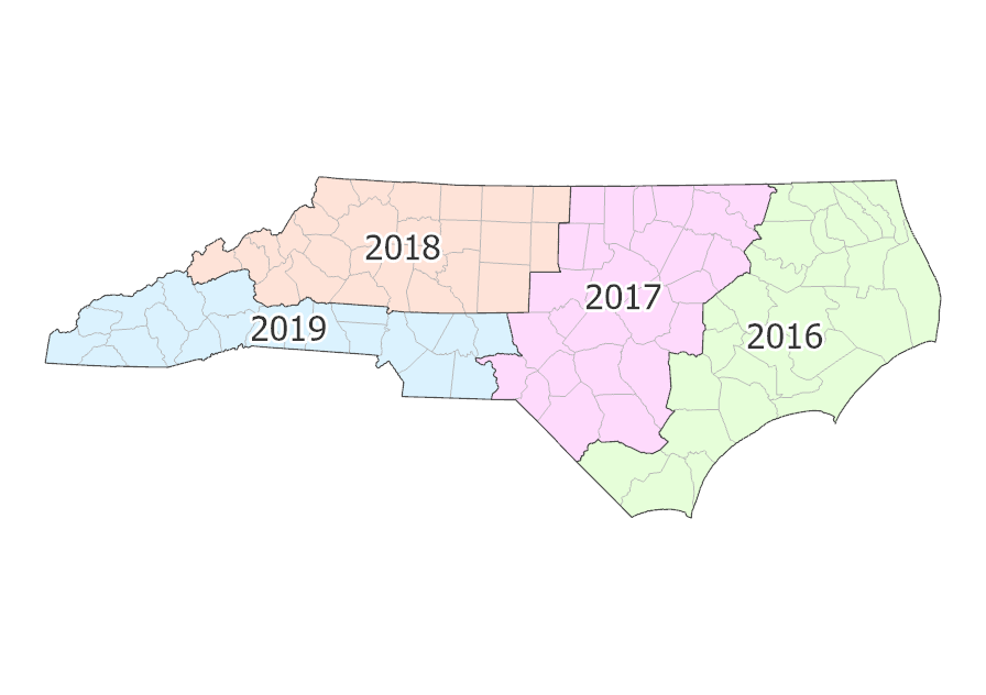
			"keyword": [
				"imagery",
				"orthoimagery",
				"NC",
				"North Carolina",
				"Department of Information Technology",
				"DIT",
				"CGIA",
				"Center for Geographic Information and Analysis",
				"imageryBaseMapsEarthCover",
				"photograph",
				"photo",
				"picture",
				"2016",
				"2017",
				"2018",
				"2019",
				"aerial"
			],
			"issued": "2026-01-14T17:14:30.000Z",
			"modified": "2026-01-30T16:55:57.000Z",
			"publisher": {
				"name": "NC OneMap / State of North Carolina"
			},
			"contactPoint": {
				"@type": "vcard:Contact",
				"fn": "nconemap",
				"hasEmail": "mailto:nconemap@its.nc.gov"
			},
			"accessLevel": "public",
			"spatial": "-84.4694,33.6790,-75.4041,36.6379",
			"license": "<div style='text-align:Left;'><div><div><p><span>Please refer to </span><a target='_blank' href='https://www.nconemap.gov:443/pages/terms' rel='nofollow ugc noopener noreferrer'><span><u>https://www.nconemap.gov/pages/terms</u></span></a>.</p><p>&nbsp;</p></div></div></div>",
			"distribution": [
				{
					"@type": "dcat:Distribution",
					"title": "ArcGIS Hub Dataset",
					"format": "Web Page",
					"mediaType": "text/html",
					"accessURL": "https://www.nconemap.gov/maps/nconemap::nc-orthoimagery-2016-2019-wms"
				},
				{
					"@type": "dcat:Distribution",
					"title": "ArcGIS GeoService",
					"format": "ArcGIS GeoServices REST API",
					"mediaType": "application/json",
					"accessURL": "https://services.nconemap.gov/secure/services/Imagery/Orthoimagery_2016_2019/ImageServer/WMSServer"
				}
			],
			"theme": [
				"geospatial"
			]
		},
		{
			"@type": "dcat:Dataset",
			"identifier": "https://www.arcgis.com/home/item.html?id=74e595b38a6a41b6a7a876531c24b730",
			"landingPage": "https://www.nconemap.gov/datasets/nconemap::nc-orthoimagery-2016-2019",
			"title": "NC Orthoimagery 2016-2019",
			"description": "<div><strong><u>NOTE:</u></strong>&nbsp;DO NOT DOWNLOAD THE IMAGERY BY USING THE MAP OR DOWNLOAD TOOLS ON THIS ARCGIS HUB ITEM PAGE. IT WILL RESULT IN A PIXELATED ORTHOIMAGE. INSTEAD, DOWNLOAD THE IMAGERY BY&nbsp;<a target='_blank' href='https://nconemap.maps.arcgis.com/apps/webappviewer/index.html?id=2c8a9b366c4841f1be2b464347d04a2b' rel='nofollow ugc noopener noreferrer'><strong>TILE</strong></a>&nbsp;OR BY&nbsp;<a target='_blank' href='https://www.nconemap.gov/#directdatadownloads' rel='nofollow ugc noopener noreferrer'>COUNTY&nbsp;MOSAIC</a>&nbsp;(2010 - current year).</div><div style='margin:0 auto; padding-bottom:2em; padding-top:2em; text-align:center; width:40%;'><figure style='margin:0;'><p><img style='box-shadow:0 4px 10px rgba(0, 0, 0, 0.25); height:auto; max-width:100%;' src='https://assets.nconemap.gov/img/orthoimagery-cycles-2016-2019.gif' alt='State map showing image project areas between 2020 and 2023' /></p><figcaption style='color:#555; font-size:14px; margin-top:3px;'>2016-2019 project areas</figcaption></figure></div><p>The <a target='_blank' href='https://nconemap.gov/pages/imagery' rel='nofollow ugc noopener noreferrer'>NC Orthoimagery Program</a> collects and produces 6-inch (15cm) orthoimagery on a 4-year cycle. Approximately a quarter of the state is flown each year to develop streaming imagery services, 5,000' by 5,000' tiles, and compressed single-file county mosaics. Beginning in 2020, the State started collecting a&nbsp;fourth band (near infrared) of imagery which, when combined with the other 3 bands of red, green, and blue, opens new possibilities for exploration and analysis.</p><p>This service contains 3-band, natural color imagery collected by the&nbsp;<a target='_blank' href='https://www.nconemap.gov/pages/imagery' rel='nofollow ugc noopener noreferrer'>NC Orthoimagery Program</a>&nbsp;for any given area of North Carolina between 2016 and 2019. The imagery has a pixel resolution of 6 inches with an RMSE of 1.0 ft X and Y.&nbsp;Individual pixel values may have been altered during image processing. Therefore, this service should be used for general reference and viewing. Image analysis requiring examination of individual pixel values is discouraged. This data is also available as a <a target='_blank' href='https://www.nconemap.gov/maps/a3d5873f22ea4d96a9260f13c0ff6d0c/explore?location=35.158450%2C-79.936750%2C7' rel='nofollow ugc noopener noreferrer'>WMS</a> service.&nbsp;</p><p>To find specific dates the images were captured use the&nbsp;<a target='_blank' href='https://nconemap.maps.arcgis.com/apps/webappviewer/index.html?id=888ed175c17744228f43d3b9107fdc5f' rel='nofollow ugc noopener noreferrer'>imagery dates&nbsp;app</a>&nbsp;or&nbsp;<a target='_blank' href='https://www.nconemap.gov/search?q=imagery%20seamlines' rel='nofollow ugc noopener noreferrer'>download the data</a>.</p><p><strong>Viewing the latest imagery</strong><br />Several web services are also available that depict the latest imagery for any location in the state.&nbsp; These support general viewing and raster analysis and are offered in various protocols including Esri (e.g. REST, SOAP) and OGC (e.g., WMS, WFS, WCS). These can be found by searching using the terms \"orthoimagery\" and \"latest.\" To help determine which is most suitable, refer to <a target='_blank' href='https://www.nconemap.gov/pages/announcements#post20251209' rel='nofollow ugc noopener noreferrer'>this guide</a>.</p>",
			"keyword": [
				"imagery",
				"orthoimagery",
				"NC",
				"North Carolina",
				"Department of Information Technology",
				"DIT",
				"CGIA",
				"Center for Geographic Information and Analysis",
				"imageryBaseMapsEarthCover",
				"photograph",
				"photo",
				"picture",
				"2016",
				"2017",
				"2018",
				"2019",
				"aerial"
			],
			"issued": "2026-01-14T17:10:07.000Z",
			"modified": "2026-01-30T16:54:03.000Z",
			"publisher": {
				"name": "NC OneMap / State of North Carolina"
			},
			"contactPoint": {
				"@type": "vcard:Contact",
				"fn": "nconemap",
				"hasEmail": "mailto:nconemap@its.nc.gov"
			},
			"accessLevel": "public",
			"spatial": "-84.2822,33.6790,-75.4041,36.5854",
			"license": "<div style='text-align:Left;'><div><div><p><span>Please refer to </span><a target='_blank' href='https://www.nconemap.gov:443/pages/terms' rel='nofollow ugc noopener noreferrer'><span><u>https://www.nconemap.gov/pages/terms</u></span></a>.</p><p>&nbsp;</p></div></div></div>",
			"distribution": [
				{
					"@type": "dcat:Distribution",
					"title": "ArcGIS Hub Dataset",
					"format": "Web Page",
					"mediaType": "text/html",
					"accessURL": "https://www.nconemap.gov/datasets/nconemap::nc-orthoimagery-2016-2019"
				},
				{
					"@type": "dcat:Distribution",
					"title": "ArcGIS GeoService",
					"format": "ArcGIS GeoServices REST API",
					"mediaType": "application/json",
					"accessURL": "https://services.nconemap.gov/secure/rest/services/Imagery/Orthoimagery_2016_2019/ImageServer"
				}
			],
			"theme": [
				"geospatial"
			]
		},
		{
			"@type": "dcat:Dataset",
			"identifier": "https://www.arcgis.com/home/item.html?id=cdedc87c59fb451b966a64982dc391c0",
			"landingPage": "https://www.nconemap.gov/maps/nconemap::nc-orthoimagery-2012-2015-wms",
			"title": "NC Orthoimagery 2012-2015 (WMS)",
			"description": "<div><strong><u>NOTE:</u></strong>&nbsp;DO NOT DOWNLOAD THE IMAGERY BY USING THE MAP OR DOWNLOAD TOOLS ON THIS ARCGIS HUB ITEM PAGE. IT WILL RESULT IN A PIXELATED ORTHOIMAGE. INSTEAD, DOWNLOAD THE IMAGERY BY&nbsp;<a target='_blank' href='https://nconemap.maps.arcgis.com/apps/webappviewer/index.html?id=2c8a9b366c4841f1be2b464347d04a2b' rel='nofollow ugc noopener noreferrer'><strong>TILE</strong></a>&nbsp;OR BY&nbsp;<a target='_blank' href='https://www.nconemap.gov/#directdatadownloads' rel='nofollow ugc noopener noreferrer'>COUNTY&nbsp;MOSAIC</a>&nbsp;(2010 - current year).</div><div style='margin:0 auto; padding-bottom:2em; padding-top:2em; text-align:center; width:40%;'><figure style='margin:0;'><p><img style='box-shadow:0 4px 10px rgba(0, 0, 0, 0.25); height:auto; max-width:100%;' src='https://assets.nconemap.gov/img/orthoimagery-cycles-2012-2015.gif' alt='State map showing image project areas between 2012 and 2015' /></p><figcaption style='color:#555; font-size:14px; margin-top:3px;'>2012-2015 project areas</figcaption></figure></div><p>The <a target='_blank' href='https://nconemap.gov/pages/imagery' rel='nofollow ugc noopener noreferrer'>NC Orthoimagery Program</a> collects and produces 6-inch (15cm) orthoimagery on a 4-year cycle. Approximately a quarter of the state is flown each year to develop streaming imagery services, 5,000' by 5,000' tiles, and compressed single-file county mosaics. Beginning in 2020, the State started collecting a&nbsp;fourth band (near infrared) of imagery which, when combined with the other 3 bands of red, green, and blue, opens new possibilities for exploration and analysis.</p><p>This service contains 3-band, natural color imagery collected by the&nbsp;<a target='_blank' href='https://www.nconemap.gov/pages/imagery' rel='nofollow ugc noopener noreferrer'>NC Orthoimagery Program</a>&nbsp;for any given area of North Carolina between 2012 and 2015. The imagery has a pixel resolution of 6 inches with an RMSE of 1.0 ft X and Y.&nbsp;Individual pixel values may have been altered during image processing. Therefore, this service should be used for general reference and viewing. This data is also available as an <a target='_blank' href='https://www.nconemap.gov/datasets/6c10b6cb9c314446b1cf5a836c2baf19/explore?location=35.168500%2C-79.926600%2C7' rel='nofollow ugc noopener noreferrer'>ArcGIS REST</a> service. Image analysis requiring examination of individual pixel values is discouraged.&nbsp;</p><p>To find specific dates the images were captured use the&nbsp;<a target='_blank' href='https://nconemap.maps.arcgis.com/apps/webappviewer/index.html?id=888ed175c17744228f43d3b9107fdc5f' rel='nofollow ugc noopener noreferrer'>imagery dates&nbsp;app</a>&nbsp;or&nbsp;<a target='_blank' href='https://www.nconemap.gov/search?q=imagery%20seamlines' rel='nofollow ugc noopener noreferrer'>download the data</a>.</p><p><strong>Viewing the latest imagery</strong><br />Several web services are also available that depict the latest imagery for any location in the state.&nbsp; These support general viewing and raster analysis and are offered in various protocols including Esri (e.g. REST, SOAP) and OGC (e.g., WMS, WFS, WCS). These can be found by searching using the terms \"orthoimagery\" and \"latest.\" To help determine which is most suitable, refer to <a target='_blank' href='https://www.nconemap.gov/pages/announcements#post20251209' rel='nofollow ugc noopener noreferrer'>this guide</a>.</p>",
			"keyword": [
				"imagery",
				"orthoimagery",
				"aerial",
				"NC",
				"North Carolina",
				"NC OneMap",
				"Department of Information Technology",
				"DIT",
				"CGIA",
				"NC Center for Geographic Information and Analysis",
				"imageryBaseMapsEarthCover",
				"photograph",
				"photo",
				"picture",
				"2012",
				"2013",
				"2014",
				"2015"
			],
			"issued": "2026-01-14T16:39:41.000Z",
			"modified": "2026-01-30T16:52:13.000Z",
			"publisher": {
				"name": "NC OneMap / State of North Carolina"
			},
			"contactPoint": {
				"@type": "vcard:Contact",
				"fn": "nconemap",
				"hasEmail": "mailto:nconemap@its.nc.gov"
			},
			"accessLevel": "public",
			"spatial": "-84.4465,33.7022,-75.4067,36.6348",
			"license": "<div style='text-align:Left;'><div><div><p><span>Please refer to </span><a target='_blank' href='https://www.nconemap.gov:443/pages/terms' rel='nofollow ugc noopener noreferrer'><span><u>https://www.nconemap.gov/pages/terms</u></span></a>.</p><p>&nbsp;</p></div></div></div>",
			"distribution": [
				{
					"@type": "dcat:Distribution",
					"title": "ArcGIS Hub Dataset",
					"format": "Web Page",
					"mediaType": "text/html",
					"accessURL": "https://www.nconemap.gov/maps/nconemap::nc-orthoimagery-2012-2015-wms"
				},
				{
					"@type": "dcat:Distribution",
					"title": "ArcGIS GeoService",
					"format": "ArcGIS GeoServices REST API",
					"mediaType": "application/json",
					"accessURL": "https://services.nconemap.gov/secure/services/Imagery/Orthoimagery_2012_2015/ImageServer/WMSServer"
				}
			],
			"theme": [
				"geospatial"
			]
		},
		{
			"@type": "dcat:Dataset",
			"identifier": "https://www.arcgis.com/home/item.html?id=6c10b6cb9c314446b1cf5a836c2baf19",
			"landingPage": "https://www.nconemap.gov/datasets/nconemap::nc-orthoimagery-2012-2015",
			"title": "NC Orthoimagery 2012-2015",
			"description": "<div><strong><u>NOTE:</u></strong>&nbsp;DO NOT DOWNLOAD THE IMAGERY BY USING THE MAP OR DOWNLOAD TOOLS ON THIS ARCGIS HUB ITEM PAGE. IT WILL RESULT IN A PIXELATED ORTHOIMAGE. INSTEAD, DOWNLOAD THE IMAGERY BY&nbsp;<a target='_blank' href='https://nconemap.maps.arcgis.com/apps/webappviewer/index.html?id=2c8a9b366c4841f1be2b464347d04a2b' rel='nofollow ugc noopener noreferrer'><strong>TILE</strong></a>&nbsp;OR BY&nbsp;<a target='_blank' href='https://www.nconemap.gov/#directdatadownloads' rel='nofollow ugc noopener noreferrer'>COUNTY&nbsp;MOSAIC</a>&nbsp;(2010 - current year).</div><div style='margin:0 auto; padding-bottom:2em; padding-top:2em; text-align:center; width:40%;'><figure style='margin:0;'><p><img style='box-shadow:0 4px 10px rgba(0, 0, 0, 0.25); height:auto; max-width:100%;' src='https://assets.nconemap.gov/img/orthoimagery-cycles-2012-2015.gif' alt='State map showing image project areas between 2012 and 2015' /></p><figcaption style='color:#555; font-size:14px; margin-top:3px;'>2012-2015 project areas</figcaption></figure></div><p>The <a target='_blank' href='https://nconemap.gov/pages/imagery' rel='nofollow ugc noopener noreferrer'>NC Orthoimagery Program</a> collects and produces 6-inch (15cm) orthoimagery on a 4-year cycle. Approximately a quarter of the state is flown each year to develop streaming imagery services, 5,000' by 5,000' tiles, and compressed single-file county mosaics. Beginning in 2020, the State started collecting a&nbsp;fourth band (near infrared) of imagery which, when combined with the other 3 bands of red, green, and blue, opens new possibilities for exploration and analysis.</p><p>This service contains 3-band, natural color imagery collected by the&nbsp;<a target='_blank' href='https://www.nconemap.gov/pages/imagery' rel='nofollow ugc noopener noreferrer'>NC Orthoimagery Program</a>&nbsp;for any given area of North Carolina between 2012 and 2015. The imagery has a pixel resolution of 6 inches with an RMSE of 1.0 ft X and Y.&nbsp;Individual pixel values may have been altered during image processing. Therefore, this service should be used for general reference and viewing. This data is also available as a <a target='_blank' href='https://www.nconemap.gov/maps/cdedc87c59fb451b966a64982dc391c0/explore?location=35.168500%2C-79.926600%2C7' rel='nofollow ugc noopener noreferrer'>WMS</a> service. Image analysis requiring examination of individual pixel values is discouraged.&nbsp;</p><p>To find specific dates the images were captured use the&nbsp;<a target='_blank' href='https://nconemap.maps.arcgis.com/apps/webappviewer/index.html?id=888ed175c17744228f43d3b9107fdc5f' rel='nofollow ugc noopener noreferrer'>imagery dates&nbsp;app</a>&nbsp;or&nbsp;<a target='_blank' href='https://www.nconemap.gov/search?q=imagery%20seamlines' rel='nofollow ugc noopener noreferrer'>download the data</a>.</p><p><strong>Viewing the latest imagery</strong><br />Several web services are also available that depict the latest imagery for any location in the state.&nbsp; These support general viewing and raster analysis and are offered in various protocols including Esri (e.g. REST, SOAP) and OGC (e.g., WMS, WFS, WCS). These can be found by searching using the terms \"orthoimagery\" and \"latest.\" To help determine which is most suitable, refer to <a target='_blank' href='https://www.nconemap.gov/pages/announcements#post20251209' rel='nofollow ugc noopener noreferrer'>this guide</a>.</p>",
			"keyword": [
				"imagery",
				"orthoimagery",
				"aerial",
				"NC",
				"North Carolina",
				"NC OneMap",
				"Department of Information Technology",
				"DIT",
				"CGIA",
				"imageryBaseMapsEarthCover",
				"photograph",
				"photo",
				"picture",
				"2012",
				"2013",
				"2014",
				"2015",
				"Center for Geographic Information and Analysis"
			],
			"issued": "2026-01-14T15:54:32.000Z",
			"modified": "2026-01-30T16:50:35.000Z",
			"publisher": {
				"name": "NC OneMap / State of North Carolina"
			},
			"contactPoint": {
				"@type": "vcard:Contact",
				"fn": "nconemap",
				"hasEmail": "mailto:nconemap@its.nc.gov"
			},
			"accessLevel": "public",
			"spatial": "-84.2617,33.7022,-75.4067,36.5823",
			"license": "<div style='text-align:Left;'><div><div><p><span>Please refer to </span><a target='_blank' href='https://www.nconemap.gov:443/pages/terms' rel='nofollow ugc noopener noreferrer'><span><u>https://www.nconemap.gov/pages/terms</u></span></a>.</p><p>&nbsp;</p></div></div></div>",
			"distribution": [
				{
					"@type": "dcat:Distribution",
					"title": "ArcGIS Hub Dataset",
					"format": "Web Page",
					"mediaType": "text/html",
					"accessURL": "https://www.nconemap.gov/datasets/nconemap::nc-orthoimagery-2012-2015"
				},
				{
					"@type": "dcat:Distribution",
					"title": "ArcGIS GeoService",
					"format": "ArcGIS GeoServices REST API",
					"mediaType": "application/json",
					"accessURL": "https://services.nconemap.gov/secure/rest/services/Imagery/Orthoimagery_2012_2015/ImageServer"
				}
			],
			"theme": [
				"geospatial"
			]
		},
		{
			"@type": "dcat:Dataset",
			"identifier": "https://www.arcgis.com/home/item.html?id=6ee7f3544fda4b8eb9d6eb3c6f6b236e",
			"landingPage": "https://www.nconemap.gov/maps/nconemap::nc-orthoimagery-latest-ndvi-wms",
			"title": "NC Orthoimagery Latest - NDVI (WMS)",
			"description": "<div><strong><u>NOTE:</u></strong>&nbsp;DO NOT DOWNLOAD THE IMAGERY BY USING THE MAP OR DOWNLOAD TOOLS ON THIS ARCGIS HUB ITEM PAGE. IT WILL RESULT IN A PIXELATED ORTHOIMAGE. INSTEAD, DOWNLOAD THE IMAGERY BY&nbsp;<a target='_blank' href='https://nconemap.maps.arcgis.com/apps/webappviewer/index.html?id=2c8a9b366c4841f1be2b464347d04a2b' rel='nofollow ugc noopener noreferrer'><strong>TILE</strong></a>&nbsp;OR BY&nbsp;<a target='_blank' href='https://www.nconemap.gov/#directdatadownloads' rel='nofollow ugc noopener noreferrer'>COUNTY&nbsp;MOSAIC</a>&nbsp;(2010 - current year).</div><p>&nbsp;</p><p>The <a target='_blank' href='https://nconemap.gov/pages/imagery' rel='nofollow ugc noopener noreferrer'>NC Orthoimagery Program</a> collects and produces 6-inch (15cm) orthoimagery on a 4-year cycle. Approximately a quarter of the state is flown each year to develop streaming imagery services, 5,000' by 5,000' tiles, and compressed single-file county mosaics. Beginning in 2020, the State started collecting a&nbsp;fourth band (near infrared) of imagery which, when combined with the other 3 bands of red, green, and blue, opens new possibilities for exploration and analysis.</p><p>This service contains most recent 4-band (RGB+NIR) imagery collected by the&nbsp;<a target='_blank' href='https://www.nconemap.gov/pages/imagery' rel='nofollow ugc noopener noreferrer'>NC Orthoimagery Program</a>&nbsp;for any given area of North Carolina and is depicted using the Normalized Difference Vegetation Index (NDVI). The imagery has a pixel resolution of 6 inches with an RMSE of 1.0 ft X and Y.&nbsp;The compression method (DEFLATE) used for this imagery maintains the individual pixel values so that this data is suitable for analyses. This data is also available as <a target='_blank' href='https://www.nconemap.gov/datasets/nconemap::nc-orthoimagery-latest-ndvi/about' rel='nofollow ugc noopener noreferrer'>ArcGIS REST</a> and <a target='_blank' href='https://www.nconemap.gov/content/079f9e6e2f2e444a9b74e86f3695a54c/about' rel='nofollow ugc noopener noreferrer'>WCS</a> services.</p><p>To find specific dates the images were captured use the&nbsp;<a target='_blank' href='https://nconemap.maps.arcgis.com/apps/webappviewer/index.html?id=888ed175c17744228f43d3b9107fdc5f' rel='nofollow ugc noopener noreferrer'>imagery dates&nbsp;app</a>&nbsp;or&nbsp;<a target='_blank' href='https://www.nconemap.gov/search?q=imagery%20seamlines' rel='nofollow ugc noopener noreferrer'>download the data</a>.</p><div><strong>About NDVI</strong><br />NDVI is useful for measuring the quality, density, and amount of vegetation in a particular area.&nbsp;It is a single band dataset that represents vegetation health, based on the difference between the red and near infrared bands. Red and orange pixels represent areas with no vegetation. Yellow pixels represent areas with low to moderate vegetation. Green pixels represent areas with high vegetation density and health.&nbsp;This data is provided as a web service only (no download).<br />&nbsp;</div><p><strong>Viewing the latest imagery</strong><br />Several web services are also available that depict the latest imagery for any location in the state.&nbsp; These support general viewing and raster analysis and are offered in various protocols including Esri (e.g. REST, SOAP) and OGC (e.g., WMS, WFS, WCS). These can be found by searching using the terms \"orthoimagery\" and \"latest.\" To help determine which is most suitable, refer to <a target='_blank' href='https://www.nconemap.gov/pages/announcements#post20251209' rel='nofollow ugc noopener noreferrer'>this guide</a>.</p>",
			"keyword": [
				"North Carolina NC Department of Information Technology",
				"DIT",
				"Center for Geographic Information and Analysis",
				"CGIA",
				"NC OneMap",
				"imagery",
				"aerial",
				"orthoimagery",
				"photograph",
				"photo",
				"picture",
				"imageryBaseMapsEarthCover",
				"NDVI",
				"vegetation",
				"index"
			],
			"issued": "2025-12-22T14:43:19.000Z",
			"modified": "2026-01-30T16:33:10.000Z",
			"publisher": {
				"name": "NC OneMap / State of North Carolina"
			},
			"contactPoint": {
				"@type": "vcard:Contact",
				"fn": "nconemap",
				"hasEmail": "mailto:nconemap@its.nc.gov"
			},
			"accessLevel": "public",
			"spatial": "-84.4465,33.7022,-75.4067,36.6348",
			"license": "<p>Please refer to <a target='_blank' href='https://www.nconemap.gov/pages/terms' rel='nofollow ugc noopener noreferrer'>https://www.nconemap.gov/pages/terms</a>.</p>",
			"distribution": [
				{
					"@type": "dcat:Distribution",
					"title": "ArcGIS Hub Dataset",
					"format": "Web Page",
					"mediaType": "text/html",
					"accessURL": "https://www.nconemap.gov/maps/nconemap::nc-orthoimagery-latest-ndvi-wms"
				},
				{
					"@type": "dcat:Distribution",
					"title": "ArcGIS GeoService",
					"format": "ArcGIS GeoServices REST API",
					"mediaType": "application/json",
					"accessURL": "https://services.nconemap.gov/secure/services/Imagery/Orthoimagery_Latest_NDVI/ImageServer/WMSServer"
				}
			],
			"theme": [
				"geospatial"
			]
		},
		{
			"@type": "dcat:Dataset",
			"identifier": "https://www.arcgis.com/home/item.html?id=079f9e6e2f2e444a9b74e86f3695a54c",
			"landingPage": "https://www.nconemap.gov/content/nconemap::nc-orthoimagery-latest-ndvi-wcs",
			"title": "NC Orthoimagery Latest - NDVI (WCS)",
			"description": "<div><strong><u>NOTE:</u></strong>&nbsp;DO NOT DOWNLOAD THE IMAGERY BY USING THE MAP OR DOWNLOAD TOOLS ON THIS ARCGIS HUB ITEM PAGE. IT WILL RESULT IN A PIXELATED ORTHOIMAGE. INSTEAD, DOWNLOAD THE IMAGERY BY&nbsp;<a target='_blank' href='https://nconemap.maps.arcgis.com/apps/webappviewer/index.html?id=2c8a9b366c4841f1be2b464347d04a2b' rel='nofollow ugc noopener noreferrer'><strong>TILE</strong></a>&nbsp;OR BY&nbsp;<a target='_blank' href='https://www.nconemap.gov/#directdatadownloads' rel='nofollow ugc noopener noreferrer'>COUNTY&nbsp;MOSAIC</a>&nbsp;(2010 - current year).</div><p>&nbsp;</p><p>The <a target='_blank' href='https://nconemap.gov/pages/imagery' rel='nofollow ugc noopener noreferrer'>NC Orthoimagery Program</a> collects and produces 6-inch (15cm) orthoimagery on a 4-year cycle. Approximately a quarter of the state is flown each year to develop streaming imagery services, 5,000' by 5,000' tiles, and compressed single-file county mosaics. Beginning in 2020, the State started collecting a&nbsp;fourth band (near infrared) of imagery which, when combined with the other 3 bands of red, green, and blue, opens new possibilities for exploration and analysis.</p><p>This service contains most recent 4-band (RGB+NIR) imagery collected by the&nbsp;<a target='_blank' href='https://www.nconemap.gov/pages/imagery' rel='nofollow ugc noopener noreferrer'>NC Orthoimagery Program</a>&nbsp;for any given area of North Carolina and is depicted using the Normalized Difference Vegetation Index (NDVI). The imagery has a pixel resolution of 6 inches with an RMSE of 1.0 ft X and Y.&nbsp;The compression method (DEFLATE) used for this imagery maintains the individual pixel values so that this data is suitable for analyses. This data is also available as <a target='_blank' href='https://www.nconemap.gov/datasets/nconemap::nc-orthoimagery-latest-ndvi/about' rel='nofollow ugc noopener noreferrer'>ArcGIS REST</a> and <a target='_blank' href='https://www.nconemap.gov/maps/nconemap::nc-orthoimagery-latest-ndvi-wms/about' rel='nofollow ugc noopener noreferrer'>WMS</a> services.</p><p>To find specific dates the images were captured use the&nbsp;<a target='_blank' href='https://nconemap.maps.arcgis.com/apps/webappviewer/index.html?id=888ed175c17744228f43d3b9107fdc5f' rel='nofollow ugc noopener noreferrer'>imagery dates&nbsp;app</a>&nbsp;or&nbsp;<a target='_blank' href='https://www.nconemap.gov/search?q=imagery%20seamlines' rel='nofollow ugc noopener noreferrer'>download the data</a>.</p><div><strong>About NDVI</strong><br />NDVI is useful for measuring the quality, density, and amount of vegetation in a particular area.&nbsp;It is a single band dataset that represents vegetation health, based on the difference between the red and near infrared bands. Red and orange pixels represent areas with no vegetation. Yellow pixels represent areas with low to moderate vegetation. Green pixels represent areas with high vegetation density and health.&nbsp;This data is provided as a web service only (no download).<br />&nbsp;</div><p><strong>Viewing the latest imagery</strong><br />Several web services are also available that depict the latest imagery for any location in the state.&nbsp; These support general viewing and raster analysis and are offered in various protocols including Esri (e.g. REST, SOAP) and OGC (e.g., WMS, WFS, WCS). These can be found by searching using the terms \"orthoimagery\" and \"latest.\" To help determine which is most suitable, refer to <a target='_blank' href='https://www.nconemap.gov/pages/announcements#post20251209' rel='nofollow ugc noopener noreferrer'>this guide</a>.</p>",
			"keyword": [
				"North Carolina NC Department of Information Technology",
				"DIT",
				"Center for Geographic Information and Analysis",
				"CGIA",
				"NC OneMap",
				"imagery",
				"aerial",
				"orthoimagery",
				"photograph",
				"photo",
				"picture",
				"imageryBaseMapsEarthCover",
				"NDVI",
				"vegetation",
				"index"
			],
			"issued": "2025-12-22T14:50:44.000Z",
			"modified": "2026-01-30T16:32:11.000Z",
			"publisher": {
				"name": "NC OneMap / State of North Carolina"
			},
			"contactPoint": {
				"@type": "vcard:Contact",
				"fn": "nconemap",
				"hasEmail": "mailto:nconemap@its.nc.gov"
			},
			"accessLevel": "public",
			"spatial": "-84.4465,33.7022,-75.4067,36.6348",
			"license": "<p>Please refer to <a target='_blank' href='https://www.nconemap.gov/pages/terms' rel='nofollow ugc noopener noreferrer'>https://www.nconemap.gov/pages/terms</a>.</p>",
			"distribution": [
				{
					"@type": "dcat:Distribution",
					"title": "ArcGIS Hub Dataset",
					"format": "Web Page",
					"mediaType": "text/html",
					"accessURL": "https://www.nconemap.gov/content/nconemap::nc-orthoimagery-latest-ndvi-wcs"
				},
				{
					"@type": "dcat:Distribution",
					"title": "ArcGIS GeoService",
					"format": "ArcGIS GeoServices REST API",
					"mediaType": "application/json",
					"accessURL": "https://services.nconemap.gov/secure/services/Imagery/Orthoimagery_Latest_NDVI/ImageServer/WCSServer"
				}
			],
			"theme": [
				"geospatial"
			]
		},
		{
			"@type": "dcat:Dataset",
			"identifier": "https://www.arcgis.com/home/item.html?id=3554093a66f945bca595910b3fde9198",
			"landingPage": "https://www.nconemap.gov/datasets/nconemap::nc-orthoimagery-latest-ndvi",
			"title": "NC Orthoimagery Latest - NDVI",
			"description": "<div><strong><u>NOTE:</u></strong>&nbsp;DO NOT DOWNLOAD THE IMAGERY BY USING THE MAP OR DOWNLOAD TOOLS ON THIS ARCGIS HUB ITEM PAGE. IT WILL RESULT IN A PIXELATED ORTHOIMAGE. INSTEAD, DOWNLOAD THE IMAGERY BY&nbsp;<a target='_blank' href='https://nconemap.maps.arcgis.com/apps/webappviewer/index.html?id=2c8a9b366c4841f1be2b464347d04a2b' rel='nofollow ugc noopener noreferrer'><strong>TILE</strong></a>&nbsp;OR BY&nbsp;<a target='_blank' href='https://www.nconemap.gov/#directdatadownloads' rel='nofollow ugc noopener noreferrer'>COUNTY&nbsp;MOSAIC</a>&nbsp;(2010 - current year).</div><p>&nbsp;</p><p>The <a target='_blank' href='https://nconemap.gov/pages/imagery' rel='nofollow ugc noopener noreferrer'>NC Orthoimagery Program</a> collects and produces 6-inch (15cm) orthoimagery on a 4-year cycle. Approximately a quarter of the state is flown each year to develop streaming imagery services, 5,000' by 5,000' tiles, and compressed single-file county mosaics. Beginning in 2020, the State started collecting a&nbsp;fourth band (near infrared) of imagery which, when combined with the other 3 bands of red, green, and blue, opens new possibilities for exploration and analysis.</p><p>This service contains most recent 4-band (RGB+NIR) imagery collected by the&nbsp;<a target='_blank' href='https://www.nconemap.gov/pages/imagery' rel='nofollow ugc noopener noreferrer'>NC Orthoimagery Program</a>&nbsp;for any given area of North Carolina and is depicted using the Normalized Difference Vegetation Index (NDVI). The imagery has a pixel resolution of 6 inches with an RMSE of 1.0 ft X and Y.&nbsp;The compression method (DEFLATE) used for this imagery maintains the individual pixel values so that this data is suitable for analyses. This data is also available as <a target='_blank' href='https://www.nconemap.gov/content/079f9e6e2f2e444a9b74e86f3695a54c/about' rel='nofollow ugc noopener noreferrer'>WCS</a> and <a target='_blank' href='https://www.nconemap.gov/maps/nconemap::nc-orthoimagery-latest-ndvi-wms/about' rel='nofollow ugc noopener noreferrer'>WMS</a> services.</p><p>To find specific dates the images were captured use the&nbsp;<a target='_blank' href='https://nconemap.maps.arcgis.com/apps/webappviewer/index.html?id=888ed175c17744228f43d3b9107fdc5f' rel='nofollow ugc noopener noreferrer'>imagery dates&nbsp;app</a>&nbsp;or&nbsp;<a target='_blank' href='https://www.nconemap.gov/search?q=imagery%20seamlines' rel='nofollow ugc noopener noreferrer'>download the data</a>.</p><div><strong>About NDVI</strong><br />NDVI is useful for measuring the quality, density, and amount of vegetation in a particular area.&nbsp;It is a single band dataset that represents vegetation health, based on the difference between the red and near infrared bands. Red and orange pixels represent areas with no vegetation. Yellow pixels represent areas with low to moderate vegetation. Green pixels represent areas with high vegetation density and health.&nbsp;This data is provided as a web service only (no download).<br />&nbsp;</div><p><strong>Viewing the latest imagery</strong><br />Several web services are also available that depict the latest imagery for any location in the state.&nbsp; These support general viewing and raster analysis and are offered in various protocols including Esri (e.g. REST, SOAP) and OGC (e.g., WMS, WFS, WCS). These can be found by searching using the terms \"orthoimagery\" and \"latest.\" To help determine which is most suitable, refer to <a target='_blank' href='https://www.nconemap.gov/pages/announcements#post20251209' rel='nofollow ugc noopener noreferrer'>this guide</a>.</p>",
			"keyword": [
				"North Carolina",
				"NC",
				"Department of Information Technology",
				"DIT",
				"Center for Geographic Information and Analysis",
				"CGIA",
				"NC OneMap",
				"imagery",
				"aerial",
				"orthoimagery",
				"photograph",
				"photo",
				"picture",
				"imageryBaseMapsEarthCover",
				"NDVI",
				"vegetation",
				"index"
			],
			"issued": "2020-12-10T20:45:14.000Z",
			"modified": "2024-02-12T00:00:00.000Z",
			"publisher": {
				"name": "NC OneMap / State of North Carolina"
			},
			"contactPoint": {
				"@type": "vcard:Contact",
				"fn": "nconemap",
				"hasEmail": "mailto:nconemap@its.nc.gov"
			},
			"accessLevel": "public",
			"spatial": "-84.2617,33.7022,-75.4067,36.5823",
			"license": "<p>Please refer to <a target='_blank' href='https://www.nconemap.gov/pages/terms' rel='nofollow ugc noopener noreferrer'>https://www.nconemap.gov/pages/terms</a>.</p>",
			"distribution": [
				{
					"@type": "dcat:Distribution",
					"title": "ArcGIS Hub Dataset",
					"format": "Web Page",
					"mediaType": "text/html",
					"accessURL": "https://www.nconemap.gov/datasets/nconemap::nc-orthoimagery-latest-ndvi"
				},
				{
					"@type": "dcat:Distribution",
					"title": "ArcGIS GeoService",
					"format": "ArcGIS GeoServices REST API",
					"mediaType": "application/json",
					"accessURL": "https://services.nconemap.gov/secure/rest/services/Imagery/Orthoimagery_Latest_NDVI/ImageServer"
				}
			],
			"theme": [
				"geospatial"
			]
		},
		{
			"@type": "dcat:Dataset",
			"identifier": "https://www.arcgis.com/home/item.html?id=1b0593c975ab4d188ea2d621c454ae41",
			"landingPage": "https://www.nconemap.gov/content/nconemap::nc-orthoimagery-latest-cir-wcs",
			"title": "NC Orthoimagery Latest - CIR (WCS)",
			"description": "<div><strong><u>NOTE:</u></strong>&nbsp;DO NOT DOWNLOAD THE IMAGERY BY USING THE MAP OR DOWNLOAD TOOLS ON THIS ARCGIS HUB ITEM PAGE. IT WILL RESULT IN A PIXELATED ORTHOIMAGE. INSTEAD, DOWNLOAD THE IMAGERY BY&nbsp;<a target='_blank' href='https://nconemap.maps.arcgis.com/apps/webappviewer/index.html?id=2c8a9b366c4841f1be2b464347d04a2b' rel='nofollow ugc noopener noreferrer'><strong>TILE</strong></a>&nbsp;OR BY&nbsp;<a target='_blank' href='https://www.nconemap.gov/#directdatadownloads' rel='nofollow ugc noopener noreferrer'>COUNTY&nbsp;MOSAIC</a>&nbsp;(2010 - current year).</div><p>&nbsp;</p><p>The <a target='_blank' href='https://nconemap.gov/pages/imagery' rel='nofollow ugc noopener noreferrer'>NC Orthoimagery Program</a> collects and produces 6-inch (15cm) orthoimagery on a 4-year cycle. Approximately a quarter of the state is flown each year to develop streaming imagery services, 5,000' by 5,000' tiles, and compressed single-file county mosaics. Beginning in 2020, the State started collecting a&nbsp;fourth band (near infrared) of imagery which, when combined with the other 3 bands of red, green, and blue, opens new possibilities for exploration and analysis.</p><p>This service contains most recent 4-band (RGB+NIR) imagery collected by the&nbsp;<a target='_blank' href='https://www.nconemap.gov/pages/imagery' rel='nofollow ugc noopener noreferrer'>NC Orthoimagery Program</a>&nbsp;for any given area of North Carolina between 2020 and 2023 and is depicted using color-infrared (CIR). The imagery has a pixel resolution of 6 inches with an RMSE of 1.0 ft X and Y.&nbsp;The compression method (DEFLATE) used for this imagery maintains the individual pixel values so that this data is suitable for analyses. This data is also available as <a target='_blank' href='https://www.nconemap.gov/content/1b0593c975ab4d188ea2d621c454ae41/about' rel='nofollow ugc noopener noreferrer'>WCS</a> and <a target='_blank' href='https://www.nconemap.gov/maps/nconemap::nc-orthoimagery-latest-cir-wms/about' rel='nofollow ugc noopener noreferrer'>WMS</a> services.</p><p>To find specific dates the images were captured use the&nbsp;<a target='_blank' href='https://nconemap.maps.arcgis.com/apps/webappviewer/index.html?id=888ed175c17744228f43d3b9107fdc5f' rel='nofollow ugc noopener noreferrer'>imagery dates&nbsp;app</a>&nbsp;or&nbsp;<a target='_blank' href='https://www.nconemap.gov/search?q=imagery%20seamlines' rel='nofollow ugc noopener noreferrer'>download the data</a>.</p><div><strong>About CIR</strong><br />CIR is useful for environmental and land use monitoring because they can highlight features that are not as easily visible in standard visible light photographs. Some examples include assessing the health of vegetation, assessing soil moisture, determining water quality, and identifying man-made features.<br />&nbsp;</div><p><strong>Viewing the latest imagery</strong><br />Several web services are also available that depict the latest imagery for any location in the state.&nbsp; These support general viewing and raster analysis and are offered in various protocols including Esri (e.g. REST, SOAP) and OGC (e.g., WMS, WFS, WCS). These can be found by searching using the terms \"orthoimagery\" and \"latest.\" To help determine which is most suitable, refer to <a target='_blank' href='https://www.nconemap.gov/pages/announcements#post20251209' rel='nofollow ugc noopener noreferrer'>this guide</a>.</p>",
			"keyword": [
				"imagery",
				"orthoimagery",
				"aerial",
				"NC",
				"North Carolina",
				"NC OneMap",
				"Department of Information Technology",
				"DIT",
				"CGIA",
				"Center for Geographic Information and Analysis",
				"imageryBaseMapsEarthCover",
				"photograph",
				"photo",
				"picture",
				"CIR",
				"infrared",
				"false color"
			],
			"issued": "2025-12-22T14:32:21.000Z",
			"modified": "2026-01-30T16:22:19.000Z",
			"publisher": {
				"name": "NC OneMap / State of North Carolina"
			},
			"contactPoint": {
				"@type": "vcard:Contact",
				"fn": "nconemap",
				"hasEmail": "mailto:nconemap@its.nc.gov"
			},
			"accessLevel": "public",
			"spatial": "-84.4465,33.7022,-75.4067,36.6348",
			"license": "<p>Please refer to <a target='_blank' href='https://www.nconemap.gov/pages/terms' rel='nofollow ugc noopener noreferrer'>https://www.nconemap.gov/pages/terms</a>.</p>",
			"distribution": [
				{
					"@type": "dcat:Distribution",
					"title": "ArcGIS Hub Dataset",
					"format": "Web Page",
					"mediaType": "text/html",
					"accessURL": "https://www.nconemap.gov/content/nconemap::nc-orthoimagery-latest-cir-wcs"
				},
				{
					"@type": "dcat:Distribution",
					"title": "ArcGIS GeoService",
					"format": "ArcGIS GeoServices REST API",
					"mediaType": "application/json",
					"accessURL": "https://services.nconemap.gov/secure/services/Imagery/Orthoimagery_Latest_CIR/ImageServer/WCSServer"
				}
			],
			"theme": [
				"geospatial"
			]
		},
		{
			"@type": "dcat:Dataset",
			"identifier": "https://www.arcgis.com/home/item.html?id=9d1184df4c314ab88fb2d998fec03d94",
			"landingPage": "https://www.nconemap.gov/maps/nconemap::nc-orthoimagery-latest-cir-wms",
			"title": "NC Orthoimagery Latest - CIR (WMS)",
			"description": "<div><strong><u>NOTE:</u></strong>&nbsp;DO NOT DOWNLOAD THE IMAGERY BY USING THE MAP OR DOWNLOAD TOOLS ON THIS ARCGIS HUB ITEM PAGE. IT WILL RESULT IN A PIXELATED ORTHOIMAGE. INSTEAD, DOWNLOAD THE IMAGERY BY&nbsp;<a target='_blank' href='https://nconemap.maps.arcgis.com/apps/webappviewer/index.html?id=2c8a9b366c4841f1be2b464347d04a2b' rel='nofollow ugc noopener noreferrer'><strong>TILE</strong></a>&nbsp;OR BY&nbsp;<a target='_blank' href='https://www.nconemap.gov/#directdatadownloads' rel='nofollow ugc noopener noreferrer'>COUNTY&nbsp;MOSAIC</a>&nbsp;(2010 - current year).</div><p>&nbsp;</p><p>The <a target='_blank' href='https://nconemap.gov/pages/imagery' rel='nofollow ugc noopener noreferrer'>NC Orthoimagery Program</a> collects and produces 6-inch (15cm) orthoimagery on a 4-year cycle. Approximately a quarter of the state is flown each year to develop streaming imagery services, 5,000' by 5,000' tiles, and compressed single-file county mosaics. Beginning in 2020, the State started collecting a&nbsp;fourth band (near infrared) of imagery which, when combined with the other 3 bands of red, green, and blue, opens new possibilities for exploration and analysis.</p><p>This service contains most recent 4-band (RGB+NIR) imagery collected by the&nbsp;<a target='_blank' href='https://www.nconemap.gov/pages/imagery' rel='nofollow ugc noopener noreferrer'>NC Orthoimagery Program</a>&nbsp;for any given area of North Carolina between 2020 and 2023 and is depicted using color-infrared (CIR). The imagery has a pixel resolution of 6 inches with an RMSE of 1.0 ft X and Y.&nbsp;The compression method (DEFLATE) used for this imagery maintains the individual pixel values so that this data is suitable for analyses. This data is also available as <a target='_blank' href='https://www.nconemap.gov/datasets/nconemap::nc-orthoimagery-latest-cir/about' rel='nofollow ugc noopener noreferrer'>ArcGIS REST</a> and <a target='_blank' href='https://www.nconemap.gov/content/1b0593c975ab4d188ea2d621c454ae41/about' rel='nofollow ugc noopener noreferrer'>WCS</a> services.</p><p>To find specific dates the images were captured use the&nbsp;<a target='_blank' href='https://nconemap.maps.arcgis.com/apps/webappviewer/index.html?id=888ed175c17744228f43d3b9107fdc5f' rel='nofollow ugc noopener noreferrer'>imagery dates&nbsp;app</a>&nbsp;or&nbsp;<a target='_blank' href='https://www.nconemap.gov/search?q=imagery%20seamlines' rel='nofollow ugc noopener noreferrer'>download the data</a>.</p><div><strong>About CIR</strong><br />CIR is useful for environmental and land use monitoring because they can highlight features that are not as easily visible in standard visible light photographs. Some examples include assessing the health of vegetation, assessing soil moisture, determining water quality, and identifying man-made features.<br />&nbsp;</div><p><strong>Viewing the latest imagery</strong><br />Several web services are also available that depict the latest imagery for any location in the state.&nbsp; These support general viewing and raster analysis and are offered in various protocols including Esri (e.g. REST, SOAP) and OGC (e.g., WMS, WFS, WCS). These can be found by searching using the terms \"orthoimagery\" and \"latest.\" To help determine which is most suitable, refer to <a target='_blank' href='https://www.nconemap.gov/pages/announcements#post20251209' rel='nofollow ugc noopener noreferrer'>this guide</a>.</p>",
			"keyword": [
				"imagery",
				"orthoimagery",
				"aerial",
				"NC",
				"North Carolina",
				"NC OneMap",
				"Department of Information Technology",
				"DIT",
				"CGIA",
				"Center for Geographic Information and Analysis",
				"imageryBaseMapsEarthCover",
				"photograph",
				"photo",
				"picture",
				"CIR",
				"infrared",
				"false color"
			],
			"issued": "2025-12-22T14:35:24.000Z",
			"modified": "2026-01-30T16:20:52.000Z",
			"publisher": {
				"name": "NC OneMap / State of North Carolina"
			},
			"contactPoint": {
				"@type": "vcard:Contact",
				"fn": "nconemap",
				"hasEmail": "mailto:nconemap@its.nc.gov"
			},
			"accessLevel": "public",
			"spatial": "-84.4465,33.7022,-75.4067,36.6348",
			"license": "<p>Please refer to <a target='_blank' href='https://www.nconemap.gov/pages/terms' rel='nofollow ugc noopener noreferrer'>https://www.nconemap.gov/pages/terms</a>.</p>",
			"distribution": [
				{
					"@type": "dcat:Distribution",
					"title": "ArcGIS Hub Dataset",
					"format": "Web Page",
					"mediaType": "text/html",
					"accessURL": "https://www.nconemap.gov/maps/nconemap::nc-orthoimagery-latest-cir-wms"
				},
				{
					"@type": "dcat:Distribution",
					"title": "ArcGIS GeoService",
					"format": "ArcGIS GeoServices REST API",
					"mediaType": "application/json",
					"accessURL": "https://services.nconemap.gov/secure/services/Imagery/Orthoimagery_Latest_CIR/ImageServer/WMSServer"
				}
			],
			"theme": [
				"geospatial"
			]
		},
		{
			"@type": "dcat:Dataset",
			"identifier": "https://www.arcgis.com/home/item.html?id=35baeff690de45f8b5f6f081f1542384",
			"landingPage": "https://www.nconemap.gov/datasets/nconemap::nc-orthoimagery-latest-cir",
			"title": "NC Orthoimagery Latest - CIR",
			"description": "<div><strong><u>NOTE:</u></strong>&nbsp;DO NOT DOWNLOAD THE IMAGERY BY USING THE MAP OR DOWNLOAD TOOLS ON THIS ARCGIS HUB ITEM PAGE. IT WILL RESULT IN A PIXELATED ORTHOIMAGE. INSTEAD, DOWNLOAD THE IMAGERY BY&nbsp;<a target='_blank' href='https://nconemap.maps.arcgis.com/apps/webappviewer/index.html?id=2c8a9b366c4841f1be2b464347d04a2b' rel='nofollow ugc noopener noreferrer'><strong>TILE</strong></a>&nbsp;OR BY&nbsp;<a target='_blank' href='https://www.nconemap.gov/#directdatadownloads' rel='nofollow ugc noopener noreferrer'>COUNTY&nbsp;MOSAIC</a>&nbsp;(2010 - current year).</div><p>&nbsp;</p><p>The <a target='_blank' href='https://nconemap.gov/pages/imagery' rel='nofollow ugc noopener noreferrer'>NC Orthoimagery Program</a> collects and produces 6-inch (15cm) orthoimagery on a 4-year cycle. Approximately a quarter of the state is flown each year to develop streaming imagery services, 5,000' by 5,000' tiles, and compressed single-file county mosaics. Beginning in 2020, the State started collecting a&nbsp;fourth band (near infrared) of imagery which, when combined with the other 3 bands of red, green, and blue, opens new possibilities for exploration and analysis.</p><p>This service contains most recent 4-band (RGB+NIR) imagery collected by the&nbsp;<a target='_blank' href='https://www.nconemap.gov/pages/imagery' rel='nofollow ugc noopener noreferrer'>NC Orthoimagery Program</a>&nbsp;for any given area of North Carolina between 2020 and 2023 and is depicted using color-infrared (CIR). The imagery has a pixel resolution of 6 inches with an RMSE of 1.0 ft X and Y.&nbsp;The compression method (DEFLATE) used for this imagery maintains the individual pixel values so that this data is suitable for analyses. This data is also available as <a target='_blank' href='https://www.nconemap.gov/content/1b0593c975ab4d188ea2d621c454ae41/about' rel='nofollow ugc noopener noreferrer'>WCS</a> and <a target='_blank' href='https://www.nconemap.gov/maps/nconemap::nc-orthoimagery-latest-cir-wms/about' rel='nofollow ugc noopener noreferrer'>WMS</a> services.</p><p>To find specific dates the images were captured use the&nbsp;<a target='_blank' href='https://nconemap.maps.arcgis.com/apps/webappviewer/index.html?id=888ed175c17744228f43d3b9107fdc5f' rel='nofollow ugc noopener noreferrer'>imagery dates&nbsp;app</a>&nbsp;or&nbsp;<a target='_blank' href='https://www.nconemap.gov/search?q=imagery%20seamlines' rel='nofollow ugc noopener noreferrer'>download the data</a>.</p><div><strong>About CIR</strong><br />CIR is useful for environmental and land use monitoring because they can highlight features that are not as easily visible in standard visible light photographs. Some examples include assessing the health of vegetation, assessing soil moisture, determining water quality, and identifying man-made features.<br />&nbsp;</div><p><strong>Viewing the latest imagery</strong><br />Several web services are also available that depict the latest imagery for any location in the state.&nbsp; These support general viewing and raster analysis and are offered in various protocols including Esri (e.g. REST, SOAP) and OGC (e.g., WMS, WFS, WCS). These can be found by searching using the terms \"orthoimagery\" and \"latest.\" To help determine which is most suitable, refer to <a target='_blank' href='https://www.nconemap.gov/pages/announcements#post20251209' rel='nofollow ugc noopener noreferrer'>this guide</a>.</p>",
			"keyword": [
				"North Carolina",
				"NC",
				"Department of Information Technology",
				"DIT",
				"Center for Geographic Information and Analysis",
				"CGIA",
				"NC OneMap",
				"imagery",
				"aerial",
				"orthoimagery",
				"photograph",
				"photo",
				"picture",
				"imageryBaseMapsEarthCover",
				"CIR",
				"infrared",
				"false color"
			],
			"issued": "2020-12-10T20:59:28.000Z",
			"modified": "2024-02-12T00:00:00.000Z",
			"publisher": {
				"name": "NC OneMap / State of North Carolina"
			},
			"contactPoint": {
				"@type": "vcard:Contact",
				"fn": "nconemap",
				"hasEmail": "mailto:nconemap@its.nc.gov"
			},
			"accessLevel": "public",
			"spatial": "-84.2617,33.7022,-75.4067,36.5823",
			"license": "<p>Please refer to <a target='_blank' href='https://www.nconemap.gov/pages/terms' rel='nofollow ugc noopener noreferrer'>https://www.nconemap.gov/pages/terms</a>.</p>",
			"distribution": [
				{
					"@type": "dcat:Distribution",
					"title": "ArcGIS Hub Dataset",
					"format": "Web Page",
					"mediaType": "text/html",
					"accessURL": "https://www.nconemap.gov/datasets/nconemap::nc-orthoimagery-latest-cir"
				},
				{
					"@type": "dcat:Distribution",
					"title": "ArcGIS GeoService",
					"format": "ArcGIS GeoServices REST API",
					"mediaType": "application/json",
					"accessURL": "https://services.nconemap.gov/secure/rest/services/Imagery/Orthoimagery_Latest_CIR/ImageServer"
				}
			],
			"theme": [
				"geospatial"
			]
		},
		{
			"@type": "dcat:Dataset",
			"identifier": "https://www.arcgis.com/home/item.html?id=ca00b8a90d484822861fbf6ddddc29f4",
			"landingPage": "https://www.nconemap.gov/content/nconemap::nc-orthoimagery-latest-analysis-wcs",
			"title": "NC Orthoimagery Latest - Analysis (WCS)",
			"description": "<p>The <a target='_blank' href='https://nconemap.gov/pages/imagery' rel='nofollow ugc noopener noreferrer'>NC Orthoimagery Program</a> collects and produces 6-inch (15cm) orthoimagery on a 4-year cycle. Approximately a quarter of the state is flown each year to develop streaming imagery services, 5,000' by 5,000' tiles, and compressed single-file county mosaics. Beginning in 2020, the State started collecting a fourth band (near infrared) of imagery which, when combined with the other 3 bands of red, green, and blue, opens new possibilities for exploration and analysis.&nbsp;</p><p>The <i>NC Orthoimagery - Analysis (WCS)</i> image service uses the most recent 4-band imagery collected for any location in North Carolina to depict a 3-band, natural color representation of the data. The compression method (DEFLATE) used for this imagery minimizes the alteration of individual pixel values so that this data may be used for analyses. The imagery has a pixel resolution of 6 inches with an RMSE of 1.0 ft X and Y. This data is also available as <a target='_blank' href='https://www.nconemap.gov/datasets/nconemap::nc-orthoimagery-latest-analysis/about' rel='nofollow ugc noopener noreferrer'>ArcGIS REST</a><a target='_blank' href='https://www.nconemap.gov/content/143d02c375c3471798b0d03742cc3b9a/about' rel='nofollow ugc noopener noreferrer'> </a>and <a target='_blank' href='https://www.nconemap.gov/maps/nconemap::nc-orthoimagery-latest-analysis-wms/about' rel='nofollow ugc noopener noreferrer'>WMS</a> services.</p><p><strong>Viewing the latest imagery</strong><br />Several web services are also available that depict the latest imagery for any location in the state.&nbsp; These support general viewing and raster analysis and are offered in various protocols including Esri (e.g. REST, SOAP) and OGC (e.g., WMS, WFS, WCS). These can be found by searching using the terms \"orthoimagery\" and \"latest.\" To help determine which is most suitable, refer to <a target='_blank' href='https://www.nconemap.gov/pages/announcements#post20251209' rel='nofollow ugc noopener noreferrer'>this guide</a>.</p>",
			"keyword": [
				"North Carolina",
				"NC",
				"Department of Information Technology",
				"DIT",
				"CGIA",
				"Center for Geographic Information and Analysis",
				"NC OneMap",
				"imagery",
				"aerial",
				"orthoimagery",
				"photograph",
				"photo"
			],
			"issued": "2025-12-09T21:14:18.000Z",
			"modified": "2026-01-30T16:17:26.000Z",
			"publisher": {
				"name": "NC OneMap / State of North Carolina"
			},
			"contactPoint": {
				"@type": "vcard:Contact",
				"fn": "nconemap",
				"hasEmail": "mailto:nconemap@its.nc.gov"
			},
			"accessLevel": "public",
			"spatial": "-84.4465,33.7022,-75.4067,36.6348",
			"license": "<p>Please refer to <a target='_blank' href='https://www.nconemap.gov/pages/terms' rel='nofollow ugc noopener noreferrer'>https://www.nconemap.gov/pages/terms</a>.</p>",
			"distribution": [
				{
					"@type": "dcat:Distribution",
					"title": "ArcGIS Hub Dataset",
					"format": "Web Page",
					"mediaType": "text/html",
					"accessURL": "https://www.nconemap.gov/content/nconemap::nc-orthoimagery-latest-analysis-wcs"
				},
				{
					"@type": "dcat:Distribution",
					"title": "ArcGIS GeoService",
					"format": "ArcGIS GeoServices REST API",
					"mediaType": "application/json",
					"accessURL": "https://services.nconemap.gov/secure/services/Imagery/Orthoimagery_Latest_Analysis/ImageServer/WCSServer"
				}
			],
			"theme": [
				"geospatial"
			]
		},
		{
			"@type": "dcat:Dataset",
			"identifier": "https://www.arcgis.com/home/item.html?id=7060ca2477f6433da31360b51feef979",
			"landingPage": "https://www.nconemap.gov/maps/nconemap::nc-orthoimagery-2007-wms",
			"title": "NC Orthoimagery 2007 (WMS)",
			"description": "This service represents orthoimagery collected in 2007 for the state of North Carolina. The coverage area and pixel resolution varies for each year.  Individual pixel values have been altered during image processing. Therefore, this service should be used for general reference and viewing. Image analysis requiring examination of individual pixel values is discouraged. <div><br /></div><div>Counties included in this service are:</div><div><div><ul><li>Beaufort</li><li>Craven</li><li>Dare</li><li>Davie</li><li>Franklin</li><li>Greensboro</li><li>Henderson</li><li>Hoke</li><li>Moore</li><li>Raleigh</li><li>Randolph</li><li>Rockingham</li><li>Tyrrell</li><li>Union</li><li>Yadkin</li></ul><div><br /></div></div></div>",
			"keyword": [
				"imagery",
				"orthoimagery",
				"2007",
				"aerial",
				"NC",
				"North Carolina",
				"NC OneMap",
				"Department of Information Technology",
				"DIT",
				"Center for Geographic Information and Analysis",
				"CGIA",
				"imageryBaseMapsEarthCover",
				"photograph",
				"photo",
				"picture"
			],
			"issued": "2025-04-07T20:48:05.000Z",
			"modified": "2025-12-19T20:01:05.000Z",
			"publisher": {
				"name": "NC OneMap / State of North Carolina"
			},
			"contactPoint": {
				"@type": "vcard:Contact",
				"fn": "nconemap",
				"hasEmail": "mailto:nconemap@its.nc.gov"
			},
			"accessLevel": "public",
			"spatial": "0.0000,0.0000,0.0000,0.0000",
			"license": "https://nconemap.gov/pages/terms",
			"distribution": [
				{
					"@type": "dcat:Distribution",
					"title": "ArcGIS Hub Dataset",
					"format": "Web Page",
					"mediaType": "text/html",
					"accessURL": "https://www.nconemap.gov/maps/nconemap::nc-orthoimagery-2007-wms"
				},
				{
					"@type": "dcat:Distribution",
					"title": "ArcGIS GeoService",
					"format": "ArcGIS GeoServices REST API",
					"mediaType": "application/json",
					"accessURL": "https://services.gis.nc.gov/secure/services/Imagery/Orthoimagery_2007/ImageServer/WMSServer"
				}
			],
			"theme": [
				"geospatial"
			]
		},
		{
			"@type": "dcat:Dataset",
			"identifier": "https://www.arcgis.com/home/item.html?id=af8ee2859adc47bd85cac01a6a94ee14",
			"landingPage": "https://www.nconemap.gov/datasets/nconemap::artificial-reef-sonar-scans",
			"title": "Artificial Reef Sonar Scans",
			"description": "<div style='text-align:Left;'><div><div><p><span>All side scan sonar imagery was captured by 1200 kHz and 600 kHz single frequency towfish manufactured by Chesapeake Technology. All post processing was done through SonarWeb and SonarWiz software and performed by NCDMF Staff. Collection of all field data was performed by NCDMF staff between the years 2000 and 2015.</span></p></div></div></div>",
			"keyword": [
				"habitat",
				"NC DMF",
				"fishing",
				"oyster sanctuaries",
				"web guide",
				"NC oyster sanctuary program",
				"Artificial Reef Program",
				"artificial",
				"NCDMF",
				"reefs",
				"diving",
				"oysters",
				"Artificial Reef",
				"NC artificial reef",
				"oyster",
				"biota",
				"NC",
				"North Carolina",
				"Department of Information Technology",
				"DIT",
				"Center for Geographic Information and Analysis",
				"CGIA",
				"NC OneMap"
			],
			"issued": "2016-12-09T15:46:51.000Z",
			"modified": "2023-03-22T15:44:29.000Z",
			"publisher": {
				"name": "NC CGIA"
			},
			"contactPoint": {
				"@type": "vcard:Contact",
				"fn": "nconemap",
				"hasEmail": "mailto:nconemap@its.nc.gov"
			},
			"accessLevel": "public",
			"spatial": "-78.3823,33.3844,-75.3829,36.0070",
			"license": "https://www.nconemap.gov/pages/terms",
			"distribution": [
				{
					"@type": "dcat:Distribution",
					"title": "ArcGIS Hub Dataset",
					"format": "Web Page",
					"mediaType": "text/html",
					"accessURL": "https://www.nconemap.gov/datasets/nconemap::artificial-reef-sonar-scans"
				},
				{
					"@type": "dcat:Distribution",
					"title": "ArcGIS GeoService",
					"format": "ArcGIS GeoServices REST API",
					"mediaType": "application/json",
					"accessURL": "https://services.nconemap.gov/secure/rest/services/Artificial_Reef_Sonar_Scans/ImageServer"
				}
			],
			"theme": [
				"geospatial"
			]
		},
		{
			"@type": "dcat:Dataset",
			"identifier": "https://www.arcgis.com/home/item.html?id=ba10a4fbe3ad483faf4eda024a20950d",
			"landingPage": "https://www.nconemap.gov/maps/nconemap::nc-orthoimagery-latest-analysis-wms",
			"title": "NC Orthoimagery Latest - Analysis (WMS)",
			"description": "<p>The <a target='_blank' href='https://nconemap.gov/pages/imagery' rel='nofollow ugc noopener noreferrer'>NC Orthoimagery Program</a> collects and produces 6-inch (15cm) orthoimagery on a 4-year cycle. Approximately a quarter of the state is flown each year to develop streaming imagery services, 5,000' by 5,000' tiles, and compressed single-file county mosaics. Beginning in 2020, the State started collecting a fourth band (near infrared) of imagery which, when combined with the other 3 bands of red, green, and blue, opens new possibilities for exploration and analysis.&nbsp;</p><p>The <i>NC Orthoimagery - Analysis (WMS)</i> image service uses the most recent 4-band imagery collected for any location in North Carolina to depict a 3-band, natural color representation of the data. The compression method (DEFLATE) used for this imagery minimizes the alteration of individual pixel values so that this data may be used for analyses. The imagery has a pixel resolution of 6 inches with an RMSE of 1.0 ft X and Y. This data is also available as <a target='_blank' href='https://www.nconemap.gov/datasets/nconemap::nc-orthoimagery-latest-analysis/about' rel='nofollow ugc noopener noreferrer'>ArcGIS REST</a> and <a target='_blank' href='https://www.nconemap.gov/content/143d02c375c3471798b0d03742cc3b9a/about' rel='nofollow ugc noopener noreferrer'>WCS</a> services.</p><p><strong>Viewing the latest imagery</strong><br />Several web services are also available that depict the latest imagery for any location in the state.&nbsp; These support general viewing and raster analysis and are offered in various protocols including Esri (e.g. REST, SOAP) and OGC (e.g., WMS, WFS, WCS). These can be found by searching using the terms \"orthoimagery\" and \"latest.\" To help determine which is most suitable, refer to <a target='_blank' href='https://www.nconemap.gov/pages/announcements#post20251209' rel='nofollow ugc noopener noreferrer'>this guide</a>.</p>",
			"keyword": [
				"North Carolina",
				"NC",
				"Department of Information Technology",
				"DIT",
				"CGIA",
				"Center for Geographic Information and Analysis",
				"NC OneMap",
				"imagery",
				"aerial",
				"orthoimagery",
				"photograph",
				"photo",
				"picture",
				"imageryBaseMapsEarthCover"
			],
			"issued": "2025-12-09T20:57:34.000Z",
			"modified": "2026-01-30T16:16:58.000Z",
			"publisher": {
				"name": "NC OneMap / State of North Carolina"
			},
			"contactPoint": {
				"@type": "vcard:Contact",
				"fn": "nconemap",
				"hasEmail": "mailto:nconemap@its.nc.gov"
			},
			"accessLevel": "public",
			"spatial": "-84.4465,33.6986,-75.3964,36.6348",
			"license": "<p><a target='_blank' href='https://www.nconemap.gov/pages/terms' rel='nofollow ugc noopener noreferrer'>https://www.nconemap.gov/pages/terms</a></p>",
			"distribution": [
				{
					"@type": "dcat:Distribution",
					"title": "ArcGIS Hub Dataset",
					"format": "Web Page",
					"mediaType": "text/html",
					"accessURL": "https://www.nconemap.gov/maps/nconemap::nc-orthoimagery-latest-analysis-wms"
				},
				{
					"@type": "dcat:Distribution",
					"title": "ArcGIS GeoService",
					"format": "ArcGIS GeoServices REST API",
					"mediaType": "application/json",
					"accessURL": "https://services.nconemap.gov/secure/services/Imagery/Orthoimagery_Latest_Analysis/ImageServer/WMSServer"
				}
			],
			"theme": [
				"geospatial"
			]
		},
		{
			"@type": "dcat:Dataset",
			"identifier": "https://www.arcgis.com/home/item.html?id=70e3d496a7304faeba8a6fd30ff923ba",
			"landingPage": "https://www.nconemap.gov/datasets/nconemap::nc-orthoimagery-latest-analysis",
			"title": "NC Orthoimagery Latest - Analysis",
			"description": "<p>The <a target='_blank' href='https://nconemap.gov/pages/imagery' rel='nofollow ugc noopener noreferrer'>NC Orthoimagery Program</a> collects and produces 6-inch (15cm) orthoimagery on a 4-year cycle. Approximately a quarter of the state is flown each year to develop streaming imagery services, 5,000' by 5,000' tiles, and compressed single-file county mosaics. Beginning in 2020, the State started collecting a fourth band (near infrared) of imagery which, when combined with the other 3 bands of red, green, and blue, opens new possibilities for exploration and analysis.&nbsp;</p><p>The <i>NC Orthoimagery - Analysis </i>image service uses the most recent 4-band imagery collected for any location in North Carolina to depict a 3-band, natural color representation of the data. The compression method (DEFLATE) used for this imagery minimizes the alteration of individual pixel values so that this data may be used for analyses. The imagery has a pixel resolution of 6 inches with an RMSE of 1.0 ft X and Y. This data is also available as <a target='_blank' href='https://www.nconemap.gov/content/143d02c375c3471798b0d03742cc3b9a/about' rel='nofollow ugc noopener noreferrer'>WCS</a> and <a target='_blank' href='https://www.nconemap.gov/maps/nconemap::nc-orthoimagery-latest-analysis-wms/about' rel='nofollow ugc noopener noreferrer'>WMS</a> services.</p><p><strong>Viewing the latest imagery</strong><br />Several web services are also available that depict the latest imagery for any location in the state.&nbsp; These support general viewing and raster analysis and are offered in various protocols including Esri (e.g. REST, SOAP) and OGC (e.g., WMS, WFS, WCS). These can be found by searching using the terms \"orthoimagery\" and \"latest.\" To help determine which is most suitable, refer to <a target='_blank' href='https://www.nconemap.gov/pages/announcements#post20251209' rel='nofollow ugc noopener noreferrer'>this guide</a>.</p>",
			"keyword": [
				"North Carolina",
				"NC",
				"Department of Information Technology",
				"DIT",
				"Center for Geographic Information and Analysis",
				"CGIA",
				"NC OneMap",
				"imagery",
				"aerial",
				"orthoimagery",
				"photograph",
				"photo",
				"picture",
				"imageryBaseMapsEarthCover"
			],
			"issued": "2022-09-26T14:36:24.000Z",
			"modified": "2024-02-12T00:00:00.000Z",
			"publisher": {
				"name": "NC OneMap / State of North Carolina"
			},
			"contactPoint": {
				"@type": "vcard:Contact",
				"fn": "nconemap",
				"hasEmail": "mailto:nconemap@its.nc.gov"
			},
			"accessLevel": "public",
			"spatial": "-84.2617,33.7022,-75.4067,36.5823",
			"license": "<p>Please refer to<a target='_blank' href='https://www.nconemap.gov/pages/terms' rel='nofollow ugc noopener noreferrer'> https://www.nconemap.gov/pages/terms</a>.</p>",
			"distribution": [
				{
					"@type": "dcat:Distribution",
					"title": "ArcGIS Hub Dataset",
					"format": "Web Page",
					"mediaType": "text/html",
					"accessURL": "https://www.nconemap.gov/datasets/nconemap::nc-orthoimagery-latest-analysis"
				},
				{
					"@type": "dcat:Distribution",
					"title": "ArcGIS GeoService",
					"format": "ArcGIS GeoServices REST API",
					"mediaType": "application/json",
					"accessURL": "https://services.nconemap.gov/secure/rest/services/Imagery/Orthoimagery_Latest_Analysis/ImageServer"
				}
			],
			"theme": [
				"geospatial"
			]
		},
		{
			"@type": "dcat:Dataset",
			"identifier": "https://www.arcgis.com/home/item.html?id=540ce490c0d34ff5974d96eed842dc17",
			"landingPage": "https://www.nconemap.gov/maps/nconemap::nc-latest-orthoimagery-wms",
			"title": "NC Latest Orthoimagery (WMS)",
			"description": "<div><strong><u>NOTE:</u></strong>&nbsp;DO NOT DOWNLOAD THE IMAGERY BY USING THE MAP OR DOWNLOAD TOOLS ON THIS ARCGIS HUB ITEM PAGE. IT WILL RESULT IN A PIXELATED ORTHOIMAGE. INSTEAD, DOWNLOAD THE IMAGERY BY&nbsp;<a target='_blank' href='https://nconemap.maps.arcgis.com/apps/webappviewer/index.html?id=2c8a9b366c4841f1be2b464347d04a2b' rel='nofollow ugc noopener noreferrer'><strong>TILE</strong></a>&nbsp;OR BY&nbsp;<a target='_blank' href='https://www.nconemap.gov/#directdatadownloads' rel='nofollow ugc noopener noreferrer'>COUNTY&nbsp;MOSAIC</a>&nbsp;(2010 - current year).</div><div>&nbsp;</div><p>The <a target='_blank' href='https://nconemap.gov/pages/imagery' rel='nofollow ugc noopener noreferrer'>NC Orthoimagery Program</a> collects and produces 6-inch (15cm) orthoimagery on a 4-year cycle. Approximately a quarter of the state is flown each year to develop streaming imagery services, 5,000' by 5,000' tiles, and compressed single-file county mosaics. Beginning in 2020, the State started collecting a fourth band (near infrared) of imagery which, when combined with the other 3 bands of red, green, and blue, opens new possibilities for exploration and analysis.</p><p>The <i>Orthoimagery Latest</i> image service uses the most recent imagery collected for any location in North Carolina to depict a 3-band, natural color representation of the data. The imagery has a pixel resolution of 6 inches with an RMSE of 1.0 ft X and Y. Pixel values have been altered during processing so this data is best suited for general or background viewing and should not be used for raster analysis. This data is also available as an <a target='_blank' href='https://www.nconemap.gov/datasets/nconemap::nc-latest-orthoimagery/about' rel='nofollow ugc noopener noreferrer'>ArcGIS REST</a> service.</p><p><strong>Viewing the latest imagery</strong><br />Several web services are also available that depict the latest imagery for any location in the state.&nbsp; These support general viewing and raster analysis and are offered in various protocols including Esri (e.g. REST, SOAP) and OGC (e.g., WMS, WFS, WCS). These can be found by searching using the terms \"orthoimagery\" and \"latest.\" To help determine which is most suitable, refer to <a target='_blank' href='https://www.nconemap.gov/pages/announcements#post20251209' rel='nofollow ugc noopener noreferrer'>this guide</a>.</p>",
			"keyword": [
				"imagery",
				"orthoimagery",
				"aerial",
				"NC",
				"North Carolina",
				"NC OneMap",
				"Department of Information Technology",
				"DIT",
				"CGIA",
				"Center for Geographic Information and Analysis",
				"imageryBaseMapsEarthCover",
				"photograph",
				"photo",
				"picture",
				"mosaics",
				"tiles"
			],
			"issued": "2025-12-09T20:31:13.000Z",
			"modified": "2026-01-30T16:15:54.000Z",
			"publisher": {
				"name": "NC OneMap / State of North Carolina"
			},
			"contactPoint": {
				"@type": "vcard:Contact",
				"fn": "nconemap",
				"hasEmail": "mailto:nconemap@its.nc.gov"
			},
			"accessLevel": "public",
			"spatial": "-84.4465,33.6986,-75.3964,36.6348",
			"license": "<p><a target='_blank' href='https://www.nconemap.gov/pages/terms' rel='nofollow ugc noopener noreferrer'>https://www.nconemap.gov/pages/terms</a></p>",
			"distribution": [
				{
					"@type": "dcat:Distribution",
					"title": "ArcGIS Hub Dataset",
					"format": "Web Page",
					"mediaType": "text/html",
					"accessURL": "https://www.nconemap.gov/maps/nconemap::nc-latest-orthoimagery-wms"
				},
				{
					"@type": "dcat:Distribution",
					"title": "ArcGIS GeoService",
					"format": "ArcGIS GeoServices REST API",
					"mediaType": "application/json",
					"accessURL": "https://services.nconemap.gov/secure/services/Imagery/Orthoimagery_Latest/ImageServer/WMSServer"
				}
			],
			"theme": [
				"geospatial"
			]
		},
		{
			"@type": "dcat:Dataset",
			"identifier": "https://www.arcgis.com/home/item.html?id=c5b316f805ab4d74bf7b598220ac5558",
			"landingPage": "https://www.nconemap.gov/datasets/nconemap::nc-latest-orthoimagery",
			"title": "NC Latest Orthoimagery",
			"description": "<div><strong><u>NOTE:</u></strong>&nbsp;DO NOT DOWNLOAD THE IMAGERY BY USING THE MAP OR DOWNLOAD TOOLS ON THIS ARCGIS HUB ITEM PAGE. IT WILL RESULT IN A PIXELATED ORTHOIMAGE. INSTEAD, DOWNLOAD THE IMAGERY BY&nbsp;<a target='_blank' href='https://nconemap.maps.arcgis.com/apps/webappviewer/index.html?id=2c8a9b366c4841f1be2b464347d04a2b' rel='nofollow ugc noopener noreferrer'><strong>TILE</strong></a>&nbsp;OR BY&nbsp;<a target='_blank' href='https://www.nconemap.gov/#directdatadownloads' rel='nofollow ugc noopener noreferrer'>COUNTY&nbsp;MOSAIC</a>&nbsp;(2010 - current year).</div><div>&nbsp;</div><p>The <a target='_blank' href='https://nconemap.gov/pages/imagery' rel='nofollow ugc noopener noreferrer'>NC Orthoimagery Program</a> collects and produces 6-inch (15cm) orthoimagery on a 4-year cycle. Approximately a quarter of the state is flown each year to develop streaming imagery services, 5,000' by 5,000' tiles, and compressed single-file county mosaics. Beginning in 2020, the State started collecting a fourth band (near infrared) of imagery which, when combined with the other 3 bands of red, green, and blue, opens new possibilities for exploration and analysis.</p><p>The <i>Orthoimagery Latest</i> image service uses the most recent imagery collected for any location in North Carolina to depict a 3-band, natural color representation of the data. The imagery has a pixel resolution of 6 inches with an RMSE of 1.0 ft X and Y. Pixel values have been altered during processing so this data is best suited for general or background viewing and should not be used for raster analysis. This data is also available as <a target='_blank' href='https://www.nconemap.gov/content/143d02c375c3471798b0d03742cc3b9a/about' rel='nofollow ugc noopener noreferrer'>a </a><a target='_blank' href='https://www.nconemap.gov/maps/nconemap::nc-latest-orthoimagery-wms/about' rel='nofollow ugc noopener noreferrer'>WMS</a> service.</p><p><strong>Viewing the latest imagery</strong><br />Several web services are also available that depict the latest imagery for any location in the state.&nbsp; These support general viewing and raster analysis and are offered in various protocols including Esri (e.g. REST, SOAP) and OGC (e.g., WMS, WFS, WCS). These can be found by searching using the terms \"orthoimagery\" and \"latest.\" To help determine which is most suitable, refer to <a target='_blank' href='https://www.nconemap.gov/pages/announcements#post20251209' rel='nofollow ugc noopener noreferrer'>this guide</a>.</p>",
			"keyword": [
				"imagery",
				"orthoimagery",
				"aerial",
				"NC",
				"North Carolina",
				"NC OneMap",
				"Department of Information Technology",
				"DIT",
				"Center for Geographic Information and Analysis",
				"CGIA",
				"imageryBaseMapsEarthCover",
				"photograph",
				"photo",
				"picture",
				"tiles",
				"mosaics"
			],
			"issued": "2016-12-09T15:22:46.000Z",
			"modified": "2024-02-13T00:00:00.000Z",
			"publisher": {
				"name": "NC OneMap / State of North Carolina"
			},
			"contactPoint": {
				"@type": "vcard:Contact",
				"fn": "nconemap",
				"hasEmail": "mailto:nconemap@its.nc.gov"
			},
			"accessLevel": "public",
			"spatial": "-84.2822,33.6790,-75.3963,36.5851",
			"license": "<p><a target='_blank' href='https://www.nconemap.gov/pages/terms' rel='nofollow ugc noopener noreferrer'>https://www.nconemap.gov/pages/terms</a></p>",
			"distribution": [
				{
					"@type": "dcat:Distribution",
					"title": "ArcGIS Hub Dataset",
					"format": "Web Page",
					"mediaType": "text/html",
					"accessURL": "https://www.nconemap.gov/datasets/nconemap::nc-latest-orthoimagery"
				},
				{
					"@type": "dcat:Distribution",
					"title": "ArcGIS GeoService",
					"format": "ArcGIS GeoServices REST API",
					"mediaType": "application/json",
					"accessURL": "https://services.nconemap.gov/secure/rest/services/Imagery/Orthoimagery_Latest/ImageServer"
				},
				{
					"@type": "dcat:Distribution",
					"title": "County Orthoimagery Mosaic Download",
					"format": null,
					"accessURL": "https://assets.nconemap.gov/pages/hub/file-downloads-min.html",
					"description": "Download the imagery for a county as a single file"
				},
				{
					"@type": "dcat:Distribution",
					"title": "Download Imagery by Tile",
					"format": null,
					"accessURL": "https://nconemap.maps.arcgis.com/apps/webappviewer/index.html?id=2c8a9b366c4841f1be2b464347d04a2b",
					"description": null
				},
				{
					"@type": "dcat:Distribution",
					"title": "OGC WMS GetCapabilities",
					"format": null,
					"accessURL": "https://services.nconemap.gov/secure/services/Imagery/Orthoimagery_Latest/ImageServer/WMSServer?REQUEST=GetCapabilities",
					"description": null
				}
			],
			"theme": [
				"geospatial"
			]
		},
		{
			"@type": "dcat:Dataset",
			"identifier": "https://www.arcgis.com/home/item.html?id=dcb73c080a144fd1bf5e972f037ca688",
			"landingPage": "https://www.nconemap.gov/maps/nconemap::-1993-nc-digital-ortho-quarter-quad-imagery-usgs-wms",
			"title": " 1993 NC Digital Ortho Quarter-Quad Imagery USGS  (WMS)",
			"description": "<p>These digital images of aerial photographs have had the displacements caused by the camera and terrain removed. Each image represents 1/4 of a standard USGS 7.5 minute quadrangle map extent. The images are black and white, compressed .jpg format, 256 radiometric brightness levels-of-grey and contain no attributes. The original uncompressed format files are in .bip. The images were flown in 1993 - 1995 as conditions and photo quality allowed. The images have a resolution of 1 ground meter and have been pixel rectified to create a spatially accurate image.</p>",
			"keyword": [
				"imageryBaseMapsEarthCover",
				"imagery",
				"orthophoto",
				"doqq",
				"aerial",
				"North Carolina",
				"ortho",
				"NC",
				"NC OneMap",
				"Department of Information Technology",
				"DIT",
				"CGIA",
				"Center for Geographic Information and Analysis"
			],
			"issued": "2025-12-19T15:55:40.000Z",
			"modified": "2026-01-26T20:05:03.000Z",
			"publisher": {
				"name": "NC OneMap / State of North Carolina"
			},
			"contactPoint": {
				"@type": "vcard:Contact",
				"fn": "nconemap",
				"hasEmail": "mailto:nconemap@its.nc.gov"
			},
			"accessLevel": "public",
			"spatial": "-84.4822,33.6951,-75.3878,36.6557",
			"license": "<p>Please refer to <a target='_blank' href='https://www.nconemap.gov/pages/terms' rel='nofollow ugc noopener noreferrer'>https://www.nconemap.gov/pages/terms</a>.</p>",
			"distribution": [
				{
					"@type": "dcat:Distribution",
					"title": "ArcGIS Hub Dataset",
					"format": "Web Page",
					"mediaType": "text/html",
					"accessURL": "https://www.nconemap.gov/maps/nconemap::-1993-nc-digital-ortho-quarter-quad-imagery-usgs-wms"
				},
				{
					"@type": "dcat:Distribution",
					"title": "ArcGIS GeoService",
					"format": "ArcGIS GeoServices REST API",
					"mediaType": "application/json",
					"accessURL": "https://services.nconemap.gov/secure/services/Imagery/DOQQ_NC_1993/ImageServer/WMSServer"
				}
			],
			"theme": [
				"geospatial"
			]
		},
		{
			"@type": "dcat:Dataset",
			"identifier": "https://www.arcgis.com/home/item.html?id=fe0bd6c850c24da9ad06c87f1b261b48",
			"landingPage": "https://www.nconemap.gov/apps/nconemap::nc-onemap-ortho-flight-seam-lines-with-imagery-acquisition-dates",
			"title": "NC OneMap Ortho Flight/Seam Lines with Imagery Acquisition Dates",
			"description": "This web application shows the flight/seam lines with acquisition dates for the aerial imagery captured from the <a href='https://www.nconemap.gov/pages/imagery' target='_blank' rel='nofollow ugc noopener noreferrer'>NC Statewide Orthoimagery Program</a>.",
			"keyword": [
				"ortho",
				"imagery",
				"flight lines",
				"seam lines",
				"image date",
				"image dates",
				"aerial dates",
				"photo dates",
				"ortho dates",
				"imageryBaseMapsEarthCover",
				"NC",
				"North Carolina",
				"NC OneMap",
				"Department of Information Technology",
				"DIT",
				"Center for Geographic Information and Analysis",
				"CGIA"
			],
			"issued": "2025-03-10T18:41:05.000Z",
			"modified": "2026-01-23T18:48:11.000Z",
			"publisher": {
				"name": "NC OneMap / State of North Carolina"
			},
			"contactPoint": {
				"@type": "vcard:Contact",
				"fn": "nconemap",
				"hasEmail": "mailto:nconemap@its.nc.gov"
			},
			"accessLevel": "public",
			"spatial": "-84.3970,33.7812,-75.3979,36.6547",
			"license": "<span style='font-family:&quot;Avenir Next W01&quot;, &quot;Avenir Next W00&quot;, &quot;Avenir Next&quot;, Avenir, &quot;Helvetica Neue&quot;, sans-serif; font-size:16px;'>https://www.nconemap.gov/pages/terms</span>",
			"distribution": [
				{
					"@type": "dcat:Distribution",
					"title": "ArcGIS Hub Dataset",
					"format": "Web Page",
					"mediaType": "text/html",
					"accessURL": "https://www.nconemap.gov/apps/nconemap::nc-onemap-ortho-flight-seam-lines-with-imagery-acquisition-dates"
				},
				{
					"@type": "dcat:Distribution",
					"title": "ArcGIS GeoService",
					"format": "ArcGIS GeoServices REST API",
					"mediaType": "application/json",
					"accessURL": "https://experience.arcgis.com/experience/fe0bd6c850c24da9ad06c87f1b261b48"
				}
			],
			"theme": [
				"geospatial"
			]
		},
		{
			"@type": "dcat:Dataset",
			"identifier": "https://www.arcgis.com/home/item.html?id=8c1136e01d2a468ca3728178ed4b48b7&sublayer=2",
			"landingPage": "https://www.nconemap.gov/maps/nconemap::forest-health",
			"title": "Forest Health",
			"description": "<div style=\"text-align:Left;\"><div><p><span>Threats to Forest Health (FIGURE 1b-4) The Forest Health Priority map shows areas of North Carolina currently at a moderate to high risk of damage from insects and diseases, both native and/or established and imminent invasive threats. The specific pests used to develop this map are as follows: southern pine beetle, littleleaf disease, annosus root rot, fusiform rust, hemlock woolly adelgid, balsam woolly adelgid, beech bark disease, redbay ambrosia beetlelaurel wilt, emerald ash borer, Asian longhorned beetle, and sirex woodwasp. As the map shows, both rural and urban landscapes across the state will likely see negative impacts from these pests. Although climate change is an important factor in modeling future impacts to forest health, much of the data is very coarse and was consequently left out of this analysis.</span></p><p><span>Download dataset </span><a target=\"_blank\" rel=\"noopener noreferrer\" href=\"https://dit-cgia-gis-data.s3.us-east-1.amazonaws.com/NCOM-data/forest/forest_health.zip\"><span>here</span></a><span>.</span></p></div></div>",
			"keyword": [
				"environment",
				"Environment",
				"Response",
				"Disease",
				"Hazards",
				"Ecology",
				"Insects",
				"Management",
				"Natural Resources",
				"United States",
				"Land",
				"Risk",
				"Modeling",
				"NC",
				"North Carolina",
				"Department of Information Technology",
				"DIT",
				"Center for Geographic Information and Analysis",
				"CGIA",
				"NC OneMap"
			],
			"issued": "2017-01-12T19:47:22.000Z",
			"modified": "2026-01-22T18:31:28.000Z",
			"publisher": {
				"name": "NC Division of Forest Resources, Central Office (CO) GIS Program"
			},
			"contactPoint": {
				"@type": "vcard:Contact",
				"fn": "nconemap",
				"hasEmail": "mailto:nconemap@its.nc.gov"
			},
			"accessLevel": "public",
			"spatial": "-84.2258,33.4918,-75.0558,36.5543",
			"license": "https://www.nconemap.gov/pages/terms",
			"distribution": [
				{
					"@type": "dcat:Distribution",
					"title": "ArcGIS Hub Dataset",
					"format": "Web Page",
					"mediaType": "text/html",
					"accessURL": "https://www.nconemap.gov/maps/nconemap::forest-health"
				},
				{
					"@type": "dcat:Distribution",
					"title": "ArcGIS GeoService",
					"format": "ArcGIS GeoServices REST API",
					"mediaType": "application/json",
					"accessURL": "https://services.nconemap.gov/secure/rest/services/NC1Map_Environment/MapServer/2"
				},
				{
					"@type": "dcat:Distribution",
					"title": "OGC WMS",
					"format": "OGC WMS",
					"mediaType": "application/vnd.ogc.wms_xml",
					"accessURL": "https://services.nconemap.gov/secure/services/NC1Map_Environment/MapServer/WMSServer?request=GetCapabilities&service=WMS"
				},
				{
					"@type": "dcat:Distribution",
					"title": "CSV",
					"format": "CSV",
					"mediaType": "text/csv",
					"accessURL": "https://www.nconemap.gov/api/download/v1/items/8c1136e01d2a468ca3728178ed4b48b7/csv?layers=2"
				},
				{
					"@type": "dcat:Distribution",
					"title": "Shapefile",
					"format": "ZIP",
					"mediaType": "application/zip",
					"accessURL": "https://www.nconemap.gov/api/download/v1/items/8c1136e01d2a468ca3728178ed4b48b7/shapefile?layers=2"
				},
				{
					"@type": "dcat:Distribution",
					"title": "GeoJSON",
					"format": "GeoJSON",
					"mediaType": "application/vnd.geo+json",
					"accessURL": "https://www.nconemap.gov/api/download/v1/items/8c1136e01d2a468ca3728178ed4b48b7/geojson?layers=2"
				},
				{
					"@type": "dcat:Distribution",
					"title": "KML",
					"format": "KML",
					"mediaType": "application/vnd.google-earth.kml+xml",
					"accessURL": "https://www.nconemap.gov/api/download/v1/items/8c1136e01d2a468ca3728178ed4b48b7/kml?layers=2"
				},
				{
					"@type": "dcat:Distribution",
					"title": null,
					"format": null,
					"accessURL": "http://www.ncforestservice.gov",
					"description": null
				},
				{
					"@type": "dcat:Distribution",
					"title": "Download Forest Health",
					"format": "HTTPS",
					"accessURL": "https://dit-cgia-gis-data.s3.us-east-1.amazonaws.com/NCOM-data/forest/forest_health.zip",
					"description": "Download Forest Health"
				}
			],
			"theme": [
				"geospatial"
			]
		},
		{
			"@type": "dcat:Dataset",
			"identifier": "https://www.arcgis.com/home/item.html?id=72c8953ed7df4a5e9f8ee3ede0e54ba8&sublayer=3",
			"landingPage": "https://www.nconemap.gov/maps/nconemap::rural-forest-landscape",
			"title": "Rural Forest Landscape",
			"description": "<div style=\"text-align:Left;\"><div><p><span>Rural Forest Priority Landscapes (FIGURE 1b-6) The Rural Forest Priority Landscapes map shows areas of North Carolina where forestry is an especially significant part of the rural landscape. Forestlands in these areas provide valuable benefits, such as the protection of critical water quality resources, wildlife habitat for threatened and endangered species, and viable economic options for landowners. Threats to forest health and productivity through insect and disease pests and wildfire are especially significant in these areas. Threats here have the potential to disrupt ecological systems depended upon by all NC inhabitants. Much of the priority rural forest acreage is in the NC coastal plain and mountains, though significant priority area exists in the Uwharrie Mountains, sandhills, and northern tier areas of the piedmont.</span></p><p><span>Download dataset </span><a target=\"_blank\" rel=\"noopener noreferrer\" href=\"https://dit-cgia-gis-data.s3.us-east-1.amazonaws.com/NCOM-data/forest/rural_forest_landscape.zip\"><span>here</span></a><span>.</span></p></div></div>",
			"keyword": [
				"Ecosystem",
				"environment",
				"Environment",
				"Response",
				"Hazards",
				"Ecology",
				"Conservation",
				"Management",
				"Natural Resources",
				"United States",
				"Land",
				"Risk",
				"Human",
				"Modeling",
				"Rural landscape",
				"NC",
				"North Carolina",
				"Department of Information Technology",
				"DIT",
				"Center for Geographic Information and Analysis",
				"CGIA",
				"NC OneMap"
			],
			"issued": "2017-01-12T19:49:03.000Z",
			"modified": "2026-01-22T18:25:51.000Z",
			"publisher": {
				"name": "NC Division of Forest Resources, Central Office (CO) GIS Program"
			},
			"contactPoint": {
				"@type": "vcard:Contact",
				"fn": "nconemap",
				"hasEmail": "mailto:nconemap@its.nc.gov"
			},
			"accessLevel": "public",
			"spatial": "-84.2258,33.4918,-75.0555,36.5546",
			"license": "https://www.nconemap.gov/pages/terms",
			"distribution": [
				{
					"@type": "dcat:Distribution",
					"title": "ArcGIS Hub Dataset",
					"format": "Web Page",
					"mediaType": "text/html",
					"accessURL": "https://www.nconemap.gov/maps/nconemap::rural-forest-landscape"
				},
				{
					"@type": "dcat:Distribution",
					"title": "ArcGIS GeoService",
					"format": "ArcGIS GeoServices REST API",
					"mediaType": "application/json",
					"accessURL": "https://services.nconemap.gov/secure/rest/services/NC1Map_Environment/MapServer/3"
				},
				{
					"@type": "dcat:Distribution",
					"title": "OGC WMS",
					"format": "OGC WMS",
					"mediaType": "application/vnd.ogc.wms_xml",
					"accessURL": "https://services.nconemap.gov/secure/services/NC1Map_Environment/MapServer/WMSServer?request=GetCapabilities&service=WMS"
				},
				{
					"@type": "dcat:Distribution",
					"title": "CSV",
					"format": "CSV",
					"mediaType": "text/csv",
					"accessURL": "https://www.nconemap.gov/api/download/v1/items/72c8953ed7df4a5e9f8ee3ede0e54ba8/csv?layers=3"
				},
				{
					"@type": "dcat:Distribution",
					"title": "Shapefile",
					"format": "ZIP",
					"mediaType": "application/zip",
					"accessURL": "https://www.nconemap.gov/api/download/v1/items/72c8953ed7df4a5e9f8ee3ede0e54ba8/shapefile?layers=3"
				},
				{
					"@type": "dcat:Distribution",
					"title": "GeoJSON",
					"format": "GeoJSON",
					"mediaType": "application/vnd.geo+json",
					"accessURL": "https://www.nconemap.gov/api/download/v1/items/72c8953ed7df4a5e9f8ee3ede0e54ba8/geojson?layers=3"
				},
				{
					"@type": "dcat:Distribution",
					"title": "KML",
					"format": "KML",
					"mediaType": "application/vnd.google-earth.kml+xml",
					"accessURL": "https://www.nconemap.gov/api/download/v1/items/72c8953ed7df4a5e9f8ee3ede0e54ba8/kml?layers=3"
				},
				{
					"@type": "dcat:Distribution",
					"title": null,
					"format": null,
					"accessURL": "http://www.ncforestservice.gov",
					"description": null
				},
				{
					"@type": "dcat:Distribution",
					"title": "Download Rural Forest Landscape",
					"format": "HTTPS",
					"accessURL": "https://dit-cgia-gis-data.s3.us-east-1.amazonaws.com/NCOM-data/forest/rural_forest_landscape.zip",
					"description": "Download Rural Forest Landscape"
				}
			],
			"theme": [
				"geospatial"
			]
		},
		{
			"@type": "dcat:Dataset",
			"identifier": "https://www.arcgis.com/home/item.html?id=bd9ab2c803bd4751828701e2ded4c5d3&sublayer=4",
			"landingPage": "https://www.nconemap.gov/maps/nconemap::urban-forest-landscape",
			"title": "Urban Forest Landscape",
			"description": "<div style='text-align:Left;'><div><div><p><span>Urban Forest Landscape Priority (FIGURE 1b-7) The Urban Forest Landscape Priority map complements the Maintaining Viable Urban Forests map (FIGURE 1b-5) by adding layers from these maps that have an urban component: Conserving Working Forestlands (FIGURE 1b-2), Protecting Forests and Communities from Wildfire Risk (FIGURE 1b-3), and Forest Health Priority (FIGURE 1b-4). Wildland-urban interface areas have inherent urban components, and many of these areas need intervention to reduce wildfire risk. Improving water quality is a commonly cited reason for maintaining urban tree canopy. Forest insects and diseases spread regardless of what is urban forest and what is rural; indeed, many invasive pests become established first in urban areas due to the easy movement afforded by dense transportation networks. Much of the forestland delineated as priority in this map are tracts of less than 14 acres. Parcelization and fragmentation are issues that must be addressed to effectively manage these forests.</span></p><p><span>Download dataset </span><a target='_blank' href='https://dit-cgia-gis-data.s3.us-east-1.amazonaws.com/NCOM-data/forest/urban_forest_landscape.zip' rel='nofollow ugc noopener noreferrer'><span>here</span></a><span>.</span></p></div></div></div>",
			"keyword": [
				"Ecosystem",
				"environment",
				"Environment",
				"Response",
				"Hazards",
				"Ecology",
				"Conservation",
				"Management",
				"Urban forest",
				"Natural Resources",
				"United States",
				"Land",
				"Risk",
				"Human",
				"Modeling",
				"Urban",
				"NC",
				"North Carolina",
				"Department of Information Technology",
				"DIT",
				"Center for Geographic Information and Analysis",
				"CGIA",
				"NC OneMap"
			],
			"issued": "2017-01-12T19:49:40.000Z",
			"modified": "2026-01-22T18:19:35.000Z",
			"publisher": {
				"name": "NC Division of Forest Resources, Central Office (CO) GIS Program"
			},
			"contactPoint": {
				"@type": "vcard:Contact",
				"fn": "nconemap",
				"hasEmail": "mailto:nconemap@its.nc.gov"
			},
			"accessLevel": "public",
			"spatial": "-84.2258,33.4918,-75.0679,36.5544",
			"license": "https://www.nconemap.gov/pages/terms",
			"distribution": [
				{
					"@type": "dcat:Distribution",
					"title": "ArcGIS Hub Dataset",
					"format": "Web Page",
					"mediaType": "text/html",
					"accessURL": "https://www.nconemap.gov/maps/nconemap::urban-forest-landscape"
				},
				{
					"@type": "dcat:Distribution",
					"title": "ArcGIS GeoService",
					"format": "ArcGIS GeoServices REST API",
					"mediaType": "application/json",
					"accessURL": "https://services.nconemap.gov/secure/rest/services/NC1Map_Environment/MapServer/4"
				},
				{
					"@type": "dcat:Distribution",
					"title": "OGC WMS",
					"format": "OGC WMS",
					"mediaType": "application/vnd.ogc.wms_xml",
					"accessURL": "https://services.nconemap.gov/secure/services/NC1Map_Environment/MapServer/WMSServer?request=GetCapabilities&service=WMS"
				},
				{
					"@type": "dcat:Distribution",
					"title": "CSV",
					"format": "CSV",
					"mediaType": "text/csv",
					"accessURL": "https://www.nconemap.gov/api/download/v1/items/bd9ab2c803bd4751828701e2ded4c5d3/csv?layers=4"
				},
				{
					"@type": "dcat:Distribution",
					"title": "Shapefile",
					"format": "ZIP",
					"mediaType": "application/zip",
					"accessURL": "https://www.nconemap.gov/api/download/v1/items/bd9ab2c803bd4751828701e2ded4c5d3/shapefile?layers=4"
				},
				{
					"@type": "dcat:Distribution",
					"title": "GeoJSON",
					"format": "GeoJSON",
					"mediaType": "application/vnd.geo+json",
					"accessURL": "https://www.nconemap.gov/api/download/v1/items/bd9ab2c803bd4751828701e2ded4c5d3/geojson?layers=4"
				},
				{
					"@type": "dcat:Distribution",
					"title": "KML",
					"format": "KML",
					"mediaType": "application/vnd.google-earth.kml+xml",
					"accessURL": "https://www.nconemap.gov/api/download/v1/items/bd9ab2c803bd4751828701e2ded4c5d3/kml?layers=4"
				},
				{
					"@type": "dcat:Distribution",
					"title": null,
					"format": null,
					"accessURL": "http://www.ncforestservice.gov",
					"description": null
				},
				{
					"@type": "dcat:Distribution",
					"title": "Download Urban Forest Landscape",
					"format": "HTTPS",
					"accessURL": "https://dit-cgia-gis-data.s3.us-east-1.amazonaws.com/NCOM-data/forest/urban_forest_landscape.zip",
					"description": "Download Urban Forest Landscape"
				}
			],
			"theme": [
				"geospatial"
			]
		},
		{
			"@type": "dcat:Dataset",
			"identifier": "https://www.arcgis.com/home/item.html?id=5e20770426fd497981871223868aea6c&sublayer=5",
			"landingPage": "https://www.nconemap.gov/maps/nconemap::urban-forest-priority",
			"title": "Urban Forest Priority",
			"description": "<div style=\"text-align:Left;\"><div><p><span>Maintaining Viable Urban Forests (FIGURE 1b-5) The Maintaining Viable Urban Forests map shows areas of North Carolina that are essential for restoring, conserving, and maintaining healthy urban trees and forests. These lands are experiencing rapid urbanization, increased amounts of impervious surface, and a higher number of catastrophic storm events, while also having tree canopy potential to offset the negative impacts of land-use change. These urban forestlands also have high values for energy conservation and improved air quality. Many municipalities within the priority areas manage their urban forests with limited resources and lack one or more of the components necessary for a sustained community forestry program. Coordinated planning and management of urban forests across jurisdictional boundaries will require new partnerships and initiatives at municipal, county, and statewide levels.</span></p><p><span>Download dataset </span><a target=\"_blank\" rel=\"noopener noreferrer\" href=\"https://dit-cgia-gis-data.s3.us-east-1.amazonaws.com/NCOM-data/forest/urban_forest_priority.zip\"><span>here</span></a><span>.</span></p></div></div>",
			"keyword": [
				"Ecosystem",
				"environment",
				"Environment",
				"Response",
				"Ecology",
				"Conservation",
				"Management",
				"Urban forest",
				"Natural Resources",
				"United States",
				"Land",
				"Risk",
				"Human",
				"Modeling",
				"Urban",
				"NC",
				"North Carolina",
				"Department of Information Technology",
				"DIT",
				"Center for Geographic Information and Analysis",
				"CGIA",
				"NC OneMap"
			],
			"issued": "2017-01-12T19:50:22.000Z",
			"modified": "2026-01-22T18:08:45.000Z",
			"publisher": {
				"name": "NC Division of Forest Resources, Central Office (CO) GIS Program"
			},
			"contactPoint": {
				"@type": "vcard:Contact",
				"fn": "nconemap",
				"hasEmail": "mailto:nconemap@its.nc.gov"
			},
			"accessLevel": "public",
			"spatial": "-84.2258,33.4918,-75.0558,36.5543",
			"license": "https://www.nconemap.gov/pages/terms",
			"distribution": [
				{
					"@type": "dcat:Distribution",
					"title": "ArcGIS Hub Dataset",
					"format": "Web Page",
					"mediaType": "text/html",
					"accessURL": "https://www.nconemap.gov/maps/nconemap::urban-forest-priority"
				},
				{
					"@type": "dcat:Distribution",
					"title": "ArcGIS GeoService",
					"format": "ArcGIS GeoServices REST API",
					"mediaType": "application/json",
					"accessURL": "https://services.nconemap.gov/secure/rest/services/NC1Map_Environment/MapServer/5"
				},
				{
					"@type": "dcat:Distribution",
					"title": "OGC WMS",
					"format": "OGC WMS",
					"mediaType": "application/vnd.ogc.wms_xml",
					"accessURL": "https://services.nconemap.gov/secure/services/NC1Map_Environment/MapServer/WMSServer?request=GetCapabilities&service=WMS"
				},
				{
					"@type": "dcat:Distribution",
					"title": "CSV",
					"format": "CSV",
					"mediaType": "text/csv",
					"accessURL": "https://www.nconemap.gov/api/download/v1/items/5e20770426fd497981871223868aea6c/csv?layers=5"
				},
				{
					"@type": "dcat:Distribution",
					"title": "Shapefile",
					"format": "ZIP",
					"mediaType": "application/zip",
					"accessURL": "https://www.nconemap.gov/api/download/v1/items/5e20770426fd497981871223868aea6c/shapefile?layers=5"
				},
				{
					"@type": "dcat:Distribution",
					"title": "GeoJSON",
					"format": "GeoJSON",
					"mediaType": "application/vnd.geo+json",
					"accessURL": "https://www.nconemap.gov/api/download/v1/items/5e20770426fd497981871223868aea6c/geojson?layers=5"
				},
				{
					"@type": "dcat:Distribution",
					"title": "KML",
					"format": "KML",
					"mediaType": "application/vnd.google-earth.kml+xml",
					"accessURL": "https://www.nconemap.gov/api/download/v1/items/5e20770426fd497981871223868aea6c/kml?layers=5"
				},
				{
					"@type": "dcat:Distribution",
					"title": null,
					"format": null,
					"accessURL": "http://www.ncforestservice.gov",
					"description": null
				},
				{
					"@type": "dcat:Distribution",
					"title": "Download Urban Forest Priority",
					"format": "HTTPS",
					"accessURL": "https://dit-cgia-gis-data.s3.us-east-1.amazonaws.com/NCOM-data/forest/urban_forest_priority.zip",
					"description": "Download Urban Forest Priority"
				}
			],
			"theme": [
				"geospatial"
			]
		},
		{
			"@type": "dcat:Dataset",
			"identifier": "https://www.arcgis.com/home/item.html?id=b6403e0e0f48437c8093c715c307986d",
			"landingPage": "https://www.nconemap.gov/maps/nconemap::nc-orthoimagery-latest-cached-wmts",
			"title": "NC Orthoimagery Latest - Cached (WMTS)",
			"description": "<div style='font-family:&quot;Avenir Next W01&quot;, &quot;Avenir Next W00&quot;, &quot;Avenir Next&quot;, Avenir, &quot;Helvetica Neue&quot;, sans-serif; font-size:16px;'><strong><u>NOTE:</u></strong>&nbsp;DO NOT DOWNLOAD THE IMAGERY BY USING THE MAP OR DOWNLOAD TOOLS ON THIS ARCGIS HUB ITEM PAGE. IT WILL RESULT IN A PIXELATED ORTHOIMAGE. INSTEAD, DOWNLOAD THE IMAGERY BY&nbsp;<a style='color:rgb(0, 121, 193); font-family:inherit; text-decoration-line:none;' target='_blank' href='https://nconemap.maps.arcgis.com/apps/webappviewer/index.html?id=2c8a9b366c4841f1be2b464347d04a2b' rel='nofollow ugc noopener noreferrer'><strong>TILE</strong></a>&nbsp;OR BY&nbsp;<a target='_blank' href='https://www.nconemap.gov/#directdatadownloads' rel='nofollow ugc noopener noreferrer'>COUNTY&nbsp;MOSAIC</a>&nbsp;(2010 - current year).<br />&nbsp;</div><div style='font-family:&quot;Avenir Next W01&quot;, &quot;Avenir Next W00&quot;, &quot;Avenir Next&quot;, Avenir, &quot;Helvetica Neue&quot;, sans-serif; font-size:16px;'>&nbsp;</div><p><span style='font-family:&quot;Avenir Next W01&quot;, &quot;Avenir Next W00&quot;, &quot;Avenir Next&quot;, Avenir, &quot;Helvetica Neue&quot;, sans-serif; font-size:16px;'>This service represents the most recent true color imagery for the state of North Carolina. It represents the most recent imagery NC OneMap has for any location in the state. The imagery has a pixel resolution of 6 inches. Individual pixel values may have been altered during image processing. Therefore, this service should be used for general reference and viewing. Image analysis requiring examination of individual pixel values is discouraged.&nbsp;This is a cached image service and is WGS84 Web Mercator </span><span style='background-color:rgb(255,255,255); color:rgb(76,76,76); font-family:&quot;Avenir Next W01&quot;, &quot;Avenir Next W00&quot;, &quot;Avenir Next&quot;, Avenir, &quot;Helvetica Neue&quot;, sans-serif; font-size:16px;'><span style='display:inline !important; font-style:normal; font-variant-caps:normal; font-variant-ligatures:normal; font-weight:400; letter-spacing:normal; text-align:start; text-decoration-color:initial; text-decoration-style:initial; text-indent:0px; text-transform:none; word-spacing:0px;'>which zooms to a scale of 1:564.</span></span><span style='font-family:&quot;Avenir Next W01&quot;, &quot;Avenir Next W00&quot;, &quot;Avenir Next&quot;, Avenir, &quot;Helvetica Neue&quot;, sans-serif; font-size:16px;'>.</span></p>",
			"keyword": [
				"North Carolina NC Department of Information Technology",
				"DIT",
				"Center for Geographic Information and Analysis",
				"CGIA",
				"NC OneMap",
				"imagery",
				"aerial",
				"orthoimagery",
				"photograph",
				"photo",
				"picture"
			],
			"issued": "2025-12-22T15:12:17.000Z",
			"modified": "2026-01-22T16:31:29.000Z",
			"publisher": {
				"name": "NC OneMap / State of North Carolina"
			},
			"contactPoint": {
				"@type": "vcard:Contact",
				"fn": "nconemap",
				"hasEmail": "mailto:nconemap@its.nc.gov"
			},
			"accessLevel": "public",
			"spatial": "-84.3485,33.8140,-75.4481,36.6097",
			"license": "<p>Please refer to <a target='_blank' href='https://www.nconemap.gov/pages/terms' rel='nofollow ugc noopener noreferrer'>https://www.nconemap.gov/pages/terms</a>.</p>",
			"distribution": [
				{
					"@type": "dcat:Distribution",
					"title": "ArcGIS Hub Dataset",
					"format": "Web Page",
					"mediaType": "text/html",
					"accessURL": "https://www.nconemap.gov/maps/nconemap::nc-orthoimagery-latest-cached-wmts"
				},
				{
					"@type": "dcat:Distribution",
					"title": "ArcGIS GeoService",
					"format": "ArcGIS GeoServices REST API",
					"mediaType": "application/json",
					"accessURL": "https://services.nconemap.gov/secure/rest/services/Imagery/Orthoimagery_Latest_cached/ImageServer/WMTS"
				}
			],
			"theme": [
				"geospatial"
			]
		},
		{
			"@type": "dcat:Dataset",
			"identifier": "https://www.arcgis.com/home/item.html?id=cb0b474547544c7abbedbcfd82d95389&sublayer=6",
			"landingPage": "https://www.nconemap.gov/maps/nconemap::wildfire-risk",
			"title": "Wildfire Risk",
			"description": "<div style=\"text-align:Left;\"><div><p><span>Protecting Forests and Communities from Wildfire Risk (FIGURE 1b-3) The Protecting Forests and Communities from Wildfire Risk map shows areas of North Carolina where wildfire mitigation and preparedness efforts can reduce loss of life and property, and prevent degradation of the forest resource due to intense fires typical of southern forests. These lands rank high for wildfire susceptibility in the Southern Wildfire Risk Assessment System (ArcGIS software). Many of these areas are considered to be within the wildland-urban interface, and many are owned by individuals who may be unfamiliar with the role of fire in southern forests and firewise building principles.</span></p><p><span>Download dataset </span><a target=\"_blank\" rel=\"noopener noreferrer\" href=\"https://dit-cgia-gis-data.s3.us-east-1.amazonaws.com/NCOM-data/forest/wildfire_risk.zip\"><span>here</span></a><span>.</span></p></div></div>",
			"keyword": [
				"environment",
				"Environment",
				"Response",
				"Hazards",
				"Ecology",
				"Management",
				"Natural Resources",
				"United States",
				"Land",
				"Risk",
				"Wildfire risk",
				"Modeling",
				"NC",
				"North Carolina",
				"Department of Information Technology",
				"DIT",
				"Center for Geographic Information and Analysis",
				"CGIA",
				"NC OneMap"
			],
			"issued": "2017-01-12T19:51:30.000Z",
			"modified": "2026-01-22T16:12:11.000Z",
			"publisher": {
				"name": "NC Division of Forest Resources, Central Office (CO) GIS Program"
			},
			"contactPoint": {
				"@type": "vcard:Contact",
				"fn": "nconemap",
				"hasEmail": "mailto:nconemap@its.nc.gov"
			},
			"accessLevel": "public",
			"spatial": "-84.2258,33.4918,-75.0555,36.5546",
			"license": "https://www.nconemap.gov/pages/terms",
			"distribution": [
				{
					"@type": "dcat:Distribution",
					"title": "ArcGIS Hub Dataset",
					"format": "Web Page",
					"mediaType": "text/html",
					"accessURL": "https://www.nconemap.gov/maps/nconemap::wildfire-risk"
				},
				{
					"@type": "dcat:Distribution",
					"title": "ArcGIS GeoService",
					"format": "ArcGIS GeoServices REST API",
					"mediaType": "application/json",
					"accessURL": "https://services.nconemap.gov/secure/rest/services/NC1Map_Environment/MapServer/6"
				},
				{
					"@type": "dcat:Distribution",
					"title": "OGC WMS",
					"format": "OGC WMS",
					"mediaType": "application/vnd.ogc.wms_xml",
					"accessURL": "https://services.nconemap.gov/secure/services/NC1Map_Environment/MapServer/WMSServer?request=GetCapabilities&service=WMS"
				},
				{
					"@type": "dcat:Distribution",
					"title": "CSV",
					"format": "CSV",
					"mediaType": "text/csv",
					"accessURL": "https://www.nconemap.gov/api/download/v1/items/cb0b474547544c7abbedbcfd82d95389/csv?layers=6"
				},
				{
					"@type": "dcat:Distribution",
					"title": "Shapefile",
					"format": "ZIP",
					"mediaType": "application/zip",
					"accessURL": "https://www.nconemap.gov/api/download/v1/items/cb0b474547544c7abbedbcfd82d95389/shapefile?layers=6"
				},
				{
					"@type": "dcat:Distribution",
					"title": "GeoJSON",
					"format": "GeoJSON",
					"mediaType": "application/vnd.geo+json",
					"accessURL": "https://www.nconemap.gov/api/download/v1/items/cb0b474547544c7abbedbcfd82d95389/geojson?layers=6"
				},
				{
					"@type": "dcat:Distribution",
					"title": "KML",
					"format": "KML",
					"mediaType": "application/vnd.google-earth.kml+xml",
					"accessURL": "https://www.nconemap.gov/api/download/v1/items/cb0b474547544c7abbedbcfd82d95389/kml?layers=6"
				},
				{
					"@type": "dcat:Distribution",
					"title": null,
					"format": null,
					"accessURL": "http://www.ncforestservice.gov",
					"description": null
				},
				{
					"@type": "dcat:Distribution",
					"title": "Download Wildfire Risk",
					"format": "HTTPS",
					"accessURL": "https://dit-cgia-gis-data.s3.us-east-1.amazonaws.com/NCOM-data/forest/wildfire_risk.zip",
					"description": "Download Wildfire Risk"
				}
			],
			"theme": [
				"geospatial"
			]
		},
		{
			"@type": "dcat:Dataset",
			"identifier": "https://www.arcgis.com/home/item.html?id=a265ce681dac47079ef72e642d8c8b8c&sublayer=7",
			"landingPage": "https://www.nconemap.gov/maps/nconemap::working-forest-lands",
			"title": "Working Forest Lands",
			"description": "<div style=\"text-align:Left;\"><div><p><span>Conserving Working Forest Lands (FIGURE 1b-2) The Conserving Working Forest Lands map shows areas of North Carolina that should be targeted to prevent the loss of working forestlands from development and conversion to other nonforestry uses. These lands have high values for connectivity with other forestlands, water quality protection in existing high-quality waters, habitat for wildlife, and strong markets for hardwood and softwood products. The final component in the map is development risk. With active and informed forest management, these lands can provide economic and ecosystem benefits; in the absence of involved and informed management, they are at higher risk of succumbing to development pressure.</span></p><p><span>Download dataset </span><a target=\"_blank\" rel=\"noopener noreferrer\" href=\"https://dit-cgia-gis-data.s3.us-east-1.amazonaws.com/NCOM-data/forest/working_forest_lands.zip\"><span>here</span></a><span>.</span></p></div></div>",
			"keyword": [
				"Working forests",
				"environment",
				"Drinking Water",
				"Water",
				"Ecology",
				"Conservation",
				"Management",
				"Natural Resources",
				"Environment",
				"Working forest",
				"United States",
				"Surface Water",
				"Land",
				"Risk",
				"Modeling",
				"NC",
				"North Carolina",
				"Department of Information Technology",
				"DIT",
				"Center for Geographic Information and Analysis",
				"CGIA",
				"NC OneMap"
			],
			"issued": "2017-01-12T19:52:06.000Z",
			"modified": "2026-01-22T15:58:10.000Z",
			"publisher": {
				"name": "NC Division of Forest Resources, Central Office (CO) GIS Program"
			},
			"contactPoint": {
				"@type": "vcard:Contact",
				"fn": "nconemap",
				"hasEmail": "mailto:nconemap@its.nc.gov"
			},
			"accessLevel": "public",
			"spatial": "-84.2258,33.4918,-75.0555,36.5546",
			"license": "https://www.nconemap.gov/pages/terms",
			"distribution": [
				{
					"@type": "dcat:Distribution",
					"title": "ArcGIS Hub Dataset",
					"format": "Web Page",
					"mediaType": "text/html",
					"accessURL": "https://www.nconemap.gov/maps/nconemap::working-forest-lands"
				},
				{
					"@type": "dcat:Distribution",
					"title": "ArcGIS GeoService",
					"format": "ArcGIS GeoServices REST API",
					"mediaType": "application/json",
					"accessURL": "https://services.nconemap.gov/secure/rest/services/NC1Map_Environment/MapServer/7"
				},
				{
					"@type": "dcat:Distribution",
					"title": "OGC WMS",
					"format": "OGC WMS",
					"mediaType": "application/vnd.ogc.wms_xml",
					"accessURL": "https://services.nconemap.gov/secure/services/NC1Map_Environment/MapServer/WMSServer?request=GetCapabilities&service=WMS"
				},
				{
					"@type": "dcat:Distribution",
					"title": "CSV",
					"format": "CSV",
					"mediaType": "text/csv",
					"accessURL": "https://www.nconemap.gov/api/download/v1/items/a265ce681dac47079ef72e642d8c8b8c/csv?layers=7"
				},
				{
					"@type": "dcat:Distribution",
					"title": "Shapefile",
					"format": "ZIP",
					"mediaType": "application/zip",
					"accessURL": "https://www.nconemap.gov/api/download/v1/items/a265ce681dac47079ef72e642d8c8b8c/shapefile?layers=7"
				},
				{
					"@type": "dcat:Distribution",
					"title": "GeoJSON",
					"format": "GeoJSON",
					"mediaType": "application/vnd.geo+json",
					"accessURL": "https://www.nconemap.gov/api/download/v1/items/a265ce681dac47079ef72e642d8c8b8c/geojson?layers=7"
				},
				{
					"@type": "dcat:Distribution",
					"title": "KML",
					"format": "KML",
					"mediaType": "application/vnd.google-earth.kml+xml",
					"accessURL": "https://www.nconemap.gov/api/download/v1/items/a265ce681dac47079ef72e642d8c8b8c/kml?layers=7"
				},
				{
					"@type": "dcat:Distribution",
					"title": null,
					"format": null,
					"accessURL": "http://www.ncforestservice.gov",
					"description": null
				},
				{
					"@type": "dcat:Distribution",
					"title": "Download Working Forest Lands",
					"format": "HTTPS",
					"accessURL": "https://dit-cgia-gis-data.s3.us-east-1.amazonaws.com/NCOM-data/forest/working_forest_lands.zip",
					"description": "Download Working Forest Lands"
				}
			],
			"theme": [
				"geospatial"
			]
		},
		{
			"@type": "dcat:Dataset",
			"identifier": "https://www.arcgis.com/home/item.html?id=ae49f7bba73f46e987f6f9ba19efbfa1",
			"landingPage": "https://www.nconemap.gov/maps/nconemap::pole-replacement-program-eligible-areas",
			"title": "Pole Replacement Program Eligible Areas",
			"description": "<div style='margin:0px; padding:0px; clear:both; color:rgb(0, 0, 0); font-family:&quot;Segoe UI&quot;, &quot;Segoe UI Web&quot;, Arial, Verdana, sans-serif;'><p style='margin-top:0px; margin-bottom:0px; padding:0px; font-kerning:none; background-color:transparent; color:windowtext;'><font size='3'><span style='margin:0px; padding:0px; font-family:Calibri, Calibri_EmbeddedFont, Calibri_MSFontService, sans-serif; font-variant-ligatures:none !important;'><span style='margin:0px; padding:0px;'>NCDIT's Broadband Infrastructure Office is receiving applications for reimbursement for a </span><span style='margin:0px; padding:0px;'>portion</span><span style='margin:0px; padding:0px;'> of eligible pole replacement costs incurred by communications service providers as part of the Broadband Pole Replacement Program</span><span style='margin:0px; padding:0px;'>.  </span><span style='margin:0px; padding:0px;'>This program will speed and </span><span style='margin:0px; padding:0px;'>facilitate</span><span style='margin:0px; padding:0px;'> the deployment of broadband service by reimbursing providers for the costs of removing and replacing existing utility poles in connection with a qualified project</span><span style='margin:0px; padding:0px;'>.  </span><span style='margin:0px; padding:0px;'>For more information on the Pole Replacement Program, visit the NCDIT website here: </span></span><a href='https://www.ncbroadband.gov/polereplacement' style='margin:0px; padding:0px; text-decoration-line:none;' target='_blank' rel='nofollow ugc noopener noreferrer'><span style='margin:0px; padding:0px; color:rgb(0, 0, 255); text-decoration-line:underline; font-family:Calibri, Calibri_EmbeddedFont, Calibri_MSFontService, sans-serif; font-variant-ligatures:none !important;'><span style='margin:0px; padding:0px;'>https://www.ncbroadband.gov/polereplacement</span></span></a><span style='margin:0px; padding:0px; font-family:Calibri, Calibri_EmbeddedFont, Calibri_MSFontService, sans-serif; font-variant-ligatures:none !important;'>.  </span><span style='margin:0px; padding:0px; font-family:Calibri, Calibri_EmbeddedFont, Calibri_MSFontService, sans-serif;'> </span></font></p></div><div style='margin:0px; padding:0px; clear:both; color:rgb(0, 0, 0); font-family:&quot;Segoe UI&quot;, &quot;Segoe UI Web&quot;, Arial, Verdana, sans-serif;'><p style='margin-top:0px; margin-bottom:0px; padding:0px; font-kerning:none; background-color:transparent; color:windowtext;'><font size='3'><span style='margin:0px; padding:0px; font-family:Calibri, Calibri_EmbeddedFont, Calibri_MSFontService, sans-serif; font-variant-ligatures:none !important;'> </span><span style='margin:0px; padding:0px; font-family:Calibri, Calibri_EmbeddedFont, Calibri_MSFontService, sans-serif;'> </span></font></p></div><div style='margin:0px; padding:0px; color:rgb(0, 0, 0); font-family:&quot;Segoe UI&quot;, &quot;Segoe UI Web&quot;, Arial, Verdana, sans-serif;'><div style='margin:0px; padding:0px; clear:both;'><p style='margin-top:0px; margin-bottom:0px; padding:0px; font-kerning:none; background-color:transparent; color:windowtext;'><font size='3'><span style='margin:0px; padding:0px; font-family:Calibri, Calibri_EmbeddedFont, Calibri_MSFontService, sans-serif; font-variant-ligatures:none !important;'>Applicants to this program must be seeking reimbursement for costs of removing and replacing an existing pole in connection with a qualified project, and one that is an eligible broadband infrastructure project per the U.S. Department of the Treasury ARPA SLFRF rules.</span><span style='margin:0px; padding:0px; font-family:Calibri, Calibri_EmbeddedFont, Calibri_MSFontService, sans-serif;'> </span></font></p></div><div style='margin:0px; padding:0px; clear:both;'><p style='margin-top:0px; margin-bottom:0px; padding:0px; font-kerning:none; background-color:transparent; color:windowtext;'><font size='3'><span style='margin:0px; padding:0px; font-family:Calibri, Calibri_EmbeddedFont, Calibri_MSFontService, sans-serif; font-variant-ligatures:none !important;'> </span><span style='margin:0px; padding:0px; font-family:Calibri, Calibri_EmbeddedFont, Calibri_MSFontService, sans-serif;'> </span></font></p></div><div style='margin:0px; padding:0px; clear:both;'><p style='margin-top:0px; margin-bottom:0px; padding:0px; font-kerning:none; background-color:transparent; color:windowtext;'><font size='3'><span style='margin:0px; padding:0px; font-family:Calibri, Calibri_EmbeddedFont, Calibri_MSFontService, sans-serif; font-variant-ligatures:none !important;'>Eligible broadband project areas may include: </span><span style='margin:0px; padding:0px; font-family:Calibri, Calibri_EmbeddedFont, Calibri_MSFontService, sans-serif;'> </span></font></p></div><div style='margin:0px; padding:0px;'><ul><li><font size='3'><span style='background-color:transparent; color:windowtext; margin:0px; padding:0px; font-family:Calibri, Calibri_EmbeddedFont, Calibri_MSFontService, sans-serif; font-variant-ligatures:none !important;'><span style='margin:0px; padding:0px;'>An area that is the subject of a federal or state grant to deploy broadband service, the </span><span style='margin:0px; padding:0px;'>conditions</span><span style='margin:0px; padding:0px;'> of which limit the availability of a grant to unserved</span><span style='margin:0px; padding:0px;'> </span><span style='margin:0px; padding:0px; background-repeat:repeat-x; background-position:left bottom; background-image:var(--urlContextualSpellingAndGrammarErrorV2, url(&apos;data:image/svg+xml;base64,PD94bWwgdmVyc2lvbj0iMS4wIiBlbmNvZGluZz0iVVRGLTgiPz4KPHN2ZyB3aWR0aD0iNXB4IiBoZWlnaHQ9IjNweCIgdmlld0JveD0iMCAwIDUgMyIgdmVyc2lvbj0iMS4xIiB4bWxucz0iaHR0cDovL3d3dy53My5vcmcvMjAwMC9zdmciIHhtbG5zOnhsaW5rPSJodHRwOi8vd3d3LnczLm9yZy8xOTk5L3hsaW5rIj4KICAgIDwhLS0gR2VuZXJhdG9yOiBTa2V0Y2ggNTUuMiAoNzgxODEpIC0gaHR0cHM6Ly9za2V0Y2hhcHAuY29tIC0tPgogICAgPHRpdGxlPmdyYW1tYXJfZG91YmxlX2xpbmU8L3RpdGxlPgogICAgPGRlc2M+Q3JlYXRlZCB3aXRoIFNrZXRjaC48L2Rlc2M+CiAgICA8ZyBpZD0iZ3JhbW1hcl9kb3VibGVfbGluZSIgc3Ryb2tlPSJub25lIiBzdHJva2Utd2lkdGg9IjEiIGZpbGw9Im5vbmUiIGZpbGwtcnVsZT0iZXZlbm9kZCIgc3Ryb2tlLWxpbmVjYXA9InJvdW5kIj4KICAgICAgICA8ZyBpZD0iR3JhbW1hci1UaWxlLUNvcHkiIHN0cm9rZT0iIzMzNTVGRiI+CiAgICAgICAgICAgIDxwYXRoIGQ9Ik0wLDAuNSBMNSwwLjUiIGlkPSJMaW5lLTItQ29weS0xMCI+PC9wYXRoPgogICAgICAgICAgICA8cGF0aCBkPSJNMCwyLjUgTDUsMi41IiBpZD0iTGluZS0yLUNvcHktMTEiPjwvcGF0aD4KICAgICAgICA8L2c+CiAgICA8L2c+Cjwvc3ZnPg==&apos;)); border-bottom:1px solid transparent;'>areas</span><span style='margin:0px; padding:0px; background-repeat:repeat-x; background-position:left bottom; background-image:var(--urlContextualSpellingAndGrammarErrorV2, url(&apos;data:image/svg+xml;base64,PD94bWwgdmVyc2lvbj0iMS4wIiBlbmNvZGluZz0iVVRGLTgiPz4KPHN2ZyB3aWR0aD0iNXB4IiBoZWlnaHQ9IjNweCIgdmlld0JveD0iMCAwIDUgMyIgdmVyc2lvbj0iMS4xIiB4bWxucz0iaHR0cDovL3d3dy53My5vcmcvMjAwMC9zdmciIHhtbG5zOnhsaW5rPSJodHRwOi8vd3d3LnczLm9yZy8xOTk5L3hsaW5rIj4KICAgIDwhLS0gR2VuZXJhdG9yOiBTa2V0Y2ggNTUuMiAoNzgxODEpIC0gaHR0cHM6Ly9za2V0Y2hhcHAuY29tIC0tPgogICAgPHRpdGxlPmdyYW1tYXJfZG91YmxlX2xpbmU8L3RpdGxlPgogICAgPGRlc2M+Q3JlYXRlZCB3aXRoIFNrZXRjaC48L2Rlc2M+CiAgICA8ZyBpZD0iZ3JhbW1hcl9kb3VibGVfbGluZSIgc3Ryb2tlPSJub25lIiBzdHJva2Utd2lkdGg9IjEiIGZpbGw9Im5vbmUiIGZpbGwtcnVsZT0iZXZlbm9kZCIgc3Ryb2tlLWxpbmVjYXA9InJvdW5kIj4KICAgICAgICA8ZyBpZD0iR3JhbW1hci1UaWxlLUNvcHkiIHN0cm9rZT0iIzMzNTVGRiI+CiAgICAgICAgICAgIDxwYXRoIGQ9Ik0wLDAuNSBMNSwwLjUiIGlkPSJMaW5lLTItQ29weS0xMCI+PC9wYXRoPgogICAgICAgICAgICA8cGF0aCBkPSJNMCwyLjUgTDUsMi41IiBpZD0iTGluZS0yLUNvcHktMTEiPjwvcGF0aD4KICAgICAgICA8L2c+CiAgICA8L2c+Cjwvc3ZnPg==&apos;)); border-bottom:1px solid transparent;'>;</span><span style='margin:0px; padding:0px;'> </span></span><span style='background-color:transparent; color:windowtext; margin:0px; padding:0px; font-family:Calibri, Calibri_EmbeddedFont, Calibri_MSFontService, sans-serif;'> </span></font></li><li><font size='3'><span style='background-color:transparent; color:windowtext; margin:0px; padding:0px; font-family:Calibri, Calibri_EmbeddedFont, Calibri_MSFontService, sans-serif; font-variant-ligatures:none !important;'><span style='margin:0px; padding:0px;'>An area that is the subject of a county-funded grant to deploy broadband service, the condi</span><span style='margin:0px; padding:0px;'>ti</span><span style='margin:0px; padding:0px;'>ons of which limit the availability of a grant to unserved areas; or </span></span><span style='background-color:transparent; color:windowtext; margin:0px; padding:0px; font-family:Calibri, Calibri_EmbeddedFont, Calibri_MSFontService, sans-serif;'> </span></font></li><li><font size='3'><span style='background-color:transparent; color:windowtext; margin:0px; padding:0px; font-family:Calibri, Calibri_EmbeddedFont, Calibri_MSFontService, sans-serif; font-variant-ligatures:none !important;'>An area where a broadband provider is deploying, or has deployed since June 1, 2021, a broadband project to build service specifically to unserved locations using private funds.</span><span style='background-color:transparent; color:windowtext; margin:0px; padding:0px; font-family:Calibri, Calibri_EmbeddedFont, Calibri_MSFontService, sans-serif;'> </span></font></li></ul></div></div><div style='margin:0px; padding:0px; color:rgb(0, 0, 0); font-family:&quot;Segoe UI&quot;, &quot;Segoe UI Web&quot;, Arial, Verdana, sans-serif;'><div style='margin:0px; padding:0px; clear:both;'><p style='margin-top:0px; margin-bottom:0px; padding:0px; font-kerning:none; background-color:transparent; color:windowtext;'><font size='3'><span style='margin:0px; padding:0px; font-family:Calibri, Calibri_EmbeddedFont, Calibri_MSFontService, sans-serif; font-variant-ligatures:none !important;'> </span><span style='margin:0px; padding:0px; font-family:Calibri, Calibri_EmbeddedFont, Calibri_MSFontService, sans-serif;'> </span></font></p></div><div style='margin:0px; padding:0px; clear:both;'><p style='margin-top:0px; margin-bottom:0px; padding:0px; font-kerning:none; background-color:transparent; color:windowtext;'><span style='margin:0px; padding:0px; font-family:Calibri, Calibri_EmbeddedFont, Calibri_MSFontService, sans-serif; font-variant-ligatures:none !important;'><font size='3'><span style='margin:0px; padding:0px;'>Eligible areas have been defined in this mapping tool by aggregating locations from projects or from the FCC Broadband Data Collection into H3 hexagonal indices (hexbins) that can be used to apply for reimbursement</span><span style='margin:0px; padding:0px;'>.  </span><span style='margin:0px; padding:0px;'>For </span><span style='margin:0px; padding:0px;'>assistance</span><span style='margin:0px; padding:0px;'> on selecting and exporting the hexbins to </span><span style='margin:0px; padding:0px;'>submit</span><span style='margin:0px; padding:0px;'> with an application to the Pole Replacement Program, please see the help document linked on the right-hand side of the mapping application</span><span style='margin:0px; padding:0px;'>. </span></font></span></p></div></div>",
			"keyword": [
				"Broadband",
				"NC",
				"NC Broadband Infrastructure Office",
				"NC Center for Geographic Information and Analysis",
				"NC Department of Information Technology",
				"NCDIT",
				"NCDIT-BIO",
				"NCDIT-CGIA",
				"North Carolina",
				"utilitiesCommunication"
			],
			"issued": "2024-01-23T18:37:35.000Z",
			"modified": "2026-01-20T18:53:16.000Z",
			"publisher": {
				"name": "NC OneMap / State of North Carolina"
			},
			"contactPoint": {
				"@type": "vcard:Contact",
				"fn": "daniel.turner_cgia",
				"hasEmail": "mailto:nconemap@its.nc.gov"
			},
			"accessLevel": "public",
			"spatial": "-81.4479,33.8376,-76.9435,36.8920",
			"license": "",
			"distribution": [
				{
					"@type": "dcat:Distribution",
					"title": "ArcGIS Hub Dataset",
					"format": "Web Page",
					"mediaType": "text/html",
					"accessURL": "https://www.nconemap.gov/maps/nconemap::pole-replacement-program-eligible-areas"
				}
			],
			"theme": [
				"geospatial"
			]
		},
		{
			"@type": "dcat:Dataset",
			"identifier": "https://www.arcgis.com/home/item.html?id=40d4ce5048b446658e0550cbb75f5e71&sublayer=2",
			"landingPage": "https://www.nconemap.gov/datasets/nconemap::nc-bead-award-locations",
			"title": "NC BEAD Award Locations",
			"description": "{{description}}",
			"keyword": [
				"BEAD",
				"NC",
				"NC Broadband Infrastructure Office",
				"NC Center for Geographic Information and Analysis",
				"NC Department of Information Technology",
				"NCDIT",
				"NCDIT-BIO",
				"NCDIT-CGIA",
				"North Carolina",
				"utilitiesCommunication"
			],
			"issued": "2026-01-16T15:21:16.000Z",
			"modified": "2026-01-16T15:21:17.000Z",
			"publisher": {
				"name": "NC OneMap / State of North Carolina"
			},
			"contactPoint": {
				"@type": "vcard:Contact",
				"fn": "bdshelton",
				"hasEmail": "mailto:nconemap@its.nc.gov"
			},
			"accessLevel": "public",
			"spatial": "",
			"license": "",
			"distribution": [
				{
					"@type": "dcat:Distribution",
					"title": "ArcGIS Hub Dataset",
					"format": "Web Page",
					"mediaType": "text/html",
					"accessURL": "https://www.nconemap.gov/datasets/nconemap::nc-bead-award-locations"
				},
				{
					"@type": "dcat:Distribution",
					"title": "ArcGIS GeoService",
					"format": "ArcGIS GeoServices REST API",
					"mediaType": "application/json",
					"accessURL": "https://services.gis.nc.gov/secure/rest/services/Broadband/NC_BEAD_Awards_table/MapServer/2"
				},
				{
					"@type": "dcat:Distribution",
					"title": "CSV",
					"format": "CSV",
					"mediaType": "text/csv",
					"accessURL": "https://www.nconemap.gov/api/download/v1/items/40d4ce5048b446658e0550cbb75f5e71/csv?layers=2"
				},
				{
					"@type": "dcat:Distribution",
					"title": "Shapefile",
					"format": "ZIP",
					"mediaType": "application/zip",
					"accessURL": "https://www.nconemap.gov/api/download/v1/items/40d4ce5048b446658e0550cbb75f5e71/shapefile?layers=2"
				},
				{
					"@type": "dcat:Distribution",
					"title": "GeoJSON",
					"format": "GeoJSON",
					"mediaType": "application/vnd.geo+json",
					"accessURL": "https://www.nconemap.gov/api/download/v1/items/40d4ce5048b446658e0550cbb75f5e71/geojson?layers=2"
				},
				{
					"@type": "dcat:Distribution",
					"title": "KML",
					"format": "KML",
					"mediaType": "application/vnd.google-earth.kml+xml",
					"accessURL": "https://www.nconemap.gov/api/download/v1/items/40d4ce5048b446658e0550cbb75f5e71/kml?layers=2"
				}
			],
			"theme": ""
		},
		{
			"@type": "dcat:Dataset",
			"identifier": "https://www.arcgis.com/home/item.html?id=6a686521fa7746c8800860341019e736&sublayer=0",
			"landingPage": "https://www.nconemap.gov/datasets/ncdenr::federal-remediation-branch",
			"title": "Federal Remediation Branch",
			"description": "<span style='font-family: &quot;Avenir Next W01&quot;, &quot;Avenir Next W00&quot;, &quot;Avenir Next&quot;, Avenir, &quot;Helvetica Neue&quot;, Helvetica, Arial, sans-serif; font-size: 17px;'>The Federal Remediation Branch works cooperatively with the US Environmental Protection Agency (EPA) to implement the federal Superfund program under the Comprehensive Environmental Response, Compensation and Liability Act of 1980 (CERCLA) as amended. The Federal Remediation Branch is in the Superfund Section, Division of Waste Management, Department of Environmental Quality.</span>",
			"keyword": [
				"FRB",
				"DWM",
				"NC",
				"N.C.",
				"DEQ",
				"NC DEQ",
				"Federal Remediation Branch",
				"Superfund",
				"NPL",
				"CERCLA",
				"Restoration",
				"open data",
				"Superfund Section"
			],
			"issued": "2017-12-15T20:51:58.000Z",
			"modified": "2025-04-03T18:28:15.498Z",
			"publisher": {
				"name": "NC Dept. of Environmental Quality"
			},
			"contactPoint": {
				"@type": "vcard:Contact",
				"fn": "ldgrantham1_ncdenr",
				"hasEmail": "mailto:kerry.hanko@deq.nc.gov; michael.griffin@deq.nc.gov"
			},
			"accessLevel": "public",
			"spatial": "-83.0639,34.2147,-75.5217,36.4169",
			"license": "<span style='font-family: &quot;Avenir Next W01&quot;, &quot;Avenir Next W00&quot;, &quot;Avenir Next&quot;, Avenir, &quot;Helvetica Neue&quot;, Helvetica, Arial, sans-serif; font-size: 17px;'>The North Carolina Department of Environmental Quality shall not be held liable for any errors in this metadata. This includes errors of omission, commission, errors concerning the content of the data, and relative and positional accuracy of the data. These data cannot be construed to be a legal document. Primary sources from which these data were compiled must be consulted for verification of information contained in these data.</span>",
			"distribution": [
				{
					"@type": "dcat:Distribution",
					"title": "ArcGIS Hub Dataset",
					"format": "Web Page",
					"mediaType": "text/html",
					"accessURL": "https://www.nconemap.gov/datasets/ncdenr::federal-remediation-branch"
				},
				{
					"@type": "dcat:Distribution",
					"title": "ArcGIS GeoService",
					"format": "ArcGIS GeoServices REST API",
					"mediaType": "application/json",
					"accessURL": "https://services2.arcgis.com/kCu40SDxsCGcuUWO/arcgis/rest/services/Federal_Remediation_Branch/FeatureServer/0"
				},
				{
					"@type": "dcat:Distribution",
					"title": "CSV",
					"format": "CSV",
					"mediaType": "text/csv",
					"accessURL": "https://www.nconemap.gov/api/download/v1/items/6a686521fa7746c8800860341019e736/csv?layers=0"
				},
				{
					"@type": "dcat:Distribution",
					"title": "Shapefile",
					"format": "ZIP",
					"mediaType": "application/zip",
					"accessURL": "https://www.nconemap.gov/api/download/v1/items/6a686521fa7746c8800860341019e736/shapefile?layers=0"
				},
				{
					"@type": "dcat:Distribution",
					"title": "GeoJSON",
					"format": "GeoJSON",
					"mediaType": "application/vnd.geo+json",
					"accessURL": "https://www.nconemap.gov/api/download/v1/items/6a686521fa7746c8800860341019e736/geojson?layers=0"
				},
				{
					"@type": "dcat:Distribution",
					"title": "KML",
					"format": "KML",
					"mediaType": "application/vnd.google-earth.kml+xml",
					"accessURL": "https://www.nconemap.gov/api/download/v1/items/6a686521fa7746c8800860341019e736/kml?layers=0"
				},
				{
					"@type": "dcat:Distribution",
					"title": "File Geodatabase",
					"format": "ZIP",
					"mediaType": "application/zip",
					"accessURL": "https://www.nconemap.gov/api/download/v1/items/6a686521fa7746c8800860341019e736/filegdb?layers=0"
				},
				{
					"@type": "dcat:Distribution",
					"title": "Feature Collection",
					"format": "TXT",
					"mediaType": "text/plain",
					"accessURL": "https://www.nconemap.gov/api/download/v1/items/6a686521fa7746c8800860341019e736/featureCollection?layers=0"
				},
				{
					"@type": "dcat:Distribution",
					"title": "Excel",
					"format": "XLSX",
					"mediaType": "application/vnd.ms-excel",
					"accessURL": "https://www.nconemap.gov/api/download/v1/items/6a686521fa7746c8800860341019e736/excel?layers=0"
				},
				{
					"@type": "dcat:Distribution",
					"title": "GeoPackage",
					"format": "GPKG",
					"mediaType": "application/geopackage+sqlite3",
					"accessURL": "https://www.nconemap.gov/api/download/v1/items/6a686521fa7746c8800860341019e736/geoPackage?layers=0"
				},
				{
					"@type": "dcat:Distribution",
					"title": "SQLite Geodatabase",
					"format": "GDB",
					"mediaType": "application/geopackage+sqlite3",
					"accessURL": "https://www.nconemap.gov/api/download/v1/items/6a686521fa7746c8800860341019e736/sqlite?layers=0"
				}
			],
			"theme": [
				"geospatial"
			]
		},
		{
			"@type": "dcat:Dataset",
			"identifier": "https://www.arcgis.com/home/item.html?id=9a09f6f5074549418b59c0e48c8e9966",
			"landingPage": "https://www.nconemap.gov/datasets/nconemap::nc-orthoimagery-latest-cached",
			"title": "NC Orthoimagery Latest - Cached",
			"description": "<div style='font-family:&quot;Avenir Next W01&quot;, &quot;Avenir Next W00&quot;, &quot;Avenir Next&quot;, Avenir, &quot;Helvetica Neue&quot;, sans-serif; font-size:16px;'><strong><u>NOTE:</u></strong>&nbsp;DO NOT DOWNLOAD THE IMAGERY BY USING THE MAP OR DOWNLOAD TOOLS ON THIS ARCGIS HUB ITEM PAGE. IT WILL RESULT IN A PIXELATED ORTHOIMAGE. INSTEAD, DOWNLOAD THE IMAGERY BY&nbsp;<a style='color:rgb(0, 121, 193); font-family:inherit; text-decoration-line:none;' target='_blank' href='https://nconemap.maps.arcgis.com/apps/webappviewer/index.html?id=2c8a9b366c4841f1be2b464347d04a2b' rel='nofollow ugc noopener noreferrer'><strong>TILE</strong></a>&nbsp;OR BY&nbsp;<a target='_blank' href='https://www.nconemap.gov/#directdatadownloads' rel='nofollow ugc noopener noreferrer'>COUNTY&nbsp;MOSAIC</a>&nbsp;(2010 - current year).<br />&nbsp;</div><div style='font-family:&quot;Avenir Next W01&quot;, &quot;Avenir Next W00&quot;, &quot;Avenir Next&quot;, Avenir, &quot;Helvetica Neue&quot;, sans-serif; font-size:16px;'>&nbsp;</div><p><span style='font-family:&quot;Avenir Next W01&quot;, &quot;Avenir Next W00&quot;, &quot;Avenir Next&quot;, Avenir, &quot;Helvetica Neue&quot;, sans-serif; font-size:16px;'>This service represents the most recent true color imagery for the state of North Carolina. It represents the most recent imagery NC OneMap has for any location in the state. The imagery has a pixel resolution of 6 inches. Individual pixel values may have been altered during image processing. Therefore, this service should be used for general reference and viewing. Image analysis requiring examination of individual pixel values is discouraged.&nbsp;This is a cached image service and is WGS84 Web Mercator </span><span style='background-color:rgb(255,255,255); color:rgb(76,76,76); font-family:&quot;Avenir Next W01&quot;, &quot;Avenir Next W00&quot;, &quot;Avenir Next&quot;, Avenir, &quot;Helvetica Neue&quot;, sans-serif; font-size:16px;'><span style='display:inline !important; float:none; font-style:normal; font-variant-caps:normal; font-variant-ligatures:normal; font-weight:400; letter-spacing:normal; text-align:start; text-decoration-color:initial; text-decoration-style:initial; text-indent:0px; text-transform:none; word-spacing:0px;'>which zooms to a scale of 1:564.</span></span><span style='font-family:&quot;Avenir Next W01&quot;, &quot;Avenir Next W00&quot;, &quot;Avenir Next&quot;, Avenir, &quot;Helvetica Neue&quot;, sans-serif; font-size:16px;'>.</span></p>",
			"keyword": [
				"imagery",
				"orthoimagery",
				"aerial",
				"cache",
				"NC",
				"North Carolina",
				"NC OneMap",
				"Department of Information Technology",
				"DIT",
				"Center for Geographic Information and Analysis",
				"CGIA",
				"imageryBaseMapsEarthCover",
				"photograph",
				"photo",
				"picture"
			],
			"issued": "2023-03-14T20:02:22.000Z",
			"modified": "2025-12-22T15:09:45.000Z",
			"publisher": {
				"name": "NC OneMap / State of North Carolina"
			},
			"contactPoint": {
				"@type": "vcard:Contact",
				"fn": "nconemap",
				"hasEmail": "mailto:nconemap@its.nc.gov"
			},
			"accessLevel": "public",
			"spatial": "-84.3485,33.8140,-75.4481,36.6097",
			"license": "<div style='text-align:Left;'><div><div><p><span>Please refer to </span><a target='_blank' href='https://www.nconemap.gov:443/pages/terms' rel='nofollow ugc noopener noreferrer'><span><u>https://www.nconemap.gov/pages/terms</u></span></a>.</p><p>&nbsp;</p></div></div></div>",
			"distribution": [
				{
					"@type": "dcat:Distribution",
					"title": "ArcGIS Hub Dataset",
					"format": "Web Page",
					"mediaType": "text/html",
					"accessURL": "https://www.nconemap.gov/datasets/nconemap::nc-orthoimagery-latest-cached"
				},
				{
					"@type": "dcat:Distribution",
					"title": "ArcGIS GeoService",
					"format": "ArcGIS GeoServices REST API",
					"mediaType": "application/json",
					"accessURL": "https://services.nconemap.gov/secure/rest/services/Imagery/Orthoimagery_Latest_cached/ImageServer"
				}
			],
			"theme": [
				"geospatial"
			]
		},
		{
			"@type": "dcat:Dataset",
			"identifier": "https://www.arcgis.com/home/item.html?id=16fb6e5edfa44a15860aef85a0cea512",
			"landingPage": "https://www.nconemap.gov/datasets/nconemap::nc-orthoimagery-2007",
			"title": "NC Orthoimagery 2007",
			"description": "This service represents orthoimagery collected in 2007 for the state of North Carolina. The coverage area and pixel resolution varies for each year.  Individual pixel values have been altered during image processing. Therefore, this service should be used for general reference and viewing. Image analysis requiring examination of individual pixel values is discouraged. <div><br /></div><div>Counties included in this service are:</div><div><div><ul><li>Beaufort</li><li>Craven</li><li>Dare</li><li>Davie</li><li>Franklin</li><li>Greensboro</li><li>Henderson</li><li>Hoke</li><li>Moore</li><li>Raleigh</li><li>Randolph</li><li>Rockingham</li><li>Tyrrell</li><li>Union</li><li>Yadkin</li></ul><div><br /></div></div></div>",
			"keyword": [
				"imagery",
				"orthoimagery",
				"2007",
				"aerial",
				"NC",
				"North Carolina",
				"NC OneMap",
				"Department of Information Technology",
				"DIT",
				"Center for Geographic Information and Analysis",
				"CGIA",
				"imageryBaseMapsEarthCover",
				"photograph",
				"photo",
				"picture"
			],
			"issued": "2016-12-09T15:12:39.000Z",
			"modified": "2025-12-19T20:00:45.000Z",
			"publisher": {
				"name": "NC OneMap / State of North Carolina"
			},
			"contactPoint": {
				"@type": "vcard:Contact",
				"fn": "nconemap",
				"hasEmail": "mailto:nconemap@its.nc.gov"
			},
			"accessLevel": "public",
			"spatial": "-82.7295,34.7500,-75.3931,36.4995",
			"license": "https://www.nconemap.gov/pages/terms",
			"distribution": [
				{
					"@type": "dcat:Distribution",
					"title": "ArcGIS Hub Dataset",
					"format": "Web Page",
					"mediaType": "text/html",
					"accessURL": "https://www.nconemap.gov/datasets/nconemap::nc-orthoimagery-2007"
				},
				{
					"@type": "dcat:Distribution",
					"title": "ArcGIS GeoService",
					"format": "ArcGIS GeoServices REST API",
					"mediaType": "application/json",
					"accessURL": "https://services.nconemap.gov/secure/rest/services/Imagery/Orthoimagery_2007/ImageServer"
				}
			],
			"theme": [
				"geospatial"
			]
		},
		{
			"@type": "dcat:Dataset",
			"identifier": "https://www.arcgis.com/home/item.html?id=fe6a839690d2413c9cbefa49748f6d30",
			"landingPage": "https://www.nconemap.gov/maps/nconemap::nc-orthoimagery-2006-wms",
			"title": "NC Orthoimagery 2006 (WMS)",
			"description": "This service represents orthoimagery collected in 2006 for the state of North Carolina. The coverage area and pixel resolution varies for each year.  Individual pixel values have been altered during image processing. Therefore, this service should be used for general reference and viewing. Image analysis requiring examination of individual pixel values is discouraged. <div><br /></div><div>Counties included in this service are:</div><div><ul><li>Buncombe</li><li>Hyde</li><li>Lee</li><li>New Hanover</li><li>Onslow</li><li>Rowan</li><li>Swain</li><li>Wilson</li></ul><div><br /></div></div>",
			"keyword": [
				"imagery",
				"orthoimagery",
				"2006",
				"aerial",
				"NC",
				"North Carolina",
				"NC OneMap",
				"Department of Information Technology",
				"DIT",
				"Center for Geographic Information and Analysis",
				"CGIA",
				"imageryBaseMapsEarthCover",
				"photograph",
				"photo",
				"picture"
			],
			"issued": "2025-04-07T20:45:36.000Z",
			"modified": "2025-12-19T19:57:44.000Z",
			"publisher": {
				"name": "NC OneMap / State of North Carolina"
			},
			"contactPoint": {
				"@type": "vcard:Contact",
				"fn": "nconemap",
				"hasEmail": "mailto:nconemap@its.nc.gov"
			},
			"accessLevel": "public",
			"spatial": "0.0000,0.0000,0.0000,0.0000",
			"license": "<p>Please refer to <a target='_blank' href='https://www.nconemap.gov/pages/terms' rel='nofollow ugc noopener noreferrer'>https://www.nconemap.gov/pages/terms</a>.</p>",
			"distribution": [
				{
					"@type": "dcat:Distribution",
					"title": "ArcGIS Hub Dataset",
					"format": "Web Page",
					"mediaType": "text/html",
					"accessURL": "https://www.nconemap.gov/maps/nconemap::nc-orthoimagery-2006-wms"
				},
				{
					"@type": "dcat:Distribution",
					"title": "ArcGIS GeoService",
					"format": "ArcGIS GeoServices REST API",
					"mediaType": "application/json",
					"accessURL": "https://services.gis.nc.gov/secure/services/Imagery/Orthoimagery_2006/ImageServer/WMSServer"
				}
			],
			"theme": [
				"geospatial"
			]
		},
		{
			"@type": "dcat:Dataset",
			"identifier": "https://www.arcgis.com/home/item.html?id=7f0f399896c842bbb0ec3daa357ba753",
			"landingPage": "https://www.nconemap.gov/maps/nconemap::nc-orthoimagery-2003-wms",
			"title": "NC Orthoimagery 2003 (WMS)",
			"description": "This service is a collection of orthoimagery in North Carolina that was flown in 2003. Individual pixel values may have been altered during image processing. Therefore, this service should be used for general reference and viewing. <div><br /></div><div>This service includes the counties of:</div><div><ul><li>Camden</li><li>Currituck</li><li>Guilford</li><li>Moore</li><li>Pasquotank</li><li>Wilkes</li><li>Wilson</li></ul></div>",
			"keyword": [
				"imagery",
				"orthoimagery",
				"2003",
				"aerial",
				"NC",
				"North Carolina",
				"NC OneMap",
				"Department of Information Technology",
				"DIT",
				"Center for Geographic Information and Analysis",
				"CGIA",
				"imageryBaseMapsEarthCover",
				"photograph",
				"photo",
				"picture"
			],
			"issued": "2025-04-07T20:35:11.000Z",
			"modified": "2025-12-19T16:49:14.000Z",
			"publisher": {
				"name": "NC OneMap / State of North Carolina"
			},
			"contactPoint": {
				"@type": "vcard:Contact",
				"fn": "nconemap",
				"hasEmail": "mailto:nconemap@its.nc.gov"
			},
			"accessLevel": "public",
			"spatial": "0.0000,0.0000,0.0000,0.0000",
			"license": "<div style='text-align:Left;'><p>Please refer to&nbsp;<a style='border:0px solid currentcolor; box-sizing:border-box; color:rgb(0, 97, 155); font-family:&quot;Avenir Next&quot;, Avenir, &quot;Helvetica Neue&quot;, sans-serif; font-size:16px; text-decoration-line:none;' target='_blank' href='https://www.nconemap.gov/pages/terms' rel='nofollow ugc noopener noreferrer'>https://www.nconemap.gov/pages/terms</a>.</p><p>&nbsp;</p></div>",
			"distribution": [
				{
					"@type": "dcat:Distribution",
					"title": "ArcGIS Hub Dataset",
					"format": "Web Page",
					"mediaType": "text/html",
					"accessURL": "https://www.nconemap.gov/maps/nconemap::nc-orthoimagery-2003-wms"
				},
				{
					"@type": "dcat:Distribution",
					"title": "ArcGIS GeoService",
					"format": "ArcGIS GeoServices REST API",
					"mediaType": "application/json",
					"accessURL": "https://services.gis.nc.gov/secure/services/Imagery/Orthoimagery_2003/ImageServer/WMSServer"
				}
			],
			"theme": [
				"geospatial"
			]
		},
		{
			"@type": "dcat:Dataset",
			"identifier": "https://www.arcgis.com/home/item.html?id=236703c30af54827a9e85ddd7901372e",
			"landingPage": "https://www.nconemap.gov/datasets/nconemap::nc-orthoimagery-2003",
			"title": "NC Orthoimagery 2003",
			"description": "This service is a collection of orthoimagery in North Carolina that was flown in 2003.  Individual pixel values may have been altered during image processing. Therefore, this service should be used for general reference and viewing.<div><br /></div><div>This service includes the counties of:</div><div><ul><li>Camden</li><li>Currituck</li><li>Guilford</li><li>Moore</li><li>Pasquotank</li><li>Wilkes</li><li>Wilson</li></ul><div><br /></div></div>",
			"keyword": [
				"imagery",
				"orthoimagery",
				"2003",
				"aerial",
				"NC",
				"North Carolina",
				"NC OneMap",
				"Department of Information Technology",
				"DIT",
				"Center for Geographic Information and Analysis",
				"CGIA",
				"imageryBaseMapsEarthCover",
				"photograph",
				"photo",
				"picture"
			],
			"issued": "2016-12-09T15:09:05.000Z",
			"modified": "2025-12-19T16:48:53.000Z",
			"publisher": {
				"name": "NC OneMap / State of North Carolina"
			},
			"contactPoint": {
				"@type": "vcard:Contact",
				"fn": "nconemap",
				"hasEmail": "mailto:nconemap@its.nc.gov"
			},
			"accessLevel": "public",
			"spatial": "-80.0357,35.0370,-75.7311,36.5639",
			"license": "<div style='text-align:Left;'><p>Please refer to&nbsp;<a style='border:0px solid currentcolor; box-sizing:border-box; color:rgb(0, 97, 155); font-family:&quot;Avenir Next&quot;, Avenir, &quot;Helvetica Neue&quot;, sans-serif; font-size:16px; text-decoration-line:none;' target='_blank' href='https://www.nconemap.gov/pages/terms' rel='nofollow ugc noopener noreferrer'>https://www.nconemap.gov/pages/terms</a>.</p><p>&nbsp;</p></div>",
			"distribution": [
				{
					"@type": "dcat:Distribution",
					"title": "ArcGIS Hub Dataset",
					"format": "Web Page",
					"mediaType": "text/html",
					"accessURL": "https://www.nconemap.gov/datasets/nconemap::nc-orthoimagery-2003"
				},
				{
					"@type": "dcat:Distribution",
					"title": "ArcGIS GeoService",
					"format": "ArcGIS GeoServices REST API",
					"mediaType": "application/json",
					"accessURL": "https://services.nconemap.gov/secure/rest/services/Imagery/Orthoimagery_2003/ImageServer"
				}
			],
			"theme": [
				"geospatial"
			]
		},
		{
			"@type": "dcat:Dataset",
			"identifier": "https://www.arcgis.com/home/item.html?id=8251c215c8704ed29893b6f955ca361c",
			"landingPage": "https://www.nconemap.gov/maps/nconemap::nc-orthoimagery-2004-wms",
			"title": "NC Orthoimagery 2004 (WMS)",
			"description": "This service is a collection of orthoimagery in North Carolina that was flown in 2004.  Individual pixel values may have been altered during image processing. Therefore, this service should be used for general reference and viewing.<div><br /></div><div>This services includes the counties of:</div><div><ul><li>Caldwell</li><li>Caswell</li><li>Lee</li><li>Halifax</li><li>Haywood</li><li>Rockingham</li><li>Transylvania</li><li>Union</li><li>Washington</li></ul><div><br /></div></div>",
			"keyword": [
				"imagery",
				"orthoimagery",
				"2004",
				"aerial",
				"NC",
				"North Carolina",
				"NC OneMap",
				"Department of Information Technology",
				"DIT",
				"Center for Geographic Information and Analysis",
				"CGIA",
				"imageryBaseMapsEarthCover",
				"photograph",
				"photo",
				"picture"
			],
			"issued": "2025-04-07T20:41:13.000Z",
			"modified": "2025-12-19T16:48:31.000Z",
			"publisher": {
				"name": "NC OneMap / State of North Carolina"
			},
			"contactPoint": {
				"@type": "vcard:Contact",
				"fn": "nconemap",
				"hasEmail": "mailto:nconemap@its.nc.gov"
			},
			"accessLevel": "public",
			"spatial": "0.0000,0.0000,0.0000,0.0000",
			"license": "https://nconemap.gov/pages/terms",
			"distribution": [
				{
					"@type": "dcat:Distribution",
					"title": "ArcGIS Hub Dataset",
					"format": "Web Page",
					"mediaType": "text/html",
					"accessURL": "https://www.nconemap.gov/maps/nconemap::nc-orthoimagery-2004-wms"
				},
				{
					"@type": "dcat:Distribution",
					"title": "ArcGIS GeoService",
					"format": "ArcGIS GeoServices REST API",
					"mediaType": "application/json",
					"accessURL": "https://services.gis.nc.gov/secure/services/Imagery/Orthoimagery_2004/ImageServer/WMSServer"
				}
			],
			"theme": [
				"geospatial"
			]
		},
		{
			"@type": "dcat:Dataset",
			"identifier": "https://www.arcgis.com/home/item.html?id=e2abf69b48554c44a55705259b0009f1",
			"landingPage": "https://www.nconemap.gov/datasets/nconemap::nc-orthoimagery-2004",
			"title": "NC Orthoimagery 2004",
			"description": "This service is a collection of orthoimagery in North Carolina that was flown in 2004.  Individual pixel values may have been altered during image processing. Therefore, this service should be used for general reference and viewing.<div><br /></div><div>This services includes the counties of:</div><div><ul><li>Caldwell</li><li>Caswell</li><li>Lee</li><li>Halifax</li><li>Haywood</li><li>Rockingham</li><li>Transylvania</li><li>Union</li><li>Washington</li></ul><div><br /></div></div>",
			"keyword": [
				"imagery",
				"orthoimagery",
				"2004",
				"aerial",
				"NC",
				"North Carolina",
				"NC OneMap",
				"Department of Information Technology",
				"DIT",
				"Center for Geographic Information and Analysis",
				"CGIA",
				"imageryBaseMapsEarthCover",
				"photograph",
				"photo",
				"picture"
			],
			"issued": "2016-12-09T15:09:56.000Z",
			"modified": "2025-12-19T16:47:59.000Z",
			"publisher": {
				"name": "NC OneMap / State of North Carolina"
			},
			"contactPoint": {
				"@type": "vcard:Contact",
				"fn": "nconemap",
				"hasEmail": "mailto:nconemap@its.nc.gov"
			},
			"accessLevel": "public",
			"spatial": "-83.1619,34.7358,-76.3455,36.5237",
			"license": "<div style='text-align:Left;'><p>Please refer to&nbsp;<a style='border:0px solid currentcolor; box-sizing:border-box; color:rgb(0, 97, 155); font-family:&quot;Avenir Next&quot;, Avenir, &quot;Helvetica Neue&quot;, sans-serif; font-size:16px; text-decoration-line:none;' target='_blank' href='https://www.nconemap.gov/pages/terms' rel='nofollow ugc noopener noreferrer'>https://www.nconemap.gov/pages/terms</a>.</p><p>&nbsp;</p></div>",
			"distribution": [
				{
					"@type": "dcat:Distribution",
					"title": "ArcGIS Hub Dataset",
					"format": "Web Page",
					"mediaType": "text/html",
					"accessURL": "https://www.nconemap.gov/datasets/nconemap::nc-orthoimagery-2004"
				},
				{
					"@type": "dcat:Distribution",
					"title": "ArcGIS GeoService",
					"format": "ArcGIS GeoServices REST API",
					"mediaType": "application/json",
					"accessURL": "https://services.nconemap.gov/secure/rest/services/Imagery/Orthoimagery_2004/ImageServer"
				}
			],
			"theme": [
				"geospatial"
			]
		},
		{
			"@type": "dcat:Dataset",
			"identifier": "https://www.arcgis.com/home/item.html?id=e9f5f2c4d35c419ba7b8e8c100a3604c",
			"landingPage": "https://www.nconemap.gov/datasets/nconemap::nc-orthoimagery-2002",
			"title": "NC Orthoimagery 2002",
			"description": "This service is a collection of orthoimagery in North Carolina that was flown in 2002.  Individual pixel values may have been altered during image processing. Therefore, this service should be used for general reference and viewing.<div><br /></div><div>This service includes the counties of:</div><div><ul><li>Buncombe</li><li>Chatham</li><li>Dare</li><li>Edgecombe</li><li>Harnett</li><li>Iredell</li><li>New Hanover</li><li>Pamlico</li><li>Yadkin</li></ul><div><br /></div></div>",
			"keyword": [
				"imagery",
				"orthoimagery",
				"2002",
				"aerial",
				"NC",
				"North Carolina",
				"NC OneMap",
				"Department of Information Technology",
				"DIT",
				"Center for Geographic Information and Analysis",
				"CGIA",
				"imageryBaseMapsEarthCover",
				"photograph",
				"photo",
				"picture"
			],
			"issued": "2016-12-09T15:08:17.000Z",
			"modified": "2025-12-19T16:39:30.000Z",
			"publisher": {
				"name": "NC OneMap / State of North Carolina"
			},
			"contactPoint": {
				"@type": "vcard:Contact",
				"fn": "nconemap",
				"hasEmail": "mailto:nconemap@its.nc.gov"
			},
			"accessLevel": "public",
			"spatial": "-82.8209,33.8535,-75.4045,36.2525",
			"license": "<div style='text-align:Left;'><div><div><p><span>Please refer to&nbsp;</span><a target='_blank' href='https://www.nconemap.gov/pages/terms' rel='nofollow ugc noopener noreferrer'>https://www.nconemap.gov/pages/terms</a>.</p><p>&nbsp;</p></div></div></div>",
			"distribution": [
				{
					"@type": "dcat:Distribution",
					"title": "ArcGIS Hub Dataset",
					"format": "Web Page",
					"mediaType": "text/html",
					"accessURL": "https://www.nconemap.gov/datasets/nconemap::nc-orthoimagery-2002"
				},
				{
					"@type": "dcat:Distribution",
					"title": "ArcGIS GeoService",
					"format": "ArcGIS GeoServices REST API",
					"mediaType": "application/json",
					"accessURL": "https://services.nconemap.gov/secure/rest/services/Imagery/Orthoimagery_2002/ImageServer"
				}
			],
			"theme": [
				"geospatial"
			]
		},
		{
			"@type": "dcat:Dataset",
			"identifier": "https://www.arcgis.com/home/item.html?id=ee5c77ff860741969811c952ea74f867",
			"landingPage": "https://www.nconemap.gov/maps/nconemap::nc-orthoimagery-2001-wms",
			"title": "NC Orthoimagery 2001 (WMS)",
			"description": "This service is a collection of orthoimagery in North Carolina that was flown in 2001.  Individual pixel values may have been altered during image processing. Therefore, this service should be used for general reference and viewing.<div><br /></div><div>This service includes the counties of:</div><div><ul><li>Cabarrus</li><li>Cumberland</li><li>Henderson</li></ul><div><br /></div><div><br /></div></div>",
			"keyword": [
				"imagery",
				"orthoimagery",
				"2001",
				"aerial",
				"NC",
				"North Carolina",
				"NC OneMap",
				"Department of Information Technology",
				"DIT",
				"Center for Geographic Information and Analysis",
				"CGIA",
				"imageryBaseMapsEarthCover",
				"photograph",
				"photo",
				"picture"
			],
			"issued": "2025-04-07T20:31:12.000Z",
			"modified": "2025-12-19T16:37:45.000Z",
			"publisher": {
				"name": "NC OneMap / State of North Carolina"
			},
			"contactPoint": {
				"@type": "vcard:Contact",
				"fn": "nconemap",
				"hasEmail": "mailto:nconemap@its.nc.gov"
			},
			"accessLevel": "public",
			"spatial": "0.0000,0.0000,0.0000,0.0000",
			"license": "<div style='text-align:Left;'><p>Please refer to&nbsp;<a style='border:0px solid currentcolor; box-sizing:border-box; color:rgb(0, 97, 155); font-family:&quot;Avenir Next&quot;, Avenir, &quot;Helvetica Neue&quot;, sans-serif; font-size:16px; text-decoration-line:none;' target='_blank' href='https://www.nconemap.gov/pages/terms' rel='nofollow ugc noopener noreferrer'>https://www.nconemap.gov/pages/terms</a>.</p><p>&nbsp;</p></div>",
			"distribution": [
				{
					"@type": "dcat:Distribution",
					"title": "ArcGIS Hub Dataset",
					"format": "Web Page",
					"mediaType": "text/html",
					"accessURL": "https://www.nconemap.gov/maps/nconemap::nc-orthoimagery-2001-wms"
				},
				{
					"@type": "dcat:Distribution",
					"title": "ArcGIS GeoService",
					"format": "ArcGIS GeoServices REST API",
					"mediaType": "application/json",
					"accessURL": "https://services.gis.nc.gov/secure/services/Imagery/Orthoimagery_2001/ImageServer/WMSServer"
				}
			],
			"theme": [
				"geospatial"
			]
		},
		{
			"@type": "dcat:Dataset",
			"identifier": "https://www.arcgis.com/home/item.html?id=54a80a3b557a43dc832d11a7b8ee4b5d",
			"landingPage": "https://www.nconemap.gov/datasets/nconemap::nc-orthoimagery-2001",
			"title": "NC Orthoimagery 2001",
			"description": "This service is a collection of orthoimagery in North Carolina that was flown in 2001.  Individual pixel values may have been altered during image processing. Therefore, this service should be used for general reference and viewing.<div><br /></div><div>This service includes the counties of:</div><div><ul><li>Cabarrus</li><li>Cumberland</li><li>Henderson</li></ul><div><br /></div><div><br /></div></div>",
			"keyword": [
				"imagery",
				"orthoimagery",
				"2001",
				"aerial",
				"NC",
				"North Carolina",
				"NC OneMap",
				"Department of Information Technology",
				"DIT",
				"Center for Geographic Information and Analysis",
				"CGIA",
				"imageryBaseMapsEarthCover",
				"photograph",
				"photo",
				"picture"
			],
			"issued": "2016-12-09T15:07:39.000Z",
			"modified": "2025-12-19T16:36:23.000Z",
			"publisher": {
				"name": "NC OneMap / State of North Carolina"
			},
			"contactPoint": {
				"@type": "vcard:Contact",
				"fn": "nconemap",
				"hasEmail": "mailto:nconemap@its.nc.gov"
			},
			"accessLevel": "public",
			"spatial": "-85.5683,33.5682,-78.4789,35.5486",
			"license": "<div style='text-align:Left;'><p>Please refer to&nbsp;<a style='border:0px solid currentcolor; box-sizing:border-box; color:rgb(0, 97, 155); font-family:&quot;Avenir Next&quot;, Avenir, &quot;Helvetica Neue&quot;, sans-serif; font-size:16px; text-decoration-line:none;' target='_blank' href='https://www.nconemap.gov/pages/terms' rel='nofollow ugc noopener noreferrer'>https://www.nconemap.gov/pages/terms</a>.</p><p>&nbsp;</p></div>",
			"distribution": [
				{
					"@type": "dcat:Distribution",
					"title": "ArcGIS Hub Dataset",
					"format": "Web Page",
					"mediaType": "text/html",
					"accessURL": "https://www.nconemap.gov/datasets/nconemap::nc-orthoimagery-2001"
				},
				{
					"@type": "dcat:Distribution",
					"title": "ArcGIS GeoService",
					"format": "ArcGIS GeoServices REST API",
					"mediaType": "application/json",
					"accessURL": "https://services.nconemap.gov/secure/rest/services/Imagery/Orthoimagery_2001/ImageServer"
				}
			],
			"theme": [
				"geospatial"
			]
		},
		{
			"@type": "dcat:Dataset",
			"identifier": "https://www.arcgis.com/home/item.html?id=a86fec7e0e8e453d88ffd0408c822ccd",
			"landingPage": "https://www.nconemap.gov/maps/nconemap::nc-broadband-indices",
			"title": "NC Broadband Indices",
			"description": "",
			"keyword": [
				"NC",
				"North Carolina",
				"Broadband",
				"NCDIT",
				"NC Department of Information Technology",
				"NC Broadband Infrastructure Office",
				"NCDIT-BIO",
				"NC Center for Geographic Information and Analysis",
				"NCDIT-CGIA"
			],
			"issued": "2023-02-08T18:52:40.000Z",
			"modified": "2023-02-08T18:53:14.000Z",
			"publisher": {
				"name": "NC OneMap / State of North Carolina"
			},
			"contactPoint": {
				"@type": "vcard:Contact",
				"fn": "bdshelton",
				"hasEmail": "mailto:nconemap@its.nc.gov"
			},
			"accessLevel": "public",
			"spatial": "-84.4221,33.7306,-75.4001,36.6173",
			"license": "",
			"distribution": [
				{
					"@type": "dcat:Distribution",
					"title": "ArcGIS Hub Dataset",
					"format": "Web Page",
					"mediaType": "text/html",
					"accessURL": "https://www.nconemap.gov/maps/nconemap::nc-broadband-indices"
				},
				{
					"@type": "dcat:Distribution",
					"title": "ArcGIS GeoService",
					"format": "ArcGIS GeoServices REST API",
					"mediaType": "application/json",
					"accessURL": "https://services5.arcgis.com/mSDBiLWaIfH92NqI/arcgis/rest/services/NC_Broadband_Indices/FeatureServer"
				}
			],
			"theme": [
				"geospatial"
			]
		},
		{
			"@type": "dcat:Dataset",
			"identifier": "https://www.arcgis.com/home/item.html?id=e8e1269fd35440bd9ce3f08de673c476",
			"landingPage": "https://www.nconemap.gov/maps/nconemap::nc-orthoimagery-2000-wms",
			"title": "NC Orthoimagery 2000 (WMS)",
			"description": "This service is a collection of orthoimagery in North Carolina that was flown in 2000.  Individual pixel values may have been altered during image processing. Therefore, this service should be used for general reference and viewing.<div><br /></div><div>This service includes the counties of:</div><div><ul><li>Alamance</li><li>Forsyth</li><li>Robeson</li><li>Stanly</li><li>Warren</li><li>Wayne</li></ul><div><br /></div></div>",
			"keyword": [
				"imagery",
				"orthoimagery",
				"2000",
				"aerial",
				"NC",
				"North Carolina",
				"NC OneMap",
				"Department of Information Technology",
				"DIT",
				"Center for Geographic Information and Analysis",
				"CGIA",
				"imageryBaseMapsEarthCover",
				"photograph",
				"photo",
				"picture"
			],
			"issued": "2025-04-07T20:28:44.000Z",
			"modified": "2025-12-19T16:34:59.000Z",
			"publisher": {
				"name": "NC OneMap / State of North Carolina"
			},
			"contactPoint": {
				"@type": "vcard:Contact",
				"fn": "nconemap",
				"hasEmail": "mailto:nconemap@its.nc.gov"
			},
			"accessLevel": "public",
			"spatial": "0.0000,0.0000,0.0000,0.0000",
			"license": "<div style='text-align:Left;'><p>Please refer to&nbsp;<a style='border:0px solid currentcolor; box-sizing:border-box; color:rgb(0, 97, 155); font-family:&quot;Avenir Next&quot;, Avenir, &quot;Helvetica Neue&quot;, sans-serif; font-size:16px; text-decoration-line:none;' target='_blank' href='https://www.nconemap.gov/pages/terms' rel='nofollow ugc noopener noreferrer'>https://www.nconemap.gov/pages/terms</a>.</p><p>&nbsp;</p></div>",
			"distribution": [
				{
					"@type": "dcat:Distribution",
					"title": "ArcGIS Hub Dataset",
					"format": "Web Page",
					"mediaType": "text/html",
					"accessURL": "https://www.nconemap.gov/maps/nconemap::nc-orthoimagery-2000-wms"
				},
				{
					"@type": "dcat:Distribution",
					"title": "ArcGIS GeoService",
					"format": "ArcGIS GeoServices REST API",
					"mediaType": "application/json",
					"accessURL": "https://services.gis.nc.gov/secure/services/Imagery/Orthoimagery_2000/ImageServer/WMSServer"
				}
			],
			"theme": [
				"geospatial"
			]
		},
		{
			"@type": "dcat:Dataset",
			"identifier": "https://www.arcgis.com/home/item.html?id=bb885b4ae91b4facbbafee0babd9ba4f",
			"landingPage": "https://www.nconemap.gov/datasets/nconemap::nc-orthoimagery-2000",
			"title": "NC Orthoimagery 2000",
			"description": "This service is a collection of orthoimagery in North Carolina that was flown in 2000.  Individual pixel values may have been altered during image processing. Therefore, this service should be used for general reference and viewing.<div><br /></div><div>This service includes the counties of:</div><div><ul><li>Alamance</li><li>Forsyth</li><li>Robeson</li><li>Stanly</li><li>Warren</li><li>Wayne</li></ul><div><br /></div></div>",
			"keyword": [
				"imagery",
				"orthoimagery",
				"2000",
				"aerial",
				"NC",
				"North Carolina",
				"NC OneMap",
				"Department of Information Technology",
				"DIT",
				"Center for Geographic Information and Analysis",
				"CGIA",
				"imageryBaseMapsEarthCover",
				"photograph",
				"photo",
				"picture"
			],
			"issued": "2016-12-09T15:07:06.000Z",
			"modified": "2025-12-19T16:32:45.000Z",
			"publisher": {
				"name": "NC OneMap / State of North Carolina"
			},
			"contactPoint": {
				"@type": "vcard:Contact",
				"fn": "nconemap",
				"hasEmail": "mailto:nconemap@its.nc.gov"
			},
			"accessLevel": "public",
			"spatial": "-80.5025,34.2626,-77.7746,36.5463",
			"license": "<div style='text-align:Left;'><p>Please refer to&nbsp;<a style='border:0px solid currentcolor; box-sizing:border-box; color:rgb(0, 97, 155); font-family:&quot;Avenir Next&quot;, Avenir, &quot;Helvetica Neue&quot;, sans-serif; font-size:16px; text-decoration-line:none;' target='_blank' href='https://www.nconemap.gov/pages/terms' rel='nofollow ugc noopener noreferrer'>https://www.nconemap.gov/pages/terms</a>.</p><p>&nbsp;</p></div>",
			"distribution": [
				{
					"@type": "dcat:Distribution",
					"title": "ArcGIS Hub Dataset",
					"format": "Web Page",
					"mediaType": "text/html",
					"accessURL": "https://www.nconemap.gov/datasets/nconemap::nc-orthoimagery-2000"
				},
				{
					"@type": "dcat:Distribution",
					"title": "ArcGIS GeoService",
					"format": "ArcGIS GeoServices REST API",
					"mediaType": "application/json",
					"accessURL": "https://services.nconemap.gov/secure/rest/services/Imagery/Orthoimagery_2000/ImageServer"
				}
			],
			"theme": [
				"geospatial"
			]
		},
		{
			"@type": "dcat:Dataset",
			"identifier": "https://www.arcgis.com/home/item.html?id=b3cdcbbdf081449d9c67d79319640ce0",
			"landingPage": "https://www.nconemap.gov/maps/nconemap::nc-orthoimagery-1999-wms",
			"title": "NC Orthoimagery 1999 (WMS)",
			"description": "This service is a collection of orthoimagery in North Carolina that was flown in 1999.  Individual pixel values may have been altered during image processing. Therefore, this service should be used for general reference and viewing.<div><br /></div><div>This service includes the counties of:</div><div><ul><li>Alexander</li><li>Caldwell</li><li>Haywood</li><li>Wake</li></ul><div><br /></div></div>",
			"keyword": [
				"imagery",
				"orthoimagery",
				"1999",
				"aerial",
				"NC",
				"North Carolina",
				"NC OneMap",
				"Department of Information Technology",
				"DIT",
				"Center for Geographic Information and Analysis",
				"CGIA",
				"imageryBaseMapsEarthCover",
				"photograph",
				"photo",
				"picture"
			],
			"issued": "2025-04-07T20:26:25.000Z",
			"modified": "2025-12-19T16:31:03.000Z",
			"publisher": {
				"name": "NC OneMap / State of North Carolina"
			},
			"contactPoint": {
				"@type": "vcard:Contact",
				"fn": "nconemap",
				"hasEmail": "mailto:nconemap@its.nc.gov"
			},
			"accessLevel": "public",
			"spatial": "0.0000,0.0000,0.0000,0.0000",
			"license": "<div style='text-align:Left;'><p>Please refer to <a style='border:0px solid currentcolor; box-sizing:border-box; color:rgb(0, 97, 155); font-family:&quot;Avenir Next&quot;, Avenir, &quot;Helvetica Neue&quot;, sans-serif; font-size:16px;' target='_blank' href='https://www.nconemap.gov/pages/terms' rel='nofollow ugc noopener noreferrer'>https://www.nconemap.gov/pages/terms</a>.</p><p>&nbsp;</p></div>",
			"distribution": [
				{
					"@type": "dcat:Distribution",
					"title": "ArcGIS Hub Dataset",
					"format": "Web Page",
					"mediaType": "text/html",
					"accessURL": "https://www.nconemap.gov/maps/nconemap::nc-orthoimagery-1999-wms"
				},
				{
					"@type": "dcat:Distribution",
					"title": "ArcGIS GeoService",
					"format": "ArcGIS GeoServices REST API",
					"mediaType": "application/json",
					"accessURL": "https://services.gis.nc.gov/secure/services/Imagery/Orthoimagery_1999/ImageServer/WMSServer"
				}
			],
			"theme": [
				"geospatial"
			]
		},
		{
			"@type": "dcat:Dataset",
			"identifier": "https://www.arcgis.com/home/item.html?id=e8ce82edc600491a812c263c789e8b5d",
			"landingPage": "https://www.nconemap.gov/datasets/nconemap::nc-orthoimagery-1999",
			"title": "NC Orthoimagery 1999",
			"description": "This service is a collection of orthoimagery in North Carolina that was flown in 1999.  Individual pixel values may have been altered during image processing. Therefore, this service should be used for general reference and viewing.<div><br /></div><div>This service includes the counties of:</div><div><ul><li>Alexander</li><li>Caldwell</li><li>Haywood</li><li>Wake</li></ul><div><br /></div></div>",
			"keyword": [
				"imagery",
				"orthoimagery",
				"1999",
				"aerial",
				"NC",
				"North Carolina",
				"NC OneMap",
				"Department of Information Technology",
				"DIT",
				"Center for Geographic Information and Analysis",
				"CGIA",
				"imageryBaseMapsEarthCover",
				"photograph",
				"photo",
				"picture"
			],
			"issued": "2016-12-09T15:06:35.000Z",
			"modified": "2025-12-19T16:30:13.000Z",
			"publisher": {
				"name": "NC OneMap / State of North Carolina"
			},
			"contactPoint": {
				"@type": "vcard:Contact",
				"fn": "nconemap",
				"hasEmail": "mailto:nconemap@its.nc.gov"
			},
			"accessLevel": "public",
			"spatial": "-83.2562,35.2688,-78.2378,36.1655",
			"license": "<div style='text-align:Left;'><p>Please refer to <a style='border:0px solid currentcolor; box-sizing:border-box; color:rgb(0, 97, 155); font-family:&quot;Avenir Next&quot;, Avenir, &quot;Helvetica Neue&quot;, sans-serif; font-size:16px;' target='_blank' href='https://www.nconemap.gov/pages/terms' rel='nofollow ugc noopener noreferrer'>https://www.nconemap.gov/pages/terms</a>.</p><p>&nbsp;</p></div>",
			"distribution": [
				{
					"@type": "dcat:Distribution",
					"title": "ArcGIS Hub Dataset",
					"format": "Web Page",
					"mediaType": "text/html",
					"accessURL": "https://www.nconemap.gov/datasets/nconemap::nc-orthoimagery-1999"
				},
				{
					"@type": "dcat:Distribution",
					"title": "ArcGIS GeoService",
					"format": "ArcGIS GeoServices REST API",
					"mediaType": "application/json",
					"accessURL": "https://services.nconemap.gov/secure/rest/services/Imagery/Orthoimagery_1999/ImageServer"
				}
			],
			"theme": [
				"geospatial"
			]
		},
		{
			"@type": "dcat:Dataset",
			"identifier": "https://www.arcgis.com/home/item.html?id=0e5cc48740174d698190d798a1927659",
			"landingPage": "https://www.nconemap.gov/maps/nconemap::1998-nc-digital-ortho-quarter-quad-color-infrared-imagery-usgs-wms",
			"title": "1998 NC Digital Ortho Quarter-Quad Color-Infrared Imagery USGS (WMS)",
			"description": "\n\t\t\t Orthophotos combine the image characteristics of a photograph with the geometric qualities of a map. The primary digital orthophotoquad (DOQ) is a 1-meter ground resolution, quarter-quadrangle (3.75-minutes of latitude by 3.75-minutes of longitude). The geographic extent of the DOQ is equivalent to a quarter-quad plus the overedge ranges from a minimum of 50 meters to a maximum of 300 meters beyond the extremes of the primary and secondary corner points. The overedge is included to facilitate tonal matching for mosaicking and for the placement of the NAD83 and secondary datum corner ticks. The normal orientation of data is by lines (rows) and samples (columns). Each line contains a series of pixels ordered from west to east with the order of the lines from north to south. The standard, archived digital orthophoto is formatted as four ASCII header records, followed by a series of 8-bit binary image data records. The radiometric image brightness values are stored as 256 gray levels ranging from 0 to 255. The metadata provided in the digital orthophoto contain a wide range of descriptive information including format source information, production instrumentation and dates, and data to assist with displaying and georeferencing the image. ",
			"keyword": [
				"digital image map",
				"quarter-quadrangle orthophoto",
				"aerial photograph",
				"DOQ",
				"3.75 x 3.75 minute orthophoto",
				"DOQQ",
				"rectified photograph",
				"1-meter orthophoto",
				"imageryBaseMapsEarthCover",
				"imagery",
				"rectified image",
				"orthophoto",
				"North Carolina",
				"doqq",
				"orthophotoquad",
				"aerial",
				"digital orthophoto",
				"ortho",
				"digital orthophotoquad",
				"NC",
				"NC OneMap",
				"Department of Information Technology",
				"DIT",
				"Center for Geographic Information and Analysis",
				"CGIA"
			],
			"issued": "2025-12-19T16:25:09.000Z",
			"modified": "2025-12-19T16:27:07.000Z",
			"publisher": {
				"name": "NC OneMap / State of North Carolina"
			},
			"contactPoint": {
				"@type": "vcard:Contact",
				"fn": "nconemap",
				"hasEmail": "mailto:nconemap@its.nc.gov"
			},
			"accessLevel": "public",
			"spatial": "-84.4822,33.6951,-75.3878,36.6557",
			"license": "<div style='text-align:Left;'><div><div><p><span>Please refer to </span><a target='_blank' href='https://www.nconemap.gov:443/pages/terms' rel='nofollow ugc noopener noreferrer'><span><u>https://www.nconemap.gov/pages/terms</u></span></a>.</p><p>&nbsp;</p></div></div></div>",
			"distribution": [
				{
					"@type": "dcat:Distribution",
					"title": "ArcGIS Hub Dataset",
					"format": "Web Page",
					"mediaType": "text/html",
					"accessURL": "https://www.nconemap.gov/maps/nconemap::1998-nc-digital-ortho-quarter-quad-color-infrared-imagery-usgs-wms"
				},
				{
					"@type": "dcat:Distribution",
					"title": "ArcGIS GeoService",
					"format": "ArcGIS GeoServices REST API",
					"mediaType": "application/json",
					"accessURL": "https://services.gis.nc.gov/secure/services/Imagery/DOQQ_NC_CIR_1998/ImageServer/WMSServer"
				}
			],
			"theme": [
				"geospatial"
			]
		},
		{
			"@type": "dcat:Dataset",
			"identifier": "https://www.arcgis.com/home/item.html?id=55ab3a7bb97b4a879f92491e4d79ba9c",
			"landingPage": "https://www.nconemap.gov/datasets/nconemap::1998-nc-digital-ortho-quarter-quad-color-infrared-imagery-usgs",
			"title": "1998 NC Digital Ortho Quarter-Quad Color-Infrared Imagery USGS",
			"description": "Orthophotos combine the image characteristics of a photograph with the geometric qualities of a map. The primary digital orthophotoquad (DOQ) is a 1-meter ground resolution, quarter-quadrangle (3.75-minutes of latitude by 3.75-minutes of longitude). The geographic extent of the DOQ is equivalent to a quarter-quad plus the overedge ranges from a minimum of 50 meters to a maximum of 300 meters beyond the extremes of the primary and secondary corner points. The overedge is included to facilitate tonal matching for mosaicking and for the placement of the NAD83 and secondary datum corner ticks. The normal orientation of data is by lines (rows) and samples (columns). Each line contains a series of pixels ordered from west to east with the order of the lines from north to south. The standard, archived digital orthophoto is formatted as four ASCII header records, followed by a series of 8-bit binary image data records. The radiometric image brightness values are stored as 256 gray levels ranging from 0 to 255. The metadata provided in the digital orthophoto contain a wide range of descriptive information including format source information, production instrumentation and dates, and data to assist with displaying and georeferencing the image.",
			"keyword": [
				"digital image map",
				"quarter-quadrangle orthophoto",
				"aerial photograph",
				"DOQ",
				"3.75 x 3.75 minute orthophoto",
				"DOQQ",
				"rectified photograph",
				"1-meter orthophoto",
				"imageryBaseMapsEarthCover",
				"imagery",
				"rectified image",
				"orthophoto",
				"North Carolina",
				"doqq",
				"orthophotoquad",
				"aerial",
				"digital orthophoto",
				"ortho",
				"digital orthophotoquad",
				"NC",
				"NC OneMap",
				"Department of Information Technology",
				"DIT",
				"Center for Geographic Information and Analysis",
				"CGIA"
			],
			"issued": "2016-12-09T14:50:25.000Z",
			"modified": "2025-12-19T16:24:14.000Z",
			"publisher": {
				"name": "NC OneMap / State of North Carolina"
			},
			"contactPoint": {
				"@type": "vcard:Contact",
				"fn": "nconemap",
				"hasEmail": "mailto:nconemap@its.nc.gov"
			},
			"accessLevel": "public",
			"spatial": "-84.2945,33.6951,-75.3878,36.6027",
			"license": "<div style='text-align:Left;'><div><div><p><span>Please refer to </span><a target='_blank' href='https://www.nconemap.gov:443/pages/terms' rel='nofollow ugc noopener noreferrer'><span><u>https://www.nconemap.gov/pages/terms</u></span></a>.</p><p>&nbsp;</p></div></div></div>",
			"distribution": [
				{
					"@type": "dcat:Distribution",
					"title": "ArcGIS Hub Dataset",
					"format": "Web Page",
					"mediaType": "text/html",
					"accessURL": "https://www.nconemap.gov/datasets/nconemap::1998-nc-digital-ortho-quarter-quad-color-infrared-imagery-usgs"
				},
				{
					"@type": "dcat:Distribution",
					"title": "ArcGIS GeoService",
					"format": "ArcGIS GeoServices REST API",
					"mediaType": "application/json",
					"accessURL": "https://services.nconemap.gov/secure/rest/services/Imagery/DOQQ_NC_CIR_1998/ImageServer"
				}
			],
			"theme": [
				"geospatial"
			]
		},
		{
			"@type": "dcat:Dataset",
			"identifier": "https://www.arcgis.com/home/item.html?id=070944530c1f4d8ea987b6415f11ea5d",
			"landingPage": "https://www.nconemap.gov/datasets/nconemap::nc-orthoimagery-1998",
			"title": "NC Orthoimagery 1998",
			"description": "This service is a collection of orthoimagery in North Carolina that was flown in 1998.  Individual pixel values may have been altered during image processing. Therefore, this service should be used for general reference and viewing.<div><br /></div><div>Localities in this service include:</div><div><ul><li>Avery County</li><li>Northampton County</li><li>Rutherford County</li><li>Surry County</li></ul><div><br /></div></div>",
			"keyword": [
				"imagery",
				"orthoimagery",
				"1998",
				"aerial",
				"NC",
				"North Carolina",
				"NC OneMap",
				"Department of Information Technology",
				"DIT",
				"Center for Geographic Information and Analysis",
				"CGIA",
				"imageryBaseMapsEarthCover",
				"photograph",
				"photo",
				"picture"
			],
			"issued": "2016-12-09T15:06:03.000Z",
			"modified": "2025-12-19T16:16:51.000Z",
			"publisher": {
				"name": "NC OneMap / State of North Carolina"
			},
			"contactPoint": {
				"@type": "vcard:Contact",
				"fn": "nconemap",
				"hasEmail": "mailto:nconemap@its.nc.gov"
			},
			"accessLevel": "public",
			"spatial": "-82.2796,35.1618,-77.0593,36.5645",
			"license": "<div style='text-align:Left;'><p>Please refer to&nbsp;<a style='border:0px solid currentcolor; box-sizing:border-box; color:rgb(0, 97, 155); font-family:&quot;Avenir Next&quot;, Avenir, &quot;Helvetica Neue&quot;, sans-serif; font-size:16px;' target='_blank' href='https://www.nconemap.gov/pages/terms' rel='nofollow ugc noopener noreferrer'>https://www.nconemap.gov/pages/terms</a>.</p><p>&nbsp;</p></div>",
			"distribution": [
				{
					"@type": "dcat:Distribution",
					"title": "ArcGIS Hub Dataset",
					"format": "Web Page",
					"mediaType": "text/html",
					"accessURL": "https://www.nconemap.gov/datasets/nconemap::nc-orthoimagery-1998"
				},
				{
					"@type": "dcat:Distribution",
					"title": "ArcGIS GeoService",
					"format": "ArcGIS GeoServices REST API",
					"mediaType": "application/json",
					"accessURL": "https://services.nconemap.gov/secure/rest/services/Imagery/Orthoimagery_1998/ImageServer"
				}
			],
			"theme": [
				"geospatial"
			]
		},
		{
			"@type": "dcat:Dataset",
			"identifier": "https://www.arcgis.com/home/item.html?id=e7f08f178bcf487db84cea1e88878fb5",
			"landingPage": "https://www.nconemap.gov/datasets/nconemap::nc-orthoimagery-1997",
			"title": "NC Orthoimagery 1997",
			"description": "This service is a collection of orthoimagery in North Carolina that was flown in 1997.  Individual pixel values may have been altered during image processing. Therefore, this service should be used for general reference and viewing. <div><br /></div><div>This service includes the counties of:</div><div><ul><li>Columbus</li></ul><div><br /></div></div>",
			"keyword": [
				"imagery",
				"orthoimagery",
				"1997",
				"aerial",
				"NC",
				"North Carolina",
				"NC OneMap",
				"Department of Information Technology",
				"DIT",
				"Center for Geographic Information and Analysis",
				"CGIA",
				"imageryBaseMapsEarthCover",
				"photograph",
				"photo",
				"picture"
			],
			"issued": "2016-12-09T15:05:19.000Z",
			"modified": "2025-12-19T16:13:29.000Z",
			"publisher": {
				"name": "NC OneMap / State of North Carolina"
			},
			"contactPoint": {
				"@type": "vcard:Contact",
				"fn": "nconemap",
				"hasEmail": "mailto:nconemap@its.nc.gov"
			},
			"accessLevel": "public",
			"spatial": "-79.0989,33.9423,-78.1372,34.4888",
			"license": "<div style='text-align:Left;'><p>Please refer to&nbsp;<a style='border:0px solid currentcolor; box-sizing:border-box; color:rgb(0, 97, 155); font-family:&quot;Avenir Next&quot;, Avenir, &quot;Helvetica Neue&quot;, sans-serif; font-size:16px;' target='_blank' href='https://www.nconemap.gov/pages/terms' rel='nofollow ugc noopener noreferrer'>https://www.nconemap.gov/pages/terms</a>.</p><p>&nbsp;</p></div>",
			"distribution": [
				{
					"@type": "dcat:Distribution",
					"title": "ArcGIS Hub Dataset",
					"format": "Web Page",
					"mediaType": "text/html",
					"accessURL": "https://www.nconemap.gov/datasets/nconemap::nc-orthoimagery-1997"
				},
				{
					"@type": "dcat:Distribution",
					"title": "ArcGIS GeoService",
					"format": "ArcGIS GeoServices REST API",
					"mediaType": "application/json",
					"accessURL": "https://services.nconemap.gov/secure/rest/services/Imagery/Orthoimagery_1997/ImageServer"
				}
			],
			"theme": [
				"geospatial"
			]
		},
		{
			"@type": "dcat:Dataset",
			"identifier": "https://www.arcgis.com/home/item.html?id=7322a433a15f4dc097de050af72b8c89",
			"landingPage": "https://www.nconemap.gov/datasets/nconemap::nc-orthoimagery-1996",
			"title": "NC Orthoimagery 1996",
			"description": "This service is a collection of orthoimagery in North Carolina that was flown in 1996.  Individual pixel values may have been altered during image processing. Therefore, this service should be used for general reference and viewing. <div><br /></div><div>This service includes the counties of:</div><div><ul><li>Dare</li></ul><div><br /></div></div>",
			"keyword": [
				"imagery",
				"orthoimagery",
				"1996",
				"aerial",
				"NC",
				"North Carolina",
				"NC OneMap",
				"Department of Information Technology",
				"DIT",
				"Center for Geographic Information and Analysis",
				"CGIA",
				"imageryBaseMapsEarthCover",
				"photograph",
				"photo",
				"picture"
			],
			"issued": "2016-12-09T15:03:04.000Z",
			"modified": "2025-12-19T16:10:19.000Z",
			"publisher": {
				"name": "NC OneMap / State of North Carolina"
			},
			"contactPoint": {
				"@type": "vcard:Contact",
				"fn": "nconemap",
				"hasEmail": "mailto:nconemap@its.nc.gov"
			},
			"accessLevel": "public",
			"spatial": "-76.0539,35.1979,-75.4057,36.2250",
			"license": "<div style='text-align:Left;'><p>Please refer to&nbsp;<a style='border:0px solid currentcolor; box-sizing:border-box; color:rgb(0, 97, 155); font-family:&quot;Avenir Next&quot;, Avenir, &quot;Helvetica Neue&quot;, sans-serif; font-size:16px;' target='_blank' href='https://www.nconemap.gov/pages/terms' rel='nofollow ugc noopener noreferrer'>https://www.nconemap.gov/pages/terms</a>.</p><p>&nbsp;</p></div>",
			"distribution": [
				{
					"@type": "dcat:Distribution",
					"title": "ArcGIS Hub Dataset",
					"format": "Web Page",
					"mediaType": "text/html",
					"accessURL": "https://www.nconemap.gov/datasets/nconemap::nc-orthoimagery-1996"
				},
				{
					"@type": "dcat:Distribution",
					"title": "ArcGIS GeoService",
					"format": "ArcGIS GeoServices REST API",
					"mediaType": "application/json",
					"accessURL": "https://services.nconemap.gov/secure/rest/services/Imagery/Orthoimagery_1996/ImageServer"
				}
			],
			"theme": [
				"geospatial"
			]
		},
		{
			"@type": "dcat:Dataset",
			"identifier": "https://www.arcgis.com/home/item.html?id=c4d90f80486e467389dac6d7ab45ce64",
			"landingPage": "https://www.nconemap.gov/maps/nconemap::nc-orthoimagery-1996-wms",
			"title": "NC Orthoimagery 1996 (WMS)",
			"description": "This service is a collection of orthoimagery in North Carolina that was flown in 1996.  Individual pixel values may have been altered during image processing. Therefore, this service should be used for general reference and viewing. <div><br /></div><div>This service includes the counties of:</div><div><ul><li>Dare</li></ul><div><br /></div></div>",
			"keyword": [
				"imagery",
				"orthoimagery",
				"1996",
				"aerial",
				"NC",
				"North Carolina",
				"NC OneMap",
				"Department of Information Technology",
				"DIT",
				"Center for Geographic Information and Analysis",
				"CGIA",
				"imageryBaseMapsEarthCover",
				"photograph",
				"photo",
				"picture"
			],
			"issued": "2025-04-07T20:14:41.000Z",
			"modified": "2025-12-19T16:09:57.000Z",
			"publisher": {
				"name": "NC OneMap / State of North Carolina"
			},
			"contactPoint": {
				"@type": "vcard:Contact",
				"fn": "nconemap",
				"hasEmail": "mailto:nconemap@its.nc.gov"
			},
			"accessLevel": "public",
			"spatial": "0.0000,0.0000,0.0000,0.0000",
			"license": "<div style='text-align:Left;'><p>Please refer to&nbsp;<a style='border:0px solid currentcolor; box-sizing:border-box; color:rgb(0, 97, 155); font-family:&quot;Avenir Next&quot;, Avenir, &quot;Helvetica Neue&quot;, sans-serif; font-size:16px;' target='_blank' href='https://www.nconemap.gov/pages/terms' rel='nofollow ugc noopener noreferrer'>https://www.nconemap.gov/pages/terms</a>.</p><p>&nbsp;</p></div>",
			"distribution": [
				{
					"@type": "dcat:Distribution",
					"title": "ArcGIS Hub Dataset",
					"format": "Web Page",
					"mediaType": "text/html",
					"accessURL": "https://www.nconemap.gov/maps/nconemap::nc-orthoimagery-1996-wms"
				},
				{
					"@type": "dcat:Distribution",
					"title": "ArcGIS GeoService",
					"format": "ArcGIS GeoServices REST API",
					"mediaType": "application/json",
					"accessURL": "https://services.gis.nc.gov/secure/services/Imagery/Orthoimagery_1996/ImageServer/WMSServer"
				}
			],
			"theme": [
				"geospatial"
			]
		},
		{
			"@type": "dcat:Dataset",
			"identifier": "https://www.arcgis.com/home/item.html?id=06d787552a0e4d25a887841a6f6754fc",
			"landingPage": "https://www.nconemap.gov/datasets/nconemap::nc-orthoimagery-1995",
			"title": "NC Orthoimagery 1995",
			"description": "This service is a collection of orthoimagery in North Carolina that was flown in 1995.  Individual pixel values may have been altered during image processing. Therefore, this service should be used for general reference and viewing. <div><br /></div><div>This service includes the counties of:<div><ul><li>Currituck</li><li>Guilford</li></ul></div></div>",
			"keyword": [
				"imagery",
				"orthoimagery",
				"1995",
				"aerial",
				"NC",
				"North Carolina",
				"NC OneMap",
				"Department of Information Technology",
				"DIT",
				"Center for Geographic Information and Analysis",
				"CGIA",
				"imageryBaseMapsEarthCover",
				"photograph",
				"photo",
				"picture"
			],
			"issued": "2016-12-09T15:02:21.000Z",
			"modified": "2025-12-19T16:05:14.000Z",
			"publisher": {
				"name": "NC OneMap / State of North Carolina"
			},
			"contactPoint": {
				"@type": "vcard:Contact",
				"fn": "nconemap",
				"hasEmail": "mailto:nconemap@its.nc.gov"
			},
			"accessLevel": "public",
			"spatial": "-85.5683,33.5682,-75.7311,36.5639",
			"license": "<p>Please refere to <a target='_blank' href='https://www.nconemap.gov/pages/terms' rel='nofollow ugc noopener noreferrer'>https://www.nconemap.gov/pages/terms.</a></p>",
			"distribution": [
				{
					"@type": "dcat:Distribution",
					"title": "ArcGIS Hub Dataset",
					"format": "Web Page",
					"mediaType": "text/html",
					"accessURL": "https://www.nconemap.gov/datasets/nconemap::nc-orthoimagery-1995"
				},
				{
					"@type": "dcat:Distribution",
					"title": "ArcGIS GeoService",
					"format": "ArcGIS GeoServices REST API",
					"mediaType": "application/json",
					"accessURL": "https://services.nconemap.gov/secure/rest/services/Imagery/Orthoimagery_1995/ImageServer"
				}
			],
			"theme": [
				"geospatial"
			]
		},
		{
			"@type": "dcat:Dataset",
			"identifier": "https://www.arcgis.com/home/item.html?id=f756f5fdf1514ca68c32e3a6b9e3cb89",
			"landingPage": "https://www.nconemap.gov/datasets/nconemap::1993-nc-digital-ortho-quarter-quad-imagery-usgs",
			"title": "1993 NC Digital Ortho Quarter-Quad Imagery USGS",
			"description": "These digital images of aerial photographs have had the displacements caused by the camera and terrain removed. Each image represents 1/4 of a standard USGS 7.5 minute quadrangle map extent. The images are black and white, compressed .jpg format, 256 radiometric brightness levels-of-grey and contain no attributes. The original uncompressed format files are in .bip. The images were flown in 1993 - 1995 as conditions and photo quality allowed. The images have a resolution of 1 ground meter and have been pixel rectified to create a spatially accurate image.",
			"keyword": [
				"imageryBaseMapsEarthCover",
				"imagery",
				"orthophoto",
				"doqq",
				"aerial",
				"North Carolina",
				"ortho",
				"NC",
				"NC OneMap",
				"Department of Information Technology",
				"DIT",
				"Center for Geographic Information and Analysis",
				"CGIA"
			],
			"issued": "2016-12-09T14:17:40.000Z",
			"modified": "2025-12-19T16:02:12.000Z",
			"publisher": {
				"name": "NC Center for Geographic Information and Analysis"
			},
			"contactPoint": {
				"@type": "vcard:Contact",
				"fn": "nconemap",
				"hasEmail": "mailto:nconemap@its.nc.gov"
			},
			"accessLevel": "public",
			"spatial": "-84.2945,33.6951,-75.3878,36.6027",
			"license": "<p>Please refer to <a target='_blank' href='https://www.nconemap.gov/pages/terms' rel='nofollow ugc noopener noreferrer'>https://www.nconemap.gov/pages/terms</a>.</p>",
			"distribution": [
				{
					"@type": "dcat:Distribution",
					"title": "ArcGIS Hub Dataset",
					"format": "Web Page",
					"mediaType": "text/html",
					"accessURL": "https://www.nconemap.gov/datasets/nconemap::1993-nc-digital-ortho-quarter-quad-imagery-usgs"
				},
				{
					"@type": "dcat:Distribution",
					"title": "ArcGIS GeoService",
					"format": "ArcGIS GeoServices REST API",
					"mediaType": "application/json",
					"accessURL": "https://services.nconemap.gov/secure/rest/services/Imagery/DOQQ_NC_1993/ImageServer"
				}
			],
			"theme": [
				"geospatial"
			]
		},
		{
			"@type": "dcat:Dataset",
			"identifier": "https://www.arcgis.com/home/item.html?id=a34489ccccd847c5a91c0bf5582cdeca&sublayer=10",
			"landingPage": "https://www.nconemap.gov/datasets/nconemap::ortho-seam-lines-with-photo-exposure-dates-2019-imagery",
			"title": "Ortho Seam Lines with Photo Exposure Dates - 2019 Imagery",
			"description": "<DIV STYLE=\"text-align:Left;\"><DIV><DIV><P><SPAN>In 2019, on behalf of the NC Center for Geographic Information and Analysis, four contractors captured 6-inch pixel 4-band digital aerial photos for production of 3-bands true color orthoimagery for the 21 counties in the Southern Piedmont and Mountain Region of NC. This file documents the mosaic of imagery exposures and associated seamlines used to generate the countywide collection of imagery and the dates that each of these exposures were flown. The final seamline polygons include attributes for vendor ID, strip number, exposure number &amp; date flown.</SPAN></P></DIV></DIV></DIV>",
			"keyword": [
				"Montgomery",
				"Anson",
				"Rutherford",
				"Macon",
				"Cabarrus",
				"Union",
				"CGIA",
				"Center for Geographic Information and Analysis",
				"Stanly",
				"Haywood",
				"Mecklenburg",
				"piedmont",
				"aerial image",
				"Clay",
				"Cherokee",
				"natural color",
				"Orthophotography",
				"Cleveland",
				"ortho",
				"imageryBaseMapsEarthCover",
				"imageryBaseMapsEarthCover",
				"imagery",
				"basemap",
				"North Carolina",
				"DIT",
				"Swain",
				"NC",
				"Gaston",
				"digital orthophoto",
				"DIT",
				"Department of Information Technology",
				"CGIA",
				"Transylvania",
				"Buncombe",
				"Graham",
				"leaf-off",
				"orthoimagery",
				"Jackson",
				"Henderson",
				"Polk",
				"Lincoln",
				"NC OneMap"
			],
			"issued": "2020-02-04T12:57:25.000Z",
			"modified": "2025-12-10T18:03:38.000Z",
			"publisher": {
				"name": "NC Dept. of Information Technology, Government Data Analytics Center, Center for Geographic Information and Analysis"
			},
			"contactPoint": {
				"@type": "vcard:Contact",
				"fn": "nconemap",
				"hasEmail": "mailto:nconemap@its.nc.gov"
			},
			"accessLevel": "public",
			"spatial": "-84.3243,34.6762,-79.6076,35.8779",
			"license": "https://www.nconemap.gov/pages/terms",
			"distribution": [
				{
					"@type": "dcat:Distribution",
					"title": "ArcGIS Hub Dataset",
					"format": "Web Page",
					"mediaType": "text/html",
					"accessURL": "https://www.nconemap.gov/datasets/nconemap::ortho-seam-lines-with-photo-exposure-dates-2019-imagery"
				},
				{
					"@type": "dcat:Distribution",
					"title": "ArcGIS GeoService",
					"format": "ArcGIS GeoServices REST API",
					"mediaType": "application/json",
					"accessURL": "https://services.nconemap.gov/secure/rest/services/NC1Map_Ortho_Acquisition_Related/MapServer/10"
				},
				{
					"@type": "dcat:Distribution",
					"title": "OGC WFS",
					"format": "OGC WFS",
					"mediaType": "application/vnd.ogc.wfs_xml",
					"accessURL": "https://services.nconemap.gov/secure/services/NC1Map_Ortho_Acquisition_Related/MapServer/WFSServer?request=GetCapabilities&service=WFS"
				},
				{
					"@type": "dcat:Distribution",
					"title": "OGC WMS",
					"format": "OGC WMS",
					"mediaType": "application/vnd.ogc.wms_xml",
					"accessURL": "https://services.nconemap.gov/secure/services/NC1Map_Ortho_Acquisition_Related/MapServer/WMSServer?request=GetCapabilities&service=WMS"
				},
				{
					"@type": "dcat:Distribution",
					"title": "CSV",
					"format": "CSV",
					"mediaType": "text/csv",
					"accessURL": "https://www.nconemap.gov/api/download/v1/items/a34489ccccd847c5a91c0bf5582cdeca/csv?layers=10"
				},
				{
					"@type": "dcat:Distribution",
					"title": "Shapefile",
					"format": "ZIP",
					"mediaType": "application/zip",
					"accessURL": "https://www.nconemap.gov/api/download/v1/items/a34489ccccd847c5a91c0bf5582cdeca/shapefile?layers=10"
				},
				{
					"@type": "dcat:Distribution",
					"title": "GeoJSON",
					"format": "GeoJSON",
					"mediaType": "application/vnd.geo+json",
					"accessURL": "https://www.nconemap.gov/api/download/v1/items/a34489ccccd847c5a91c0bf5582cdeca/geojson?layers=10"
				},
				{
					"@type": "dcat:Distribution",
					"title": "KML",
					"format": "KML",
					"mediaType": "application/vnd.google-earth.kml+xml",
					"accessURL": "https://www.nconemap.gov/api/download/v1/items/a34489ccccd847c5a91c0bf5582cdeca/kml?layers=10"
				},
				{
					"@type": "dcat:Distribution",
					"title": null,
					"format": null,
					"accessURL": "https://services.nconemap.gov/secure/rest/services/NC1Map_Ortho_Acquisition_Related/MapServer/10",
					"description": null
				},
				{
					"@type": "dcat:Distribution",
					"title": "Download as ready-to-go shapefile",
					"format": "HTTPS",
					"accessURL": "https://dit-cgia-gis-data.s3.amazonaws.com/orthoimagery-program/seamlines/ortho_seamlines_2019_diss.zip",
					"description": "Download seam lines as shapefile"
				}
			],
			"theme": [
				"geospatial"
			]
		},
		{
			"@type": "dcat:Dataset",
			"identifier": "https://www.arcgis.com/home/item.html?id=77ef56d9e5444fe391dcb038e90b7129&sublayer=9",
			"landingPage": "https://www.nconemap.gov/datasets/nconemap::ortho-seam-lines-with-photo-exposure-dates-2018-imagery",
			"title": "Ortho Seam Lines with Photo Exposure Dates - 2018 Imagery",
			"description": "<DIV STYLE=\"text-align:Left;\"><DIV><DIV><P><SPAN>In 2018, on behalf of the NC Center for Geographic Information and Analysis, four contractors captured 6-inch pixel 4-band digital aerial photos for production of 3-bands true color orthoimagery for the 26 counties in the Northern Piedmont and Mountain Region of NC. This file documents the mosaic of imagery exposures and associated seamlines used to generate the countywide collection of imagery and the dates that each of these exposures were flown. The final seamline polygons include attributes for vendor ID, strip number, exposure number &amp; date flown.</SPAN></P></DIV></DIV></DIV>",
			"keyword": [
				"Mitchell",
				"Randolph",
				"Stokes",
				"Guilford",
				"Iredell",
				"Surry",
				"Ashe",
				"CGIA",
				"Center for Geographic Information and Analysis",
				"Burke",
				"piedmont",
				"aerial image",
				"Avery",
				"Alamance",
				"Alleghany",
				"natural color",
				"Davidson",
				"Catawba",
				"Orthophotography",
				"Yancey",
				"ortho",
				"McDowell",
				"imageryBaseMapsEarthCover",
				"imageryBaseMapsEarthCover",
				"imagery",
				"basemap",
				"North Carolina",
				"Davie",
				"Madison",
				"Alexander",
				"DIT",
				"Forsyth",
				"Wilkes",
				"NC",
				"Caswell",
				"digital orthophoto",
				"DIT",
				"Department of Information Technology",
				"CGIA",
				"leaf-off",
				"orthoimagery",
				"Rockingham",
				"Watauga",
				"Yadkin",
				"Caldwell",
				"Rowan",
				"NC OneMap"
			],
			"issued": "2019-01-25T20:18:23.000Z",
			"modified": "2025-12-10T18:03:26.000Z",
			"publisher": {
				"name": "NC Dept. of Information Technology, Government Data Analytics Center, Center for Geographic Information and Analysis"
			},
			"contactPoint": {
				"@type": "vcard:Contact",
				"fn": "nconemap",
				"hasEmail": "mailto:nconemap@its.nc.gov"
			},
			"accessLevel": "public",
			"spatial": "-82.9743,35.3907,-79.1193,36.6743",
			"license": "https://www.nconemap.gov/pages/terms",
			"distribution": [
				{
					"@type": "dcat:Distribution",
					"title": "ArcGIS Hub Dataset",
					"format": "Web Page",
					"mediaType": "text/html",
					"accessURL": "https://www.nconemap.gov/datasets/nconemap::ortho-seam-lines-with-photo-exposure-dates-2018-imagery"
				},
				{
					"@type": "dcat:Distribution",
					"title": "ArcGIS GeoService",
					"format": "ArcGIS GeoServices REST API",
					"mediaType": "application/json",
					"accessURL": "https://services.nconemap.gov/secure/rest/services/NC1Map_Ortho_Acquisition_Related/MapServer/9"
				},
				{
					"@type": "dcat:Distribution",
					"title": "OGC WFS",
					"format": "OGC WFS",
					"mediaType": "application/vnd.ogc.wfs_xml",
					"accessURL": "https://services.nconemap.gov/secure/services/NC1Map_Ortho_Acquisition_Related/MapServer/WFSServer?request=GetCapabilities&service=WFS"
				},
				{
					"@type": "dcat:Distribution",
					"title": "OGC WMS",
					"format": "OGC WMS",
					"mediaType": "application/vnd.ogc.wms_xml",
					"accessURL": "https://services.nconemap.gov/secure/services/NC1Map_Ortho_Acquisition_Related/MapServer/WMSServer?request=GetCapabilities&service=WMS"
				},
				{
					"@type": "dcat:Distribution",
					"title": "CSV",
					"format": "CSV",
					"mediaType": "text/csv",
					"accessURL": "https://www.nconemap.gov/api/download/v1/items/77ef56d9e5444fe391dcb038e90b7129/csv?layers=9"
				},
				{
					"@type": "dcat:Distribution",
					"title": "Shapefile",
					"format": "ZIP",
					"mediaType": "application/zip",
					"accessURL": "https://www.nconemap.gov/api/download/v1/items/77ef56d9e5444fe391dcb038e90b7129/shapefile?layers=9"
				},
				{
					"@type": "dcat:Distribution",
					"title": "GeoJSON",
					"format": "GeoJSON",
					"mediaType": "application/vnd.geo+json",
					"accessURL": "https://www.nconemap.gov/api/download/v1/items/77ef56d9e5444fe391dcb038e90b7129/geojson?layers=9"
				},
				{
					"@type": "dcat:Distribution",
					"title": "KML",
					"format": "KML",
					"mediaType": "application/vnd.google-earth.kml+xml",
					"accessURL": "https://www.nconemap.gov/api/download/v1/items/77ef56d9e5444fe391dcb038e90b7129/kml?layers=9"
				},
				{
					"@type": "dcat:Distribution",
					"title": null,
					"format": null,
					"accessURL": "https://services.nconemap.gov/secure/rest/services/NC1Map_Ortho_Acquisition_Related/MapServer/9",
					"description": null
				},
				{
					"@type": "dcat:Distribution",
					"title": "Download as ready-to-go shapefile",
					"format": "HTTPS",
					"accessURL": "https://dit-cgia-gis-data.s3.amazonaws.com/orthoimagery-program/seamlines/ortho_seamlines_2018_diss.zip",
					"description": "Download seam lines as shapefile"
				}
			],
			"theme": [
				"geospatial"
			]
		},
		{
			"@type": "dcat:Dataset",
			"identifier": "https://www.arcgis.com/home/item.html?id=adf6c96df7434c32bb4dca93d035a9c6&sublayer=13",
			"landingPage": "https://www.nconemap.gov/datasets/nconemap::ortho-seam-lines-with-photo-exposure-dates-2022-imagery",
			"title": "Ortho Seam Lines with Photo Exposure Dates - 2022 Imagery",
			"description": "In 2022, on behalf of the North Carolina Center for Geographic Information and Analysis four contractors captured 6-inch pixel 4-band (RGB-IR) orthoimagery for the 26 Northern Piedmont and mountain counties in North Carolina. These contractors are Spatial Data Consultants, Inc., Sanborn Map Company, Atlas Geographic Data, Surdex Corporation, and Survey and Mapping (SAM). This file documents the mosaic of  the imagery exposures and associated seamlines used to generate the collection of imagery by the contractors for the entire study area of North Carolina for the following counties , Alamance, Alexander, Alleghany, Ashe, Avery, Burke, Caldwell, Caswell, Catawba, Davidson, Davie, Forsyth, Guilford, Iredell, Madison, Mcdowell, Mitchell, Randolph, Rockingham, Rowan, Stokes, Surry, Watauga, Wilkes, Yadkin, Yancey; and the date each exposure was flown. Seamlines were converted to polygon shapefile format, checked for gaps and overlaps, attributed, and trimmed to the study area boundary.  This dataset contains a polygon seamline index attributed with, Exposure date the season. These attributes were based on information collected from individual frames and from flight line datasets. This seamline dataset was created to identify the individual exposure frames and the seamlines that join these exposures together to generate the orthoimagery product for the Northern Piedmont and Mountains 2022 Project (NPM22). The purpose of this dataset derives information from the exploitation flight lines to provide the specific dates of imagery acquisition for each image frame.",
			"keyword": [
				"aerial image",
				"orthoimagery",
				"basemap",
				"natural color",
				"digital orthophoto",
				"Orthophotophotography",
				"ortho",
				"true ortho",
				"imagery",
				"piedmont",
				"leaf-off",
				"imageryBaseMapsEarthCover",
				"010",
				"North Carolina",
				"Alamance",
				"Alexander",
				"Alleghany",
				"Ashe",
				"Avery",
				"Burke",
				"Caldwell",
				"Caswell",
				"Catawba",
				"Davidson",
				"Davie",
				"Forsyth",
				"Guilford",
				"Iredell",
				"Madison",
				"Mcdowell",
				"Mitchell",
				"Randolph",
				"Rockingham",
				"Rowan",
				"Stokes",
				"Surry",
				"Watauga",
				"Wilkes",
				"Yadkin",
				"Yancey"
			],
			"issued": "2023-04-25T13:04:23.000Z",
			"modified": "2025-12-10T18:03:02.000Z",
			"publisher": {
				"name": "North Carolina Center for Geographic Information and Analysis"
			},
			"contactPoint": {
				"@type": "vcard:Contact",
				"fn": "nconemap",
				"hasEmail": "mailto:nconemap@its.nc.gov"
			},
			"accessLevel": "public",
			"spatial": "-82.9639,35.4300,-79.1193,36.6347",
			"license": "The State of North Carolina shall not be held liable for any errors in this dataset, including the positional accuracy of the seamlines or the accuracy of acquisition date information.",
			"distribution": [
				{
					"@type": "dcat:Distribution",
					"title": "ArcGIS Hub Dataset",
					"format": "Web Page",
					"mediaType": "text/html",
					"accessURL": "https://www.nconemap.gov/datasets/nconemap::ortho-seam-lines-with-photo-exposure-dates-2022-imagery"
				},
				{
					"@type": "dcat:Distribution",
					"title": "ArcGIS GeoService",
					"format": "ArcGIS GeoServices REST API",
					"mediaType": "application/json",
					"accessURL": "https://services.nconemap.gov/secure/rest/services/NC1Map_Ortho_Acquisition_Related/MapServer/13"
				},
				{
					"@type": "dcat:Distribution",
					"title": "OGC WFS",
					"format": "OGC WFS",
					"mediaType": "application/vnd.ogc.wfs_xml",
					"accessURL": "https://services.nconemap.gov/secure/services/NC1Map_Ortho_Acquisition_Related/MapServer/WFSServer?request=GetCapabilities&service=WFS"
				},
				{
					"@type": "dcat:Distribution",
					"title": "OGC WMS",
					"format": "OGC WMS",
					"mediaType": "application/vnd.ogc.wms_xml",
					"accessURL": "https://services.nconemap.gov/secure/services/NC1Map_Ortho_Acquisition_Related/MapServer/WMSServer?request=GetCapabilities&service=WMS"
				},
				{
					"@type": "dcat:Distribution",
					"title": "CSV",
					"format": "CSV",
					"mediaType": "text/csv",
					"accessURL": "https://www.nconemap.gov/api/download/v1/items/adf6c96df7434c32bb4dca93d035a9c6/csv?layers=13"
				},
				{
					"@type": "dcat:Distribution",
					"title": "Shapefile",
					"format": "ZIP",
					"mediaType": "application/zip",
					"accessURL": "https://www.nconemap.gov/api/download/v1/items/adf6c96df7434c32bb4dca93d035a9c6/shapefile?layers=13"
				},
				{
					"@type": "dcat:Distribution",
					"title": "GeoJSON",
					"format": "GeoJSON",
					"mediaType": "application/vnd.geo+json",
					"accessURL": "https://www.nconemap.gov/api/download/v1/items/adf6c96df7434c32bb4dca93d035a9c6/geojson?layers=13"
				},
				{
					"@type": "dcat:Distribution",
					"title": "KML",
					"format": "KML",
					"mediaType": "application/vnd.google-earth.kml+xml",
					"accessURL": "https://www.nconemap.gov/api/download/v1/items/adf6c96df7434c32bb4dca93d035a9c6/kml?layers=13"
				}
			],
			"theme": [
				"geospatial"
			]
		},
		{
			"@type": "dcat:Dataset",
			"identifier": "https://www.arcgis.com/home/item.html?id=d23a26a3afb842c8bc32cb7f7b396b68&sublayer=12",
			"landingPage": "https://www.nconemap.gov/datasets/nconemap::ortho-seam-lines-with-photo-exposure-dates-2021-imagery",
			"title": "Ortho Seam Lines with Photo Exposure Dates - 2021 Imagery",
			"description": "<DIV STYLE=\"text-align:Left;\"><DIV><P><SPAN>In 2021, on behalf of the North Carolina Center for Geographic Information and Analysis four contractors captured 6-inch pixel 4-band (RGB-IR) orthoimagery for the 26 Eastern Piedmont counties in North Carolina. These contractors are Spatial Data Consultants, Inc., Sanborn Map Company, Atlas Geographic Data, and Surdex Corporation. This file documents the mosaic of  the imagery exposures and associated seamlines used to generate the collection of imagery by the contractors for the entire study area of North Carolina for the following counties , Bladen, Chatham, Cumberland, Durham, Edgecombe, Franklin, Granville, Halifax, Harnett, Hoke, Johnston, Lee, Moore, Nash, Northampton, Orange, Person, Richmond, Robeson, Sampson, Scotland, Vance, Wake, Warren, Wayne, Wilson; and the date each exposure was flown. Seamlines were converted to polygon shapefile format, checked for gaps and overlaps, attributed, and trimmed to the study area boundary.  This dataset contains a polygon seamline index attributed with, Exposure date the season. These attributes were based on information collected from individual frames and from flight line datasets. This seamline dataset was created to identify the individual exposure frames and the seamlines that join these exposures together to generate the orthoimagery product for the Eastern Piedmont Orthoimagery 2021 Project (EP21). The purpose of this dataset derives information from the exploitation flight lines to provide the specific dates of imagery acquisition for each image frame.</SPAN></P></DIV></DIV>",
			"keyword": [
				"aerial image",
				"orthoimagery",
				"basemap",
				"natural color",
				"digital orthophoto",
				"Orthophotophotography",
				"ortho",
				"true ortho",
				"imagery",
				"piedmont",
				"leaf-off",
				"imageryBaseMapsEarthCover",
				"Bladen County",
				"Chatham County",
				"Cumberland County",
				"Durham County",
				"Edgecombe County",
				"Franklin County",
				"Granville County",
				"Halifax County",
				"Harnett County",
				"Hoke County",
				"Johnston County",
				"Lee County",
				"Moore County",
				"Nash County",
				"Northampton County",
				"Orange County",
				"Person County",
				"Richmond County",
				"Robeson County",
				"Sampson County",
				"Scotland County",
				"Vance County",
				"Wake County",
				"Warren County",
				"Wayne County",
				"Wilson County",
				"North Carolina",
				"NC",
				"NC OneMap",
				"DIT",
				"Department of Information Technology",
				"NCCGIA",
				"NC Center for Geographic Information and Analysis"
			],
			"issued": "2021-11-23T20:51:19.000Z",
			"modified": "2025-12-10T18:02:50.000Z",
			"publisher": {
				"name": "North Carolina Center for Geographic Information and Analysis"
			},
			"contactPoint": {
				"@type": "vcard:Contact",
				"fn": "nconemap",
				"hasEmail": "mailto:nconemap@its.nc.gov"
			},
			"accessLevel": "public",
			"spatial": "-80.0758,34.2809,-77.0596,36.5508",
			"license": "https://www.nconemap.gov/pages/terms",
			"distribution": [
				{
					"@type": "dcat:Distribution",
					"title": "ArcGIS Hub Dataset",
					"format": "Web Page",
					"mediaType": "text/html",
					"accessURL": "https://www.nconemap.gov/datasets/nconemap::ortho-seam-lines-with-photo-exposure-dates-2021-imagery"
				},
				{
					"@type": "dcat:Distribution",
					"title": "ArcGIS GeoService",
					"format": "ArcGIS GeoServices REST API",
					"mediaType": "application/json",
					"accessURL": "https://services.nconemap.gov/secure/rest/services/NC1Map_Ortho_Acquisition_Related/MapServer/12"
				},
				{
					"@type": "dcat:Distribution",
					"title": "OGC WFS",
					"format": "OGC WFS",
					"mediaType": "application/vnd.ogc.wfs_xml",
					"accessURL": "https://services.nconemap.gov/secure/services/NC1Map_Ortho_Acquisition_Related/MapServer/WFSServer?request=GetCapabilities&service=WFS"
				},
				{
					"@type": "dcat:Distribution",
					"title": "OGC WMS",
					"format": "OGC WMS",
					"mediaType": "application/vnd.ogc.wms_xml",
					"accessURL": "https://services.nconemap.gov/secure/services/NC1Map_Ortho_Acquisition_Related/MapServer/WMSServer?request=GetCapabilities&service=WMS"
				},
				{
					"@type": "dcat:Distribution",
					"title": "CSV",
					"format": "CSV",
					"mediaType": "text/csv",
					"accessURL": "https://www.nconemap.gov/api/download/v1/items/d23a26a3afb842c8bc32cb7f7b396b68/csv?layers=12"
				},
				{
					"@type": "dcat:Distribution",
					"title": "Shapefile",
					"format": "ZIP",
					"mediaType": "application/zip",
					"accessURL": "https://www.nconemap.gov/api/download/v1/items/d23a26a3afb842c8bc32cb7f7b396b68/shapefile?layers=12"
				},
				{
					"@type": "dcat:Distribution",
					"title": "GeoJSON",
					"format": "GeoJSON",
					"mediaType": "application/vnd.geo+json",
					"accessURL": "https://www.nconemap.gov/api/download/v1/items/d23a26a3afb842c8bc32cb7f7b396b68/geojson?layers=12"
				},
				{
					"@type": "dcat:Distribution",
					"title": "KML",
					"format": "KML",
					"mediaType": "application/vnd.google-earth.kml+xml",
					"accessURL": "https://www.nconemap.gov/api/download/v1/items/d23a26a3afb842c8bc32cb7f7b396b68/kml?layers=12"
				}
			],
			"theme": [
				"geospatial"
			]
		},
		{
			"@type": "dcat:Dataset",
			"identifier": "https://www.arcgis.com/home/item.html?id=05100fdfa48b484fbb2d10cce2f0be67&sublayer=8",
			"landingPage": "https://www.nconemap.gov/datasets/nconemap::ortho-seam-lines-with-photo-exposure-dates-2017-imagery",
			"title": "Ortho Seam Lines with Photo Exposure Dates - 2017 Imagery",
			"description": "<DIV STYLE=\"text-align:Left;\"><DIV><DIV><P><SPAN>This service depicts true color imagery for the 26 counties representing the Eastern Piedmont region of North Carolina. This includes the following counties: Bladen, Chatham, Cumberland, Durham, Edgecombe, Franklin, ,Granville, Halifax, Harnett, Hoke, Johnston, Lee, Moore, Nash, Northampton, Orange, Person, Richmond, Robeson, Sampson, Scotland, Vance, Wake, Warren, Wayne, and Wilson. The imagery has a pixel resolution of 6 inches and was flown in the beginning of 2017. Individual pixel values may have been altered during image processing. Therefore, this service should be used for general reference and viewing. Image analysis requiring examination of individual pixel values is discouraged.</SPAN></P></DIV></DIV></DIV>",
			"keyword": [
				"NC",
				"North Carolina",
				"Department of Information Technology",
				"DIT",
				"Center for Geographic Information and Analysis",
				"CGIA",
				"imageryBaseMapsEarthCover",
				"aerial image",
				"image date",
				"basemap",
				"orthoimagery date",
				"orthophotography",
				"ortho",
				"image exposure id",
				"orthoimagery",
				"photo date",
				"digital orthophoto",
				"exposure date",
				"leaf-off",
				"piedmont",
				"image name",
				"aerial photo date",
				"flight line id",
				"imagery",
				"orthophotophotography",
				"natural color"
			],
			"issued": "2018-04-25T20:07:49.000Z",
			"modified": "2025-12-10T16:01:36.000Z",
			"publisher": {
				"name": "NC CGIA"
			},
			"contactPoint": {
				"@type": "vcard:Contact",
				"fn": "nconemap",
				"hasEmail": "mailto:nconemap@its.nc.gov"
			},
			"accessLevel": "public",
			"spatial": "-80.0758,34.2809,-77.0596,36.5508",
			"license": "https://www.nconemap.gov/pages/terms",
			"distribution": [
				{
					"@type": "dcat:Distribution",
					"title": "ArcGIS Hub Dataset",
					"format": "Web Page",
					"mediaType": "text/html",
					"accessURL": "https://www.nconemap.gov/datasets/nconemap::ortho-seam-lines-with-photo-exposure-dates-2017-imagery"
				},
				{
					"@type": "dcat:Distribution",
					"title": "ArcGIS GeoService",
					"format": "ArcGIS GeoServices REST API",
					"mediaType": "application/json",
					"accessURL": "https://services.nconemap.gov/secure/rest/services/NC1Map_Ortho_Acquisition_Related/MapServer/8"
				},
				{
					"@type": "dcat:Distribution",
					"title": "OGC WFS",
					"format": "OGC WFS",
					"mediaType": "application/vnd.ogc.wfs_xml",
					"accessURL": "https://services.nconemap.gov/secure/services/NC1Map_Ortho_Acquisition_Related/MapServer/WFSServer?request=GetCapabilities&service=WFS"
				},
				{
					"@type": "dcat:Distribution",
					"title": "OGC WMS",
					"format": "OGC WMS",
					"mediaType": "application/vnd.ogc.wms_xml",
					"accessURL": "https://services.nconemap.gov/secure/services/NC1Map_Ortho_Acquisition_Related/MapServer/WMSServer?request=GetCapabilities&service=WMS"
				},
				{
					"@type": "dcat:Distribution",
					"title": "CSV",
					"format": "CSV",
					"mediaType": "text/csv",
					"accessURL": "https://www.nconemap.gov/api/download/v1/items/05100fdfa48b484fbb2d10cce2f0be67/csv?layers=8"
				},
				{
					"@type": "dcat:Distribution",
					"title": "Shapefile",
					"format": "ZIP",
					"mediaType": "application/zip",
					"accessURL": "https://www.nconemap.gov/api/download/v1/items/05100fdfa48b484fbb2d10cce2f0be67/shapefile?layers=8"
				},
				{
					"@type": "dcat:Distribution",
					"title": "GeoJSON",
					"format": "GeoJSON",
					"mediaType": "application/vnd.geo+json",
					"accessURL": "https://www.nconemap.gov/api/download/v1/items/05100fdfa48b484fbb2d10cce2f0be67/geojson?layers=8"
				},
				{
					"@type": "dcat:Distribution",
					"title": "KML",
					"format": "KML",
					"mediaType": "application/vnd.google-earth.kml+xml",
					"accessURL": "https://www.nconemap.gov/api/download/v1/items/05100fdfa48b484fbb2d10cce2f0be67/kml?layers=8"
				},
				{
					"@type": "dcat:Distribution",
					"title": null,
					"format": null,
					"accessURL": "https://services.nconemap.gov/secure/rest/services/NC1Map_Ortho_Acquisition_Related/MapServer/0",
					"description": null
				},
				{
					"@type": "dcat:Distribution",
					"title": "Download as ready-to-go shapefile",
					"format": null,
					"accessURL": "https://dit-cgia-gis-data.s3.amazonaws.com/NCOM-data/orthoimagery/seamlines/ortho_seamlines_2017_diss.zip",
					"description": "Download seam lines as shapefile"
				}
			],
			"theme": [
				"geospatial"
			]
		},
		{
			"@type": "dcat:Dataset",
			"identifier": "https://www.arcgis.com/home/item.html?id=8e6d48c912ae4a098c91156779bb4133&sublayer=4",
			"landingPage": "https://www.nconemap.gov/datasets/nconemap::ortho-seam-lines-with-photo-exposure-dates-2013-imagery",
			"title": "Ortho Seam Lines with Photo Exposure Dates - 2013 Imagery",
			"description": "<DIV STYLE=\"text-align:Left;\"><DIV><P><SPAN>In 2013, on behalf of the NC Center for Geographic Information and Analysis four contractors captured 6-inch pixel, 3-band true color orthoimagery for the 25 counties in the Eastern Piedmont Region in NC. This file documents the mosaic of imagery exposures and associated seamlines used to generate the collection of imagery. This imagery covers the following counties: Bladen, Chatham, Columbus, Cumberland, Duplin, Durham, Edgecombe, Franklin, Granville, Halifax, Harnett, Hoke, Johnston, Lee, Nash, Northampton, Orange, Person, Robeson, Sampson, Vance, Wake, Warren, Wayne, and Wilson.</SPAN></P></DIV></DIV>",
			"keyword": [
				"image name",
				"North Carolina",
				"image exposure id",
				"imagery",
				"exposure date",
				"orthophotography",
				"eastern piedmont",
				"digital orthophoto",
				"natural color",
				"basemap",
				"orthoimagery date",
				"orthoimagery",
				"aerial photo date",
				"imageryBaseMapsEarthCover",
				"orthophotophotography",
				"piedmont",
				"aerial image",
				"image date",
				"leaf-off",
				"flight line id",
				"ortho",
				"photo date"
			],
			"issued": "2017-01-12T20:45:20.000Z",
			"modified": "2025-12-10T16:00:51.000Z",
			"publisher": {
				"name": "North Carolina Center for Geographic Information and Analysis"
			},
			"contactPoint": {
				"@type": "vcard:Contact",
				"fn": "nconemap",
				"hasEmail": "mailto:nconemap@its.nc.gov"
			},
			"accessLevel": "public",
			"spatial": "-79.5603,33.9273,-77.0593,36.5645",
			"license": "https://www.nconemap.gov/pages/terms",
			"distribution": [
				{
					"@type": "dcat:Distribution",
					"title": "ArcGIS Hub Dataset",
					"format": "Web Page",
					"mediaType": "text/html",
					"accessURL": "https://www.nconemap.gov/datasets/nconemap::ortho-seam-lines-with-photo-exposure-dates-2013-imagery"
				},
				{
					"@type": "dcat:Distribution",
					"title": "ArcGIS GeoService",
					"format": "ArcGIS GeoServices REST API",
					"mediaType": "application/json",
					"accessURL": "https://services.nconemap.gov/secure/rest/services/NC1Map_Ortho_Acquisition_Related/MapServer/4"
				},
				{
					"@type": "dcat:Distribution",
					"title": "OGC WFS",
					"format": "OGC WFS",
					"mediaType": "application/vnd.ogc.wfs_xml",
					"accessURL": "https://services.nconemap.gov/secure/services/NC1Map_Ortho_Acquisition_Related/MapServer/WFSServer?request=GetCapabilities&service=WFS"
				},
				{
					"@type": "dcat:Distribution",
					"title": "OGC WMS",
					"format": "OGC WMS",
					"mediaType": "application/vnd.ogc.wms_xml",
					"accessURL": "https://services.nconemap.gov/secure/services/NC1Map_Ortho_Acquisition_Related/MapServer/WMSServer?request=GetCapabilities&service=WMS"
				},
				{
					"@type": "dcat:Distribution",
					"title": "CSV",
					"format": "CSV",
					"mediaType": "text/csv",
					"accessURL": "https://www.nconemap.gov/api/download/v1/items/8e6d48c912ae4a098c91156779bb4133/csv?layers=4"
				},
				{
					"@type": "dcat:Distribution",
					"title": "Shapefile",
					"format": "ZIP",
					"mediaType": "application/zip",
					"accessURL": "https://www.nconemap.gov/api/download/v1/items/8e6d48c912ae4a098c91156779bb4133/shapefile?layers=4"
				},
				{
					"@type": "dcat:Distribution",
					"title": "GeoJSON",
					"format": "GeoJSON",
					"mediaType": "application/vnd.geo+json",
					"accessURL": "https://www.nconemap.gov/api/download/v1/items/8e6d48c912ae4a098c91156779bb4133/geojson?layers=4"
				},
				{
					"@type": "dcat:Distribution",
					"title": "KML",
					"format": "KML",
					"mediaType": "application/vnd.google-earth.kml+xml",
					"accessURL": "https://www.nconemap.gov/api/download/v1/items/8e6d48c912ae4a098c91156779bb4133/kml?layers=4"
				}
			],
			"theme": [
				"geospatial"
			]
		},
		{
			"@type": "dcat:Dataset",
			"identifier": "https://www.arcgis.com/home/item.html?id=a7923dcf4eee4a4983f1f358f4aa7283&sublayer=15",
			"landingPage": "https://www.nconemap.gov/datasets/nconemap::ortho-seam-lines-with-photo-exposure-dates-2024-imagery",
			"title": "Ortho Seam Lines with Photo Exposure Dates - 2024 Imagery",
			"description": "In 2024, on behalf of the NC Center for Geographic Information and Analysis five contractors captured 6-inch pixel 4 band true color plus NIR ortho imagery for the 27 Coastal Counties in NC (CO24). This file documents the mosaic of imagery exposures and associated seamlines used to generate the countywide collection of imagery in all Study Areas. Seamlines were combined from each study area allowing for smooth transitions between each exposure frame. For the Surdex Corporation seamlines, the exposures have a value of 0. Surdex flies a push broom sensor where the entire flight line is caputured as a single image.",
			"keyword": [
				"North Carolina",
				"aerial image",
				"Coastal Plains Piedmont",
				"Flight line ID",
				"Image date",
				"Image exposure ID",
				"Image name",
				"imagery",
				"ortho",
				"orthoimagery",
				"Orthophotography",
				"Beaufort County",
				"Bertie County",
				"Brunswick County",
				"Camden County",
				"Carteret County",
				"Chowan County",
				"Columbus County",
				"Craven County",
				"Currituck County",
				"Dare County",
				"Duplin County",
				"Gates County",
				"Greene County",
				"Hertford County",
				"Hyde County",
				"Jones County",
				"Lenoir County",
				"Martin County",
				"New Hanover County",
				"Onslow County",
				"Pamlico County",
				"Pasquotank County",
				"Pender County",
				"Perquimans County",
				"Pitt County",
				"Tyrrell County",
				"Washington County",
				"010",
				"imageryBaseMapsEarthCover",
				"NC",
				"DIT",
				"Department of Information Technology",
				"CGIA",
				"Center for Geographic Information and Analysis"
			],
			"issued": "2024-12-16T19:02:18.000Z",
			"modified": "2025-12-10T16:00:38.000Z",
			"publisher": {
				"name": "NC Center for Geographic Information and Analysis, Department of Information Technology"
			},
			"contactPoint": {
				"@type": "vcard:Contact",
				"fn": "nconemap",
				"hasEmail": "mailto:nconemap@its.nc.gov"
			},
			"accessLevel": "public",
			"spatial": "-79.0823,33.8187,-75.4079,36.5549",
			"license": "<p>The State of North Carolina shall not be held liable for any errors in this dataset, including visual content and positional accuracy of this imagery or image capture dates associated with the filename.</p><p>https://www.nconemap.gov/pages/terms</p>",
			"distribution": [
				{
					"@type": "dcat:Distribution",
					"title": "ArcGIS Hub Dataset",
					"format": "Web Page",
					"mediaType": "text/html",
					"accessURL": "https://www.nconemap.gov/datasets/nconemap::ortho-seam-lines-with-photo-exposure-dates-2024-imagery"
				},
				{
					"@type": "dcat:Distribution",
					"title": "ArcGIS GeoService",
					"format": "ArcGIS GeoServices REST API",
					"mediaType": "application/json",
					"accessURL": "https://services.nconemap.gov/secure/rest/services/NC1Map_Ortho_Acquisition_Related/MapServer/15"
				},
				{
					"@type": "dcat:Distribution",
					"title": "OGC WFS",
					"format": "OGC WFS",
					"mediaType": "application/vnd.ogc.wfs_xml",
					"accessURL": "https://services.nconemap.gov/secure/services/NC1Map_Ortho_Acquisition_Related/MapServer/WFSServer?request=GetCapabilities&service=WFS"
				},
				{
					"@type": "dcat:Distribution",
					"title": "OGC WMS",
					"format": "OGC WMS",
					"mediaType": "application/vnd.ogc.wms_xml",
					"accessURL": "https://services.nconemap.gov/secure/services/NC1Map_Ortho_Acquisition_Related/MapServer/WMSServer?request=GetCapabilities&service=WMS"
				},
				{
					"@type": "dcat:Distribution",
					"title": "CSV",
					"format": "CSV",
					"mediaType": "text/csv",
					"accessURL": "https://www.nconemap.gov/api/download/v1/items/a7923dcf4eee4a4983f1f358f4aa7283/csv?layers=15"
				},
				{
					"@type": "dcat:Distribution",
					"title": "Shapefile",
					"format": "ZIP",
					"mediaType": "application/zip",
					"accessURL": "https://www.nconemap.gov/api/download/v1/items/a7923dcf4eee4a4983f1f358f4aa7283/shapefile?layers=15"
				},
				{
					"@type": "dcat:Distribution",
					"title": "GeoJSON",
					"format": "GeoJSON",
					"mediaType": "application/vnd.geo+json",
					"accessURL": "https://www.nconemap.gov/api/download/v1/items/a7923dcf4eee4a4983f1f358f4aa7283/geojson?layers=15"
				},
				{
					"@type": "dcat:Distribution",
					"title": "KML",
					"format": "KML",
					"mediaType": "application/vnd.google-earth.kml+xml",
					"accessURL": "https://www.nconemap.gov/api/download/v1/items/a7923dcf4eee4a4983f1f358f4aa7283/kml?layers=15"
				}
			],
			"theme": [
				"geospatial"
			]
		},
		{
			"@type": "dcat:Dataset",
			"identifier": "https://www.arcgis.com/home/item.html?id=828ce9aef5114bf3a4fc17d212f95346&sublayer=14",
			"landingPage": "https://www.nconemap.gov/datasets/nconemap::ortho-seam-lines-with-photo-exposure-dates-2023-imagery",
			"title": "Ortho Seam Lines with Photo Exposure Dates - 2023 Imagery",
			"description": "<div style=\"text-align:Left;\"><div><p>In 2023, on behalf of the NC Center for Geographic Information and Analysis five contractors captured 6-inch pixel 4 band true color plus NIR ortho imagery for the 21 inner Southern Piedmont and Mountains Counties in NC (SPM23). This file documents the mosaic of imagery exposures and associated seamlines used to generate the countywide collection of imagery in all Study Areas. Seamlines were combined from each study area allowing for smooth transitions between each exposure frame. For the Surdex Corporation seamlines, the exposures have a value of 0. Surdex flies a push broom sensor where the entire flight line is caputured as a single image.</p></div></div>",
			"keyword": [
				"010",
				"aerial image",
				"imagery",
				"imageryBaseMapsEarthCover",
				"North Carolina",
				"ortho",
				"orthoimagery",
				"Orthophotography",
				"Flight line ID",
				"Image exposure ID",
				"Image name",
				"Coastal Plains Piedmont",
				"Image date",
				"Anson County",
				"Buncombe County",
				"Cabarrus County",
				"Cherokee County",
				"Clay County",
				"Cleveland County",
				"Gaston County",
				"Graham County",
				"Haywood County",
				"Henderson County",
				"Jackson County",
				"Lincoln County",
				"Macon County",
				"Mecklenburg County",
				"Montgomery County",
				"Polk County",
				"Rutherford County",
				"Stanly County",
				"Swain County",
				"Transylvania County",
				"Union County"
			],
			"issued": "2024-03-04T16:17:22.000Z",
			"modified": "2025-12-10T16:00:27.000Z",
			"publisher": {
				"name": "NC Center for Geographic Information and Analysis, Department of Information Technology"
			},
			"contactPoint": {
				"@type": "vcard:Contact",
				"fn": "nconemap",
				"hasEmail": "mailto:nconemap@its.nc.gov"
			},
			"accessLevel": "public",
			"spatial": "-84.3243,34.6762,-79.6076,35.8779",
			"license": "<div style='text-align:Left;'><div><p>The State of North Carolina shall not be held liable for any errors in this dataset, including visual content and positional accuracy of this imagery or image capture dates associated with the filename.</p><p>https://www.nconemap.gov/pages/terms</p></div></div>",
			"distribution": [
				{
					"@type": "dcat:Distribution",
					"title": "ArcGIS Hub Dataset",
					"format": "Web Page",
					"mediaType": "text/html",
					"accessURL": "https://www.nconemap.gov/datasets/nconemap::ortho-seam-lines-with-photo-exposure-dates-2023-imagery"
				},
				{
					"@type": "dcat:Distribution",
					"title": "ArcGIS GeoService",
					"format": "ArcGIS GeoServices REST API",
					"mediaType": "application/json",
					"accessURL": "https://services.nconemap.gov/secure/rest/services/NC1Map_Ortho_Acquisition_Related/MapServer/14"
				},
				{
					"@type": "dcat:Distribution",
					"title": "OGC WFS",
					"format": "OGC WFS",
					"mediaType": "application/vnd.ogc.wfs_xml",
					"accessURL": "https://services.nconemap.gov/secure/services/NC1Map_Ortho_Acquisition_Related/MapServer/WFSServer?request=GetCapabilities&service=WFS"
				},
				{
					"@type": "dcat:Distribution",
					"title": "OGC WMS",
					"format": "OGC WMS",
					"mediaType": "application/vnd.ogc.wms_xml",
					"accessURL": "https://services.nconemap.gov/secure/services/NC1Map_Ortho_Acquisition_Related/MapServer/WMSServer?request=GetCapabilities&service=WMS"
				},
				{
					"@type": "dcat:Distribution",
					"title": "CSV",
					"format": "CSV",
					"mediaType": "text/csv",
					"accessURL": "https://www.nconemap.gov/api/download/v1/items/828ce9aef5114bf3a4fc17d212f95346/csv?layers=14"
				},
				{
					"@type": "dcat:Distribution",
					"title": "Shapefile",
					"format": "ZIP",
					"mediaType": "application/zip",
					"accessURL": "https://www.nconemap.gov/api/download/v1/items/828ce9aef5114bf3a4fc17d212f95346/shapefile?layers=14"
				},
				{
					"@type": "dcat:Distribution",
					"title": "GeoJSON",
					"format": "GeoJSON",
					"mediaType": "application/vnd.geo+json",
					"accessURL": "https://www.nconemap.gov/api/download/v1/items/828ce9aef5114bf3a4fc17d212f95346/geojson?layers=14"
				},
				{
					"@type": "dcat:Distribution",
					"title": "KML",
					"format": "KML",
					"mediaType": "application/vnd.google-earth.kml+xml",
					"accessURL": "https://www.nconemap.gov/api/download/v1/items/828ce9aef5114bf3a4fc17d212f95346/kml?layers=14"
				}
			],
			"theme": [
				"geospatial"
			]
		},
		{
			"@type": "dcat:Dataset",
			"identifier": "https://www.arcgis.com/home/item.html?id=8def226d1da847d5b6374c911d63878f&sublayer=2",
			"landingPage": "https://www.nconemap.gov/datasets/nconemap::flight-lines-2010-imagery",
			"title": "Flight Lines - 2010 Imagery",
			"description": "<DIV STYLE=\"text-align:Left;\"><DIV><DIV><P><SPAN>The NC Statewide Orthoimagery 2010 Project included imagery acquisition by multiple contractors flying long flight lines (north-south in most of the state and east-west in the mountain region). This dataset represents the flight lines of the aircraft during data collection and includes the date flown.</SPAN></P></DIV></DIV></DIV>",
			"keyword": [
				"exposure",
				"North Carolina",
				"NC",
				"Department of Information Technology",
				"orthoimagery",
				"ImageryBaseMapsEarthCover",
				"acquisition",
				"line",
				"flight",
				"aircraft",
				"mapping",
				"imagery",
				"statewide",
				"flight line",
				"seam line"
			],
			"issued": "2017-01-12T20:27:15.000Z",
			"modified": "2025-12-10T16:00:09.000Z",
			"publisher": {
				"name": "CGIA"
			},
			"contactPoint": {
				"@type": "vcard:Contact",
				"fn": "nconemap",
				"hasEmail": "mailto:nconemap@its.nc.gov"
			},
			"accessLevel": "public",
			"spatial": "-84.2566,33.7075,-75.4031,36.5654",
			"license": "https://www.nconemap.gov/pages/terms",
			"distribution": [
				{
					"@type": "dcat:Distribution",
					"title": "ArcGIS Hub Dataset",
					"format": "Web Page",
					"mediaType": "text/html",
					"accessURL": "https://www.nconemap.gov/datasets/nconemap::flight-lines-2010-imagery"
				},
				{
					"@type": "dcat:Distribution",
					"title": "ArcGIS GeoService",
					"format": "ArcGIS GeoServices REST API",
					"mediaType": "application/json",
					"accessURL": "https://services.nconemap.gov/secure/rest/services/NC1Map_Ortho_Acquisition_Related/MapServer/2"
				},
				{
					"@type": "dcat:Distribution",
					"title": "OGC WFS",
					"format": "OGC WFS",
					"mediaType": "application/vnd.ogc.wfs_xml",
					"accessURL": "https://services.nconemap.gov/secure/services/NC1Map_Ortho_Acquisition_Related/MapServer/WFSServer?request=GetCapabilities&service=WFS"
				},
				{
					"@type": "dcat:Distribution",
					"title": "OGC WMS",
					"format": "OGC WMS",
					"mediaType": "application/vnd.ogc.wms_xml",
					"accessURL": "https://services.nconemap.gov/secure/services/NC1Map_Ortho_Acquisition_Related/MapServer/WMSServer?request=GetCapabilities&service=WMS"
				},
				{
					"@type": "dcat:Distribution",
					"title": "CSV",
					"format": "CSV",
					"mediaType": "text/csv",
					"accessURL": "https://www.nconemap.gov/api/download/v1/items/8def226d1da847d5b6374c911d63878f/csv?layers=2"
				},
				{
					"@type": "dcat:Distribution",
					"title": "Shapefile",
					"format": "ZIP",
					"mediaType": "application/zip",
					"accessURL": "https://www.nconemap.gov/api/download/v1/items/8def226d1da847d5b6374c911d63878f/shapefile?layers=2"
				},
				{
					"@type": "dcat:Distribution",
					"title": "GeoJSON",
					"format": "GeoJSON",
					"mediaType": "application/vnd.geo+json",
					"accessURL": "https://www.nconemap.gov/api/download/v1/items/8def226d1da847d5b6374c911d63878f/geojson?layers=2"
				},
				{
					"@type": "dcat:Distribution",
					"title": "KML",
					"format": "KML",
					"mediaType": "application/vnd.google-earth.kml+xml",
					"accessURL": "https://www.nconemap.gov/api/download/v1/items/8def226d1da847d5b6374c911d63878f/kml?layers=2"
				}
			],
			"theme": [
				"geospatial"
			]
		},
		{
			"@type": "dcat:Dataset",
			"identifier": "https://www.arcgis.com/home/item.html?id=48e0f8f756ed4888a604ec0588eb313e&sublayer=11",
			"landingPage": "https://www.nconemap.gov/datasets/nconemap::ortho-seam-lines-with-photo-exposure-dates-2020-imagery",
			"title": "Ortho Seam Lines with Photo Exposure Dates - 2020 Imagery",
			"description": "<DIV STYLE=\"text-align:Left;\"><DIV><DIV><P><SPAN>In 2020, on behalf of the NC Center for Geographic Information and Analysis four contractors captured 6-inch pixel, 3-band true color orthoimagery for the 27 counties in the Coastal Region in NC. This file documents the mosaic of imagery exposures and associated seam lines used to generate the collection of imagery. This imagery covers the following counties: Beaufort, Bertie, Brunswick, Camden, Carteret, Chowan, Columbus, Craven, Currituck, Dare, Duplin, Gates, Greene, Hertford, Hyde, Jones, Lenoir, Martin, New Hanover, Onslow, Pamlico, Pasquotank, Pender, Perquimans, Pitt, Tyrrell, Washington.</SPAN></P></DIV></DIV></DIV>",
			"keyword": [
				"aerial image",
				"image date",
				"basemap",
				"orthoimagery date",
				"orthophotography",
				"ortho",
				"image exposure id",
				"orthoimagery",
				"photo date",
				"digital orthophoto",
				"North Carolina",
				"exposure date",
				"leaf-off",
				"coastal",
				"image name",
				"aerial photo date",
				"flight line id",
				"imagery",
				"orthophotophotography",
				"natural color",
				"imageryBaseMapsEarthCover",
				"NC",
				"NC OneMap",
				"Department of Information Technology",
				"DIT",
				"Center for Geographic Information and Analysis",
				"CGIA",
				"Beaufort",
				"Bertie",
				"Brunswick",
				"Camden",
				"Carteret",
				"Chowan",
				"Columbus",
				"Craven",
				"Currituck",
				"Dare",
				"Duplin",
				"Gates",
				"Greene",
				"Hertford",
				"Hyde",
				"Jones",
				"Lenoir",
				"Martin",
				"New Hanover",
				"Onslow",
				"Pamlico",
				"Pasquotank",
				"Pender",
				"Perquimans",
				"Pitt",
				"Tyrrell",
				"Washington"
			],
			"issued": "2020-12-22T20:20:20.000Z",
			"modified": "2025-12-10T15:59:55.000Z",
			"publisher": {
				"name": "NC CGIA"
			},
			"contactPoint": {
				"@type": "vcard:Contact",
				"fn": "nconemap",
				"hasEmail": "mailto:nconemap@its.nc.gov"
			},
			"accessLevel": "public",
			"spatial": "-79.0823,33.8187,-75.4079,36.5549",
			"license": "https://www.nconemap.gov/pages/terms",
			"distribution": [
				{
					"@type": "dcat:Distribution",
					"title": "ArcGIS Hub Dataset",
					"format": "Web Page",
					"mediaType": "text/html",
					"accessURL": "https://www.nconemap.gov/datasets/nconemap::ortho-seam-lines-with-photo-exposure-dates-2020-imagery"
				},
				{
					"@type": "dcat:Distribution",
					"title": "ArcGIS GeoService",
					"format": "ArcGIS GeoServices REST API",
					"mediaType": "application/json",
					"accessURL": "https://services.nconemap.gov/secure/rest/services/NC1Map_Ortho_Acquisition_Related/MapServer/11"
				},
				{
					"@type": "dcat:Distribution",
					"title": "OGC WFS",
					"format": "OGC WFS",
					"mediaType": "application/vnd.ogc.wfs_xml",
					"accessURL": "https://services.nconemap.gov/secure/services/NC1Map_Ortho_Acquisition_Related/MapServer/WFSServer?request=GetCapabilities&service=WFS"
				},
				{
					"@type": "dcat:Distribution",
					"title": "OGC WMS",
					"format": "OGC WMS",
					"mediaType": "application/vnd.ogc.wms_xml",
					"accessURL": "https://services.nconemap.gov/secure/services/NC1Map_Ortho_Acquisition_Related/MapServer/WMSServer?request=GetCapabilities&service=WMS"
				},
				{
					"@type": "dcat:Distribution",
					"title": "CSV",
					"format": "CSV",
					"mediaType": "text/csv",
					"accessURL": "https://www.nconemap.gov/api/download/v1/items/48e0f8f756ed4888a604ec0588eb313e/csv?layers=11"
				},
				{
					"@type": "dcat:Distribution",
					"title": "Shapefile",
					"format": "ZIP",
					"mediaType": "application/zip",
					"accessURL": "https://www.nconemap.gov/api/download/v1/items/48e0f8f756ed4888a604ec0588eb313e/shapefile?layers=11"
				},
				{
					"@type": "dcat:Distribution",
					"title": "GeoJSON",
					"format": "GeoJSON",
					"mediaType": "application/vnd.geo+json",
					"accessURL": "https://www.nconemap.gov/api/download/v1/items/48e0f8f756ed4888a604ec0588eb313e/geojson?layers=11"
				},
				{
					"@type": "dcat:Distribution",
					"title": "KML",
					"format": "KML",
					"mediaType": "application/vnd.google-earth.kml+xml",
					"accessURL": "https://www.nconemap.gov/api/download/v1/items/48e0f8f756ed4888a604ec0588eb313e/kml?layers=11"
				},
				{
					"@type": "dcat:Distribution",
					"title": null,
					"format": null,
					"accessURL": "https://services.nconemap.gov/secure/rest/services/NC1Map_Ortho_Acquisition_Related/MapServer/11",
					"description": null
				},
				{
					"@type": "dcat:Distribution",
					"title": "Download as ready-to-go shapefile",
					"format": null,
					"accessURL": "https://dit-cgia-gis-data.s3.amazonaws.com/NCOM-data/orthoimagery/seamlines/ortho_seamlines_2020_diss.zip",
					"description": "Download seam lines as shapefile"
				}
			],
			"theme": [
				"geospatial"
			]
		},
		{
			"@type": "dcat:Dataset",
			"identifier": "https://www.arcgis.com/home/item.html?id=f935ed8214ca46498ecd1e71df14e1f0&sublayer=3",
			"landingPage": "https://www.nconemap.gov/datasets/nconemap::ortho-seam-lines-with-photo-exposure-dates-2012-imagery",
			"title": "Ortho Seam Lines with Photo Exposure Dates - 2012 Imagery",
			"description": "<DIV STYLE=\"text-align:Left;\"><DIV><DIV><P><SPAN>In 2012, on behalf of the NC Center for Geographic Information and Analysis, four contractors captured 6in pixel 3 band true color ortho imagery for the 25 Eastern most counties in NC. This file documents the mosaic of imagery exposures and associated seamlines used to generate the collection of imagery and the dates that each of these exposures were flown. No automatic seamline generation processes were used. Seamlines were manually digitized in logical locations, considering the date of acquisition, conditions of radial displacement and the relationships between consecutive images within the same flight line and overlapping images in adjacent flight lines. Seamline digitizing was accomplished by inspecting each orthorectified image in its true geographic location and relationship to adjacent orthorectified images.</SPAN></P></DIV></DIV></DIV>",
			"keyword": [
				"imagery dates",
				"flight lines",
				"acquisition",
				"imagery date",
				"seamline",
				"aerial dates",
				"flight line",
				"aerial date",
				"seamlines",
				"seam line",
				"seam lines",
				"imageryBaseMapsEarthCover",
				"flight line",
				"exposure"
			],
			"issued": "2020-02-25T19:28:21.000Z",
			"modified": "2025-12-10T15:59:38.000Z",
			"publisher": {
				"name": "NC Center for Geographic Information and Analysis"
			},
			"contactPoint": {
				"@type": "vcard:Contact",
				"fn": "nconemap",
				"hasEmail": "mailto:nconemap@its.nc.gov"
			},
			"accessLevel": "public",
			"spatial": "-78.6560,33.8226,-75.3909,36.5544",
			"license": "https://www.nconemap.gov/pages/terms",
			"distribution": [
				{
					"@type": "dcat:Distribution",
					"title": "ArcGIS Hub Dataset",
					"format": "Web Page",
					"mediaType": "text/html",
					"accessURL": "https://www.nconemap.gov/datasets/nconemap::ortho-seam-lines-with-photo-exposure-dates-2012-imagery"
				},
				{
					"@type": "dcat:Distribution",
					"title": "ArcGIS GeoService",
					"format": "ArcGIS GeoServices REST API",
					"mediaType": "application/json",
					"accessURL": "https://services.nconemap.gov/secure/rest/services/NC1Map_Ortho_Acquisition_Related/MapServer/3"
				},
				{
					"@type": "dcat:Distribution",
					"title": "OGC WFS",
					"format": "OGC WFS",
					"mediaType": "application/vnd.ogc.wfs_xml",
					"accessURL": "https://services.nconemap.gov/secure/services/NC1Map_Ortho_Acquisition_Related/MapServer/WFSServer?request=GetCapabilities&service=WFS"
				},
				{
					"@type": "dcat:Distribution",
					"title": "OGC WMS",
					"format": "OGC WMS",
					"mediaType": "application/vnd.ogc.wms_xml",
					"accessURL": "https://services.nconemap.gov/secure/services/NC1Map_Ortho_Acquisition_Related/MapServer/WMSServer?request=GetCapabilities&service=WMS"
				},
				{
					"@type": "dcat:Distribution",
					"title": "CSV",
					"format": "CSV",
					"mediaType": "text/csv",
					"accessURL": "https://www.nconemap.gov/api/download/v1/items/f935ed8214ca46498ecd1e71df14e1f0/csv?layers=3"
				},
				{
					"@type": "dcat:Distribution",
					"title": "Shapefile",
					"format": "ZIP",
					"mediaType": "application/zip",
					"accessURL": "https://www.nconemap.gov/api/download/v1/items/f935ed8214ca46498ecd1e71df14e1f0/shapefile?layers=3"
				},
				{
					"@type": "dcat:Distribution",
					"title": "GeoJSON",
					"format": "GeoJSON",
					"mediaType": "application/vnd.geo+json",
					"accessURL": "https://www.nconemap.gov/api/download/v1/items/f935ed8214ca46498ecd1e71df14e1f0/geojson?layers=3"
				},
				{
					"@type": "dcat:Distribution",
					"title": "KML",
					"format": "KML",
					"mediaType": "application/vnd.google-earth.kml+xml",
					"accessURL": "https://www.nconemap.gov/api/download/v1/items/f935ed8214ca46498ecd1e71df14e1f0/kml?layers=3"
				},
				{
					"@type": "dcat:Distribution",
					"title": null,
					"format": null,
					"accessURL": "http://www.nconemap.com/OrthoimageryforNorthCarolina/2012OrthoimageryProject.aspx",
					"description": null
				},
				{
					"@type": "dcat:Distribution",
					"title": "Download as ready-to-go shapefile",
					"format": "HTTPS",
					"accessURL": "https://dit-cgia-gis-data.s3.amazonaws.com/orthoimagery-program/seamlines/ortho_seamlines_2012_diss.zip",
					"description": "Download as ready-to-go shapefile"
				}
			],
			"theme": [
				"geospatial"
			]
		},
		{
			"@type": "dcat:Dataset",
			"identifier": "https://www.arcgis.com/home/item.html?id=691f7fae6c6246dfab5f8305369ffb56&sublayer=0",
			"landingPage": "https://www.nconemap.gov/datasets/nconemap::nc-stopgap-eligible-locations-table",
			"title": "NC StopGap Eligible Locations Table",
			"description": "<div>Table of Broadband Serviceable Locations from version 6 of the FCC Broadband Serviceable Location dataset&nbsp;that are eligible for funding through the North Carolina Stop-Gap Solutions program.&nbsp; These locations represent the unserved and underserved locations in the state after the results of the BEAD funding program results.&nbsp; All locations in this table are reflected in the CostQuest Broadband Serviceable Location (BSL) dataset, version 7.&nbsp; Locations in this program were not eligible for funding in the previous BEAD program due to changes in broadband service reporting between versions 4 and 7 of the FCC Broadband Data Collection, new locations being added to the FCC location dataset after version 4 of the data, and other small adjustments to previously funded project areas. &nbsp;&nbsp;</div><div>&nbsp;</div><div>This data table includes all fields that are required to be included in BSL tab of the project data template for any provider applying to the Stop-Gap Solutions program during the application window.&nbsp;&nbsp;</div><div>&nbsp;</div><div><strong><u>ELIGIBLE LOCATIONS LAST UPDATED ON 12/8</u></strong></div>",
			"keyword": [
				"Broadband",
				"CGIA",
				"NC Broadband Infrastructure Office",
				"NC Center for Geographic Information and Analysis",
				"NCDIT",
				"NC Department of Information Technology",
				"NCDIT-BIO",
				"NCDIT-CGIA",
				"North Carolina",
				"utilitiesCommunication",
				"Stop-Gap"
			],
			"issued": "2025-10-06T18:03:08.000Z",
			"modified": "2025-12-10T15:07:20.000Z",
			"publisher": {
				"name": "NC OneMap / State of North Carolina"
			},
			"contactPoint": {
				"@type": "vcard:Contact",
				"fn": "bdshelton",
				"hasEmail": "mailto:nconemap@its.nc.gov"
			},
			"accessLevel": "public",
			"spatial": "",
			"license": "",
			"distribution": [
				{
					"@type": "dcat:Distribution",
					"title": "ArcGIS Hub Dataset",
					"format": "Web Page",
					"mediaType": "text/html",
					"accessURL": "https://www.nconemap.gov/datasets/nconemap::nc-stopgap-eligible-locations-table"
				},
				{
					"@type": "dcat:Distribution",
					"title": "ArcGIS GeoService",
					"format": "ArcGIS GeoServices REST API",
					"mediaType": "application/json",
					"accessURL": "https://services.gis.nc.gov/secure/rest/services/Broadband/StopGap_Eligible_Locations_Table/MapServer/0"
				},
				{
					"@type": "dcat:Distribution",
					"title": "CSV",
					"format": "CSV",
					"mediaType": "text/csv",
					"accessURL": "https://www.nconemap.gov/api/download/v1/items/691f7fae6c6246dfab5f8305369ffb56/csv?layers=0"
				},
				{
					"@type": "dcat:Distribution",
					"title": "Shapefile",
					"format": "ZIP",
					"mediaType": "application/zip",
					"accessURL": "https://www.nconemap.gov/api/download/v1/items/691f7fae6c6246dfab5f8305369ffb56/shapefile?layers=0"
				},
				{
					"@type": "dcat:Distribution",
					"title": "GeoJSON",
					"format": "GeoJSON",
					"mediaType": "application/vnd.geo+json",
					"accessURL": "https://www.nconemap.gov/api/download/v1/items/691f7fae6c6246dfab5f8305369ffb56/geojson?layers=0"
				},
				{
					"@type": "dcat:Distribution",
					"title": "KML",
					"format": "KML",
					"mediaType": "application/vnd.google-earth.kml+xml",
					"accessURL": "https://www.nconemap.gov/api/download/v1/items/691f7fae6c6246dfab5f8305369ffb56/kml?layers=0"
				}
			],
			"theme": ""
		},
		{
			"@type": "dcat:Dataset",
			"identifier": "https://www.arcgis.com/home/item.html?id=0000d3b82a044d76af9391a6d789523c&sublayer=16",
			"landingPage": "https://www.nconemap.gov/datasets/nconemap::ortho-seam-lines-with-photo-exposure-dates-2025-imagery",
			"title": "Ortho Seam Lines with Photo Exposure Dates - 2025 Imagery",
			"description": "<p>In 2025, on behalf of the NC Center for Geographic Information and Analysis five contractors captured 6-inch pixel 4 band true color plus NIR ortho imagery for the 26 Eastern Piedmont Counties in NC (EP25). This file documents the mosaic of imagery exposures and associated seamlines used to generate the countywide collection of imagery in all Study Areas. Seamlines were combined from each study area allowing for smooth transitions between each exposure frame.</p>",
			"keyword": [
				"aerial image",
				"orthoimagery",
				"Flight line ID",
				"Image exposure ID",
				"Image name",
				"Orthophotography",
				"ortho",
				"imagery",
				"Eastern Piedmont",
				"Image date",
				"imageryBaseMapsEarthCover",
				"010",
				"Person County",
				"Orange County",
				"Chatham County",
				"Moore County",
				"Richmond County",
				"Granville County",
				"Durham County",
				"Lee County",
				"Hoke County",
				"Scotland County",
				"Vance County",
				"Franklin County",
				"Wake County",
				"Harnett County",
				"Cumberland County",
				"Robeson County",
				"Northampton County",
				"Halifax County",
				"Nash County",
				"Edgecombe County",
				"Wilson County",
				"Johnston County",
				"Wayne County",
				"Sampson Couty",
				"Bladen County",
				"Warren County",
				"2025 imagery"
			],
			"issued": "2025-12-09T16:46:21.000Z",
			"modified": "2025-12-09T18:51:21.000Z",
			"publisher": {
				"name": "NC Center for Geographic Information and Analysis, Department of Information Technology"
			},
			"contactPoint": {
				"@type": "vcard:Contact",
				"fn": "nconemap",
				"hasEmail": "mailto:nconemap@its.nc.gov"
			},
			"accessLevel": "public",
			"spatial": "-80.0878,34.2668,-77.0596,36.5508",
			"license": "<p>The State of North Carolina shall not be held liable for any errors in this dataset, including visual content and positional accuracy of this imagery or image capture dates associated with the filename.</p><p>https://www.nconemap.gov/pages/terms</p>",
			"distribution": [
				{
					"@type": "dcat:Distribution",
					"title": "ArcGIS Hub Dataset",
					"format": "Web Page",
					"mediaType": "text/html",
					"accessURL": "https://www.nconemap.gov/datasets/nconemap::ortho-seam-lines-with-photo-exposure-dates-2025-imagery"
				},
				{
					"@type": "dcat:Distribution",
					"title": "ArcGIS GeoService",
					"format": "ArcGIS GeoServices REST API",
					"mediaType": "application/json",
					"accessURL": "https://services.nconemap.gov/secure/rest/services/NC1Map_Ortho_Acquisition_Related/MapServer/16"
				},
				{
					"@type": "dcat:Distribution",
					"title": "OGC WFS",
					"format": "OGC WFS",
					"mediaType": "application/vnd.ogc.wfs_xml",
					"accessURL": "https://services.nconemap.gov/secure/services/NC1Map_Ortho_Acquisition_Related/MapServer/WFSServer?request=GetCapabilities&service=WFS"
				},
				{
					"@type": "dcat:Distribution",
					"title": "OGC WMS",
					"format": "OGC WMS",
					"mediaType": "application/vnd.ogc.wms_xml",
					"accessURL": "https://services.nconemap.gov/secure/services/NC1Map_Ortho_Acquisition_Related/MapServer/WMSServer?request=GetCapabilities&service=WMS"
				},
				{
					"@type": "dcat:Distribution",
					"title": "CSV",
					"format": "CSV",
					"mediaType": "text/csv",
					"accessURL": "https://www.nconemap.gov/api/download/v1/items/0000d3b82a044d76af9391a6d789523c/csv?layers=16"
				},
				{
					"@type": "dcat:Distribution",
					"title": "Shapefile",
					"format": "ZIP",
					"mediaType": "application/zip",
					"accessURL": "https://www.nconemap.gov/api/download/v1/items/0000d3b82a044d76af9391a6d789523c/shapefile?layers=16"
				},
				{
					"@type": "dcat:Distribution",
					"title": "GeoJSON",
					"format": "GeoJSON",
					"mediaType": "application/vnd.geo+json",
					"accessURL": "https://www.nconemap.gov/api/download/v1/items/0000d3b82a044d76af9391a6d789523c/geojson?layers=16"
				},
				{
					"@type": "dcat:Distribution",
					"title": "KML",
					"format": "KML",
					"mediaType": "application/vnd.google-earth.kml+xml",
					"accessURL": "https://www.nconemap.gov/api/download/v1/items/0000d3b82a044d76af9391a6d789523c/kml?layers=16"
				}
			],
			"theme": [
				"geospatial"
			]
		},
		{
			"@type": "dcat:Dataset",
			"identifier": "https://www.arcgis.com/home/item.html?id=2283aae58c5f46a6ae5489f1230d0935",
			"landingPage": "https://www.nconemap.gov/documents/nconemap::pole-replacement-program-help-document",
			"title": "Pole Replacement Program Help Document",
			"description": "null",
			"keyword": [
				"Broadband",
				"Broadband Pole Replacement",
				"NC",
				"NC Broadband Infrastructure Office",
				"NC Center for Geographic Information and Analysis",
				"NC Department of Information Technology",
				"NCDIT",
				"NCDIT-BIO",
				"NCDIT-CGIA",
				"North Carolina",
				"Pole Replacement Program"
			],
			"issued": "2024-01-30T21:36:27.000Z",
			"modified": "2025-11-25T20:37:48.000Z",
			"publisher": {
				"name": "NC OneMap / State of North Carolina"
			},
			"contactPoint": {
				"@type": "vcard:Contact",
				"fn": "daniel.turner_cgia",
				"hasEmail": "mailto:nconemap@its.nc.gov"
			},
			"accessLevel": "public",
			"spatial": "",
			"license": "",
			"distribution": [
				{
					"@type": "dcat:Distribution",
					"title": "ArcGIS Hub Dataset",
					"format": "Web Page",
					"mediaType": "text/html",
					"accessURL": "https://www.nconemap.gov/documents/nconemap::pole-replacement-program-help-document"
				}
			],
			"theme": ""
		},
		{
			"@type": "dcat:Dataset",
			"identifier": "https://www.arcgis.com/home/item.html?id=342f735bec54413f9ecd6e603a937677&sublayer=3",
			"landingPage": "https://www.nconemap.gov/datasets/nconemap::broadband-pole-replacement-program-eligible-location-january-2024",
			"title": "Broadband Pole Replacement Program Eligible Location January 2024",
			"description": "<font size='3'><span style='margin:0px; padding:0px; color:rgb(0, 0, 0); font-family:Calibri, Calibri_EmbeddedFont, Calibri_MSFontService, sans-serif; font-variant-ligatures:none !important;'><span style='margin:0px; padding:0px;'>NCDIT's Broadband Infrastructure Office is receiving applications for reimbursement for a </span><span style='margin:0px; padding:0px;'>portion</span><span style='margin:0px; padding:0px;'> of eligible pole replacement costs incurred by communications service providers as part of the Broadband Pole Replacement Program</span><span style='margin:0px; padding:0px;'>.  </span><span style='margin:0px; padding:0px;'>This program will speed and </span><span style='margin:0px; padding:0px;'>facilitate</span><span style='margin:0px; padding:0px;'> the deployment of broadband service by reimbursing providers for the costs of removing and replacing existing utility poles in connection with a qualified project</span><span style='margin:0px; padding:0px;'>.  </span><span style='margin:0px; padding:0px;'>For more information on the Pole Replacement Program, visit the NCDIT website here: </span></span><a href='https://www.ncbroadband.gov/polereplacement' style='margin:0px; padding:0px; font-family:&quot;Segoe UI&quot;, &quot;Segoe UI Web&quot;, Arial, Verdana, sans-serif; text-decoration-line:none;' target='_blank' rel='nofollow ugc noopener noreferrer'><span style='margin:0px; padding:0px; color:rgb(0, 0, 255); text-decoration-line:underline; font-family:Calibri, Calibri_EmbeddedFont, Calibri_MSFontService, sans-serif; font-variant-ligatures:none !important;'><span style='margin:0px; padding:0px;'>https://www.ncbroadband.gov/polereplacement</span></span></a><span style='margin:0px; padding:0px; color:rgb(0, 0, 0); font-family:Calibri, Calibri_EmbeddedFont, Calibri_MSFontService, sans-serif; font-variant-ligatures:none !important;'>.</span></font><div><font size='3'><span style='margin:0px; padding:0px; color:rgb(0, 0, 0); font-family:Calibri, Calibri_EmbeddedFont, Calibri_MSFontService, sans-serif; font-variant-ligatures:none !important;'><br /></span></font></div><div><font size='3'><span style='background:none 0% 0% / auto repeat scroll padding-box border-box rgba(0, 0, 0, 0); border-image:none 100% / 1 / 0 stretch; border-color:rgb(0, 0, 0); border-collapse:separate; border-width:0px; border-style:none; border-spacing:0px; border-radius:0px; box-shadow:none; box-sizing:content-box; break-after:auto; break-before:auto; break-inside:auto; clear:none; color:rgb(0, 0, 0); color-interpolation-filters:linearrgb; display:inline; font-family:WordVisi_MSFontService, Calibri, Calibri_EmbeddedFont, Calibri_MSFontService, sans-serif; font-feature-settings:normal; font-kerning:none; font-stretch:100%; font-synthesis:weight style small-caps; font-variant-ligatures:none; font-variant-numeric:normal; font-variant-east-asian:normal; font-variant-alternates:normal; font-variant-position:normal; height:auto; lighting-color:rgb(255, 255, 255); list-style:outside none disc; margin:0px; max-height:none; max-width:none; min-height:0px; min-width:0px; padding:0px; text-align-last:auto; text-combine-upright:none; text-decoration-style:solid; text-decoration-color:rgb(0, 0, 0); text-emphasis:none rgb(0, 0, 0); text-emphasis-position:over; text-orientation:mixed; text-overflow:clip; text-shadow:none; text-underline-position:auto; width:auto; word-break:normal;'><span>Applicants to this program must be seeking reimbursement for costs of removing and replacing an existing pole in connection with a qualified project, and one that is an eligible broadband infrastructure project per the U.S. Department of the Treasury ARPA SLFRF rules</span></span>.</font></div><div><font size='3'><br /></font></div><div><div style='margin:0px; padding:0px;'><div style='color:rgb(0, 0, 0); font-family:Calibri, Calibri_MSFontService, sans-serif; margin:0px; padding:0px; clear:both;'><p style='margin-top:0px; margin-bottom:0px; padding:0px; font-kerning:none; background-color:transparent; color:windowtext;'><font size='3'><span style='margin:0px; padding:0px; font-family:Calibri, Calibri_EmbeddedFont, Calibri_MSFontService, sans-serif; font-variant-ligatures:none !important;'>Eligible broadband project areas may include: </span><span style='margin:0px; padding:0px; font-family:Calibri, Calibri_EmbeddedFont, Calibri_MSFontService, sans-serif;'> </span></font></p></div><div style='margin:0px; padding:0px;'><ul><li><font size='3'><span style='background-color:transparent; color:windowtext; margin:0px; padding:0px; font-family:Calibri, Calibri_EmbeddedFont, Calibri_MSFontService, sans-serif; font-variant-ligatures:none !important;'><span style='margin:0px; padding:0px;'>An area that is the subject of a federal or state grant to deploy broadband service, the </span><span style='margin:0px; padding:0px;'>conditions</span><span style='margin:0px; padding:0px;'> of which limit the availability of a grant to unserved</span><span style='margin:0px; padding:0px;'> </span><span style='margin:0px; padding:0px; background-repeat:repeat-x; background-position:left bottom; background-image:var(--urlContextualSpellingAndGrammarErrorV2, url(&apos;data:image/svg+xml;base64,PD94bWwgdmVyc2lvbj0iMS4wIiBlbmNvZGluZz0iVVRGLTgiPz4KPHN2ZyB3aWR0aD0iNXB4IiBoZWlnaHQ9IjNweCIgdmlld0JveD0iMCAwIDUgMyIgdmVyc2lvbj0iMS4xIiB4bWxucz0iaHR0cDovL3d3dy53My5vcmcvMjAwMC9zdmciIHhtbG5zOnhsaW5rPSJodHRwOi8vd3d3LnczLm9yZy8xOTk5L3hsaW5rIj4KICAgIDwhLS0gR2VuZXJhdG9yOiBTa2V0Y2ggNTUuMiAoNzgxODEpIC0gaHR0cHM6Ly9za2V0Y2hhcHAuY29tIC0tPgogICAgPHRpdGxlPmdyYW1tYXJfZG91YmxlX2xpbmU8L3RpdGxlPgogICAgPGRlc2M+Q3JlYXRlZCB3aXRoIFNrZXRjaC48L2Rlc2M+CiAgICA8ZyBpZD0iZ3JhbW1hcl9kb3VibGVfbGluZSIgc3Ryb2tlPSJub25lIiBzdHJva2Utd2lkdGg9IjEiIGZpbGw9Im5vbmUiIGZpbGwtcnVsZT0iZXZlbm9kZCIgc3Ryb2tlLWxpbmVjYXA9InJvdW5kIj4KICAgICAgICA8ZyBpZD0iR3JhbW1hci1UaWxlLUNvcHkiIHN0cm9rZT0iIzMzNTVGRiI+CiAgICAgICAgICAgIDxwYXRoIGQ9Ik0wLDAuNSBMNSwwLjUiIGlkPSJMaW5lLTItQ29weS0xMCI+PC9wYXRoPgogICAgICAgICAgICA8cGF0aCBkPSJNMCwyLjUgTDUsMi41IiBpZD0iTGluZS0yLUNvcHktMTEiPjwvcGF0aD4KICAgICAgICA8L2c+CiAgICA8L2c+Cjwvc3ZnPg==&apos;)); border-bottom:1px solid transparent;'>areas</span><span style='margin:0px; padding:0px; background-repeat:repeat-x; background-position:left bottom; background-image:var(--urlContextualSpellingAndGrammarErrorV2, url(&apos;data:image/svg+xml;base64,PD94bWwgdmVyc2lvbj0iMS4wIiBlbmNvZGluZz0iVVRGLTgiPz4KPHN2ZyB3aWR0aD0iNXB4IiBoZWlnaHQ9IjNweCIgdmlld0JveD0iMCAwIDUgMyIgdmVyc2lvbj0iMS4xIiB4bWxucz0iaHR0cDovL3d3dy53My5vcmcvMjAwMC9zdmciIHhtbG5zOnhsaW5rPSJodHRwOi8vd3d3LnczLm9yZy8xOTk5L3hsaW5rIj4KICAgIDwhLS0gR2VuZXJhdG9yOiBTa2V0Y2ggNTUuMiAoNzgxODEpIC0gaHR0cHM6Ly9za2V0Y2hhcHAuY29tIC0tPgogICAgPHRpdGxlPmdyYW1tYXJfZG91YmxlX2xpbmU8L3RpdGxlPgogICAgPGRlc2M+Q3JlYXRlZCB3aXRoIFNrZXRjaC48L2Rlc2M+CiAgICA8ZyBpZD0iZ3JhbW1hcl9kb3VibGVfbGluZSIgc3Ryb2tlPSJub25lIiBzdHJva2Utd2lkdGg9IjEiIGZpbGw9Im5vbmUiIGZpbGwtcnVsZT0iZXZlbm9kZCIgc3Ryb2tlLWxpbmVjYXA9InJvdW5kIj4KICAgICAgICA8ZyBpZD0iR3JhbW1hci1UaWxlLUNvcHkiIHN0cm9rZT0iIzMzNTVGRiI+CiAgICAgICAgICAgIDxwYXRoIGQ9Ik0wLDAuNSBMNSwwLjUiIGlkPSJMaW5lLTItQ29weS0xMCI+PC9wYXRoPgogICAgICAgICAgICA8cGF0aCBkPSJNMCwyLjUgTDUsMi41IiBpZD0iTGluZS0yLUNvcHktMTEiPjwvcGF0aD4KICAgICAgICA8L2c+CiAgICA8L2c+Cjwvc3ZnPg==&apos;)); border-bottom:1px solid transparent;'>;</span><span style='margin:0px; padding:0px;'> </span></span><span style='background-color:transparent; color:windowtext; margin:0px; padding:0px; font-family:Calibri, Calibri_EmbeddedFont, Calibri_MSFontService, sans-serif;'> </span></font></li><li><font size='3'><span style='background-color:transparent; color:windowtext; margin:0px; padding:0px; font-family:Calibri, Calibri_EmbeddedFont, Calibri_MSFontService, sans-serif; font-variant-ligatures:none !important;'><span style='margin:0px; padding:0px;'>An area that is the subject of a county-funded grant to deploy broadband service, the condi</span><span style='margin:0px; padding:0px;'>ti</span><span style='margin:0px; padding:0px;'>ons of which limit the availability of a grant to unserved areas; or </span></span><span style='background-color:transparent; color:windowtext; margin:0px; padding:0px; font-family:Calibri, Calibri_EmbeddedFont, Calibri_MSFontService, sans-serif;'> </span></font></li><li><span style='font-family:Calibri, Calibri_EmbeddedFont, Calibri_MSFontService, sans-serif; font-variant-ligatures:none; background-color:transparent; color:windowtext;'><font size='3'>An area where a broadband provider is deploying, or has deployed since June 1, 2021, a broadband project to build service specifically to unserved locations using private funds.</font></span></li></ul><div><font face='Calibri, Calibri_EmbeddedFont, Calibri_MSFontService, sans-serif'><font color='#000000' size='3'><span style='font-variant-ligatures:none;'>This layer was created by aggregating the H3 Hexbin - level 7 with Broadband Serviceable Locations (BSL) that either were funded through a federal or state grant program or are currently unserved (less than 25mb download/3 mb upload speeds). Any hexbin that contained at least one BSL from the eligible categories was considered an eligible area. </span></font></font></div><div><font face='Calibri, Calibri_EmbeddedFont, Calibri_MSFontService, sans-serif'><font color='#000000' size='3'><span style='font-variant-ligatures:none;'><br /></span></font></font></div><div><font size='3'><font face='Calibri, Calibri_EmbeddedFont, Calibri_MSFontService, sans-serif'><font color='#000000'><span style='font-variant-ligatures:none;'>Each hexbin has an average area of 1.99 sq.mi/5.16 sq.km. more information about the H3 can be found here - </span></font></font><a href='https://h3geo.org/docs/' rel='nofollow ugc'>Introduction | H3 (h3geo.org)</a></font></div></div></div></div>",
			"keyword": [
				"NC",
				"North Carolina",
				"NCDIT",
				"NC Department of Information Technology",
				"NCDIT-BIO",
				"NC Broadband Infrastructure Office",
				"NCDIT-CGIA",
				"NC Center for Geographic Information and Analysis",
				"Broadband",
				"utilitiesCommunication"
			],
			"issued": "2024-01-23T18:07:37.000Z",
			"modified": "2024-05-06T17:55:57.229Z",
			"publisher": {
				"name": "NC OneMap / State of North Carolina"
			},
			"contactPoint": {
				"@type": "vcard:Contact",
				"fn": "daniel.turner_cgia",
				"hasEmail": "mailto:nconemap@its.nc.gov"
			},
			"accessLevel": "public",
			"spatial": "-84.3465,33.8217,-75.4395,36.6047",
			"license": "",
			"distribution": [
				{
					"@type": "dcat:Distribution",
					"title": "ArcGIS Hub Dataset",
					"format": "Web Page",
					"mediaType": "text/html",
					"accessURL": "https://www.nconemap.gov/datasets/nconemap::broadband-pole-replacement-program-eligible-location-january-2024"
				},
				{
					"@type": "dcat:Distribution",
					"title": "ArcGIS GeoService",
					"format": "ArcGIS GeoServices REST API",
					"mediaType": "application/json",
					"accessURL": "https://services5.arcgis.com/mSDBiLWaIfH92NqI/arcgis/rest/services/Pole_Replacement_Program_Eligible_Location_January_2024/FeatureServer/3"
				},
				{
					"@type": "dcat:Distribution",
					"title": "CSV",
					"format": "CSV",
					"mediaType": "text/csv",
					"accessURL": "https://www.nconemap.gov/api/download/v1/items/342f735bec54413f9ecd6e603a937677/csv?layers=3"
				},
				{
					"@type": "dcat:Distribution",
					"title": "Shapefile",
					"format": "ZIP",
					"mediaType": "application/zip",
					"accessURL": "https://www.nconemap.gov/api/download/v1/items/342f735bec54413f9ecd6e603a937677/shapefile?layers=3"
				},
				{
					"@type": "dcat:Distribution",
					"title": "GeoJSON",
					"format": "GeoJSON",
					"mediaType": "application/vnd.geo+json",
					"accessURL": "https://www.nconemap.gov/api/download/v1/items/342f735bec54413f9ecd6e603a937677/geojson?layers=3"
				},
				{
					"@type": "dcat:Distribution",
					"title": "KML",
					"format": "KML",
					"mediaType": "application/vnd.google-earth.kml+xml",
					"accessURL": "https://www.nconemap.gov/api/download/v1/items/342f735bec54413f9ecd6e603a937677/kml?layers=3"
				},
				{
					"@type": "dcat:Distribution",
					"title": "File Geodatabase",
					"format": "ZIP",
					"mediaType": "application/zip",
					"accessURL": "https://www.nconemap.gov/api/download/v1/items/342f735bec54413f9ecd6e603a937677/filegdb?layers=3"
				},
				{
					"@type": "dcat:Distribution",
					"title": "Feature Collection",
					"format": "TXT",
					"mediaType": "text/plain",
					"accessURL": "https://www.nconemap.gov/api/download/v1/items/342f735bec54413f9ecd6e603a937677/featureCollection?layers=3"
				},
				{
					"@type": "dcat:Distribution",
					"title": "Excel",
					"format": "XLSX",
					"mediaType": "application/vnd.ms-excel",
					"accessURL": "https://www.nconemap.gov/api/download/v1/items/342f735bec54413f9ecd6e603a937677/excel?layers=3"
				},
				{
					"@type": "dcat:Distribution",
					"title": "GeoPackage",
					"format": "GPKG",
					"mediaType": "application/geopackage+sqlite3",
					"accessURL": "https://www.nconemap.gov/api/download/v1/items/342f735bec54413f9ecd6e603a937677/geoPackage?layers=3"
				},
				{
					"@type": "dcat:Distribution",
					"title": "SQLite Geodatabase",
					"format": "GDB",
					"mediaType": "application/geopackage+sqlite3",
					"accessURL": "https://www.nconemap.gov/api/download/v1/items/342f735bec54413f9ecd6e603a937677/sqlite?layers=3"
				}
			],
			"theme": [
				"geospatial"
			]
		},
		{
			"@type": "dcat:Dataset",
			"identifier": "https://www.arcgis.com/home/item.html?id=2706cc2268e94d5baf60193c3a8c245f&sublayer=552",
			"landingPage": "https://www.nconemap.gov/datasets/nconemap::pole-replacment-program-eligible-areas-november-2025",
			"title": "Pole Replacment Program Eligible Areas November 2025",
			"description": "<p>Broadband Pole Replacement Program Eligible Location lvl7 Hexbin Polygons</p><p>NCDIT's Broadband Infrastructure Office is receiving applications for reimbursement for a portion of eligible pole replacement costs incurred by communications service providers as part of the Broadband Pole Replacement Program. &nbsp;This program will speed and facilitate the deployment of broadband service by reimbursing providers for the costs of removing and replacing existing utility poles in connection with a qualified project. &nbsp;For more information on the Pole Replacement Program, visit the NCDIT website here: <a target='_blank' href='https://www.ncbroadband.gov/polereplacement.' rel='nofollow ugc noopener noreferrer'>https://www.ncbroadband.gov/polereplacement</a>.</p><p>Applicants to this program must be seeking reimbursement for costs of removing and replacing an existing pole in connection with a qualified project, and one that is an eligible broadband infrastructure project per the U.S. Department of the Treasury ARPA SLFRF rules.</p><p>Eligible broadband project areas may include: &nbsp;</p><p>An area that is the subject of a federal or state grant to deploy broadband service, the conditions of which limit the availability of a grant to unserved areas; &nbsp;<br />An area that is the subject of a county-funded grant to deploy broadband service, the conditions of which limit the availability of a grant to unserved areas; or &nbsp;<br />An area where a broadband provider is deploying, or has deployed since June 1, 2021, a broadband project to build service specifically to unserved locations using private funds.<br />This layer was created by aggregating the H3 Hexbin - level 7 with Broadband Serviceable Locations (BSL) that either were funded through a federal or state grant program or are currently unserved (less than 25mb download/3 mb upload speeds). Any hexbin that contained at least one BSL from the eligible categories was considered an eligible area.</p><p>Each hexbin has an average area of 1.99 sq.mi/5.16 sq.km. more information about the H3 can be found here - <a target='_blank' href='https://h3geo.org/docs/' rel='nofollow ugc noopener noreferrer'>Introduction | H3 (h3geo.org)</a></p>",
			"keyword": [
				"Broadband",
				"broadband funding",
				"Center for Geographic Information and Analysis",
				"NC Broadband Infrastructure Office",
				"Pole Replacement Program",
				"Broadband Pole Replacement"
			],
			"issued": "2025-11-04T20:06:00.000Z",
			"modified": "2025-11-04T20:06:15.889Z",
			"publisher": {
				"name": "NC OneMap / State of North Carolina"
			},
			"contactPoint": {
				"@type": "vcard:Contact",
				"fn": "daniel.turner_cgia",
				"hasEmail": "mailto:nconemap@its.nc.gov"
			},
			"accessLevel": "public",
			"spatial": "-84.3465,33.8649,-75.4518,36.5945",
			"license": "",
			"distribution": [
				{
					"@type": "dcat:Distribution",
					"title": "ArcGIS Hub Dataset",
					"format": "Web Page",
					"mediaType": "text/html",
					"accessURL": "https://www.nconemap.gov/datasets/nconemap::pole-replacment-program-eligible-areas-november-2025"
				},
				{
					"@type": "dcat:Distribution",
					"title": "ArcGIS GeoService",
					"format": "ArcGIS GeoServices REST API",
					"mediaType": "application/json",
					"accessURL": "https://services5.arcgis.com/mSDBiLWaIfH92NqI/arcgis/rest/services/PRP_Eligible_Hexbins_20251104/FeatureServer/552"
				},
				{
					"@type": "dcat:Distribution",
					"title": "CSV",
					"format": "CSV",
					"mediaType": "text/csv",
					"accessURL": "https://www.nconemap.gov/api/download/v1/items/2706cc2268e94d5baf60193c3a8c245f/csv?layers=552"
				},
				{
					"@type": "dcat:Distribution",
					"title": "Shapefile",
					"format": "ZIP",
					"mediaType": "application/zip",
					"accessURL": "https://www.nconemap.gov/api/download/v1/items/2706cc2268e94d5baf60193c3a8c245f/shapefile?layers=552"
				},
				{
					"@type": "dcat:Distribution",
					"title": "GeoJSON",
					"format": "GeoJSON",
					"mediaType": "application/vnd.geo+json",
					"accessURL": "https://www.nconemap.gov/api/download/v1/items/2706cc2268e94d5baf60193c3a8c245f/geojson?layers=552"
				},
				{
					"@type": "dcat:Distribution",
					"title": "KML",
					"format": "KML",
					"mediaType": "application/vnd.google-earth.kml+xml",
					"accessURL": "https://www.nconemap.gov/api/download/v1/items/2706cc2268e94d5baf60193c3a8c245f/kml?layers=552"
				}
			],
			"theme": [
				"geospatial"
			]
		},
		{
			"@type": "dcat:Dataset",
			"identifier": "https://www.arcgis.com/home/item.html?id=87d70bc0bca8463eb630a00d096ea6f8",
			"landingPage": "https://www.nconemap.gov/documents/nconemap::spatial-data-download-nc-emergency-management",
			"title": "Spatial Data Download - NC Emergency Management",
			"description": "<p>The NC Emergency Management's Spatial Data Download <a style='color:cadetblue !important; font-style:normal; font-variant-caps:normal; font-variant-ligatures:normal; font-weight:400; letter-spacing:normal; text-align:start; text-indent:0px; text-transform:none; word-spacing:0px;' target='_blank' href='https://sdd.nc.gov/' rel='nofollow ugc noopener noreferrer'>website</a>. GIS data available includes: <strong>flood hazards</strong>, <strong>QL1 and QL2 LiDAR</strong>, <strong>Digital Elevation Models (DEMs)</strong> sourced from the LiDAR, and <strong>building footprints</strong>. See the <a style='color:cadetblue !important; font-style:normal; font-variant-caps:normal; font-variant-ligatures:normal; font-weight:400; letter-spacing:normal; text-align:start; text-indent:0px; text-transform:none; word-spacing:0px;' target='_blank' href='https://sdd.nc.gov/' rel='nofollow ugc noopener noreferrer'>website</a> for details.<br /><br /><a style='color:cadetblue !important; font-style:normal; font-variant-caps:normal; font-variant-ligatures:normal; font-weight:400; letter-spacing:normal; text-align:start; text-indent:0px; text-transform:none; word-spacing:0px;' target='_blank' href='https://sdd.nc.gov/' rel='nofollow ugc noopener noreferrer'>https://sdd.nc.gov</a></p>",
			"keyword": [
				"NC",
				"North Carolina",
				"Department of Public Safety",
				"DPS",
				"NC Emergency Management",
				"NCEM",
				"elevation",
				"inlandWaters",
				"structure",
				"flood",
				"hazard",
				"flood hazard",
				"buildings",
				"building footprints",
				"footprints",
				"hazards",
				"footprint",
				"building",
				"building footprint",
				"DEM",
				"digital elevation model",
				"DEM tile",
				"elevation tile"
			],
			"issued": "2019-09-17T13:27:19.000Z",
			"modified": "2025-10-31T15:01:10.000Z",
			"publisher": {
				"name": "NC OneMap / State of North Carolina"
			},
			"contactPoint": {
				"@type": "vcard:Contact",
				"fn": "nconemap",
				"hasEmail": "mailto:nconemap@its.nc.gov"
			},
			"accessLevel": "public",
			"spatial": "",
			"license": "https://www.nconemap.gov/pages/terms",
			"distribution": [
				{
					"@type": "dcat:Distribution",
					"title": "ArcGIS Hub Dataset",
					"format": "Web Page",
					"mediaType": "text/html",
					"accessURL": "https://www.nconemap.gov/documents/nconemap::spatial-data-download-nc-emergency-management"
				},
				{
					"@type": "dcat:Distribution",
					"title": "ArcGIS GeoService",
					"format": "ArcGIS GeoServices REST API",
					"mediaType": "application/json",
					"accessURL": "https://assets.nconemap.gov/pages/hub/sdd/index.html"
				}
			],
			"theme": ""
		},
		{
			"@type": "dcat:Dataset",
			"identifier": "https://www.arcgis.com/home/item.html?id=b6e67926bed648cb9294f4f0d4ae8940",
			"landingPage": "https://www.nconemap.gov/maps/nconemap::nc-orthoimagery-2010-wms",
			"title": "NC Orthoimagery 2010 (WMS)",
			"description": "This service depicts true color imagery collected in early 2010 for the entire state of North Carolina and represents the first deliverable of the North Carolina Orthoimagery Program. The imagery has a pixel resolution of 6 inches and has a RMSE of 1.5 ft X and Y.",
			"keyword": [
				"imagery",
				"orthoimagery",
				"2010",
				"aerial",
				"NC",
				"North Carolina",
				"NC OneMap",
				"Department of Information Technology",
				"DIT",
				"Center for Geographic Information and Analysis",
				"CGIA",
				"imageryBaseMapsEarthCover",
				"photograph",
				"photo",
				"picture"
			],
			"issued": "2025-04-08T12:51:34.000Z",
			"modified": "2025-10-31T13:39:08.000Z",
			"publisher": {
				"name": "NC OneMap / State of North Carolina"
			},
			"contactPoint": {
				"@type": "vcard:Contact",
				"fn": "nconemap",
				"hasEmail": "mailto:nconemap@its.nc.gov"
			},
			"accessLevel": "public",
			"spatial": "0.0000,0.0000,0.0000,0.0000",
			"license": "https://nconemap.gov/pages/terms",
			"distribution": [
				{
					"@type": "dcat:Distribution",
					"title": "ArcGIS Hub Dataset",
					"format": "Web Page",
					"mediaType": "text/html",
					"accessURL": "https://www.nconemap.gov/maps/nconemap::nc-orthoimagery-2010-wms"
				},
				{
					"@type": "dcat:Distribution",
					"title": "ArcGIS GeoService",
					"format": "ArcGIS GeoServices REST API",
					"mediaType": "application/json",
					"accessURL": "https://services.gis.nc.gov/secure/rest/services/Imagery/Orthoimagery_2010/ImageServer/WMSServer"
				}
			],
			"theme": [
				"geospatial"
			]
		},
		{
			"@type": "dcat:Dataset",
			"identifier": "https://www.arcgis.com/home/item.html?id=2d07f32b93184a758be29dc1f41344bd&sublayer=0",
			"landingPage": "https://www.nconemap.gov/datasets/NCEM-GIS::building-footprints-2010",
			"title": "Building Footprints (2010)",
			"description": "<div><p style='margin-bottom:0in;margin-bottom:.0001pt;line-height:\nnormal'><span style='font-size:11.5pt;font-family:&quot;Helvetica&quot;,sans-serif;\nmso-fareast-font-family:&quot;Times New Roman&quot;;mso-bidi-font-family:&quot;Times New Roman&quot;;\ncolor:#4C4C4C;background:white'>This data set is a collection of polygons\nrepresenting the roof line of built structures wholly or partially within the\nState of North Carolina political boundary. The building footprints are closed\npolygons with a unique identifier and have the square footage calculated. The\npolygons were not required to be rectilinear (i.e. interior angles = 90 degrees),\nbut they should give an accurate representation of the building when viewed at\na scale of 1:1500 in ArcGIS.</span><span style='font-size:12.0pt;font-family:\n&quot;Times New Roman&quot;,serif;mso-fareast-font-family:&quot;Times New Roman&quot;'></span></p>\n\n<p style='margin-bottom:0in;margin-bottom:.0001pt;line-height:\nnormal;background:white'><span style='font-size:11.5pt;font-family:&quot;Helvetica&quot;,sans-serif;\nmso-fareast-font-family:&quot;Times New Roman&quot;;mso-bidi-font-family:&quot;Times New Roman&quot;;\ncolor:#4C4C4C'> </span></p>\n\n<p style='margin-bottom:0in;margin-bottom:.0001pt;line-height:\nnormal;background:white'><span style='font-size:12.0pt;font-family:&quot;Arial&quot;,sans-serif;\nmso-fareast-font-family:&quot;Times New Roman&quot;;color:#4C4C4C'>These data were\nderived by the North Carolina Floodplain Mapping Program (fris.nc.gov) as part\nof its effort to modernize FEMA Flood Insurance Rate Maps (FIRM) statewide.\nPrevious structure specific geospatial data (where it existed) was typically\nshown spatially as a point at the center of a structure or parcel boundary.\nWith a building centroid (or center) as a location, much of a building may be\nwithin a vulnerable zone of a hazard yet not be included in an evaluation. Good\ndata is extremely important to the hazard assessment. This need for accuracy\nenhances the need for building footprints to evaluate the hazard. The Statewide\nBuilding Footprint Layer was developed to meet that need. The North Carolina\nFloodplain Mapping Program was established in response to the extensive damage\ncaused by Hurricane Floyd in 1999</span><span style='font-size:11.5pt;\nfont-family:&quot;Helvetica&quot;,sans-serif;mso-fareast-font-family:&quot;Times New Roman&quot;;\nmso-bidi-font-family:&quot;Times New Roman&quot;;color:#4C4C4C'></span></p><br /></div>",
			"keyword": [
				"NC",
				"Buildings",
				"Footprints",
				"North Carolina",
				"NCOnemap",
				"Structures"
			],
			"issued": "2019-12-05T20:34:29.000Z",
			"modified": "2021-01-05T15:27:48.898Z",
			"publisher": {
				"name": "North Carolina Floodplain Mapping Program, North Carolina Division of Emergency Management"
			},
			"contactPoint": {
				"@type": "vcard:Contact",
				"fn": "Alan.Coats_NCEM_GIS",
				"hasEmail": "https://flood.nc.gov/ncflood/"
			},
			"accessLevel": "public",
			"spatial": "-84.4211,33.7326,-75.4181,36.6152",
			"license": "These data were created with the highest consideration of accuracy and data integrity. However, as with all other geospatial datasets, users must take into consideration the consequences of using the data for specific applications, business processes, decisions, and map display. A full metadata record is provided to help the user understand the date, map scale and accuracy standard applied in the collection and data development process. The data should not be used without full review and comprehension of the metadata. Acknowledgement of the North Carolina Floodplain Mapping Program is appreciated when using the data set. Data further derived from this data set should be fully documented using the federal metadata standard and listed via the NC Geospatial Data Clearinghouse. The North Carolina Floodplain Mapping Program shall not be held liable for any errors in this data. This includes errors of omission, commission, errors concerning the content of the data, and relative and positional accuracy of the data. This data cannot be constructed to be a legal document.",
			"distribution": [
				{
					"@type": "dcat:Distribution",
					"title": "ArcGIS Hub Dataset",
					"format": "Web Page",
					"mediaType": "text/html",
					"accessURL": "https://www.nconemap.gov/datasets/NCEM-GIS::building-footprints-2010"
				},
				{
					"@type": "dcat:Distribution",
					"title": "ArcGIS GeoService",
					"format": "ArcGIS GeoServices REST API",
					"mediaType": "application/json",
					"accessURL": "https://services1.arcgis.com/YBWrN5qiESVpqi92/ArcGIS/rest/services/NC_Risk_Building_Footprints/FeatureServer/0"
				},
				{
					"@type": "dcat:Distribution",
					"title": "CSV",
					"format": "CSV",
					"mediaType": "text/csv",
					"accessURL": "https://www.nconemap.gov/api/download/v1/items/2d07f32b93184a758be29dc1f41344bd/csv?layers=0"
				},
				{
					"@type": "dcat:Distribution",
					"title": "Shapefile",
					"format": "ZIP",
					"mediaType": "application/zip",
					"accessURL": "https://www.nconemap.gov/api/download/v1/items/2d07f32b93184a758be29dc1f41344bd/shapefile?layers=0"
				},
				{
					"@type": "dcat:Distribution",
					"title": "GeoJSON",
					"format": "GeoJSON",
					"mediaType": "application/vnd.geo+json",
					"accessURL": "https://www.nconemap.gov/api/download/v1/items/2d07f32b93184a758be29dc1f41344bd/geojson?layers=0"
				},
				{
					"@type": "dcat:Distribution",
					"title": "KML",
					"format": "KML",
					"mediaType": "application/vnd.google-earth.kml+xml",
					"accessURL": "https://www.nconemap.gov/api/download/v1/items/2d07f32b93184a758be29dc1f41344bd/kml?layers=0"
				},
				{
					"@type": "dcat:Distribution",
					"title": "File Geodatabase",
					"format": "ZIP",
					"mediaType": "application/zip",
					"accessURL": "https://www.nconemap.gov/api/download/v1/items/2d07f32b93184a758be29dc1f41344bd/filegdb?layers=0"
				},
				{
					"@type": "dcat:Distribution",
					"title": "Feature Collection",
					"format": "TXT",
					"mediaType": "text/plain",
					"accessURL": "https://www.nconemap.gov/api/download/v1/items/2d07f32b93184a758be29dc1f41344bd/featureCollection?layers=0"
				},
				{
					"@type": "dcat:Distribution",
					"title": "Excel",
					"format": "XLSX",
					"mediaType": "application/vnd.ms-excel",
					"accessURL": "https://www.nconemap.gov/api/download/v1/items/2d07f32b93184a758be29dc1f41344bd/excel?layers=0"
				},
				{
					"@type": "dcat:Distribution",
					"title": "GeoPackage",
					"format": "GPKG",
					"mediaType": "application/geopackage+sqlite3",
					"accessURL": "https://www.nconemap.gov/api/download/v1/items/2d07f32b93184a758be29dc1f41344bd/geoPackage?layers=0"
				},
				{
					"@type": "dcat:Distribution",
					"title": "SQLite Geodatabase",
					"format": "GDB",
					"mediaType": "application/geopackage+sqlite3",
					"accessURL": "https://www.nconemap.gov/api/download/v1/items/2d07f32b93184a758be29dc1f41344bd/sqlite?layers=0"
				}
			],
			"theme": [
				"geospatial"
			]
		},
		{
			"@type": "dcat:Dataset",
			"identifier": "https://www.arcgis.com/home/item.html?id=d07828e881f94b0aa695ccea8d2cfbcf&sublayer=0",
			"landingPage": "https://www.nconemap.gov/datasets/d07828e881f94b0aa695ccea8d2cfbcf_0",
			"title": "NCGA Congress 2025",
			"description": "<DIV STYLE=\"text-align:Left;\"><DIV><DIV><P><SPAN>North Carolina Congressional Districts as defined in North Carolina General Statute § 163-201(a)). Ratified as Session Law 2025-95 on October 22, 2025: https://www.ncleg.gov/BillLookUp/2025/S249 is known as Senate Bill 249. To be used in the 2026 Congressional Election.</SPAN></P><P><SPAN>District boundaries are based on 2020 census tabulation blocks, as represented in the 2020 TIGER/Line Shapefiles, published by the U.S. Census Bureau.</SPAN></P></DIV></DIV></DIV>",
			"keyword": [
				"Boundaries",
				"North Carolina",
				"NC",
				"Congress",
				"Session Law",
				"districts",
				"society",
				"Boundaries",
				"society",
				"General Assembly",
				"NCGA",
				"Legislature",
				"boundaries",
				"voting",
				"vote",
				"elections",
				"elected officials",
				"US",
				"House of Representatives"
			],
			"issued": "2025-10-29T20:03:36.000Z",
			"modified": "2025-10-29T20:21:43.206Z",
			"publisher": {
				"name": "{{source}}"
			},
			"contactPoint": {
				"@type": "vcard:Contact",
				"fn": "ncleg.gov",
				"hasEmail": "{{orgContactEmail}}"
			},
			"accessLevel": "public",
			"spatial": "-84.3218,33.7529,-75.4001,36.5881",
			"license": "<DIV STYLE=\"text-align:Left;\"><DIV><DIV><P><SPAN>No use constraints. This is public information.</SPAN></P><P><SPAN>Information placed on this site by the NC General Assembly is not intended to replace any official source. Please be aware that some information is provisional. Although every attempt is made to ensure that the information is accurate and timely, the information is presented \"as is\" and without warranties, either express or implied. If you believe that information obtained from this site is inaccurate, garbled, or out-of-date, or you encounter technical or other problems when using or accessing this service, please contact NCGA website support.</SPAN></P></DIV></DIV></DIV>",
			"distribution": [
				{
					"@type": "dcat:Distribution",
					"title": "ArcGIS Hub Dataset",
					"format": "Web Page",
					"mediaType": "text/html",
					"accessURL": "https://www.nconemap.gov/datasets/d07828e881f94b0aa695ccea8d2cfbcf_0"
				},
				{
					"@type": "dcat:Distribution",
					"title": "ArcGIS GeoService",
					"format": "ArcGIS GeoServices REST API",
					"mediaType": "application/json",
					"accessURL": "https://services5.arcgis.com/gRcZqepTaRC6tVZL/arcgis/rest/services/NCGA_Congress_2025/FeatureServer/0"
				},
				{
					"@type": "dcat:Distribution",
					"title": "CSV",
					"format": "CSV",
					"mediaType": "text/csv",
					"accessURL": "https://www.nconemap.gov/api/download/v1/items/d07828e881f94b0aa695ccea8d2cfbcf/csv?layers=0"
				},
				{
					"@type": "dcat:Distribution",
					"title": "Shapefile",
					"format": "ZIP",
					"mediaType": "application/zip",
					"accessURL": "https://www.nconemap.gov/api/download/v1/items/d07828e881f94b0aa695ccea8d2cfbcf/shapefile?layers=0"
				},
				{
					"@type": "dcat:Distribution",
					"title": "GeoJSON",
					"format": "GeoJSON",
					"mediaType": "application/vnd.geo+json",
					"accessURL": "https://www.nconemap.gov/api/download/v1/items/d07828e881f94b0aa695ccea8d2cfbcf/geojson?layers=0"
				},
				{
					"@type": "dcat:Distribution",
					"title": "KML",
					"format": "KML",
					"mediaType": "application/vnd.google-earth.kml+xml",
					"accessURL": "https://www.nconemap.gov/api/download/v1/items/d07828e881f94b0aa695ccea8d2cfbcf/kml?layers=0"
				},
				{
					"@type": "dcat:Distribution",
					"title": "File Geodatabase",
					"format": "ZIP",
					"mediaType": "application/zip",
					"accessURL": "https://www.nconemap.gov/api/download/v1/items/d07828e881f94b0aa695ccea8d2cfbcf/filegdb?layers=0"
				},
				{
					"@type": "dcat:Distribution",
					"title": "Feature Collection",
					"format": "TXT",
					"mediaType": "text/plain",
					"accessURL": "https://www.nconemap.gov/api/download/v1/items/d07828e881f94b0aa695ccea8d2cfbcf/featureCollection?layers=0"
				},
				{
					"@type": "dcat:Distribution",
					"title": "Excel",
					"format": "XLSX",
					"mediaType": "application/vnd.ms-excel",
					"accessURL": "https://www.nconemap.gov/api/download/v1/items/d07828e881f94b0aa695ccea8d2cfbcf/excel?layers=0"
				},
				{
					"@type": "dcat:Distribution",
					"title": "GeoPackage",
					"format": "GPKG",
					"mediaType": "application/geopackage+sqlite3",
					"accessURL": "https://www.nconemap.gov/api/download/v1/items/d07828e881f94b0aa695ccea8d2cfbcf/geoPackage?layers=0"
				},
				{
					"@type": "dcat:Distribution",
					"title": "SQLite Geodatabase",
					"format": "GDB",
					"mediaType": "application/geopackage+sqlite3",
					"accessURL": "https://www.nconemap.gov/api/download/v1/items/d07828e881f94b0aa695ccea8d2cfbcf/sqlite?layers=0"
				}
			],
			"theme": [
				"geospatial"
			]
		},
		{
			"@type": "dcat:Dataset",
			"identifier": "https://www.arcgis.com/home/item.html?id=159ffbf2137548d4931e6f2544e7cb49",
			"landingPage": "https://www.nconemap.gov/maps/159ffbf2137548d4931e6f2544e7cb49",
			"title": "NCGA Congress 2025",
			"description": "<DIV STYLE=\"text-align:Left;\"><DIV><DIV><P><SPAN>North Carolina Congressional Districts as defined in North Carolina General Statute § 163-201(a)). Ratified as Session Law 2025-95 on October 22, 2025: https://www.ncleg.gov/BillLookUp/2025/S249 is known as Senate Bill 249. To be used in the 2026 Congressional Election.</SPAN></P><P><SPAN>District boundaries are based on 2020 census tabulation blocks, as represented in the 2020 TIGER/Line Shapefiles, published by the U.S. Census Bureau.</SPAN></P></DIV></DIV></DIV>",
			"keyword": [
				"Boundaries",
				"North Carolina",
				"NC",
				"Congress",
				"Session Law",
				"districts",
				"society",
				"Boundaries",
				"society",
				"General Assembly",
				"NCGA",
				"Legislature",
				"boundaries",
				"voting",
				"vote",
				"elections",
				"elected officials",
				"US",
				"House of Representatives"
			],
			"issued": "2025-10-29T20:04:01.000Z",
			"modified": "2025-10-29T20:23:43.000Z",
			"publisher": {
				"name": "{{source}}"
			},
			"contactPoint": {
				"@type": "vcard:Contact",
				"fn": "ncleg.gov",
				"hasEmail": "{{orgContactEmail}}"
			},
			"accessLevel": "public",
			"spatial": "-84.4221,33.6420,-75.3557,36.6173",
			"license": "<DIV STYLE=\"text-align:Left;\"><DIV><DIV><P><SPAN>No use constraints. This is public information.</SPAN></P><P><SPAN>Information placed on this site by the NC General Assembly is not intended to replace any official source. Please be aware that some information is provisional. Although every attempt is made to ensure that the information is accurate and timely, the information is presented \"as is\" and without warranties, either express or implied. If you believe that information obtained from this site is inaccurate, garbled, or out-of-date, or you encounter technical or other problems when using or accessing this service, please contact NCGA website support.</SPAN></P></DIV></DIV></DIV>",
			"distribution": [
				{
					"@type": "dcat:Distribution",
					"title": "ArcGIS Hub Dataset",
					"format": "Web Page",
					"mediaType": "text/html",
					"accessURL": "https://www.nconemap.gov/maps/159ffbf2137548d4931e6f2544e7cb49"
				},
				{
					"@type": "dcat:Distribution",
					"title": "ArcGIS GeoService",
					"format": "ArcGIS GeoServices REST API",
					"mediaType": "application/json",
					"accessURL": "https://dservices5.arcgis.com/gRcZqepTaRC6tVZL/arcgis/services/NCGA_Congress_2025/WFSServer"
				}
			],
			"theme": [
				"geospatial"
			]
		},
		{
			"@type": "dcat:Dataset",
			"identifier": "https://www.arcgis.com/home/item.html?id=e70b2080c96d434d938e518bb8dc71f8&sublayer=0",
			"landingPage": "https://www.nconemap.gov/datasets/ncdenr::pre-regulatory-landfill-sites-1",
			"title": "Pre-Regulatory Landfill Sites",
			"description": "<span style='color:rgb(0, 0, 0); font-family:&quot;Avenir Next W01&quot;, &quot;Avenir Next W00&quot;, &quot;Avenir Next&quot;, Avenir, &quot;Helvetica Neue&quot;, Helvetica, Arial, sans-serif; font-size:16px; background-color:rgb(255, 255, 255);'>The Pre-Regulatory Landfill (PRLF) program was established in 2007 to address pre-1983 non-industrial landfills and dumps. A pre-regulatory landfill is defined as any land area, whether publicly or privately owner, on which municipal solid waste disposal occurred prior to January 1, 1983, but not thereafter and does not include any landfill used primarily for industrial solid waste. The PRLF program conducts the assessment and remediation of these sites directly.  Local governments may conduct the assessment work and seek reimbursement of expenses if the work was pre-approved by the Program.</span><div><span style='color:rgb(33, 37, 41); font-family:&quot;Source Sans Pro&quot;; font-size:18px;'><br /></span></div><div><font color='#000000' face='Avenir Next W01, Avenir Next W00, Avenir Next, Avenir, Helvetica Neue, Helvetica, Arial, sans-serif'><span style='font-size:16px;'>To learn more about the PRLF program, visit their website </span></font><a href='https://deq.nc.gov/about/divisions/waste-management/superfund-section/inactive-hazardous-sites-program/pre-regulatory-landfill-program' target='_blank' rel='nofollow ugc noopener noreferrer'>HERE</a><span style='color:rgb(33, 37, 41); font-family:&quot;Source Sans Pro&quot;; font-size:18px;'> </span></div>",
			"keyword": [
				"NC",
				"NC DEQ",
				"DWM",
				"SFS",
				"PRLF",
				"Restoration",
				"North Carolina",
				"Department of Environmental Quality",
				"Division of Waste Management",
				"Superfund Section",
				"Superfund"
			],
			"issued": "2017-10-10T19:23:01.000Z",
			"modified": "2026-06-25T19:53:18.647Z",
			"publisher": {
				"name": "NC Dept. of Environmental Quality"
			},
			"contactPoint": {
				"@type": "vcard:Contact",
				"fn": "rsgagliardi_ncdenr",
				"hasEmail": "mailto:kerry.hanko@deq.nc.gov; michael.griffin@deq.nc.gov"
			},
			"accessLevel": "public",
			"spatial": "-84.2417,33.9084,-75.5357,36.5383",
			"license": "<span style='font-family: &quot;Avenir Next W01&quot;, &quot;Avenir Next W00&quot;, &quot;Avenir Next&quot;, Avenir, &quot;Helvetica Neue&quot;, Helvetica, Arial, sans-serif; font-size: 17px; background-color: rgb(255, 255, 255);'>The North Carolina Department of Environmental Quality shall not be held liable for any errors in this metadata. This includes errors of omission, commission, errors concerning the content of the data, and relative and positional accuracy of the data. These data cannot be construed to be a legal document. Primary sources from which these data were compiled must be consulted for verification of information contained in these data.</span>",
			"distribution": [
				{
					"@type": "dcat:Distribution",
					"title": "ArcGIS Hub Dataset",
					"format": "Web Page",
					"mediaType": "text/html",
					"accessURL": "https://www.nconemap.gov/datasets/ncdenr::pre-regulatory-landfill-sites-1"
				},
				{
					"@type": "dcat:Distribution",
					"title": "ArcGIS GeoService",
					"format": "ArcGIS GeoServices REST API",
					"mediaType": "application/json",
					"accessURL": "https://services2.arcgis.com/kCu40SDxsCGcuUWO/arcgis/rest/services/Pre_Regulatory_Landfill_Sites/FeatureServer/0"
				},
				{
					"@type": "dcat:Distribution",
					"title": "CSV",
					"format": "CSV",
					"mediaType": "text/csv",
					"accessURL": "https://www.nconemap.gov/api/download/v1/items/e70b2080c96d434d938e518bb8dc71f8/csv?layers=0"
				},
				{
					"@type": "dcat:Distribution",
					"title": "Shapefile",
					"format": "ZIP",
					"mediaType": "application/zip",
					"accessURL": "https://www.nconemap.gov/api/download/v1/items/e70b2080c96d434d938e518bb8dc71f8/shapefile?layers=0"
				},
				{
					"@type": "dcat:Distribution",
					"title": "GeoJSON",
					"format": "GeoJSON",
					"mediaType": "application/vnd.geo+json",
					"accessURL": "https://www.nconemap.gov/api/download/v1/items/e70b2080c96d434d938e518bb8dc71f8/geojson?layers=0"
				},
				{
					"@type": "dcat:Distribution",
					"title": "KML",
					"format": "KML",
					"mediaType": "application/vnd.google-earth.kml+xml",
					"accessURL": "https://www.nconemap.gov/api/download/v1/items/e70b2080c96d434d938e518bb8dc71f8/kml?layers=0"
				},
				{
					"@type": "dcat:Distribution",
					"title": "File Geodatabase",
					"format": "ZIP",
					"mediaType": "application/zip",
					"accessURL": "https://www.nconemap.gov/api/download/v1/items/e70b2080c96d434d938e518bb8dc71f8/filegdb?layers=0"
				},
				{
					"@type": "dcat:Distribution",
					"title": "Feature Collection",
					"format": "TXT",
					"mediaType": "text/plain",
					"accessURL": "https://www.nconemap.gov/api/download/v1/items/e70b2080c96d434d938e518bb8dc71f8/featureCollection?layers=0"
				},
				{
					"@type": "dcat:Distribution",
					"title": "Excel",
					"format": "XLSX",
					"mediaType": "application/vnd.ms-excel",
					"accessURL": "https://www.nconemap.gov/api/download/v1/items/e70b2080c96d434d938e518bb8dc71f8/excel?layers=0"
				},
				{
					"@type": "dcat:Distribution",
					"title": "GeoPackage",
					"format": "GPKG",
					"mediaType": "application/geopackage+sqlite3",
					"accessURL": "https://www.nconemap.gov/api/download/v1/items/e70b2080c96d434d938e518bb8dc71f8/geoPackage?layers=0"
				},
				{
					"@type": "dcat:Distribution",
					"title": "SQLite Geodatabase",
					"format": "GDB",
					"mediaType": "application/geopackage+sqlite3",
					"accessURL": "https://www.nconemap.gov/api/download/v1/items/e70b2080c96d434d938e518bb8dc71f8/sqlite?layers=0"
				}
			],
			"theme": [
				"geospatial"
			]
		},
		{
			"@type": "dcat:Dataset",
			"identifier": "https://www.arcgis.com/home/item.html?id=e415813409e341a1aaba5fe913ccc2a1&sublayer=0",
			"landingPage": "https://www.nconemap.gov/datasets/nconemap::nc-stopgap-solutions-eligible-cai-table",
			"title": "NC StopGap Solutions Eligible CAI Table",
			"description": "<div>Table of Community Anchor Institution (CAI) locations that are eligible for funding through the North Carolina Stop-Gap Solutions program.&nbsp; These locations represent the unserved and underserved CAI locations in the state after the results of the BEAD funding program results.&nbsp; If available, CAIs in this table are reflected in the CostQuest Broadband Serviceable Location (BSL) dataset, version 6. &nbsp;Otherwise, coordinates can be used to map the CAIs.&nbsp;</div><div>&nbsp;</div><div>This data table includes all fields that are required to be included in CAI tab of the project data template for any provider applying to the Stop-Gap Solutions program during the application window.&nbsp;&nbsp;</div><div>&nbsp;</div><div><strong><u>ELIGIBLE LOCATIONS LAST UPDATED ON 10/24</u></strong></div>",
			"keyword": [
				"CGIA",
				"Broadband",
				"NC Broadband Infrastructure Office",
				"NC Center for Geographic Information and Analysis",
				"NC Department of Information Technology",
				"NCDIT",
				"NCDIT-BIO",
				"NCDIT-CGIA",
				"North Carolina",
				"utilitiesCommunication",
				"Stop-Gap"
			],
			"issued": "2025-10-24T20:26:52.000Z",
			"modified": "2025-10-24T20:31:47.000Z",
			"publisher": {
				"name": "NC OneMap / State of North Carolina"
			},
			"contactPoint": {
				"@type": "vcard:Contact",
				"fn": "bdshelton",
				"hasEmail": "mailto:nconemap@its.nc.gov"
			},
			"accessLevel": "public",
			"spatial": "",
			"license": "",
			"distribution": [
				{
					"@type": "dcat:Distribution",
					"title": "ArcGIS Hub Dataset",
					"format": "Web Page",
					"mediaType": "text/html",
					"accessURL": "https://www.nconemap.gov/datasets/nconemap::nc-stopgap-solutions-eligible-cai-table"
				},
				{
					"@type": "dcat:Distribution",
					"title": "ArcGIS GeoService",
					"format": "ArcGIS GeoServices REST API",
					"mediaType": "application/json",
					"accessURL": "https://services.gis.nc.gov/secure/rest/services/Broadband/Stopgap_Eligible_CAI_Table/MapServer/0"
				},
				{
					"@type": "dcat:Distribution",
					"title": "CSV",
					"format": "CSV",
					"mediaType": "text/csv",
					"accessURL": "https://www.nconemap.gov/api/download/v1/items/e415813409e341a1aaba5fe913ccc2a1/csv?layers=0"
				},
				{
					"@type": "dcat:Distribution",
					"title": "Shapefile",
					"format": "ZIP",
					"mediaType": "application/zip",
					"accessURL": "https://www.nconemap.gov/api/download/v1/items/e415813409e341a1aaba5fe913ccc2a1/shapefile?layers=0"
				},
				{
					"@type": "dcat:Distribution",
					"title": "GeoJSON",
					"format": "GeoJSON",
					"mediaType": "application/vnd.geo+json",
					"accessURL": "https://www.nconemap.gov/api/download/v1/items/e415813409e341a1aaba5fe913ccc2a1/geojson?layers=0"
				},
				{
					"@type": "dcat:Distribution",
					"title": "KML",
					"format": "KML",
					"mediaType": "application/vnd.google-earth.kml+xml",
					"accessURL": "https://www.nconemap.gov/api/download/v1/items/e415813409e341a1aaba5fe913ccc2a1/kml?layers=0"
				}
			],
			"theme": ""
		},
		{
			"@type": "dcat:Dataset",
			"identifier": "https://www.arcgis.com/home/item.html?id=892b6918ea7446ea97ce5fe65f32d73a",
			"landingPage": "https://www.nconemap.gov/datasets/nconemap::nc-orthoimagery-for-hurricane-helene-2025",
			"title": "NC Orthoimagery for Hurricane Helene 2025",
			"description": "<div style='text-align:Left;'><div><p>The imagery was <strong>acquired in spring 2025</strong> as part of the ongoing response to the effects of Hurricane Helene (2024). The extent of the service covers 13 counties including: <strong>Alexander, Ashe, Avery, Burke, Buncombe, Haywood, Henderson, Jackson, McDowell, Mitchell, Rutherford, Watauga, and Yancey</strong><br /><br />The imagery features a <strong>6-inch pixel resolution</strong> and is presented in <strong>natural color</strong>. Individual pixel values may have been adjusted during image service preparation, making the data best suited for <strong>visual interpretation and general mapping</strong>. Use for detailed image analysis involving individual pixel values is not recommended. The service is compatible with both <strong>ArcGIS (Esri)</strong> and <strong>OGC WMS (Open Geospatial Consortium)</strong> standards.<br /><br />These data were acquired by the NC Collaboratory at UNC Chapel Hill utilizing funds appropriated by the NC General Assembly.</p></div></div>",
			"keyword": [
				"aerial",
				"Center for Geographic Information and Analysis",
				"CGIA",
				"Department of Information Technology",
				"DIT",
				"imagery",
				"imageryBaseMapsEarthCover",
				"NC",
				"NC OneMap",
				"North Carolina",
				"orthoimagery",
				"photo",
				"photograph",
				"picture",
				"Helene"
			],
			"issued": "2025-10-16T18:12:44.000Z",
			"modified": "2025-10-21T16:54:27.000Z",
			"publisher": {
				"name": "NC OneMap / State of North Carolina"
			},
			"contactPoint": {
				"@type": "vcard:Contact",
				"fn": "nconemap",
				"hasEmail": "mailto:nconemap@its.nc.gov"
			},
			"accessLevel": "public",
			"spatial": "-83.3579,34.9764,-81.0101,36.6184",
			"license": "<p><a target='_blank' href='https://www.nconemap.gov/pages/terms' rel='nofollow ugc noopener noreferrer'>https://www.nconemap.gov/pages/terms</a></p>",
			"distribution": [
				{
					"@type": "dcat:Distribution",
					"title": "ArcGIS Hub Dataset",
					"format": "Web Page",
					"mediaType": "text/html",
					"accessURL": "https://www.nconemap.gov/datasets/nconemap::nc-orthoimagery-for-hurricane-helene-2025"
				},
				{
					"@type": "dcat:Distribution",
					"title": "ArcGIS GeoService",
					"format": "ArcGIS GeoServices REST API",
					"mediaType": "application/json",
					"accessURL": "https://services.nconemap.gov/secure/rest/services/Imagery/Orthoimagery_Helene_2025/ImageServer"
				}
			],
			"theme": [
				"geospatial"
			]
		},
		{
			"@type": "dcat:Dataset",
			"identifier": "https://www.arcgis.com/home/item.html?id=06367a1aa3c044b890ca21cdbb2804e2",
			"landingPage": "https://www.nconemap.gov/maps/nconemap::nc-orthoimagery-for-hurricane-helene-2025-wms",
			"title": "NC Orthoimagery for Hurricane Helene 2025 (WMS)",
			"description": "<div style='text-align:Left;'><div><p>This service consists of 6 inch imagery that was <strong>acquired in spring 2025</strong> as part of the ongoing response to the effects of Hurricane Helene (2024). The extent of the service covers 13 counties including: <strong>Alexander, Ashe, Avery, Burke, Buncombe, Haywood, Henderson, Jackson, McDowell, Mitchell, Rutherford, Watauga, and Yancey</strong><br /><br />The imagery features a <strong>6-inch pixel resolution</strong> and is presented in <strong>natural color</strong>. Individual pixel values may have been adjusted during image service preparation, making the data best suited for <strong>visual interpretation and general mapping</strong>. Use for detailed image analysis involving individual pixel values is not recommended. The service is compatible with both <strong>ArcGIS (Esri)</strong> and <strong>OGC WMS (Open Geospatial Consortium)</strong> standards.<br /><br />These data were acquired by the NC Collaboratory at UNC Chapel Hill utilizing funds appropriated by the NC General Assembly.</p></div></div>",
			"keyword": [
				"aerial",
				"aerial imagery",
				"Center for Geographic Information and Analysis",
				"DIT",
				"CGIA",
				"Department of Information Technology",
				"imagery",
				"imageryBaseMapsEarthCover",
				"NC",
				"North Carolina",
				"orthoimagery",
				"photo",
				"photograph",
				"picture",
				"Helene"
			],
			"issued": "2025-10-16T18:39:57.000Z",
			"modified": "2025-10-16T18:46:06.000Z",
			"publisher": {
				"name": "NC OneMap / State of North Carolina"
			},
			"contactPoint": {
				"@type": "vcard:Contact",
				"fn": "nconemap",
				"hasEmail": "mailto:nconemap@its.nc.gov"
			},
			"accessLevel": "public",
			"spatial": "-83.4438,34.9764,-80.9712,36.6184",
			"license": "<p><a target='_blank' href='https://www.nconemap.gov/pages/terms' rel='nofollow ugc noopener noreferrer'>https://www.nconemap.gov/pages/terms</a></p>",
			"distribution": [
				{
					"@type": "dcat:Distribution",
					"title": "ArcGIS Hub Dataset",
					"format": "Web Page",
					"mediaType": "text/html",
					"accessURL": "https://www.nconemap.gov/maps/nconemap::nc-orthoimagery-for-hurricane-helene-2025-wms"
				},
				{
					"@type": "dcat:Distribution",
					"title": "ArcGIS GeoService",
					"format": "ArcGIS GeoServices REST API",
					"mediaType": "application/json",
					"accessURL": "https://services.nconemap.gov/secure/services/Imagery/Orthoimagery_Helene_2025/ImageServer/WMSServer"
				}
			],
			"theme": [
				"geospatial"
			]
		},
		{
			"@type": "dcat:Dataset",
			"identifier": "https://www.arcgis.com/home/item.html?id=247dfe30ec42476a96926ad9e35f725f",
			"landingPage": "https://www.nconemap.gov/content/nconemap::geocoding-service-addressnc-",
			"title": "Geocoding Service - AddressNC ",
			"description": "<p>This geocoding service provides the ability to perform tabular geocoding, reverse geocoding, and identifying results for locations that contain sub-addresses. This service and the supporting data are provided by the <a href='https://www.nconemap.gov/pages/addresses' target='_blank' rel='nofollow ugc noopener noreferrer'>AddressNC</a> program.</p><p></p><p>A <a href='https://www.nconemap.gov/documents/nconemap::locator-file-addressnc/explore' target='_blank' rel='nofollow ugc noopener noreferrer'>geocoding locator file</a> is also available for users of ArcGIS Pro or ArcGIS Desktop in an offline/disconnected environment.</p>",
			"keyword": [
				"NC",
				"North Carolina",
				"DIT",
				"Department of Information Technology",
				"CGIA",
				"Center for Geographic Information and Analysis",
				"AddressNC",
				"Geocoding",
				"address points",
				"addresses"
			],
			"issued": "2022-12-16T17:37:16.000Z",
			"modified": "2025-07-30T00:00:00.000Z",
			"publisher": {
				"name": "NC OneMap / State of North Carolina"
			},
			"contactPoint": {
				"@type": "vcard:Contact",
				"fn": "darrin.smith_nconemap",
				"hasEmail": "mailto:nconemap@its.nc.gov"
			},
			"accessLevel": "public",
			"spatial": "",
			"license": "https://www.nconemap.gov/pages/terms",
			"distribution": [
				{
					"@type": "dcat:Distribution",
					"title": "ArcGIS Hub Dataset",
					"format": "Web Page",
					"mediaType": "text/html",
					"accessURL": "https://www.nconemap.gov/content/nconemap::geocoding-service-addressnc-"
				},
				{
					"@type": "dcat:Distribution",
					"title": "ArcGIS GeoService",
					"format": "ArcGIS GeoServices REST API",
					"mediaType": "application/json",
					"accessURL": "https://services.nconemap.gov/secure/rest/services/AddressNC/AddressNC_geocoder/GeocodeServer"
				}
			],
			"theme": ""
		},
		{
			"@type": "dcat:Dataset",
			"identifier": "https://www.arcgis.com/home/item.html?id=c55eae86ffc54bba9574370a93faec32&sublayer=0",
			"landingPage": "https://www.nconemap.gov/datasets/NCEM-GIS::north-carolina-mountain-ridge-protection-act-mrpa-ridgelines",
			"title": "North Carolina Mountain Ridge Protection Act (MRPA) Ridgelines",
			"description": "<div style='text-align:Left;'><div><div><p><span>The Mountain Ridge Protection Act (MRPA) of 1983 established protections in the form of building height restrictions for ridgelines at or above 3,000 feet in elevation and/or that rise 500 feet or more above their adjacent valley floor. This dataset identifies, via vector line data, the ridges which meet those criteria, as initially determined on a series of hand-annotated United States Geological Survey (USGS) 7.5 minute topographic quadrangle maps and later digitized into this vector line dataset. The data will not be updated except in the event of an amendment to the MRPA of 1983.</span></p><p><span>Text of the MRPA of 1983 (North Carolina General Statute Chapter 113A, Article 14) is available at https://www.ncleg.gov/EnactedLegislation/Statutes/PDF/ByArticle/Chapter_113A/Article_14.pdf.</span></p></div></div></div>",
			"keyword": [
				"NC",
				"North Carolina",
				"NC OneMap",
				"Department of Public Safety",
				"DPS",
				"North Carolina Emergency Management",
				"NCEM",
				"North Carolina Geodetic Survey",
				"NC Geodetic Survey",
				"NCGS",
				"environment",
				"location",
				"planningCadastre",
				"structure",
				"Mountain Ridge Protection Act",
				"MRPA",
				"Ridge",
				"Ridgeline"
			],
			"issued": "2020-06-09T21:43:47.000Z",
			"modified": "2025-09-12T15:00:20.858Z",
			"publisher": {
				"name": "North Carolina Geodetic Survey"
			},
			"contactPoint": {
				"@type": "vcard:Contact",
				"fn": "watson.ross_NCEM_GIS",
				"hasEmail": "https://flood.nc.gov/ncflood/"
			},
			"accessLevel": "public",
			"spatial": "-84.2951,34.9551,-80.5165,36.6024",
			"license": "<div style='text-align:Left;'><div><div><p><span>None. Please check sources, scale, accuracy, currentness and other available information. Please confirm that you are using the most recent copy of both data and metadata.</span>Although these data have been processed successfully on a computer system at the NC Geodetic Survey, no warranty expressed or implied is made regarding the accuracy or utility of the data on any other system or for general or scientific purposes, nor shall the act of distribution constitute any such warranty. It is also strongly recommended that careful attention be paid to the contents of the metadata file associated with these data to evaluate data set limitations, restrictions or intended use. The NC Geodetic Survey shall not be held liable for improper or incorrect use of the data described.</p></div></div></div>",
			"distribution": [
				{
					"@type": "dcat:Distribution",
					"title": "ArcGIS Hub Dataset",
					"format": "Web Page",
					"mediaType": "text/html",
					"accessURL": "https://www.nconemap.gov/datasets/NCEM-GIS::north-carolina-mountain-ridge-protection-act-mrpa-ridgelines"
				},
				{
					"@type": "dcat:Distribution",
					"title": "ArcGIS GeoService",
					"format": "ArcGIS GeoServices REST API",
					"mediaType": "application/json",
					"accessURL": "https://services1.arcgis.com/YBWrN5qiESVpqi92/arcgis/rest/services/mrpa_ridgelines/FeatureServer/0"
				},
				{
					"@type": "dcat:Distribution",
					"title": "CSV",
					"format": "CSV",
					"mediaType": "text/csv",
					"accessURL": "https://www.nconemap.gov/api/download/v1/items/c55eae86ffc54bba9574370a93faec32/csv?layers=0"
				},
				{
					"@type": "dcat:Distribution",
					"title": "Shapefile",
					"format": "ZIP",
					"mediaType": "application/zip",
					"accessURL": "https://www.nconemap.gov/api/download/v1/items/c55eae86ffc54bba9574370a93faec32/shapefile?layers=0"
				},
				{
					"@type": "dcat:Distribution",
					"title": "GeoJSON",
					"format": "GeoJSON",
					"mediaType": "application/vnd.geo+json",
					"accessURL": "https://www.nconemap.gov/api/download/v1/items/c55eae86ffc54bba9574370a93faec32/geojson?layers=0"
				},
				{
					"@type": "dcat:Distribution",
					"title": "KML",
					"format": "KML",
					"mediaType": "application/vnd.google-earth.kml+xml",
					"accessURL": "https://www.nconemap.gov/api/download/v1/items/c55eae86ffc54bba9574370a93faec32/kml?layers=0"
				},
				{
					"@type": "dcat:Distribution",
					"title": "File Geodatabase",
					"format": "ZIP",
					"mediaType": "application/zip",
					"accessURL": "https://www.nconemap.gov/api/download/v1/items/c55eae86ffc54bba9574370a93faec32/filegdb?layers=0"
				},
				{
					"@type": "dcat:Distribution",
					"title": "Feature Collection",
					"format": "TXT",
					"mediaType": "text/plain",
					"accessURL": "https://www.nconemap.gov/api/download/v1/items/c55eae86ffc54bba9574370a93faec32/featureCollection?layers=0"
				},
				{
					"@type": "dcat:Distribution",
					"title": "Excel",
					"format": "XLSX",
					"mediaType": "application/vnd.ms-excel",
					"accessURL": "https://www.nconemap.gov/api/download/v1/items/c55eae86ffc54bba9574370a93faec32/excel?layers=0"
				},
				{
					"@type": "dcat:Distribution",
					"title": "GeoPackage",
					"format": "GPKG",
					"mediaType": "application/geopackage+sqlite3",
					"accessURL": "https://www.nconemap.gov/api/download/v1/items/c55eae86ffc54bba9574370a93faec32/geoPackage?layers=0"
				},
				{
					"@type": "dcat:Distribution",
					"title": "SQLite Geodatabase",
					"format": "GDB",
					"mediaType": "application/geopackage+sqlite3",
					"accessURL": "https://www.nconemap.gov/api/download/v1/items/c55eae86ffc54bba9574370a93faec32/sqlite?layers=0"
				}
			],
			"theme": [
				"geospatial"
			]
		},
		{
			"@type": "dcat:Dataset",
			"identifier": "https://www.arcgis.com/home/item.html?id=715f54a7c3c14cb08b3a2a5b78dbcea4",
			"landingPage": "https://www.nconemap.gov/documents/nconemap::2020-us-census-geospatial-tiger-line-data",
			"title": "2020 US Census Geospatial TIGER/Line Data",
			"description": "<div style='text-align:justify;'><span style='font-size:medium;'>The 2020 TIGER/Line Shapefiles contain current geographic extent and boundaries of both legal and statistical entities (which have no governmental standing) for the United States, the District of Columbia, Puerto Rico, and the Island areas. This vintage includes boundaries of governmental units that match the data from the surveys that use 2020 geography (e.g., 2020 Population Estimates and the 2020 American Community Survey). In addition to geographic boundaries, the 2020 TIGER/Line Shapefiles also include geographic feature shapefiles and relationship files. Feature shapefiles represent the point, line and polygon features in the MTDB (e.g., roads and rivers). Relationship files contain additional attribute information users can join to the shapefiles. Both the feature shapefiles and relationship files reflect updates made in the database through September 2020. To see how the geographic entities, relate to one another, please see our geographic hierarchy diagrams&nbsp;</span><a style='font-size:medium;' target='_blank' href='https://www.census.gov/programs-surveys/geography/guidance/hierarchy.html' rel='nofollow ugc noopener noreferrer'>here</a><span style='font-size:medium;'>.</span><br />&nbsp;</div><div style='text-align:justify;'>&nbsp;</div><div><div style='text-align:justify;'><span style='font-size:medium;'><strong>Census Urbanized Areas</strong></span></div><div style='text-align:justify;'><a target='_blank' href='https://www2.census.gov/geo/tiger/TIGER2020/UAC' rel='nofollow ugc noopener noreferrer'><span style='font-size:medium;'><strong>https://www2.census.gov/geo/tiger/TIGER2020/UAC</strong></span></a></div><div style='text-align:justify;'>&nbsp;</div><div><div style='text-align:justify;'><span style='font-size:medium;'><strong>Census Urban/Rural Census Block Shapefiles</strong></span></div><div style='text-align:justify;'><a target='_blank' href='https://www.census.gov/cgi-bin/geo/shapefiles/index.php' rel='nofollow ugc noopener noreferrer'><span style='font-size:medium;'><strong>https://www.census.gov/cgi-bin/geo/shapefiles/index.php</strong></span></a></div><div style='text-align:justify;'>&nbsp;</div></div></div><div><div style='text-align:justify;'><span style='font-size:medium;'><strong>2020 TIGER/Line and Redistricting shapefiles:</strong></span></div><div style='text-align:justify;'><a target='_blank' href='https://www.census.gov/geographies/mapping-files/time-series/geo/tiger-line-file.2020.html' rel='nofollow ugc noopener noreferrer'><span style='font-size:medium;'><strong>https://www.census.gov/geographies/mapping-files/time-series/geo/tiger-line-file.2020.html</strong></span></a></div><div style='text-align:justify;'>&nbsp;</div><div style='text-align:justify;'><span style='font-size:medium;'><strong>Technical documentation:</strong></span></div><div style='text-align:justify;'><a target='_blank' href='https://www2.census.gov/geo/pdfs/maps-data/data/tiger/tgrshp2020/TGRSHP2020_TechDoc.pdf' rel='nofollow ugc noopener noreferrer'><span style='font-size:medium;'><strong>https://www2.census.gov/geo/pdfs/maps-data/data/tiger/tgrshp2020/TGRSHP2020_TechDoc.pdf</strong></span></a></div><div style='text-align:justify;'>&nbsp;</div></div><div><div style='text-align:justify;'><strong>TIGERweb REST Services:</strong></div><div style='text-align:justify;'><a target='_blank' href='https://tigerweb.geo.census.gov/tigerwebmain/TIGERweb_restmapservice.html' rel='nofollow ugc noopener noreferrer'><strong>https://tigerweb.geo.census.gov/tigerwebmain/TIGERweb_restmapservice.html</strong></a></div><div style='text-align:justify;'>&nbsp;</div></div><div><div style='text-align:justify;'><strong>TIGERweb WMS Services:</strong></div><div style='text-align:justify;'><a target='_blank' href='https://tigerweb.geo.census.gov/tigerwebmain/TIGERweb_wms.html' rel='nofollow ugc noopener noreferrer'><strong>https://tigerweb.geo.census.gov/tigerwebmain/TIGERweb_wms.html</strong></a><br />&nbsp;</div></div><div style='text-align:justify;'>&nbsp;</div><div><div style='text-align:justify;'><span style='font-size:medium;'>The legal entities included in these shapefiles are:</span></div><div><ul><li><p style='text-align:justify;'><span style='font-size:medium;'>American Indian Off-Reservation Trust Lands</span></p></li><li><p style='text-align:justify;'><span style='font-size:medium;'>American Indian Reservations – Federal</span></p></li><li><p style='text-align:justify;'><span style='font-size:medium;'>American Indian Reservations – State</span></p></li><li><p style='text-align:justify;'><span style='font-size:medium;'>American Indian Tribal Subdivisions (within legal American Indian areas)</span></p></li><li><p style='text-align:justify;'><span style='font-size:medium;'>Alaska Native Regional Corporations</span></p></li><li><p style='text-align:justify;'><span style='font-size:medium;'>Congressional Districts – 116th Congress</span></p></li><li><p style='text-align:justify;'><span style='font-size:medium;'>Consolidated Cities</span></p></li><li><p style='text-align:justify;'><span style='font-size:medium;'>Counties and Equivalent Entities (except census areas in Alaska)</span></p></li><li><p style='text-align:justify;'><span style='font-size:medium;'>Estates (US Virgin Islands only)</span></p></li><li><p style='text-align:justify;'><span style='font-size:medium;'>Hawaiian Home Lands</span></p></li><li><p style='text-align:justify;'><span style='font-size:medium;'>Incorporated Places</span></p></li><li><p style='text-align:justify;'><span style='font-size:medium;'>Minor Civil Divisions</span></p></li><li><p style='text-align:justify;'><span style='font-size:medium;'>School Districts – Elementary</span></p></li><li><p style='text-align:justify;'><span style='font-size:medium;'>School Districts – Secondary</span></p></li><li><p style='text-align:justify;'><span style='font-size:medium;'>School Districts – Unified</span></p></li><li><p style='text-align:justify;'><span style='font-size:medium;'>States and Equivalent Entities</span></p></li><li><p style='text-align:justify;'><span style='font-size:medium;'>State Legislative Districts – Upper</span></p></li><li><p style='text-align:justify;'><span style='font-size:medium;'>State Legislative Districts – Lower</span></p></li><li><p style='text-align:justify;'><span style='font-size:medium;'>Subminor Civil Divisions (Subbarrios in Puerto Rico)</span></p></li></ul></div><div style='text-align:justify;'>&nbsp;</div><div style='text-align:justify;'><span style='font-size:medium;'>The statistical entities included in these shapefiles are:</span></div><div><ul><li><p style='text-align:justify;'><span style='font-size:medium;'>Alaska Native Village Statistical Areas</span></p></li><li><p style='text-align:justify;'><span style='font-size:medium;'>American Indian/Alaska Native Statistical Areas</span></p></li><li><p style='text-align:justify;'><span style='font-size:medium;'>American Indian Tribal Subdivisions (within Oklahoma Tribal Statistical Areas)</span></p></li><li><p style='text-align:justify;'><span style='font-size:medium;'>Block Groups</span></p></li><li><p style='text-align:justify;'><span style='font-size:medium;'>3-5</span></p></li><li><p style='text-align:justify;'><span style='font-size:medium;'>Census Areas</span></p></li><li><p style='text-align:justify;'><span style='font-size:medium;'>Census Blocks</span></p></li><li><p style='text-align:justify;'><span style='font-size:medium;'>Census County Divisions (Census Subareas in Alaska)</span></p></li><li><p style='text-align:justify;'><span style='font-size:medium;'>Unorganized Territories (statistical county subdivisions)</span></p></li><li><p style='text-align:justify;'><span style='font-size:medium;'>Census Designated Places (CDPs)</span></p></li><li><p style='text-align:justify;'><span style='font-size:medium;'>Census Tracts</span></p></li><li><p style='text-align:justify;'><span style='font-size:medium;'>Combined New England City and Town Areas</span></p></li><li><p style='text-align:justify;'><span style='font-size:medium;'>Combined Statistical Areas</span></p></li><li><p style='text-align:justify;'><span style='font-size:medium;'>Metropolitan and Micropolitan Statistical Areas and related statistical areas</span></p></li><li><p style='text-align:justify;'><span style='font-size:medium;'>Metropolitan Divisions</span></p></li><li><p style='text-align:justify;'><span style='font-size:medium;'>New England City and Town Areas</span></p></li><li><p style='text-align:justify;'><span style='font-size:medium;'>New England City and Town Area Divisions</span></p></li><li><p style='text-align:justify;'><span style='font-size:medium;'>Oklahoma Tribal Statistical Areas</span></p></li><li><p style='text-align:justify;'><span style='font-size:medium;'>Public Use Microdata Areas (PUMAs)</span></p></li><li><p style='text-align:justify;'><span style='font-size:medium;'>State Designated Tribal Statistical Areas</span></p></li><li><p style='text-align:justify;'><span style='font-size:medium;'>Tribal Designated Statistical Areas</span></p></li><li><p style='text-align:justify;'><span style='font-size:medium;'>Urban Areas</span></p></li><li><p style='text-align:justify;'><span style='font-size:medium;'>ZIP Code Tabulation Areas (ZCTAs)</span></p></li></ul></div><div style='text-align:justify;'><span style='font-size:medium;'>Shapefiles - Features:</span></div><div><ul><li><p style='text-align:justify;'><span style='font-size:medium;'>Address Range-Feature</span></p></li><li><p style='text-align:justify;'><span style='font-size:medium;'>All Lines (called Edges)</span></p></li><li><p style='text-align:justify;'><span style='font-size:medium;'>All Roads</span></p></li><li><p style='text-align:justify;'><span style='font-size:medium;'>Area Hydrography</span></p></li><li><p style='text-align:justify;'><span style='font-size:medium;'>Area Landmark</span></p></li><li><p style='text-align:justify;'><span style='font-size:medium;'>Coastline</span></p></li><li><p style='text-align:justify;'><span style='font-size:medium;'>Linear Hydrography</span></p></li><li><p style='text-align:justify;'><span style='font-size:medium;'>Military Installation</span></p></li><li><p style='text-align:justify;'><span style='font-size:medium;'>Point Landmark</span></p></li><li><p style='text-align:justify;'><span style='font-size:medium;'>Primary Roads</span></p></li><li><p style='text-align:justify;'><span style='font-size:medium;'>Primary and Secondary Roads</span></p></li><li><p style='text-align:justify;'><span style='font-size:medium;'>Topological Faces (polygons with all geocodes)</span></p></li></ul></div><div style='text-align:justify;'><span style='font-size:medium;'>Relationship Files:</span></div><div><ul><li><p style='text-align:justify;'><span style='font-size:medium;'>Address Range-Feature Name</span></p></li><li><p style='text-align:justify;'><span style='font-size:medium;'>Address Ranges</span></p></li><li><p style='text-align:justify;'><span style='font-size:medium;'>Feature Names</span></p></li><li><p style='text-align:justify;'><span style='font-size:medium;'>Topological Faces – Area Landmark</span></p></li><li><p style='text-align:justify;'><span style='font-size:medium;'>Topological Faces – Area Hydrography</span></p></li><li><p style='text-align:justify;'><span style='font-size:medium;'>Topological Faces – Military Installations</span></p></li></ul></div></div>",
			"keyword": [
				"NC",
				"North Carolina",
				"DIT",
				"Department of Information Technology",
				"GDAC",
				"Government Data Analytics Center",
				"CGIA",
				"Center for Geographic Information and Analysis",
				"TIGER/Line",
				"US Census Bureau",
				"US Census",
				"Census Bureau",
				"Redistricting",
				"NC OneMap",
				"Census",
				"Urbanized",
				"Urban",
				"Rural",
				"REST",
				"WMS",
				"Web Services",
				"Web Service",
				"Map Services",
				"Map Service",
				"ZCTA",
				"ZIP Code Tabulation Area"
			],
			"issued": "2021-07-08T14:29:15.000Z",
			"modified": "2025-08-05T17:21:09.000Z",
			"publisher": {
				"name": "NC OneMap / State of North Carolina"
			},
			"contactPoint": {
				"@type": "vcard:Contact",
				"fn": "nconemap",
				"hasEmail": "mailto:nconemap@its.nc.gov"
			},
			"accessLevel": "public",
			"spatial": "",
			"license": "https://www.nconemap.gov/pages/terms",
			"distribution": [
				{
					"@type": "dcat:Distribution",
					"title": "ArcGIS Hub Dataset",
					"format": "Web Page",
					"mediaType": "text/html",
					"accessURL": "https://www.nconemap.gov/documents/nconemap::2020-us-census-geospatial-tiger-line-data"
				},
				{
					"@type": "dcat:Distribution",
					"title": "ArcGIS GeoService",
					"format": "ArcGIS GeoServices REST API",
					"mediaType": "application/json",
					"accessURL": "https://assets.nconemap.gov/pages/hub/census2020/index.html"
				}
			],
			"theme": ""
		},
		{
			"@type": "dcat:Dataset",
			"identifier": "https://www.arcgis.com/home/item.html?id=083bc1c0e9324071b72c83e4deb18be1",
			"landingPage": "https://www.nconemap.gov/documents/nconemap::2025-tiger-line-geodatabases",
			"title": "2025 TIGER/Line Geodatabases",
			"description": "<p style='text-align:justify;'>The US Census TIGER/Line Geodatabases are spatial extracts from the Census Bureau's Master Address File/Topologically Integrated Geographic Encoding and Referencing (MAF/TIGER) System, designed for use with Geographic Information Systems (GIS) software. They allow users to visualize and analyze geographic features.</p><p style='text-align:justify;'>These geodatabases are derived from the MAF/TIGER system, a comprehensive geographic database for the United States. They contain data on geographic boundaries and features, including roads, railroads, rivers, lakes, and political boundaries (state, county, city). They also include Census statistical boundaries like census blocks, block groups, and census tracts.</p><p style='text-align:justify;'>While TIGER/Line Geodatabases do not contain demographic data, they have geographic entity codes that can be linked to demographic data available on <a target='_blank' href='https://data.census.gov' rel='nofollow ugc noopener noreferrer'>data.census.gov</a>. This allows users to combine geographic features with demographic statistics for analysis and mapping.</p><p style='text-align:justify;'>Further details of the geographic boundaries and features can be found in the TIGER/Line Shapefiles <a target='_blank' href='https://www.census.gov/programs-surveys/geography/technical-documentation/complete-technical-documentation/tiger-geo-line.html' rel='nofollow ugc noopener noreferrer'>technical documentation</a>.</p><p style='text-align:justify;'><strong>TIGER/Line Geodatabases</strong><br /><a target='_blank' href='https://www.census.gov/geographies/mapping-files/time-series/geo/tiger-geodatabase-file.html' rel='nofollow ugc noopener noreferrer'>https://www.census.gov/geographies/mapping-files/time-series/geo/tiger-geodatabase-file.html</a></p><p style='text-align:justify;'><strong>TIGER/Line Geodatabase Documentation</strong><br /><a target='_blank' href='https://www.census.gov/programs-surveys/geography/technical-documentation/complete-technical-documentation/tiger-geodatabase-file.html' rel='nofollow ugc noopener noreferrer'>https://www.census.gov/programs-surveys/geography/technical-documentation/complete-technical-documentation/tiger-geodatabase-file.html</a></p><p style='text-align:justify;'><strong>TIGER/Line Shapefiles and TIGER/Line Files Technical Documentation</strong><br /><a target='_blank' href='https://www.census.gov/programs-surveys/geography/technical-documentation/complete-technical-documentation/tiger-geo-line.html' rel='nofollow ugc noopener noreferrer'>https://www.census.gov/programs-surveys/geography/technical-documentation/complete-technical-documentation/tiger-geo-line.html</a></p><p style='text-align:justify;'><strong>TIGERweb REST Services</strong><br /><a target='_blank' href='https://tigerweb.geo.census.gov/tigerwebmain/TIGERweb_restmapservice.html' rel='nofollow ugc noopener noreferrer'>https://tigerweb.geo.census.gov/tigerwebmain/TIGERweb_restmapservice.html</a></p><p style='text-align:justify;'><strong>TIGERweb WMS Services</strong><br /><a target='_blank' href='https://tigerweb.geo.census.gov/tigerwebmain/TIGERweb_wms.html' rel='nofollow ugc noopener noreferrer'>https://tigerweb.geo.census.gov/tigerwebmain/TIGERweb_wms.html</a></p>",
			"keyword": [
				"NC",
				"North Carolina",
				"DIT",
				"Department of Information Technology",
				"Center for Geographic Information and Analysis",
				"CGIA",
				"TIGER/Line",
				"US Census Bureau",
				"US Census",
				"Census Bureau",
				"Redistricting",
				"NC OneMap",
				"Census",
				"Urbanized",
				"Urban",
				"Rural",
				"REST",
				"WMS",
				"Web Services",
				"Web Service",
				"Map Services",
				"Map Service"
			],
			"issued": "2025-08-05T16:00:05.000Z",
			"modified": "2025-08-05T17:19:41.000Z",
			"publisher": {
				"name": "NC OneMap / State of North Carolina"
			},
			"contactPoint": {
				"@type": "vcard:Contact",
				"fn": "nconemap",
				"hasEmail": "mailto:nconemap@its.nc.gov"
			},
			"accessLevel": "public",
			"spatial": "",
			"license": "<p>https://www.nconemap.gov/pages/terms</p>",
			"distribution": [
				{
					"@type": "dcat:Distribution",
					"title": "ArcGIS Hub Dataset",
					"format": "Web Page",
					"mediaType": "text/html",
					"accessURL": "https://www.nconemap.gov/documents/nconemap::2025-tiger-line-geodatabases"
				},
				{
					"@type": "dcat:Distribution",
					"title": "ArcGIS GeoService",
					"format": "ArcGIS GeoServices REST API",
					"mediaType": "application/json",
					"accessURL": "https://assets.nconemap.gov/pages/hub/tiger2025/index.html"
				}
			],
			"theme": ""
		},
		{
			"@type": "dcat:Dataset",
			"identifier": "https://www.arcgis.com/home/item.html?id=abc2d489a9484854b21ffb029eb45a98&sublayer=0",
			"landingPage": "https://www.nconemap.gov/datasets/abc2d489a9484854b21ffb029eb45a98_0",
			"title": "NC Fire Districts",
			"description": "<div style='text-align:left;'><p style='font-size:12pt;'><span><span>This service represents all North Carolina fire department response district boundaries and is produced by North Carolina County and local government entities for submission to the North Carolina Office of State Fire Marshal (OSFM) fire department ratings and inspections program. This dataset was obtained by OSFM prior to any ratings submission and contains no related fire rating information. Districts are updated on a periodic basis ranging from 3 to 5 years which is indicated by the “Date_Updated” field. Please check with individual jurisdictions to obtain the latest boundary changes.</span></span></p><p><span style='font-size:16px;'>For questions regarding the data please contact Adam Blythe at adam.blythe@ncdoi.com.</span><br /></p></div>",
			"keyword": [
				"NC",
				"North Carolina",
				"NC OneMap",
				"Office of State Fire Marshal",
				"Department of Insurance",
				"OSFM",
				"DOI",
				"Fire Departments",
				"Fire Districts",
				"Emergency Response"
			],
			"issued": "2024-01-10T20:04:47.000Z",
			"modified": "2025-07-25T16:54:35.015Z",
			"publisher": {
				"name": "{{source}}"
			},
			"contactPoint": {
				"@type": "vcard:Contact",
				"fn": "ablythe_GIS",
				"hasEmail": "{{orgContactEmail}}"
			},
			"accessLevel": "public",
			"spatial": "-84.3218,33.8400,-75.4001,36.5885",
			"license": "<div style='text-align:Left;font-size:12pt'><p><span>Boundaries are to be used for reference only.</span></p></div>",
			"distribution": [
				{
					"@type": "dcat:Distribution",
					"title": "ArcGIS Hub Dataset",
					"format": "Web Page",
					"mediaType": "text/html",
					"accessURL": "https://www.nconemap.gov/datasets/abc2d489a9484854b21ffb029eb45a98_0"
				},
				{
					"@type": "dcat:Distribution",
					"title": "ArcGIS GeoService",
					"format": "ArcGIS GeoServices REST API",
					"mediaType": "application/json",
					"accessURL": "https://services5.arcgis.com/yCv672AxcRF0kngG/arcgis/rest/services/NC_Fire_Districts/FeatureServer/0"
				},
				{
					"@type": "dcat:Distribution",
					"title": "CSV",
					"format": "CSV",
					"mediaType": "text/csv",
					"accessURL": "https://www.nconemap.gov/api/download/v1/items/abc2d489a9484854b21ffb029eb45a98/csv?layers=0"
				},
				{
					"@type": "dcat:Distribution",
					"title": "Shapefile",
					"format": "ZIP",
					"mediaType": "application/zip",
					"accessURL": "https://www.nconemap.gov/api/download/v1/items/abc2d489a9484854b21ffb029eb45a98/shapefile?layers=0"
				},
				{
					"@type": "dcat:Distribution",
					"title": "GeoJSON",
					"format": "GeoJSON",
					"mediaType": "application/vnd.geo+json",
					"accessURL": "https://www.nconemap.gov/api/download/v1/items/abc2d489a9484854b21ffb029eb45a98/geojson?layers=0"
				},
				{
					"@type": "dcat:Distribution",
					"title": "KML",
					"format": "KML",
					"mediaType": "application/vnd.google-earth.kml+xml",
					"accessURL": "https://www.nconemap.gov/api/download/v1/items/abc2d489a9484854b21ffb029eb45a98/kml?layers=0"
				}
			],
			"theme": [
				"geospatial"
			]
		},
		{
			"@type": "dcat:Dataset",
			"identifier": "https://www.arcgis.com/home/item.html?id=a19c1ef4553b483792a08dcaf27caf29",
			"landingPage": "https://www.nconemap.gov/documents/nconemap::eastern-north-carolina-2014-2015-lidar-derived-20ft-resolution-canopy-height",
			"title": "Eastern North Carolina 2014-2015 LiDAR Derived 20ft Resolution Canopy Height",
			"description": "<div>This data set is a 20ft resolution canopy height layer for the eastern 59 counties of North Carolina. This data was derived from the 2014 and 2015 QL2 LiDAR datasets collected by USGS and the North Carolina Department of Public Safety. This data was processed using Laszip software to compress the LAS data to LASZIP format, GDAL gdalbuildvirt was used to create county mosaics of 5ft resolution.</div><div>&nbsp;</div><div>The counties are: Alamance, Beaufort, Bertie, Bladen, Brunswick, Camden, Carteret, Caswell, Chatham, Chowan, Columbus, Craven, Cumberland, Currituck, Dare, Duplin, Durham, Edgecombe, Franklin, Gates, Granville, Greene, Guilford, Halifax, Harnett, Hertford, Hoke, Hyde, Johnston, Jones, Lee, Lenoir, Martin, Montgomery, Moore, Nash, New Hanover, Northampton, Onslow, Orange, Pamlico, Pasquotank, Pender, Perquimans, Person, Pitt, Randolph, Richmond, Robeson, Rockingham, Sampson, Scotland, Tyrrell, Vance, Wake, Warren, Washington, Wayne, and Wilson.</div><div>&nbsp;</div><div><strong>LINK TO THE DATA SET:</strong> <a target='_blank' href='https://www.sciencebase.gov/catalog/item/5a591b25e4b00b291cd6a949' rel='nofollow ugc noopener noreferrer'>https://www.sciencebase.gov/catalog/item/5a591b25e4b00b291cd6a949</a></div>",
			"keyword": [
				"NC",
				"North Carolina",
				"NC OneMap",
				"Department of Agriculture and Consumer Services",
				"DACS",
				"Emergency Programs",
				"EP",
				"imageryBaseMapsEarthCover",
				"tree",
				"canopy",
				"tree canopy",
				"tree height"
			],
			"issued": "2020-11-05T16:55:59.000Z",
			"modified": "2025-07-17T13:42:51.000Z",
			"publisher": {
				"name": "U.S. Fish and Wildlife Service"
			},
			"contactPoint": {
				"@type": "vcard:Contact",
				"fn": "nconemap",
				"hasEmail": "mailto:nconemap@its.nc.gov"
			},
			"accessLevel": "public",
			"spatial": "",
			"license": "https://www.nconemap.gov/pages/terms",
			"distribution": [
				{
					"@type": "dcat:Distribution",
					"title": "ArcGIS Hub Dataset",
					"format": "Web Page",
					"mediaType": "text/html",
					"accessURL": "https://www.nconemap.gov/documents/nconemap::eastern-north-carolina-2014-2015-lidar-derived-20ft-resolution-canopy-height"
				},
				{
					"@type": "dcat:Distribution",
					"title": "ArcGIS GeoService",
					"format": "ArcGIS GeoServices REST API",
					"mediaType": "application/json",
					"accessURL": "https://www.sciencebase.gov/catalog/item/5a591b25e4b00b291cd6a949"
				}
			],
			"theme": ""
		},
		{
			"@type": "dcat:Dataset",
			"identifier": "https://www.arcgis.com/home/item.html?id=9ce81c2014ac425180e31a3db4615e8d",
			"landingPage": "https://www.nconemap.gov/maps/nconemap::nc-fcc-broadband-data-collection-aggregated-to-hexbins-7july025",
			"title": "NC FCC Broadband Data Collection Aggregated to Hexbins 7July025",
			"description": "<p><span style='background-color:rgb(255,255,255); color:rgb(74,74,74); font-family:&quot;Avenir Next W01&quot;, &quot;Avenir Next W00&quot;, &quot;Avenir Next&quot;, Avenir, &quot;Helvetica Neue&quot;, sans-serif; font-size:16px;'><span style='border:0px solid currentcolor; box-sizing:border-box; font-style:normal; font-variant-caps:normal; font-variant-ligatures:normal; font-weight:400; letter-spacing:normal; line-height:1.5; text-align:start; text-decoration-color:initial; text-decoration-style:initial; text-indent:0px; text-transform:none; word-spacing:0px;'>Three sizes of hexbins were used to aggregate location-level broadband availability and funding data to provide details on the status of broadband deployment across North Carolina.&nbsp; Broadband service availability data from the&nbsp;<u>FCC Broadband Data Collection, version 6, representing reported service as of 12/31/2024</u>&nbsp;analyzed to classify locations as:</span></span></p><div style='background-color:rgb(255, 255, 255); border:0px solid currentcolor; box-sizing:border-box; color:rgb(74, 74, 74); font-family:&quot;Avenir Next W01&quot;, &quot;Avenir Next W00&quot;, &quot;Avenir Next&quot;, Avenir, &quot;Helvetica Neue&quot;, sans-serif; font-size:16px; font-style:normal; font-variant-caps:normal; font-variant-ligatures:normal; font-weight:400; letter-spacing:normal; line-height:1.5; text-align:start; text-decoration-color:initial; text-decoration-style:initial; text-indent:0px; text-transform:none; word-spacing:0px;'><div style='border:0px solid currentcolor; box-sizing:border-box; font-family:inherit; line-height:1.5;'><ul><li><strong>Served&nbsp;</strong>- fixed wireline service of greater than 100mb/s download and 20mb/s upload.</li><li><strong>Underserved&nbsp;</strong>- fixed wireline or terrestrial licensed fixed wireless service of greater than 25mb/s download and 3mb/s upload, but no fixed wireline service of greater than 100mb/s download and 20mb/s upload.</li><li><strong>Unserved&nbsp;</strong>- No fixed wireline of greater than or equal to 25mb/s download and 3mb/s upload.</li></ul><div style='border:0px solid currentcolor; box-sizing:border-box; font-family:inherit; line-height:1.5;'>The total number of locations within each hexagon area, as well as the number of Served, Underserved, and Unserved locations is summarized in the attributes of the hexbin layers.&nbsp; In addition, the number of locations receiving funding through State, Local, and Federal funding programs in each hexbin is summarized in the hexbin layer.&nbsp; Eligible locations for the Completing Access to Broadband (CAB) program are defined as Unserved and Underserved locations that have not already received funding through another program.&nbsp; The total eligible locations within each hexbin is also provided in the attributes.&nbsp; The approximate size or area of each hexbin:</div><ul><li>Level 6 hexagons represent approximately 14 square miles per hexagon.</li><li>Level 7 hexagons represent approximately 2 square miles per hexagon.</li><li>Level 8 hexagons represent approximately 0.28 square miles per hexagon.</li></ul></div></div>",
			"keyword": [
				"Broadband",
				"broadband funding",
				"Center for Geographic Information and Analysis",
				"CGIA",
				"Department of Information Technology",
				"DIT",
				"NC",
				"NC Broadband Infrastructure Office",
				"FCC BDC",
				"NC Center for Geographic Information and Analysis",
				"NCDIT",
				"NCDIT-BIO",
				"North Carolina",
				"utilitiesCommunication"
			],
			"issued": "2025-07-15T15:34:48.000Z",
			"modified": "2025-07-15T15:42:58.000Z",
			"publisher": {
				"name": "NC OneMap / State of North Carolina"
			},
			"contactPoint": {
				"@type": "vcard:Contact",
				"fn": "daniel.turner_cgia",
				"hasEmail": "mailto:nconemap@its.nc.gov"
			},
			"accessLevel": "public",
			"spatial": "-84.3218,33.7727,-75.4001,36.5881",
			"license": "",
			"distribution": [
				{
					"@type": "dcat:Distribution",
					"title": "ArcGIS Hub Dataset",
					"format": "Web Page",
					"mediaType": "text/html",
					"accessURL": "https://www.nconemap.gov/maps/nconemap::nc-fcc-broadband-data-collection-aggregated-to-hexbins-7july025"
				},
				{
					"@type": "dcat:Distribution",
					"title": "ArcGIS GeoService",
					"format": "ArcGIS GeoServices REST API",
					"mediaType": "application/json",
					"accessURL": "https://services5.arcgis.com/mSDBiLWaIfH92NqI/arcgis/rest/services/NC_FCC_Broadband_Data_Collection_Aggregated_to_Hexbins_7July025/FeatureServer"
				}
			],
			"theme": [
				"geospatial"
			]
		},
		{
			"@type": "dcat:Dataset",
			"identifier": "https://www.arcgis.com/home/item.html?id=9ce81c2014ac425180e31a3db4615e8d&sublayer=0",
			"landingPage": "https://www.nconemap.gov/datasets/nconemap::nc-fcc-bdc-locations-aggregated-to-hexbins-level-6",
			"title": "NC FCC BDC Locations Aggregated to Hexbins Level 6",
			"description": "<p><span style='background-color:rgb(255,255,255); color:rgb(74,74,74); font-family:&quot;Avenir Next W01&quot;, &quot;Avenir Next W00&quot;, &quot;Avenir Next&quot;, Avenir, &quot;Helvetica Neue&quot;, sans-serif; font-size:16px;'><span style='border:0px solid currentcolor; box-sizing:border-box; font-style:normal; font-variant-caps:normal; font-variant-ligatures:normal; font-weight:400; letter-spacing:normal; line-height:1.5; text-align:start; text-decoration-color:initial; text-decoration-style:initial; text-indent:0px; text-transform:none; word-spacing:0px;'>Three sizes of hexbins were used to aggregate location-level broadband availability and funding data to provide details on the status of broadband deployment across North Carolina.&nbsp; Broadband service availability data from the&nbsp;<u>FCC Broadband Data Collection, version 6, representing reported service as of 12/31/2024</u>&nbsp;analyzed to classify locations as:</span></span></p><div style='background-color:rgb(255, 255, 255); border:0px solid currentcolor; box-sizing:border-box; color:rgb(74, 74, 74); font-family:&quot;Avenir Next W01&quot;, &quot;Avenir Next W00&quot;, &quot;Avenir Next&quot;, Avenir, &quot;Helvetica Neue&quot;, sans-serif; font-size:16px; font-style:normal; font-variant-caps:normal; font-variant-ligatures:normal; font-weight:400; letter-spacing:normal; line-height:1.5; text-align:start; text-decoration-color:initial; text-decoration-style:initial; text-indent:0px; text-transform:none; word-spacing:0px;'><div style='border:0px solid currentcolor; box-sizing:border-box; font-family:inherit; line-height:1.5;'><ul><li><strong>Served&nbsp;</strong>- fixed wireline service of greater than 100mb/s download and 20mb/s upload.</li><li><strong>Underserved&nbsp;</strong>- fixed wireline or terrestrial licensed fixed wireless service of greater than 25mb/s download and 3mb/s upload, but no fixed wireline service of greater than 100mb/s download and 20mb/s upload.</li><li><strong>Unserved&nbsp;</strong>- No fixed wireline of greater than or equal to 25mb/s download and 3mb/s upload.</li></ul><div style='border:0px solid currentcolor; box-sizing:border-box; font-family:inherit; line-height:1.5;'>The total number of locations within each hexagon area, as well as the number of Served, Underserved, and Unserved locations is summarized in the attributes of the hexbin layers.&nbsp; In addition, the number of locations receiving funding through State, Local, and Federal funding programs in each hexbin is summarized in the hexbin layer.&nbsp; Eligible locations for the Completing Access to Broadband (CAB) program are defined as Unserved and Underserved locations that have not already received funding through another program.&nbsp; The total eligible locations within each hexbin is also provided in the attributes.&nbsp; The approximate size or area of each hexbin:</div><ul><li>Level 6 hexagons represent approximately 14 square miles per hexagon.</li><li>Level 7 hexagons represent approximately 2 square miles per hexagon.</li><li>Level 8 hexagons represent approximately 0.28 square miles per hexagon.</li></ul></div></div>",
			"keyword": [
				"Broadband",
				"broadband funding",
				"Center for Geographic Information and Analysis",
				"CGIA",
				"Department of Information Technology",
				"DIT",
				"NC",
				"NC Broadband Infrastructure Office",
				"FCC BDC",
				"NC Center for Geographic Information and Analysis",
				"NCDIT",
				"NCDIT-BIO",
				"North Carolina",
				"utilitiesCommunication"
			],
			"issued": "2025-07-15T15:34:48.000Z",
			"modified": "2026-04-23T15:00:27.096Z",
			"publisher": {
				"name": "NC OneMap / State of North Carolina"
			},
			"contactPoint": {
				"@type": "vcard:Contact",
				"fn": "daniel.turner_cgia",
				"hasEmail": "mailto:nconemap@its.nc.gov"
			},
			"accessLevel": "public",
			"spatial": "-84.3218,33.7727,-75.4012,36.5881",
			"license": "",
			"distribution": [
				{
					"@type": "dcat:Distribution",
					"title": "ArcGIS Hub Dataset",
					"format": "Web Page",
					"mediaType": "text/html",
					"accessURL": "https://www.nconemap.gov/datasets/nconemap::nc-fcc-bdc-locations-aggregated-to-hexbins-level-6"
				},
				{
					"@type": "dcat:Distribution",
					"title": "ArcGIS GeoService",
					"format": "ArcGIS GeoServices REST API",
					"mediaType": "application/json",
					"accessURL": "https://services5.arcgis.com/mSDBiLWaIfH92NqI/arcgis/rest/services/NC_FCC_Broadband_Data_Collection_Aggregated_to_Hexbins_7July025/FeatureServer/0"
				},
				{
					"@type": "dcat:Distribution",
					"title": "CSV",
					"format": "CSV",
					"mediaType": "text/csv",
					"accessURL": "https://www.nconemap.gov/api/download/v1/items/9ce81c2014ac425180e31a3db4615e8d/csv?layers=0"
				},
				{
					"@type": "dcat:Distribution",
					"title": "Shapefile",
					"format": "ZIP",
					"mediaType": "application/zip",
					"accessURL": "https://www.nconemap.gov/api/download/v1/items/9ce81c2014ac425180e31a3db4615e8d/shapefile?layers=0"
				},
				{
					"@type": "dcat:Distribution",
					"title": "GeoJSON",
					"format": "GeoJSON",
					"mediaType": "application/vnd.geo+json",
					"accessURL": "https://www.nconemap.gov/api/download/v1/items/9ce81c2014ac425180e31a3db4615e8d/geojson?layers=0"
				},
				{
					"@type": "dcat:Distribution",
					"title": "KML",
					"format": "KML",
					"mediaType": "application/vnd.google-earth.kml+xml",
					"accessURL": "https://www.nconemap.gov/api/download/v1/items/9ce81c2014ac425180e31a3db4615e8d/kml?layers=0"
				}
			],
			"theme": [
				"geospatial"
			]
		},
		{
			"@type": "dcat:Dataset",
			"identifier": "https://www.arcgis.com/home/item.html?id=a86fec7e0e8e453d88ffd0408c822ccd&sublayer=4",
			"landingPage": "https://www.nconemap.gov/datasets/nconemap::broadbandindices-bycounty-allyears",
			"title": "BroadbandIndices ByCounty ALLYEARS",
			"description": "",
			"keyword": [
				"NC",
				"North Carolina",
				"Broadband",
				"NCDIT",
				"NC Department of Information Technology",
				"NC Broadband Infrastructure Office",
				"NCDIT-BIO",
				"NC Center for Geographic Information and Analysis",
				"NCDIT-CGIA"
			],
			"issued": "2023-02-08T18:52:40.000Z",
			"modified": "2023-02-08T18:52:47.768Z",
			"publisher": {
				"name": "NC OneMap / State of North Carolina"
			},
			"contactPoint": {
				"@type": "vcard:Contact",
				"fn": "bdshelton",
				"hasEmail": "mailto:nconemap@its.nc.gov"
			},
			"accessLevel": "public",
			"spatial": "-84.4221,33.7306,-75.4160,36.6173",
			"license": "",
			"distribution": [
				{
					"@type": "dcat:Distribution",
					"title": "ArcGIS Hub Dataset",
					"format": "Web Page",
					"mediaType": "text/html",
					"accessURL": "https://www.nconemap.gov/datasets/nconemap::broadbandindices-bycounty-allyears"
				},
				{
					"@type": "dcat:Distribution",
					"title": "ArcGIS GeoService",
					"format": "ArcGIS GeoServices REST API",
					"mediaType": "application/json",
					"accessURL": "https://services5.arcgis.com/mSDBiLWaIfH92NqI/arcgis/rest/services/NC_Broadband_Indices/FeatureServer/4"
				},
				{
					"@type": "dcat:Distribution",
					"title": "CSV",
					"format": "CSV",
					"mediaType": "text/csv",
					"accessURL": "https://www.nconemap.gov/api/download/v1/items/a86fec7e0e8e453d88ffd0408c822ccd/csv?layers=4"
				},
				{
					"@type": "dcat:Distribution",
					"title": "Shapefile",
					"format": "ZIP",
					"mediaType": "application/zip",
					"accessURL": "https://www.nconemap.gov/api/download/v1/items/a86fec7e0e8e453d88ffd0408c822ccd/shapefile?layers=4"
				},
				{
					"@type": "dcat:Distribution",
					"title": "GeoJSON",
					"format": "GeoJSON",
					"mediaType": "application/vnd.geo+json",
					"accessURL": "https://www.nconemap.gov/api/download/v1/items/a86fec7e0e8e453d88ffd0408c822ccd/geojson?layers=4"
				},
				{
					"@type": "dcat:Distribution",
					"title": "KML",
					"format": "KML",
					"mediaType": "application/vnd.google-earth.kml+xml",
					"accessURL": "https://www.nconemap.gov/api/download/v1/items/a86fec7e0e8e453d88ffd0408c822ccd/kml?layers=4"
				}
			],
			"theme": [
				"geospatial"
			]
		},
		{
			"@type": "dcat:Dataset",
			"identifier": "https://www.arcgis.com/home/item.html?id=9ce81c2014ac425180e31a3db4615e8d&sublayer=1",
			"landingPage": "https://www.nconemap.gov/datasets/nconemap::nc-fcc-bdc-locations-aggregated-to-hexbins-level-7",
			"title": "NC FCC BDC Locations Aggregated to Hexbins Level 7",
			"description": "<p><span style='background-color:rgb(255,255,255); color:rgb(74,74,74); font-family:&quot;Avenir Next W01&quot;, &quot;Avenir Next W00&quot;, &quot;Avenir Next&quot;, Avenir, &quot;Helvetica Neue&quot;, sans-serif; font-size:16px;'><span style='border:0px solid currentcolor; box-sizing:border-box; font-style:normal; font-variant-caps:normal; font-variant-ligatures:normal; font-weight:400; letter-spacing:normal; line-height:1.5; text-align:start; text-decoration-color:initial; text-decoration-style:initial; text-indent:0px; text-transform:none; word-spacing:0px;'>Three sizes of hexbins were used to aggregate location-level broadband availability and funding data to provide details on the status of broadband deployment across North Carolina.&nbsp; Broadband service availability data from the&nbsp;<u>FCC Broadband Data Collection, version 6, representing reported service as of 12/31/2024</u>&nbsp;analyzed to classify locations as:</span></span></p><div style='background-color:rgb(255, 255, 255); border:0px solid currentcolor; box-sizing:border-box; color:rgb(74, 74, 74); font-family:&quot;Avenir Next W01&quot;, &quot;Avenir Next W00&quot;, &quot;Avenir Next&quot;, Avenir, &quot;Helvetica Neue&quot;, sans-serif; font-size:16px; font-style:normal; font-variant-caps:normal; font-variant-ligatures:normal; font-weight:400; letter-spacing:normal; line-height:1.5; text-align:start; text-decoration-color:initial; text-decoration-style:initial; text-indent:0px; text-transform:none; word-spacing:0px;'><div style='border:0px solid currentcolor; box-sizing:border-box; font-family:inherit; line-height:1.5;'><ul><li><strong>Served&nbsp;</strong>- fixed wireline service of greater than 100mb/s download and 20mb/s upload.</li><li><strong>Underserved&nbsp;</strong>- fixed wireline or terrestrial licensed fixed wireless service of greater than 25mb/s download and 3mb/s upload, but no fixed wireline service of greater than 100mb/s download and 20mb/s upload.</li><li><strong>Unserved&nbsp;</strong>- No fixed wireline of greater than or equal to 25mb/s download and 3mb/s upload.</li></ul><div style='border:0px solid currentcolor; box-sizing:border-box; font-family:inherit; line-height:1.5;'>The total number of locations within each hexagon area, as well as the number of Served, Underserved, and Unserved locations is summarized in the attributes of the hexbin layers.&nbsp; In addition, the number of locations receiving funding through State, Local, and Federal funding programs in each hexbin is summarized in the hexbin layer.&nbsp; Eligible locations for the Completing Access to Broadband (CAB) program are defined as Unserved and Underserved locations that have not already received funding through another program.&nbsp; The total eligible locations within each hexbin is also provided in the attributes.&nbsp; The approximate size or area of each hexbin:</div><ul><li>Level 6 hexagons represent approximately 14 square miles per hexagon.</li><li>Level 7 hexagons represent approximately 2 square miles per hexagon.</li><li>Level 8 hexagons represent approximately 0.28 square miles per hexagon.</li></ul></div></div>",
			"keyword": [
				"Broadband",
				"broadband funding",
				"Center for Geographic Information and Analysis",
				"CGIA",
				"Department of Information Technology",
				"DIT",
				"NC",
				"NC Broadband Infrastructure Office",
				"FCC BDC",
				"NC Center for Geographic Information and Analysis",
				"NCDIT",
				"NCDIT-BIO",
				"North Carolina",
				"utilitiesCommunication"
			],
			"issued": "2025-07-15T15:34:48.000Z",
			"modified": "2026-04-23T15:00:37.575Z",
			"publisher": {
				"name": "NC OneMap / State of North Carolina"
			},
			"contactPoint": {
				"@type": "vcard:Contact",
				"fn": "daniel.turner_cgia",
				"hasEmail": "mailto:nconemap@its.nc.gov"
			},
			"accessLevel": "public",
			"spatial": "-84.3218,33.8217,-75.4395,36.5881",
			"license": "",
			"distribution": [
				{
					"@type": "dcat:Distribution",
					"title": "ArcGIS Hub Dataset",
					"format": "Web Page",
					"mediaType": "text/html",
					"accessURL": "https://www.nconemap.gov/datasets/nconemap::nc-fcc-bdc-locations-aggregated-to-hexbins-level-7"
				},
				{
					"@type": "dcat:Distribution",
					"title": "ArcGIS GeoService",
					"format": "ArcGIS GeoServices REST API",
					"mediaType": "application/json",
					"accessURL": "https://services5.arcgis.com/mSDBiLWaIfH92NqI/arcgis/rest/services/NC_FCC_Broadband_Data_Collection_Aggregated_to_Hexbins_7July025/FeatureServer/1"
				},
				{
					"@type": "dcat:Distribution",
					"title": "CSV",
					"format": "CSV",
					"mediaType": "text/csv",
					"accessURL": "https://www.nconemap.gov/api/download/v1/items/9ce81c2014ac425180e31a3db4615e8d/csv?layers=1"
				},
				{
					"@type": "dcat:Distribution",
					"title": "Shapefile",
					"format": "ZIP",
					"mediaType": "application/zip",
					"accessURL": "https://www.nconemap.gov/api/download/v1/items/9ce81c2014ac425180e31a3db4615e8d/shapefile?layers=1"
				},
				{
					"@type": "dcat:Distribution",
					"title": "GeoJSON",
					"format": "GeoJSON",
					"mediaType": "application/vnd.geo+json",
					"accessURL": "https://www.nconemap.gov/api/download/v1/items/9ce81c2014ac425180e31a3db4615e8d/geojson?layers=1"
				},
				{
					"@type": "dcat:Distribution",
					"title": "KML",
					"format": "KML",
					"mediaType": "application/vnd.google-earth.kml+xml",
					"accessURL": "https://www.nconemap.gov/api/download/v1/items/9ce81c2014ac425180e31a3db4615e8d/kml?layers=1"
				}
			],
			"theme": [
				"geospatial"
			]
		},
		{
			"@type": "dcat:Dataset",
			"identifier": "https://www.arcgis.com/home/item.html?id=9ce81c2014ac425180e31a3db4615e8d&sublayer=2",
			"landingPage": "https://www.nconemap.gov/datasets/nconemap::nc-fcc-bdc-locations-aggregated-to-hexbins-level-8",
			"title": "NC FCC BDC Locations Aggregated to Hexbins Level 8",
			"description": "<p><span style='background-color:rgb(255,255,255); color:rgb(74,74,74); font-family:&quot;Avenir Next W01&quot;, &quot;Avenir Next W00&quot;, &quot;Avenir Next&quot;, Avenir, &quot;Helvetica Neue&quot;, sans-serif; font-size:16px;'><span style='border:0px solid currentcolor; box-sizing:border-box; font-style:normal; font-variant-caps:normal; font-variant-ligatures:normal; font-weight:400; letter-spacing:normal; line-height:1.5; text-align:start; text-decoration-color:initial; text-decoration-style:initial; text-indent:0px; text-transform:none; word-spacing:0px;'>Three sizes of hexbins were used to aggregate location-level broadband availability and funding data to provide details on the status of broadband deployment across North Carolina.&nbsp; Broadband service availability data from the&nbsp;<u>FCC Broadband Data Collection, version 6, representing reported service as of 12/31/2024</u>&nbsp;analyzed to classify locations as:</span></span></p><div style='background-color:rgb(255, 255, 255); border:0px solid currentcolor; box-sizing:border-box; color:rgb(74, 74, 74); font-family:&quot;Avenir Next W01&quot;, &quot;Avenir Next W00&quot;, &quot;Avenir Next&quot;, Avenir, &quot;Helvetica Neue&quot;, sans-serif; font-size:16px; font-style:normal; font-variant-caps:normal; font-variant-ligatures:normal; font-weight:400; letter-spacing:normal; line-height:1.5; text-align:start; text-decoration-color:initial; text-decoration-style:initial; text-indent:0px; text-transform:none; word-spacing:0px;'><div style='border:0px solid currentcolor; box-sizing:border-box; font-family:inherit; line-height:1.5;'><ul><li><strong>Served&nbsp;</strong>- fixed wireline service of greater than 100mb/s download and 20mb/s upload.</li><li><strong>Underserved&nbsp;</strong>- fixed wireline or terrestrial licensed fixed wireless service of greater than 25mb/s download and 3mb/s upload, but no fixed wireline service of greater than 100mb/s download and 20mb/s upload.</li><li><strong>Unserved&nbsp;</strong>- No fixed wireline of greater than or equal to 25mb/s download and 3mb/s upload.</li></ul><div style='border:0px solid currentcolor; box-sizing:border-box; font-family:inherit; line-height:1.5;'>The total number of locations within each hexagon area, as well as the number of Served, Underserved, and Unserved locations is summarized in the attributes of the hexbin layers.&nbsp; In addition, the number of locations receiving funding through State, Local, and Federal funding programs in each hexbin is summarized in the hexbin layer.&nbsp; Eligible locations for the Completing Access to Broadband (CAB) program are defined as Unserved and Underserved locations that have not already received funding through another program.&nbsp; The total eligible locations within each hexbin is also provided in the attributes.&nbsp; The approximate size or area of each hexbin:</div><ul><li>Level 6 hexagons represent approximately 14 square miles per hexagon.</li><li>Level 7 hexagons represent approximately 2 square miles per hexagon.</li><li>Level 8 hexagons represent approximately 0.28 square miles per hexagon.</li></ul></div></div>",
			"keyword": [
				"Broadband",
				"broadband funding",
				"Center for Geographic Information and Analysis",
				"CGIA",
				"Department of Information Technology",
				"DIT",
				"NC",
				"NC Broadband Infrastructure Office",
				"FCC BDC",
				"NC Center for Geographic Information and Analysis",
				"NCDIT",
				"NCDIT-BIO",
				"North Carolina",
				"utilitiesCommunication"
			],
			"issued": "2025-07-15T15:34:48.000Z",
			"modified": "2026-04-23T15:00:48.858Z",
			"publisher": {
				"name": "NC OneMap / State of North Carolina"
			},
			"contactPoint": {
				"@type": "vcard:Contact",
				"fn": "daniel.turner_cgia",
				"hasEmail": "mailto:nconemap@its.nc.gov"
			},
			"accessLevel": "public",
			"spatial": "-84.3218,33.7832,-75.4001,36.5881",
			"license": "",
			"distribution": [
				{
					"@type": "dcat:Distribution",
					"title": "ArcGIS Hub Dataset",
					"format": "Web Page",
					"mediaType": "text/html",
					"accessURL": "https://www.nconemap.gov/datasets/nconemap::nc-fcc-bdc-locations-aggregated-to-hexbins-level-8"
				},
				{
					"@type": "dcat:Distribution",
					"title": "ArcGIS GeoService",
					"format": "ArcGIS GeoServices REST API",
					"mediaType": "application/json",
					"accessURL": "https://services5.arcgis.com/mSDBiLWaIfH92NqI/arcgis/rest/services/NC_FCC_Broadband_Data_Collection_Aggregated_to_Hexbins_7July025/FeatureServer/2"
				},
				{
					"@type": "dcat:Distribution",
					"title": "CSV",
					"format": "CSV",
					"mediaType": "text/csv",
					"accessURL": "https://www.nconemap.gov/api/download/v1/items/9ce81c2014ac425180e31a3db4615e8d/csv?layers=2"
				},
				{
					"@type": "dcat:Distribution",
					"title": "Shapefile",
					"format": "ZIP",
					"mediaType": "application/zip",
					"accessURL": "https://www.nconemap.gov/api/download/v1/items/9ce81c2014ac425180e31a3db4615e8d/shapefile?layers=2"
				},
				{
					"@type": "dcat:Distribution",
					"title": "GeoJSON",
					"format": "GeoJSON",
					"mediaType": "application/vnd.geo+json",
					"accessURL": "https://www.nconemap.gov/api/download/v1/items/9ce81c2014ac425180e31a3db4615e8d/geojson?layers=2"
				},
				{
					"@type": "dcat:Distribution",
					"title": "KML",
					"format": "KML",
					"mediaType": "application/vnd.google-earth.kml+xml",
					"accessURL": "https://www.nconemap.gov/api/download/v1/items/9ce81c2014ac425180e31a3db4615e8d/kml?layers=2"
				}
			],
			"theme": [
				"geospatial"
			]
		},
		{
			"@type": "dcat:Dataset",
			"identifier": "https://www.arcgis.com/home/item.html?id=6fa239b887c6499da601d495ca87405a",
			"landingPage": "https://www.nconemap.gov/datasets/nconemap::100-ft-raster-contours-from-3-ft-dems",
			"title": "100 ft. Raster Contours (from 3 ft. DEMs)",
			"description": "<p>This web service depicts raster contour lines that are generated on-the-fly from 3-ft. NC Dept. of Public Safety DEMs using the ArcGIS contour function. They are created for visualization and have been smoothed for a more cartographic-pleasing appearance. These contour lines do not have elevation values attached to them. However, if displayed in a GIS application, an \"identify\" on the map will display the elevation value of the contour based on the 3-ft. DEM source. This contour layer can be overlaid on a map and provide information regarding terrain without obscuring the underlying data. The contour interval is 100 ft.</p><p>The DEMs these raster contours are based on can be downloaded from the Direct Data Downloads <a target='_blank' href='https://www.nconemap.gov/#directdatadownloads' rel='nofollow ugc noopener noreferrer'>section</a> on the NCOneMap.gov website. Unsmoothed vector contour lines can also be downloaded. Do not use the map to download the raster contours (JPG, PNG, etc).</p>",
			"keyword": [
				"NC",
				"North Carolina",
				"DIT",
				"Department of Information Technology",
				"CGIA",
				"Center for Geographic Information and Analysis",
				"elevation",
				"contours",
				"contour lines",
				"equal elevation",
				"raster_contours"
			],
			"issued": "2024-04-08T17:43:22.000Z",
			"modified": "2025-07-14T18:54:33.000Z",
			"publisher": {
				"name": "NC OneMap / State of North Carolina"
			},
			"contactPoint": {
				"@type": "vcard:Contact",
				"fn": "nconemap",
				"hasEmail": "mailto:nconemap@its.nc.gov"
			},
			"accessLevel": "public",
			"spatial": "-84.2531,33.7039,-75.3880,36.5836",
			"license": "<p><a target=\"_blank\" rel=\"noopener noreferrer\" href=\"https://www.nconemap.gov/pages/terms\">https://www.nconemap.gov/pages/terms</a></p>",
			"distribution": [
				{
					"@type": "dcat:Distribution",
					"title": "ArcGIS Hub Dataset",
					"format": "Web Page",
					"mediaType": "text/html",
					"accessURL": "https://www.nconemap.gov/datasets/nconemap::100-ft-raster-contours-from-3-ft-dems"
				},
				{
					"@type": "dcat:Distribution",
					"title": "ArcGIS GeoService",
					"format": "ArcGIS GeoServices REST API",
					"mediaType": "application/json",
					"accessURL": "https://services.nconemap.gov/secure/rest/services/Elevation/DEM03_Contours100_raster/ImageServer"
				},
				{
					"@type": "dcat:Distribution",
					"title": "Web Service",
					"format": null,
					"accessURL": "https://services.nconemap.gov/secure/rest/services/Elevation/DEM03_Contours100_raster/ImageServer",
					"description": "Web Service"
				},
				{
					"@type": "dcat:Distribution",
					"title": "Download 3-ft. DEMs",
					"format": null,
					"accessURL": "https://www.nconemap.gov/#directdatadownloads",
					"description": "Download 3-ft. DEMs"
				},
				{
					"@type": "dcat:Distribution",
					"title": "Download unsmoothed vector contour lines",
					"format": null,
					"accessURL": "https://www.nconemap.gov/#directdatadownloads",
					"description": "Download unsmoothed vector contour lines"
				}
			],
			"theme": [
				"geospatial"
			]
		},
		{
			"@type": "dcat:Dataset",
			"identifier": "https://www.arcgis.com/home/item.html?id=79704e5232324633b15e5ffdca508356",
			"landingPage": "https://www.nconemap.gov/datasets/nconemap::20-ft-raster-contours-from-3-ft-dems",
			"title": "20 ft. Raster Contours (from 3 ft. DEMs)",
			"description": "<p>This web service depicts raster contour lines that are generated on-the-fly from 3-ft. NC Dept. of Public Safety DEMs using the ArcGIS contour function. They are created for visualization and have been smoothed for a more cartographic-pleasing appearance. These contour lines do not have elevation values attached to them. However, if displayed in a GIS application, an \"identify\" on the map will display the elevation value of the contour based on the 3-ft. DEM source. This contour layer can be overlaid on a map and provide information regarding terrain without obscuring the underlying data. The contour interval is 20 ft.</p><p>The DEMs these raster contours are based on can be downloaded from the Direct Data Downloads <a target='_blank' href='https://www.nconemap.gov/#directdatadownloads' rel='nofollow ugc noopener noreferrer'>section</a> on the NCOneMap.gov website. Unsmoothed vector contour lines can also be downloaded. Do not use the map to download the raster contours (JPG, PNG, etc).</p>",
			"keyword": [
				"Center for Geographic Information and Analysis",
				"CGIA",
				"contours",
				"Department of Information Technology",
				"DIT",
				"elevation",
				"NC",
				"North Carolina",
				"contour lines",
				"equal elevation",
				"raster_contours"
			],
			"issued": "2024-04-15T15:12:27.000Z",
			"modified": "2025-07-14T18:53:20.000Z",
			"publisher": {
				"name": "NC OneMap / State of North Carolina"
			},
			"contactPoint": {
				"@type": "vcard:Contact",
				"fn": "nconemap",
				"hasEmail": "mailto:nconemap@its.nc.gov"
			},
			"accessLevel": "public",
			"spatial": "-84.2531,33.7039,-75.3880,36.5836",
			"license": "<p><a target=\"_blank\" rel=\"noopener noreferrer\" href=\"https://www.nconemap.gov/pages/terms\">https://www.nconemap.gov/pages/terms</a></p>",
			"distribution": [
				{
					"@type": "dcat:Distribution",
					"title": "ArcGIS Hub Dataset",
					"format": "Web Page",
					"mediaType": "text/html",
					"accessURL": "https://www.nconemap.gov/datasets/nconemap::20-ft-raster-contours-from-3-ft-dems"
				},
				{
					"@type": "dcat:Distribution",
					"title": "ArcGIS GeoService",
					"format": "ArcGIS GeoServices REST API",
					"mediaType": "application/json",
					"accessURL": "https://services.nconemap.gov/secure/rest/services/Elevation/DEM03_Contours20_raster/ImageServer"
				},
				{
					"@type": "dcat:Distribution",
					"title": "Web Service",
					"format": null,
					"accessURL": "https://services.nconemap.gov/secure/rest/services/Elevation/DEM03_Contours20_raster/ImageServer",
					"description": "Web Service"
				},
				{
					"@type": "dcat:Distribution",
					"title": "Download 3-ft. DEMs",
					"format": null,
					"accessURL": "https://www.nconemap.gov/#directdatadownloads",
					"description": "Download 3-ft. DEMs"
				},
				{
					"@type": "dcat:Distribution",
					"title": "Download unsmoothed vector contour lines",
					"format": null,
					"accessURL": "https://www.nconemap.gov/#directdatadownloads",
					"description": "Download unsmoothed vector contour lines"
				}
			],
			"theme": [
				"geospatial"
			]
		},
		{
			"@type": "dcat:Dataset",
			"identifier": "https://www.arcgis.com/home/item.html?id=05837db4161d4ebfb31e1c5e0888b5b0",
			"landingPage": "https://www.nconemap.gov/datasets/nconemap::4-ft-raster-contours-from-3-ft-dems",
			"title": "4 ft. Raster Contours (from 3 ft. DEMs)",
			"description": "<p>This web service depicts raster contour lines that are generated on-the-fly from 3-ft. NC Dept. of Public Safety DEMs using the ArcGIS contour function. They are created for visualization and have been smoothed for a more cartographic-pleasing appearance. These contour lines do not have elevation values attached to them. However, if displayed in a GIS application, an \"identify\" on the map will display the elevation value of the contour based on the 3-ft. DEM source. This contour layer can be overlaid on a map and provide information regarding terrain without obscuring the underlying data. The contour interval is 4 ft.</p><p>The DEMs these raster contours are based on can be downloaded from the Direct Data Downloads <a target='_blank' href='https://www.nconemap.gov/#directdatadownloads' rel='nofollow ugc noopener noreferrer'>section</a> on the NCOneMap.gov website. Unsmoothed vector contour lines can also be downloaded. Do not use the map to download the raster contours (JPG, PNG, etc).</p>",
			"keyword": [
				"Center for Geographic Information and Analysis",
				"CGIA",
				"contour lines",
				"contours",
				"Department of Information Technology",
				"DIT",
				"elevation",
				"equal elevation",
				"NC",
				"North Carolina",
				"raster_contours"
			],
			"issued": "2024-04-15T15:22:23.000Z",
			"modified": "2025-07-14T18:52:19.000Z",
			"publisher": {
				"name": "NC OneMap / State of North Carolina"
			},
			"contactPoint": {
				"@type": "vcard:Contact",
				"fn": "nconemap",
				"hasEmail": "mailto:nconemap@its.nc.gov"
			},
			"accessLevel": "public",
			"spatial": "-84.2531,33.7039,-75.3880,36.5836",
			"license": "<p><a target=\"_blank\" rel=\"noopener noreferrer\" href=\"https://www.nconemap.gov/pages/terms\">https://www.nconemap.gov/pages/terms</a></p>",
			"distribution": [
				{
					"@type": "dcat:Distribution",
					"title": "ArcGIS Hub Dataset",
					"format": "Web Page",
					"mediaType": "text/html",
					"accessURL": "https://www.nconemap.gov/datasets/nconemap::4-ft-raster-contours-from-3-ft-dems"
				},
				{
					"@type": "dcat:Distribution",
					"title": "ArcGIS GeoService",
					"format": "ArcGIS GeoServices REST API",
					"mediaType": "application/json",
					"accessURL": "https://services.nconemap.gov/secure/rest/services/Elevation/DEM03_Contours4_raster/ImageServer"
				},
				{
					"@type": "dcat:Distribution",
					"title": "Web Service",
					"format": null,
					"accessURL": "https://services.nconemap.gov/secure/rest/services/Elevation/DEM03_Contours4_raster/ImageServer",
					"description": "Web Service"
				},
				{
					"@type": "dcat:Distribution",
					"title": "Download 3-ft. DEMs",
					"format": null,
					"accessURL": "https://www.nconemap.gov/#directdatadownloads",
					"description": "Download 3-ft. DEMs"
				},
				{
					"@type": "dcat:Distribution",
					"title": "Download unsmoothed vector contour lines",
					"format": null,
					"accessURL": "https://www.nconemap.gov/#directdatadownloads",
					"description": "Download unsmoothed vector contour lines"
				}
			],
			"theme": [
				"geospatial"
			]
		},
		{
			"@type": "dcat:Dataset",
			"identifier": "https://www.arcgis.com/home/item.html?id=d4aa049675f1496a9438242618d4c289",
			"landingPage": "https://www.nconemap.gov/datasets/nconemap::2-ft-raster-contours-from-3-ft-dems",
			"title": "2 ft. Raster Contours (from 3 ft. DEMs)",
			"description": "<p>This web service depicts raster contour lines that are generated on-the-fly from 3-ft. NC Dept. of Public Safety DEMs using the ArcGIS contour function. They are created for visualization and have been smoothed for a more cartographic-pleasing appearance. These contour lines do not have elevation values attached to them. However, if displayed in a GIS application, an \"identify\" on the map will display the elevation value of the contour based on the 3-ft. DEM source. This contour layer can be overlaid on a map and provide information regarding terrain without obscuring the underlying data. The contour interval is 2 ft.</p><p>The DEMs these raster contours are based on can be downloaded from the Direct Data Downloads <a target='_blank' href='https://www.nconemap.gov/#directdatadownloads' rel='nofollow ugc noopener noreferrer'>section</a> on the NCOneMap.gov website. Unsmoothed vector contour lines can also be downloaded. Do not use the map to download the raster contours (JPG, PNG, etc).</p>",
			"keyword": [
				"Center for Geographic Information and Analysis",
				"CGIA",
				"contour lines",
				"contours",
				"Department of Information Technology",
				"DIT",
				"elevation",
				"equal elevation",
				"NC",
				"North Carolina",
				"raster_contours"
			],
			"issued": "2024-04-15T15:27:43.000Z",
			"modified": "2025-07-14T18:50:43.000Z",
			"publisher": {
				"name": "NC OneMap / State of North Carolina"
			},
			"contactPoint": {
				"@type": "vcard:Contact",
				"fn": "nconemap",
				"hasEmail": "mailto:nconemap@its.nc.gov"
			},
			"accessLevel": "public",
			"spatial": "-84.2531,33.7039,-75.3880,36.5836",
			"license": "<p><a target=\"_blank\" rel=\"noopener noreferrer\" href=\"https://www.nconemap.gov/pages/terms\">https://www.nconemap.gov/pages/terms</a></p>",
			"distribution": [
				{
					"@type": "dcat:Distribution",
					"title": "ArcGIS Hub Dataset",
					"format": "Web Page",
					"mediaType": "text/html",
					"accessURL": "https://www.nconemap.gov/datasets/nconemap::2-ft-raster-contours-from-3-ft-dems"
				},
				{
					"@type": "dcat:Distribution",
					"title": "ArcGIS GeoService",
					"format": "ArcGIS GeoServices REST API",
					"mediaType": "application/json",
					"accessURL": "https://services.nconemap.gov/secure/rest/services/Elevation/DEM03_Contours2_raster/ImageServer"
				},
				{
					"@type": "dcat:Distribution",
					"title": "Web Service",
					"format": null,
					"accessURL": "https://services.nconemap.gov/secure/rest/services/Elevation/DEM03_Contours2_raster/ImageServer",
					"description": "Web Service"
				},
				{
					"@type": "dcat:Distribution",
					"title": "Download 3-ft. DEMs",
					"format": null,
					"accessURL": "https://www.nconemap.gov/#directdatadownloads",
					"description": "Download 3-ft. DEMs"
				},
				{
					"@type": "dcat:Distribution",
					"title": "Download unsmoothed vector contour lines",
					"format": null,
					"accessURL": "https://www.nconemap.gov/#directdatadownloads",
					"description": "Download unsmoothed vector contour lines"
				}
			],
			"theme": [
				"geospatial"
			]
		},
		{
			"@type": "dcat:Dataset",
			"identifier": "https://www.arcgis.com/home/item.html?id=3dba4df576da47f4acc7e9806986aa2b",
			"landingPage": "https://www.nconemap.gov/datasets/nconemap::1-ft-raster-contours-from-3-ft-dems",
			"title": "1 ft. Raster Contours (from 3 ft. DEMs)",
			"description": "<p>This web service depicts raster contour lines that are generated on-the-fly from 3-ft. NC Dept. of Public Safety DEMs using the ArcGIS contour function. They are created for visualization and have been smoothed for a more cartographic-pleasing appearance. These contour lines do not have elevation values attached to them. However, if displayed in a GIS application, an \"identify\" on the map will display the elevation value of the contour based on the 3-ft. DEM source. This contour layer can be overlaid on a map and provide information regarding terrain without obscuring the underlying data. The contour interval is 1 ft.</p><p>The DEMs these raster contours are based on can be downloaded from the Direct Data Downloads <a target='_blank' href='https://www.nconemap.gov/#directdatadownloads' rel='nofollow ugc noopener noreferrer'>section</a> on the NCOneMap.gov website. Unsmoothed vector contour lines can also be downloaded. Do not use the map to download the raster contours (JPG, PNG, etc).</p>",
			"keyword": [
				"Center for Geographic Information and Analysis",
				"CGIA",
				"contour lines",
				"contours",
				"Department of Information Technology",
				"DIT",
				"elevation",
				"equal elevation",
				"NC",
				"North Carolina",
				"raster_contours"
			],
			"issued": "2024-04-15T15:31:24.000Z",
			"modified": "2025-07-14T18:50:04.000Z",
			"publisher": {
				"name": "NC OneMap / State of North Carolina"
			},
			"contactPoint": {
				"@type": "vcard:Contact",
				"fn": "nconemap",
				"hasEmail": "mailto:nconemap@its.nc.gov"
			},
			"accessLevel": "public",
			"spatial": "-84.2580,33.7037,-75.3880,36.5836",
			"license": "<p><a target=\"_blank\" rel=\"noopener noreferrer\" href=\"https://www.nconemap.gov/pages/terms\">https://www.nconemap.gov/pages/terms</a></p>",
			"distribution": [
				{
					"@type": "dcat:Distribution",
					"title": "ArcGIS Hub Dataset",
					"format": "Web Page",
					"mediaType": "text/html",
					"accessURL": "https://www.nconemap.gov/datasets/nconemap::1-ft-raster-contours-from-3-ft-dems"
				},
				{
					"@type": "dcat:Distribution",
					"title": "ArcGIS GeoService",
					"format": "ArcGIS GeoServices REST API",
					"mediaType": "application/json",
					"accessURL": "https://services.nconemap.gov/secure/rest/services/Elevation/DEM03_Contours1_raster/ImageServer"
				},
				{
					"@type": "dcat:Distribution",
					"title": "Web Service",
					"format": null,
					"accessURL": "https://services.nconemap.gov/secure/rest/services/Elevation/DEM03_Contours1_raster/ImageServer",
					"description": "Web Service"
				},
				{
					"@type": "dcat:Distribution",
					"title": "Download 3-ft. DEMs",
					"format": null,
					"accessURL": "https://www.nconemap.gov/#directdatadownloads",
					"description": "Download 3-ft. DEMs"
				},
				{
					"@type": "dcat:Distribution",
					"title": "Download unsmoothed vector contour lines",
					"format": null,
					"accessURL": "https://www.nconemap.gov/#directdatadownloads",
					"description": "Download unsmoothed vector contour lines"
				}
			],
			"theme": [
				"geospatial"
			]
		},
		{
			"@type": "dcat:Dataset",
			"identifier": "https://www.arcgis.com/home/item.html?id=7b6fa77eef9c4deeaf561a74785d5ad7",
			"landingPage": "https://www.nconemap.gov/maps/nconemap::nc-bead-hexbins",
			"title": "NC BEAD HEXBINS",
			"description": "",
			"keyword": [
				"NC",
				"North Carolina",
				"BEAD",
				"Broadband"
			],
			"issued": "2025-06-20T20:00:55.000Z",
			"modified": "2025-07-01T19:24:27.000Z",
			"publisher": {
				"name": "NC OneMap / State of North Carolina"
			},
			"contactPoint": {
				"@type": "vcard:Contact",
				"fn": "daniel.turner_cgia",
				"hasEmail": "mailto:nconemap@its.nc.gov"
			},
			"accessLevel": "public",
			"spatial": "-84.3218,33.7727,-75.4001,36.5881",
			"license": "",
			"distribution": [
				{
					"@type": "dcat:Distribution",
					"title": "ArcGIS Hub Dataset",
					"format": "Web Page",
					"mediaType": "text/html",
					"accessURL": "https://www.nconemap.gov/maps/nconemap::nc-bead-hexbins"
				},
				{
					"@type": "dcat:Distribution",
					"title": "ArcGIS GeoService",
					"format": "ArcGIS GeoServices REST API",
					"mediaType": "application/json",
					"accessURL": "https://services5.arcgis.com/mSDBiLWaIfH92NqI/arcgis/rest/services/NC_BEAD_HEXBINS/FeatureServer"
				}
			],
			"theme": [
				"geospatial"
			]
		},
		{
			"@type": "dcat:Dataset",
			"identifier": "https://www.arcgis.com/home/item.html?id=7b6fa77eef9c4deeaf561a74785d5ad7&sublayer=0",
			"landingPage": "https://www.nconemap.gov/datasets/nconemap::nc-bead-eligible-locations-aggregated-to-hexbins-level-6",
			"title": "NC BEAD Eligible Locations Aggregated to Hexbins Level 6",
			"description": "",
			"keyword": [
				"NC",
				"North Carolina",
				"BEAD",
				"Broadband"
			],
			"issued": "2025-06-20T20:00:55.000Z",
			"modified": "2025-07-01T15:18:23.480Z",
			"publisher": {
				"name": "NC OneMap / State of North Carolina"
			},
			"contactPoint": {
				"@type": "vcard:Contact",
				"fn": "daniel.turner_cgia",
				"hasEmail": "mailto:nconemap@its.nc.gov"
			},
			"accessLevel": "public",
			"spatial": "-84.3218,33.7727,-75.4012,36.5881",
			"license": "",
			"distribution": [
				{
					"@type": "dcat:Distribution",
					"title": "ArcGIS Hub Dataset",
					"format": "Web Page",
					"mediaType": "text/html",
					"accessURL": "https://www.nconemap.gov/datasets/nconemap::nc-bead-eligible-locations-aggregated-to-hexbins-level-6"
				},
				{
					"@type": "dcat:Distribution",
					"title": "ArcGIS GeoService",
					"format": "ArcGIS GeoServices REST API",
					"mediaType": "application/json",
					"accessURL": "https://services5.arcgis.com/mSDBiLWaIfH92NqI/arcgis/rest/services/NC_BEAD_HEXBINS/FeatureServer/0"
				},
				{
					"@type": "dcat:Distribution",
					"title": "CSV",
					"format": "CSV",
					"mediaType": "text/csv",
					"accessURL": "https://www.nconemap.gov/api/download/v1/items/7b6fa77eef9c4deeaf561a74785d5ad7/csv?layers=0"
				},
				{
					"@type": "dcat:Distribution",
					"title": "Shapefile",
					"format": "ZIP",
					"mediaType": "application/zip",
					"accessURL": "https://www.nconemap.gov/api/download/v1/items/7b6fa77eef9c4deeaf561a74785d5ad7/shapefile?layers=0"
				},
				{
					"@type": "dcat:Distribution",
					"title": "GeoJSON",
					"format": "GeoJSON",
					"mediaType": "application/vnd.geo+json",
					"accessURL": "https://www.nconemap.gov/api/download/v1/items/7b6fa77eef9c4deeaf561a74785d5ad7/geojson?layers=0"
				},
				{
					"@type": "dcat:Distribution",
					"title": "KML",
					"format": "KML",
					"mediaType": "application/vnd.google-earth.kml+xml",
					"accessURL": "https://www.nconemap.gov/api/download/v1/items/7b6fa77eef9c4deeaf561a74785d5ad7/kml?layers=0"
				}
			],
			"theme": [
				"geospatial"
			]
		},
		{
			"@type": "dcat:Dataset",
			"identifier": "https://www.arcgis.com/home/item.html?id=7b6fa77eef9c4deeaf561a74785d5ad7&sublayer=1",
			"landingPage": "https://www.nconemap.gov/datasets/nconemap::nc-bead-eligible-locations-aggregated-to-hexbins-level-7",
			"title": "NC BEAD Eligible Locations Aggregated to Hexbins Level 7",
			"description": "",
			"keyword": [
				"NC",
				"North Carolina",
				"BEAD",
				"Broadband"
			],
			"issued": "2025-06-20T20:00:55.000Z",
			"modified": "2025-07-01T15:18:30.776Z",
			"publisher": {
				"name": "NC OneMap / State of North Carolina"
			},
			"contactPoint": {
				"@type": "vcard:Contact",
				"fn": "daniel.turner_cgia",
				"hasEmail": "mailto:nconemap@its.nc.gov"
			},
			"accessLevel": "public",
			"spatial": "-84.3218,33.8217,-75.4395,36.5881",
			"license": "",
			"distribution": [
				{
					"@type": "dcat:Distribution",
					"title": "ArcGIS Hub Dataset",
					"format": "Web Page",
					"mediaType": "text/html",
					"accessURL": "https://www.nconemap.gov/datasets/nconemap::nc-bead-eligible-locations-aggregated-to-hexbins-level-7"
				},
				{
					"@type": "dcat:Distribution",
					"title": "ArcGIS GeoService",
					"format": "ArcGIS GeoServices REST API",
					"mediaType": "application/json",
					"accessURL": "https://services5.arcgis.com/mSDBiLWaIfH92NqI/arcgis/rest/services/NC_BEAD_HEXBINS/FeatureServer/1"
				},
				{
					"@type": "dcat:Distribution",
					"title": "CSV",
					"format": "CSV",
					"mediaType": "text/csv",
					"accessURL": "https://www.nconemap.gov/api/download/v1/items/7b6fa77eef9c4deeaf561a74785d5ad7/csv?layers=1"
				},
				{
					"@type": "dcat:Distribution",
					"title": "Shapefile",
					"format": "ZIP",
					"mediaType": "application/zip",
					"accessURL": "https://www.nconemap.gov/api/download/v1/items/7b6fa77eef9c4deeaf561a74785d5ad7/shapefile?layers=1"
				},
				{
					"@type": "dcat:Distribution",
					"title": "GeoJSON",
					"format": "GeoJSON",
					"mediaType": "application/vnd.geo+json",
					"accessURL": "https://www.nconemap.gov/api/download/v1/items/7b6fa77eef9c4deeaf561a74785d5ad7/geojson?layers=1"
				},
				{
					"@type": "dcat:Distribution",
					"title": "KML",
					"format": "KML",
					"mediaType": "application/vnd.google-earth.kml+xml",
					"accessURL": "https://www.nconemap.gov/api/download/v1/items/7b6fa77eef9c4deeaf561a74785d5ad7/kml?layers=1"
				}
			],
			"theme": [
				"geospatial"
			]
		},
		{
			"@type": "dcat:Dataset",
			"identifier": "https://www.arcgis.com/home/item.html?id=7b6fa77eef9c4deeaf561a74785d5ad7&sublayer=2",
			"landingPage": "https://www.nconemap.gov/datasets/nconemap::nc-bead-eligible-locations-aggregated-to-hexbins-level-8",
			"title": "NC BEAD Eligible Locations Aggregated to Hexbins Level 8",
			"description": "",
			"keyword": [
				"NC",
				"North Carolina",
				"BEAD",
				"Broadband"
			],
			"issued": "2025-06-20T20:00:55.000Z",
			"modified": "2025-07-01T15:19:13.517Z",
			"publisher": {
				"name": "NC OneMap / State of North Carolina"
			},
			"contactPoint": {
				"@type": "vcard:Contact",
				"fn": "daniel.turner_cgia",
				"hasEmail": "mailto:nconemap@its.nc.gov"
			},
			"accessLevel": "public",
			"spatial": "-84.3218,33.7832,-75.4001,36.5881",
			"license": "",
			"distribution": [
				{
					"@type": "dcat:Distribution",
					"title": "ArcGIS Hub Dataset",
					"format": "Web Page",
					"mediaType": "text/html",
					"accessURL": "https://www.nconemap.gov/datasets/nconemap::nc-bead-eligible-locations-aggregated-to-hexbins-level-8"
				},
				{
					"@type": "dcat:Distribution",
					"title": "ArcGIS GeoService",
					"format": "ArcGIS GeoServices REST API",
					"mediaType": "application/json",
					"accessURL": "https://services5.arcgis.com/mSDBiLWaIfH92NqI/arcgis/rest/services/NC_BEAD_HEXBINS/FeatureServer/2"
				},
				{
					"@type": "dcat:Distribution",
					"title": "CSV",
					"format": "CSV",
					"mediaType": "text/csv",
					"accessURL": "https://www.nconemap.gov/api/download/v1/items/7b6fa77eef9c4deeaf561a74785d5ad7/csv?layers=2"
				},
				{
					"@type": "dcat:Distribution",
					"title": "Shapefile",
					"format": "ZIP",
					"mediaType": "application/zip",
					"accessURL": "https://www.nconemap.gov/api/download/v1/items/7b6fa77eef9c4deeaf561a74785d5ad7/shapefile?layers=2"
				},
				{
					"@type": "dcat:Distribution",
					"title": "GeoJSON",
					"format": "GeoJSON",
					"mediaType": "application/vnd.geo+json",
					"accessURL": "https://www.nconemap.gov/api/download/v1/items/7b6fa77eef9c4deeaf561a74785d5ad7/geojson?layers=2"
				},
				{
					"@type": "dcat:Distribution",
					"title": "KML",
					"format": "KML",
					"mediaType": "application/vnd.google-earth.kml+xml",
					"accessURL": "https://www.nconemap.gov/api/download/v1/items/7b6fa77eef9c4deeaf561a74785d5ad7/kml?layers=2"
				}
			],
			"theme": [
				"geospatial"
			]
		},
		{
			"@type": "dcat:Dataset",
			"identifier": "https://www.arcgis.com/home/item.html?id=46fbc7bc1eca4241891e9011da95b59a",
			"landingPage": "https://www.nconemap.gov/content/nconemap::nc-onemap-elevation-raster-functions",
			"title": "NC OneMap Elevation Raster Functions",
			"description": "Raster functions are operations that apply processing directly to raster dataset pixels. The raster functions supplied here are the same operations applied to the 3 ft. DEM-related web services from NC OneMap (<a href='https://www.nconemap.gov/datasets/nconemap::digital-elevation-model-3-ft-grid-cells-aspect-slope-direction/about' target='_blank' rel='nofollow ugc noopener noreferrer'>Aspect</a>, <a href='https://www.nconemap.gov/datasets/nconemap::digital-elevation-model-3-ft-grid-cells-hillshade/about' target='_blank' rel='nofollow ugc noopener noreferrer'>Hillshade</a>, <a href='https://www.nconemap.gov/datasets/nconemap::digital-elevation-model-3-ft-grid-cells-shaded-elevation/about' target='_blank' rel='nofollow ugc noopener noreferrer'>Shaded Elevation</a>, <a href='https://www.nconemap.gov/datasets/nconemap::digital-elevation-model-3-ft-grid-cells-shaded-relief/about' target='_blank' rel='nofollow ugc noopener noreferrer'>Shaded Relief</a>, <a href='https://www.nconemap.gov/datasets/nconemap::digital-elevation-model-3-ft-grid-cells-slope/about' target='_blank' rel='nofollow ugc noopener noreferrer'>Slope</a>, and raster contours for <a href='https://www.nconemap.gov/datasets/nconemap::1-ft-raster-contours-from-3-ft-dems/about' target='_blank' rel='nofollow ugc noopener noreferrer'>1 foot</a>, <a href='https://www.nconemap.gov/datasets/nconemap::2-ft-raster-contours-from-3-ft-dems/about' target='_blank' rel='nofollow ugc noopener noreferrer'>2 feet</a>, <a href='https://www.nconemap.gov/datasets/nconemap::4-ft-raster-contours-from-3-ft-dems/about' target='_blank' rel='nofollow ugc noopener noreferrer'>4 feet</a>, <a href='https://www.nconemap.gov/datasets/nconemap::20-ft-raster-contours-from-3-ft-dems/about' target='_blank' rel='nofollow ugc noopener noreferrer'>20 feet</a>, and <a href='https://www.nconemap.gov/datasets/nconemap::100-ft-raster-contours-from-3-ft-dems/about' target='_blank' rel='nofollow ugc noopener noreferrer'>100 feet</a>). The downloaded functions can be used in ArcGIS products.\n<div><br /></div>\n<div>These could be helpful if there is a need to use an NC OneMap DEM-derivative elevation product in a disconnected environment, an instance where web service use is not practical. The county-based DEMs can be <a href='https://www.nconemap.gov/#directdatadownloads' target='_blank' rel='nofollow ugc noopener noreferrer'>downloaded</a> and the raster functions applied in ArcGIS Pro, for use in an offline environment.</div>\n<div><br /></div>\n<div>In the downloaded raster functions ZIP file are XML files for:</div>\n<div>\n   <ul>\n      <li>Aspect</li>\n      <li>Hillshade</li>\n      <li>Shaded Elevation</li>\n      <li>Shaded Relief</li>\n      <li>Slope</li>\n      <li>Raster Contours for intervals: 1 ft., 2 ft., 4 ft., 20 ft., 100 ft.</li>\n   </ul>\n   <div>Information on using raster functions in ArcGIS Pro can be found <a href='https://pro.arcgis.com/en/pro-app/latest/help/analysis/raster-functions/raster-functions.htm' target='_blank' rel='nofollow ugc noopener noreferrer'>here</a>.</div>\n</div>",
			"keyword": [
				"NC",
				"North Carolina",
				"Department of Information Technology",
				"DIT",
				"Center for Geographic Information and Analysis",
				"CGIA",
				"elevation",
				"DEM",
				"digital elevation model",
				"aspect",
				"hillshade",
				"shaded elevation",
				"shaded relief",
				"slope",
				"raster function",
				"raster contour",
				"contour"
			],
			"issued": "2025-03-28T17:58:44.000Z",
			"modified": "2025-06-24T19:23:34.000Z",
			"publisher": {
				"name": "NC OneMap / State of North Carolina"
			},
			"contactPoint": {
				"@type": "vcard:Contact",
				"fn": "nconemap",
				"hasEmail": "mailto:nconemap@its.nc.gov"
			},
			"accessLevel": "public",
			"spatial": "",
			"license": "https://www.nconemap.gov/pages/terms",
			"distribution": [
				{
					"@type": "dcat:Distribution",
					"title": "ArcGIS Hub Dataset",
					"format": "Web Page",
					"mediaType": "text/html",
					"accessURL": "https://www.nconemap.gov/content/nconemap::nc-onemap-elevation-raster-functions"
				}
			],
			"theme": ""
		},
		{
			"@type": "dcat:Dataset",
			"identifier": "https://www.arcgis.com/home/item.html?id=3c8642bcf1e64e858c91543e2788f6f5",
			"landingPage": "https://www.nconemap.gov/documents/nconemap::nc-onemap-guidelines-recommendations-and-best-practices",
			"title": "NC OneMap Guidelines, Recommendations, and Best Practices",
			"description": "<div><p style='margin-top:0px; margin-bottom:0.75rem; max-width:100%;'><span style='max-width:100%; display:inherit;'>The NC OneMap Geoportal has matured into an essential resource many professionals rely upon to perform their daily business. Data managers and custodians are urged to adopt the recommendations contained in this document. Doing so will ensure that NC OneMap continues to be an easy-to-use and reliable data discovery tool providing resources that have consistent capabilities and are well-documented. This document provides guidance for data managers to configure geospatial resources in uniform, consistent ways for successful discovery within NC OneMap.</span><div><br /></div></p></div>",
			"keyword": [
				"NC OneMap",
				"best practices",
				"guidelines",
				"NC",
				"North Carolina",
				"Department of Information Technology",
				"DIT",
				"Center for Geographic Information and Analysis",
				"CGIA",
				"recommendations"
			],
			"issued": "2020-04-20T20:14:24.000Z",
			"modified": "2025-06-23T15:49:04.000Z",
			"publisher": {
				"name": "NC OneMap / State of North Carolina"
			},
			"contactPoint": {
				"@type": "vcard:Contact",
				"fn": "nconemap",
				"hasEmail": "mailto:nconemap@its.nc.gov"
			},
			"accessLevel": "public",
			"spatial": "",
			"license": "https://www.nconemap.gov/pages/terms",
			"distribution": [
				{
					"@type": "dcat:Distribution",
					"title": "ArcGIS Hub Dataset",
					"format": "Web Page",
					"mediaType": "text/html",
					"accessURL": "https://www.nconemap.gov/documents/nconemap::nc-onemap-guidelines-recommendations-and-best-practices"
				}
			],
			"theme": ""
		},
		{
			"@type": "dcat:Dataset",
			"identifier": "https://www.arcgis.com/home/item.html?id=262a00090d584e92a802d81626da08b0",
			"landingPage": "https://www.nconemap.gov/documents/nconemap::addressnc-quality-control-outputs",
			"title": "AddressNC Quality Control Outputs",
			"description": "AddressNC list of layers and tables",
			"keyword": [
				"NC;North Carolina;NC OneMap;Department of Information Technology;DIT;Center for Geographic Information and Analysis;CGIA;location;AddressNC;Geocoding;Inconsistency"
			],
			"issued": "2022-10-26T19:20:18.000Z",
			"modified": "2025-05-07T14:36:23.000Z",
			"publisher": {
				"name": "NC OneMap / State of North Carolina"
			},
			"contactPoint": {
				"@type": "vcard:Contact",
				"fn": "darrin.smith_nconemap",
				"hasEmail": "mailto:nconemap@its.nc.gov"
			},
			"accessLevel": "public",
			"spatial": "",
			"license": "https://www.nconemap.gov/pages/terms",
			"distribution": [
				{
					"@type": "dcat:Distribution",
					"title": "ArcGIS Hub Dataset",
					"format": "Web Page",
					"mediaType": "text/html",
					"accessURL": "https://www.nconemap.gov/documents/nconemap::addressnc-quality-control-outputs"
				}
			],
			"theme": ""
		},
		{
			"@type": "dcat:Dataset",
			"identifier": "https://www.arcgis.com/home/item.html?id=0cf18ad64fb14bd197a511fe8d654438",
			"landingPage": "https://www.nconemap.gov/datasets/nconemap::nc-orthoimagery-2010",
			"title": "NC Orthoimagery 2010",
			"description": "<div><b><u>NOTE:</u></b> DO NOT DOWNLOAD THE IMAGERY BY USING THE MAP OR DOWNLOAD TOOLS ON THIS ARCGIS HUB ITEM PAGE. IT WILL RESULT IN A PIXELATED ORTHOIMAGE. INSTEAD, DOWNLOAD THE IMAGERY BY <a href='https://nconemap.maps.arcgis.com/apps/webappviewer/index.html?id=2c8a9b366c4841f1be2b464347d04a2b' target='_blank' rel='nofollow ugc noopener noreferrer'><b>TILE</b></a> OR BY <a href='https://www.nconemap.gov/#directdatadownloads' target='_blank' rel='nofollow ugc noopener noreferrer'>COUNTY MOSAIC</a> (2010 - current year).<br /></div><div><br /></div>This service depicts true color imagery for the entire state of North Carolina at a pixel resolution of 6 inches. The RMSE is 1.5 ft X and Y. Individual pixel values may have been altered during image processing. Therefore, this service should be used for general reference and viewing. Image analysis requiring examination of individual pixel values is discouraged. To view the latest imagery for any location in the state, customers should use the &quot;Orthoimagery_Latest&quot; image service (<a href='https://services.nconemap.gov/secure/rest/services/Imagery/Orthoimagery_Latest/ImageServer' target='_blank' rel='nofollow ugc noopener noreferrer'>https://services.nconemap.gov/secure/rest/services/Imagery/Orthoimagery_Latest/ImageServer</a>).<div><br /></div><div>To find specific dates the images were captured use the <a href='https://nconemap.maps.arcgis.com/apps/webappviewer/index.html?id=888ed175c17744228f43d3b9107fdc5f' target='_blank' rel='nofollow ugc noopener noreferrer'>imagery dates app</a> or <a href='https://www.nconemap.gov/search?q=imagery%20seamlines' target='_blank' rel='nofollow ugc noopener noreferrer'>download the data</a>.<br /></div>",
			"keyword": [
				"imagery",
				"orthoimagery",
				"2010",
				"aerial",
				"NC",
				"North Carolina",
				"NC OneMap",
				"Department of Information Technology",
				"DIT",
				"Center for Geographic Information and Analysis",
				"CGIA",
				"imageryBaseMapsEarthCover",
				"photograph",
				"photo",
				"picture"
			],
			"issued": "2016-12-09T15:14:15.000Z",
			"modified": "2025-04-14T13:26:17.000Z",
			"publisher": {
				"name": "NC OneMap / State of North Carolina"
			},
			"contactPoint": {
				"@type": "vcard:Contact",
				"fn": "nconemap",
				"hasEmail": "mailto:nconemap@its.nc.gov"
			},
			"accessLevel": "public",
			"spatial": "-84.2626,33.7159,-75.4067,36.5823",
			"license": "https://www.nconemap.gov/pages/terms",
			"distribution": [
				{
					"@type": "dcat:Distribution",
					"title": "ArcGIS Hub Dataset",
					"format": "Web Page",
					"mediaType": "text/html",
					"accessURL": "https://www.nconemap.gov/datasets/nconemap::nc-orthoimagery-2010"
				},
				{
					"@type": "dcat:Distribution",
					"title": "ArcGIS GeoService",
					"format": "ArcGIS GeoServices REST API",
					"mediaType": "application/json",
					"accessURL": "https://services.nconemap.gov/secure/rest/services/Imagery/Orthoimagery_2010/ImageServer"
				},
				{
					"@type": "dcat:Distribution",
					"title": null,
					"format": null,
					"accessURL": "https://services.nconemap.gov/secure/rest/services/Imagery/Orthoimagery_2010/ImageServer",
					"description": null
				},
				{
					"@type": "dcat:Distribution",
					"title": "Download Imagery by Tile",
					"format": null,
					"accessURL": "https://nconemap.maps.arcgis.com/apps/webappviewer/index.html?id=2c8a9b366c4841f1be2b464347d04a2b",
					"description": null
				}
			],
			"theme": [
				"geospatial"
			]
		},
		{
			"@type": "dcat:Dataset",
			"identifier": "https://www.arcgis.com/home/item.html?id=c57f8276f9cd4ac2a950df34b41f5395",
			"landingPage": "https://www.nconemap.gov/maps/c57f8276f9cd4ac2a950df34b41f5395",
			"title": "NC Orthoimagery 2008 (WMS)",
			"description": "This service represents orthoimagery collected in 2008 for the state of North Carolina. The coverage area and pixel resolution varies for each year.  Individual pixel values have been altered during image processing. Therefore, this service should be used for general reference and viewing. Image analysis requiring examination of individual pixel values is discouraged. <div><br /></div><div>Counties included in this service are:</div><div><div><ul><li>Bladen</li><li>Brunswick</li><li>Caldwell</li><li>Camden</li><li>Caswell</li><li>Chowan</li><li>Cumberland</li><li>Currituck</li><li>Edgecombe</li><li>Guilford</li><li>Harnett</li><li>Jones</li><li>Lenoir</li><li>Nash</li><li>Orange</li><li>Pamlico</li><li>Pender</li><li>Perquimans</li><li>Person</li><li>Robeson</li><li>Sampson</li><li>Scotland</li><li>Stokes</li><li>Surry</li><li>Wayne</li><li>Wilkes</li></ul><div><br /></div></div></div>",
			"keyword": [
				"imagery",
				"orthoimagery",
				"2008",
				"aerial",
				"NC",
				"North Carolina",
				"NC OneMap",
				"Department of Information Technology",
				"DIT",
				"Center for Geographic Information and Analysis",
				"CGIA",
				"imageryBaseMapsEarthCover",
				"photograph",
				"photo",
				"picture"
			],
			"issued": "2025-04-11T12:09:45.000Z",
			"modified": "2025-04-14T13:22:29.000Z",
			"publisher": {
				"name": "NC OneMap / State of North Carolina"
			},
			"contactPoint": {
				"@type": "vcard:Contact",
				"fn": "nconemap",
				"hasEmail": "mailto:nconemap@its.nc.gov"
			},
			"accessLevel": "public",
			"spatial": "0.0000,0.0000,0.0000,0.0000",
			"license": "https://nconemap.gov/pages/terms",
			"distribution": [
				{
					"@type": "dcat:Distribution",
					"title": "ArcGIS Hub Dataset",
					"format": "Web Page",
					"mediaType": "text/html",
					"accessURL": "https://www.nconemap.gov/maps/c57f8276f9cd4ac2a950df34b41f5395"
				},
				{
					"@type": "dcat:Distribution",
					"title": "ArcGIS GeoService",
					"format": "ArcGIS GeoServices REST API",
					"mediaType": "application/json",
					"accessURL": "https://services.gis.nc.gov/secure/services/Imagery/Orthoimagery_2008/ImageServer/WMSServer"
				}
			],
			"theme": [
				"geospatial"
			]
		},
		{
			"@type": "dcat:Dataset",
			"identifier": "https://www.arcgis.com/home/item.html?id=67ad40c0a9564165a0e2dd04b75f1805",
			"landingPage": "https://www.nconemap.gov/maps/nconemap::nc-orthoimagery-2002-wms",
			"title": "NC Orthoimagery 2002 (WMS)",
			"description": "This service is a collection of orthoimagery in North Carolina that was flown in 2002.  Individual pixel values may have been altered during image processing. Therefore, this service should be used for general reference and viewing.<div><br /></div><div>This service includes the counties of:</div><div><ul><li>Buncombe</li><li>Chatham</li><li>Dare</li><li>Edgecombe</li><li>Harnett</li><li>Iredell</li><li>New Hanover</li><li>Pamlico</li><li>Yadkin</li></ul><div><br /></div></div>",
			"keyword": [
				"imagery",
				"orthoimagery",
				"2002",
				"aerial",
				"NC",
				"North Carolina",
				"NC OneMap",
				"Department of Information Technology",
				"DIT",
				"Center for Geographic Information and Analysis",
				"CGIA",
				"imageryBaseMapsEarthCover",
				"photograph",
				"photo",
				"picture"
			],
			"issued": "2025-04-07T20:33:06.000Z",
			"modified": "2025-04-14T13:10:21.000Z",
			"publisher": {
				"name": "NC OneMap / State of North Carolina"
			},
			"contactPoint": {
				"@type": "vcard:Contact",
				"fn": "nconemap",
				"hasEmail": "mailto:nconemap@its.nc.gov"
			},
			"accessLevel": "public",
			"spatial": "0.0000,0.0000,0.0000,0.0000",
			"license": "https://nconemap.gov/pages/terms",
			"distribution": [
				{
					"@type": "dcat:Distribution",
					"title": "ArcGIS Hub Dataset",
					"format": "Web Page",
					"mediaType": "text/html",
					"accessURL": "https://www.nconemap.gov/maps/nconemap::nc-orthoimagery-2002-wms"
				},
				{
					"@type": "dcat:Distribution",
					"title": "ArcGIS GeoService",
					"format": "ArcGIS GeoServices REST API",
					"mediaType": "application/json",
					"accessURL": "https://services.gis.nc.gov/secure/services/Imagery/Orthoimagery_2002/ImageServer/WMSServer"
				}
			],
			"theme": [
				"geospatial"
			]
		},
		{
			"@type": "dcat:Dataset",
			"identifier": "https://www.arcgis.com/home/item.html?id=8f9fb2846ec14f25855c109487ce06bc",
			"landingPage": "https://www.nconemap.gov/maps/nconemap::nc-orthoimagery-1998-wms",
			"title": "NC Orthoimagery 1998 (WMS)",
			"description": "This service is a collection of orthoimagery in North Carolina that was flown in 1998.  Individual pixel values may have been altered during image processing. Therefore, this service should be used for general reference and viewing.<div><br /></div><div>Localities in this service include:</div><div><ul><li>Avery County</li><li>Northampton County</li><li>Rutherford County</li><li>Surry County</li></ul><div><br /></div></div>",
			"keyword": [
				"imagery",
				"orthoimagery",
				"1998",
				"aerial",
				"NC",
				"North Carolina",
				"NC OneMap",
				"Department of Information Technology",
				"DIT",
				"Center for Geographic Information and Analysis",
				"CGIA",
				"imageryBaseMapsEarthCover",
				"photograph",
				"photo",
				"picture"
			],
			"issued": "2025-04-07T20:23:32.000Z",
			"modified": "2025-04-14T13:04:32.000Z",
			"publisher": {
				"name": "NC OneMap / State of North Carolina"
			},
			"contactPoint": {
				"@type": "vcard:Contact",
				"fn": "nconemap",
				"hasEmail": "mailto:nconemap@its.nc.gov"
			},
			"accessLevel": "public",
			"spatial": "0.0000,0.0000,0.0000,0.0000",
			"license": "https://nconemap.gov/pages/terms",
			"distribution": [
				{
					"@type": "dcat:Distribution",
					"title": "ArcGIS Hub Dataset",
					"format": "Web Page",
					"mediaType": "text/html",
					"accessURL": "https://www.nconemap.gov/maps/nconemap::nc-orthoimagery-1998-wms"
				},
				{
					"@type": "dcat:Distribution",
					"title": "ArcGIS GeoService",
					"format": "ArcGIS GeoServices REST API",
					"mediaType": "application/json",
					"accessURL": "https://services.gis.nc.gov/secure/services/Imagery/Orthoimagery_1998/ImageServer/WMSServer"
				}
			],
			"theme": [
				"geospatial"
			]
		},
		{
			"@type": "dcat:Dataset",
			"identifier": "https://www.arcgis.com/home/item.html?id=0552416be11e43ebbc5a2d8222bf20f4",
			"landingPage": "https://www.nconemap.gov/maps/nconemap::nc-orthoimagery-1997-wms",
			"title": "NC Orthoimagery 1997 (WMS)",
			"description": "This service is a collection of orthoimagery in North Carolina that was flown in 1997.  Individual pixel values may have been altered during image processing. Therefore, this service should be used for general reference and viewing. <div><br /></div><div>This service includes the counties of:</div><div><ul><li>Columbus</li></ul><div><br /></div></div>",
			"keyword": [
				"imagery",
				"orthoimagery",
				"1997",
				"aerial",
				"NC",
				"North Carolina",
				"NC OneMap",
				"Department of Information Technology",
				"DIT",
				"Center for Geographic Information and Analysis",
				"CGIA",
				"imageryBaseMapsEarthCover",
				"photograph",
				"photo",
				"picture"
			],
			"issued": "2025-04-07T20:21:48.000Z",
			"modified": "2025-04-14T13:03:47.000Z",
			"publisher": {
				"name": "NC OneMap / State of North Carolina"
			},
			"contactPoint": {
				"@type": "vcard:Contact",
				"fn": "nconemap",
				"hasEmail": "mailto:nconemap@its.nc.gov"
			},
			"accessLevel": "public",
			"spatial": "0.0000,0.0000,0.0000,0.0000",
			"license": "https://nconemap.gov/pages/terms",
			"distribution": [
				{
					"@type": "dcat:Distribution",
					"title": "ArcGIS Hub Dataset",
					"format": "Web Page",
					"mediaType": "text/html",
					"accessURL": "https://www.nconemap.gov/maps/nconemap::nc-orthoimagery-1997-wms"
				},
				{
					"@type": "dcat:Distribution",
					"title": "ArcGIS GeoService",
					"format": "ArcGIS GeoServices REST API",
					"mediaType": "application/json",
					"accessURL": "https://services.gis.nc.gov/secure/services/Imagery/Orthoimagery_1997/ImageServer/WMSServer"
				}
			],
			"theme": [
				"geospatial"
			]
		},
		{
			"@type": "dcat:Dataset",
			"identifier": "https://www.arcgis.com/home/item.html?id=a86fec7e0e8e453d88ffd0408c822ccd&sublayer=5",
			"landingPage": "https://www.nconemap.gov/datasets/nconemap::broadbandindices-bytract-allyears",
			"title": "BroadbandIndices ByTract ALLYEARS",
			"description": "",
			"keyword": [
				"NC",
				"North Carolina",
				"Broadband",
				"NCDIT",
				"NC Department of Information Technology",
				"NC Broadband Infrastructure Office",
				"NCDIT-BIO",
				"NC Center for Geographic Information and Analysis",
				"NCDIT-CGIA"
			],
			"issued": "2023-02-08T18:52:40.000Z",
			"modified": "2023-02-08T18:53:05.145Z",
			"publisher": {
				"name": "NC OneMap / State of North Carolina"
			},
			"contactPoint": {
				"@type": "vcard:Contact",
				"fn": "bdshelton",
				"hasEmail": "mailto:nconemap@its.nc.gov"
			},
			"accessLevel": "public",
			"spatial": "-84.3218,33.7529,-75.4001,36.5881",
			"license": "",
			"distribution": [
				{
					"@type": "dcat:Distribution",
					"title": "ArcGIS Hub Dataset",
					"format": "Web Page",
					"mediaType": "text/html",
					"accessURL": "https://www.nconemap.gov/datasets/nconemap::broadbandindices-bytract-allyears"
				},
				{
					"@type": "dcat:Distribution",
					"title": "ArcGIS GeoService",
					"format": "ArcGIS GeoServices REST API",
					"mediaType": "application/json",
					"accessURL": "https://services5.arcgis.com/mSDBiLWaIfH92NqI/arcgis/rest/services/NC_Broadband_Indices/FeatureServer/5"
				},
				{
					"@type": "dcat:Distribution",
					"title": "CSV",
					"format": "CSV",
					"mediaType": "text/csv",
					"accessURL": "https://www.nconemap.gov/api/download/v1/items/a86fec7e0e8e453d88ffd0408c822ccd/csv?layers=5"
				},
				{
					"@type": "dcat:Distribution",
					"title": "Shapefile",
					"format": "ZIP",
					"mediaType": "application/zip",
					"accessURL": "https://www.nconemap.gov/api/download/v1/items/a86fec7e0e8e453d88ffd0408c822ccd/shapefile?layers=5"
				},
				{
					"@type": "dcat:Distribution",
					"title": "GeoJSON",
					"format": "GeoJSON",
					"mediaType": "application/vnd.geo+json",
					"accessURL": "https://www.nconemap.gov/api/download/v1/items/a86fec7e0e8e453d88ffd0408c822ccd/geojson?layers=5"
				},
				{
					"@type": "dcat:Distribution",
					"title": "KML",
					"format": "KML",
					"mediaType": "application/vnd.google-earth.kml+xml",
					"accessURL": "https://www.nconemap.gov/api/download/v1/items/a86fec7e0e8e453d88ffd0408c822ccd/kml?layers=5"
				}
			],
			"theme": [
				"geospatial"
			]
		},
		{
			"@type": "dcat:Dataset",
			"identifier": "https://www.arcgis.com/home/item.html?id=75d981ded8dd4e339761fbbfd3f481a8",
			"landingPage": "https://www.nconemap.gov/maps/nconemap::nc-orthoimagery-1995-wms",
			"title": "NC Orthoimagery 1995 (WMS)",
			"description": "This service is a collection of orthoimagery in North Carolina that was flown in 1995.  Individual pixel values may have been altered during image processing. Therefore, this service should be used for general reference and viewing. <div><br /></div><div>This service includes the counties of:<div><ul><li>Currituck</li><li>Guilford</li></ul></div></div>",
			"keyword": [
				"imagery",
				"orthoimagery",
				"1995",
				"aerial",
				"NC",
				"North Carolina",
				"NC OneMap",
				"Department of Information Technology",
				"DIT",
				"Center for Geographic Information and Analysis",
				"CGIA",
				"imageryBaseMapsEarthCover",
				"photograph",
				"photo",
				"picture"
			],
			"issued": "2025-04-07T20:06:37.000Z",
			"modified": "2025-04-14T13:01:10.000Z",
			"publisher": {
				"name": "NC OneMap / State of North Carolina"
			},
			"contactPoint": {
				"@type": "vcard:Contact",
				"fn": "nconemap",
				"hasEmail": "mailto:nconemap@its.nc.gov"
			},
			"accessLevel": "public",
			"spatial": "0.0000,0.0000,0.0000,0.0000",
			"license": "https://nconemap.gov/pages/terms",
			"distribution": [
				{
					"@type": "dcat:Distribution",
					"title": "ArcGIS Hub Dataset",
					"format": "Web Page",
					"mediaType": "text/html",
					"accessURL": "https://www.nconemap.gov/maps/nconemap::nc-orthoimagery-1995-wms"
				},
				{
					"@type": "dcat:Distribution",
					"title": "ArcGIS GeoService",
					"format": "ArcGIS GeoServices REST API",
					"mediaType": "application/json",
					"accessURL": "https://services.gis.nc.gov/secure/services/Imagery/Orthoimagery_1995/ImageServer/WMSServer"
				}
			],
			"theme": [
				"geospatial"
			]
		},
		{
			"@type": "dcat:Dataset",
			"identifier": "https://www.arcgis.com/home/item.html?id=c3a53e14d5704a13b61c6589b1a7569a",
			"landingPage": "https://www.nconemap.gov/documents/nconemap::state-and-local-government-gis-metadata-profile",
			"title": "State and Local Government GIS Metadata Profile",
			"description": "The North Carolina state and local government metadata profile as adopted by the&nbsp;<a href='https://it.nc.gov/gicc' target='_blank' rel='nofollow ugc noopener noreferrer'>NC Geographic Information Coordinating Council</a>. The document and other information can be found at:&nbsp;<a href='https://it.nc.gov/documents/files/gicc-smac-state-local-gov-metadata-profile' target='_blank' rel='nofollow ugc noopener noreferrer'>https://it.nc.gov/documents/files/gicc-smac-state-local-gov-metadata-profile</a>.",
			"keyword": [
				"NC",
				"North Carolina",
				"DIT",
				"Department of Information Technology",
				"CGIA",
				"Center for Geographic Information and Analysis",
				"metadata",
				"documentation",
				"meta",
				"metadata profile"
			],
			"issued": "2025-02-13T18:31:37.000Z",
			"modified": "2025-02-13T20:10:15.000Z",
			"publisher": {
				"name": "NC OneMap / State of North Carolina"
			},
			"contactPoint": {
				"@type": "vcard:Contact",
				"fn": "nconemap",
				"hasEmail": "mailto:nconemap@its.nc.gov"
			},
			"accessLevel": "public",
			"spatial": "",
			"license": "https://www.nconemap.gov/pages/terms",
			"distribution": [
				{
					"@type": "dcat:Distribution",
					"title": "ArcGIS Hub Dataset",
					"format": "Web Page",
					"mediaType": "text/html",
					"accessURL": "https://www.nconemap.gov/documents/nconemap::state-and-local-government-gis-metadata-profile"
				}
			],
			"theme": ""
		},
		{
			"@type": "dcat:Dataset",
			"identifier": "https://www.arcgis.com/home/item.html?id=a333a2cd88564a1e9fa6aac56e11ccdc",
			"landingPage": "https://www.nconemap.gov/documents/nconemap::nc-onemap-direct-data-downloads",
			"title": "NC OneMap Direct Data Downloads",
			"description": "The <a href='https://www.nconemap.gov/#directdatadownloads' target='_blank' rel='nofollow ugc noopener noreferrer'>NC OneMap Direct Data Downloads</a> allows for the download of pre-packaged popular data sets <b>imagery</b>, <b>parcels</b>, <b>contour lines</b>, <b>elevation data (DEMs)</b> and <b>address points</b>, by county.\n<div><br /></div>\n<div>For more information related to these data, please see:</div>\n<div>\n   <ul>\n      <li><a href='https://www.nconemap.gov/pages/imagery' rel='nofollow ugc'>Imagery</a></li>\n      <li><a href='https://www.nconemap.gov/pages/parcels' rel='nofollow ugc'>Parcels</a></li>\n      <li><a href='https://www.nconemap.gov/pages/elevation' rel='nofollow ugc'>Contours/Elevation</a></li>\n      <li><a href='https://www.nconemap.gov/pages/addresses' rel='nofollow ugc'>Addresses</a></li>\n   </ul>\n</div>",
			"keyword": [
				"NC",
				"North Carolina",
				"Department of Information Technology",
				"DIT",
				"Center for Geographic Information and Analysis",
				"CGIA",
				"imageryBaseMapsEarthCover",
				"planningCadastre",
				"elevation",
				"location",
				"DDD",
				"direct data downloads",
				"imagery",
				"parcels",
				"contour lines",
				"contours",
				"addresses",
				"address points",
				"DEM",
				"digital elevation model",
				"elevation data"
			],
			"issued": "2025-02-11T20:23:56.000Z",
			"modified": "2025-02-12T20:00:55.000Z",
			"publisher": {
				"name": "NC OneMap / State of North Carolina"
			},
			"contactPoint": {
				"@type": "vcard:Contact",
				"fn": "nconemap",
				"hasEmail": "mailto:nconemap@its.nc.gov"
			},
			"accessLevel": "public",
			"spatial": "",
			"license": "https://www.nconemap.gov/pages/terms",
			"distribution": [
				{
					"@type": "dcat:Distribution",
					"title": "ArcGIS Hub Dataset",
					"format": "Web Page",
					"mediaType": "text/html",
					"accessURL": "https://www.nconemap.gov/documents/nconemap::nc-onemap-direct-data-downloads"
				},
				{
					"@type": "dcat:Distribution",
					"title": "ArcGIS GeoService",
					"format": "ArcGIS GeoServices REST API",
					"mediaType": "application/json",
					"accessURL": "https://assets.nconemap.gov/pages/hub/ddd/index.html"
				}
			],
			"theme": ""
		},
		{
			"@type": "dcat:Dataset",
			"identifier": "https://www.arcgis.com/home/item.html?id=2b1ca63e541145fc895c2c3d3bbe34b4&sublayer=85",
			"landingPage": "https://www.nconemap.gov/datasets/nconemap::nc-fcc-bdc-boadbandproviderreportedservice-aggregated-v5",
			"title": "NC FCC BDC BoadbandProviderReportedService Aggregated v5",
			"description": "",
			"keyword": [
				"NC",
				"North Carolina",
				"NCDIT",
				"NC Department of Information Technology",
				"NCDIT-BIO",
				"NC Broadband Infrastructure Office",
				"NCDIT-CGIA",
				"NC Center for Geographic Information and Analysis",
				"Broadband",
				"utilitiesCommunication"
			],
			"issued": "2025-01-27T20:55:24.000Z",
			"modified": "2025-01-27T21:00:53.273Z",
			"publisher": {
				"name": "NC OneMap / State of North Carolina"
			},
			"contactPoint": {
				"@type": "vcard:Contact",
				"fn": "daniel.turner_cgia",
				"hasEmail": "mailto:nconemap@its.nc.gov"
			},
			"accessLevel": "public",
			"spatial": "-84.3218,33.8410,-75.4525,36.5878",
			"license": "",
			"distribution": [
				{
					"@type": "dcat:Distribution",
					"title": "ArcGIS Hub Dataset",
					"format": "Web Page",
					"mediaType": "text/html",
					"accessURL": "https://www.nconemap.gov/datasets/nconemap::nc-fcc-bdc-boadbandproviderreportedservice-aggregated-v5"
				},
				{
					"@type": "dcat:Distribution",
					"title": "ArcGIS GeoService",
					"format": "ArcGIS GeoServices REST API",
					"mediaType": "application/json",
					"accessURL": "https://services5.arcgis.com/mSDBiLWaIfH92NqI/arcgis/rest/services/NC_FCC_BDC_BoadbandProviderReportedService_Aggregated_v5/FeatureServer/85"
				},
				{
					"@type": "dcat:Distribution",
					"title": "CSV",
					"format": "CSV",
					"mediaType": "text/csv",
					"accessURL": "https://www.nconemap.gov/api/download/v1/items/2b1ca63e541145fc895c2c3d3bbe34b4/csv?layers=85"
				},
				{
					"@type": "dcat:Distribution",
					"title": "Shapefile",
					"format": "ZIP",
					"mediaType": "application/zip",
					"accessURL": "https://www.nconemap.gov/api/download/v1/items/2b1ca63e541145fc895c2c3d3bbe34b4/shapefile?layers=85"
				},
				{
					"@type": "dcat:Distribution",
					"title": "GeoJSON",
					"format": "GeoJSON",
					"mediaType": "application/vnd.geo+json",
					"accessURL": "https://www.nconemap.gov/api/download/v1/items/2b1ca63e541145fc895c2c3d3bbe34b4/geojson?layers=85"
				},
				{
					"@type": "dcat:Distribution",
					"title": "KML",
					"format": "KML",
					"mediaType": "application/vnd.google-earth.kml+xml",
					"accessURL": "https://www.nconemap.gov/api/download/v1/items/2b1ca63e541145fc895c2c3d3bbe34b4/kml?layers=85"
				}
			],
			"theme": [
				"geospatial"
			]
		},
		{
			"@type": "dcat:Dataset",
			"identifier": "https://www.arcgis.com/home/item.html?id=30cf567422ec4930ae0b0c8544f8263f&sublayer=1",
			"landingPage": "https://www.nconemap.gov/datasets/nconemap::public-water-supply-water-sources",
			"title": "Public Water Supply Water Sources",
			"description": "<div style=\"text-align:Left;\"><div><div><p><span>The North Carolina Department of Environment and Natural Resources, Division of Water Resources, Public Water Supply Section in cooperation with the NC Center for Geographic Information and Analysis, has developed the geographic data to provide accurate location of public water supply system sources in North Carolina. Notes: Surface Water Intakes are a subset of this data and can be extracted by selecting SOURCE_TYPE = Surface Water. Sources located on U.S. Department of Defense bases and facilities have been removed from this dataset for operational security.</span></p></div></div></div>",
			"keyword": [
				"environment",
				"inlandWaters",
				"NC NC OneMap DEQ DWR Division of Water Resources Public Water Supply Drinking Water Wells Intakes North Carolina CGIA DIT Department of Information Technology Department of Environmental Quality",
				"North Carolina",
				"health",
				"Hydrology"
			],
			"issued": "2017-01-13T13:11:07.000Z",
			"modified": "2025-01-24T20:36:09.000Z",
			"publisher": {
				"name": "NC DEQ, Division of Water Resources, Public Water Supply Section"
			},
			"contactPoint": {
				"@type": "vcard:Contact",
				"fn": "nconemap",
				"hasEmail": "mailto:nconemap@its.nc.gov"
			},
			"accessLevel": "public",
			"spatial": "-84.1620,33.7402,-75.4226,36.5336",
			"license": "<div style=\"text-align:Left;\"><div><div><p><span>https://www.nconemap.gov/pages/terms</span></p></div></div></div>",
			"distribution": [
				{
					"@type": "dcat:Distribution",
					"title": "ArcGIS Hub Dataset",
					"format": "Web Page",
					"mediaType": "text/html",
					"accessURL": "https://www.nconemap.gov/datasets/nconemap::public-water-supply-water-sources"
				},
				{
					"@type": "dcat:Distribution",
					"title": "ArcGIS GeoService",
					"format": "ArcGIS GeoServices REST API",
					"mediaType": "application/json",
					"accessURL": "https://services.nconemap.gov/secure/rest/services/NC1Map_Water_Sources/MapServer/1"
				},
				{
					"@type": "dcat:Distribution",
					"title": "OGC WFS",
					"format": "OGC WFS",
					"mediaType": "application/vnd.ogc.wfs_xml",
					"accessURL": "https://services.nconemap.gov/secure/services/NC1Map_Water_Sources/MapServer/WFSServer?request=GetCapabilities&service=WFS"
				},
				{
					"@type": "dcat:Distribution",
					"title": "OGC WMS",
					"format": "OGC WMS",
					"mediaType": "application/vnd.ogc.wms_xml",
					"accessURL": "https://services.nconemap.gov/secure/services/NC1Map_Water_Sources/MapServer/WMSServer?request=GetCapabilities&service=WMS"
				},
				{
					"@type": "dcat:Distribution",
					"title": "CSV",
					"format": "CSV",
					"mediaType": "text/csv",
					"accessURL": "https://www.nconemap.gov/api/download/v1/items/30cf567422ec4930ae0b0c8544f8263f/csv?layers=1"
				},
				{
					"@type": "dcat:Distribution",
					"title": "Shapefile",
					"format": "ZIP",
					"mediaType": "application/zip",
					"accessURL": "https://www.nconemap.gov/api/download/v1/items/30cf567422ec4930ae0b0c8544f8263f/shapefile?layers=1"
				},
				{
					"@type": "dcat:Distribution",
					"title": "GeoJSON",
					"format": "GeoJSON",
					"mediaType": "application/vnd.geo+json",
					"accessURL": "https://www.nconemap.gov/api/download/v1/items/30cf567422ec4930ae0b0c8544f8263f/geojson?layers=1"
				},
				{
					"@type": "dcat:Distribution",
					"title": "KML",
					"format": "KML",
					"mediaType": "application/vnd.google-earth.kml+xml",
					"accessURL": "https://www.nconemap.gov/api/download/v1/items/30cf567422ec4930ae0b0c8544f8263f/kml?layers=1"
				}
			],
			"theme": [
				"geospatial"
			]
		},
		{
			"@type": "dcat:Dataset",
			"identifier": "https://www.arcgis.com/home/item.html?id=4f16fc8689c94eacac4b8f1ed199eb6e&sublayer=0",
			"landingPage": "https://www.nconemap.gov/datasets/ncdenr::permitted-solid-waste-septage-facilities-slas-or-sdtf",
			"title": "Permitted Solid Waste Septage Facilities (SLAS or SDTF)",
			"description": "<span style='font-family:&quot;Avenir Next W01&quot;, &quot;Avenir Next W00&quot;, &quot;Avenir Next&quot;, Avenir, &quot;Helvetica Neue&quot;, sans-serif; font-size:17px;'>This map reflects all active and permitted Septage Land Application Site (SLAS) and Septage Detention and Treatment Facility (SDTF) sites in North Carolina, in point data form. The purpose of this map is to provide the public and government entities a visual overview of the businesses that manage septage and septage facilities throughout the state. Updated on an as-needed basis.</span><div style='font-size:17px; font-family:&quot;Avenir Next W01&quot;, &quot;Avenir Next W00&quot;, &quot;Avenir Next&quot;, Avenir, &quot;Helvetica Neue&quot;, Helvetica, Arial, sans-serif !important;'><br /></div><div style='font-size:17px; font-family:&quot;Avenir Next W01&quot;, &quot;Avenir Next W00&quot;, &quot;Avenir Next&quot;, Avenir, &quot;Helvetica Neue&quot;, Helvetica, Arial, sans-serif !important;'><b>Attributes:</b></div><div style='font-size:17px; font-family:&quot;Avenir Next W01&quot;, &quot;Avenir Next W00&quot;, &quot;Avenir Next&quot;, Avenir, &quot;Helvetica Neue&quot;, Helvetica, Arial, sans-serif !important;'>SLAS_Number: Business permit identification (SDTF-XX-XX or SLAS-XX-XX)</div><div style='font-size:17px; font-family:&quot;Avenir Next W01&quot;, &quot;Avenir Next W00&quot;, &quot;Avenir Next&quot;, Avenir, &quot;Helvetica Neue&quot;, Helvetica, Arial, sans-serif !important;'>NCS_Number: Additional identification number (NCS-XXXXX)</div><div style='font-size:17px; font-family:&quot;Avenir Next W01&quot;, &quot;Avenir Next W00&quot;, &quot;Avenir Next&quot;, Avenir, &quot;Helvetica Neue&quot;, Helvetica, Arial, sans-serif !important;'>Address: Facility or Facility contact address</div><div style='font-size:17px; font-family:&quot;Avenir Next W01&quot;, &quot;Avenir Next W00&quot;, &quot;Avenir Next&quot;, Avenir, &quot;Helvetica Neue&quot;, Helvetica, Arial, sans-serif !important;'>City</div><div style='font-size:17px; font-family:&quot;Avenir Next W01&quot;, &quot;Avenir Next W00&quot;, &quot;Avenir Next&quot;, Avenir, &quot;Helvetica Neue&quot;, Helvetica, Arial, sans-serif !important;'>County</div><div style='font-size:17px; font-family:&quot;Avenir Next W01&quot;, &quot;Avenir Next W00&quot;, &quot;Avenir Next&quot;, Avenir, &quot;Helvetica Neue&quot;, Helvetica, Arial, sans-serif !important;'>Date Originally Permitted</div><div style='font-size:17px; font-family:&quot;Avenir Next W01&quot;, &quot;Avenir Next W00&quot;, &quot;Avenir Next&quot;, Avenir, &quot;Helvetica Neue&quot;, Helvetica, Arial, sans-serif !important;'>Date Permit Issued </div><div style='font-size:17px; font-family:&quot;Avenir Next W01&quot;, &quot;Avenir Next W00&quot;, &quot;Avenir Next&quot;, Avenir, &quot;Helvetica Neue&quot;, Helvetica, Arial, sans-serif !important;'>Date Permit Expires</div><div style='font-size:17px; font-family:&quot;Avenir Next W01&quot;, &quot;Avenir Next W00&quot;, &quot;Avenir Next&quot;, Avenir, &quot;Helvetica Neue&quot;, Helvetica, Arial, sans-serif !important;'>Acres: Facility size (SLAS Facilities)<br />Gallons: Total storage capacity for septage tanks (SLAS Facilities)</div><div style='font-size:17px; font-family:&quot;Avenir Next W01&quot;, &quot;Avenir Next W00&quot;, &quot;Avenir Next&quot;, Avenir, &quot;Helvetica Neue&quot;, Helvetica, Arial, sans-serif !important;'>Capacity: Total storage capacity of septage for business trucks (SDTF Facilities)<br /></div><div style='font-size:17px; font-family:&quot;Avenir Next W01&quot;, &quot;Avenir Next W00&quot;, &quot;Avenir Next&quot;, Avenir, &quot;Helvetica Neue&quot;, Helvetica, Arial, sans-serif !important;'>Domestic/Grease/Portable Toilet/Other Waste: (Y or N); Which types of septage does the business work with?</div><div style='font-size:17px; font-family:&quot;Avenir Next W01&quot;, &quot;Avenir Next W00&quot;, &quot;Avenir Next&quot;, Avenir, &quot;Helvetica Neue&quot;, Helvetica, Arial, sans-serif !important;'>Status: Active or Inactive </div><div style='font-size:17px; font-family:&quot;Avenir Next W01&quot;, &quot;Avenir Next W00&quot;, &quot;Avenir Next&quot;, Avenir, &quot;Helvetica Neue&quot;, Helvetica, Arial, sans-serif !important;'>Latitude</div><div style='font-size:17px; font-family:&quot;Avenir Next W01&quot;, &quot;Avenir Next W00&quot;, &quot;Avenir Next&quot;, Avenir, &quot;Helvetica Neue&quot;, Helvetica, Arial, sans-serif !important;'>Longitude</div><div style='font-size:17px; font-family:&quot;Avenir Next W01&quot;, &quot;Avenir Next W00&quot;, &quot;Avenir Next&quot;, Avenir, &quot;Helvetica Neue&quot;, Helvetica, Arial, sans-serif !important;'><br /></div><div style='font-size:17px; font-family:&quot;Avenir Next W01&quot;, &quot;Avenir Next W00&quot;, &quot;Avenir Next&quot;, Avenir, &quot;Helvetica Neue&quot;, Helvetica, Arial, sans-serif !important;'><div><b>Data Contact:</b></div></div><div style='font-size:17px; font-family:&quot;Avenir Next W01&quot;, &quot;Avenir Next W00&quot;, &quot;Avenir Next&quot;, Avenir, &quot;Helvetica Neue&quot;, Helvetica, Arial, sans-serif !important;'>Solid Waste Section - Jeffrey Bullard</div>",
			"keyword": [
				"NC",
				"NC DEQ",
				"Septage",
				"Septage Hauling"
			],
			"issued": "2021-05-11T15:58:50.000Z",
			"modified": "2023-12-10T00:00:00.000Z",
			"publisher": {
				"name": "NC DEQ  - Division of Waste Management - Solid Waste Section"
			},
			"contactPoint": {
				"@type": "vcard:Contact",
				"fn": "dfriedenberg_ncdenr",
				"hasEmail": "mailto:kerry.hanko@deq.nc.gov; michael.griffin@deq.nc.gov"
			},
			"accessLevel": "public",
			"spatial": "-84.1661,33.9226,-75.6994,36.5565",
			"license": "<div style='text-align:Left;'><div><div><p><span>The North Carolina Department of Environmental Quality shall not be held liable for any errors in this metadata. This includes errors of omission, commission, errors concerning the content of the data, and relative and positional accuracy of the data. These data cannot be construed to be a legal document. Primary sources from which these data were compiled must be consulted for verification of information contained in these data.</span></p></div></div></div>",
			"distribution": [
				{
					"@type": "dcat:Distribution",
					"title": "ArcGIS Hub Dataset",
					"format": "Web Page",
					"mediaType": "text/html",
					"accessURL": "https://www.nconemap.gov/datasets/ncdenr::permitted-solid-waste-septage-facilities-slas-or-sdtf"
				},
				{
					"@type": "dcat:Distribution",
					"title": "ArcGIS GeoService",
					"format": "ArcGIS GeoServices REST API",
					"mediaType": "application/json",
					"accessURL": "https://services2.arcgis.com/kCu40SDxsCGcuUWO/arcgis/rest/services/Solid_Waste_Permitted_Septage_Facilities_(SLAS_or_SDTF)/FeatureServer/0"
				},
				{
					"@type": "dcat:Distribution",
					"title": "CSV",
					"format": "CSV",
					"mediaType": "text/csv",
					"accessURL": "https://www.nconemap.gov/api/download/v1/items/4f16fc8689c94eacac4b8f1ed199eb6e/csv?layers=0"
				},
				{
					"@type": "dcat:Distribution",
					"title": "Shapefile",
					"format": "ZIP",
					"mediaType": "application/zip",
					"accessURL": "https://www.nconemap.gov/api/download/v1/items/4f16fc8689c94eacac4b8f1ed199eb6e/shapefile?layers=0"
				},
				{
					"@type": "dcat:Distribution",
					"title": "GeoJSON",
					"format": "GeoJSON",
					"mediaType": "application/vnd.geo+json",
					"accessURL": "https://www.nconemap.gov/api/download/v1/items/4f16fc8689c94eacac4b8f1ed199eb6e/geojson?layers=0"
				},
				{
					"@type": "dcat:Distribution",
					"title": "KML",
					"format": "KML",
					"mediaType": "application/vnd.google-earth.kml+xml",
					"accessURL": "https://www.nconemap.gov/api/download/v1/items/4f16fc8689c94eacac4b8f1ed199eb6e/kml?layers=0"
				},
				{
					"@type": "dcat:Distribution",
					"title": "File Geodatabase",
					"format": "ZIP",
					"mediaType": "application/zip",
					"accessURL": "https://www.nconemap.gov/api/download/v1/items/4f16fc8689c94eacac4b8f1ed199eb6e/filegdb?layers=0"
				},
				{
					"@type": "dcat:Distribution",
					"title": "Feature Collection",
					"format": "TXT",
					"mediaType": "text/plain",
					"accessURL": "https://www.nconemap.gov/api/download/v1/items/4f16fc8689c94eacac4b8f1ed199eb6e/featureCollection?layers=0"
				},
				{
					"@type": "dcat:Distribution",
					"title": "Excel",
					"format": "XLSX",
					"mediaType": "application/vnd.ms-excel",
					"accessURL": "https://www.nconemap.gov/api/download/v1/items/4f16fc8689c94eacac4b8f1ed199eb6e/excel?layers=0"
				},
				{
					"@type": "dcat:Distribution",
					"title": "GeoPackage",
					"format": "GPKG",
					"mediaType": "application/geopackage+sqlite3",
					"accessURL": "https://www.nconemap.gov/api/download/v1/items/4f16fc8689c94eacac4b8f1ed199eb6e/geoPackage?layers=0"
				},
				{
					"@type": "dcat:Distribution",
					"title": "SQLite Geodatabase",
					"format": "GDB",
					"mediaType": "application/geopackage+sqlite3",
					"accessURL": "https://www.nconemap.gov/api/download/v1/items/4f16fc8689c94eacac4b8f1ed199eb6e/sqlite?layers=0"
				}
			],
			"theme": [
				"geospatial"
			]
		},
		{
			"@type": "dcat:Dataset",
			"identifier": "https://www.arcgis.com/home/item.html?id=bf57b18811a440deb00f4c19cc406c08&sublayer=2",
			"landingPage": "https://www.nconemap.gov/datasets/nconemap::nc-cab-eligible-locations-table",
			"title": "NC CAB Eligible Locations Table",
			"description": "<p>Broadband Serviceable Locations (BSLs) that are eligible for funding through the NC Completing Access to Broadband (CAB) Program. Eligible locations are determined by analyzing the availability of broadband as reported by internet providers to the Federal Communications Commission (FCC) through their Broadband Data Collection (BDC). Locations are categorized into service levels in the data as:</p><div><ul><li>No Service – Locations with no reported service from Fiber, Cable, DSL, Licensed Fixed Wireless, or Licensed-by-Rule Fixed Wireless providers at any speed.</li><li>Unserved Locations – Locations without access to internet service of at least 25mb/s download and 3mb/s upload speeds (25/3) and with low latency. Locations which are only served by DSL, Licensed-by-Rule Terrestrial Fixed Wireless, Unlicensed Fixed Wireless, or Licensed Fixed Wireless over mobile networks at any speed are also considered unserved.</li><li>Underserved Locations – Locations with access to internet service of at least 25mb/s download and 3mb/s upload speeds, but less than 100mb/s Download and 20mb/s Upload speeds (100/20). Locations with service greater than 25/3 but are served with technology other than Cable and Fiber are also considered underserved.</li></ul><div>Participating counties may choose to prioritize certain geographic areas, within its county geographic boundaries, as areas to receive priority for CAB project deployments. Those counties that have prioritized certain locations for CAB applications will have those rankings listed in the \"county_priority_rank\" field in the data table with values of 1 being the highest priority locations, 2 being the next highest priority locations, and so on. Locations with a value of NULL have not been prioritized by the county. A county with all locations containing a value of NULL have either not become active projects or have not prioritized any areas in the respective county.</div></div>",
			"keyword": [
				"Broadband",
				"NC Broadband Infrastructure Office",
				"NC Center for Geographic Information and Analysis",
				"NC Department of Information Technology",
				"NCDIT",
				"NCDIT-BIO",
				"NCDIT-CGIA",
				"North Carolina",
				"utilitiesCommunication",
				"NC",
				"CAB"
			],
			"issued": "2024-08-30T19:46:39.000Z",
			"modified": "2025-01-15T21:07:54.000Z",
			"publisher": {
				"name": "NC OneMap / State of North Carolina"
			},
			"contactPoint": {
				"@type": "vcard:Contact",
				"fn": "bdshelton",
				"hasEmail": "mailto:nconemap@its.nc.gov"
			},
			"accessLevel": "public",
			"spatial": "",
			"license": "",
			"distribution": [
				{
					"@type": "dcat:Distribution",
					"title": "ArcGIS Hub Dataset",
					"format": "Web Page",
					"mediaType": "text/html",
					"accessURL": "https://www.nconemap.gov/datasets/nconemap::nc-cab-eligible-locations-table"
				},
				{
					"@type": "dcat:Distribution",
					"title": "ArcGIS GeoService",
					"format": "ArcGIS GeoServices REST API",
					"mediaType": "application/json",
					"accessURL": "https://services.gis.nc.gov/secure/rest/services/Broadband/NC_CAB_Eligible_Locations_Table/MapServer/2"
				},
				{
					"@type": "dcat:Distribution",
					"title": "CSV",
					"format": "CSV",
					"mediaType": "text/csv",
					"accessURL": "https://www.nconemap.gov/api/download/v1/items/bf57b18811a440deb00f4c19cc406c08/csv?layers=2"
				},
				{
					"@type": "dcat:Distribution",
					"title": "Shapefile",
					"format": "ZIP",
					"mediaType": "application/zip",
					"accessURL": "https://www.nconemap.gov/api/download/v1/items/bf57b18811a440deb00f4c19cc406c08/shapefile?layers=2"
				},
				{
					"@type": "dcat:Distribution",
					"title": "GeoJSON",
					"format": "GeoJSON",
					"mediaType": "application/vnd.geo+json",
					"accessURL": "https://www.nconemap.gov/api/download/v1/items/bf57b18811a440deb00f4c19cc406c08/geojson?layers=2"
				},
				{
					"@type": "dcat:Distribution",
					"title": "KML",
					"format": "KML",
					"mediaType": "application/vnd.google-earth.kml+xml",
					"accessURL": "https://www.nconemap.gov/api/download/v1/items/bf57b18811a440deb00f4c19cc406c08/kml?layers=2"
				},
				{
					"@type": "dcat:Distribution",
					"title": null,
					"format": null,
					"accessURL": "https://services.gis.nc.gov/secure/rest/services/Broadband/NC_CAB_Eligible_Locations_Table/MapServer/2",
					"description": null
				},
				{
					"@type": "dcat:Distribution",
					"title": "Download full table from AWS S3 (May need to clear browser cache to see updated files)",
					"format": null,
					"accessURL": "https://dit-cgia-outgoing.s3.amazonaws.com/NC_CAB_Eligible_BSLs.zip",
					"description": null
				}
			],
			"theme": ""
		},
		{
			"@type": "dcat:Dataset",
			"identifier": "https://www.arcgis.com/home/item.html?id=5c1fd48f8add4672a05373025883614e&sublayer=0",
			"landingPage": "https://www.nconemap.gov/datasets/5c1fd48f8add4672a05373025883614e_0",
			"title": "NCGA Congress 2023",
			"description": "<div style=\"text-align:Left;\"><div><div><p><span>North Carolina congressional district plan slated for use in the 2024 election cycle.</span></p><p><span>Enacted by the NC General Assembly on October 25, 2023 as Senate Bill 757, becoming Session Law 2023-145.</span></p><p><span>District boundaries are based on 2020 census blocks, as represented in the 2020 TIGER/Line Shapefiles, published by the U.S. Census Bureau.</span></p><p></p></div></div></div>",
			"keyword": [
				"NC",
				"North Carolina",
				"General Assembly",
				"NCGA",
				"Legislature",
				"boundaries",
				"Districts",
				"Congress",
				"voting",
				"vote",
				"elections",
				"elected officials",
				"US",
				"House of Representatives"
			],
			"issued": "2023-11-02T14:08:44.000Z",
			"modified": "2025-09-22T14:19:00.250Z",
			"publisher": {
				"name": "North Carolina General Assembly"
			},
			"contactPoint": {
				"@type": "vcard:Contact",
				"fn": "ncleg.gov",
				"hasEmail": "{{orgContactEmail}}"
			},
			"accessLevel": "public",
			"spatial": "-84.3218,33.7529,-75.4001,36.5881",
			"license": "<div style=\"text-align:Left;\"><div><div><p><span>Information placed on this site by the NC General Assembly is not intended to replace any official source. Please be aware that some information is provisional. Although every attempt is made to ensure that the information is accurate and timely, the information is presented \"as is\" and without warranties, either express or implied. If you believe that information obtained from this site is inaccurate, garbled, or out-of-date, or you encounter technical or other problems when using or accessing this service, please contact </span><a target=\"_blank\" rel=\"noopener noreferrer\" href=\"https://www.ncleg.gov:443/Help/ContactSupport\"><span><u>NCGA website support</u></span></a><span>.</span></p></div></div></div>",
			"distribution": [
				{
					"@type": "dcat:Distribution",
					"title": "ArcGIS Hub Dataset",
					"format": "Web Page",
					"mediaType": "text/html",
					"accessURL": "https://www.nconemap.gov/datasets/5c1fd48f8add4672a05373025883614e_0"
				},
				{
					"@type": "dcat:Distribution",
					"title": "ArcGIS GeoService",
					"format": "ArcGIS GeoServices REST API",
					"mediaType": "application/json",
					"accessURL": "https://services5.arcgis.com/gRcZqepTaRC6tVZL/arcgis/rest/services/NCGA_Congress_2023/FeatureServer/0"
				},
				{
					"@type": "dcat:Distribution",
					"title": "CSV",
					"format": "CSV",
					"mediaType": "text/csv",
					"accessURL": "https://www.nconemap.gov/api/download/v1/items/5c1fd48f8add4672a05373025883614e/csv?layers=0"
				},
				{
					"@type": "dcat:Distribution",
					"title": "Shapefile",
					"format": "ZIP",
					"mediaType": "application/zip",
					"accessURL": "https://www.nconemap.gov/api/download/v1/items/5c1fd48f8add4672a05373025883614e/shapefile?layers=0"
				},
				{
					"@type": "dcat:Distribution",
					"title": "GeoJSON",
					"format": "GeoJSON",
					"mediaType": "application/vnd.geo+json",
					"accessURL": "https://www.nconemap.gov/api/download/v1/items/5c1fd48f8add4672a05373025883614e/geojson?layers=0"
				},
				{
					"@type": "dcat:Distribution",
					"title": "KML",
					"format": "KML",
					"mediaType": "application/vnd.google-earth.kml+xml",
					"accessURL": "https://www.nconemap.gov/api/download/v1/items/5c1fd48f8add4672a05373025883614e/kml?layers=0"
				}
			],
			"theme": [
				"geospatial"
			]
		},
		{
			"@type": "dcat:Dataset",
			"identifier": "https://www.arcgis.com/home/item.html?id=efdeebfe3bfe44ba90766891fd71fd90&sublayer=0",
			"landingPage": "https://www.nconemap.gov/datasets/efdeebfe3bfe44ba90766891fd71fd90_0",
			"title": "NCGA Senate 2023",
			"description": "<div style=\"text-align:Left;\"><div><div><p style=\"margin:0 0 6;\"><span>North Carolina Senate district plan slated to be used for the 2024 election cycle.</span></p><p style=\"margin:0 0 6;\"><span>Enacted by the NC General Assembly on October 25, 2023 as Senate Bill 757, becoming Session Law 2023-146.</span></p><p style=\"margin:0 0 6;\"><span>District boundaries are based on 2020 census tabulation blocks, as represented in the 2020 TIGER/Line Shapefiles, published by the U.S. Census Bureau.</span></p><p></p></div></div></div>",
			"keyword": [
				"NC",
				"North Carolina",
				"General Assembly",
				"NCGA",
				"Legislature",
				"boundaries",
				"Districts",
				"Senate",
				"Elections",
				"Voting",
				"Vote",
				"Elected Officials"
			],
			"issued": "2023-11-02T13:59:46.000Z",
			"modified": "2026-09-03T20:28:03.757Z",
			"publisher": {
				"name": "{{source}}"
			},
			"contactPoint": {
				"@type": "vcard:Contact",
				"fn": "ncleg.gov",
				"hasEmail": "{{orgContactEmail}}"
			},
			"accessLevel": "public",
			"spatial": "-84.3218,33.7529,-75.4001,36.5881",
			"license": "<DIV STYLE=\"text-align:Left;\"><P STYLE=\"margin:0 0 6 0;\"><SPAN><SPAN>Information placed on this site by the NC General Assembly is not intended to replace any official source. Please be aware that some information is provisional. Although every attempt is made to ensure that the information is accurate and timely, the information is presented \"as is\" and without warranties, either express or implied. If you believe that information obtained from this service is inaccurate, garbled, or out-of-date, or you encounter technical or other problems when using or accessing this service, please contact </SPAN></SPAN><A href=\"https://www.ncleg.gov:443/Help/ContactSupport\" STYLE=\"text-decoration:underline;\"><SPAN STYLE=\"text-decoration:underline;\"><SPAN>NCGA website support</SPAN></SPAN></A><SPAN><SPAN>.</SPAN></SPAN></P><P STYLE=\"margin:0 0 6 0;\"><SPAN>Note also that district boundaries reflect the spatial accuracy of the 2020 decennial census features upon which they are based. Boundaries are most appropriately interpreted within the census base geography context in which they were originally drawn. </SPAN></P></DIV>",
			"distribution": [
				{
					"@type": "dcat:Distribution",
					"title": "ArcGIS Hub Dataset",
					"format": "Web Page",
					"mediaType": "text/html",
					"accessURL": "https://www.nconemap.gov/datasets/efdeebfe3bfe44ba90766891fd71fd90_0"
				},
				{
					"@type": "dcat:Distribution",
					"title": "ArcGIS GeoService",
					"format": "ArcGIS GeoServices REST API",
					"mediaType": "application/json",
					"accessURL": "https://services5.arcgis.com/gRcZqepTaRC6tVZL/arcgis/rest/services/NCGA_Senate_2023/FeatureServer/0"
				},
				{
					"@type": "dcat:Distribution",
					"title": "CSV",
					"format": "CSV",
					"mediaType": "text/csv",
					"accessURL": "https://www.nconemap.gov/api/download/v1/items/efdeebfe3bfe44ba90766891fd71fd90/csv?layers=0"
				},
				{
					"@type": "dcat:Distribution",
					"title": "Shapefile",
					"format": "ZIP",
					"mediaType": "application/zip",
					"accessURL": "https://www.nconemap.gov/api/download/v1/items/efdeebfe3bfe44ba90766891fd71fd90/shapefile?layers=0"
				},
				{
					"@type": "dcat:Distribution",
					"title": "GeoJSON",
					"format": "GeoJSON",
					"mediaType": "application/vnd.geo+json",
					"accessURL": "https://www.nconemap.gov/api/download/v1/items/efdeebfe3bfe44ba90766891fd71fd90/geojson?layers=0"
				},
				{
					"@type": "dcat:Distribution",
					"title": "KML",
					"format": "KML",
					"mediaType": "application/vnd.google-earth.kml+xml",
					"accessURL": "https://www.nconemap.gov/api/download/v1/items/efdeebfe3bfe44ba90766891fd71fd90/kml?layers=0"
				},
				{
					"@type": "dcat:Distribution",
					"title": "File Geodatabase",
					"format": "ZIP",
					"mediaType": "application/zip",
					"accessURL": "https://www.nconemap.gov/api/download/v1/items/efdeebfe3bfe44ba90766891fd71fd90/filegdb?layers=0"
				},
				{
					"@type": "dcat:Distribution",
					"title": "Feature Collection",
					"format": "TXT",
					"mediaType": "text/plain",
					"accessURL": "https://www.nconemap.gov/api/download/v1/items/efdeebfe3bfe44ba90766891fd71fd90/featureCollection?layers=0"
				},
				{
					"@type": "dcat:Distribution",
					"title": "Excel",
					"format": "XLSX",
					"mediaType": "application/vnd.ms-excel",
					"accessURL": "https://www.nconemap.gov/api/download/v1/items/efdeebfe3bfe44ba90766891fd71fd90/excel?layers=0"
				},
				{
					"@type": "dcat:Distribution",
					"title": "GeoPackage",
					"format": "GPKG",
					"mediaType": "application/geopackage+sqlite3",
					"accessURL": "https://www.nconemap.gov/api/download/v1/items/efdeebfe3bfe44ba90766891fd71fd90/geoPackage?layers=0"
				},
				{
					"@type": "dcat:Distribution",
					"title": "SQLite Geodatabase",
					"format": "GDB",
					"mediaType": "application/geopackage+sqlite3",
					"accessURL": "https://www.nconemap.gov/api/download/v1/items/efdeebfe3bfe44ba90766891fd71fd90/sqlite?layers=0"
				}
			],
			"theme": [
				"geospatial"
			]
		},
		{
			"@type": "dcat:Dataset",
			"identifier": "https://www.arcgis.com/home/item.html?id=8a50635c58914c3aa60e1d578685a27a&sublayer=0",
			"landingPage": "https://www.nconemap.gov/datasets/8a50635c58914c3aa60e1d578685a27a_0",
			"title": "NCGA House 2023",
			"description": "<div style=\"text-align:Left;\"><div><div><p><span>North Carolina House district plan slated to be used for the 2024 election cycle.</span></p><p><span>Enacted by the NC General Assembly on October 25, 2023 as House Bill 898, becoming Session Law 2023-149.</span></p><p><span>District boundaries are based on 2020 census tabulation blocks, as represented in the 2020 TIGER/Line Shapefiles, published by the U.S. Census Bureau.</span></p></div></div></div>",
			"keyword": [
				"NC",
				"North Carolina",
				"General Assembly",
				"NCGA",
				"Legislature",
				"boundaries",
				"Districts",
				"House",
				"Voting",
				"Vote",
				"Elections",
				"Elected Officials"
			],
			"issued": "2023-11-02T14:11:01.000Z",
			"modified": "2026-06-24T13:00:12.734Z",
			"publisher": {
				"name": "North Carolina General Assembly"
			},
			"contactPoint": {
				"@type": "vcard:Contact",
				"fn": "ncleg.gov",
				"hasEmail": "{{orgContactEmail}}"
			},
			"accessLevel": "public",
			"spatial": "-84.3218,33.7529,-75.4001,36.5881",
			"license": "<div style=\"text-align:Left;\"><div><div><p><span>Information placed on this site by the NC General Assembly is not intended to replace any official source. Please be aware that some information is provisional. Although every attempt is made to ensure that the information is accurate and timely, the information is presented \"as is\" and without warranties, either express or implied. If you believe that information obtained from this service is inaccurate, garbled, or out-of-date, or you encounter technical or other problems when using or accessing this service, please contact </span><a target=\"_blank\" rel=\"noopener noreferrer\" href=\"https://www.ncleg.gov:443/Help/ContactSupport\"><span><u>NCGA website support</u></span></a><span>.</span></p><p><span>Note also that district boundaries reflect the spatial accuracy of the 2020 decennial census features upon which they are based. Boundaries are most appropriately interpreted within the census base geography context in which they were originally drawn.</span></p></div></div></div>",
			"distribution": [
				{
					"@type": "dcat:Distribution",
					"title": "ArcGIS Hub Dataset",
					"format": "Web Page",
					"mediaType": "text/html",
					"accessURL": "https://www.nconemap.gov/datasets/8a50635c58914c3aa60e1d578685a27a_0"
				},
				{
					"@type": "dcat:Distribution",
					"title": "ArcGIS GeoService",
					"format": "ArcGIS GeoServices REST API",
					"mediaType": "application/json",
					"accessURL": "https://services5.arcgis.com/gRcZqepTaRC6tVZL/arcgis/rest/services/NCGA_House_2023/FeatureServer/0"
				},
				{
					"@type": "dcat:Distribution",
					"title": "CSV",
					"format": "CSV",
					"mediaType": "text/csv",
					"accessURL": "https://www.nconemap.gov/api/download/v1/items/8a50635c58914c3aa60e1d578685a27a/csv?layers=0"
				},
				{
					"@type": "dcat:Distribution",
					"title": "Shapefile",
					"format": "ZIP",
					"mediaType": "application/zip",
					"accessURL": "https://www.nconemap.gov/api/download/v1/items/8a50635c58914c3aa60e1d578685a27a/shapefile?layers=0"
				},
				{
					"@type": "dcat:Distribution",
					"title": "GeoJSON",
					"format": "GeoJSON",
					"mediaType": "application/vnd.geo+json",
					"accessURL": "https://www.nconemap.gov/api/download/v1/items/8a50635c58914c3aa60e1d578685a27a/geojson?layers=0"
				},
				{
					"@type": "dcat:Distribution",
					"title": "KML",
					"format": "KML",
					"mediaType": "application/vnd.google-earth.kml+xml",
					"accessURL": "https://www.nconemap.gov/api/download/v1/items/8a50635c58914c3aa60e1d578685a27a/kml?layers=0"
				},
				{
					"@type": "dcat:Distribution",
					"title": "File Geodatabase",
					"format": "ZIP",
					"mediaType": "application/zip",
					"accessURL": "https://www.nconemap.gov/api/download/v1/items/8a50635c58914c3aa60e1d578685a27a/filegdb?layers=0"
				},
				{
					"@type": "dcat:Distribution",
					"title": "Feature Collection",
					"format": "TXT",
					"mediaType": "text/plain",
					"accessURL": "https://www.nconemap.gov/api/download/v1/items/8a50635c58914c3aa60e1d578685a27a/featureCollection?layers=0"
				},
				{
					"@type": "dcat:Distribution",
					"title": "Excel",
					"format": "XLSX",
					"mediaType": "application/vnd.ms-excel",
					"accessURL": "https://www.nconemap.gov/api/download/v1/items/8a50635c58914c3aa60e1d578685a27a/excel?layers=0"
				},
				{
					"@type": "dcat:Distribution",
					"title": "GeoPackage",
					"format": "GPKG",
					"mediaType": "application/geopackage+sqlite3",
					"accessURL": "https://www.nconemap.gov/api/download/v1/items/8a50635c58914c3aa60e1d578685a27a/geoPackage?layers=0"
				},
				{
					"@type": "dcat:Distribution",
					"title": "SQLite Geodatabase",
					"format": "GDB",
					"mediaType": "application/geopackage+sqlite3",
					"accessURL": "https://www.nconemap.gov/api/download/v1/items/8a50635c58914c3aa60e1d578685a27a/sqlite?layers=0"
				}
			],
			"theme": [
				"geospatial"
			]
		},
		{
			"@type": "dcat:Dataset",
			"identifier": "https://www.arcgis.com/home/item.html?id=3130903607fa4105a800573ee6816d2f",
			"landingPage": "https://www.nconemap.gov/maps/nconemap::nc-fcc-broadband-data-collection-aggregated-to-hexbins-20dec24",
			"title": "NC FCC Broadband Data Collection Aggregated to Hexbins 20Dec24",
			"description": "<span style='font-family:&quot;Avenir Next W01&quot;, &quot;Avenir Next W00&quot;, &quot;Avenir Next&quot;, Avenir, &quot;Helvetica Neue&quot;, sans-serif; font-size:16px;'>Three sizes of hexbins were used to aggregate location-level broadband availability and funding data to provide details on the status of broadband deployment across North Carolina.  Broadband service availability data from the <u>FCC Broadband Data Collection, version 5, representing reported service as of 06/30/2024</u> analyzed to classify locations as:</span><div style='font-family:&quot;Avenir Next W01&quot;, &quot;Avenir Next W00&quot;, &quot;Avenir Next&quot;, Avenir, &quot;Helvetica Neue&quot;, sans-serif; font-size:16px;'><div style='font-family:inherit;'><ul><li><b>Served </b>- fixed wireline service of greater than 100mb/s download and 20mb/s upload.</li><li><b>Underserved </b>- fixed wireline or terrestrial licensed fixed wireless service of greater than 25mb/s download and 3mb/s upload, but no fixed wireline service of greater than 100mb/s download and 20mb/s upload.</li><li><b>Unserved </b>- No fixed wireline of greater than or equal to 25mb/s download and 3mb/s upload.</li></ul><div style='font-family:inherit;'>The total number of locations within each hexagon area, as well as the number of Served, Underserved, and Unserved locations is summarized in the attributes of the hexbin layers.  In addition, the number of locations receiving funding through State, Local, and Federal funding programs in each hexbin is summarized in the hexbin layer.  Eligible locations for the Completing Access to Broadband (CAB) program are defined as Unserved and Underserved locations that have not already received funding through another program.  The total eligible locations within each hexbin is also provided in the attributes.  The approximate size or area of each hexbin:</div><ul><li>Level 6 hexagons represent approximately 14 square miles per hexagon.</li><li>Level 7 hexagons represent approximately 2 square miles per hexagon.</li><li>Level 8 hexagons represent approximately 0.28 square miles per hexagon.</li></ul></div></div>",
			"keyword": [
				"NC",
				"North Carolina",
				"NCDIT",
				"NC Department of Information Technology",
				"NCDIT-BIO",
				"NC Broadband Infrastructure Office",
				"NCDIT-CGIA",
				"NC Center for Geographic Information and Analysis",
				"Broadband",
				"utilitiesCommunication",
				"CAB"
			],
			"issued": "2024-12-20T13:50:41.000Z",
			"modified": "2024-12-20T13:54:41.000Z",
			"publisher": {
				"name": "NC OneMap / State of North Carolina"
			},
			"contactPoint": {
				"@type": "vcard:Contact",
				"fn": "bdshelton",
				"hasEmail": "mailto:nconemap@its.nc.gov"
			},
			"accessLevel": "public",
			"spatial": "-84.3218,33.8416,-75.4597,36.5881",
			"license": "",
			"distribution": [
				{
					"@type": "dcat:Distribution",
					"title": "ArcGIS Hub Dataset",
					"format": "Web Page",
					"mediaType": "text/html",
					"accessURL": "https://www.nconemap.gov/maps/nconemap::nc-fcc-broadband-data-collection-aggregated-to-hexbins-20dec24"
				},
				{
					"@type": "dcat:Distribution",
					"title": "ArcGIS GeoService",
					"format": "ArcGIS GeoServices REST API",
					"mediaType": "application/json",
					"accessURL": "https://services5.arcgis.com/mSDBiLWaIfH92NqI/arcgis/rest/services/NC_FCC_Broadband_Data_Collection_Aggregated_to_Hexbins_20Dec24/FeatureServer"
				}
			],
			"theme": [
				"geospatial"
			]
		},
		{
			"@type": "dcat:Dataset",
			"identifier": "https://www.arcgis.com/home/item.html?id=3130903607fa4105a800573ee6816d2f&sublayer=0",
			"landingPage": "https://www.nconemap.gov/datasets/nconemap::nc-fcc-broadband-data-collection-aggregated-level-6-3",
			"title": "NC FCC Broadband Data Collection Aggregated Level 6",
			"description": "<span style='font-family:&quot;Avenir Next W01&quot;, &quot;Avenir Next W00&quot;, &quot;Avenir Next&quot;, Avenir, &quot;Helvetica Neue&quot;, sans-serif; font-size:16px;'>Three sizes of hexbins were used to aggregate location-level broadband availability and funding data to provide details on the status of broadband deployment across North Carolina.  Broadband service availability data from the <u>FCC Broadband Data Collection, version 5, representing reported service as of 06/30/2024</u> analyzed to classify locations as:</span><div style='font-family:&quot;Avenir Next W01&quot;, &quot;Avenir Next W00&quot;, &quot;Avenir Next&quot;, Avenir, &quot;Helvetica Neue&quot;, sans-serif; font-size:16px;'><div style='font-family:inherit;'><ul><li><b>Served </b>- fixed wireline service of greater than 100mb/s download and 20mb/s upload.</li><li><b>Underserved </b>- fixed wireline or terrestrial licensed fixed wireless service of greater than 25mb/s download and 3mb/s upload, but no fixed wireline service of greater than 100mb/s download and 20mb/s upload.</li><li><b>Unserved </b>- No fixed wireline of greater than or equal to 25mb/s download and 3mb/s upload.</li></ul><div style='font-family:inherit;'>The total number of locations within each hexagon area, as well as the number of Served, Underserved, and Unserved locations is summarized in the attributes of the hexbin layers.  In addition, the number of locations receiving funding through State, Local, and Federal funding programs in each hexbin is summarized in the hexbin layer.  Eligible locations for the Completing Access to Broadband (CAB) program are defined as Unserved and Underserved locations that have not already received funding through another program.  The total eligible locations within each hexbin is also provided in the attributes.  The approximate size or area of each hexbin:</div><ul><li>Level 6 hexagons represent approximately 14 square miles per hexagon.</li><li>Level 7 hexagons represent approximately 2 square miles per hexagon.</li><li>Level 8 hexagons represent approximately 0.28 square miles per hexagon.</li></ul></div></div>",
			"keyword": [
				"NC",
				"North Carolina",
				"NCDIT",
				"NC Department of Information Technology",
				"NCDIT-BIO",
				"NC Broadband Infrastructure Office",
				"NCDIT-CGIA",
				"NC Center for Geographic Information and Analysis",
				"Broadband",
				"utilitiesCommunication",
				"CAB"
			],
			"issued": "2024-12-20T13:50:41.000Z",
			"modified": "2024-12-20T13:55:50.455Z",
			"publisher": {
				"name": "NC OneMap / State of North Carolina"
			},
			"contactPoint": {
				"@type": "vcard:Contact",
				"fn": "bdshelton",
				"hasEmail": "mailto:nconemap@its.nc.gov"
			},
			"accessLevel": "public",
			"spatial": "-84.3218,33.8416,-75.4597,36.5881",
			"license": "",
			"distribution": [
				{
					"@type": "dcat:Distribution",
					"title": "ArcGIS Hub Dataset",
					"format": "Web Page",
					"mediaType": "text/html",
					"accessURL": "https://www.nconemap.gov/datasets/nconemap::nc-fcc-broadband-data-collection-aggregated-level-6-3"
				},
				{
					"@type": "dcat:Distribution",
					"title": "ArcGIS GeoService",
					"format": "ArcGIS GeoServices REST API",
					"mediaType": "application/json",
					"accessURL": "https://services5.arcgis.com/mSDBiLWaIfH92NqI/arcgis/rest/services/NC_FCC_Broadband_Data_Collection_Aggregated_to_Hexbins_20Dec24/FeatureServer/0"
				},
				{
					"@type": "dcat:Distribution",
					"title": "CSV",
					"format": "CSV",
					"mediaType": "text/csv",
					"accessURL": "https://www.nconemap.gov/api/download/v1/items/3130903607fa4105a800573ee6816d2f/csv?layers=0"
				},
				{
					"@type": "dcat:Distribution",
					"title": "Shapefile",
					"format": "ZIP",
					"mediaType": "application/zip",
					"accessURL": "https://www.nconemap.gov/api/download/v1/items/3130903607fa4105a800573ee6816d2f/shapefile?layers=0"
				},
				{
					"@type": "dcat:Distribution",
					"title": "GeoJSON",
					"format": "GeoJSON",
					"mediaType": "application/vnd.geo+json",
					"accessURL": "https://www.nconemap.gov/api/download/v1/items/3130903607fa4105a800573ee6816d2f/geojson?layers=0"
				},
				{
					"@type": "dcat:Distribution",
					"title": "KML",
					"format": "KML",
					"mediaType": "application/vnd.google-earth.kml+xml",
					"accessURL": "https://www.nconemap.gov/api/download/v1/items/3130903607fa4105a800573ee6816d2f/kml?layers=0"
				}
			],
			"theme": [
				"geospatial"
			]
		},
		{
			"@type": "dcat:Dataset",
			"identifier": "https://www.arcgis.com/home/item.html?id=3130903607fa4105a800573ee6816d2f&sublayer=1",
			"landingPage": "https://www.nconemap.gov/datasets/nconemap::nc-fcc-broadband-data-collection-aggregated-level-7-3",
			"title": "NC FCC Broadband Data Collection Aggregated Level 7",
			"description": "<span style='font-family:&quot;Avenir Next W01&quot;, &quot;Avenir Next W00&quot;, &quot;Avenir Next&quot;, Avenir, &quot;Helvetica Neue&quot;, sans-serif; font-size:16px;'>Three sizes of hexbins were used to aggregate location-level broadband availability and funding data to provide details on the status of broadband deployment across North Carolina.  Broadband service availability data from the <u>FCC Broadband Data Collection, version 5, representing reported service as of 06/30/2024</u> analyzed to classify locations as:</span><div style='font-family:&quot;Avenir Next W01&quot;, &quot;Avenir Next W00&quot;, &quot;Avenir Next&quot;, Avenir, &quot;Helvetica Neue&quot;, sans-serif; font-size:16px;'><div style='font-family:inherit;'><ul><li><b>Served </b>- fixed wireline service of greater than 100mb/s download and 20mb/s upload.</li><li><b>Underserved </b>- fixed wireline or terrestrial licensed fixed wireless service of greater than 25mb/s download and 3mb/s upload, but no fixed wireline service of greater than 100mb/s download and 20mb/s upload.</li><li><b>Unserved </b>- No fixed wireline of greater than or equal to 25mb/s download and 3mb/s upload.</li></ul><div style='font-family:inherit;'>The total number of locations within each hexagon area, as well as the number of Served, Underserved, and Unserved locations is summarized in the attributes of the hexbin layers.  In addition, the number of locations receiving funding through State, Local, and Federal funding programs in each hexbin is summarized in the hexbin layer.  Eligible locations for the Completing Access to Broadband (CAB) program are defined as Unserved and Underserved locations that have not already received funding through another program.  The total eligible locations within each hexbin is also provided in the attributes.  The approximate size or area of each hexbin:</div><ul><li>Level 6 hexagons represent approximately 14 square miles per hexagon.</li><li>Level 7 hexagons represent approximately 2 square miles per hexagon.</li><li>Level 8 hexagons represent approximately 0.28 square miles per hexagon.</li></ul></div></div>",
			"keyword": [
				"NC",
				"North Carolina",
				"NCDIT",
				"NC Department of Information Technology",
				"NCDIT-BIO",
				"NC Broadband Infrastructure Office",
				"NCDIT-CGIA",
				"NC Center for Geographic Information and Analysis",
				"Broadband",
				"utilitiesCommunication",
				"CAB"
			],
			"issued": "2024-12-20T13:50:41.000Z",
			"modified": "2024-12-20T13:55:50.455Z",
			"publisher": {
				"name": "NC OneMap / State of North Carolina"
			},
			"contactPoint": {
				"@type": "vcard:Contact",
				"fn": "bdshelton",
				"hasEmail": "mailto:nconemap@its.nc.gov"
			},
			"accessLevel": "public",
			"spatial": "-84.3218,33.8416,-75.4597,36.5881",
			"license": "",
			"distribution": [
				{
					"@type": "dcat:Distribution",
					"title": "ArcGIS Hub Dataset",
					"format": "Web Page",
					"mediaType": "text/html",
					"accessURL": "https://www.nconemap.gov/datasets/nconemap::nc-fcc-broadband-data-collection-aggregated-level-7-3"
				},
				{
					"@type": "dcat:Distribution",
					"title": "ArcGIS GeoService",
					"format": "ArcGIS GeoServices REST API",
					"mediaType": "application/json",
					"accessURL": "https://services5.arcgis.com/mSDBiLWaIfH92NqI/arcgis/rest/services/NC_FCC_Broadband_Data_Collection_Aggregated_to_Hexbins_20Dec24/FeatureServer/1"
				},
				{
					"@type": "dcat:Distribution",
					"title": "CSV",
					"format": "CSV",
					"mediaType": "text/csv",
					"accessURL": "https://www.nconemap.gov/api/download/v1/items/3130903607fa4105a800573ee6816d2f/csv?layers=1"
				},
				{
					"@type": "dcat:Distribution",
					"title": "Shapefile",
					"format": "ZIP",
					"mediaType": "application/zip",
					"accessURL": "https://www.nconemap.gov/api/download/v1/items/3130903607fa4105a800573ee6816d2f/shapefile?layers=1"
				},
				{
					"@type": "dcat:Distribution",
					"title": "GeoJSON",
					"format": "GeoJSON",
					"mediaType": "application/vnd.geo+json",
					"accessURL": "https://www.nconemap.gov/api/download/v1/items/3130903607fa4105a800573ee6816d2f/geojson?layers=1"
				},
				{
					"@type": "dcat:Distribution",
					"title": "KML",
					"format": "KML",
					"mediaType": "application/vnd.google-earth.kml+xml",
					"accessURL": "https://www.nconemap.gov/api/download/v1/items/3130903607fa4105a800573ee6816d2f/kml?layers=1"
				}
			],
			"theme": [
				"geospatial"
			]
		},
		{
			"@type": "dcat:Dataset",
			"identifier": "https://www.arcgis.com/home/item.html?id=3130903607fa4105a800573ee6816d2f&sublayer=2",
			"landingPage": "https://www.nconemap.gov/datasets/nconemap::nc-fcc-broadband-data-collection-aggregated-level-8-3",
			"title": "NC FCC Broadband Data Collection Aggregated Level 8",
			"description": "<span style='font-family:&quot;Avenir Next W01&quot;, &quot;Avenir Next W00&quot;, &quot;Avenir Next&quot;, Avenir, &quot;Helvetica Neue&quot;, sans-serif; font-size:16px;'>Three sizes of hexbins were used to aggregate location-level broadband availability and funding data to provide details on the status of broadband deployment across North Carolina.  Broadband service availability data from the <u>FCC Broadband Data Collection, version 5, representing reported service as of 06/30/2024</u> analyzed to classify locations as:</span><div style='font-family:&quot;Avenir Next W01&quot;, &quot;Avenir Next W00&quot;, &quot;Avenir Next&quot;, Avenir, &quot;Helvetica Neue&quot;, sans-serif; font-size:16px;'><div style='font-family:inherit;'><ul><li><b>Served </b>- fixed wireline service of greater than 100mb/s download and 20mb/s upload.</li><li><b>Underserved </b>- fixed wireline or terrestrial licensed fixed wireless service of greater than 25mb/s download and 3mb/s upload, but no fixed wireline service of greater than 100mb/s download and 20mb/s upload.</li><li><b>Unserved </b>- No fixed wireline of greater than or equal to 25mb/s download and 3mb/s upload.</li></ul><div style='font-family:inherit;'>The total number of locations within each hexagon area, as well as the number of Served, Underserved, and Unserved locations is summarized in the attributes of the hexbin layers.  In addition, the number of locations receiving funding through State, Local, and Federal funding programs in each hexbin is summarized in the hexbin layer.  Eligible locations for the Completing Access to Broadband (CAB) program are defined as Unserved and Underserved locations that have not already received funding through another program.  The total eligible locations within each hexbin is also provided in the attributes.  The approximate size or area of each hexbin:</div><ul><li>Level 6 hexagons represent approximately 14 square miles per hexagon.</li><li>Level 7 hexagons represent approximately 2 square miles per hexagon.</li><li>Level 8 hexagons represent approximately 0.28 square miles per hexagon.</li></ul></div></div>",
			"keyword": [
				"NC",
				"North Carolina",
				"NCDIT",
				"NC Department of Information Technology",
				"NCDIT-BIO",
				"NC Broadband Infrastructure Office",
				"NCDIT-CGIA",
				"NC Center for Geographic Information and Analysis",
				"Broadband",
				"utilitiesCommunication",
				"CAB"
			],
			"issued": "2024-12-20T13:50:41.000Z",
			"modified": "2024-12-20T13:55:50.455Z",
			"publisher": {
				"name": "NC OneMap / State of North Carolina"
			},
			"contactPoint": {
				"@type": "vcard:Contact",
				"fn": "bdshelton",
				"hasEmail": "mailto:nconemap@its.nc.gov"
			},
			"accessLevel": "public",
			"spatial": "-84.3218,33.8416,-75.4597,36.5881",
			"license": "",
			"distribution": [
				{
					"@type": "dcat:Distribution",
					"title": "ArcGIS Hub Dataset",
					"format": "Web Page",
					"mediaType": "text/html",
					"accessURL": "https://www.nconemap.gov/datasets/nconemap::nc-fcc-broadband-data-collection-aggregated-level-8-3"
				},
				{
					"@type": "dcat:Distribution",
					"title": "ArcGIS GeoService",
					"format": "ArcGIS GeoServices REST API",
					"mediaType": "application/json",
					"accessURL": "https://services5.arcgis.com/mSDBiLWaIfH92NqI/arcgis/rest/services/NC_FCC_Broadband_Data_Collection_Aggregated_to_Hexbins_20Dec24/FeatureServer/2"
				},
				{
					"@type": "dcat:Distribution",
					"title": "CSV",
					"format": "CSV",
					"mediaType": "text/csv",
					"accessURL": "https://www.nconemap.gov/api/download/v1/items/3130903607fa4105a800573ee6816d2f/csv?layers=2"
				},
				{
					"@type": "dcat:Distribution",
					"title": "Shapefile",
					"format": "ZIP",
					"mediaType": "application/zip",
					"accessURL": "https://www.nconemap.gov/api/download/v1/items/3130903607fa4105a800573ee6816d2f/shapefile?layers=2"
				},
				{
					"@type": "dcat:Distribution",
					"title": "GeoJSON",
					"format": "GeoJSON",
					"mediaType": "application/vnd.geo+json",
					"accessURL": "https://www.nconemap.gov/api/download/v1/items/3130903607fa4105a800573ee6816d2f/geojson?layers=2"
				},
				{
					"@type": "dcat:Distribution",
					"title": "KML",
					"format": "KML",
					"mediaType": "application/vnd.google-earth.kml+xml",
					"accessURL": "https://www.nconemap.gov/api/download/v1/items/3130903607fa4105a800573ee6816d2f/kml?layers=2"
				}
			],
			"theme": [
				"geospatial"
			]
		},
		{
			"@type": "dcat:Dataset",
			"identifier": "https://www.arcgis.com/home/item.html?id=0ce9462972a5432c9c3bcf167acdf602&sublayer=0",
			"landingPage": "https://www.nconemap.gov/datasets/nconemap::nc-broadband-survey-pts",
			"title": "NC Broadband Survey Pts",
			"description": "",
			"keyword": [
				""
			],
			"issued": "2020-10-23T15:10:17.000Z",
			"modified": "2024-11-23T10:08:26.476Z",
			"publisher": {
				"name": "NC OneMap / State of North Carolina"
			},
			"contactPoint": {
				"@type": "vcard:Contact",
				"fn": "nconemap",
				"hasEmail": "mailto:nconemap@its.nc.gov"
			},
			"accessLevel": "public",
			"spatial": "-157.6706,13.6758,9.3926,64.7552",
			"license": "https://www.nconemap.gov/pages/terms",
			"distribution": [
				{
					"@type": "dcat:Distribution",
					"title": "ArcGIS Hub Dataset",
					"format": "Web Page",
					"mediaType": "text/html",
					"accessURL": "https://www.nconemap.gov/datasets/nconemap::nc-broadband-survey-pts"
				},
				{
					"@type": "dcat:Distribution",
					"title": "ArcGIS GeoService",
					"format": "ArcGIS GeoServices REST API",
					"mediaType": "application/json",
					"accessURL": "https://services5.arcgis.com/mSDBiLWaIfH92NqI/arcgis/rest/services/NC_Broadband_Survey_Pts/FeatureServer/0"
				},
				{
					"@type": "dcat:Distribution",
					"title": "CSV",
					"format": "CSV",
					"mediaType": "text/csv",
					"accessURL": "https://www.nconemap.gov/api/download/v1/items/0ce9462972a5432c9c3bcf167acdf602/csv?layers=0"
				},
				{
					"@type": "dcat:Distribution",
					"title": "Shapefile",
					"format": "ZIP",
					"mediaType": "application/zip",
					"accessURL": "https://www.nconemap.gov/api/download/v1/items/0ce9462972a5432c9c3bcf167acdf602/shapefile?layers=0"
				},
				{
					"@type": "dcat:Distribution",
					"title": "GeoJSON",
					"format": "GeoJSON",
					"mediaType": "application/vnd.geo+json",
					"accessURL": "https://www.nconemap.gov/api/download/v1/items/0ce9462972a5432c9c3bcf167acdf602/geojson?layers=0"
				},
				{
					"@type": "dcat:Distribution",
					"title": "KML",
					"format": "KML",
					"mediaType": "application/vnd.google-earth.kml+xml",
					"accessURL": "https://www.nconemap.gov/api/download/v1/items/0ce9462972a5432c9c3bcf167acdf602/kml?layers=0"
				},
				{
					"@type": "dcat:Distribution",
					"title": "File Geodatabase",
					"format": "ZIP",
					"mediaType": "application/zip",
					"accessURL": "https://www.nconemap.gov/api/download/v1/items/0ce9462972a5432c9c3bcf167acdf602/filegdb?layers=0"
				},
				{
					"@type": "dcat:Distribution",
					"title": "Feature Collection",
					"format": "TXT",
					"mediaType": "text/plain",
					"accessURL": "https://www.nconemap.gov/api/download/v1/items/0ce9462972a5432c9c3bcf167acdf602/featureCollection?layers=0"
				},
				{
					"@type": "dcat:Distribution",
					"title": "Excel",
					"format": "XLSX",
					"mediaType": "application/vnd.ms-excel",
					"accessURL": "https://www.nconemap.gov/api/download/v1/items/0ce9462972a5432c9c3bcf167acdf602/excel?layers=0"
				},
				{
					"@type": "dcat:Distribution",
					"title": "GeoPackage",
					"format": "GPKG",
					"mediaType": "application/geopackage+sqlite3",
					"accessURL": "https://www.nconemap.gov/api/download/v1/items/0ce9462972a5432c9c3bcf167acdf602/geoPackage?layers=0"
				},
				{
					"@type": "dcat:Distribution",
					"title": "SQLite Geodatabase",
					"format": "GDB",
					"mediaType": "application/geopackage+sqlite3",
					"accessURL": "https://www.nconemap.gov/api/download/v1/items/0ce9462972a5432c9c3bcf167acdf602/sqlite?layers=0"
				}
			],
			"theme": [
				"geospatial"
			]
		},
		{
			"@type": "dcat:Dataset",
			"identifier": "https://www.arcgis.com/home/item.html?id=6d6e0b6597894afaa29ce4c834ae562a",
			"landingPage": "https://www.nconemap.gov/documents/nconemap::locator-file-addressnc",
			"title": "Locator File - AddressNC",
			"description": "<p>This locator file provides the ability to perform tabular geocoding, reverse geocoding, and identifying results for locations that contain sub-addresses using ArcGIS Pro or ArcGIS Desktop in an offline/disconnected environment. This service and the supporting data are provided by the <a target=\"_blank\" rel=\"noopener noreferrer\" href=\"https://www.nconemap.gov/pages/addresses\">AddressNC</a> program.</p><p></p><p>A <a target=\"_blank\" rel=\"noopener noreferrer\" href=\"https://www.nconemap.gov/content/247dfe30ec42476a96926ad9e35f725f/about\">geocoding web service</a> is also available.</p>",
			"keyword": [
				"NC",
				"North Carolina",
				"DIT",
				"Department of Information Technology",
				"CGIA",
				"Center for Geographic Information and Analysis",
				"AddressNC",
				"Geocoding",
				"addresses",
				"address points"
			],
			"issued": "2022-12-16T17:00:25.000Z",
			"modified": "2023-09-20T00:00:00.000Z",
			"publisher": {
				"name": "NC OneMap / State of North Carolina"
			},
			"contactPoint": {
				"@type": "vcard:Contact",
				"fn": "nconemap",
				"hasEmail": "mailto:nconemap@its.nc.gov"
			},
			"accessLevel": "public",
			"spatial": "",
			"license": "https://www.nconemap.gov/pages/terms",
			"distribution": [
				{
					"@type": "dcat:Distribution",
					"title": "ArcGIS Hub Dataset",
					"format": "Web Page",
					"mediaType": "text/html",
					"accessURL": "https://www.nconemap.gov/documents/nconemap::locator-file-addressnc"
				},
				{
					"@type": "dcat:Distribution",
					"title": "ArcGIS GeoService",
					"format": "ArcGIS GeoServices REST API",
					"mediaType": "application/json",
					"accessURL": "https://assets.nconemap.gov/pages/hub/file-downloads-min.html"
				}
			],
			"theme": ""
		},
		{
			"@type": "dcat:Dataset",
			"identifier": "https://www.arcgis.com/home/item.html?id=141d533a2d7e4b36802b6abc22c853b1&sublayer=0",
			"landingPage": "https://www.nconemap.gov/datasets/141d533a2d7e4b36802b6abc22c853b1_0",
			"title": "NCGA House 2022",
			"description": "<div style=\"text-align:Left;\"><div><div><p>North Carolina House district plan slated to be used for the 2022 election cycle.</p><p>Enacted by the NC General Assembly on February 17, 2022 as House Bill 980, becoming Session Law 2022-4.</p><p>District boundaries are based on 2020 census tabulation blocks, as represented in the 2020 TIGER/Line Shapefiles, published by the U.S. Census Bureau.</p></div></div></div>",
			"keyword": [
				"NC",
				"North Carolina",
				"General Assembly",
				"NCGA",
				"Legislature",
				"boundaries",
				"Districts",
				"House",
				"voting",
				"vote",
				"elections",
				"elected officials"
			],
			"issued": "2022-03-03T14:53:37.000Z",
			"modified": "2024-09-30T18:57:00.335Z",
			"publisher": {
				"name": "North Carolina General Assembly"
			},
			"contactPoint": {
				"@type": "vcard:Contact",
				"fn": "ncleg.gov",
				"hasEmail": "{{orgContactEmail}}"
			},
			"accessLevel": "public",
			"spatial": "-84.3218,33.7529,-75.4001,36.5881",
			"license": "<DIV STYLE=\"text-align:Left;\"><DIV><DIV><P><SPAN>Information placed on this site by the NC General Assembly is not intended to replace any official source. Please be aware that some information is provisional. Although every attempt is made to ensure that the information is accurate and timely, the information is presented \"as is\" and without warranties, either express or implied. If you believe that information obtained from this service is inaccurate, garbled, or out-of-date, or you encounter technical or other problems when using or accessing this service, please contact </SPAN><A href=\"https://www.ncleg.gov:443/Help/ContactSupport\" STYLE=\"text-decoration:underline;\"><SPAN>NCGA website support</SPAN></A><SPAN>.</SPAN></P><P><SPAN>Note also that district boundaries reflect the spatial accuracy of the 2020 decennial census features upon which they are based. Boundaries are most appropriately interpreted within the census base geography context in which they were originally drawn. </SPAN></P></DIV></DIV></DIV>",
			"distribution": [
				{
					"@type": "dcat:Distribution",
					"title": "ArcGIS Hub Dataset",
					"format": "Web Page",
					"mediaType": "text/html",
					"accessURL": "https://www.nconemap.gov/datasets/141d533a2d7e4b36802b6abc22c853b1_0"
				},
				{
					"@type": "dcat:Distribution",
					"title": "ArcGIS GeoService",
					"format": "ArcGIS GeoServices REST API",
					"mediaType": "application/json",
					"accessURL": "https://services5.arcgis.com/gRcZqepTaRC6tVZL/arcgis/rest/services/NCGA_House_2022/FeatureServer/0"
				},
				{
					"@type": "dcat:Distribution",
					"title": "CSV",
					"format": "CSV",
					"mediaType": "text/csv",
					"accessURL": "https://www.nconemap.gov/api/download/v1/items/141d533a2d7e4b36802b6abc22c853b1/csv?layers=0"
				},
				{
					"@type": "dcat:Distribution",
					"title": "Shapefile",
					"format": "ZIP",
					"mediaType": "application/zip",
					"accessURL": "https://www.nconemap.gov/api/download/v1/items/141d533a2d7e4b36802b6abc22c853b1/shapefile?layers=0"
				},
				{
					"@type": "dcat:Distribution",
					"title": "GeoJSON",
					"format": "GeoJSON",
					"mediaType": "application/vnd.geo+json",
					"accessURL": "https://www.nconemap.gov/api/download/v1/items/141d533a2d7e4b36802b6abc22c853b1/geojson?layers=0"
				},
				{
					"@type": "dcat:Distribution",
					"title": "KML",
					"format": "KML",
					"mediaType": "application/vnd.google-earth.kml+xml",
					"accessURL": "https://www.nconemap.gov/api/download/v1/items/141d533a2d7e4b36802b6abc22c853b1/kml?layers=0"
				},
				{
					"@type": "dcat:Distribution",
					"title": "File Geodatabase",
					"format": "ZIP",
					"mediaType": "application/zip",
					"accessURL": "https://www.nconemap.gov/api/download/v1/items/141d533a2d7e4b36802b6abc22c853b1/filegdb?layers=0"
				},
				{
					"@type": "dcat:Distribution",
					"title": "Feature Collection",
					"format": "TXT",
					"mediaType": "text/plain",
					"accessURL": "https://www.nconemap.gov/api/download/v1/items/141d533a2d7e4b36802b6abc22c853b1/featureCollection?layers=0"
				},
				{
					"@type": "dcat:Distribution",
					"title": "Excel",
					"format": "XLSX",
					"mediaType": "application/vnd.ms-excel",
					"accessURL": "https://www.nconemap.gov/api/download/v1/items/141d533a2d7e4b36802b6abc22c853b1/excel?layers=0"
				},
				{
					"@type": "dcat:Distribution",
					"title": "GeoPackage",
					"format": "GPKG",
					"mediaType": "application/geopackage+sqlite3",
					"accessURL": "https://www.nconemap.gov/api/download/v1/items/141d533a2d7e4b36802b6abc22c853b1/geoPackage?layers=0"
				},
				{
					"@type": "dcat:Distribution",
					"title": "SQLite Geodatabase",
					"format": "GDB",
					"mediaType": "application/geopackage+sqlite3",
					"accessURL": "https://www.nconemap.gov/api/download/v1/items/141d533a2d7e4b36802b6abc22c853b1/sqlite?layers=0"
				}
			],
			"theme": [
				"geospatial"
			]
		},
		{
			"@type": "dcat:Dataset",
			"identifier": "https://www.arcgis.com/home/item.html?id=0fdaff9adcad441a8ab874228fa2792c",
			"landingPage": "https://www.nconemap.gov/datasets/ncagr::forest-land-cover-2016",
			"title": "Forest Land Cover 2016",
			"description": "This data set was created by the North Carolina Department of Agriculture and Consumer Services (NCDA&amp;CS).  This Forest (Tree) Land Cover data was derived from the North Carolina, 4 band, 2016, USDA National Agriculture Imagery Program (NAIP) imagery.<p>It includes the entire state of NC, except Ft. Bragg.<span style=''>  </span>It is one (1) meter pixel resolution which makes\nhiding errors difficult.<span style=''>  </span>Some errors\n(incorrect classification) exists but we estimate the data is better than 90%\naccurate.<span style=''>  When viewing this data, </span>NCDA&amp;CS highly recommends using\naerials from 2016 for a base map. The original NAIP (raster) data was in TIF format (DOQQ tiles) and was\nnatively in UTM projection.</p><p><span style='font-size:11.0pt; font-family:&quot;Calibri&quot;,sans-serif;'>A\ndecision rule supervised classification process was specifically designed\naround the tonal differences inherent in NAIP imagery.<span style=''>  </span>It used with spectral and textural (to separation grasslands from trees)\ninformation derived for each 4 band NAIP tile (quarter quad). A total of 3,564\ntiles or 16 TBs of data were processed.<span style=''> <br /></span></span></p><p><span style='font-size:11.0pt; font-family:&quot;Calibri&quot;,sans-serif;'><span style=''></span>The classification resulted in a 2-class\nclassification schema. Class 1 is </span><span style='font-size:11.0pt; font-family:&quot;Calibri&quot;,sans-serif;'><span style='font-size:11.0pt; font-family:&quot;Calibri&quot;,sans-serif;'>Forest/Trees</span> and Class 2 Non-forest/trees. <span style=''> </span>Class 2 is set to white/transparent by default.\nTexture processing was applied to reduce mixed pixel values between tree\ncanopy, healthy grass and agriculture land areas. These features have similar\nvegetation spectral response and would otherwise result in a significant number\nof misclassified pixels.<span style=''>   </span>In many areas\nhowever, agriculture and grass land areas containing higher texture values\nstill resulted in mixed canopy pixels.<span style=''>  </span>We\nassume this introduces around a 5% error or misclassification rate. </span></p>",
			"keyword": [
				"Forest Land Cover",
				"Tree Land Cover",
				"Land Cover",
				"2016",
				"Statewide"
			],
			"issued": "2019-11-05T15:08:22.000Z",
			"modified": "2023-01-20T14:52:50.000Z",
			"publisher": {
				"name": "NC Department of Agriculture & Consumer Services"
			},
			"contactPoint": {
				"@type": "vcard:Contact",
				"fn": "vosech_ncagr",
				"hasEmail": "http://www.ncagr.gov"
			},
			"accessLevel": "public",
			"spatial": "-84.3010,33.6820,-75.2994,36.6392",
			"license": "<p>For large areas such as a watershed or county, the data is pretty good but at 1 meter resolution it has some issues (missing values) in areas of heavy forest.<span style='mso-spacerun:yes'>  </span>For smaller, local areas (parcel scale) it is the best data set available and more appropriate than 30 meter resolution data sets.<span style='mso-spacerun:yes'>  </span></p>",
			"distribution": [
				{
					"@type": "dcat:Distribution",
					"title": "ArcGIS Hub Dataset",
					"format": "Web Page",
					"mediaType": "text/html",
					"accessURL": "https://www.nconemap.gov/datasets/ncagr::forest-land-cover-2016"
				},
				{
					"@type": "dcat:Distribution",
					"title": "ArcGIS GeoService",
					"format": "ArcGIS GeoServices REST API",
					"mediaType": "application/json",
					"accessURL": "https://www.ncmhtd.com/arcgis/rest/services/General/2016_Forest_Land_Cover/ImageServer"
				}
			],
			"theme": [
				"geospatial"
			]
		},
		{
			"@type": "dcat:Dataset",
			"identifier": "https://www.arcgis.com/home/item.html?id=8a34fa9f36674b4796a742d7f361c4df",
			"landingPage": "https://www.nconemap.gov/maps/nconemap::helene-base-map",
			"title": "Helene - Base Map",
			"description": "",
			"keyword": [
				"NC",
				"North Carolina",
				"Department of Information Technology",
				"NCDIT",
				"Center for Geographic Information and Analysis",
				"CGIA",
				"imagery"
			],
			"issued": "2024-09-30T16:06:14.000Z",
			"modified": "2024-09-30T16:13:48.000Z",
			"publisher": {
				"name": "NC OneMap / State of North Carolina"
			},
			"contactPoint": {
				"@type": "vcard:Contact",
				"fn": "nconemap",
				"hasEmail": "mailto:nconemap@its.nc.gov"
			},
			"accessLevel": "public",
			"spatial": "-84.4117,34.7677,-79.7096,36.6741",
			"license": "",
			"distribution": [
				{
					"@type": "dcat:Distribution",
					"title": "ArcGIS Hub Dataset",
					"format": "Web Page",
					"mediaType": "text/html",
					"accessURL": "https://www.nconemap.gov/maps/nconemap::helene-base-map"
				}
			],
			"theme": [
				"geospatial"
			]
		},
		{
			"@type": "dcat:Dataset",
			"identifier": "https://www.arcgis.com/home/item.html?id=51687eeaf4d14d009abf13d4b80c6643&sublayer=0",
			"landingPage": "https://www.nconemap.gov/maps/nconemap::category-3-hurricane-storm-surge-risk-maps-tile-layer",
			"title": "Category 3 Hurricane Storm Surge Risk Maps - Tile Layer",
			"description": "<div style='font-family:Consolas, &quot;Courier New&quot;, monospace; font-size:14px;'><font color='#000000'>National Hurricane Center - National Storm Surge Hazard Maps - </font><a href='https://www.nhc.noaa.gov/nationalsurge/' target='_blank' rel='nofollow ugc noopener noreferrer'>https://www.nhc.noaa.gov/nationalsurge/</a></div><font color='#000000' style='font-family:Consolas, &quot;Courier New&quot;, monospace; font-size:14px;'><br /></font><div style='font-family:Consolas, &quot;Courier New&quot;, monospace; font-size:14px;'><font color='#000000'>The SLOSH (Sea, Lake, and Overland Surges from Hurricanes) model is a numerical model used by NWS to compute storm surge. Storm surge is defined as the abnormal rise of water generated by a storm, over and above the predicted astronomical tides. Flooding from storm surge depends on many factors, such as the track, intensity, size, and forward speed of the hurricane and the characteristics of the coastline where it comes ashore or passes nearby. For planning purposes, the NHC uses a representative sample of hypothetical storms to estimate the near worst-case scenario of flooding for each hurricane category.</font></div><font color='#000000' style='font-family:Consolas, &quot;Courier New&quot;, monospace; font-size:14px;'><br /></font><div style='font-family:Consolas, &quot;Courier New&quot;, monospace; font-size:14px;'><font color='#000000'>This is version 3 of the NHC National Storm Surge Risk Maps.  The updates in this version include data mapped to 10m DEMs for the US Gulf and East Coast. The following new regions have been added: Southern California (hurricane wind category 1 and 2 storms), Guam, American Samoa, and the Yucatan Peninsula for parts of Mexico, Belize, and Honduras.  For simplicity, the tiled map services are published by hurricane wind category and all available mapped regions for that category are provided in that web map.</font></div><font color='#000000' style='font-family:Consolas, &quot;Courier New&quot;, monospace; font-size:14px;'><br /></font><div style='font-family:Consolas, &quot;Courier New&quot;, monospace; font-size:14px;'><font color='#000000'>The following areas are mapped in the hurricane wind Category 3 Maps:</font></div><div style='font-family:Consolas, &quot;Courier New&quot;, monospace; font-size:14px;'><font color='#000000'>US Gulf and East Coast</font></div><div style='font-family:Consolas, &quot;Courier New&quot;, monospace; font-size:14px;'><font color='#000000'>Puerto Rico and US Virgin Islands</font></div><div style='font-family:Consolas, &quot;Courier New&quot;, monospace; font-size:14px;'><font color='#000000'>Hawaii</font></div><div style='font-family:Consolas, &quot;Courier New&quot;, monospace; font-size:14px;'><font color='#000000'>Guam</font></div><div style='font-family:Consolas, &quot;Courier New&quot;, monospace; font-size:14px;'><font color='#000000'>American Samoa</font></div><div style='font-family:Consolas, &quot;Courier New&quot;, monospace; font-size:14px;'><font color='#000000'>Hispaniola</font></div><div style='font-family:Consolas, &quot;Courier New&quot;, monospace; font-size:14px;'><span style='color:rgb(0, 0, 0);'>Yucatan Peninsula- parts of Mexico, Belize, Guatemala, and western Honduras</span><br /></div><font color='#000000' style='font-family:Consolas, &quot;Courier New&quot;, monospace; font-size:14px;'><br /></font><div style='font-family:Consolas, &quot;Courier New&quot;, monospace; font-size:14px;'><font color='#000000'>SLOSH employs curvilinear polar, elliptical, and hyperbolic telescoping mesh grids to simulate the storm surge hazard. The spatial coverage for each SLOSH grid ranges from an area the size of a few counties to a few states. The resolution of individual grid cells within each basin ranges from tens to hundreds of meters to a kilometer or more. Sub-grid scale water features and topographic obstructions such as channels, rivers, and cuts and levees, barriers, and roads, respectively, are parameterized to improve the modeled water levels.</font></div><font color='#000000' style='font-family:Consolas, &quot;Courier New&quot;, monospace; font-size:14px;'><br /></font><div style='font-family:Consolas, &quot;Courier New&quot;, monospace; font-size:14px;'><font color='#000000'>The NHC provides two products based on hypothetical hurricanes: MEOWs and MOMs. MEOWs are created by computing the maximum storm surge resulting from up to 100,000 hypothetical storms simulated through each SLOSH grid of varying forward speed, radius of maximum wind, intensity (Categories 1-5), landfall location, tide level, and storm direction. A MEOW product is created for each combination of category, forward speed, storm direction, and tide level. SLOSH products exclude Category 5 storms north of the NC/VA border.  SLOSH products only include hurricane wind Category 1-4 scenarios for Hawaii and hurricane wind category 1-2 scenarios for Southern California. For each storm combination, parallel storms make landfall in 5 to 10 mile increments along the coast within the SLOSH grid, and the maximum storm surge footprint from each simulation is composited, retaining the maximum height of storm surge in a given basin grid cell. These are called MEOWs and no single hurricane will produce the regional flooding depicted in the MEOWs. SLOSH model MOMs are an ensemble product of maximum storm surge heights. SLOSH MOMs are created for each storm category by retaining the maximum storm surge value in each grid cell for all the MEOWs, regardless of the forward speed, storm trajectory, or landfall location. SLOSH MOMs are available for mean tide and high tide scenarios and represent the near worst-case scenario of flooding under ideal storm conditions. A high tide initial water level was used for the storm surge hazard maps.</font></div><font color='#000000' style='font-family:Consolas, &quot;Courier New&quot;, monospace; font-size:14px;'><br /></font><div style='font-family:Consolas, &quot;Courier New&quot;, monospace; font-size:14px;'><font color='#000000'>This product uses the expertise of the NHC Storm Surge Unit to merge the operational SLOSH grids to build a seamless map of storm surge hazard scenarios using the MOM product. Each individual SLOSH grid for the Category 1-5 MOMs are merged into a single, seamless grid. The seamless grid is then resampled, interpolated, and processed with a DEM (Digital Elevation Model, i.e. topography) to compute the storm surge hazard above ground for each hurricane wind category.  The SLOSH MOM storm surge hazard data used to create these maps are constrained by the extent of the SLOSH grids and users should be aware that risk due to storm surge flooding could extend beyond the areas depicted in these maps.</font></div><font color='#000000' style='font-family:Consolas, &quot;Courier New&quot;, monospace; font-size:14px;'><br /></font><div style='font-family:Consolas, &quot;Courier New&quot;, monospace; font-size:14px;'><font color='#000000'>Users of this hazard map should be aware that potential storm surge flooding is not depicted within some levee areas, such as the Hurricane &amp; Storm Damage Risk Reduction System in Louisiana. These areas are highly complex and water levels resulting from overtopping are difficult to predict. Users are urged to consult local officials for flood risk inside these leveed areas. If applicable to the region displayed by the map, these leveed areas will be depicted with a black and white diagonal hatch pattern. Not all levee areas are included in this analysis - in particular, local features such as construction walls, levees, berms, pumping systems, or other mitigation systems found at the local level may not be included in this analysis.  Additionally, some marshy or low lying areas are not mapped in this analysis.</font></div><font color='#000000' style='font-family:Consolas, &quot;Courier New&quot;, monospace; font-size:14px;'><br /></font><div style='font-family:Consolas, &quot;Courier New&quot;, monospace; font-size:14px;'><font color='#000000'>In locations that have a steep and narrow continental shelf, wave setup can be a substantial contributor to the total water level rise observed during a tropical cyclone. Wave setup is defined as the increase in mean water level due to momentum transfer to the water column by waves that are breaking or otherwise dissipating their energy. The following locations use SLOSH+Wave Setup simulations to create MEOW and MOM products that account for the increase in the mean water level due to wave setup: Puerto Rico, US Virgin Islands, Hawaii, Hispaniola, Guam, American Samoa, and Southern California. Through the USAID/WMO Coastal Inundation and Flooding Demonstration Project, these SLOSH storm surge risk products were created for the Island of Hispaniola.</font></div>",
			"keyword": [
				"storm surge",
				"inundation",
				"SLOSH",
				"hurricanes",
				"tropical cyclones",
				"National Hurricane Center",
				"NWS",
				"NOAA"
			],
			"issued": "2024-08-06T11:58:42.000Z",
			"modified": "2024-08-06T12:06:18.000Z",
			"publisher": {
				"name": "NC OneMap / State of North Carolina"
			},
			"contactPoint": {
				"@type": "vcard:Contact",
				"fn": "nconemap",
				"hasEmail": "mailto:nconemap@its.nc.gov"
			},
			"accessLevel": "public",
			"spatial": "-180.0000,-89.0000,180.0000,89.0000",
			"license": "",
			"distribution": [
				{
					"@type": "dcat:Distribution",
					"title": "ArcGIS Hub Dataset",
					"format": "Web Page",
					"mediaType": "text/html",
					"accessURL": "https://www.nconemap.gov/maps/nconemap::category-3-hurricane-storm-surge-risk-maps-tile-layer"
				},
				{
					"@type": "dcat:Distribution",
					"title": "ArcGIS GeoService",
					"format": "ArcGIS GeoServices REST API",
					"mediaType": "application/json",
					"accessURL": "https://tiles.arcgis.com/tiles/C8EMgrsFcRFL6LrL/arcgis/rest/services/Storm_Surge_HazardMaps_Category3_v3/MapServer/0"
				}
			],
			"theme": [
				"geospatial"
			]
		},
		{
			"@type": "dcat:Dataset",
			"identifier": "https://www.arcgis.com/home/item.html?id=d2e80c12d7234428b18ace3df61a6ef6&sublayer=0",
			"landingPage": "https://www.nconemap.gov/maps/nconemap::category-2-hurricane-storm-surge-risk-maps-tile-layer",
			"title": "Category 2 Hurricane Storm Surge Risk Maps - TIle Layer",
			"description": "<div style='font-family:Consolas, &quot;Courier New&quot;, monospace; font-size:14px;'><font color='#000000'>National Hurricane Center - National Storm Surge Hazard Maps - </font><a href='https://www.nhc.noaa.gov/nationalsurge/' target='_blank' rel='nofollow ugc noopener noreferrer'>https://www.nhc.noaa.gov/nationalsurge/</a></div><font color='#000000' style='font-family:Consolas, &quot;Courier New&quot;, monospace; font-size:14px;'><br /></font><div style='font-family:Consolas, &quot;Courier New&quot;, monospace; font-size:14px;'><font color='#000000'>The SLOSH (Sea, Lake, and Overland Surges from Hurricanes) model is a numerical model used by NWS to compute storm surge. Storm surge is defined as the abnormal rise of water generated by a storm, over and above the predicted astronomical tides. Flooding from storm surge depends on many factors, such as the track, intensity, size, and forward speed of the hurricane and the characteristics of the coastline where it comes ashore or passes nearby. For planning purposes, the NHC uses a representative sample of hypothetical storms to estimate the near worst-case scenario of flooding for each hurricane category.</font></div><font color='#000000' style='font-family:Consolas, &quot;Courier New&quot;, monospace; font-size:14px;'><br /></font><div style='font-family:Consolas, &quot;Courier New&quot;, monospace; font-size:14px;'><font color='#000000'>This is version 3 of the NHC National Storm Surge Risk Maps.  The updates in this version include data mapped to 10m DEMs for the US Gulf and East Coast. The following new regions have been added: Southern California (hurricane wind category 1 and 2 storms), Guam, American Samoa, and the Yucatan Peninsula for parts of Mexico, Belize, and Honduras.  For simplicity, the tiled map services are published by hurricane wind category and all available mapped regions for that category are provided in that web map.</font></div><font color='#000000' style='font-family:Consolas, &quot;Courier New&quot;, monospace; font-size:14px;'><br /></font><div style='font-family:Consolas, &quot;Courier New&quot;, monospace; font-size:14px;'><font color='#000000'>The following areas are mapped in the hurricane wind Category 2 Maps:</font></div><div style='font-family:Consolas, &quot;Courier New&quot;, monospace; font-size:14px;'><font color='#000000'>US Gulf and East Coast</font></div><div style='font-family:Consolas, &quot;Courier New&quot;, monospace; font-size:14px;'><font color='#000000'>Puerto Rico and US Virgin Islands</font></div><div style='font-family:Consolas, &quot;Courier New&quot;, monospace; font-size:14px;'><font color='#000000'>Southern California</font></div><div style='font-family:Consolas, &quot;Courier New&quot;, monospace; font-size:14px;'><font color='#000000'>Hawaii</font></div><div style='font-family:Consolas, &quot;Courier New&quot;, monospace; font-size:14px;'><font color='#000000'>Guam</font></div><div style='font-family:Consolas, &quot;Courier New&quot;, monospace; font-size:14px;'><font color='#000000'>American Samoa</font></div><div style='font-family:Consolas, &quot;Courier New&quot;, monospace; font-size:14px;'><font color='#000000'>Hispaniola</font></div><div style='font-family:Consolas, &quot;Courier New&quot;, monospace; font-size:14px;'><span style='color:rgb(0, 0, 0);'>Yucatan Peninsula- parts of Mexico, Belize, Guatemala, and western Honduras</span><br /></div><font color='#000000' style='font-family:Consolas, &quot;Courier New&quot;, monospace; font-size:14px;'><br /></font><div style='font-family:Consolas, &quot;Courier New&quot;, monospace; font-size:14px;'><font color='#000000'>SLOSH employs curvilinear polar, elliptical, and hyperbolic telescoping mesh grids to simulate the storm surge hazard. The spatial coverage for each SLOSH grid ranges from an area the size of a few counties to a few states. The resolution of individual grid cells within each basin ranges from tens to hundreds of meters to a kilometer or more. Sub-grid scale water features and topographic obstructions such as channels, rivers, and cuts and levees, barriers, and roads, respectively, are parameterized to improve the modeled water levels.</font></div><font color='#000000' style='font-family:Consolas, &quot;Courier New&quot;, monospace; font-size:14px;'><br /></font><div style='font-family:Consolas, &quot;Courier New&quot;, monospace; font-size:14px;'><font color='#000000'>The NHC provides two products based on hypothetical hurricanes: MEOWs and MOMs. MEOWs are created by computing the maximum storm surge resulting from up to 100,000 hypothetical storms simulated through each SLOSH grid of varying forward speed, radius of maximum wind, intensity (Categories 1-5), landfall location, tide level, and storm direction. A MEOW product is created for each combination of category, forward speed, storm direction, and tide level. SLOSH products exclude Category 5 storms north of the NC/VA border.  SLOSH products only include hurricane wind Category 1-4 scenarios for Hawaii and hurricane wind category 1-2 scenarios for Southern California. For each storm combination, parallel storms make landfall in 5 to 10 mile increments along the coast within the SLOSH grid, and the maximum storm surge footprint from each simulation is composited, retaining the maximum height of storm surge in a given basin grid cell. These are called MEOWs and no single hurricane will produce the regional flooding depicted in the MEOWs. SLOSH model MOMs are an ensemble product of maximum storm surge heights. SLOSH MOMs are created for each storm category by retaining the maximum storm surge value in each grid cell for all the MEOWs, regardless of the forward speed, storm trajectory, or landfall location. SLOSH MOMs are available for mean tide and high tide scenarios and represent the near worst-case scenario of flooding under ideal storm conditions. A high tide initial water level was used for the storm surge hazard maps.</font></div><font color='#000000' style='font-family:Consolas, &quot;Courier New&quot;, monospace; font-size:14px;'><br /></font><div style='font-family:Consolas, &quot;Courier New&quot;, monospace; font-size:14px;'><font color='#000000'>This product uses the expertise of the NHC Storm Surge Unit to merge the operational SLOSH grids to build a seamless map of storm surge hazard scenarios using the MOM product. Each individual SLOSH grid for the Category 1-5 MOMs are merged into a single, seamless grid. The seamless grid is then resampled, interpolated, and processed with a DEM (Digital Elevation Model, i.e. topography) to compute the storm surge hazard above ground for each hurricane wind category.  The SLOSH MOM storm surge hazard data used to create these maps are constrained by the extent of the SLOSH grids and users should be aware that risk due to storm surge flooding could extend beyond the areas depicted in these maps.</font></div><font color='#000000' style='font-family:Consolas, &quot;Courier New&quot;, monospace; font-size:14px;'><br /></font><div style='font-family:Consolas, &quot;Courier New&quot;, monospace; font-size:14px;'><font color='#000000'>Users of this hazard map should be aware that potential storm surge flooding is not depicted within some levee areas, such as the Hurricane &amp; Storm Damage Risk Reduction System in Louisiana. These areas are highly complex and water levels resulting from overtopping are difficult to predict. Users are urged to consult local officials for flood risk inside these leveed areas. If applicable to the region displayed by the map, these leveed areas will be depicted with a black and white diagonal hatch pattern. Not all levee areas are included in this analysis - in particular, local features such as construction walls, levees, berms, pumping systems, or other mitigation systems found at the local level may not be included in this analysis.  Additionally, some marshy or low lying areas are not mapped in this analysis.</font></div><font color='#000000' style='font-family:Consolas, &quot;Courier New&quot;, monospace; font-size:14px;'><br /></font><div style='font-family:Consolas, &quot;Courier New&quot;, monospace; font-size:14px;'><font color='#000000'>In locations that have a steep and narrow continental shelf, wave setup can be a substantial contributor to the total water level rise observed during a tropical cyclone. Wave setup is defined as the increase in mean water level due to momentum transfer to the water column by waves that are breaking or otherwise dissipating their energy. The following locations use SLOSH+Wave Setup simulations to create MEOW and MOM products that account for the increase in the mean water level due to wave setup: Puerto Rico, US Virgin Islands, Hawaii, Hispaniola, Guam, American Samoa, and Southern California. Through the USAID/WMO Coastal Inundation and Flooding Demonstration Project, these SLOSH storm surge risk products were created for the Island of Hispaniola.</font></div>",
			"keyword": [
				"storm surge",
				"inundation",
				"SLOSH",
				"hurricanes",
				"tropical cyclones",
				"National Hurricane Center",
				"NWS",
				"NOAA"
			],
			"issued": "2024-08-06T11:56:36.000Z",
			"modified": "2024-08-06T12:05:57.000Z",
			"publisher": {
				"name": "NC OneMap / State of North Carolina"
			},
			"contactPoint": {
				"@type": "vcard:Contact",
				"fn": "nconemap",
				"hasEmail": "mailto:nconemap@its.nc.gov"
			},
			"accessLevel": "public",
			"spatial": "-180.0000,-89.0000,180.0000,89.0000",
			"license": "",
			"distribution": [
				{
					"@type": "dcat:Distribution",
					"title": "ArcGIS Hub Dataset",
					"format": "Web Page",
					"mediaType": "text/html",
					"accessURL": "https://www.nconemap.gov/maps/nconemap::category-2-hurricane-storm-surge-risk-maps-tile-layer"
				},
				{
					"@type": "dcat:Distribution",
					"title": "ArcGIS GeoService",
					"format": "ArcGIS GeoServices REST API",
					"mediaType": "application/json",
					"accessURL": "https://tiles.arcgis.com/tiles/C8EMgrsFcRFL6LrL/arcgis/rest/services/Storm_Surge_HazardMaps_Category2_v3/MapServer/0"
				}
			],
			"theme": [
				"geospatial"
			]
		},
		{
			"@type": "dcat:Dataset",
			"identifier": "https://www.arcgis.com/home/item.html?id=dc2a360fb5ce43fa820fdbd9eb3cc52e&sublayer=0",
			"landingPage": "https://www.nconemap.gov/maps/nconemap::category-1-hurricane-storm-surge-risk-maps-tile-layer",
			"title": "Category 1 Hurricane Storm Surge Risk Maps - Tile Layer",
			"description": "<div style='font-family:Consolas, &quot;Courier New&quot;, monospace; font-size:14px;'><font color='#000000'>National Hurricane Center - National Storm Surge Hazard Maps - </font><a href='https://www.nhc.noaa.gov/nationalsurge/' target='_blank' rel='nofollow ugc noopener noreferrer'>https://www.nhc.noaa.gov/nationalsurge/</a></div><font color='#000000' style='font-family:Consolas, &quot;Courier New&quot;, monospace; font-size:14px;'><br /></font><div style='font-family:Consolas, &quot;Courier New&quot;, monospace; font-size:14px;'><font color='#000000'>The SLOSH (Sea, Lake, and Overland Surges from Hurricanes) model is a numerical model used by NWS to compute storm surge. Storm surge is defined as the abnormal rise of water generated by a storm, over and above the predicted astronomical tides. Flooding from storm surge depends on many factors, such as the track, intensity, size, and forward speed of the hurricane and the characteristics of the coastline where it comes ashore or passes nearby. For planning purposes, the NHC uses a representative sample of hypothetical storms to estimate the near worst-case scenario of flooding for each hurricane category.</font></div><font color='#000000' style='font-family:Consolas, &quot;Courier New&quot;, monospace; font-size:14px;'><br /></font><div style='font-family:Consolas, &quot;Courier New&quot;, monospace; font-size:14px;'><font color='#000000'>This is version 3 of the NHC National Storm Surge Risk Maps.  The updates in this version include data mapped to 10m DEMs for the US Gulf and East Coast. The following new regions have been added: Southern California (hurricane wind category 1 and 2 storms), Guam, American Samoa, and the Yucatan Peninsula for parts of Mexico, Belize, and Honduras.  For simplicity, the tiled map services are published by hurricane wind category and all available mapped regions for that category are provided in that web map.</font></div><font color='#000000' style='font-family:Consolas, &quot;Courier New&quot;, monospace; font-size:14px;'><br /></font><div style='font-family:Consolas, &quot;Courier New&quot;, monospace; font-size:14px;'><font color='#000000'>The following areas are mapped in the hurricane wind Category 1 Maps:</font></div><div style='font-family:Consolas, &quot;Courier New&quot;, monospace; font-size:14px;'><font color='#000000'>US Gulf and East Coast</font></div><div style='font-family:Consolas, &quot;Courier New&quot;, monospace; font-size:14px;'><font color='#000000'>Puerto Rico and US Virgin Islands</font></div><div style='font-family:Consolas, &quot;Courier New&quot;, monospace; font-size:14px;'><font color='#000000'>Southern California</font></div><div style='font-family:Consolas, &quot;Courier New&quot;, monospace; font-size:14px;'><font color='#000000'>Hawaii</font></div><div style='font-family:Consolas, &quot;Courier New&quot;, monospace; font-size:14px;'><font color='#000000'>Guam</font></div><div style='font-family:Consolas, &quot;Courier New&quot;, monospace; font-size:14px;'><font color='#000000'>American Samoa</font></div><div style='font-family:Consolas, &quot;Courier New&quot;, monospace; font-size:14px;'><font color='#000000'>Hispaniola</font></div><div style='font-family:Consolas, &quot;Courier New&quot;, monospace; font-size:14px;'><span style='color:rgb(0, 0, 0);'>Yucatan Peninsula- parts of Mexico, Belize, Guatemala, and western Honduras</span><br /></div><font color='#000000' style='font-family:Consolas, &quot;Courier New&quot;, monospace; font-size:14px;'><br /></font><div style='font-family:Consolas, &quot;Courier New&quot;, monospace; font-size:14px;'><font color='#000000'>SLOSH employs curvilinear polar, elliptical, and hyperbolic telescoping mesh grids to simulate the storm surge hazard. The spatial coverage for each SLOSH grid ranges from an area the size of a few counties to a few states. The resolution of individual grid cells within each basin ranges from tens to hundreds of meters to a kilometer or more. Sub-grid scale water features and topographic obstructions such as channels, rivers, and cuts and levees, barriers, and roads, respectively, are parameterized to improve the modeled water levels.</font></div><font color='#000000' style='font-family:Consolas, &quot;Courier New&quot;, monospace; font-size:14px;'><br /></font><div style='font-family:Consolas, &quot;Courier New&quot;, monospace; font-size:14px;'><font color='#000000'>The NHC provides two products based on hypothetical hurricanes: MEOWs and MOMs. MEOWs are created by computing the maximum storm surge resulting from up to 100,000 hypothetical storms simulated through each SLOSH grid of varying forward speed, radius of maximum wind, intensity (Categories 1-5), landfall location, tide level, and storm direction. A MEOW product is created for each combination of category, forward speed, storm direction, and tide level. SLOSH products exclude Category 5 storms north of the NC/VA border.  SLOSH products only include hurricane wind Category 1-4 scenarios for Hawaii and hurricane wind category 1-2 scenarios for Southern California. For each storm combination, parallel storms make landfall in 5 to 10 mile increments along the coast within the SLOSH grid, and the maximum storm surge footprint from each simulation is composited, retaining the maximum height of storm surge in a given basin grid cell. These are called MEOWs and no single hurricane will produce the regional flooding depicted in the MEOWs. SLOSH model MOMs are an ensemble product of maximum storm surge heights. SLOSH MOMs are created for each storm category by retaining the maximum storm surge value in each grid cell for all the MEOWs, regardless of the forward speed, storm trajectory, or landfall location. SLOSH MOMs are available for mean tide and high tide scenarios and represent the near worst-case scenario of flooding under ideal storm conditions. A high tide initial water level was used for the storm surge hazard maps.</font></div><font color='#000000' style='font-family:Consolas, &quot;Courier New&quot;, monospace; font-size:14px;'><br /></font><div style='font-family:Consolas, &quot;Courier New&quot;, monospace; font-size:14px;'><font color='#000000'>This product uses the expertise of the NHC Storm Surge Unit to merge the operational SLOSH grids to build a seamless map of storm surge hazard scenarios using the MOM product. Each individual SLOSH grid for the Category 1-5 MOMs are merged into a single, seamless grid. The seamless grid is then resampled, interpolated, and processed with a DEM (Digital Elevation Model, i.e. topography) to compute the storm surge hazard above ground for each hurricane wind category.  The SLOSH MOM storm surge hazard data used to create these maps are constrained by the extent of the SLOSH grids and users should be aware that risk due to storm surge flooding could extend beyond the areas depicted in these maps.</font></div><font color='#000000' style='font-family:Consolas, &quot;Courier New&quot;, monospace; font-size:14px;'><br /></font><div style='font-family:Consolas, &quot;Courier New&quot;, monospace; font-size:14px;'><font color='#000000'>Users of this hazard map should be aware that potential storm surge flooding is not depicted within some levee areas, such as the Hurricane &amp; Storm Damage Risk Reduction System in Louisiana. These areas are highly complex and water levels resulting from overtopping are difficult to predict. Users are urged to consult local officials for flood risk inside these leveed areas. If applicable to the region displayed by the map, these leveed areas will be depicted with a black and white diagonal hatch pattern. Not all levee areas are included in this analysis - in particular, local features such as construction walls, levees, berms, pumping systems, or other mitigation systems found at the local level may not be included in this analysis.  Additionally, some marshy or low lying areas are not mapped in this analysis.</font></div><font color='#000000' style='font-family:Consolas, &quot;Courier New&quot;, monospace; font-size:14px;'><br /></font><div style='font-family:Consolas, &quot;Courier New&quot;, monospace; font-size:14px;'><font color='#000000'>In locations that have a steep and narrow continental shelf, wave setup can be a substantial contributor to the total water level rise observed during a tropical cyclone. Wave setup is defined as the increase in mean water level due to momentum transfer to the water column by waves that are breaking or otherwise dissipating their energy. The following locations use SLOSH+Wave Setup simulations to create MEOW and MOM products that account for the increase in the mean water level due to wave setup: Puerto Rico, US Virgin Islands, Hawaii, Hispaniola, Guam, American Samoa, and Southern California. Through the USAID/WMO Coastal Inundation and Flooding Demonstration Project, these SLOSH storm surge risk products were created for the Island of Hispaniola.</font></div>",
			"keyword": [
				"storm surge",
				"inundation",
				"SLOSH",
				"hurricanes",
				"tropical cyclones",
				"National Hurricane Center",
				"NWS",
				"NOAA"
			],
			"issued": "2024-08-06T11:50:16.000Z",
			"modified": "2024-08-06T12:05:44.000Z",
			"publisher": {
				"name": "NC OneMap / State of North Carolina"
			},
			"contactPoint": {
				"@type": "vcard:Contact",
				"fn": "nconemap",
				"hasEmail": "mailto:nconemap@its.nc.gov"
			},
			"accessLevel": "public",
			"spatial": "-180.0000,-89.0000,180.0000,89.0000",
			"license": "",
			"distribution": [
				{
					"@type": "dcat:Distribution",
					"title": "ArcGIS Hub Dataset",
					"format": "Web Page",
					"mediaType": "text/html",
					"accessURL": "https://www.nconemap.gov/maps/nconemap::category-1-hurricane-storm-surge-risk-maps-tile-layer"
				},
				{
					"@type": "dcat:Distribution",
					"title": "ArcGIS GeoService",
					"format": "ArcGIS GeoServices REST API",
					"mediaType": "application/json",
					"accessURL": "https://tiles.arcgis.com/tiles/C8EMgrsFcRFL6LrL/arcgis/rest/services/Storm_Surge_HazardMaps_Category1_v3/MapServer/0"
				}
			],
			"theme": [
				"geospatial"
			]
		},
		{
			"@type": "dcat:Dataset",
			"identifier": "https://www.arcgis.com/home/item.html?id=a3ecd471179543c2810c66028480a2f5&sublayer=0",
			"landingPage": "https://www.nconemap.gov/maps/nconemap::category-4-hurricane-storm-surge-risk-maps-tile-layer",
			"title": "Category 4 Hurricane Storm Surge Risk Maps - Tile Layer",
			"description": "<div style='font-family:Consolas, &quot;Courier New&quot;, monospace; font-size:14px;'><font color='#000000'>National Hurricane Center - National Storm Surge Hazard Maps - </font><a href='https://www.nhc.noaa.gov/nationalsurge/' target='_blank' rel='nofollow ugc noopener noreferrer'>https://www.nhc.noaa.gov/nationalsurge/</a></div><font color='#000000' style='font-family:Consolas, &quot;Courier New&quot;, monospace; font-size:14px;'><br /></font><div style='font-family:Consolas, &quot;Courier New&quot;, monospace; font-size:14px;'><font color='#000000'>The SLOSH (Sea, Lake, and Overland Surges from Hurricanes) model is a numerical model used by NWS to compute storm surge. Storm surge is defined as the abnormal rise of water generated by a storm, over and above the predicted astronomical tides. Flooding from storm surge depends on many factors, such as the track, intensity, size, and forward speed of the hurricane and the characteristics of the coastline where it comes ashore or passes nearby. For planning purposes, the NHC uses a representative sample of hypothetical storms to estimate the near worst-case scenario of flooding for each hurricane category.</font></div><font color='#000000' style='font-family:Consolas, &quot;Courier New&quot;, monospace; font-size:14px;'><br /></font><div style='font-family:Consolas, &quot;Courier New&quot;, monospace; font-size:14px;'><font color='#000000'>This is version 3 of the NHC National Storm Surge Risk Maps.  The updates in this version include data mapped to 10m DEMs for the US Gulf and East Coast. The following new regions have been added: Southern California (hurricane wind category 1 and 2 storms), Guam, American Samoa, and the Yucatan Peninsula for parts of Mexico, Belize, and Honduras.  For simplicity, the tiled map services are published by hurricane wind category and all available mapped regions for that category are provided in that web map.</font></div><font color='#000000' style='font-family:Consolas, &quot;Courier New&quot;, monospace; font-size:14px;'><br /></font><div style='font-family:Consolas, &quot;Courier New&quot;, monospace; font-size:14px;'><font color='#000000'>The following areas are mapped in the hurricane wind Category 4 Maps:</font></div><div style='font-family:Consolas, &quot;Courier New&quot;, monospace; font-size:14px;'><font color='#000000'>US Gulf and East Coast</font></div><div style='font-family:Consolas, &quot;Courier New&quot;, monospace; font-size:14px;'><font color='#000000'>Puerto Rico and US Virgin Islands</font></div><div style='font-family:Consolas, &quot;Courier New&quot;, monospace; font-size:14px;'><font color='#000000'>Hawaii</font></div><div style='font-family:Consolas, &quot;Courier New&quot;, monospace; font-size:14px;'><font color='#000000'>Guam</font></div><div style='font-family:Consolas, &quot;Courier New&quot;, monospace; font-size:14px;'><font color='#000000'>American Samoa</font></div><div style='font-family:Consolas, &quot;Courier New&quot;, monospace; font-size:14px;'><font color='#000000'>Hispaniola</font></div><div style='font-family:Consolas, &quot;Courier New&quot;, monospace; font-size:14px;'><span style='color:rgb(0, 0, 0);'>Yucatan Peninsula- parts of Mexico, Belize, Guatemala, and western Honduras</span><br /></div><font color='#000000' style='font-family:Consolas, &quot;Courier New&quot;, monospace; font-size:14px;'><br /></font><div style='font-family:Consolas, &quot;Courier New&quot;, monospace; font-size:14px;'><font color='#000000'>SLOSH employs curvilinear polar, elliptical, and hyperbolic telescoping mesh grids to simulate the storm surge hazard. The spatial coverage for each SLOSH grid ranges from an area the size of a few counties to a few states. The resolution of individual grid cells within each basin ranges from tens to hundreds of meters to a kilometer or more. Sub-grid scale water features and topographic obstructions such as channels, rivers, and cuts and levees, barriers, and roads, respectively, are parameterized to improve the modeled water levels.</font></div><font color='#000000' style='font-family:Consolas, &quot;Courier New&quot;, monospace; font-size:14px;'><br /></font><div style='font-family:Consolas, &quot;Courier New&quot;, monospace; font-size:14px;'><font color='#000000'>The NHC provides two products based on hypothetical hurricanes: MEOWs and MOMs. MEOWs are created by computing the maximum storm surge resulting from up to 100,000 hypothetical storms simulated through each SLOSH grid of varying forward speed, radius of maximum wind, intensity (Categories 1-5), landfall location, tide level, and storm direction. A MEOW product is created for each combination of category, forward speed, storm direction, and tide level. SLOSH products exclude Category 5 storms north of the NC/VA border.  SLOSH products only include hurricane wind Category 1-4 scenarios for Hawaii and hurricane wind category 1-2 scenarios for Southern California. For each storm combination, parallel storms make landfall in 5 to 10 mile increments along the coast within the SLOSH grid, and the maximum storm surge footprint from each simulation is composited, retaining the maximum height of storm surge in a given basin grid cell. These are called MEOWs and no single hurricane will produce the regional flooding depicted in the MEOWs. SLOSH model MOMs are an ensemble product of maximum storm surge heights. SLOSH MOMs are created for each storm category by retaining the maximum storm surge value in each grid cell for all the MEOWs, regardless of the forward speed, storm trajectory, or landfall location. SLOSH MOMs are available for mean tide and high tide scenarios and represent the near worst-case scenario of flooding under ideal storm conditions. A high tide initial water level was used for the storm surge hazard maps.</font></div><font color='#000000' style='font-family:Consolas, &quot;Courier New&quot;, monospace; font-size:14px;'><br /></font><div style='font-family:Consolas, &quot;Courier New&quot;, monospace; font-size:14px;'><font color='#000000'>This product uses the expertise of the NHC Storm Surge Unit to merge the operational SLOSH grids to build a seamless map of storm surge hazard scenarios using the MOM product. Each individual SLOSH grid for the Category 1-5 MOMs are merged into a single, seamless grid. The seamless grid is then resampled, interpolated, and processed with a DEM (Digital Elevation Model, i.e. topography) to compute the storm surge hazard above ground for each hurricane wind category.  The SLOSH MOM storm surge hazard data used to create these maps are constrained by the extent of the SLOSH grids and users should be aware that risk due to storm surge flooding could extend beyond the areas depicted in these maps.</font></div><font color='#000000' style='font-family:Consolas, &quot;Courier New&quot;, monospace; font-size:14px;'><br /></font><div style='font-family:Consolas, &quot;Courier New&quot;, monospace; font-size:14px;'><font color='#000000'>Users of this hazard map should be aware that potential storm surge flooding is not depicted within some levee areas, such as the Hurricane &amp; Storm Damage Risk Reduction System in Louisiana. These areas are highly complex and water levels resulting from overtopping are difficult to predict. Users are urged to consult local officials for flood risk inside these leveed areas. If applicable to the region displayed by the map, these leveed areas will be depicted with a black and white diagonal hatch pattern. Not all levee areas are included in this analysis - in particular, local features such as construction walls, levees, berms, pumping systems, or other mitigation systems found at the local level may not be included in this analysis.  Additionally, some marshy or low lying areas are not mapped in this analysis.</font></div><font color='#000000' style='font-family:Consolas, &quot;Courier New&quot;, monospace; font-size:14px;'><br /></font><div style='font-family:Consolas, &quot;Courier New&quot;, monospace; font-size:14px;'><font color='#000000'>In locations that have a steep and narrow continental shelf, wave setup can be a substantial contributor to the total water level rise observed during a tropical cyclone. Wave setup is defined as the increase in mean water level due to momentum transfer to the water column by waves that are breaking or otherwise dissipating their energy. The following locations use SLOSH+Wave Setup simulations to create MEOW and MOM products that account for the increase in the mean water level due to wave setup: Puerto Rico, US Virgin Islands, Hawaii, Hispaniola, Guam, American Samoa, and Southern California. Through the USAID/WMO Coastal Inundation and Flooding Demonstration Project, these SLOSH storm surge risk products were created for the Island of Hispaniola.</font></div>",
			"keyword": [
				"storm surge",
				"inundation",
				"SLOSH",
				"hurricanes",
				"tropical cyclones",
				"National Hurricane Center",
				"NWS",
				"NOAA"
			],
			"issued": "2024-08-06T12:00:19.000Z",
			"modified": "2024-08-06T12:05:27.000Z",
			"publisher": {
				"name": "NC OneMap / State of North Carolina"
			},
			"contactPoint": {
				"@type": "vcard:Contact",
				"fn": "nconemap",
				"hasEmail": "mailto:nconemap@its.nc.gov"
			},
			"accessLevel": "public",
			"spatial": "-180.0000,-89.0000,180.0000,89.0000",
			"license": "",
			"distribution": [
				{
					"@type": "dcat:Distribution",
					"title": "ArcGIS Hub Dataset",
					"format": "Web Page",
					"mediaType": "text/html",
					"accessURL": "https://www.nconemap.gov/maps/nconemap::category-4-hurricane-storm-surge-risk-maps-tile-layer"
				},
				{
					"@type": "dcat:Distribution",
					"title": "ArcGIS GeoService",
					"format": "ArcGIS GeoServices REST API",
					"mediaType": "application/json",
					"accessURL": "https://tiles.arcgis.com/tiles/C8EMgrsFcRFL6LrL/arcgis/rest/services/Storm_Surge_HazardMaps_Category4_v3/MapServer/0"
				}
			],
			"theme": [
				"geospatial"
			]
		},
		{
			"@type": "dcat:Dataset",
			"identifier": "https://www.arcgis.com/home/item.html?id=bcc9d41232484dffb696e9f9363f127a&sublayer=23",
			"landingPage": "https://www.nconemap.gov/datasets/nconemap::nc-broadbandprovider-serviceblocks-bycounty",
			"title": "NC BroadbandProvider ServiceBlocks ByCounty",
			"description": "",
			"keyword": [
				"NC",
				"North Carolina",
				"NCDIT",
				"NC Department of Information Technology",
				"NCDIT-BIO",
				"NC Broadband Infrastructure Office",
				"NCDIT-CGIA",
				"NC Center for Geographic Information and Analysis",
				"Broadband"
			],
			"issued": "2021-10-14T12:19:18.000Z",
			"modified": "2022-11-18T16:58:36.897Z",
			"publisher": {
				"name": "NC OneMap / State of North Carolina"
			},
			"contactPoint": {
				"@type": "vcard:Contact",
				"fn": "bdshelton",
				"hasEmail": "mailto:nconemap@its.nc.gov"
			},
			"accessLevel": "public",
			"spatial": "-84.2405,33.7302,-75.3982,36.5636",
			"license": "",
			"distribution": [
				{
					"@type": "dcat:Distribution",
					"title": "ArcGIS Hub Dataset",
					"format": "Web Page",
					"mediaType": "text/html",
					"accessURL": "https://www.nconemap.gov/datasets/nconemap::nc-broadbandprovider-serviceblocks-bycounty"
				},
				{
					"@type": "dcat:Distribution",
					"title": "ArcGIS GeoService",
					"format": "ArcGIS GeoServices REST API",
					"mediaType": "application/json",
					"accessURL": "https://services5.arcgis.com/mSDBiLWaIfH92NqI/arcgis/rest/services/NC_BroadbandProvider_ServiceBlocks_ByCounty/FeatureServer/23"
				},
				{
					"@type": "dcat:Distribution",
					"title": "CSV",
					"format": "CSV",
					"mediaType": "text/csv",
					"accessURL": "https://www.nconemap.gov/api/download/v1/items/bcc9d41232484dffb696e9f9363f127a/csv?layers=23"
				},
				{
					"@type": "dcat:Distribution",
					"title": "Shapefile",
					"format": "ZIP",
					"mediaType": "application/zip",
					"accessURL": "https://www.nconemap.gov/api/download/v1/items/bcc9d41232484dffb696e9f9363f127a/shapefile?layers=23"
				},
				{
					"@type": "dcat:Distribution",
					"title": "GeoJSON",
					"format": "GeoJSON",
					"mediaType": "application/vnd.geo+json",
					"accessURL": "https://www.nconemap.gov/api/download/v1/items/bcc9d41232484dffb696e9f9363f127a/geojson?layers=23"
				},
				{
					"@type": "dcat:Distribution",
					"title": "KML",
					"format": "KML",
					"mediaType": "application/vnd.google-earth.kml+xml",
					"accessURL": "https://www.nconemap.gov/api/download/v1/items/bcc9d41232484dffb696e9f9363f127a/kml?layers=23"
				}
			],
			"theme": [
				"geospatial"
			]
		},
		{
			"@type": "dcat:Dataset",
			"identifier": "https://www.arcgis.com/home/item.html?id=5bf6e9eac4f24c58ad9595723992394a&sublayer=18",
			"landingPage": "https://www.nconemap.gov/datasets/nconemap::nc-fixed-jun2021-blocksummary-v1",
			"title": "NC Fixed Jun2021 BlockSummary v1",
			"description": "The TIGER/Line Files are shapefiles and related database files (.dbf) that are an extract of selected geographic and cartographic information from the U.S. Census Bureau's Master Address File / Topologically Integrated Geographic Encoding and Referencing (MAF/TIGER) Database (MTDB). The MTDB represents a seamless national file with no overlaps or gaps between parts, however, each TIGER/Line File is designed to stand alone as an independent data set, or they can be combined to cover the entire nation. Census Blocks are statistical areas bounded on all sides by visible features, such as streets, roads, streams, and railroad tracks, and/or by nonvisible boundaries such as city, town, township, and county limits, and short line-of-sight extensions of streets and roads. Census blocks are relatively small in area; for example, a block in a city bounded by streets. However, census blocks in remote areas are often large and irregular and may even be many square miles in area. A common misunderstanding is that data users think census blocks are used geographically to build all other census geographic areas, rather all other census geographic areas are updated and then used as the primary constraints, along with roads and water features, to delineate the tabulation blocks. As a result, all 2010 Census blocks nest within every other 2010 Census geographic area, so that Census Bureau statistical data can be tabulated at the block level and aggregated up to the appropriate geographic areas. Census blocks cover all territory in the United States, Puerto Rico, and the Island Areas (American Samoa, Guam, the Commonwealth of the Northern Mariana Islands, and the U.S. Virgin Islands). Blocks are the smallest geographic areas for which the Census Bureau publishes data from the decennial census. A block may consist of one or more faces.",
			"keyword": [
				"State or Equivalent Entity",
				"U.S.",
				"United States",
				"NC",
				"37",
				"State or equivalent entity",
				"Census Block",
				"Block",
				"North Carolina",
				"Polygon",
				"boundaries",
				"NCDIT",
				"NCDIT-BIO",
				"NCDIT-CGIA",
				"NC Broadband Infrastructure Office",
				"NC Center for Geographic Information and Analysis",
				"Broadband"
			],
			"issued": "2022-06-06T12:05:54.000Z",
			"modified": "2022-11-18T17:09:43.659Z",
			"publisher": {
				"name": "U.S. Department of Commerce, U.S. Census Bureau, Geography Division"
			},
			"contactPoint": {
				"@type": "vcard:Contact",
				"fn": "bdshelton",
				"hasEmail": "mailto:nconemap@its.nc.gov"
			},
			"accessLevel": "public",
			"spatial": "-84.2406,33.7234,-75.4165,36.5651",
			"license": "No warranty, expressed or implied is made with regard to the accuracy of these data, and no liability is assumed by the U.S. Government in general or the U.S. Census Bureau in specific as to the spatial or attribute accuracy of the data. The act of distribution shall not constitute any such warranty and no responsibility is assumed by the U.S. government in the use of these files. The boundary information in the TIGER/Line Shapefiles is for statistical data collection and tabulation purposes only; their depiction and designation for statistical purposes do not constitute a determination of jurisdictional authority or rights of ownership or entitlement and they are not legal land descriptions. NCCGIA is charged with the development and maintenance of NC OneMap and, in cooperation with other mapping organizations, is committed to offering its users accurate, useful, and current information. Although every effort has been made to ensure the accuracy of information, errors and conditions originating from physical sources used to develop this dataset may be reflected in the data supplied. The user must be aware of possible conditions and bear responsibility for the appropriate use of the information with respect to possible errors, original map scale, collection methodology, currency of data, and other conditions specific to certain data. NCCGIA does not support secondary distribution of this dataset without its current, compliant metadata record. The use of trade names or commercial products does not constitute their endorsement by NCCGIA or North Carolina State Government.",
			"distribution": [
				{
					"@type": "dcat:Distribution",
					"title": "ArcGIS Hub Dataset",
					"format": "Web Page",
					"mediaType": "text/html",
					"accessURL": "https://www.nconemap.gov/datasets/nconemap::nc-fixed-jun2021-blocksummary-v1"
				},
				{
					"@type": "dcat:Distribution",
					"title": "ArcGIS GeoService",
					"format": "ArcGIS GeoServices REST API",
					"mediaType": "application/json",
					"accessURL": "https://services5.arcgis.com/mSDBiLWaIfH92NqI/arcgis/rest/services/NC_Fixed_Dec2020_BlockSummary_v2/FeatureServer/18"
				},
				{
					"@type": "dcat:Distribution",
					"title": "CSV",
					"format": "CSV",
					"mediaType": "text/csv",
					"accessURL": "https://www.nconemap.gov/api/download/v1/items/5bf6e9eac4f24c58ad9595723992394a/csv?layers=18"
				},
				{
					"@type": "dcat:Distribution",
					"title": "Shapefile",
					"format": "ZIP",
					"mediaType": "application/zip",
					"accessURL": "https://www.nconemap.gov/api/download/v1/items/5bf6e9eac4f24c58ad9595723992394a/shapefile?layers=18"
				},
				{
					"@type": "dcat:Distribution",
					"title": "GeoJSON",
					"format": "GeoJSON",
					"mediaType": "application/vnd.geo+json",
					"accessURL": "https://www.nconemap.gov/api/download/v1/items/5bf6e9eac4f24c58ad9595723992394a/geojson?layers=18"
				},
				{
					"@type": "dcat:Distribution",
					"title": "KML",
					"format": "KML",
					"mediaType": "application/vnd.google-earth.kml+xml",
					"accessURL": "https://www.nconemap.gov/api/download/v1/items/5bf6e9eac4f24c58ad9595723992394a/kml?layers=18"
				}
			],
			"theme": [
				"geospatial"
			]
		},
		{
			"@type": "dcat:Dataset",
			"identifier": "https://www.arcgis.com/home/item.html?id=b3a5ea13c7194363bb4bb9fb8192974a&sublayer=0",
			"landingPage": "https://www.nconemap.gov/datasets/ncdenr::hazardous-waste-sites",
			"title": "Hazardous Waste Sites",
			"description": "This data set represents the location of sites within North Carolina that are regulated by the hazardous waste portions of the Resource Conservation and Recovery Act (RCRA). This includes Large Quantity Generators, Small Quantity Generators, Transporters of Hazardous Waste, permitted treatment, storage or disposal (TSD) facilities and TSD facilities that are under an Order or a Consent Agreement. (Note: facilities that are Conditionally Exempt Small Quantity Generators may also be included if they are also a Transporter or TSD facility.) The data is extracted from the EPA RCRAInfo database. The State of North Carolina, Division of Waste Management, Hazardous Waste Section is the implementer of record for this data. The Hazardous Waste Section is authorized by EPA to administer the hazardous waste program.",
			"keyword": [
				"DWM",
				"Hazardous Waste",
				"NC",
				"North Carolina",
				"NC DEQ",
				"Restoration"
			],
			"issued": "2016-03-04T13:55:00.000Z",
			"modified": "2024-05-29T13:17:13.860Z",
			"publisher": {
				"name": "NC DENR"
			},
			"contactPoint": {
				"@type": "vcard:Contact",
				"fn": "ldgrantham1_ncdenr",
				"hasEmail": "mailto:kerry.hanko@deq.nc.gov; michael.griffin@deq.nc.gov"
			},
			"accessLevel": "public",
			"spatial": "-84.0277,33.8965,-75.6036,36.5309",
			"license": "<DIV STYLE=\"text-align:Left;\"><DIV><P><SPAN>None. Please check sources, scale, accuracy, currentness and other available information. Please confirm that you are using the most recent copy of both data and metadata. Acknowledgement of the Division of Waste Management would be appreciated.</SPAN></P></DIV></DIV>",
			"distribution": [
				{
					"@type": "dcat:Distribution",
					"title": "ArcGIS Hub Dataset",
					"format": "Web Page",
					"mediaType": "text/html",
					"accessURL": "https://www.nconemap.gov/datasets/ncdenr::hazardous-waste-sites"
				},
				{
					"@type": "dcat:Distribution",
					"title": "ArcGIS GeoService",
					"format": "ArcGIS GeoServices REST API",
					"mediaType": "application/json",
					"accessURL": "https://services2.arcgis.com/kCu40SDxsCGcuUWO/arcgis/rest/services/HW_Sites/FeatureServer/0"
				},
				{
					"@type": "dcat:Distribution",
					"title": "CSV",
					"format": "CSV",
					"mediaType": "text/csv",
					"accessURL": "https://www.nconemap.gov/api/download/v1/items/b3a5ea13c7194363bb4bb9fb8192974a/csv?layers=0"
				},
				{
					"@type": "dcat:Distribution",
					"title": "Shapefile",
					"format": "ZIP",
					"mediaType": "application/zip",
					"accessURL": "https://www.nconemap.gov/api/download/v1/items/b3a5ea13c7194363bb4bb9fb8192974a/shapefile?layers=0"
				},
				{
					"@type": "dcat:Distribution",
					"title": "GeoJSON",
					"format": "GeoJSON",
					"mediaType": "application/vnd.geo+json",
					"accessURL": "https://www.nconemap.gov/api/download/v1/items/b3a5ea13c7194363bb4bb9fb8192974a/geojson?layers=0"
				},
				{
					"@type": "dcat:Distribution",
					"title": "KML",
					"format": "KML",
					"mediaType": "application/vnd.google-earth.kml+xml",
					"accessURL": "https://www.nconemap.gov/api/download/v1/items/b3a5ea13c7194363bb4bb9fb8192974a/kml?layers=0"
				},
				{
					"@type": "dcat:Distribution",
					"title": "File Geodatabase",
					"format": "ZIP",
					"mediaType": "application/zip",
					"accessURL": "https://www.nconemap.gov/api/download/v1/items/b3a5ea13c7194363bb4bb9fb8192974a/filegdb?layers=0"
				},
				{
					"@type": "dcat:Distribution",
					"title": "Feature Collection",
					"format": "TXT",
					"mediaType": "text/plain",
					"accessURL": "https://www.nconemap.gov/api/download/v1/items/b3a5ea13c7194363bb4bb9fb8192974a/featureCollection?layers=0"
				},
				{
					"@type": "dcat:Distribution",
					"title": "Excel",
					"format": "XLSX",
					"mediaType": "application/vnd.ms-excel",
					"accessURL": "https://www.nconemap.gov/api/download/v1/items/b3a5ea13c7194363bb4bb9fb8192974a/excel?layers=0"
				},
				{
					"@type": "dcat:Distribution",
					"title": "GeoPackage",
					"format": "GPKG",
					"mediaType": "application/geopackage+sqlite3",
					"accessURL": "https://www.nconemap.gov/api/download/v1/items/b3a5ea13c7194363bb4bb9fb8192974a/geoPackage?layers=0"
				},
				{
					"@type": "dcat:Distribution",
					"title": "SQLite Geodatabase",
					"format": "GDB",
					"mediaType": "application/geopackage+sqlite3",
					"accessURL": "https://www.nconemap.gov/api/download/v1/items/b3a5ea13c7194363bb4bb9fb8192974a/sqlite?layers=0"
				},
				{
					"@type": "dcat:Distribution",
					"title": null,
					"format": null,
					"accessURL": "http://portal.ncdenr.org/web/wm/gis/data",
					"description": null
				},
				{
					"@type": "dcat:Distribution",
					"title": null,
					"format": null,
					"accessURL": "http://portal.ncdenr.org/web/wm/hw",
					"description": null
				}
			],
			"theme": [
				"geospatial"
			]
		},
		{
			"@type": "dcat:Dataset",
			"identifier": "https://www.arcgis.com/home/item.html?id=aa128b49103c433bb45335f154b0a3ec&sublayer=0",
			"landingPage": "https://www.nconemap.gov/datasets/ncagr::gasstations",
			"title": "GasStations",
			"description": "This is a comprehensive gas station dataset that identifies the spatial locations of North Carolina gas stations. It is created by the North Carolina Department of Agriculture and Consumer Services Standard Divisions. Other information includes: address, city, zip-code, county; phone number; store type; number of gas diesel, kerosene, and non-highway diesel nozzles.",
			"keyword": [
				"North Carolina Gas Stations",
				"Diesel",
				"Kerosene",
				"Fuel",
				"Motor fuel",
				"Gas",
				"Oil",
				"Energy",
				"Public Gas Stations in NC",
				"Service Station"
			],
			"issued": "2020-06-11T16:46:30.000Z",
			"modified": "2020-06-11T16:46:39.047Z",
			"publisher": {
				"name": "NCDA&CS"
			},
			"contactPoint": {
				"@type": "vcard:Contact",
				"fn": "NCDA_EP_vosech",
				"hasEmail": "http://www.ncagr.gov"
			},
			"accessLevel": "public",
			"spatial": "-84.2175,33.8902,-75.4673,36.5603",
			"license": "This data is public record and  free to use. This data is NOT 100% accurate and some gas stations are missing or have changed brands.",
			"distribution": [
				{
					"@type": "dcat:Distribution",
					"title": "ArcGIS Hub Dataset",
					"format": "Web Page",
					"mediaType": "text/html",
					"accessURL": "https://www.nconemap.gov/datasets/ncagr::gasstations"
				},
				{
					"@type": "dcat:Distribution",
					"title": "ArcGIS GeoService",
					"format": "ArcGIS GeoServices REST API",
					"mediaType": "application/json",
					"accessURL": "https://services6.arcgis.com/3Sj1fiIDvQtFfbvg/arcgis/rest/services/GasStations/FeatureServer/0"
				},
				{
					"@type": "dcat:Distribution",
					"title": "CSV",
					"format": "CSV",
					"mediaType": "text/csv",
					"accessURL": "https://www.nconemap.gov/api/download/v1/items/aa128b49103c433bb45335f154b0a3ec/csv?layers=0"
				},
				{
					"@type": "dcat:Distribution",
					"title": "Shapefile",
					"format": "ZIP",
					"mediaType": "application/zip",
					"accessURL": "https://www.nconemap.gov/api/download/v1/items/aa128b49103c433bb45335f154b0a3ec/shapefile?layers=0"
				},
				{
					"@type": "dcat:Distribution",
					"title": "GeoJSON",
					"format": "GeoJSON",
					"mediaType": "application/vnd.geo+json",
					"accessURL": "https://www.nconemap.gov/api/download/v1/items/aa128b49103c433bb45335f154b0a3ec/geojson?layers=0"
				},
				{
					"@type": "dcat:Distribution",
					"title": "KML",
					"format": "KML",
					"mediaType": "application/vnd.google-earth.kml+xml",
					"accessURL": "https://www.nconemap.gov/api/download/v1/items/aa128b49103c433bb45335f154b0a3ec/kml?layers=0"
				}
			],
			"theme": [
				"geospatial"
			]
		},
		{
			"@type": "dcat:Dataset",
			"identifier": "https://www.arcgis.com/home/item.html?id=0070e643eb88413881efdbaf01a986b2",
			"landingPage": "https://www.nconemap.gov/maps/0070e643eb88413881efdbaf01a986b2",
			"title": "NCGA House 2022 (WFS)",
			"description": "<div style='text-align:Left;'><div><div><p><span>North Carolina House district plan slated to be used for the 2022 election cycle.</span></p><p><span>Enacted by the NC General Assembly on February 17, 2022 as House Bill 980, becoming Session Law 2022-4. </span></p><p><span>District boundaries are based on 2020 census tabulation blocks, as represented in the 2020 TIGER/Line Shapefiles, published by the U.S. Census Bureau.</span></p></div></div></div>",
			"keyword": [
				"NC",
				"North Carolina",
				"General Assembly",
				"NCGA",
				"Legislature",
				"boundaries",
				"Districts",
				"House",
				"Voting",
				"Vote",
				"Elections",
				"Elected Officials"
			],
			"issued": "2022-03-03T14:54:01.000Z",
			"modified": "2022-03-03T15:32:18.000Z",
			"publisher": {
				"name": "North Carolina General Assembly"
			},
			"contactPoint": {
				"@type": "vcard:Contact",
				"fn": "ncleg.gov",
				"hasEmail": "{{orgContactEmail}}"
			},
			"accessLevel": "public",
			"spatial": "-84.3218,33.7529,-75.4001,36.5881",
			"license": "<div style='text-align:Left;'><div><div><p><span>Information placed on this site by the NC General Assembly is not intended to replace any official source. Please be aware that some information is provisional. Although every attempt is made to ensure that the information is accurate and timely, the information is presented \"as is\" and without warranties, either express or implied. If you believe that information obtained from this service is inaccurate, garbled, or out-of-date, or you encounter technical or other problems when using or accessing this service, please contact </span><a href='https://www.ncleg.gov:443/Help/ContactSupport' style='text-decoration:underline;' rel='nofollow ugc'><span>NCGA website support</span></a><span>.</span></p><p><span>Note also that district boundaries reflect the spatial accuracy of the 2020 decennial census features upon which they are based. Boundaries are most appropriately interpreted within the census base geography context in which they were originally drawn. </span></p></div></div></div>",
			"distribution": [
				{
					"@type": "dcat:Distribution",
					"title": "ArcGIS Hub Dataset",
					"format": "Web Page",
					"mediaType": "text/html",
					"accessURL": "https://www.nconemap.gov/maps/0070e643eb88413881efdbaf01a986b2"
				},
				{
					"@type": "dcat:Distribution",
					"title": "ArcGIS GeoService",
					"format": "ArcGIS GeoServices REST API",
					"mediaType": "application/json",
					"accessURL": "https://dservices5.arcgis.com/gRcZqepTaRC6tVZL/arcgis/services/NCGA_House_2022/WFSServer"
				}
			],
			"theme": [
				"geospatial"
			]
		},
		{
			"@type": "dcat:Dataset",
			"identifier": "https://www.arcgis.com/home/item.html?id=23aa8ca62ce645798a38b59490d91b3d",
			"landingPage": "https://www.nconemap.gov/maps/23aa8ca62ce645798a38b59490d91b3d",
			"title": "NCGA Senate 2022 (WFS)",
			"description": "<div style='text-align:Left;'><div><div><p><span>North Carolina Senate district plan slated to be used for the 2022 election cycle.</span></p><p><span>Enacted by the NC General Assembly on February 17, 2022 as Senate Bill 744, becoming Session Law 2022-2. </span></p><p><span>District boundaries are based on 2020 census tabulation blocks, as represented in the 2020 TIGER/Line Shapefiles, published by the U.S. Census Bureau.</span></p></div></div></div>",
			"keyword": [
				"NC",
				"North Carolina",
				"General Assembly",
				"NCGA",
				"Legislature",
				"boundaries",
				"Districts",
				"Senate",
				"Elections",
				"Voting",
				"Vote",
				"Elected Officials"
			],
			"issued": "2022-02-23T16:09:48.000Z",
			"modified": "2022-02-25T15:13:32.000Z",
			"publisher": {
				"name": "North Carolina General Assembly"
			},
			"contactPoint": {
				"@type": "vcard:Contact",
				"fn": "ncleg.gov",
				"hasEmail": "{{orgContactEmail}}"
			},
			"accessLevel": "public",
			"spatial": "-84.4221,33.6420,-75.3557,36.6173",
			"license": "<DIV STYLE=\"text-align:Left;\"><DIV><DIV><P><SPAN>Information placed on this site by the NC General Assembly is not intended to replace any official source. Please be aware that some information is provisional. Although every attempt is made to ensure that the information is accurate and timely, the information is presented \"as is\" and without warranties, either express or implied. If you believe that information obtained from this service is inaccurate, garbled, or out-of-date, or you encounter technical or other problems when using or accessing this service, please contact </SPAN><A href=\"https://www.ncleg.gov:443/Help/ContactSupport\" STYLE=\"text-decoration:underline;\"><SPAN>NCGA website support</SPAN></A><SPAN>.</SPAN></P><P><SPAN>Note also that district boundaries reflect the spatial accuracy of the 2020 decennial census features upon which they are based. Boundaries are most appropriately interpreted within the census base geography context in which they were originally drawn. </SPAN></P></DIV></DIV></DIV>",
			"distribution": [
				{
					"@type": "dcat:Distribution",
					"title": "ArcGIS Hub Dataset",
					"format": "Web Page",
					"mediaType": "text/html",
					"accessURL": "https://www.nconemap.gov/maps/23aa8ca62ce645798a38b59490d91b3d"
				},
				{
					"@type": "dcat:Distribution",
					"title": "ArcGIS GeoService",
					"format": "ArcGIS GeoServices REST API",
					"mediaType": "application/json",
					"accessURL": "https://dservices5.arcgis.com/gRcZqepTaRC6tVZL/arcgis/services/NCGA_Senate_2022/WFSServer"
				}
			],
			"theme": [
				"geospatial"
			]
		},
		{
			"@type": "dcat:Dataset",
			"identifier": "https://www.arcgis.com/home/item.html?id=7a94411da7354fbebf8ab06665e284a7",
			"landingPage": "https://www.nconemap.gov/maps/7a94411da7354fbebf8ab06665e284a7",
			"title": "NCGA Congress 2022 Court (WFS)",
			"description": "<div style='text-align:Left;'><div><div><p><span>North Carolina congressional district plan slated for use in the 2022 election cycle.</span></p><p><span>Imposed by order of the NC Courts in Harper v. Hall, February 23, 2022.</span></p><p><span>District boundaries are based on 2020 census tabulation blocks, as represented in the 2020 TIGER/Line Shapefiles, published by the U.S. Census Bureau.</span></p><p><span /></p></div></div></div>",
			"keyword": [
				"NC",
				"North Carolina",
				"General Assembly",
				"NCGA",
				"Legislature",
				"boundaries",
				"Districts",
				"Congress",
				"voting",
				"vote",
				"elections",
				"elected officials",
				"US",
				"House of Representatives"
			],
			"issued": "2022-02-25T14:16:53.000Z",
			"modified": "2022-02-25T15:12:34.000Z",
			"publisher": {
				"name": "North Carolina General Assembly"
			},
			"contactPoint": {
				"@type": "vcard:Contact",
				"fn": "ncleg.gov",
				"hasEmail": "{{orgContactEmail}}"
			},
			"accessLevel": "public",
			"spatial": "-84.3219,33.7529,-75.4001,36.5882",
			"license": "<DIV STYLE=\"text-align:Left;\"><DIV><DIV><P><SPAN>Information placed on this site by the NC General Assembly is not intended to replace any official source. Please be aware that some information is provisional. Although every attempt is made to ensure that the information is accurate and timely, the information is presented \"as is\" and without warranties, either express or implied. If you believe that information obtained from this site is inaccurate, garbled, or out-of-date, or you encounter technical or other problems when using or accessing this service, please contact </SPAN><A href=\"https://www.ncleg.gov:443/Help/ContactSupport\" STYLE=\"text-decoration:underline;\"><SPAN>NCGA website support</SPAN></A><SPAN>.</SPAN></P></DIV></DIV></DIV>",
			"distribution": [
				{
					"@type": "dcat:Distribution",
					"title": "ArcGIS Hub Dataset",
					"format": "Web Page",
					"mediaType": "text/html",
					"accessURL": "https://www.nconemap.gov/maps/7a94411da7354fbebf8ab06665e284a7"
				},
				{
					"@type": "dcat:Distribution",
					"title": "ArcGIS GeoService",
					"format": "ArcGIS GeoServices REST API",
					"mediaType": "application/json",
					"accessURL": "https://dservices5.arcgis.com/gRcZqepTaRC6tVZL/arcgis/services/NCGA_Congress_2022_Court/WFSServer"
				}
			],
			"theme": [
				"geospatial"
			]
		},
		{
			"@type": "dcat:Dataset",
			"identifier": "https://www.arcgis.com/home/item.html?id=58263da90df94d179c2c3b86f1696015",
			"landingPage": "https://www.nconemap.gov/maps/58263da90df94d179c2c3b86f1696015",
			"title": "NCGA House 2018 Court (WFS)",
			"description": "<div style='text-align:Left;'><div><div><p><span>North Carolina House district plan used for the 2018 election cycle.</span></p><p><span>Ordered by the U.S. Supreme Court on February 6, 2018 in North Carolina v. Covington. </span></p><p><span>Districts in all but Mecklenburg and Wake counties are those drawn by a special master. The districts of Mecklenburg and Wake counties are those of the 2017 'House Redistricting Plan A2' (Session Law 2017-208).</span></p><p><span>District boundaries are based on 2010 census tabulation blocks, as represented in the 2010 TIGER/Line Shapefiles, published by the U.S. Census Bureau.</span></p></div></div></div>",
			"keyword": [
				"NC",
				"North Carolina",
				"General Assembly",
				"NCGA",
				"Legislature",
				"boundaries",
				"Districts",
				"House"
			],
			"issued": "2020-01-15T15:55:30.000Z",
			"modified": "2022-02-25T14:25:18.000Z",
			"publisher": {
				"name": "North Carolina General Assembly"
			},
			"contactPoint": {
				"@type": "vcard:Contact",
				"fn": "ncleg.gov",
				"hasEmail": "{{orgContactEmail}}"
			},
			"accessLevel": "public",
			"spatial": "-84.3219,33.7529,-75.4001,36.5882",
			"license": "<DIV STYLE=\"text-align:Left;\"><DIV><DIV><P><SPAN>Information placed on this site by the NC General Assembly is not intended to replace any official source. Please be aware that some information is provisional. Although every attempt is made to ensure that the information is accurate and timely, the information is presented \"as is\" and without warranties, either express or implied. If you believe that information obtained from this service is inaccurate, garbled, or out-of-date, or you encounter technical or other problems when using or accessing this service, please contact </SPAN><A href=\"https://www.ncleg.gov:443/Help/ContactSupport\" STYLE=\"text-decoration:underline;\"><SPAN>NCGA website support</SPAN></A><SPAN>.</SPAN></P><P><SPAN>Note also that district boundaries reflect the spatial accuracy of the 2010 decennial census features upon which they are based. Boundaries are most appropriately interpreted within the census base geography context in which they were originally drawn. </SPAN></P></DIV></DIV></DIV>",
			"distribution": [
				{
					"@type": "dcat:Distribution",
					"title": "ArcGIS Hub Dataset",
					"format": "Web Page",
					"mediaType": "text/html",
					"accessURL": "https://www.nconemap.gov/maps/58263da90df94d179c2c3b86f1696015"
				},
				{
					"@type": "dcat:Distribution",
					"title": "ArcGIS GeoService",
					"format": "ArcGIS GeoServices REST API",
					"mediaType": "application/json",
					"accessURL": "https://dservices5.arcgis.com/gRcZqepTaRC6tVZL/arcgis/services/NCGA_House_2018/WFSServer"
				}
			],
			"theme": [
				"geospatial"
			]
		},
		{
			"@type": "dcat:Dataset",
			"identifier": "https://www.arcgis.com/home/item.html?id=c8b78a81d9e84090be12daff292741ef",
			"landingPage": "https://www.nconemap.gov/maps/c8b78a81d9e84090be12daff292741ef",
			"title": "NCGA Senate 2018 Court (WFS)",
			"description": "<div style='text-align:Left;'><div><div><p><span>North Carolina Senate district plan used for the 2018 election cycle.</span></p><p><span>Ordered by the U.S. Supreme Court on February 6, 2018 in North Carolina v. Covington. </span></p><p><span>District boundaries are based on 2010 census tabulation blocks, as represented in the 2010 TIGER/Line Shapefiles, published by the U.S. Census Bureau.</span></p></div></div></div>",
			"keyword": [
				"NC",
				"North Carolina",
				"General Assembly",
				"NCGA",
				"Legislature",
				"boundaries",
				"Districts",
				"Senate"
			],
			"issued": "2020-01-15T16:08:23.000Z",
			"modified": "2022-02-25T14:24:53.000Z",
			"publisher": {
				"name": "North Carolina General Assembly"
			},
			"contactPoint": {
				"@type": "vcard:Contact",
				"fn": "ncleg.gov",
				"hasEmail": "{{orgContactEmail}}"
			},
			"accessLevel": "public",
			"spatial": "-84.3219,33.7529,-75.4001,36.5882",
			"license": "<DIV STYLE=\"text-align:Left;\"><DIV><DIV><P><SPAN>Information placed on this site by the NC General Assembly is not intended to replace any official source. Please be aware that some information is provisional. Although every attempt is made to ensure that the information is accurate and timely, the information is presented \"as is\" and without warranties, either express or implied. If you believe that information obtained from this service is inaccurate, garbled, or out-of-date, or you encounter technical or other problems when using or accessing this service, please contact </SPAN><A href=\"https://www.ncleg.gov:443/Help/ContactSupport\" STYLE=\"text-decoration:underline;\"><SPAN>NCGA website support</SPAN></A><SPAN>.</SPAN></P><P><SPAN>Note also that district boundaries reflect the spatial accuracy of the 2010 decennial census features upon which they are based. Boundaries are most appropriately interpreted within the census base geography context in which they were originally drawn. </SPAN></P></DIV></DIV></DIV>",
			"distribution": [
				{
					"@type": "dcat:Distribution",
					"title": "ArcGIS Hub Dataset",
					"format": "Web Page",
					"mediaType": "text/html",
					"accessURL": "https://www.nconemap.gov/maps/c8b78a81d9e84090be12daff292741ef"
				},
				{
					"@type": "dcat:Distribution",
					"title": "ArcGIS GeoService",
					"format": "ArcGIS GeoServices REST API",
					"mediaType": "application/json",
					"accessURL": "https://dservices5.arcgis.com/gRcZqepTaRC6tVZL/arcgis/services/NCGA_Senate_2018/WFSServer"
				}
			],
			"theme": [
				"geospatial"
			]
		},
		{
			"@type": "dcat:Dataset",
			"identifier": "https://www.arcgis.com/home/item.html?id=fddd9ef328be49758eeafe38dee0109e&sublayer=0",
			"landingPage": "https://www.nconemap.gov/datasets/fddd9ef328be49758eeafe38dee0109e_0",
			"title": "NCGA Senate 2018 Court",
			"description": "<div style='text-align:Left;'><div><div><p><span>North Carolina Senate district plan used for the 2018 election cycle.</span></p><p><span>Ordered by the U.S. Supreme Court on February 6, 2018 in North Carolina v. Covington. </span></p><p><span>District boundaries are based on 2010 census tabulation blocks, as represented in the 2010 TIGER/Line Shapefiles, published by the U.S. Census Bureau.</span></p></div></div></div>",
			"keyword": [
				"NC",
				"North Carolina",
				"General Assembly",
				"NCGA",
				"Legislature",
				"boundaries",
				"Districts",
				"Senate",
				"vote",
				"voting",
				"elections",
				"elected officials"
			],
			"issued": "2019-11-13T14:42:03.000Z",
			"modified": "2021-01-04T16:06:04.179Z",
			"publisher": {
				"name": "North Carolina General Assembly"
			},
			"contactPoint": {
				"@type": "vcard:Contact",
				"fn": "ncleg.gov",
				"hasEmail": "{{orgContactEmail}}"
			},
			"accessLevel": "public",
			"spatial": "-84.3219,33.7529,-75.4001,36.5882",
			"license": "<DIV STYLE=\"text-align:Left;\"><DIV><DIV><P><SPAN>Information placed on this site by the NC General Assembly is not intended to replace any official source. Please be aware that some information is provisional. Although every attempt is made to ensure that the information is accurate and timely, the information is presented \"as is\" and without warranties, either express or implied. If you believe that information obtained from this service is inaccurate, garbled, or out-of-date, or you encounter technical or other problems when using or accessing this service, please contact </SPAN><A href=\"https://www.ncleg.gov:443/Help/ContactSupport\" STYLE=\"text-decoration:underline;\"><SPAN>NCGA website support</SPAN></A><SPAN>.</SPAN></P><P><SPAN>Note also that district boundaries reflect the spatial accuracy of the 2010 decennial census features upon which they are based. Boundaries are most appropriately interpreted within the census base geography context in which they were originally drawn. </SPAN></P></DIV></DIV></DIV>",
			"distribution": [
				{
					"@type": "dcat:Distribution",
					"title": "ArcGIS Hub Dataset",
					"format": "Web Page",
					"mediaType": "text/html",
					"accessURL": "https://www.nconemap.gov/datasets/fddd9ef328be49758eeafe38dee0109e_0"
				},
				{
					"@type": "dcat:Distribution",
					"title": "ArcGIS GeoService",
					"format": "ArcGIS GeoServices REST API",
					"mediaType": "application/json",
					"accessURL": "https://services5.arcgis.com/gRcZqepTaRC6tVZL/arcgis/rest/services/NCGA_Senate_2018/FeatureServer/0"
				},
				{
					"@type": "dcat:Distribution",
					"title": "CSV",
					"format": "CSV",
					"mediaType": "text/csv",
					"accessURL": "https://www.nconemap.gov/api/download/v1/items/fddd9ef328be49758eeafe38dee0109e/csv?layers=0"
				},
				{
					"@type": "dcat:Distribution",
					"title": "Shapefile",
					"format": "ZIP",
					"mediaType": "application/zip",
					"accessURL": "https://www.nconemap.gov/api/download/v1/items/fddd9ef328be49758eeafe38dee0109e/shapefile?layers=0"
				},
				{
					"@type": "dcat:Distribution",
					"title": "GeoJSON",
					"format": "GeoJSON",
					"mediaType": "application/vnd.geo+json",
					"accessURL": "https://www.nconemap.gov/api/download/v1/items/fddd9ef328be49758eeafe38dee0109e/geojson?layers=0"
				},
				{
					"@type": "dcat:Distribution",
					"title": "KML",
					"format": "KML",
					"mediaType": "application/vnd.google-earth.kml+xml",
					"accessURL": "https://www.nconemap.gov/api/download/v1/items/fddd9ef328be49758eeafe38dee0109e/kml?layers=0"
				},
				{
					"@type": "dcat:Distribution",
					"title": "File Geodatabase",
					"format": "ZIP",
					"mediaType": "application/zip",
					"accessURL": "https://www.nconemap.gov/api/download/v1/items/fddd9ef328be49758eeafe38dee0109e/filegdb?layers=0"
				},
				{
					"@type": "dcat:Distribution",
					"title": "Feature Collection",
					"format": "TXT",
					"mediaType": "text/plain",
					"accessURL": "https://www.nconemap.gov/api/download/v1/items/fddd9ef328be49758eeafe38dee0109e/featureCollection?layers=0"
				},
				{
					"@type": "dcat:Distribution",
					"title": "Excel",
					"format": "XLSX",
					"mediaType": "application/vnd.ms-excel",
					"accessURL": "https://www.nconemap.gov/api/download/v1/items/fddd9ef328be49758eeafe38dee0109e/excel?layers=0"
				},
				{
					"@type": "dcat:Distribution",
					"title": "GeoPackage",
					"format": "GPKG",
					"mediaType": "application/geopackage+sqlite3",
					"accessURL": "https://www.nconemap.gov/api/download/v1/items/fddd9ef328be49758eeafe38dee0109e/geoPackage?layers=0"
				},
				{
					"@type": "dcat:Distribution",
					"title": "SQLite Geodatabase",
					"format": "GDB",
					"mediaType": "application/geopackage+sqlite3",
					"accessURL": "https://www.nconemap.gov/api/download/v1/items/fddd9ef328be49758eeafe38dee0109e/sqlite?layers=0"
				}
			],
			"theme": [
				"geospatial"
			]
		},
		{
			"@type": "dcat:Dataset",
			"identifier": "https://www.arcgis.com/home/item.html?id=0d00f0b370bd43f6a5007da7e3440b5c&sublayer=0",
			"landingPage": "https://www.nconemap.gov/datasets/0d00f0b370bd43f6a5007da7e3440b5c_0",
			"title": "NCGA House 2018 Court",
			"description": "<div style='text-align:Left;'><div><div><p><span>North Carolina House district plan used for the 2018 election cycle.</span></p><p><span>Ordered by the U.S. Supreme Court on February 6, 2018 in North Carolina v. Covington. </span></p><p><span>Districts in all but Mecklenburg and Wake counties are those drawn by a special master. The districts of Mecklenburg and Wake counties are those of the 2017 'House Redistricting Plan A2' (Session Law 2017-208).</span></p><p><span>District boundaries are based on 2010 census tabulation blocks, as represented in the 2010 TIGER/Line Shapefiles, published by the U.S. Census Bureau.</span></p></div></div></div>",
			"keyword": [
				"NC",
				"North Carolina",
				"General Assembly",
				"NCGA",
				"Legislature",
				"boundaries",
				"Districts",
				"House",
				"vote",
				"voting",
				"elected officials",
				"elections"
			],
			"issued": "2019-11-13T13:23:15.000Z",
			"modified": "2021-01-04T16:00:29.800Z",
			"publisher": {
				"name": "North Carolina General Assembly"
			},
			"contactPoint": {
				"@type": "vcard:Contact",
				"fn": "ncleg.gov",
				"hasEmail": "{{orgContactEmail}}"
			},
			"accessLevel": "public",
			"spatial": "-84.3219,33.7529,-75.4001,36.5882",
			"license": "<DIV STYLE=\"text-align:Left;\"><DIV><DIV><P><SPAN>Information placed on this site by the NC General Assembly is not intended to replace any official source. Please be aware that some information is provisional. Although every attempt is made to ensure that the information is accurate and timely, the information is presented \"as is\" and without warranties, either express or implied. If you believe that information obtained from this service is inaccurate, garbled, or out-of-date, or you encounter technical or other problems when using or accessing this service, please contact </SPAN><A href=\"https://www.ncleg.gov:443/Help/ContactSupport\" STYLE=\"text-decoration:underline;\"><SPAN>NCGA website support</SPAN></A><SPAN>.</SPAN></P><P><SPAN>Note also that district boundaries reflect the spatial accuracy of the 2010 decennial census features upon which they are based. Boundaries are most appropriately interpreted within the census base geography context in which they were originally drawn. </SPAN></P></DIV></DIV></DIV>",
			"distribution": [
				{
					"@type": "dcat:Distribution",
					"title": "ArcGIS Hub Dataset",
					"format": "Web Page",
					"mediaType": "text/html",
					"accessURL": "https://www.nconemap.gov/datasets/0d00f0b370bd43f6a5007da7e3440b5c_0"
				},
				{
					"@type": "dcat:Distribution",
					"title": "ArcGIS GeoService",
					"format": "ArcGIS GeoServices REST API",
					"mediaType": "application/json",
					"accessURL": "https://services5.arcgis.com/gRcZqepTaRC6tVZL/arcgis/rest/services/NCGA_House_2018/FeatureServer/0"
				},
				{
					"@type": "dcat:Distribution",
					"title": "CSV",
					"format": "CSV",
					"mediaType": "text/csv",
					"accessURL": "https://www.nconemap.gov/api/download/v1/items/0d00f0b370bd43f6a5007da7e3440b5c/csv?layers=0"
				},
				{
					"@type": "dcat:Distribution",
					"title": "Shapefile",
					"format": "ZIP",
					"mediaType": "application/zip",
					"accessURL": "https://www.nconemap.gov/api/download/v1/items/0d00f0b370bd43f6a5007da7e3440b5c/shapefile?layers=0"
				},
				{
					"@type": "dcat:Distribution",
					"title": "GeoJSON",
					"format": "GeoJSON",
					"mediaType": "application/vnd.geo+json",
					"accessURL": "https://www.nconemap.gov/api/download/v1/items/0d00f0b370bd43f6a5007da7e3440b5c/geojson?layers=0"
				},
				{
					"@type": "dcat:Distribution",
					"title": "KML",
					"format": "KML",
					"mediaType": "application/vnd.google-earth.kml+xml",
					"accessURL": "https://www.nconemap.gov/api/download/v1/items/0d00f0b370bd43f6a5007da7e3440b5c/kml?layers=0"
				},
				{
					"@type": "dcat:Distribution",
					"title": "File Geodatabase",
					"format": "ZIP",
					"mediaType": "application/zip",
					"accessURL": "https://www.nconemap.gov/api/download/v1/items/0d00f0b370bd43f6a5007da7e3440b5c/filegdb?layers=0"
				},
				{
					"@type": "dcat:Distribution",
					"title": "Feature Collection",
					"format": "TXT",
					"mediaType": "text/plain",
					"accessURL": "https://www.nconemap.gov/api/download/v1/items/0d00f0b370bd43f6a5007da7e3440b5c/featureCollection?layers=0"
				},
				{
					"@type": "dcat:Distribution",
					"title": "Excel",
					"format": "XLSX",
					"mediaType": "application/vnd.ms-excel",
					"accessURL": "https://www.nconemap.gov/api/download/v1/items/0d00f0b370bd43f6a5007da7e3440b5c/excel?layers=0"
				},
				{
					"@type": "dcat:Distribution",
					"title": "GeoPackage",
					"format": "GPKG",
					"mediaType": "application/geopackage+sqlite3",
					"accessURL": "https://www.nconemap.gov/api/download/v1/items/0d00f0b370bd43f6a5007da7e3440b5c/geoPackage?layers=0"
				},
				{
					"@type": "dcat:Distribution",
					"title": "SQLite Geodatabase",
					"format": "GDB",
					"mediaType": "application/geopackage+sqlite3",
					"accessURL": "https://www.nconemap.gov/api/download/v1/items/0d00f0b370bd43f6a5007da7e3440b5c/sqlite?layers=0"
				}
			],
			"theme": [
				"geospatial"
			]
		},
		{
			"@type": "dcat:Dataset",
			"identifier": "https://www.arcgis.com/home/item.html?id=b11f1fa0dd6f411ebda0bd26e779d215&sublayer=0",
			"landingPage": "https://www.nconemap.gov/datasets/nconemap::fcc-rdof-auction-904-results",
			"title": "FCC RDOF Auction 904 Results",
			"description": "For more information on the FCC Rural Digital Opportunity Fund, see the FCC website on the program: <a href='https://www.fcc.gov/auction/904' target='_blank' rel='nofollow ugc noopener noreferrer'>https://www.fcc.gov/auction/904</a>.  This service includes awarded census blocks for both terrestrial and satellite providers in North Carolina.  ",
			"keyword": [
				"NC",
				"North Carolina",
				"Broadband",
				"NCDIT-BIO",
				"NC Broadband Infrastructure Office",
				"NCDIT-CGIA",
				"NC Center for Geographic Information and Analysis",
				"Broadband Planning",
				"GREAT2022"
			],
			"issued": "2021-04-09T16:26:26.000Z",
			"modified": "2022-01-29T11:27:26.591Z",
			"publisher": {
				"name": "NC OneMap / State of North Carolina"
			},
			"contactPoint": {
				"@type": "vcard:Contact",
				"fn": "bdshelton",
				"hasEmail": "mailto:nconemap@its.nc.gov"
			},
			"accessLevel": "public",
			"spatial": "-84.4174,33.8455,-75.7110,36.5903",
			"license": "",
			"distribution": [
				{
					"@type": "dcat:Distribution",
					"title": "ArcGIS Hub Dataset",
					"format": "Web Page",
					"mediaType": "text/html",
					"accessURL": "https://www.nconemap.gov/datasets/nconemap::fcc-rdof-auction-904-results"
				},
				{
					"@type": "dcat:Distribution",
					"title": "ArcGIS GeoService",
					"format": "ArcGIS GeoServices REST API",
					"mediaType": "application/json",
					"accessURL": "https://services5.arcgis.com/mSDBiLWaIfH92NqI/arcgis/rest/services/FCC_RDOF_Auction_904_Results/FeatureServer/0"
				},
				{
					"@type": "dcat:Distribution",
					"title": "CSV",
					"format": "CSV",
					"mediaType": "text/csv",
					"accessURL": "https://www.nconemap.gov/api/download/v1/items/b11f1fa0dd6f411ebda0bd26e779d215/csv?layers=0"
				},
				{
					"@type": "dcat:Distribution",
					"title": "Shapefile",
					"format": "ZIP",
					"mediaType": "application/zip",
					"accessURL": "https://www.nconemap.gov/api/download/v1/items/b11f1fa0dd6f411ebda0bd26e779d215/shapefile?layers=0"
				},
				{
					"@type": "dcat:Distribution",
					"title": "GeoJSON",
					"format": "GeoJSON",
					"mediaType": "application/vnd.geo+json",
					"accessURL": "https://www.nconemap.gov/api/download/v1/items/b11f1fa0dd6f411ebda0bd26e779d215/geojson?layers=0"
				},
				{
					"@type": "dcat:Distribution",
					"title": "KML",
					"format": "KML",
					"mediaType": "application/vnd.google-earth.kml+xml",
					"accessURL": "https://www.nconemap.gov/api/download/v1/items/b11f1fa0dd6f411ebda0bd26e779d215/kml?layers=0"
				}
			],
			"theme": [
				"geospatial"
			]
		},
		{
			"@type": "dcat:Dataset",
			"identifier": "https://www.arcgis.com/home/item.html?id=2256b36efa9e409e983f3b51e3f368cb&sublayer=14",
			"landingPage": "https://www.nconemap.gov/datasets/nconemap::great-ineligibletracts-2022",
			"title": "GREAT IneligibleTracts 2022",
			"description": "",
			"keyword": [
				"North Carolina",
				"NC",
				"Broadband",
				"GREAT2022"
			],
			"issued": "2022-01-19T21:15:09.000Z",
			"modified": "2022-01-19T21:15:37.451Z",
			"publisher": {
				"name": "NC OneMap / State of North Carolina"
			},
			"contactPoint": {
				"@type": "vcard:Contact",
				"fn": "bdshelton",
				"hasEmail": "mailto:nconemap@its.nc.gov"
			},
			"accessLevel": "public",
			"spatial": "-83.3519,34.3051,-76.6475,36.2269",
			"license": "",
			"distribution": [
				{
					"@type": "dcat:Distribution",
					"title": "ArcGIS Hub Dataset",
					"format": "Web Page",
					"mediaType": "text/html",
					"accessURL": "https://www.nconemap.gov/datasets/nconemap::great-ineligibletracts-2022"
				},
				{
					"@type": "dcat:Distribution",
					"title": "ArcGIS GeoService",
					"format": "ArcGIS GeoServices REST API",
					"mediaType": "application/json",
					"accessURL": "https://services5.arcgis.com/mSDBiLWaIfH92NqI/arcgis/rest/services/GREAT_IneligibleTracts_2022/FeatureServer/14"
				},
				{
					"@type": "dcat:Distribution",
					"title": "CSV",
					"format": "CSV",
					"mediaType": "text/csv",
					"accessURL": "https://www.nconemap.gov/api/download/v1/items/2256b36efa9e409e983f3b51e3f368cb/csv?layers=14"
				},
				{
					"@type": "dcat:Distribution",
					"title": "Shapefile",
					"format": "ZIP",
					"mediaType": "application/zip",
					"accessURL": "https://www.nconemap.gov/api/download/v1/items/2256b36efa9e409e983f3b51e3f368cb/shapefile?layers=14"
				},
				{
					"@type": "dcat:Distribution",
					"title": "GeoJSON",
					"format": "GeoJSON",
					"mediaType": "application/vnd.geo+json",
					"accessURL": "https://www.nconemap.gov/api/download/v1/items/2256b36efa9e409e983f3b51e3f368cb/geojson?layers=14"
				},
				{
					"@type": "dcat:Distribution",
					"title": "KML",
					"format": "KML",
					"mediaType": "application/vnd.google-earth.kml+xml",
					"accessURL": "https://www.nconemap.gov/api/download/v1/items/2256b36efa9e409e983f3b51e3f368cb/kml?layers=14"
				}
			],
			"theme": [
				"geospatial"
			]
		},
		{
			"@type": "dcat:Dataset",
			"identifier": "https://www.arcgis.com/home/item.html?id=86473c5dc12b4c07b7029727ce855c83&sublayer=0",
			"landingPage": "https://www.nconemap.gov/datasets/nconemap::fcc-blocks-lessthan-10-download-and-1-upload-december2020",
			"title": "FCC Blocks LessThan 10 Download And 1 Upload December2020",
			"description": "The TIGER/Line Files are shapefiles and related database files (.dbf) that are an extract of selected geographic and cartographic information from the U.S. Census Bureau's Master Address File / Topologically Integrated Geographic Encoding and Referencing (MAF/TIGER) Database (MTDB). The MTDB represents a seamless national file with no overlaps or gaps between parts, however, each TIGER/Line File is designed to stand alone as an independent data set, or they can be combined to cover the entire nation. Census Blocks are statistical areas bounded on all sides by visible features, such as streets, roads, streams, and railroad tracks, and/or by nonvisible boundaries such as city, town, township, and county limits, and short line-of-sight extensions of streets and roads. Census blocks are relatively small in area; for example, a block in a city bounded by streets. However, census blocks in remote areas are often large and irregular and may even be many square miles in area. A common misunderstanding is that data users think census blocks are used geographically to build all other census geographic areas, rather all other census geographic areas are updated and then used as the primary constraints, along with roads and water features, to delineate the tabulation blocks. As a result, all 2010 Census blocks nest within every other 2010 Census geographic area, so that Census Bureau statistical data can be tabulated at the block level and aggregated up to the appropriate geographic areas. Census blocks cover all territory in the United States, Puerto Rico, and the Island Areas (American Samoa, Guam, the Commonwealth of the Northern Mariana Islands, and the U.S. Virgin Islands). Blocks are the smallest geographic areas for which the Census Bureau publishes data from the decennial census. A block may consist of one or more faces.",
			"keyword": [
				"FCC Form 477",
				"CGIA",
				"Broadband"
			],
			"issued": "2021-05-06T18:54:43.000Z",
			"modified": "2022-01-12T15:12:45.690Z",
			"publisher": {
				"name": "NC OneMap / State of North Carolina"
			},
			"contactPoint": {
				"@type": "vcard:Contact",
				"fn": "elizabeth.daniel_nconemap",
				"hasEmail": "mailto:nconemap@its.nc.gov"
			},
			"accessLevel": "public",
			"spatial": "-84.2355,33.6420,-75.3568,36.5387",
			"license": "",
			"distribution": [
				{
					"@type": "dcat:Distribution",
					"title": "ArcGIS Hub Dataset",
					"format": "Web Page",
					"mediaType": "text/html",
					"accessURL": "https://www.nconemap.gov/datasets/nconemap::fcc-blocks-lessthan-10-download-and-1-upload-december2020"
				},
				{
					"@type": "dcat:Distribution",
					"title": "ArcGIS GeoService",
					"format": "ArcGIS GeoServices REST API",
					"mediaType": "application/json",
					"accessURL": "https://services5.arcgis.com/mSDBiLWaIfH92NqI/arcgis/rest/services/FCC_477_June2020/FeatureServer/0"
				},
				{
					"@type": "dcat:Distribution",
					"title": "CSV",
					"format": "CSV",
					"mediaType": "text/csv",
					"accessURL": "https://www.nconemap.gov/api/download/v1/items/86473c5dc12b4c07b7029727ce855c83/csv?layers=0"
				},
				{
					"@type": "dcat:Distribution",
					"title": "Shapefile",
					"format": "ZIP",
					"mediaType": "application/zip",
					"accessURL": "https://www.nconemap.gov/api/download/v1/items/86473c5dc12b4c07b7029727ce855c83/shapefile?layers=0"
				},
				{
					"@type": "dcat:Distribution",
					"title": "GeoJSON",
					"format": "GeoJSON",
					"mediaType": "application/vnd.geo+json",
					"accessURL": "https://www.nconemap.gov/api/download/v1/items/86473c5dc12b4c07b7029727ce855c83/geojson?layers=0"
				},
				{
					"@type": "dcat:Distribution",
					"title": "KML",
					"format": "KML",
					"mediaType": "application/vnd.google-earth.kml+xml",
					"accessURL": "https://www.nconemap.gov/api/download/v1/items/86473c5dc12b4c07b7029727ce855c83/kml?layers=0"
				},
				{
					"@type": "dcat:Distribution",
					"title": "File Geodatabase",
					"format": "ZIP",
					"mediaType": "application/zip",
					"accessURL": "https://www.nconemap.gov/api/download/v1/items/86473c5dc12b4c07b7029727ce855c83/filegdb?layers=0"
				},
				{
					"@type": "dcat:Distribution",
					"title": "Feature Collection",
					"format": "TXT",
					"mediaType": "text/plain",
					"accessURL": "https://www.nconemap.gov/api/download/v1/items/86473c5dc12b4c07b7029727ce855c83/featureCollection?layers=0"
				},
				{
					"@type": "dcat:Distribution",
					"title": "Excel",
					"format": "XLSX",
					"mediaType": "application/vnd.ms-excel",
					"accessURL": "https://www.nconemap.gov/api/download/v1/items/86473c5dc12b4c07b7029727ce855c83/excel?layers=0"
				},
				{
					"@type": "dcat:Distribution",
					"title": "GeoPackage",
					"format": "GPKG",
					"mediaType": "application/geopackage+sqlite3",
					"accessURL": "https://www.nconemap.gov/api/download/v1/items/86473c5dc12b4c07b7029727ce855c83/geoPackage?layers=0"
				},
				{
					"@type": "dcat:Distribution",
					"title": "SQLite Geodatabase",
					"format": "GDB",
					"mediaType": "application/geopackage+sqlite3",
					"accessURL": "https://www.nconemap.gov/api/download/v1/items/86473c5dc12b4c07b7029727ce855c83/sqlite?layers=0"
				}
			],
			"theme": [
				"geospatial"
			]
		},
		{
			"@type": "dcat:Dataset",
			"identifier": "https://www.arcgis.com/home/item.html?id=60e2dc3dcc9e4b099208c71399aeb8f5&sublayer=0",
			"landingPage": "https://www.nconemap.gov/datasets/nconemap::fcc-477-lessthan-25-download-and-3-upload-december-2020",
			"title": "FCC 477 LessThan 25 Download And 3 Upload December 2020",
			"description": "<span style='font-family:&quot;Avenir Next W01&quot;, &quot;Avenir Next W00&quot;, &quot;Avenir Next&quot;, Avenir, &quot;Helvetica Neue&quot;, sans-serif; font-size:16px;'>The TIGER/Line Files are shapefiles and related database files (.dbf) that are an extract of selected geographic and cartographic information from the U.S. Census Bureau's Master Address File / Topologically Integrated Geographic Encoding and Referencing (MAF/TIGER) Database (MTDB). The MTDB represents a seamless national file with no overlaps or gaps between parts, however, each TIGER/Line File is designed to stand alone as an independent data set, or they can be combined to cover the entire nation. Census Blocks are statistical areas bounded on all sides by visible features, such as streets, roads, streams, and railroad tracks, and/or by nonvisible boundaries such as city, town, township, and county limits, and short line-of-sight extensions of streets and roads. Census blocks are relatively small in area; for example, a block in a city bounded by streets. However, census blocks in remote areas are often large and irregular and may even be many square miles in area. A common misunderstanding is that data users think census blocks are used geographically to build all other census geographic areas, rather all other census geographic areas are updated and then used as the primary constraints, along with roads and water features, to delineate the tabulation blocks. As a result, all 2010 Census blocks nest within every other 2010 Census geographic area, so that Census Bureau statistical data can be tabulated at the block level and aggregated up to the appropriate geographic areas. Census blocks cover all territory in the United States, Puerto Rico, and the Island Areas (American Samoa, Guam, the Commonwealth of the Northern Mariana Islands, and the U.S. Virgin Islands). Blocks are the smallest geographic areas for which the Census Bureau publishes data from the decennial census. A block may consist of one or more faces.</span>",
			"keyword": [
				"CGIA",
				"FCC F477 Form",
				"Broadband"
			],
			"issued": "2021-05-06T20:18:09.000Z",
			"modified": "2022-01-11T19:53:04.959Z",
			"publisher": {
				"name": "NC OneMap / State of North Carolina"
			},
			"contactPoint": {
				"@type": "vcard:Contact",
				"fn": "elizabeth.daniel_nconemap",
				"hasEmail": "mailto:nconemap@its.nc.gov"
			},
			"accessLevel": "public",
			"spatial": "-84.2355,33.6420,-75.3568,36.5387",
			"license": "",
			"distribution": [
				{
					"@type": "dcat:Distribution",
					"title": "ArcGIS Hub Dataset",
					"format": "Web Page",
					"mediaType": "text/html",
					"accessURL": "https://www.nconemap.gov/datasets/nconemap::fcc-477-lessthan-25-download-and-3-upload-december-2020"
				},
				{
					"@type": "dcat:Distribution",
					"title": "ArcGIS GeoService",
					"format": "ArcGIS GeoServices REST API",
					"mediaType": "application/json",
					"accessURL": "https://services5.arcgis.com/mSDBiLWaIfH92NqI/arcgis/rest/services/FCC_477_LessThan_25_Download_And_3_Upload_June2020/FeatureServer/0"
				},
				{
					"@type": "dcat:Distribution",
					"title": "CSV",
					"format": "CSV",
					"mediaType": "text/csv",
					"accessURL": "https://www.nconemap.gov/api/download/v1/items/60e2dc3dcc9e4b099208c71399aeb8f5/csv?layers=0"
				},
				{
					"@type": "dcat:Distribution",
					"title": "Shapefile",
					"format": "ZIP",
					"mediaType": "application/zip",
					"accessURL": "https://www.nconemap.gov/api/download/v1/items/60e2dc3dcc9e4b099208c71399aeb8f5/shapefile?layers=0"
				},
				{
					"@type": "dcat:Distribution",
					"title": "GeoJSON",
					"format": "GeoJSON",
					"mediaType": "application/vnd.geo+json",
					"accessURL": "https://www.nconemap.gov/api/download/v1/items/60e2dc3dcc9e4b099208c71399aeb8f5/geojson?layers=0"
				},
				{
					"@type": "dcat:Distribution",
					"title": "KML",
					"format": "KML",
					"mediaType": "application/vnd.google-earth.kml+xml",
					"accessURL": "https://www.nconemap.gov/api/download/v1/items/60e2dc3dcc9e4b099208c71399aeb8f5/kml?layers=0"
				}
			],
			"theme": [
				"geospatial"
			]
		},
		{
			"@type": "dcat:Dataset",
			"identifier": "https://www.arcgis.com/home/item.html?id=cf2849ba3e594b8ab85e0ed3e800c536",
			"landingPage": "https://www.nconemap.gov/maps/cf2849ba3e594b8ab85e0ed3e800c536",
			"title": "NCGA House 2019 (WFS)",
			"description": "<div style='text-align:Left;'><div><div><p><span>North Carolina House district plan used for the 2020 election cycle.</span></p><p><span>The district plan was given the name '2019 House Remedial Map'.</span></p><p><span>Enacted by the NC General Assembly on September 17, 2019 as House Bill 1020, becoming Session Law 2019-220. </span></p><p><span>District boundaries are based on 2010 census tabulation blocks, as represented in the 2010 TIGER/Line Shapefiles, published by the U.S. Census Bureau.</span></p></div></div></div>",
			"keyword": [
				"NC",
				"North Carolina",
				"General Assembly",
				"NCGA",
				"Legislature",
				"boundaries",
				"Districts",
				"House",
				"vote",
				"voting",
				"elected officials",
				"elections"
			],
			"issued": "2020-01-15T15:58:05.000Z",
			"modified": "2021-12-16T19:21:54.000Z",
			"publisher": {
				"name": "North Carolina General Assembly"
			},
			"contactPoint": {
				"@type": "vcard:Contact",
				"fn": "ncleg.gov",
				"hasEmail": "{{orgContactEmail}}"
			},
			"accessLevel": "public",
			"spatial": "-84.3219,33.7529,-75.4001,36.5882",
			"license": "<DIV STYLE=\"text-align:Left;\"><DIV><DIV><P><SPAN>Information placed on this site by the NC General Assembly is not intended to replace any official source. Please be aware that some information is provisional. Although every attempt is made to ensure that the information is accurate and timely, the information is presented \"as is\" and without warranties, either express or implied. If you believe that information obtained from this service is inaccurate, garbled, or out-of-date, or you encounter technical or other problems when using or accessing this service, please contact </SPAN><A href=\"https://www.ncleg.gov:443/Help/ContactSupport\" STYLE=\"text-decoration:underline;\"><SPAN>NCGA website support</SPAN></A><SPAN>.</SPAN></P><P><SPAN>Note also that district boundaries reflect the spatial accuracy of the 2010 decennial census features upon which they are based. Boundaries are most appropriately interpreted within the census base geography context in which they were originally drawn. </SPAN></P></DIV></DIV></DIV>",
			"distribution": [
				{
					"@type": "dcat:Distribution",
					"title": "ArcGIS Hub Dataset",
					"format": "Web Page",
					"mediaType": "text/html",
					"accessURL": "https://www.nconemap.gov/maps/cf2849ba3e594b8ab85e0ed3e800c536"
				},
				{
					"@type": "dcat:Distribution",
					"title": "ArcGIS GeoService",
					"format": "ArcGIS GeoServices REST API",
					"mediaType": "application/json",
					"accessURL": "https://dservices5.arcgis.com/gRcZqepTaRC6tVZL/arcgis/services/NCGA_House_2019/WFSServer"
				}
			],
			"theme": [
				"geospatial"
			]
		},
		{
			"@type": "dcat:Dataset",
			"identifier": "https://www.arcgis.com/home/item.html?id=3b87742e14be49729f136f2ae2bccbb3",
			"landingPage": "https://www.nconemap.gov/maps/3b87742e14be49729f136f2ae2bccbb3",
			"title": "NCGA Senate 2019 (WFS)",
			"description": "<div style='text-align:Left;'><div><div><p><span>North Carolina Senate district plan used for the 2020 election cycle.</span></p><p><span>The district plan was given the name '2019 Senate Consensus Nonpartisan Map'.</span></p><p><span>Enacted by the NC General Assembly on September 17, 2019 as Senate Bill 692, becoming Session Law 2019-219. </span></p><p><span>District boundaries are based on 2010 census tabulation blocks, as represented in the 2010 TIGER/Line Shapefiles, published by the U.S. Census Bureau.</span></p></div></div></div>",
			"keyword": [
				"NC",
				"North Carolina",
				"General Assembly",
				"NCGA",
				"Legislature",
				"boundaries",
				"Districts",
				"Senate",
				"vote",
				"voting",
				"elected officials",
				"elections"
			],
			"issued": "2020-01-15T16:10:34.000Z",
			"modified": "2021-12-16T19:21:26.000Z",
			"publisher": {
				"name": "North Carolina General Assembly"
			},
			"contactPoint": {
				"@type": "vcard:Contact",
				"fn": "ncleg.gov",
				"hasEmail": "{{orgContactEmail}}"
			},
			"accessLevel": "public",
			"spatial": "-84.3219,33.7529,-75.4001,36.5882",
			"license": "<DIV STYLE=\"text-align:Left;\"><DIV><DIV><P><SPAN>Information placed on this site by the NC General Assembly is not intended to replace any official source. Please be aware that some information is provisional. Although every attempt is made to ensure that the information is accurate and timely, the information is presented \"as is\" and without warranties, either express or implied. If you believe that information obtained from this service is inaccurate, garbled, or out-of-date, or you encounter technical or other problems when using or accessing this service, please contact </SPAN><A href=\"https://www.ncleg.gov:443/Help/ContactSupport\" STYLE=\"text-decoration:underline;\"><SPAN>NCGA website support</SPAN></A><SPAN>.</SPAN></P><P><SPAN>Note also that district boundaries reflect the spatial accuracy of the 2010 decennial census features upon which they are based. Boundaries are most appropriately interpreted within the census base geography context in which they were originally drawn. </SPAN></P></DIV></DIV></DIV>",
			"distribution": [
				{
					"@type": "dcat:Distribution",
					"title": "ArcGIS Hub Dataset",
					"format": "Web Page",
					"mediaType": "text/html",
					"accessURL": "https://www.nconemap.gov/maps/3b87742e14be49729f136f2ae2bccbb3"
				},
				{
					"@type": "dcat:Distribution",
					"title": "ArcGIS GeoService",
					"format": "ArcGIS GeoServices REST API",
					"mediaType": "application/json",
					"accessURL": "https://dservices5.arcgis.com/gRcZqepTaRC6tVZL/arcgis/services/NCGA_Senate_2019/WFSServer"
				}
			],
			"theme": [
				"geospatial"
			]
		},
		{
			"@type": "dcat:Dataset",
			"identifier": "https://www.arcgis.com/home/item.html?id=d32b3cafe3d54bf39022eed8522507c7&sublayer=0",
			"landingPage": "https://www.nconemap.gov/datasets/d32b3cafe3d54bf39022eed8522507c7_0",
			"title": "NCGA Congress 2016",
			"description": "<div style='text-align:Left;'><div><div><p><span>North Carolina congressional district plan used for the 2016 and 2018 election cycles.</span></p><p><span>The district plan was given the name '2016 Contingent Congressional Plan - Corrected'.</span></p><p><span>Enacted by the NC General Assembly on February 19, 2016 as Senate Bill 2, becoming Session Law 2016-1. </span></p><p><span>District boundaries are based on 2010 census tabulation blocks, as represented in the 2010 TIGER/Line Shapefiles, published by the U.S. Census Bureau.</span></p></div></div></div>",
			"keyword": [
				"NC",
				"North Carolina",
				"General Assembly",
				"NCGA",
				"Legislature",
				"boundaries",
				"Districts",
				"Congress",
				"vote",
				"voting",
				"elected officials",
				"elections",
				"US",
				"House of Representatives"
			],
			"issued": "2019-11-08T20:43:40.000Z",
			"modified": "2021-01-04T16:07:58.105Z",
			"publisher": {
				"name": "North Carolina General Assembly"
			},
			"contactPoint": {
				"@type": "vcard:Contact",
				"fn": "ncleg.gov",
				"hasEmail": "{{orgContactEmail}}"
			},
			"accessLevel": "public",
			"spatial": "-84.3219,33.7529,-75.4001,36.5882",
			"license": "<DIV STYLE=\"text-align:Left;\"><DIV><DIV><P><SPAN>Information placed on this site by the NC General Assembly is not intended to replace any official source. Please be aware that some information is provisional. Although every attempt is made to ensure that the information is accurate and timely, the information is presented \"as is\" and without warranties, either express or implied. If you believe that information obtained from this service is inaccurate, garbled, or out-of-date, or you encounter technical or other problems when using or accessing this service, please contact </SPAN><A href=\"https://www.ncleg.gov:443/Help/ContactSupport\" STYLE=\"text-decoration:underline;\"><SPAN>NCGA website support</SPAN></A><SPAN>.</SPAN></P><P><SPAN>Note also that district boundaries reflect the spatial accuracy of the 2010 decennial census features upon which they are based. Boundaries are most appropriately interpreted within the census base geography context in which they were originally drawn. </SPAN></P></DIV></DIV></DIV>",
			"distribution": [
				{
					"@type": "dcat:Distribution",
					"title": "ArcGIS Hub Dataset",
					"format": "Web Page",
					"mediaType": "text/html",
					"accessURL": "https://www.nconemap.gov/datasets/d32b3cafe3d54bf39022eed8522507c7_0"
				},
				{
					"@type": "dcat:Distribution",
					"title": "ArcGIS GeoService",
					"format": "ArcGIS GeoServices REST API",
					"mediaType": "application/json",
					"accessURL": "https://services5.arcgis.com/gRcZqepTaRC6tVZL/arcgis/rest/services/NCGA_Congress_2016/FeatureServer/0"
				},
				{
					"@type": "dcat:Distribution",
					"title": "CSV",
					"format": "CSV",
					"mediaType": "text/csv",
					"accessURL": "https://www.nconemap.gov/api/download/v1/items/d32b3cafe3d54bf39022eed8522507c7/csv?layers=0"
				},
				{
					"@type": "dcat:Distribution",
					"title": "Shapefile",
					"format": "ZIP",
					"mediaType": "application/zip",
					"accessURL": "https://www.nconemap.gov/api/download/v1/items/d32b3cafe3d54bf39022eed8522507c7/shapefile?layers=0"
				},
				{
					"@type": "dcat:Distribution",
					"title": "GeoJSON",
					"format": "GeoJSON",
					"mediaType": "application/vnd.geo+json",
					"accessURL": "https://www.nconemap.gov/api/download/v1/items/d32b3cafe3d54bf39022eed8522507c7/geojson?layers=0"
				},
				{
					"@type": "dcat:Distribution",
					"title": "KML",
					"format": "KML",
					"mediaType": "application/vnd.google-earth.kml+xml",
					"accessURL": "https://www.nconemap.gov/api/download/v1/items/d32b3cafe3d54bf39022eed8522507c7/kml?layers=0"
				},
				{
					"@type": "dcat:Distribution",
					"title": "File Geodatabase",
					"format": "ZIP",
					"mediaType": "application/zip",
					"accessURL": "https://www.nconemap.gov/api/download/v1/items/d32b3cafe3d54bf39022eed8522507c7/filegdb?layers=0"
				},
				{
					"@type": "dcat:Distribution",
					"title": "Feature Collection",
					"format": "TXT",
					"mediaType": "text/plain",
					"accessURL": "https://www.nconemap.gov/api/download/v1/items/d32b3cafe3d54bf39022eed8522507c7/featureCollection?layers=0"
				},
				{
					"@type": "dcat:Distribution",
					"title": "Excel",
					"format": "XLSX",
					"mediaType": "application/vnd.ms-excel",
					"accessURL": "https://www.nconemap.gov/api/download/v1/items/d32b3cafe3d54bf39022eed8522507c7/excel?layers=0"
				},
				{
					"@type": "dcat:Distribution",
					"title": "GeoPackage",
					"format": "GPKG",
					"mediaType": "application/geopackage+sqlite3",
					"accessURL": "https://www.nconemap.gov/api/download/v1/items/d32b3cafe3d54bf39022eed8522507c7/geoPackage?layers=0"
				},
				{
					"@type": "dcat:Distribution",
					"title": "SQLite Geodatabase",
					"format": "GDB",
					"mediaType": "application/geopackage+sqlite3",
					"accessURL": "https://www.nconemap.gov/api/download/v1/items/d32b3cafe3d54bf39022eed8522507c7/sqlite?layers=0"
				}
			],
			"theme": [
				"geospatial"
			]
		},
		{
			"@type": "dcat:Dataset",
			"identifier": "https://www.arcgis.com/home/item.html?id=5f287c96a5ae4d20a7a957d4de9c435a&sublayer=0",
			"landingPage": "https://www.nconemap.gov/datasets/5f287c96a5ae4d20a7a957d4de9c435a_0",
			"title": "NCGA Congress 2021",
			"description": "<div style='text-align:Left;'><div><div><p><span>North Carolina congressional district plan slated for use in the 2022 election cycle.</span></p><p><span>Enacted by the NC General Assembly on November 4, 2021 as Senate Bill 740, becoming Session Law 2021-174. </span></p><p><span>District boundaries are based on 2020 census tabulation blocks, as represented in the 2020 TIGER/Line Shapefiles, published by the U.S. Census Bureau.</span></p><p><span /></p></div></div></div>",
			"keyword": [
				"NC",
				"North Carolina",
				"General Assembly",
				"NCGA",
				"Legislature",
				"boundaries",
				"Districts",
				"Congress",
				"voting",
				"vote",
				"elections",
				"elected officials",
				"US",
				"House of Representatives"
			],
			"issued": "2021-11-22T20:00:53.000Z",
			"modified": "2021-11-22T20:06:36.881Z",
			"publisher": {
				"name": "North Carolina General Assembly"
			},
			"contactPoint": {
				"@type": "vcard:Contact",
				"fn": "ncleg.gov",
				"hasEmail": "{{orgContactEmail}}"
			},
			"accessLevel": "public",
			"spatial": "-84.3218,33.7529,-75.4001,36.5881",
			"license": "<DIV STYLE=\"text-align:Left;\"><DIV><DIV><P><SPAN>Information placed on this site by the NC General Assembly is not intended to replace any official source. Please be aware that some information is provisional. Although every attempt is made to ensure that the information is accurate and timely, the information is presented \"as is\" and without warranties, either express or implied. If you believe that information obtained from this site is inaccurate, garbled, or out-of-date, or you encounter technical or other problems when using or accessing this service, please contact </SPAN><A href=\"https://www.ncleg.gov:443/Help/ContactSupport\" STYLE=\"text-decoration:underline;\"><SPAN>NCGA website support</SPAN></A><SPAN>.</SPAN></P></DIV></DIV></DIV>",
			"distribution": [
				{
					"@type": "dcat:Distribution",
					"title": "ArcGIS Hub Dataset",
					"format": "Web Page",
					"mediaType": "text/html",
					"accessURL": "https://www.nconemap.gov/datasets/5f287c96a5ae4d20a7a957d4de9c435a_0"
				},
				{
					"@type": "dcat:Distribution",
					"title": "ArcGIS GeoService",
					"format": "ArcGIS GeoServices REST API",
					"mediaType": "application/json",
					"accessURL": "https://services5.arcgis.com/gRcZqepTaRC6tVZL/arcgis/rest/services/NCGA_Congress_2021/FeatureServer/0"
				},
				{
					"@type": "dcat:Distribution",
					"title": "CSV",
					"format": "CSV",
					"mediaType": "text/csv",
					"accessURL": "https://www.nconemap.gov/api/download/v1/items/5f287c96a5ae4d20a7a957d4de9c435a/csv?layers=0"
				},
				{
					"@type": "dcat:Distribution",
					"title": "Shapefile",
					"format": "ZIP",
					"mediaType": "application/zip",
					"accessURL": "https://www.nconemap.gov/api/download/v1/items/5f287c96a5ae4d20a7a957d4de9c435a/shapefile?layers=0"
				},
				{
					"@type": "dcat:Distribution",
					"title": "GeoJSON",
					"format": "GeoJSON",
					"mediaType": "application/vnd.geo+json",
					"accessURL": "https://www.nconemap.gov/api/download/v1/items/5f287c96a5ae4d20a7a957d4de9c435a/geojson?layers=0"
				},
				{
					"@type": "dcat:Distribution",
					"title": "KML",
					"format": "KML",
					"mediaType": "application/vnd.google-earth.kml+xml",
					"accessURL": "https://www.nconemap.gov/api/download/v1/items/5f287c96a5ae4d20a7a957d4de9c435a/kml?layers=0"
				},
				{
					"@type": "dcat:Distribution",
					"title": "File Geodatabase",
					"format": "ZIP",
					"mediaType": "application/zip",
					"accessURL": "https://www.nconemap.gov/api/download/v1/items/5f287c96a5ae4d20a7a957d4de9c435a/filegdb?layers=0"
				},
				{
					"@type": "dcat:Distribution",
					"title": "Feature Collection",
					"format": "TXT",
					"mediaType": "text/plain",
					"accessURL": "https://www.nconemap.gov/api/download/v1/items/5f287c96a5ae4d20a7a957d4de9c435a/featureCollection?layers=0"
				},
				{
					"@type": "dcat:Distribution",
					"title": "Excel",
					"format": "XLSX",
					"mediaType": "application/vnd.ms-excel",
					"accessURL": "https://www.nconemap.gov/api/download/v1/items/5f287c96a5ae4d20a7a957d4de9c435a/excel?layers=0"
				},
				{
					"@type": "dcat:Distribution",
					"title": "GeoPackage",
					"format": "GPKG",
					"mediaType": "application/geopackage+sqlite3",
					"accessURL": "https://www.nconemap.gov/api/download/v1/items/5f287c96a5ae4d20a7a957d4de9c435a/geoPackage?layers=0"
				},
				{
					"@type": "dcat:Distribution",
					"title": "SQLite Geodatabase",
					"format": "GDB",
					"mediaType": "application/geopackage+sqlite3",
					"accessURL": "https://www.nconemap.gov/api/download/v1/items/5f287c96a5ae4d20a7a957d4de9c435a/sqlite?layers=0"
				}
			],
			"theme": [
				"geospatial"
			]
		},
		{
			"@type": "dcat:Dataset",
			"identifier": "https://www.arcgis.com/home/item.html?id=96461ffd6abb424085a20ed87954fdfa&sublayer=0",
			"landingPage": "https://www.nconemap.gov/datasets/96461ffd6abb424085a20ed87954fdfa_0",
			"title": "NCGA Senate 2021",
			"description": "<div style='text-align:Left;'><div><div><p><span>North Carolina Senate district plan to be used for the 2022 election cycle.</span></p><p><span>Enacted by the NC General Assembly on November 4, 2021 as Senate Bill 739, becoming Session Law 2021-173. </span></p><p><span>District boundaries are based on 2020 census tabulation blocks, as represented in the 2020 TIGER/Line Shapefiles, published by the U.S. Census Bureau.</span></p></div></div></div>",
			"keyword": [
				"NC",
				"North Carolina",
				"General Assembly",
				"NCGA",
				"Legislature",
				"boundaries",
				"Districts",
				"Senate",
				"vote",
				"voting",
				"elections",
				"elected officials"
			],
			"issued": "2021-11-19T14:25:53.000Z",
			"modified": "2021-11-19T14:44:34.367Z",
			"publisher": {
				"name": "North Carolina General Assembly"
			},
			"contactPoint": {
				"@type": "vcard:Contact",
				"fn": "ncleg.gov",
				"hasEmail": "{{orgContactEmail}}"
			},
			"accessLevel": "public",
			"spatial": "-84.3218,33.7529,-75.4001,36.5881",
			"license": "<DIV STYLE=\"text-align:Left;\"><DIV><DIV><P><SPAN>Information placed on this site by the NC General Assembly is not intended to replace any official source. Please be aware that some information is provisional. Although every attempt is made to ensure that the information is accurate and timely, the information is presented \"as is\" and without warranties, either express or implied. If you believe that information obtained from this site is inaccurate, garbled, or out-of-date, or you encounter technical or other problems when using or accessing this service, please contact </SPAN><A href=\"https://www.ncleg.gov:443/Help/ContactSupport\" STYLE=\"text-decoration:underline;\"><SPAN>NCGA website support</SPAN></A><SPAN>.</SPAN></P></DIV></DIV></DIV>",
			"distribution": [
				{
					"@type": "dcat:Distribution",
					"title": "ArcGIS Hub Dataset",
					"format": "Web Page",
					"mediaType": "text/html",
					"accessURL": "https://www.nconemap.gov/datasets/96461ffd6abb424085a20ed87954fdfa_0"
				},
				{
					"@type": "dcat:Distribution",
					"title": "ArcGIS GeoService",
					"format": "ArcGIS GeoServices REST API",
					"mediaType": "application/json",
					"accessURL": "https://services5.arcgis.com/gRcZqepTaRC6tVZL/arcgis/rest/services/NCGA_Senate_2021/FeatureServer/0"
				},
				{
					"@type": "dcat:Distribution",
					"title": "CSV",
					"format": "CSV",
					"mediaType": "text/csv",
					"accessURL": "https://www.nconemap.gov/api/download/v1/items/96461ffd6abb424085a20ed87954fdfa/csv?layers=0"
				},
				{
					"@type": "dcat:Distribution",
					"title": "Shapefile",
					"format": "ZIP",
					"mediaType": "application/zip",
					"accessURL": "https://www.nconemap.gov/api/download/v1/items/96461ffd6abb424085a20ed87954fdfa/shapefile?layers=0"
				},
				{
					"@type": "dcat:Distribution",
					"title": "GeoJSON",
					"format": "GeoJSON",
					"mediaType": "application/vnd.geo+json",
					"accessURL": "https://www.nconemap.gov/api/download/v1/items/96461ffd6abb424085a20ed87954fdfa/geojson?layers=0"
				},
				{
					"@type": "dcat:Distribution",
					"title": "KML",
					"format": "KML",
					"mediaType": "application/vnd.google-earth.kml+xml",
					"accessURL": "https://www.nconemap.gov/api/download/v1/items/96461ffd6abb424085a20ed87954fdfa/kml?layers=0"
				},
				{
					"@type": "dcat:Distribution",
					"title": "File Geodatabase",
					"format": "ZIP",
					"mediaType": "application/zip",
					"accessURL": "https://www.nconemap.gov/api/download/v1/items/96461ffd6abb424085a20ed87954fdfa/filegdb?layers=0"
				},
				{
					"@type": "dcat:Distribution",
					"title": "Feature Collection",
					"format": "TXT",
					"mediaType": "text/plain",
					"accessURL": "https://www.nconemap.gov/api/download/v1/items/96461ffd6abb424085a20ed87954fdfa/featureCollection?layers=0"
				},
				{
					"@type": "dcat:Distribution",
					"title": "Excel",
					"format": "XLSX",
					"mediaType": "application/vnd.ms-excel",
					"accessURL": "https://www.nconemap.gov/api/download/v1/items/96461ffd6abb424085a20ed87954fdfa/excel?layers=0"
				},
				{
					"@type": "dcat:Distribution",
					"title": "GeoPackage",
					"format": "GPKG",
					"mediaType": "application/geopackage+sqlite3",
					"accessURL": "https://www.nconemap.gov/api/download/v1/items/96461ffd6abb424085a20ed87954fdfa/geoPackage?layers=0"
				},
				{
					"@type": "dcat:Distribution",
					"title": "SQLite Geodatabase",
					"format": "GDB",
					"mediaType": "application/geopackage+sqlite3",
					"accessURL": "https://www.nconemap.gov/api/download/v1/items/96461ffd6abb424085a20ed87954fdfa/sqlite?layers=0"
				}
			],
			"theme": [
				"geospatial"
			]
		},
		{
			"@type": "dcat:Dataset",
			"identifier": "https://www.arcgis.com/home/item.html?id=e9ad492a1b3147b69373607264d2835b&sublayer=0",
			"landingPage": "https://www.nconemap.gov/datasets/e9ad492a1b3147b69373607264d2835b_0",
			"title": "NCGA House 2021",
			"description": "<div style='text-align:Left;'><div><div><p><span>North Carolina House district plan to be used for the 2022 election cycle.</span></p><p><span>Enacted by the NC General Assembly on November 4, 2021 as House Bill 976, becoming Session Law 2021-175. </span></p><p><span>District boundaries are based on 2020 census tabulation blocks, as represented in the 2020 TIGER/Line Shapefiles, published by the U.S. Census Bureau.</span></p></div></div></div>",
			"keyword": [
				"NC",
				"North Carolina",
				"General Assembly",
				"NCGA",
				"Legislature",
				"boundaries",
				"Districts",
				"House",
				"vote",
				"voting",
				"elections",
				"elected officials"
			],
			"issued": "2021-11-22T18:01:02.000Z",
			"modified": "2021-11-22T18:07:54.626Z",
			"publisher": {
				"name": "North Carolina General Assembly"
			},
			"contactPoint": {
				"@type": "vcard:Contact",
				"fn": "ncleg.gov",
				"hasEmail": "{{orgContactEmail}}"
			},
			"accessLevel": "public",
			"spatial": "-84.3218,33.7529,-75.4001,36.5881",
			"license": "<DIV STYLE=\"text-align:Left;\"><DIV><DIV><P><SPAN>Information placed on this site by the NC General Assembly is not intended to replace any official source. Please be aware that some information is provisional. Although every attempt is made to ensure that the information is accurate and timely, the information is presented \"as is\" and without warranties, either express or implied. If you believe that information obtained from this site is inaccurate, garbled, or out-of-date, or you encounter technical or other problems when using or accessing this service, please contact </SPAN><A href=\"https://www.ncleg.gov:443/Help/ContactSupport\" STYLE=\"text-decoration:underline;\"><SPAN>NCGA website support</SPAN></A><SPAN>.</SPAN></P></DIV></DIV></DIV>",
			"distribution": [
				{
					"@type": "dcat:Distribution",
					"title": "ArcGIS Hub Dataset",
					"format": "Web Page",
					"mediaType": "text/html",
					"accessURL": "https://www.nconemap.gov/datasets/e9ad492a1b3147b69373607264d2835b_0"
				},
				{
					"@type": "dcat:Distribution",
					"title": "ArcGIS GeoService",
					"format": "ArcGIS GeoServices REST API",
					"mediaType": "application/json",
					"accessURL": "https://services5.arcgis.com/gRcZqepTaRC6tVZL/arcgis/rest/services/NCGA_House_2021/FeatureServer/0"
				},
				{
					"@type": "dcat:Distribution",
					"title": "CSV",
					"format": "CSV",
					"mediaType": "text/csv",
					"accessURL": "https://www.nconemap.gov/api/download/v1/items/e9ad492a1b3147b69373607264d2835b/csv?layers=0"
				},
				{
					"@type": "dcat:Distribution",
					"title": "Shapefile",
					"format": "ZIP",
					"mediaType": "application/zip",
					"accessURL": "https://www.nconemap.gov/api/download/v1/items/e9ad492a1b3147b69373607264d2835b/shapefile?layers=0"
				},
				{
					"@type": "dcat:Distribution",
					"title": "GeoJSON",
					"format": "GeoJSON",
					"mediaType": "application/vnd.geo+json",
					"accessURL": "https://www.nconemap.gov/api/download/v1/items/e9ad492a1b3147b69373607264d2835b/geojson?layers=0"
				},
				{
					"@type": "dcat:Distribution",
					"title": "KML",
					"format": "KML",
					"mediaType": "application/vnd.google-earth.kml+xml",
					"accessURL": "https://www.nconemap.gov/api/download/v1/items/e9ad492a1b3147b69373607264d2835b/kml?layers=0"
				},
				{
					"@type": "dcat:Distribution",
					"title": "File Geodatabase",
					"format": "ZIP",
					"mediaType": "application/zip",
					"accessURL": "https://www.nconemap.gov/api/download/v1/items/e9ad492a1b3147b69373607264d2835b/filegdb?layers=0"
				},
				{
					"@type": "dcat:Distribution",
					"title": "Feature Collection",
					"format": "TXT",
					"mediaType": "text/plain",
					"accessURL": "https://www.nconemap.gov/api/download/v1/items/e9ad492a1b3147b69373607264d2835b/featureCollection?layers=0"
				},
				{
					"@type": "dcat:Distribution",
					"title": "Excel",
					"format": "XLSX",
					"mediaType": "application/vnd.ms-excel",
					"accessURL": "https://www.nconemap.gov/api/download/v1/items/e9ad492a1b3147b69373607264d2835b/excel?layers=0"
				},
				{
					"@type": "dcat:Distribution",
					"title": "GeoPackage",
					"format": "GPKG",
					"mediaType": "application/geopackage+sqlite3",
					"accessURL": "https://www.nconemap.gov/api/download/v1/items/e9ad492a1b3147b69373607264d2835b/geoPackage?layers=0"
				},
				{
					"@type": "dcat:Distribution",
					"title": "SQLite Geodatabase",
					"format": "GDB",
					"mediaType": "application/geopackage+sqlite3",
					"accessURL": "https://www.nconemap.gov/api/download/v1/items/e9ad492a1b3147b69373607264d2835b/sqlite?layers=0"
				}
			],
			"theme": [
				"geospatial"
			]
		},
		{
			"@type": "dcat:Dataset",
			"identifier": "https://www.arcgis.com/home/item.html?id=29e9433932ee4d229d5fc4368f79b0b6&sublayer=0",
			"landingPage": "https://www.nconemap.gov/datasets/29e9433932ee4d229d5fc4368f79b0b6_0",
			"title": "NCGA Congress 2019",
			"description": "<div style='text-align:Left;'><div><div><p><span>North Carolina congressional district plan used for the 2020 election cycle.</span></p><p><span>Enacted by the NC General Assembly on November 15, 2019 as House Bill 1029, becoming Session Law 2019-249. </span></p><p><span>District boundaries are based on 2010 census tabulation blocks, as represented in the 2010 TIGER/Line Shapefiles, published by the U.S. Census Bureau.</span></p><p><span /></p></div></div></div>",
			"keyword": [
				"NC",
				"North Carolina",
				"General Assembly",
				"NCGA",
				"Legislature",
				"boundaries",
				"Districts",
				"Congress",
				"vote",
				"voting",
				"elections",
				"elected officials"
			],
			"issued": "2019-11-19T16:56:58.000Z",
			"modified": "2020-12-04T17:04:35.598Z",
			"publisher": {
				"name": "North Carolina General Assembly"
			},
			"contactPoint": {
				"@type": "vcard:Contact",
				"fn": "ncleg.gov",
				"hasEmail": "{{orgContactEmail}}"
			},
			"accessLevel": "public",
			"spatial": "-84.3219,33.7529,-75.4001,36.5882",
			"license": "<DIV STYLE=\"text-align:Left;\"><DIV><DIV><P><SPAN>Information placed on this site by the NC General Assembly is not intended to replace any official source. Please be aware that some information is provisional. Although every attempt is made to ensure that the information is accurate and timely, the information is presented \"as is\" and without warranties, either express or implied. If you believe that information obtained from this service is inaccurate, garbled, or out-of-date, or you encounter technical or other problems when using or accessing this service, please contact </SPAN><A href=\"https://www.ncleg.gov:443/Help/ContactSupport\" STYLE=\"text-decoration:underline;\"><SPAN>NCGA website support</SPAN></A><SPAN>.</SPAN></P><P><SPAN>Note also that district boundaries reflect the spatial accuracy of the 2010 decennial census features upon which they are based. Boundaries are most appropriately interpreted within the census base geography context in which they were originally drawn. </SPAN></P></DIV></DIV></DIV>",
			"distribution": [
				{
					"@type": "dcat:Distribution",
					"title": "ArcGIS Hub Dataset",
					"format": "Web Page",
					"mediaType": "text/html",
					"accessURL": "https://www.nconemap.gov/datasets/29e9433932ee4d229d5fc4368f79b0b6_0"
				},
				{
					"@type": "dcat:Distribution",
					"title": "ArcGIS GeoService",
					"format": "ArcGIS GeoServices REST API",
					"mediaType": "application/json",
					"accessURL": "https://services5.arcgis.com/gRcZqepTaRC6tVZL/arcgis/rest/services/NCGA_Congress_2019/FeatureServer/0"
				},
				{
					"@type": "dcat:Distribution",
					"title": "CSV",
					"format": "CSV",
					"mediaType": "text/csv",
					"accessURL": "https://www.nconemap.gov/api/download/v1/items/29e9433932ee4d229d5fc4368f79b0b6/csv?layers=0"
				},
				{
					"@type": "dcat:Distribution",
					"title": "Shapefile",
					"format": "ZIP",
					"mediaType": "application/zip",
					"accessURL": "https://www.nconemap.gov/api/download/v1/items/29e9433932ee4d229d5fc4368f79b0b6/shapefile?layers=0"
				},
				{
					"@type": "dcat:Distribution",
					"title": "GeoJSON",
					"format": "GeoJSON",
					"mediaType": "application/vnd.geo+json",
					"accessURL": "https://www.nconemap.gov/api/download/v1/items/29e9433932ee4d229d5fc4368f79b0b6/geojson?layers=0"
				},
				{
					"@type": "dcat:Distribution",
					"title": "KML",
					"format": "KML",
					"mediaType": "application/vnd.google-earth.kml+xml",
					"accessURL": "https://www.nconemap.gov/api/download/v1/items/29e9433932ee4d229d5fc4368f79b0b6/kml?layers=0"
				},
				{
					"@type": "dcat:Distribution",
					"title": "File Geodatabase",
					"format": "ZIP",
					"mediaType": "application/zip",
					"accessURL": "https://www.nconemap.gov/api/download/v1/items/29e9433932ee4d229d5fc4368f79b0b6/filegdb?layers=0"
				},
				{
					"@type": "dcat:Distribution",
					"title": "Feature Collection",
					"format": "TXT",
					"mediaType": "text/plain",
					"accessURL": "https://www.nconemap.gov/api/download/v1/items/29e9433932ee4d229d5fc4368f79b0b6/featureCollection?layers=0"
				},
				{
					"@type": "dcat:Distribution",
					"title": "Excel",
					"format": "XLSX",
					"mediaType": "application/vnd.ms-excel",
					"accessURL": "https://www.nconemap.gov/api/download/v1/items/29e9433932ee4d229d5fc4368f79b0b6/excel?layers=0"
				},
				{
					"@type": "dcat:Distribution",
					"title": "GeoPackage",
					"format": "GPKG",
					"mediaType": "application/geopackage+sqlite3",
					"accessURL": "https://www.nconemap.gov/api/download/v1/items/29e9433932ee4d229d5fc4368f79b0b6/geoPackage?layers=0"
				},
				{
					"@type": "dcat:Distribution",
					"title": "SQLite Geodatabase",
					"format": "GDB",
					"mediaType": "application/geopackage+sqlite3",
					"accessURL": "https://www.nconemap.gov/api/download/v1/items/29e9433932ee4d229d5fc4368f79b0b6/sqlite?layers=0"
				}
			],
			"theme": [
				"geospatial"
			]
		},
		{
			"@type": "dcat:Dataset",
			"identifier": "https://www.arcgis.com/home/item.html?id=6e015c96eb4a42968b66acf5e7e23565&sublayer=0",
			"landingPage": "https://www.nconemap.gov/datasets/ncdenr::shellfish-growing-area-classifications",
			"title": "Shellfish Growing Area Classifications",
			"description": "<p>The North Carolina (NC) Department of Environmental Quality (DEQ) Division of Marine Fisheries (DMF) - Shellfish Sanitation and Recreational Water Quality Section (SSRWQ) identifies Designated Shellfish Growing Areas (SGA) covering the entire NC coast. The SSRWQ performs water sampling at designated stations throughout the year to determine the extent of contamination of waters in each SGA. Based on these results, shoreline survey information, and hydrographic factors, the DMF disseminates proclamations to create closed harvesting areas with specified closure boundaries, in which the harvest of shellfish is prohibited. Waters within each SGA may be permanently closed (prohibited), restricted, open (approved), or subject to being opened or closed (conditionally approved open or conditionally approved closed) based on an existing management plan for the area.</p>",
			"keyword": [
				"United States",
				"Boundaries",
				"oceans",
				"FDA",
				"Estuary",
				"health",
				"North Carolina",
				"Shellfish",
				"Fisheries",
				"DMF",
				"NCDENR",
				"NCDEQ",
				"Dmf",
				"Feature Service",
				"NCDMF",
				"dmf",
				"Final",
				"Water"
			],
			"issued": "2026-03-04T16:47:20.000Z",
			"modified": "2026-09-01T17:27:36.608Z",
			"publisher": {
				"name": "NC Dept. of Environmental Quality"
			},
			"contactPoint": {
				"@type": "vcard:Contact",
				"fn": "ecmason_admin",
				"hasEmail": "mailto:kerry.hanko@deq.nc.gov; michael.griffin@deq.nc.gov"
			},
			"accessLevel": "public",
			"spatial": "-78.8262,33.8506,-75.4662,36.5530",
			"license": "",
			"distribution": [
				{
					"@type": "dcat:Distribution",
					"title": "ArcGIS Hub Dataset",
					"format": "Web Page",
					"mediaType": "text/html",
					"accessURL": "https://www.nconemap.gov/datasets/ncdenr::shellfish-growing-area-classifications"
				},
				{
					"@type": "dcat:Distribution",
					"title": "ArcGIS GeoService",
					"format": "ArcGIS GeoServices REST API",
					"mediaType": "application/json",
					"accessURL": "https://services2.arcgis.com/kCu40SDxsCGcuUWO/arcgis/rest/services/ShellfishGrowingArea/FeatureServer/0"
				},
				{
					"@type": "dcat:Distribution",
					"title": "CSV",
					"format": "CSV",
					"mediaType": "text/csv",
					"accessURL": "https://www.nconemap.gov/api/download/v1/items/6e015c96eb4a42968b66acf5e7e23565/csv?layers=0"
				},
				{
					"@type": "dcat:Distribution",
					"title": "Shapefile",
					"format": "ZIP",
					"mediaType": "application/zip",
					"accessURL": "https://www.nconemap.gov/api/download/v1/items/6e015c96eb4a42968b66acf5e7e23565/shapefile?layers=0"
				},
				{
					"@type": "dcat:Distribution",
					"title": "GeoJSON",
					"format": "GeoJSON",
					"mediaType": "application/vnd.geo+json",
					"accessURL": "https://www.nconemap.gov/api/download/v1/items/6e015c96eb4a42968b66acf5e7e23565/geojson?layers=0"
				},
				{
					"@type": "dcat:Distribution",
					"title": "KML",
					"format": "KML",
					"mediaType": "application/vnd.google-earth.kml+xml",
					"accessURL": "https://www.nconemap.gov/api/download/v1/items/6e015c96eb4a42968b66acf5e7e23565/kml?layers=0"
				},
				{
					"@type": "dcat:Distribution",
					"title": "File Geodatabase",
					"format": "ZIP",
					"mediaType": "application/zip",
					"accessURL": "https://www.nconemap.gov/api/download/v1/items/6e015c96eb4a42968b66acf5e7e23565/filegdb?layers=0"
				},
				{
					"@type": "dcat:Distribution",
					"title": "Feature Collection",
					"format": "TXT",
					"mediaType": "text/plain",
					"accessURL": "https://www.nconemap.gov/api/download/v1/items/6e015c96eb4a42968b66acf5e7e23565/featureCollection?layers=0"
				},
				{
					"@type": "dcat:Distribution",
					"title": "Excel",
					"format": "XLSX",
					"mediaType": "application/vnd.ms-excel",
					"accessURL": "https://www.nconemap.gov/api/download/v1/items/6e015c96eb4a42968b66acf5e7e23565/excel?layers=0"
				},
				{
					"@type": "dcat:Distribution",
					"title": "GeoPackage",
					"format": "GPKG",
					"mediaType": "application/geopackage+sqlite3",
					"accessURL": "https://www.nconemap.gov/api/download/v1/items/6e015c96eb4a42968b66acf5e7e23565/geoPackage?layers=0"
				},
				{
					"@type": "dcat:Distribution",
					"title": "SQLite Geodatabase",
					"format": "GDB",
					"mediaType": "application/geopackage+sqlite3",
					"accessURL": "https://www.nconemap.gov/api/download/v1/items/6e015c96eb4a42968b66acf5e7e23565/sqlite?layers=0"
				}
			],
			"theme": [
				"geospatial"
			]
		},
		{
			"@type": "dcat:Dataset",
			"identifier": "https://www.arcgis.com/home/item.html?id=2f057c7bd9fc41f788cc18c0c3799517",
			"landingPage": "https://www.nconemap.gov/maps/2f057c7bd9fc41f788cc18c0c3799517",
			"title": "NCGA Congress 2021 (WFS)",
			"description": "<div style='text-align:Left;'><div><div><p><span>North Carolina congressional district plan slated to be used for the 2022 election cycle.</span></p><p><span>Enacted by the NC General Assembly on November 4, 2021 as Senate Bill 740, becoming Session Law 2021-174. </span></p><p><span>District boundaries are based on 2020 census tabulation blocks, as represented in the 2020 TIGER/Line Shapefiles, published by the U.S. Census Bureau.</span></p><p><span /></p></div></div></div>",
			"keyword": [
				"NC",
				"North Carolina",
				"General Assembly",
				"NCGA",
				"Legislature",
				"boundaries",
				"Districts",
				"Congress",
				"vote",
				"voting",
				"elections",
				"elected officials"
			],
			"issued": "2021-11-22T20:01:19.000Z",
			"modified": "2021-12-14T20:29:50.000Z",
			"publisher": {
				"name": "North Carolina General Assembly"
			},
			"contactPoint": {
				"@type": "vcard:Contact",
				"fn": "ncleg.gov",
				"hasEmail": "{{orgContactEmail}}"
			},
			"accessLevel": "public",
			"spatial": "-84.4221,33.6420,-75.3557,36.6173",
			"license": "<DIV STYLE=\"text-align:Left;\"><DIV><DIV><P><SPAN>Information placed on this site by the NC General Assembly is not intended to replace any official source. Please be aware that some information is provisional. Although every attempt is made to ensure that the information is accurate and timely, the information is presented \"as is\" and without warranties, either express or implied. If you believe that information obtained from this service is inaccurate, garbled, or out-of-date, or you encounter technical or other problems when using or accessing this service, please contact </SPAN><A href=\"https://www.ncleg.gov:443/Help/ContactSupport\" STYLE=\"text-decoration:underline;\"><SPAN>NCGA website support</SPAN></A><SPAN>.</SPAN></P><P><SPAN>Note also that district boundaries reflect the spatial accuracy of the 2020 decennial census features upon which they are based. Boundaries are most appropriately interpreted within the census base geography context in which they were originally drawn. </SPAN></P></DIV></DIV></DIV>",
			"distribution": [
				{
					"@type": "dcat:Distribution",
					"title": "ArcGIS Hub Dataset",
					"format": "Web Page",
					"mediaType": "text/html",
					"accessURL": "https://www.nconemap.gov/maps/2f057c7bd9fc41f788cc18c0c3799517"
				},
				{
					"@type": "dcat:Distribution",
					"title": "ArcGIS GeoService",
					"format": "ArcGIS GeoServices REST API",
					"mediaType": "application/json",
					"accessURL": "https://dservices5.arcgis.com/gRcZqepTaRC6tVZL/arcgis/services/NCGA_Congress_2021/WFSServer"
				}
			],
			"theme": [
				"geospatial"
			]
		},
		{
			"@type": "dcat:Dataset",
			"identifier": "https://www.arcgis.com/home/item.html?id=b93d264db51f451896629ab118451ba2",
			"landingPage": "https://www.nconemap.gov/maps/b93d264db51f451896629ab118451ba2",
			"title": "NCGA House 2021 (WFS)",
			"description": "<div style='text-align:Left;'><div><div><p><span>North Carolina House district plan slated to be used for the 2022 election cycle.</span></p><p><span>Enacted by the NC General Assembly on November 4, 2021 as House Bill 976, becoming Session Law 2021-175. </span></p><p><span>District boundaries are based on 2020 census tabulation blocks, as represented in the 2020 TIGER/Line Shapefiles, published by the U.S. Census Bureau.</span></p></div></div></div>",
			"keyword": [
				"NC",
				"North Carolina",
				"General Assembly",
				"NCGA",
				"Legislature",
				"boundaries",
				"Districts",
				"House",
				"voting",
				"vote",
				"elections",
				"elected officials"
			],
			"issued": "2021-11-22T18:01:42.000Z",
			"modified": "2021-12-14T20:25:00.000Z",
			"publisher": {
				"name": "North Carolina General Assembly"
			},
			"contactPoint": {
				"@type": "vcard:Contact",
				"fn": "ncleg.gov",
				"hasEmail": "{{orgContactEmail}}"
			},
			"accessLevel": "public",
			"spatial": "-84.4221,33.6420,-75.3557,36.6173",
			"license": "<DIV STYLE=\"text-align:Left;\"><DIV><DIV><P><SPAN>Information placed on this site by the NC General Assembly is not intended to replace any official source. Please be aware that some information is provisional. Although every attempt is made to ensure that the information is accurate and timely, the information is presented \"as is\" and without warranties, either express or implied. If you believe that information obtained from this service is inaccurate, garbled, or out-of-date, or you encounter technical or other problems when using or accessing this service, please contact </SPAN><A href=\"https://www.ncleg.gov:443/Help/ContactSupport\" STYLE=\"text-decoration:underline;\"><SPAN>NCGA website support</SPAN></A><SPAN>.</SPAN></P><P><SPAN>Note also that district boundaries reflect the spatial accuracy of the 2020 decennial census features upon which they are based. Boundaries are most appropriately interpreted within the census base geography context in which they were originally drawn. </SPAN></P></DIV></DIV></DIV>",
			"distribution": [
				{
					"@type": "dcat:Distribution",
					"title": "ArcGIS Hub Dataset",
					"format": "Web Page",
					"mediaType": "text/html",
					"accessURL": "https://www.nconemap.gov/maps/b93d264db51f451896629ab118451ba2"
				},
				{
					"@type": "dcat:Distribution",
					"title": "ArcGIS GeoService",
					"format": "ArcGIS GeoServices REST API",
					"mediaType": "application/json",
					"accessURL": "https://dservices5.arcgis.com/gRcZqepTaRC6tVZL/arcgis/services/NCGA_House_2021/WFSServer"
				}
			],
			"theme": [
				"geospatial"
			]
		},
		{
			"@type": "dcat:Dataset",
			"identifier": "https://www.arcgis.com/home/item.html?id=e1e257474f7a4b27888929bcb1d75c43",
			"landingPage": "https://www.nconemap.gov/maps/e1e257474f7a4b27888929bcb1d75c43",
			"title": "NCGA Senate 2021 (WFS)",
			"description": "<div style='text-align:Left;'><div><div><p><span>North Carolina Senate district plan slated to be used for the 2022 election cycle.</span></p><p><span>Enacted by the NC General Assembly on November 4, 2021 as Senate Bill 739, becoming Session Law 2021-173. </span></p><p><span>District boundaries are based on 2020 census tabulation blocks, as represented in the 2020 TIGER/Line Shapefiles, published by the U.S. Census Bureau.</span></p></div></div></div>",
			"keyword": [
				"NC",
				"North Carolina",
				"General Assembly",
				"NCGA",
				"Legislature",
				"boundaries",
				"Districts",
				"Senate",
				"voting",
				"vote",
				"elections",
				"elected officials"
			],
			"issued": "2021-11-19T14:26:30.000Z",
			"modified": "2021-12-14T20:19:12.000Z",
			"publisher": {
				"name": "North Carolina General Assembly"
			},
			"contactPoint": {
				"@type": "vcard:Contact",
				"fn": "ncleg.gov",
				"hasEmail": "{{orgContactEmail}}"
			},
			"accessLevel": "public",
			"spatial": "-84.4221,33.6420,-75.3557,36.6173",
			"license": "<DIV STYLE=\"text-align:Left;\"><DIV><DIV><P><SPAN>Information placed on this site by the NC General Assembly is not intended to replace any official source. Please be aware that some information is provisional. Although every attempt is made to ensure that the information is accurate and timely, the information is presented \"as is\" and without warranties, either express or implied. If you believe that information obtained from this service is inaccurate, garbled, or out-of-date, or you encounter technical or other problems when using or accessing this service, please contact </SPAN><A href=\"https://www.ncleg.gov:443/Help/ContactSupport\" STYLE=\"text-decoration:underline;\"><SPAN>NCGA website support</SPAN></A><SPAN>.</SPAN></P><P><SPAN>Note also that district boundaries reflect the spatial accuracy of the 2020 decennial census features upon which they are based. Boundaries are most appropriately interpreted within the census base geography context in which they were originally drawn. </SPAN></P></DIV></DIV></DIV>",
			"distribution": [
				{
					"@type": "dcat:Distribution",
					"title": "ArcGIS Hub Dataset",
					"format": "Web Page",
					"mediaType": "text/html",
					"accessURL": "https://www.nconemap.gov/maps/e1e257474f7a4b27888929bcb1d75c43"
				},
				{
					"@type": "dcat:Distribution",
					"title": "ArcGIS GeoService",
					"format": "ArcGIS GeoServices REST API",
					"mediaType": "application/json",
					"accessURL": "https://dservices5.arcgis.com/gRcZqepTaRC6tVZL/arcgis/services/NCGA_Senate_2021/WFSServer"
				}
			],
			"theme": [
				"geospatial"
			]
		},
		{
			"@type": "dcat:Dataset",
			"identifier": "https://www.arcgis.com/home/item.html?id=67d9579aeeda45a68642bb4489ca369f&sublayer=0",
			"landingPage": "https://www.nconemap.gov/datasets/ncdenr::permitted-solid-waste-landfills",
			"title": "Permitted Solid Waste Landfills",
			"description": "<span style='font-family:&quot;Avenir Next W01&quot;, &quot;Avenir Next W00&quot;, &quot;Avenir Next&quot;, Avenir, &quot;Helvetica Neue&quot;, sans-serif; font-size:17px;'>This map reflects all active and closed, but permitted Municipal Solid Waste (MSW), Construction and Demolition (CDLF), Land-Clearing and Inert Debris (LCID) and Demolition (DEMO) landfill facilities. <i>For all other Solid Waste facilities, please see the &quot;Other Permitted Solid Waste Faciltiies&quot; layer.</i> The purpose of this map is to provide the public and other government entities a visual overview of facilities that undergo inspections and groundwater monitoring as part of facility management. Updated on an as-needed basis. </span><div style='font-size:17px; font-family:&quot;Avenir Next W01&quot;, &quot;Avenir Next W00&quot;, &quot;Avenir Next&quot;, Avenir, &quot;Helvetica Neue&quot;, Helvetica, Arial, sans-serif !important;'><b><br /></b></div><div style='font-size:17px; font-family:&quot;Avenir Next W01&quot;, &quot;Avenir Next W00&quot;, &quot;Avenir Next&quot;, Avenir, &quot;Helvetica Neue&quot;, Helvetica, Arial, sans-serif !important;'><b>Attributes:</b></div><div style='font-size:17px; font-family:&quot;Avenir Next W01&quot;, &quot;Avenir Next W00&quot;, &quot;Avenir Next&quot;, Avenir, &quot;Helvetica Neue&quot;, Helvetica, Arial, sans-serif !important;'>Permit_ID: Facility identification number (Varies depending on facility type)</div><div style='font-size:17px; font-family:&quot;Avenir Next W01&quot;, &quot;Avenir Next W00&quot;, &quot;Avenir Next&quot;, Avenir, &quot;Helvetica Neue&quot;, Helvetica, Arial, sans-serif !important;'>Permit_Name: Facility name</div><div style='font-size:17px; font-family:&quot;Avenir Next W01&quot;, &quot;Avenir Next W00&quot;, &quot;Avenir Next&quot;, Avenir, &quot;Helvetica Neue&quot;, Helvetica, Arial, sans-serif !important;'>Address</div><div style='font-size:17px; font-family:&quot;Avenir Next W01&quot;, &quot;Avenir Next W00&quot;, &quot;Avenir Next&quot;, Avenir, &quot;Helvetica Neue&quot;, Helvetica, Arial, sans-serif !important;'>City</div><div style='font-size:17px; font-family:&quot;Avenir Next W01&quot;, &quot;Avenir Next W00&quot;, &quot;Avenir Next&quot;, Avenir, &quot;Helvetica Neue&quot;, Helvetica, Arial, sans-serif !important;'>State</div><div style='font-size:17px; font-family:&quot;Avenir Next W01&quot;, &quot;Avenir Next W00&quot;, &quot;Avenir Next&quot;, Avenir, &quot;Helvetica Neue&quot;, Helvetica, Arial, sans-serif !important;'>Zip</div><div style='font-size:17px; font-family:&quot;Avenir Next W01&quot;, &quot;Avenir Next W00&quot;, &quot;Avenir Next&quot;, Avenir, &quot;Helvetica Neue&quot;, Helvetica, Arial, sans-serif !important;'>County</div><div style='font-size:17px; font-family:&quot;Avenir Next W01&quot;, &quot;Avenir Next W00&quot;, &quot;Avenir Next&quot;, Avenir, &quot;Helvetica Neue&quot;, Helvetica, Arial, sans-serif !important;'>PrimaryWaste_Type: Type of waste that makes up the bulk of material at the facility</div><div style='font-size:17px; font-family:&quot;Avenir Next W01&quot;, &quot;Avenir Next W00&quot;, &quot;Avenir Next&quot;, Avenir, &quot;Helvetica Neue&quot;, Helvetica, Arial, sans-serif !important;'>PrimaryOperation_Type: All listed as &quot;LF&quot; for regulatory purposes</div><div style='font-size:17px; font-family:&quot;Avenir Next W01&quot;, &quot;Avenir Next W00&quot;, &quot;Avenir Next&quot;, Avenir, &quot;Helvetica Neue&quot;, Helvetica, Arial, sans-serif !important;'>PermitStatus: Active, InactiveClosed, or InactivePermitted </div><div style='font-size:17px; font-family:&quot;Avenir Next W01&quot;, &quot;Avenir Next W00&quot;, &quot;Avenir Next&quot;, Avenir, &quot;Helvetica Neue&quot;, Helvetica, Arial, sans-serif !important;'>Status: Open (if Active) or Closed (if InactiveClosed or InactivePermitted)</div><div style='font-size:17px; font-family:&quot;Avenir Next W01&quot;, &quot;Avenir Next W00&quot;, &quot;Avenir Next&quot;, Avenir, &quot;Helvetica Neue&quot;, Helvetica, Arial, sans-serif !important;'><br /></div><div style='font-size:17px; font-family:&quot;Avenir Next W01&quot;, &quot;Avenir Next W00&quot;, &quot;Avenir Next&quot;, Avenir, &quot;Helvetica Neue&quot;, Helvetica, Arial, sans-serif !important;'><b>Data Contact:</b> </div><div style='font-size:17px; font-family:&quot;Avenir Next W01&quot;, &quot;Avenir Next W00&quot;, &quot;Avenir Next&quot;, Avenir, &quot;Helvetica Neue&quot;, Helvetica, Arial, sans-serif !important;'>Dylan Friedenberg - dylan.friedenberg@ncdenr.gov ; (919) 707-8248</div>",
			"keyword": [
				"NC",
				"NC DEQ",
				"Solid Waste",
				"Solid Waste Section"
			],
			"issued": "2021-05-10T15:11:19.000Z",
			"modified": "2021-03-25T00:00:00.000Z",
			"publisher": {
				"name": "NC DEQ - Division of Waste Management - Solid Waste Section"
			},
			"contactPoint": {
				"@type": "vcard:Contact",
				"fn": "dfriedenberg_ncdenr",
				"hasEmail": "mailto:kerry.hanko@deq.nc.gov; michael.griffin@deq.nc.gov"
			},
			"accessLevel": "public",
			"spatial": "-83.9081,33.9213,79.1769,36.5332",
			"license": "<DIV STYLE=\"text-align:Left;\"><DIV><DIV><P><SPAN>The North Carolina Department of Environmental Quality shall not be held liable for any errors in this metadata. This includes errors of omission, commission, errors concerning the content of the data, and relative and positional accuracy of the data. These data cannot be construed to be a legal document. Primary sources from which these data were compiled must be consulted for verification of information contained in these data.</SPAN></P></DIV></DIV></DIV>",
			"distribution": [
				{
					"@type": "dcat:Distribution",
					"title": "ArcGIS Hub Dataset",
					"format": "Web Page",
					"mediaType": "text/html",
					"accessURL": "https://www.nconemap.gov/datasets/ncdenr::permitted-solid-waste-landfills"
				},
				{
					"@type": "dcat:Distribution",
					"title": "ArcGIS GeoService",
					"format": "ArcGIS GeoServices REST API",
					"mediaType": "application/json",
					"accessURL": "https://services2.arcgis.com/kCu40SDxsCGcuUWO/arcgis/rest/services/Permitted_Solid_Waste_Landfills/FeatureServer/0"
				},
				{
					"@type": "dcat:Distribution",
					"title": "CSV",
					"format": "CSV",
					"mediaType": "text/csv",
					"accessURL": "https://www.nconemap.gov/api/download/v1/items/67d9579aeeda45a68642bb4489ca369f/csv?layers=0"
				},
				{
					"@type": "dcat:Distribution",
					"title": "Shapefile",
					"format": "ZIP",
					"mediaType": "application/zip",
					"accessURL": "https://www.nconemap.gov/api/download/v1/items/67d9579aeeda45a68642bb4489ca369f/shapefile?layers=0"
				},
				{
					"@type": "dcat:Distribution",
					"title": "GeoJSON",
					"format": "GeoJSON",
					"mediaType": "application/vnd.geo+json",
					"accessURL": "https://www.nconemap.gov/api/download/v1/items/67d9579aeeda45a68642bb4489ca369f/geojson?layers=0"
				},
				{
					"@type": "dcat:Distribution",
					"title": "KML",
					"format": "KML",
					"mediaType": "application/vnd.google-earth.kml+xml",
					"accessURL": "https://www.nconemap.gov/api/download/v1/items/67d9579aeeda45a68642bb4489ca369f/kml?layers=0"
				},
				{
					"@type": "dcat:Distribution",
					"title": "File Geodatabase",
					"format": "ZIP",
					"mediaType": "application/zip",
					"accessURL": "https://www.nconemap.gov/api/download/v1/items/67d9579aeeda45a68642bb4489ca369f/filegdb?layers=0"
				},
				{
					"@type": "dcat:Distribution",
					"title": "Feature Collection",
					"format": "TXT",
					"mediaType": "text/plain",
					"accessURL": "https://www.nconemap.gov/api/download/v1/items/67d9579aeeda45a68642bb4489ca369f/featureCollection?layers=0"
				},
				{
					"@type": "dcat:Distribution",
					"title": "Excel",
					"format": "XLSX",
					"mediaType": "application/vnd.ms-excel",
					"accessURL": "https://www.nconemap.gov/api/download/v1/items/67d9579aeeda45a68642bb4489ca369f/excel?layers=0"
				},
				{
					"@type": "dcat:Distribution",
					"title": "GeoPackage",
					"format": "GPKG",
					"mediaType": "application/geopackage+sqlite3",
					"accessURL": "https://www.nconemap.gov/api/download/v1/items/67d9579aeeda45a68642bb4489ca369f/geoPackage?layers=0"
				},
				{
					"@type": "dcat:Distribution",
					"title": "SQLite Geodatabase",
					"format": "GDB",
					"mediaType": "application/geopackage+sqlite3",
					"accessURL": "https://www.nconemap.gov/api/download/v1/items/67d9579aeeda45a68642bb4489ca369f/sqlite?layers=0"
				}
			],
			"theme": [
				"geospatial"
			]
		},
		{
			"@type": "dcat:Dataset",
			"identifier": "https://www.arcgis.com/home/item.html?id=977d118a7c554995a3a63b461561af99",
			"landingPage": "https://www.nconemap.gov/maps/nconemap::nc-broadband-surveypts-farm",
			"title": "NC Broadband SurveyPts Farm",
			"description": "",
			"keyword": [
				"CGIA",
				"NC",
				"Broadband",
				"Friday Institute"
			],
			"issued": "2020-11-16T01:03:09.000Z",
			"modified": "2021-05-06T22:24:27.000Z",
			"publisher": {
				"name": "NC OneMap / State of North Carolina"
			},
			"contactPoint": {
				"@type": "vcard:Contact",
				"fn": "elizabeth.daniel_nconemap",
				"hasEmail": "mailto:nconemap@its.nc.gov"
			},
			"accessLevel": "public",
			"spatial": "-85.8642,30.3965,-73.7243,37.8618",
			"license": "",
			"distribution": [
				{
					"@type": "dcat:Distribution",
					"title": "ArcGIS Hub Dataset",
					"format": "Web Page",
					"mediaType": "text/html",
					"accessURL": "https://www.nconemap.gov/maps/nconemap::nc-broadband-surveypts-farm"
				}
			],
			"theme": [
				"geospatial"
			]
		},
		{
			"@type": "dcat:Dataset",
			"identifier": "https://www.arcgis.com/home/item.html?id=b335d12dfc7145b39278e0763ae625f9",
			"landingPage": "https://www.nconemap.gov/maps/nconemap::nc-broadband-surveypts-phone-current",
			"title": "NC Broadband SurveyPts Phone current",
			"description": "",
			"keyword": [
				"CGIA",
				"NC",
				"Broadband",
				"Friday Institute"
			],
			"issued": "2020-11-16T03:06:39.000Z",
			"modified": "2021-05-06T22:14:04.000Z",
			"publisher": {
				"name": "NC OneMap / State of North Carolina"
			},
			"contactPoint": {
				"@type": "vcard:Contact",
				"fn": "elizabeth.daniel_nconemap",
				"hasEmail": "mailto:nconemap@its.nc.gov"
			},
			"accessLevel": "public",
			"spatial": "-85.7993,31.2146,-73.6594,38.6100",
			"license": "",
			"distribution": [
				{
					"@type": "dcat:Distribution",
					"title": "ArcGIS Hub Dataset",
					"format": "Web Page",
					"mediaType": "text/html",
					"accessURL": "https://www.nconemap.gov/maps/nconemap::nc-broadband-surveypts-phone-current"
				}
			],
			"theme": [
				"geospatial"
			]
		},
		{
			"@type": "dcat:Dataset",
			"identifier": "https://www.arcgis.com/home/item.html?id=775d408e4d0a4eae9e425f30d42674e0",
			"landingPage": "https://www.nconemap.gov/maps/NCEM-GIS::nc-evacuation-zones",
			"title": "NC Evacuation Zones",
			"description": "<div style='text-align:Left;'><div><p><span>Ready NC Know Your Zone Evacuation Zones for North Carolina</span></p></div></div>",
			"keyword": [
				"NCEM",
				"NC",
				"North Carolina",
				"Evacuation",
				"Disaster Response",
				"Flooding",
				"Storm Surge",
				"Hurricane",
				"NCFMP"
			],
			"issued": "2020-06-01T17:25:44.000Z",
			"modified": "2021-05-04T16:16:49.000Z",
			"publisher": {
				"name": "State of North Carolina - Emergency Management"
			},
			"contactPoint": {
				"@type": "vcard:Contact",
				"fn": "John.Lay_NCEM_GIS",
				"hasEmail": "https://flood.nc.gov/ncflood/"
			},
			"accessLevel": "public",
			"spatial": "-78.6513,33.7957,-75.4172,36.5898",
			"license": "",
			"distribution": [
				{
					"@type": "dcat:Distribution",
					"title": "ArcGIS Hub Dataset",
					"format": "Web Page",
					"mediaType": "text/html",
					"accessURL": "https://www.nconemap.gov/maps/NCEM-GIS::nc-evacuation-zones"
				},
				{
					"@type": "dcat:Distribution",
					"title": "ArcGIS GeoService",
					"format": "ArcGIS GeoServices REST API",
					"mediaType": "application/json",
					"accessURL": "https://tiles.arcgis.com/tiles/YBWrN5qiESVpqi92/arcgis/rest/services/NC_Evacuation_Zones/VectorTileServer"
				}
			],
			"theme": [
				"geospatial"
			]
		},
		{
			"@type": "dcat:Dataset",
			"identifier": "https://www.arcgis.com/home/item.html?id=5c95c536e3274cc48dae664a80bd5e28&sublayer=0",
			"landingPage": "https://www.nconemap.gov/datasets/ncdenr::active-permitted-landfills",
			"title": "Active Permitted Landfills",
			"description": "GIS dataset that depicts the location of active landfills, including Construction Debris, Industrial, Land Clearing/Inert Debris, Municipal Solid Waste, and Tires. <span style='font-family:&quot;Avenir Next W01&quot;, &quot;Avenir Next W00&quot;, &quot;Avenir Next&quot;, Avenir, &quot;Helvetica Neue&quot;, sans-serif; font-size:16px;'> For more information regarding the Solid Waste Section, please visit: </span><font><span style='font-size:16px;'>https://deq.nc.gov/about/divisions/waste-management/solid-waste-section</span></font><div><font><span style='font-size:16px;'><br /></span></font></div><div><font><span style='font-size:16px;'><b>Data Custodian Contact Information:</b></span></font></div><div><font><span style='font-size:16px;'>Dylan Friedenberg</span></font></div><div><font><span style='font-size:16px;'>Environmental Specialist, Solid Waste Section</span></font></div><div><font><span style='font-size:16px;'>Email: dylan.friedenberg@ncdenr.gov</span></font></div>",
			"keyword": [
				"NC",
				"North Carolina",
				"NC OneMap",
				"North Carolina Department of Environmental Quality",
				"NC DEQ",
				"Division of Waste Management",
				"DWM",
				"Solid Waste Section",
				"Solid Waste",
				"SW",
				"Active Landfills",
				"Environment",
				"Groundwater",
				"Waste Management",
				"Landfill",
				"Compliance",
				"Regulatory",
				"Restoration",
				"Monitoring"
			],
			"issued": "2021-03-26T14:59:14.000Z",
			"modified": "2021-03-26T20:59:37.194Z",
			"publisher": {
				"name": "NC DEQ - Solid Waste Section"
			},
			"contactPoint": {
				"@type": "vcard:Contact",
				"fn": "dfriedenberg_ncdenr",
				"hasEmail": "mailto:kerry.hanko@deq.nc.gov; michael.griffin@deq.nc.gov"
			},
			"accessLevel": "public",
			"spatial": "-83.9081,34.0441,79.1769,36.5332",
			"license": "<span style='font-family:&quot;Avenir Next W01&quot;, &quot;Avenir Next W00&quot;, &quot;Avenir Next&quot;, Avenir, &quot;Helvetica Neue&quot;, sans-serif; font-size:16px;'>The North Carolina Department of Environmental Quality shall not be held liable for any errors in this metadata. This includes errors of omission, commission, errors concerning the content of the data, and relative and positional accuracy of the data. These data cannot be construed to be a legal document. Primary sources from which these data were compiled must be consulted for verification of information contained in these data. </span><span style='font-family:&quot;Avenir Next W01&quot;, &quot;Avenir Next W00&quot;, &quot;Avenir Next&quot;, Avenir, &quot;Helvetica Neue&quot;, sans-serif; font-size:16px;'>Acknowledgement of the Division of Waste Management would be appreciated.</span>",
			"distribution": [
				{
					"@type": "dcat:Distribution",
					"title": "ArcGIS Hub Dataset",
					"format": "Web Page",
					"mediaType": "text/html",
					"accessURL": "https://www.nconemap.gov/datasets/ncdenr::active-permitted-landfills"
				},
				{
					"@type": "dcat:Distribution",
					"title": "ArcGIS GeoService",
					"format": "ArcGIS GeoServices REST API",
					"mediaType": "application/json",
					"accessURL": "https://services2.arcgis.com/kCu40SDxsCGcuUWO/arcgis/rest/services/Active_Permitted_Landfills/FeatureServer/0"
				},
				{
					"@type": "dcat:Distribution",
					"title": "CSV",
					"format": "CSV",
					"mediaType": "text/csv",
					"accessURL": "https://www.nconemap.gov/api/download/v1/items/5c95c536e3274cc48dae664a80bd5e28/csv?layers=0"
				},
				{
					"@type": "dcat:Distribution",
					"title": "Shapefile",
					"format": "ZIP",
					"mediaType": "application/zip",
					"accessURL": "https://www.nconemap.gov/api/download/v1/items/5c95c536e3274cc48dae664a80bd5e28/shapefile?layers=0"
				},
				{
					"@type": "dcat:Distribution",
					"title": "GeoJSON",
					"format": "GeoJSON",
					"mediaType": "application/vnd.geo+json",
					"accessURL": "https://www.nconemap.gov/api/download/v1/items/5c95c536e3274cc48dae664a80bd5e28/geojson?layers=0"
				},
				{
					"@type": "dcat:Distribution",
					"title": "KML",
					"format": "KML",
					"mediaType": "application/vnd.google-earth.kml+xml",
					"accessURL": "https://www.nconemap.gov/api/download/v1/items/5c95c536e3274cc48dae664a80bd5e28/kml?layers=0"
				}
			],
			"theme": [
				"geospatial"
			]
		},
		{
			"@type": "dcat:Dataset",
			"identifier": "https://www.arcgis.com/home/item.html?id=e6ef720d329f46398bae23133e99894f",
			"landingPage": "https://www.nconemap.gov/maps/e6ef720d329f46398bae23133e99894f",
			"title": "NCGA Congress 2019 (WFS)",
			"description": "<div style='text-align:Left;'><div><div><p><span>North Carolina congressional district plan used for the 2020 election cycle.</span></p><p><span>Enacted by the NC General Assembly on November 15, 2019 as House Bill 1029, becoming Session Law 2019-249. </span></p><p><span>District boundaries are based on 2010 census tabulation blocks, as represented in the 2010 TIGER/Line Shapefiles, published by the U.S. Census Bureau.</span></p><p><span /></p></div></div></div>",
			"keyword": [
				"NC",
				"North Carolina",
				"General Assembly",
				"NCGA",
				"Legislature",
				"boundaries",
				"Districts",
				"Congress"
			],
			"issued": "2020-01-15T16:18:07.000Z",
			"modified": "2020-12-04T18:37:47.000Z",
			"publisher": {
				"name": "North Carolina General Assembly"
			},
			"contactPoint": {
				"@type": "vcard:Contact",
				"fn": "ncleg.gov",
				"hasEmail": "{{orgContactEmail}}"
			},
			"accessLevel": "public",
			"spatial": "-84.3219,33.7529,-75.4001,36.5882",
			"license": "<DIV STYLE=\"text-align:Left;\"><DIV><DIV><P><SPAN>Information placed on this site by the NC General Assembly is not intended to replace any official source. Please be aware that some information is provisional. Although every attempt is made to ensure that the information is accurate and timely, the information is presented \"as is\" and without warranties, either express or implied. If you believe that information obtained from this service is inaccurate, garbled, or out-of-date, or you encounter technical or other problems when using or accessing this service, please contact </SPAN><A href=\"https://www.ncleg.gov:443/Help/ContactSupport\" STYLE=\"text-decoration:underline;\"><SPAN>NCGA website support</SPAN></A><SPAN>.</SPAN></P><P><SPAN>Note also that district boundaries reflect the spatial accuracy of the 2010 decennial census features upon which they are based. Boundaries are most appropriately interpreted within the census base geography context in which they were originally drawn. </SPAN></P></DIV></DIV></DIV>",
			"distribution": [
				{
					"@type": "dcat:Distribution",
					"title": "ArcGIS Hub Dataset",
					"format": "Web Page",
					"mediaType": "text/html",
					"accessURL": "https://www.nconemap.gov/maps/e6ef720d329f46398bae23133e99894f"
				},
				{
					"@type": "dcat:Distribution",
					"title": "ArcGIS GeoService",
					"format": "ArcGIS GeoServices REST API",
					"mediaType": "application/json",
					"accessURL": "https://dservices5.arcgis.com/gRcZqepTaRC6tVZL/arcgis/services/NCGA_Congress_2019/WFSServer"
				}
			],
			"theme": [
				"geospatial"
			]
		},
		{
			"@type": "dcat:Dataset",
			"identifier": "https://www.arcgis.com/home/item.html?id=41382a5c439e4ed384ba4ecf6ac170ad&sublayer=0",
			"landingPage": "https://www.nconemap.gov/datasets/NCEM-GIS::county-eocs",
			"title": "County EOCs",
			"description": "County EOCs Locations",
			"keyword": [
				"NCEM",
				" ECO"
			],
			"issued": "2020-10-16T17:24:44.000Z",
			"modified": "2020-10-16T17:27:28.184Z",
			"publisher": {
				"name": "State of North Carolina - Emergency Management"
			},
			"contactPoint": {
				"@type": "vcard:Contact",
				"fn": "John.Lay_NCEM_GIS",
				"hasEmail": "https://flood.nc.gov/ncflood/"
			},
			"accessLevel": "public",
			"spatial": "-84.0339,34.0577,-75.6887,36.5077",
			"license": "",
			"distribution": [
				{
					"@type": "dcat:Distribution",
					"title": "ArcGIS Hub Dataset",
					"format": "Web Page",
					"mediaType": "text/html",
					"accessURL": "https://www.nconemap.gov/datasets/NCEM-GIS::county-eocs"
				},
				{
					"@type": "dcat:Distribution",
					"title": "ArcGIS GeoService",
					"format": "ArcGIS GeoServices REST API",
					"mediaType": "application/json",
					"accessURL": "https://services1.arcgis.com/YBWrN5qiESVpqi92/arcgis/rest/services/County_EOCs/FeatureServer/0"
				},
				{
					"@type": "dcat:Distribution",
					"title": "CSV",
					"format": "CSV",
					"mediaType": "text/csv",
					"accessURL": "https://www.nconemap.gov/api/download/v1/items/41382a5c439e4ed384ba4ecf6ac170ad/csv?layers=0"
				},
				{
					"@type": "dcat:Distribution",
					"title": "Shapefile",
					"format": "ZIP",
					"mediaType": "application/zip",
					"accessURL": "https://www.nconemap.gov/api/download/v1/items/41382a5c439e4ed384ba4ecf6ac170ad/shapefile?layers=0"
				},
				{
					"@type": "dcat:Distribution",
					"title": "GeoJSON",
					"format": "GeoJSON",
					"mediaType": "application/vnd.geo+json",
					"accessURL": "https://www.nconemap.gov/api/download/v1/items/41382a5c439e4ed384ba4ecf6ac170ad/geojson?layers=0"
				},
				{
					"@type": "dcat:Distribution",
					"title": "KML",
					"format": "KML",
					"mediaType": "application/vnd.google-earth.kml+xml",
					"accessURL": "https://www.nconemap.gov/api/download/v1/items/41382a5c439e4ed384ba4ecf6ac170ad/kml?layers=0"
				},
				{
					"@type": "dcat:Distribution",
					"title": "File Geodatabase",
					"format": "ZIP",
					"mediaType": "application/zip",
					"accessURL": "https://www.nconemap.gov/api/download/v1/items/41382a5c439e4ed384ba4ecf6ac170ad/filegdb?layers=0"
				},
				{
					"@type": "dcat:Distribution",
					"title": "Feature Collection",
					"format": "TXT",
					"mediaType": "text/plain",
					"accessURL": "https://www.nconemap.gov/api/download/v1/items/41382a5c439e4ed384ba4ecf6ac170ad/featureCollection?layers=0"
				},
				{
					"@type": "dcat:Distribution",
					"title": "Excel",
					"format": "XLSX",
					"mediaType": "application/vnd.ms-excel",
					"accessURL": "https://www.nconemap.gov/api/download/v1/items/41382a5c439e4ed384ba4ecf6ac170ad/excel?layers=0"
				},
				{
					"@type": "dcat:Distribution",
					"title": "GeoPackage",
					"format": "GPKG",
					"mediaType": "application/geopackage+sqlite3",
					"accessURL": "https://www.nconemap.gov/api/download/v1/items/41382a5c439e4ed384ba4ecf6ac170ad/geoPackage?layers=0"
				},
				{
					"@type": "dcat:Distribution",
					"title": "SQLite Geodatabase",
					"format": "GDB",
					"mediaType": "application/geopackage+sqlite3",
					"accessURL": "https://www.nconemap.gov/api/download/v1/items/41382a5c439e4ed384ba4ecf6ac170ad/sqlite?layers=0"
				}
			],
			"theme": [
				"geospatial"
			]
		},
		{
			"@type": "dcat:Dataset",
			"identifier": "https://www.arcgis.com/home/item.html?id=64f160bc83fe400886f05245fb4ac042",
			"landingPage": "https://www.nconemap.gov/maps/nconemap::caf-broadbandfunding-nc",
			"title": "CAF BroadbandFunding NC",
			"description": "",
			"keyword": [
				"North Carolina",
				"NC",
				"NC DIT",
				"NC Department of Information Technology",
				"NC Broadband Infrastructure Office",
				"NC Center for Geographic Information and Analysis",
				"NCDIT-BIO",
				"NCDIT-CGIA",
				"Broadband",
				"utilitiesCommunication"
			],
			"issued": "2020-06-03T15:16:05.000Z",
			"modified": "2020-09-14T12:26:33.000Z",
			"publisher": {
				"name": "NC OneMap / State of North Carolina"
			},
			"contactPoint": {
				"@type": "vcard:Contact",
				"fn": "bdshelton",
				"hasEmail": "mailto:nconemap@its.nc.gov"
			},
			"accessLevel": "public",
			"spatial": "-84.3080,33.7714,-75.4085,36.6246",
			"license": "",
			"distribution": [
				{
					"@type": "dcat:Distribution",
					"title": "ArcGIS Hub Dataset",
					"format": "Web Page",
					"mediaType": "text/html",
					"accessURL": "https://www.nconemap.gov/maps/nconemap::caf-broadbandfunding-nc"
				},
				{
					"@type": "dcat:Distribution",
					"title": "ArcGIS GeoService",
					"format": "ArcGIS GeoServices REST API",
					"mediaType": "application/json",
					"accessURL": "https://services5.arcgis.com/mSDBiLWaIfH92NqI/arcgis/rest/services/CAF_BroadbandFunding_NC/FeatureServer"
				}
			],
			"theme": [
				"geospatial"
			]
		},
		{
			"@type": "dcat:Dataset",
			"identifier": "https://www.arcgis.com/home/item.html?id=64f160bc83fe400886f05245fb4ac042&sublayer=0",
			"landingPage": "https://www.nconemap.gov/datasets/nconemap::caf-broadbanddeployments-nc-1",
			"title": "CAF BroadbandDeployments NC",
			"description": "",
			"keyword": [
				"North Carolina",
				"NC",
				"NC DIT",
				"NC Department of Information Technology",
				"NC Broadband Infrastructure Office",
				"NC Center for Geographic Information and Analysis",
				"NCDIT-BIO",
				"NCDIT-CGIA",
				"Broadband",
				"utilitiesCommunication"
			],
			"issued": "2020-06-03T15:16:05.000Z",
			"modified": "2020-09-14T12:25:38.442Z",
			"publisher": {
				"name": "NC OneMap / State of North Carolina"
			},
			"contactPoint": {
				"@type": "vcard:Contact",
				"fn": "bdshelton",
				"hasEmail": "mailto:nconemap@its.nc.gov"
			},
			"accessLevel": "public",
			"spatial": "-84.1983,33.7763,-75.4088,36.6192",
			"license": "",
			"distribution": [
				{
					"@type": "dcat:Distribution",
					"title": "ArcGIS Hub Dataset",
					"format": "Web Page",
					"mediaType": "text/html",
					"accessURL": "https://www.nconemap.gov/datasets/nconemap::caf-broadbanddeployments-nc-1"
				},
				{
					"@type": "dcat:Distribution",
					"title": "ArcGIS GeoService",
					"format": "ArcGIS GeoServices REST API",
					"mediaType": "application/json",
					"accessURL": "https://services5.arcgis.com/mSDBiLWaIfH92NqI/arcgis/rest/services/CAF_BroadbandFunding_NC/FeatureServer/0"
				},
				{
					"@type": "dcat:Distribution",
					"title": "CSV",
					"format": "CSV",
					"mediaType": "text/csv",
					"accessURL": "https://www.nconemap.gov/api/download/v1/items/64f160bc83fe400886f05245fb4ac042/csv?layers=0"
				},
				{
					"@type": "dcat:Distribution",
					"title": "Shapefile",
					"format": "ZIP",
					"mediaType": "application/zip",
					"accessURL": "https://www.nconemap.gov/api/download/v1/items/64f160bc83fe400886f05245fb4ac042/shapefile?layers=0"
				},
				{
					"@type": "dcat:Distribution",
					"title": "GeoJSON",
					"format": "GeoJSON",
					"mediaType": "application/vnd.geo+json",
					"accessURL": "https://www.nconemap.gov/api/download/v1/items/64f160bc83fe400886f05245fb4ac042/geojson?layers=0"
				},
				{
					"@type": "dcat:Distribution",
					"title": "KML",
					"format": "KML",
					"mediaType": "application/vnd.google-earth.kml+xml",
					"accessURL": "https://www.nconemap.gov/api/download/v1/items/64f160bc83fe400886f05245fb4ac042/kml?layers=0"
				}
			],
			"theme": [
				"geospatial"
			]
		},
		{
			"@type": "dcat:Dataset",
			"identifier": "https://www.arcgis.com/home/item.html?id=64f160bc83fe400886f05245fb4ac042&sublayer=1",
			"landingPage": "https://www.nconemap.gov/datasets/nconemap::caf-broadbanddeployments-nc-heat",
			"title": "CAF BroadbandDeployments NC Heat",
			"description": "",
			"keyword": [
				"North Carolina",
				"NC",
				"NC DIT",
				"NC Department of Information Technology",
				"NC Broadband Infrastructure Office",
				"NC Center for Geographic Information and Analysis",
				"NCDIT-BIO",
				"NCDIT-CGIA",
				"Broadband",
				"utilitiesCommunication"
			],
			"issued": "2020-06-03T15:16:05.000Z",
			"modified": "2020-09-14T12:25:38.442Z",
			"publisher": {
				"name": "NC OneMap / State of North Carolina"
			},
			"contactPoint": {
				"@type": "vcard:Contact",
				"fn": "bdshelton",
				"hasEmail": "mailto:nconemap@its.nc.gov"
			},
			"accessLevel": "public",
			"spatial": "-84.1983,33.7763,-75.4088,36.6192",
			"license": "",
			"distribution": [
				{
					"@type": "dcat:Distribution",
					"title": "ArcGIS Hub Dataset",
					"format": "Web Page",
					"mediaType": "text/html",
					"accessURL": "https://www.nconemap.gov/datasets/nconemap::caf-broadbanddeployments-nc-heat"
				},
				{
					"@type": "dcat:Distribution",
					"title": "ArcGIS GeoService",
					"format": "ArcGIS GeoServices REST API",
					"mediaType": "application/json",
					"accessURL": "https://services5.arcgis.com/mSDBiLWaIfH92NqI/arcgis/rest/services/CAF_BroadbandFunding_NC/FeatureServer/1"
				},
				{
					"@type": "dcat:Distribution",
					"title": "CSV",
					"format": "CSV",
					"mediaType": "text/csv",
					"accessURL": "https://www.nconemap.gov/api/download/v1/items/64f160bc83fe400886f05245fb4ac042/csv?layers=1"
				},
				{
					"@type": "dcat:Distribution",
					"title": "Shapefile",
					"format": "ZIP",
					"mediaType": "application/zip",
					"accessURL": "https://www.nconemap.gov/api/download/v1/items/64f160bc83fe400886f05245fb4ac042/shapefile?layers=1"
				},
				{
					"@type": "dcat:Distribution",
					"title": "GeoJSON",
					"format": "GeoJSON",
					"mediaType": "application/vnd.geo+json",
					"accessURL": "https://www.nconemap.gov/api/download/v1/items/64f160bc83fe400886f05245fb4ac042/geojson?layers=1"
				},
				{
					"@type": "dcat:Distribution",
					"title": "KML",
					"format": "KML",
					"mediaType": "application/vnd.google-earth.kml+xml",
					"accessURL": "https://www.nconemap.gov/api/download/v1/items/64f160bc83fe400886f05245fb4ac042/kml?layers=1"
				}
			],
			"theme": [
				"geospatial"
			]
		},
		{
			"@type": "dcat:Dataset",
			"identifier": "https://www.arcgis.com/home/item.html?id=64f160bc83fe400886f05245fb4ac042&sublayer=2",
			"landingPage": "https://www.nconemap.gov/datasets/nconemap::caf-auction904-eligible-blocks-updated",
			"title": "CAF Auction904 Eligible Blocks - Updated",
			"description": "",
			"keyword": [
				"North Carolina",
				"NC",
				"NC DIT",
				"NC Department of Information Technology",
				"NC Broadband Infrastructure Office",
				"NC Center for Geographic Information and Analysis",
				"NCDIT-BIO",
				"NCDIT-CGIA",
				"Broadband",
				"utilitiesCommunication"
			],
			"issued": "2020-06-03T15:16:05.000Z",
			"modified": "2020-09-14T12:25:38.442Z",
			"publisher": {
				"name": "NC OneMap / State of North Carolina"
			},
			"contactPoint": {
				"@type": "vcard:Contact",
				"fn": "bdshelton",
				"hasEmail": "mailto:nconemap@its.nc.gov"
			},
			"accessLevel": "public",
			"spatial": "-84.3123,33.8377,-75.6196,36.6305",
			"license": "",
			"distribution": [
				{
					"@type": "dcat:Distribution",
					"title": "ArcGIS Hub Dataset",
					"format": "Web Page",
					"mediaType": "text/html",
					"accessURL": "https://www.nconemap.gov/datasets/nconemap::caf-auction904-eligible-blocks-updated"
				},
				{
					"@type": "dcat:Distribution",
					"title": "ArcGIS GeoService",
					"format": "ArcGIS GeoServices REST API",
					"mediaType": "application/json",
					"accessURL": "https://services5.arcgis.com/mSDBiLWaIfH92NqI/arcgis/rest/services/CAF_BroadbandFunding_NC/FeatureServer/2"
				},
				{
					"@type": "dcat:Distribution",
					"title": "CSV",
					"format": "CSV",
					"mediaType": "text/csv",
					"accessURL": "https://www.nconemap.gov/api/download/v1/items/64f160bc83fe400886f05245fb4ac042/csv?layers=2"
				},
				{
					"@type": "dcat:Distribution",
					"title": "Shapefile",
					"format": "ZIP",
					"mediaType": "application/zip",
					"accessURL": "https://www.nconemap.gov/api/download/v1/items/64f160bc83fe400886f05245fb4ac042/shapefile?layers=2"
				},
				{
					"@type": "dcat:Distribution",
					"title": "GeoJSON",
					"format": "GeoJSON",
					"mediaType": "application/vnd.geo+json",
					"accessURL": "https://www.nconemap.gov/api/download/v1/items/64f160bc83fe400886f05245fb4ac042/geojson?layers=2"
				},
				{
					"@type": "dcat:Distribution",
					"title": "KML",
					"format": "KML",
					"mediaType": "application/vnd.google-earth.kml+xml",
					"accessURL": "https://www.nconemap.gov/api/download/v1/items/64f160bc83fe400886f05245fb4ac042/kml?layers=2"
				}
			],
			"theme": [
				"geospatial"
			]
		},
		{
			"@type": "dcat:Dataset",
			"identifier": "https://www.arcgis.com/home/item.html?id=8761fbd0d43d4a929c6d5b2936e83c41",
			"landingPage": "https://www.nconemap.gov/maps/nconemap::starter-web-map-template",
			"title": "Starter Web Map Template",
			"description": "<div>This web map serves as a starter template to allow users to quickly create customized maps by including many commonly used data layers in project specific web maps for North Carolina. <br /></div><div><br /></div><div>Use this web map template by opening and then saving a copy of the map, removing unnecessary layers, and customizing with project specific data. If you have discovered this resource from a data portal, such as NC OneMap, you will need to click on the<span style='font-style:italic;'> View Metadata</span> link in the <span style='font-style:italic;'>About</span> section to open the map.<br /></div>",
			"keyword": [
				"NC",
				"North Carolina",
				"CGIA",
				"template",
				"NC OneMap",
				"Department of Information Technology",
				"DIT",
				"NCDIT",
				"Center for Geographic Information and Analysis",
				"boundaries",
				"transportation"
			],
			"issued": "2020-08-05T13:51:20.000Z",
			"modified": "2020-08-20T20:17:22.000Z",
			"publisher": {
				"name": "NC OneMap / State of North Carolina"
			},
			"contactPoint": {
				"@type": "vcard:Contact",
				"fn": "bspivey",
				"hasEmail": "mailto:nconemap@its.nc.gov"
			},
			"accessLevel": "public",
			"spatial": "-88.0036,31.4069,-71.7768,38.9140",
			"license": "This web map is free to use, without restriction.",
			"distribution": [
				{
					"@type": "dcat:Distribution",
					"title": "ArcGIS Hub Dataset",
					"format": "Web Page",
					"mediaType": "text/html",
					"accessURL": "https://www.nconemap.gov/maps/nconemap::starter-web-map-template"
				}
			],
			"theme": [
				"geospatial"
			]
		},
		{
			"@type": "dcat:Dataset",
			"identifier": "https://www.arcgis.com/home/item.html?id=4a76b66114ae431f95eb1de7d0673ff8&sublayer=1",
			"landingPage": "https://www.nconemap.gov/datasets/NCEM-GIS::north-carolina-flood-hazard-lines-prelim",
			"title": "North Carolina Flood Hazard Lines - Prelim",
			"description": "<p><span style='background:white;'>North Carolina Preliminary Flood Lines: In 2000, the Federal Emergency Management Agency (FEMA)\ndesignated North Carolina a Cooperating Technical Partner State, formalizing an\nagreement between FEMA and the State to modernize flood maps. This partnership\nresulted in creation of the North Carolina Floodplain Mapping Program (NCFMP).\nAs a CTS, the State assumed primary ownership and responsibility of the Flood\nInsurance Rate Maps (FIRMs) for all North Carolina communities as part of the\nNational Flood Insurance Program (NFIP). This project includes conducting flood\nhazard analyses and producing updated, Digital Flood Insurance Rate Maps\n(DFIRMs). <span style='color:#333333;'>Floodplain management is a process\nthat aims to achieve reduced losses due to flooding. It takes on many forms,\nbut is realized through a series of federal, state, and local programs and\nregulations, in concert with industry practice, to identify flood risk,\nimplement methods to protect man-made development from flooding, and protect\nthe natural and beneficial functions of floodplains.</span>  FIRMs\nare the primary tool for state and local governments to mitigate areas of\nflooding.  Individual county databases can be downloaded from <a href='https://fris.nc.gov/fris' rel='nofollow ugc' target='_blank'><span style='color:#0079C1;'>https://fris.nc.gov/fris</span></a>.</span><span style='font-size:11.5pt;'></span></p>\n\n<p><span style='font-size:11.5pt; background:white;'>Flood Hazard Lines are a linear feature class representing the flood\nmapping boundaries defined by the engineering models for the 100 year, 500 year\nand floodway. The Flood Hazard Lines spatial table contains information about\nthe flood hazard line features for the study area. These data are the linear\nrepresentation of the boundaries of the flood hazard areas that are or will be\ndepicted on the FIRM.  These zones are currently in the process of local review and revision.</span><span style='font-size:11.5pt;'></span></p>",
			"keyword": [
				"NC",
				"NCEM",
				"FRIS",
				"North Carolina",
				"FIRM",
				"Flood Insurance Rate Map",
				"Flood",
				"Flooding",
				"Emergency Management",
				"Environment",
				"Floodplain",
				"RiskMap",
				"NC OneMap",
				"Hazard Lines"
			],
			"issued": "2019-12-09T17:11:24.000Z",
			"modified": "2020-06-23T13:32:11.000Z",
			"publisher": {
				"name": "North Carolina Floodplain Mapping Program, North Carolina Division of Emergency Management"
			},
			"contactPoint": {
				"@type": "vcard:Contact",
				"fn": "Casey.Buddenbaum_NCEM_GIS",
				"hasEmail": "https://flood.nc.gov/ncflood/"
			},
			"accessLevel": "public",
			"spatial": "-84.3867,33.7299,-75.4140,36.6173",
			"license": "These data were created with the highest consideration of accuracy and data integrity. However, as with all other geospatial datasets, users must take into consideration the consequences of using the data for specific applications, business processes, decisions, and map display. For example, surface conditions may have changed in some areas since the initial data was captured. A full metadata record is provided to help the user understand the date, map scale and accuracy standard applied in the collection and data development process. The data should not be used without full review and comprehension of the metadata. Acknowledgement of the North Carolina Floodplain Mapping Program is appreciated when using the data set. Data further derived from this data set should be fully documented using the federal metadata standard and listed via the NC Geospatial Data Clearinghouse.",
			"distribution": [
				{
					"@type": "dcat:Distribution",
					"title": "ArcGIS Hub Dataset",
					"format": "Web Page",
					"mediaType": "text/html",
					"accessURL": "https://www.nconemap.gov/datasets/NCEM-GIS::north-carolina-flood-hazard-lines-prelim"
				},
				{
					"@type": "dcat:Distribution",
					"title": "ArcGIS GeoService",
					"format": "ArcGIS GeoServices REST API",
					"mediaType": "application/json",
					"accessURL": "https://spartagis.ncem.org/arcgis/rest/services/Public/FRIS_FloodZones_Prelim/MapServer/1"
				},
				{
					"@type": "dcat:Distribution",
					"title": "CSV",
					"format": "CSV",
					"mediaType": "text/csv",
					"accessURL": "https://www.nconemap.gov/api/download/v1/items/4a76b66114ae431f95eb1de7d0673ff8/csv?layers=1"
				},
				{
					"@type": "dcat:Distribution",
					"title": "Shapefile",
					"format": "ZIP",
					"mediaType": "application/zip",
					"accessURL": "https://www.nconemap.gov/api/download/v1/items/4a76b66114ae431f95eb1de7d0673ff8/shapefile?layers=1"
				},
				{
					"@type": "dcat:Distribution",
					"title": "GeoJSON",
					"format": "GeoJSON",
					"mediaType": "application/vnd.geo+json",
					"accessURL": "https://www.nconemap.gov/api/download/v1/items/4a76b66114ae431f95eb1de7d0673ff8/geojson?layers=1"
				},
				{
					"@type": "dcat:Distribution",
					"title": "KML",
					"format": "KML",
					"mediaType": "application/vnd.google-earth.kml+xml",
					"accessURL": "https://www.nconemap.gov/api/download/v1/items/4a76b66114ae431f95eb1de7d0673ff8/kml?layers=1"
				}
			],
			"theme": [
				"geospatial"
			]
		},
		{
			"@type": "dcat:Dataset",
			"identifier": "https://www.arcgis.com/home/item.html?id=2245f125c97142379e6a4b069c97e9e5",
			"landingPage": "https://www.nconemap.gov/maps/NCEM-GIS::north-carolina-mountain-ridge-protection-act-mrpa-ridgelines-1",
			"title": "North Carolina Mountain Ridge Protection Act (MRPA) Ridgelines",
			"description": "<div style='text-align:Left;'><div><div><p><span>The Mountain Ridge Protection Act (MRPA) of 1983 established protections in the form of building height restrictions for ridgelines at or above 3,000 feet in elevation and/or that rise 500 feet or more above their adjacent valley floor. This dataset identifies, via vector line data, the ridges which meet those criteria, as initially determined on a series of hand-annotated United States Geological Survey (USGS) 7.5 minute topographic quadrangle maps and later digitized into this vector line dataset. The data will not be updated except in the event of an amendment to the MRPA of 1983.</span></p><p><span>Text of the MRPA of 1983 (North Carolina General Statute Chapter 113A, Article 14) is available at https://www.ncleg.gov/EnactedLegislation/Statutes/PDF/ByArticle/Chapter_113A/Article_14.pdf.</span></p></div></div></div>",
			"keyword": [
				"NC",
				"North Carolina",
				"NC OneMap",
				"Department of Public Safety",
				"DPS",
				"North Carolina Emergency Management",
				"NCEM",
				"North Carolina Geodetic Survey",
				"NC Geodetic Survey",
				"NCGS",
				"environment",
				"location",
				"planningCadastre",
				"structure",
				"Mountain Ridge Protection Act",
				"MRPA",
				"Ridge",
				"Ridgeline"
			],
			"issued": "2020-06-11T14:05:50.000Z",
			"modified": "2020-06-11T20:10:06.000Z",
			"publisher": {
				"name": "North Carolina Geodetic Survey"
			},
			"contactPoint": {
				"@type": "vcard:Contact",
				"fn": "watson.ross_NCEM_GIS",
				"hasEmail": "https://flood.nc.gov/ncflood/"
			},
			"accessLevel": "public",
			"spatial": "-84.3968,34.9551,-80.4879,36.6024",
			"license": "<div style='text-align:Left;'><div><div><p><span>None. Please check sources, scale, accuracy, currentness and other available information. Please confirm that you are using the most recent copy of both data and metadata.</span>Although these data have been processed successfully on a computer system at the NC Geodetic Survey, no warranty expressed or implied is made regarding the accuracy or utility of the data on any other system or for general or scientific purposes, nor shall the act of distribution constitute any such warranty. It is also strongly recommended that careful attention be paid to the contents of the metadata file associated with these data to evaluate data set limitations, restrictions or intended use. The NC Geodetic Survey shall not be held liable for improper or incorrect use of the data described.</p></div></div></div>",
			"distribution": [
				{
					"@type": "dcat:Distribution",
					"title": "ArcGIS Hub Dataset",
					"format": "Web Page",
					"mediaType": "text/html",
					"accessURL": "https://www.nconemap.gov/maps/NCEM-GIS::north-carolina-mountain-ridge-protection-act-mrpa-ridgelines-1"
				},
				{
					"@type": "dcat:Distribution",
					"title": "ArcGIS GeoService",
					"format": "ArcGIS GeoServices REST API",
					"mediaType": "application/json",
					"accessURL": "https://dservices1.arcgis.com/YBWrN5qiESVpqi92/arcgis/services/North_Carolina_Mountain_Ridge_Protection_Act_(MRPA)_Ridgelines/WFSServer"
				}
			],
			"theme": [
				"geospatial"
			]
		},
		{
			"@type": "dcat:Dataset",
			"identifier": "https://www.arcgis.com/home/item.html?id=8c5ab62410c44f7cafe9977153393b9b",
			"landingPage": "https://www.nconemap.gov/maps/nconemap::nc-caf-broadband-funding",
			"title": "NC CAF Broadband Funding",
			"description": "{{description}}",
			"keyword": [
				"North Carolina",
				"NC",
				"NCDIT",
				"NCDIT-BIO",
				"NCDIT-CGIA",
				"NC Broadband Infrastructure Office",
				"NC Center for Geographic Information and Analysis",
				"Broadband",
				"utilitiesCommunication"
			],
			"issued": "2020-06-03T15:43:59.000Z",
			"modified": "2020-06-05T12:28:24.000Z",
			"publisher": {
				"name": "NC OneMap / State of North Carolina"
			},
			"contactPoint": {
				"@type": "vcard:Contact",
				"fn": "bdshelton",
				"hasEmail": "mailto:nconemap@its.nc.gov"
			},
			"accessLevel": "public",
			"spatial": "-83.0003,34.0467,-77.5758,36.7045",
			"license": "",
			"distribution": [
				{
					"@type": "dcat:Distribution",
					"title": "ArcGIS Hub Dataset",
					"format": "Web Page",
					"mediaType": "text/html",
					"accessURL": "https://www.nconemap.gov/maps/nconemap::nc-caf-broadband-funding"
				}
			],
			"theme": [
				"geospatial"
			]
		},
		{
			"@type": "dcat:Dataset",
			"identifier": "https://www.arcgis.com/home/item.html?id=1b497082eea648fdbe32db757dc34079",
			"landingPage": "https://www.nconemap.gov/maps/1b497082eea648fdbe32db757dc34079",
			"title": "NCGA Congress 2016 (WFS)",
			"description": "<div style='text-align:Left;'><div><div><p><span>North Carolina congressional district plan used for the 2016 and 2018 election cycles.</span></p><p><span>The district plan was given the name '2016 Contingent Congressional Plan - Corrected'.</span></p><p><span>Enacted by the NC General Assembly on February 19, 2016 as Senate Bill 2, becoming Session Law 2016-1. </span></p><p><span>District boundaries are based on 2010 census tabulation blocks, as represented in the 2010 TIGER/Line Shapefiles, published by the U.S. Census Bureau.</span></p></div></div></div>",
			"keyword": [
				"NC",
				"North Carolina",
				"General Assembly",
				"NCGA",
				"Legislature",
				"boundaries",
				"Districts",
				"Congress"
			],
			"issued": "2020-01-15T15:52:59.000Z",
			"modified": "2020-01-15T18:42:08.000Z",
			"publisher": {
				"name": "North Carolina General Assembly"
			},
			"contactPoint": {
				"@type": "vcard:Contact",
				"fn": "ncleg.gov",
				"hasEmail": "{{orgContactEmail}}"
			},
			"accessLevel": "public",
			"spatial": "-84.3219,33.7529,-75.4001,36.5882",
			"license": "<DIV STYLE=\"text-align:Left;\"><DIV><DIV><P><SPAN>Information placed on this site by the NC General Assembly is not intended to replace any official source. Please be aware that some information is provisional. Although every attempt is made to ensure that the information is accurate and timely, the information is presented \"as is\" and without warranties, either express or implied. If you believe that information obtained from this service is inaccurate, garbled, or out-of-date, or you encounter technical or other problems when using or accessing this service, please contact </SPAN><A href=\"https://www.ncleg.gov:443/Help/ContactSupport\" STYLE=\"text-decoration:underline;\"><SPAN>NCGA website support</SPAN></A><SPAN>.</SPAN></P><P><SPAN>Note also that district boundaries reflect the spatial accuracy of the 2010 decennial census features upon which they are based. Boundaries are most appropriately interpreted within the census base geography context in which they were originally drawn. </SPAN></P></DIV></DIV></DIV>",
			"distribution": [
				{
					"@type": "dcat:Distribution",
					"title": "ArcGIS Hub Dataset",
					"format": "Web Page",
					"mediaType": "text/html",
					"accessURL": "https://www.nconemap.gov/maps/1b497082eea648fdbe32db757dc34079"
				},
				{
					"@type": "dcat:Distribution",
					"title": "ArcGIS GeoService",
					"format": "ArcGIS GeoServices REST API",
					"mediaType": "application/json",
					"accessURL": "https://dservices5.arcgis.com/gRcZqepTaRC6tVZL/arcgis/services/NCGA_Congress_2016/WFSServer"
				}
			],
			"theme": [
				"geospatial"
			]
		},
		{
			"@type": "dcat:Dataset",
			"identifier": "https://www.arcgis.com/home/item.html?id=f82f583438e74bf29adcc76247381eee",
			"landingPage": "https://www.nconemap.gov/apps/ncdenr::north-carolina-river-basins",
			"title": "North Carolina River Basins",
			"description": "This application displays North Carolina's River Basins. The purpose of this app is to locate which river basin you live in and explore N.C. river basins. The application has a search engine to locate which river basin you live in. To assist, the application also has layers on the location of schools and day care centers in N.C., as well as county boundaries.  River basin names, fun facts about each river basin, the location of each basin, and link to information sheet provided for each river basin. <div>--</div><div>Tools available:</div><div><ul><li>Search</li><li>Zoom in/out</li><li>Home</li><li>My location</li><li>Information</li><li>Legend</li><li>Layers</li></ul><div>--</div><div>Layers:</div><div><ul><li>Public schools</li><li>Non-public schools</li><li>Broad</li><li>Cape Fear</li><li>Catawba</li><li>Chowan</li><li>French Broad</li><li>Hiwassee</li><li>Little Tennessee</li><li>Lumber</li><li>Neuse</li><li>New</li><li>Pasquotank</li><li>Roanoke</li><li>Savannah</li><li>Tar-Pamilco</li><li>Watauga</li><li>White Oak</li><li>Yadkin-PeeDee</li><li>Counties</li></ul><div>--</div></div><div>App contact: Rachel Szczytko, rachel.szczytko@ncdenr.gov</div></div>",
			"keyword": [
				"River basins",
				"schools",
				"NC",
				"North",
				"NC DEQ",
				"OEE",
				"OEEPA",
				"education",
				"environmental education",
				"environment"
			],
			"issued": "2017-01-22T03:26:34.000Z",
			"modified": "2019-10-18T19:53:11.000Z",
			"publisher": {
				"name": "NC Dept. of Environmental Quality"
			},
			"contactPoint": {
				"@type": "vcard:Contact",
				"fn": "ldtolley_ncdenr",
				"hasEmail": "mailto:kerry.hanko@deq.nc.gov; michael.griffin@deq.nc.gov"
			},
			"accessLevel": "public",
			"spatial": "-84.6538,33.3900,-74.8979,37.0506",
			"license": "<i>The North Carolina Department of Environmental Quality shall not be held liable for any errors in this metadata. This includes errors of omission, commission, errors concerning the content of the data, and relative and positional accuracy of the data. These data cannot be construed to be a legal document. Primary sources from which these data were compiled must be consulted for verification of information contained in these data.</i>",
			"distribution": [
				{
					"@type": "dcat:Distribution",
					"title": "ArcGIS Hub Dataset",
					"format": "Web Page",
					"mediaType": "text/html",
					"accessURL": "https://www.nconemap.gov/apps/ncdenr::north-carolina-river-basins"
				},
				{
					"@type": "dcat:Distribution",
					"title": "ArcGIS GeoService",
					"format": "ArcGIS GeoServices REST API",
					"mediaType": "application/json",
					"accessURL": "https://ncdenr.maps.arcgis.com/apps/PublicInformation/index.html?appid=f82f583438e74bf29adcc76247381eee"
				}
			],
			"theme": [
				"geospatial"
			]
		},
		{
			"@type": "dcat:Dataset",
			"identifier": "https://www.arcgis.com/home/item.html?id=943c5690291445c4bb679a7422dd8b93&sublayer=0",
			"landingPage": "https://www.nconemap.gov/datasets/nconemap::north-carolina-parcels-centroids",
			"title": "North Carolina Parcels (Centroids)",
			"description": "<p><strong><u>NOTE</u></strong><span><strong>: To download parcels by county </strong></span><span style='background-color:rgb(255,215,0);'><span><strong>do not use the map. Only download using the directions below.</strong></span></span></p><ol><li>click the<strong> </strong><i><strong>Download</strong></i><strong> button</strong></li><li>click<strong> </strong><i><strong>Download parcels by county or all counties at once</strong></i></li><li>scroll to the<strong> </strong><i><strong>Direct Data Downloads </strong></i><strong>section and download your data</strong></li></ol><p><span>This digital geospatial dataset represents parcel boundaries with standard core attributes for a collection of parcel data from North Carolina county data producers and the Eastern Band of Cherokee Indians. The Integrated Cadastral Data Exchange project transformed source datasets from county data producers to create a standardized dataset with consistent attributes (fields). The individual standardized county datasets were aggregated into a single dataset. The aggregated parcel dataset includes all 100 counties in North Carolina plus lands of the Eastern Band of Cherokee Indians. The source geometry is retained as published by individual county data producers. This dataset includes attributes such as ownership, area in acres, assessed value, and other core cadastral attributes. Web services have both polygons (parcel boundaries) and points representing each property, placed at or near the geometric center, with the same set of attributes.</span></p><p><span>See the </span><a target='_blank' href='https://www.nconemap.gov/pages/parcels' rel='nofollow ugc noopener noreferrer'><span><u>NC OneMap parcels page</u></span></a><span> for more information.</span></p>",
			"keyword": [
				"Land value",
				"Parcel data",
				"North America",
				"Ownership",
				"Land use",
				"Cadastre",
				"Owner",
				"Parcel ownership",
				"Parcel",
				"Planning",
				"Land",
				"Mapping",
				"planningCadastre",
				"Property boundaries",
				"Assessment",
				"Tax parcel",
				"Building value",
				"Assessed value",
				"Parcels",
				"Land records",
				"North Carolina",
				"Property",
				"USA",
				"Cadastral",
				"NC",
				"NC OneMap",
				"Department of Information Technology",
				"DIT",
				"Center for Geographic Information and Analysis",
				"CGIA"
			],
			"issued": "2017-01-12T20:53:29.000Z",
			"modified": "2026-09-17T12:08:52.000Z",
			"publisher": {
				"name": "NC Dept. of Information Technology, Government Data Analytics Center, Center for Geographic Information and Analysis"
			},
			"contactPoint": {
				"@type": "vcard:Contact",
				"fn": "nconemap",
				"hasEmail": "mailto:nconemap@its.nc.gov"
			},
			"accessLevel": "public",
			"spatial": "-84.2387,33.7322,-75.3635,37.7631",
			"license": "https://www.nconemap.gov/pages/terms",
			"distribution": [
				{
					"@type": "dcat:Distribution",
					"title": "ArcGIS Hub Dataset",
					"format": "Web Page",
					"mediaType": "text/html",
					"accessURL": "https://www.nconemap.gov/datasets/nconemap::north-carolina-parcels-centroids"
				},
				{
					"@type": "dcat:Distribution",
					"title": "ArcGIS GeoService",
					"format": "ArcGIS GeoServices REST API",
					"mediaType": "application/json",
					"accessURL": "https://services.nconemap.gov/secure/rest/services/NC1Map_Parcels/MapServer/0"
				},
				{
					"@type": "dcat:Distribution",
					"title": "OGC WFS",
					"format": "OGC WFS",
					"mediaType": "application/vnd.ogc.wfs_xml",
					"accessURL": "https://services.nconemap.gov/secure/services/NC1Map_Parcels/MapServer/WFSServer?request=GetCapabilities&service=WFS"
				},
				{
					"@type": "dcat:Distribution",
					"title": "OGC WMS",
					"format": "OGC WMS",
					"mediaType": "application/vnd.ogc.wms_xml",
					"accessURL": "https://services.nconemap.gov/secure/services/NC1Map_Parcels/MapServer/WMSServer?request=GetCapabilities&service=WMS"
				},
				{
					"@type": "dcat:Distribution",
					"title": "CSV",
					"format": "CSV",
					"mediaType": "text/csv",
					"accessURL": "https://www.nconemap.gov/api/download/v1/items/943c5690291445c4bb679a7422dd8b93/csv?layers=0"
				},
				{
					"@type": "dcat:Distribution",
					"title": "Shapefile",
					"format": "ZIP",
					"mediaType": "application/zip",
					"accessURL": "https://www.nconemap.gov/api/download/v1/items/943c5690291445c4bb679a7422dd8b93/shapefile?layers=0"
				},
				{
					"@type": "dcat:Distribution",
					"title": "GeoJSON",
					"format": "GeoJSON",
					"mediaType": "application/vnd.geo+json",
					"accessURL": "https://www.nconemap.gov/api/download/v1/items/943c5690291445c4bb679a7422dd8b93/geojson?layers=0"
				},
				{
					"@type": "dcat:Distribution",
					"title": "KML",
					"format": "KML",
					"mediaType": "application/vnd.google-earth.kml+xml",
					"accessURL": "https://www.nconemap.gov/api/download/v1/items/943c5690291445c4bb679a7422dd8b93/kml?layers=0"
				}
			],
			"theme": [
				"geospatial"
			]
		},
		{
			"@type": "dcat:Dataset",
			"identifier": "https://www.arcgis.com/home/item.html?id=1de3d7d828ce4813b838ddf055b40317&sublayer=1",
			"landingPage": "https://www.nconemap.gov/datasets/nconemap::north-carolina-parcels-polygons",
			"title": "North Carolina Parcels (Polygons)",
			"description": "<div style='text-align:Left;'><p><strong><u>NOTE</u></strong><span><strong>: To download parcels by county </strong></span><span style='background-color:rgb(255,215,0);'><span><strong>do not use the map. Only download using the directions below.</strong></span></span></p><ol><li>click the<strong> </strong><i><strong>Download</strong></i><strong> button</strong></li><li>click<strong> </strong><i><strong>Download parcels by county or all counties at once</strong></i></li><li>scroll to the<strong> </strong><i><strong>Direct Data Downloads </strong></i><strong>section and download your data</strong></li></ol><p><span>This digital geospatial dataset represents parcel boundaries with standard core attributes for a collection of parcel data from North Carolina county data producers and the Eastern Band of Cherokee Indians. The Integrated Cadastral Data Exchange project transformed source datasets from county data producers to create a standardized dataset with consistent attributes (fields). The individual standardized county datasets were aggregated into a single dataset. The aggregated parcel dataset includes all 100 counties in North Carolina plus lands of the Eastern Band of Cherokee Indians. The source geometry is retained as published by individual county data producers. This dataset includes attributes such as ownership, area in acres, assessed value, and other core cadastral attributes. Web services have both polygons (parcel boundaries) and points representing each property, placed at or near the geometric center, with the same set of attributes.</span></p><p><span>See the </span><a target='_blank' href='https://www.nconemap.gov/pages/parcels' rel='nofollow ugc noopener noreferrer'><span><u>NC OneMap parcels page</u></span></a><span> for more information.</span><br />&nbsp;</p></div>",
			"keyword": [
				"Land value",
				"Parcel data",
				"North America",
				"Ownership",
				"Land use",
				"Cadastre",
				"Owner",
				"Parcel ownership",
				"Parcel",
				"Planning",
				"Land",
				"Mapping",
				"planningCadastre",
				"Property boundaries",
				"Assessment",
				"Tax parcel",
				"Building value",
				"Assessed value",
				"Parcels",
				"Land records",
				"North Carolina",
				"Property",
				"USA",
				"Cadastral",
				"NC",
				"NC OneMap",
				"Department of Information Technology",
				"DIT",
				"Center for Geographic Information and Analysis",
				"CGIA"
			],
			"issued": "2017-01-12T20:54:16.000Z",
			"modified": "2026-09-17T12:08:22.000Z",
			"publisher": {
				"name": "NC Dept. of Information Technology, Government Data Analytics Center, Center for Geographic Information and Analysis"
			},
			"contactPoint": {
				"@type": "vcard:Contact",
				"fn": "nconemap",
				"hasEmail": "mailto:nconemap@its.nc.gov"
			},
			"accessLevel": "public",
			"spatial": "-84.2410,33.7305,-75.3628,37.7631",
			"license": "https://www.nconemap.gov/pages/terms",
			"distribution": [
				{
					"@type": "dcat:Distribution",
					"title": "ArcGIS Hub Dataset",
					"format": "Web Page",
					"mediaType": "text/html",
					"accessURL": "https://www.nconemap.gov/datasets/nconemap::north-carolina-parcels-polygons"
				},
				{
					"@type": "dcat:Distribution",
					"title": "ArcGIS GeoService",
					"format": "ArcGIS GeoServices REST API",
					"mediaType": "application/json",
					"accessURL": "https://services.nconemap.gov/secure/rest/services/NC1Map_Parcels/MapServer/1"
				},
				{
					"@type": "dcat:Distribution",
					"title": "OGC WFS",
					"format": "OGC WFS",
					"mediaType": "application/vnd.ogc.wfs_xml",
					"accessURL": "https://services.nconemap.gov/secure/services/NC1Map_Parcels/MapServer/WFSServer?request=GetCapabilities&service=WFS"
				},
				{
					"@type": "dcat:Distribution",
					"title": "OGC WMS",
					"format": "OGC WMS",
					"mediaType": "application/vnd.ogc.wms_xml",
					"accessURL": "https://services.nconemap.gov/secure/services/NC1Map_Parcels/MapServer/WMSServer?request=GetCapabilities&service=WMS"
				},
				{
					"@type": "dcat:Distribution",
					"title": "CSV",
					"format": "CSV",
					"mediaType": "text/csv",
					"accessURL": "https://www.nconemap.gov/api/download/v1/items/1de3d7d828ce4813b838ddf055b40317/csv?layers=1"
				},
				{
					"@type": "dcat:Distribution",
					"title": "Shapefile",
					"format": "ZIP",
					"mediaType": "application/zip",
					"accessURL": "https://www.nconemap.gov/api/download/v1/items/1de3d7d828ce4813b838ddf055b40317/shapefile?layers=1"
				},
				{
					"@type": "dcat:Distribution",
					"title": "GeoJSON",
					"format": "GeoJSON",
					"mediaType": "application/vnd.geo+json",
					"accessURL": "https://www.nconemap.gov/api/download/v1/items/1de3d7d828ce4813b838ddf055b40317/geojson?layers=1"
				},
				{
					"@type": "dcat:Distribution",
					"title": "KML",
					"format": "KML",
					"mediaType": "application/vnd.google-earth.kml+xml",
					"accessURL": "https://www.nconemap.gov/api/download/v1/items/1de3d7d828ce4813b838ddf055b40317/kml?layers=1"
				}
			],
			"theme": [
				"geospatial"
			]
		},
		{
			"@type": "dcat:Dataset",
			"identifier": "https://www.arcgis.com/home/item.html?id=268c396eb28b445b9a188e2097429c5d",
			"landingPage": "https://www.nconemap.gov/apps/nconemap::nc-onemap-parcels-with-statewide-standardized-attributes",
			"title": "NC OneMap Parcels with Statewide Standardized Attributes",
			"description": "<p>This is an easy-to-use web app that allows for the browsing and simple querying of parcel data across North Carolina. For more information on the NC Parcels, please see the <a target='_blank' href='https://www.nconemap.gov/pages/parcels' rel='nofollow ugc noopener noreferrer'>project page</a>.</p>",
			"keyword": [
				"Land value",
				"Parcel data",
				"North America",
				"Ownership",
				"Land use",
				"Cadastre",
				"Owner",
				"Parcel ownership",
				"Parcel",
				"Planning",
				"Land",
				"Mapping",
				"planningCadastre",
				"Property boundaries",
				"Assessment",
				"Building value",
				"Assessed value",
				"Parcels",
				"Land records",
				"North Carolina",
				"Property",
				"Cadastral",
				"NC",
				"NC OneMap",
				"Department of Information Technology",
				"DIT",
				"CGIA",
				"Center for Geographic Information and Analysis",
				"Tax parcel",
				"USA"
			],
			"issued": "2023-03-28T18:33:32.000Z",
			"modified": "2026-09-16T12:31:12.000Z",
			"publisher": {
				"name": "NC OneMap / State of North Carolina"
			},
			"contactPoint": {
				"@type": "vcard:Contact",
				"fn": "nconemap",
				"hasEmail": "mailto:nconemap@its.nc.gov"
			},
			"accessLevel": "public",
			"spatial": "",
			"license": "<p>https://www.nconemap.gov/pages/terms</p>",
			"distribution": [
				{
					"@type": "dcat:Distribution",
					"title": "ArcGIS Hub Dataset",
					"format": "Web Page",
					"mediaType": "text/html",
					"accessURL": "https://www.nconemap.gov/apps/nconemap::nc-onemap-parcels-with-statewide-standardized-attributes"
				},
				{
					"@type": "dcat:Distribution",
					"title": "ArcGIS GeoService",
					"format": "ArcGIS GeoServices REST API",
					"mediaType": "application/json",
					"accessURL": "https://experience.arcgis.com/experience/268c396eb28b445b9a188e2097429c5d"
				}
			],
			"theme": ""
		},
		{
			"@type": "dcat:Dataset",
			"identifier": "https://www.arcgis.com/home/item.html?id=521525b30ab14243af86092b739a125b",
			"landingPage": "https://www.nconemap.gov/apps/nconemap::nc-onemap-addresses-with-addressnc-geocoder",
			"title": "NC OneMap Addresses with AddressNC Geocoder",
			"description": "<p style='margin-top:0px; margin-bottom:0.75rem; max-width:100%; font-family:&quot;Avenir Next W01&quot;, &quot;Avenir Next W00&quot;, &quot;Avenir Next&quot;, Avenir, &quot;Helvetica Neue&quot;, sans-serif; font-size:16px;'><span style='max-width:100%; display:inherit;'>An NC OneMap experience builder web app with AddressNC points and address location search using the AddressNC Geocoder. This replaces the similar deprecated <a href='https://nconemap.maps.arcgis.com/apps/instant/media/index.html?appid=c51b8ef4c4334835807a2850b7daa855' target='_blank' rel='nofollow ugc noopener noreferrer'>web application</a>.</span></p>",
			"keyword": [
				"location",
				"NC",
				"North Carolina",
				"NC OneMap",
				"Department of Information Technology",
				"DIT",
				"Center for Geographic Information and Analysis",
				"CGIA",
				"AddressNC",
				"Address:911",
				"Geocoding",
				"Addresses"
			],
			"issued": "2025-05-27T14:50:37.000Z",
			"modified": "2026-09-16T12:29:35.000Z",
			"publisher": {
				"name": "NC OneMap / State of North Carolina"
			},
			"contactPoint": {
				"@type": "vcard:Contact",
				"fn": "nconemap",
				"hasEmail": "mailto:nconemap@its.nc.gov"
			},
			"accessLevel": "public",
			"spatial": "",
			"license": "https://www.nconemap.gov/pages/terms",
			"distribution": [
				{
					"@type": "dcat:Distribution",
					"title": "ArcGIS Hub Dataset",
					"format": "Web Page",
					"mediaType": "text/html",
					"accessURL": "https://www.nconemap.gov/apps/nconemap::nc-onemap-addresses-with-addressnc-geocoder"
				},
				{
					"@type": "dcat:Distribution",
					"title": "ArcGIS GeoService",
					"format": "ArcGIS GeoServices REST API",
					"mediaType": "application/json",
					"accessURL": "https://experience.arcgis.com/experience/521525b30ab14243af86092b739a125b"
				}
			],
			"theme": ""
		},
		{
			"@type": "dcat:Dataset",
			"identifier": "https://www.arcgis.com/home/item.html?id=771ae6473a1c4ba3bc768cc2c4b10015&sublayer=0",
			"landingPage": "https://www.nconemap.gov/datasets/nconemap::north-carolina-voting-precincts",
			"title": "North Carolina Voting Precincts",
			"description": "These voting precincts are from the North Carolina State Board of Elections at https://www.ncsbe.gov. It depicts voting precincts for all 100 counties in NC.",
			"keyword": [
				"DIT",
				"SBE",
				"electoral precincts",
				"boundaries",
				"voting districts",
				"precinct maps",
				"voting",
				"elected officials",
				"voting precincts",
				"CGIA",
				"Center for Geographic Information and Analysis",
				"elections",
				"vote",
				"NC OneMap",
				"State Board of Elections",
				"Department of Information Technology",
				"North Carolina",
				"NC"
			],
			"issued": "2020-06-05T18:37:39.000Z",
			"modified": "2026-09-09T14:53:31.000Z",
			"publisher": {
				"name": "North Carolina State Board of Elections"
			},
			"contactPoint": {
				"@type": "vcard:Contact",
				"fn": "nconemap",
				"hasEmail": "mailto:nconemap@its.nc.gov"
			},
			"accessLevel": "public",
			"spatial": "-84.2355,33.6420,-75.3557,36.5633",
			"license": "https://www.nconemap.gov/pages/terms",
			"distribution": [
				{
					"@type": "dcat:Distribution",
					"title": "ArcGIS Hub Dataset",
					"format": "Web Page",
					"mediaType": "text/html",
					"accessURL": "https://www.nconemap.gov/datasets/nconemap::north-carolina-voting-precincts"
				},
				{
					"@type": "dcat:Distribution",
					"title": "ArcGIS GeoService",
					"format": "ArcGIS GeoServices REST API",
					"mediaType": "application/json",
					"accessURL": "https://services.nconemap.gov/secure/rest/services/NC1Map_Boundaries/MapServer/0"
				},
				{
					"@type": "dcat:Distribution",
					"title": "OGC WFS",
					"format": "OGC WFS",
					"mediaType": "application/vnd.ogc.wfs_xml",
					"accessURL": "https://services.nconemap.gov/secure/services/NC1Map_Boundaries/MapServer/WFSServer?request=GetCapabilities&service=WFS"
				},
				{
					"@type": "dcat:Distribution",
					"title": "OGC WMS",
					"format": "OGC WMS",
					"mediaType": "application/vnd.ogc.wms_xml",
					"accessURL": "https://services.nconemap.gov/secure/services/NC1Map_Boundaries/MapServer/WMSServer?request=GetCapabilities&service=WMS"
				},
				{
					"@type": "dcat:Distribution",
					"title": "CSV",
					"format": "CSV",
					"mediaType": "text/csv",
					"accessURL": "https://www.nconemap.gov/api/download/v1/items/771ae6473a1c4ba3bc768cc2c4b10015/csv?layers=0"
				},
				{
					"@type": "dcat:Distribution",
					"title": "Shapefile",
					"format": "ZIP",
					"mediaType": "application/zip",
					"accessURL": "https://www.nconemap.gov/api/download/v1/items/771ae6473a1c4ba3bc768cc2c4b10015/shapefile?layers=0"
				},
				{
					"@type": "dcat:Distribution",
					"title": "GeoJSON",
					"format": "GeoJSON",
					"mediaType": "application/vnd.geo+json",
					"accessURL": "https://www.nconemap.gov/api/download/v1/items/771ae6473a1c4ba3bc768cc2c4b10015/geojson?layers=0"
				},
				{
					"@type": "dcat:Distribution",
					"title": "KML",
					"format": "KML",
					"mediaType": "application/vnd.google-earth.kml+xml",
					"accessURL": "https://www.nconemap.gov/api/download/v1/items/771ae6473a1c4ba3bc768cc2c4b10015/kml?layers=0"
				}
			],
			"theme": [
				"geospatial"
			]
		},
		{
			"@type": "dcat:Dataset",
			"identifier": "https://www.arcgis.com/home/item.html?id=c36acfd789a049579f3bbc8920613da7&sublayer=0",
			"landingPage": "https://www.nconemap.gov/datasets/nconemap::next-generation-911-road-centerlines",
			"title": "Next Generation 911 Road Centerlines",
			"description": "<div style='text-align:Left;'><div><p><span>This data set is part of the NENA Standard NG911 GIS Data Model and is referred to as the RoadCenterlineLine layer in the GIS Data Layers Registry in NENA-STA-010 [3] and in NENA documents. The Road Centerlines feature class represents the navigable roadway network used for Next Generation 911 (NG911) call routing and location validation in North Carolina. Each feature is a linear geometry depicting the centerline of a roadway segment and includes standardized attributes required for emergency response operations. These attributes include complete road name elements, left and right address ranges with parity, directionality, and jurisdictional information.</span></p><p><span>The data set is structured according to the NG911 GIS Data Model and aligns with NENA NG911 data standards. The data is maintained by local GIS authorities and aggregated at the state level to ensure completeness, topological accuracy, and interoperability across jurisdictions. The RoadCenterlineLine layer is an integral part of any public safety GIS. Projected Coordinate System: NAD 1983 (2011) State Plane North Carolina FIPS 3200 (US Feet).</span></p></div></div>",
			"keyword": [
				"NC",
				"North Carolina",
				"NC OneMap",
				"Department of Information Technology",
				"DIT",
				"Center for Geographic Information and Analysis",
				"CGIA",
				"transportation",
				"NG911",
				"NextGen",
				"Next Generation",
				"911",
				"9-1-1",
				"road centerlines",
				"roadway",
				"address ranges"
			],
			"issued": "2025-07-30T15:10:06.000Z",
			"modified": "2026-09-09T13:21:44.000Z",
			"publisher": {
				"name": "NC Center for Geographic Information and Analysis"
			},
			"contactPoint": {
				"@type": "vcard:Contact",
				"fn": "nconemap",
				"hasEmail": "mailto:nconemap@its.nc.gov"
			},
			"accessLevel": "public",
			"spatial": "-84.2407,33.7333,-75.4184,36.5629",
			"license": "<DIV STYLE=\"text-align:Left;\"><DIV><P><SPAN>https://www.nconemap.gov/pages/terms</SPAN></P></DIV></DIV>",
			"distribution": [
				{
					"@type": "dcat:Distribution",
					"title": "ArcGIS Hub Dataset",
					"format": "Web Page",
					"mediaType": "text/html",
					"accessURL": "https://www.nconemap.gov/datasets/nconemap::next-generation-911-road-centerlines"
				},
				{
					"@type": "dcat:Distribution",
					"title": "ArcGIS GeoService",
					"format": "ArcGIS GeoServices REST API",
					"mediaType": "application/json",
					"accessURL": "https://services.nconemap.gov/secure/rest/services/NC1Map_Transportation/MapServer/0"
				},
				{
					"@type": "dcat:Distribution",
					"title": "OGC WFS",
					"format": "OGC WFS",
					"mediaType": "application/vnd.ogc.wfs_xml",
					"accessURL": "https://services.nconemap.gov/secure/services/NC1Map_Transportation/MapServer/WFSServer?request=GetCapabilities&service=WFS"
				},
				{
					"@type": "dcat:Distribution",
					"title": "OGC WMS",
					"format": "OGC WMS",
					"mediaType": "application/vnd.ogc.wms_xml",
					"accessURL": "https://services.nconemap.gov/secure/services/NC1Map_Transportation/MapServer/WMSServer?request=GetCapabilities&service=WMS"
				},
				{
					"@type": "dcat:Distribution",
					"title": "CSV",
					"format": "CSV",
					"mediaType": "text/csv",
					"accessURL": "https://www.nconemap.gov/api/download/v1/items/c36acfd789a049579f3bbc8920613da7/csv?layers=0"
				},
				{
					"@type": "dcat:Distribution",
					"title": "Shapefile",
					"format": "ZIP",
					"mediaType": "application/zip",
					"accessURL": "https://www.nconemap.gov/api/download/v1/items/c36acfd789a049579f3bbc8920613da7/shapefile?layers=0"
				},
				{
					"@type": "dcat:Distribution",
					"title": "GeoJSON",
					"format": "GeoJSON",
					"mediaType": "application/vnd.geo+json",
					"accessURL": "https://www.nconemap.gov/api/download/v1/items/c36acfd789a049579f3bbc8920613da7/geojson?layers=0"
				},
				{
					"@type": "dcat:Distribution",
					"title": "KML",
					"format": "KML",
					"mediaType": "application/vnd.google-earth.kml+xml",
					"accessURL": "https://www.nconemap.gov/api/download/v1/items/c36acfd789a049579f3bbc8920613da7/kml?layers=0"
				}
			],
			"theme": [
				"geospatial"
			]
		},
		{
			"@type": "dcat:Dataset",
			"identifier": "https://www.arcgis.com/home/item.html?id=a70ac04c94f248b2beb261fd411019cc&sublayer=22",
			"landingPage": "https://www.nconemap.gov/datasets/ncwrc::ncwrc-game-lands-detail",
			"title": "NCWRC Game Lands - detail",
			"description": "<div style='text-align:Left;'><div><div><p><span>This dataset shows lands in North Carolina designated as &quot;game lands&quot; and managed by the North Carolina Wildlife Resources Commission (NCWRC) for public hunting, trapping, inland fishing and other wildlife-related activities. This dataset consists of game land detailed information such as individual tracts, ownership, game land types and hunting designations. </span><span style='font-family:&quot;Avenir Next W01&quot;, &quot;Avenir Next W00&quot;, &quot;Avenir Next&quot;, Avenir, &quot;Helvetica Neue&quot;, sans-serif; font-size:16px;'>Game land regulations are available in the </span><a href='https://www.eregulations.com/northcarolina/hunting/general-game-lands-regulations' style='color:rgb(0, 97, 155); text-decoration-line:none; font-family:&quot;Avenir Next W01&quot;, &quot;Avenir Next W00&quot;, &quot;Avenir Next&quot;, Avenir, &quot;Helvetica Neue&quot;, sans-serif; font-size:16px;' target='_blank' rel='nofollow ugc noopener noreferrer'>North Carolina Regulation Digest</a><span style='font-family:&quot;Avenir Next W01&quot;, &quot;Avenir Next W00&quot;, &quot;Avenir Next&quot;, Avenir, &quot;Helvetica Neue&quot;, sans-serif; font-size:16px;'>.</span><span style='font-family:&quot;Avenir Next W01&quot;, &quot;Avenir Next W00&quot;, &quot;Avenir Next&quot;, Avenir, &quot;Helvetica Neue&quot;, sans-serif; font-size:16px;'> Individual game land maps are available at </span><a href='https://www.ncwildlife.org/hunting/where-hunt-shoot' style='color:rgb(0, 97, 155); text-decoration-line:none; font-family:&quot;Avenir Next W01&quot;, &quot;Avenir Next W00&quot;, &quot;Avenir Next&quot;, Avenir, &quot;Helvetica Neue&quot;, sans-serif; font-size:16px;' target='_blank' rel='nofollow ugc noopener noreferrer'>https://www.ncwildlife.gov/hunting/where-hunt-shoot</a><span style='font-family:&quot;Avenir Next W01&quot;, &quot;Avenir Next W00&quot;, &quot;Avenir Next&quot;, Avenir, &quot;Helvetica Neue&quot;, sans-serif; font-size:16px;'>.</span></p></div></div></div>",
			"keyword": [
				"game lands",
				"hunting",
				"trapping",
				"fishing",
				"conservation lands",
				"wildlife",
				"NC",
				"North Carolina",
				"Wildlife Resources Commission",
				"NCWRC",
				"NC OneMap"
			],
			"issued": "2020-02-05T20:52:47.000Z",
			"modified": "2026-05-20T18:26:12.000Z",
			"publisher": {
				"name": "North Carolina Wildlife Resources Commission"
			},
			"contactPoint": {
				"@type": "vcard:Contact",
				"fn": "ncwildlife.gov",
				"hasEmail": "{{orgContactEmail}}"
			},
			"accessLevel": "public",
			"spatial": "-84.2115,33.8533,-75.4927,36.5673",
			"license": "<div style='text-align:Left;'><div><div><p><span>While efforts have been made to ensure that the information provided is accurate as possible, the NCWRC gives no warranty, expressed or implied, as to the accuracy, reliability, or completeness of this information. Features and boundaries may be approximate and should not be used for regulatory purposes.</span></p></div></div></div>",
			"distribution": [
				{
					"@type": "dcat:Distribution",
					"title": "ArcGIS Hub Dataset",
					"format": "Web Page",
					"mediaType": "text/html",
					"accessURL": "https://www.nconemap.gov/datasets/ncwrc::ncwrc-game-lands-detail"
				},
				{
					"@type": "dcat:Distribution",
					"title": "ArcGIS GeoService",
					"format": "ArcGIS GeoServices REST API",
					"mediaType": "application/json",
					"accessURL": "https://services1.arcgis.com/YfqBAUM5nWR3yhGP/arcgis/rest/services/gamelands_detail/FeatureServer/22"
				},
				{
					"@type": "dcat:Distribution",
					"title": "CSV",
					"format": "CSV",
					"mediaType": "text/csv",
					"accessURL": "https://www.nconemap.gov/api/download/v1/items/a70ac04c94f248b2beb261fd411019cc/csv?layers=22"
				},
				{
					"@type": "dcat:Distribution",
					"title": "Shapefile",
					"format": "ZIP",
					"mediaType": "application/zip",
					"accessURL": "https://www.nconemap.gov/api/download/v1/items/a70ac04c94f248b2beb261fd411019cc/shapefile?layers=22"
				},
				{
					"@type": "dcat:Distribution",
					"title": "GeoJSON",
					"format": "GeoJSON",
					"mediaType": "application/vnd.geo+json",
					"accessURL": "https://www.nconemap.gov/api/download/v1/items/a70ac04c94f248b2beb261fd411019cc/geojson?layers=22"
				},
				{
					"@type": "dcat:Distribution",
					"title": "KML",
					"format": "KML",
					"mediaType": "application/vnd.google-earth.kml+xml",
					"accessURL": "https://www.nconemap.gov/api/download/v1/items/a70ac04c94f248b2beb261fd411019cc/kml?layers=22"
				},
				{
					"@type": "dcat:Distribution",
					"title": "File Geodatabase",
					"format": "ZIP",
					"mediaType": "application/zip",
					"accessURL": "https://www.nconemap.gov/api/download/v1/items/a70ac04c94f248b2beb261fd411019cc/filegdb?layers=22"
				},
				{
					"@type": "dcat:Distribution",
					"title": "Feature Collection",
					"format": "TXT",
					"mediaType": "text/plain",
					"accessURL": "https://www.nconemap.gov/api/download/v1/items/a70ac04c94f248b2beb261fd411019cc/featureCollection?layers=22"
				},
				{
					"@type": "dcat:Distribution",
					"title": "Excel",
					"format": "XLSX",
					"mediaType": "application/vnd.ms-excel",
					"accessURL": "https://www.nconemap.gov/api/download/v1/items/a70ac04c94f248b2beb261fd411019cc/excel?layers=22"
				},
				{
					"@type": "dcat:Distribution",
					"title": "GeoPackage",
					"format": "GPKG",
					"mediaType": "application/geopackage+sqlite3",
					"accessURL": "https://www.nconemap.gov/api/download/v1/items/a70ac04c94f248b2beb261fd411019cc/geoPackage?layers=22"
				},
				{
					"@type": "dcat:Distribution",
					"title": "SQLite Geodatabase",
					"format": "GDB",
					"mediaType": "application/geopackage+sqlite3",
					"accessURL": "https://www.nconemap.gov/api/download/v1/items/a70ac04c94f248b2beb261fd411019cc/sqlite?layers=22"
				}
			],
			"theme": [
				"geospatial"
			]
		},
		{
			"@type": "dcat:Dataset",
			"identifier": "https://www.arcgis.com/home/item.html?id=713e6200142d4c88850cc35ac207b157&sublayer=0",
			"landingPage": "https://www.nconemap.gov/datasets/ncdenr::nc-dwr-benthos-sample-results",
			"title": "NC DWR Benthos Sample Results",
			"description": "<p>This layer includes locations and sampling results for Macroinvertebrate sampling in NC's surface waters conducted by the NCDEQ Division of Water Resources - Water Sciences Section. For more information, please contact the <a target='_blank' href='https://www.deq.nc.gov/about/divisions/water-resources/water-sciences-section/biological-assessment-branch' rel='nofollow ugc noopener noreferrer'>DWR Biological Assessment Branch</a> or for GIS inquiries, contact the <a href='mailto:app_deq_dwrgis@deq.nc.gov' rel='nofollow ugc'>DWR GIS Team</a>.</p>",
			"keyword": [
				"Monitoring",
				"DWR",
				"WSS",
				"Benthos"
			],
			"issued": "2021-01-14T15:13:30.000Z",
			"modified": "2026-08-26T20:12:51.283Z",
			"publisher": {
				"name": "NC Dept. of Environmental Quality"
			},
			"contactPoint": {
				"@type": "vcard:Contact",
				"fn": "DWR_GIS_Team",
				"hasEmail": "mailto:kerry.hanko@deq.nc.gov; michael.griffin@deq.nc.gov"
			},
			"accessLevel": "public",
			"spatial": "-84.2803,33.9422,-76.0828,36.5697",
			"license": "<p>The NC Department of Environmental Quality (DEQ) is committed to offering access to current State geospatial information developed and maintained by DEQ at no charge. By sharing this content, all partner organizations understand this free and unrestricted use policy of public data. Although every effort has been made to ensure the accuracy of information, errors and conditions originating from sources used to develop the data may be reflected in the information supplied. The user must be aware of possible conditions and bear responsibility with respect to errors, collection methodologies, currency, and other conditions related to all data, web services or applications. While every effort has been made by data providers to ensure this information is accurate and reliable, there is no assumption of liability for any damages caused by inaccuracies in the data, web services or applications. There is no warranty, express or implied, nor does the fact of access or distribution constitute any such warranty. Written release agreements to authorize use of the geospatial data, web services, and applications found on the NC DEQ website are not required and will not be issued. The use of trade names or commercial products does not constitute their endorsement by DEQ or North Carolina State Government. Any sale of this data must not violate applicable state laws or regulations.</p>",
			"distribution": [
				{
					"@type": "dcat:Distribution",
					"title": "ArcGIS Hub Dataset",
					"format": "Web Page",
					"mediaType": "text/html",
					"accessURL": "https://www.nconemap.gov/datasets/ncdenr::nc-dwr-benthos-sample-results"
				},
				{
					"@type": "dcat:Distribution",
					"title": "ArcGIS GeoService",
					"format": "ArcGIS GeoServices REST API",
					"mediaType": "application/json",
					"accessURL": "https://services2.arcgis.com/kCu40SDxsCGcuUWO/arcgis/rest/services/Benthos_Sample_Results/FeatureServer/0"
				},
				{
					"@type": "dcat:Distribution",
					"title": "CSV",
					"format": "CSV",
					"mediaType": "text/csv",
					"accessURL": "https://www.nconemap.gov/api/download/v1/items/713e6200142d4c88850cc35ac207b157/csv?layers=0"
				},
				{
					"@type": "dcat:Distribution",
					"title": "Shapefile",
					"format": "ZIP",
					"mediaType": "application/zip",
					"accessURL": "https://www.nconemap.gov/api/download/v1/items/713e6200142d4c88850cc35ac207b157/shapefile?layers=0"
				},
				{
					"@type": "dcat:Distribution",
					"title": "GeoJSON",
					"format": "GeoJSON",
					"mediaType": "application/vnd.geo+json",
					"accessURL": "https://www.nconemap.gov/api/download/v1/items/713e6200142d4c88850cc35ac207b157/geojson?layers=0"
				},
				{
					"@type": "dcat:Distribution",
					"title": "KML",
					"format": "KML",
					"mediaType": "application/vnd.google-earth.kml+xml",
					"accessURL": "https://www.nconemap.gov/api/download/v1/items/713e6200142d4c88850cc35ac207b157/kml?layers=0"
				}
			],
			"theme": [
				"geospatial"
			]
		},
		{
			"@type": "dcat:Dataset",
			"identifier": "https://www.arcgis.com/home/item.html?id=ee098aeaf28d44138d63446fbdaac1ee&sublayer=0",
			"landingPage": "https://www.nconemap.gov/datasets/NCDOT::ncdot-city-municipal-boundaries",
			"title": "NCDOT City/Municipal Boundaries",
			"description": "<div><font><div>This service provides visual representation of North Carolina Municipal Boundaries defined through the 2021-2022 Powell Bill.</div><div><br /></div><div>This service was created to assist governmental agencies and others in making resource management decisions through use of a Geographic Information System (GIS). Municipal boundaries are recognized as a base cartographic layer for location analysis. This data is current for the fiscal year 2021 - 2022. Municipal boundaries updated this year were based on towns that reported annexation changes to the NC Office of Secretary of State. This may not be representative of all towns with boundary changes this year.</div><div><br /></div><div>The Municipal Boundaries service is based on the Powell Bill Program maps for the 2021-2022 fiscal year. Municipalities in North Carolina participating in the Powell Bill Program are required to submit to NCDOT on a regular basis. These datasets include incorporated municipalities in North Carolina that participate in the Powell Bill Program. Boundaries of municipalities which do not participate in the Powell Bill Program are also included in this data. Sources for the boundaries vary in scale and format as provided by the individual Municipalities.</div><div><br /></div><div>For more detailed information about the Powell Bill Program: <a href='https://connect.ncdot.gov/municipalities/State-Street-Aid/pages/default.aspx' target='_blank' rel='nofollow ugc noopener noreferrer'>https://connect.ncdot.gov/municipalities/State-Street-Aid/pages/default.aspx</a></div><div><br /></div><div>The Spatial Data Operations Group at the North Carolina Department of Information Technology-Transportation, GIS Unit serves as the data steward of this service, on behalf of the North Carolina Department of Transportation, Powell Bill (State Street-Aid) Program Unit. This data is updated annually, first quarter (usually in February).</div><div><br /></div><div><b>Metadata</b></div><div>The metadata for the contained layer of the NCDOT City Boundaries Service is available through the following link:</div><div><br /></div><div><a href='https://xfer.services.ncdot.gov/gisdot/Metadata/QuarterlyPublication/BOUNDARYMUNICIPALPOLYGON.pdf' target='_blank' rel='nofollow ugc noopener noreferrer'>Municipal Boundaries</a><br /></div><div><b><br /></b></div><div><b>Point of Contact</b></div><div>North Carolina Department of Information Technology -Transportation, GIS Unit</div><div>GIS Data and Services Consultant</div><div>Contact information:</div><div>gishelp@ncdot.gov</div><div><div>Century Center – Building B</div><div>1020 Birch Ridge Drive</div><div>Raleigh, NC 27610</div></div><div><b><br /></b></div><div><b>Hours of service:</b> 9:00am - 5:00pm Monday – Friday</div><div><b><br /></b></div><div><b>Contact instructions:</b> Please send an email with any issues, questions, or comments regarding the City Boundaries data. If it is an immediate need, please indicate as such in the subject line in an email.</div><div style='text-align:right;'>NCDOT GIS Unit <font size='2'><b><span style='color:rgb(0, 128, 0); font-size:11pt; font-style:italic;'>GO! </span><span style='color:rgb(0, 102, 204); font-size:11pt;'>NC</span></b> </font>Product Team<br /></div></font></div><div><div><span style='font-size:11.0pt; font-family:&quot;Calibri&quot;,&quot;sans-serif&quot;;'><span></span></span></div></div>",
			"keyword": [
				"North Carolina",
				"NC",
				"NCDOT",
				"Transportation",
				"City",
				"Municipal",
				"Boundary",
				"Incorporated",
				"Powell Bill"
			],
			"issued": "2013-11-20T21:37:45.000Z",
			"modified": "2026-08-25T18:02:52.000Z",
			"publisher": {
				"name": "North Carolina Department of Transportation"
			},
			"contactPoint": {
				"@type": "vcard:Contact",
				"fn": "NCDOT.GOV",
				"hasEmail": "mailto:gishelp@ncdot.gov"
			},
			"accessLevel": "public",
			"spatial": "-83.9632,33.7417,-75.5342,36.5139",
			"license": "<p></p><p>  </p><p>The North Carolina Department of Transportation shall not be held liable for any errors in this data. This includes errors of omission, commission, errors concerning the content of the data, and relative and positional accuracy of the data. This data cannot be construed to be a legal document. Primary sources from which this data was compiled must be consulted for verification of information contained in this data.</p>",
			"distribution": [
				{
					"@type": "dcat:Distribution",
					"title": "ArcGIS Hub Dataset",
					"format": "Web Page",
					"mediaType": "text/html",
					"accessURL": "https://www.nconemap.gov/datasets/NCDOT::ncdot-city-municipal-boundaries"
				},
				{
					"@type": "dcat:Distribution",
					"title": "ArcGIS GeoService",
					"format": "ArcGIS GeoServices REST API",
					"mediaType": "application/json",
					"accessURL": "https://gis11.services.ncdot.gov/arcgis/rest/services/NCDOT_CityBdy_Poly/MapServer/0"
				},
				{
					"@type": "dcat:Distribution",
					"title": "CSV",
					"format": "CSV",
					"mediaType": "text/csv",
					"accessURL": "https://www.nconemap.gov/api/download/v1/items/ee098aeaf28d44138d63446fbdaac1ee/csv?layers=0"
				},
				{
					"@type": "dcat:Distribution",
					"title": "Shapefile",
					"format": "ZIP",
					"mediaType": "application/zip",
					"accessURL": "https://www.nconemap.gov/api/download/v1/items/ee098aeaf28d44138d63446fbdaac1ee/shapefile?layers=0"
				},
				{
					"@type": "dcat:Distribution",
					"title": "GeoJSON",
					"format": "GeoJSON",
					"mediaType": "application/vnd.geo+json",
					"accessURL": "https://www.nconemap.gov/api/download/v1/items/ee098aeaf28d44138d63446fbdaac1ee/geojson?layers=0"
				},
				{
					"@type": "dcat:Distribution",
					"title": "KML",
					"format": "KML",
					"mediaType": "application/vnd.google-earth.kml+xml",
					"accessURL": "https://www.nconemap.gov/api/download/v1/items/ee098aeaf28d44138d63446fbdaac1ee/kml?layers=0"
				}
			],
			"theme": [
				"geospatial"
			]
		},
		{
			"@type": "dcat:Dataset",
			"identifier": "https://www.arcgis.com/home/item.html?id=250446a96ae7468db4cf24a27c21a04c&sublayer=0",
			"landingPage": "https://www.nconemap.gov/datasets/NCDOT::ncdot-state-boundary",
			"title": "NCDOT State Boundary",
			"description": "<p>This service provides the polygon representing the North Carolina state boundary. It allows the entire state to be viewed as one polygon. The boundary is selected from the outermost county boundaries bordering other states and the Atlantic Ocean.<br /></p><div><div><b>Metadata</b></div><p></p>The metadata for the contained layer of the NCDOT State Boundary Service is available through the following link:</div><p style='font-family:&quot;Avenir Next W01&quot;, &quot;Avenir Next W00&quot;, &quot;Avenir Next&quot;, Avenir, &quot;Helvetica Neue&quot;, sans-serif; font-size:16px;'><a href='https://xfer.services.ncdot.gov/gisdot/Metadata/QuarterlyPublication/BoundaryStateNCPolygon.pdf' target='_blank' rel='nofollow ugc noopener noreferrer'>NC State Boundary</a><br /></p><div><b>Point of Contact </b></div><div>North Carolina Department of Information Technology -Transportation, GIS Unit</div><div>GIS Data and Services Consultant</div><div>Contact information:</div><div>gishelp@ncdot.gov</div><div><div>Century Center – Building B</div><div>1020 Birch Ridge Drive</div><div>Raleigh, NC 27610</div></div><div><br /></div><div><b>Hours of service:</b> 9:00am - 5:00pm Monday – Friday</div><div><br /></div><div><b>Contact instructions</b>: Please send an email with any issues, questions, or comments regarding the State Boundary data. If it is an immediate need, please indicate as such in the subject line in an email.</div><div style='text-align:right;'>NCDOT GIS Unit <font size='2'><b><span style='color:rgb(0, 128, 0); font-size:11pt; font-style:italic;'>GO! </span><span style='color:rgb(0, 102, 204); font-size:11pt;'>NC</span></b> </font>Product Team<br /></div>",
			"keyword": [
				"NCDOT",
				"State",
				"Boundary"
			],
			"issued": "2020-01-10T13:14:51.000Z",
			"modified": "2026-08-25T18:00:55.000Z",
			"publisher": {
				"name": "North Carolina Department of Transportation"
			},
			"contactPoint": {
				"@type": "vcard:Contact",
				"fn": "NCDOT.GOV",
				"hasEmail": "mailto:gishelp@ncdot.gov"
			},
			"accessLevel": "public",
			"spatial": "-84.2410,33.7306,-75.4160,36.5651",
			"license": "<span style='font-family: &quot;Avenir Next W01&quot;, &quot;Avenir Next W00&quot;, &quot;Avenir Next&quot;, Avenir, &quot;Helvetica Neue&quot;, sans-serif; font-size: 16px;'>The North Carolina Department of Transportation shall not be held liable for any errors in this data. This includes errors of omission, commission, errors concerning the content of the data, and relative and positional accuracy of the data. This data cannot be construed to be a legal document. Primary sources from which this data was compiled must be consulted for verification of information contained in this data.</span>",
			"distribution": [
				{
					"@type": "dcat:Distribution",
					"title": "ArcGIS Hub Dataset",
					"format": "Web Page",
					"mediaType": "text/html",
					"accessURL": "https://www.nconemap.gov/datasets/NCDOT::ncdot-state-boundary"
				},
				{
					"@type": "dcat:Distribution",
					"title": "ArcGIS GeoService",
					"format": "ArcGIS GeoServices REST API",
					"mediaType": "application/json",
					"accessURL": "https://gis11.services.ncdot.gov/arcgis/rest/services/NCDOT_StateBdy_poly/MapServer/0"
				},
				{
					"@type": "dcat:Distribution",
					"title": "CSV",
					"format": "CSV",
					"mediaType": "text/csv",
					"accessURL": "https://www.nconemap.gov/api/download/v1/items/250446a96ae7468db4cf24a27c21a04c/csv?layers=0"
				},
				{
					"@type": "dcat:Distribution",
					"title": "Shapefile",
					"format": "ZIP",
					"mediaType": "application/zip",
					"accessURL": "https://www.nconemap.gov/api/download/v1/items/250446a96ae7468db4cf24a27c21a04c/shapefile?layers=0"
				},
				{
					"@type": "dcat:Distribution",
					"title": "GeoJSON",
					"format": "GeoJSON",
					"mediaType": "application/vnd.geo+json",
					"accessURL": "https://www.nconemap.gov/api/download/v1/items/250446a96ae7468db4cf24a27c21a04c/geojson?layers=0"
				},
				{
					"@type": "dcat:Distribution",
					"title": "KML",
					"format": "KML",
					"mediaType": "application/vnd.google-earth.kml+xml",
					"accessURL": "https://www.nconemap.gov/api/download/v1/items/250446a96ae7468db4cf24a27c21a04c/kml?layers=0"
				}
			],
			"theme": [
				"geospatial"
			]
		},
		{
			"@type": "dcat:Dataset",
			"identifier": "https://www.arcgis.com/home/item.html?id=d192da4d0ac249fa9584109b1d626286&sublayer=0",
			"landingPage": "https://www.nconemap.gov/datasets/NCDOT::ncdot-county-boundaries",
			"title": "NCDOT County Boundaries",
			"description": "<p>This service provides vector polygon dataset defining the official boundaries of the 100 counties within North Carolina as well as the boundaries between North Carolina and the states which border North Carolina.</p><p>The North Carolina county polygon boundary service provides location information for North Carolina State and County Boundary lines derived from the best available survey and/or Geographic Information System (GIS) data. Sources for information are the North Carolina Geodetic Survey (NCGS), NC Department of Transportation (NCDOT), United States Geological Survey (USGS), and field surveys conducted by licensed surveyors in North Carolina and neighboring states that have been approved and recorded in their respective counties. Some boundaries cannot be surveyed in cases where boundaries are coincident with river centers. North Carolina Geodetic Survey assists counties on a cooperative basis (NC General Statute 153A-18) in defining and monumenting the location of uncertain or disputed boundaries as established by law. Some counties have completed boundary surveys for at least a portion of their county boundary. However, the majority of county boundaries have not been surveyed and are represented by the best currently available data from GIS sources, including NCDOT county maps (which originally came from the USGS) and updated county parcel maps.<br /></p><p>This data is updated annually, first quarter (usually in February).<br /></p><div><div><b>Metadata</b></div><p></p>The metadata for the contained layer of the NCDOT County Boundaries Service is available through the following link:</div><p style='font-family:&quot;Avenir Next W01&quot;, &quot;Avenir Next W00&quot;, &quot;Avenir Next&quot;, Avenir, &quot;Helvetica Neue&quot;, sans-serif; font-size:16px;'><a href='https://xfer.services.ncdot.gov/gisdot/Metadata/QuarterlyPublication/BOUNDARYCOUNTYPOLYGON.pdf' target='_blank' rel='nofollow ugc noopener noreferrer'>County Boundaries Polygon</a><br /></p><div><b>Point of Contact </b></div><div>North Carolina Department of Information Technology -Transportation, GIS Unit</div><div>GIS Data and Services Consultant</div><div>Contact information:</div><div>gishelp@ncdot.gov</div><div><div>Century Center – Building B</div><div>1020 Birch Ridge Drive</div><div>Raleigh, NC 27610</div></div><div><br /></div><div><b>Hours of service:</b> 9:00am - 5:00pm Monday – Friday</div><div><br /></div><div><b>Contact instructions</b>: Please send an email with any issues, questions, or comments regarding the County Boundaries data. If it is an immediate need, please indicate as such in the subject line in an email.</div><div style='text-align:right;'>NCDOT GIS Unit <font size='2'><b><span style='color:rgb(0, 128, 0); font-size:11pt; font-style:italic;'>GO! </span><span style='color:rgb(0, 102, 204); font-size:11pt;'>NC</span></b> </font>Product Team<br /></div><div><span style='font-size:11.0pt; font-family:&quot;Calibri&quot;,&quot;sans-serif&quot;;'><span></span></span></div>",
			"keyword": [
				"NCDOT",
				"County",
				"Boundary",
				"North Carolina",
				"NC",
				"Transportation"
			],
			"issued": "2013-11-20T22:36:47.000Z",
			"modified": "2026-08-25T17:39:42.000Z",
			"publisher": {
				"name": "North Carolina Department of Transportation"
			},
			"contactPoint": {
				"@type": "vcard:Contact",
				"fn": "NCDOT.GOV",
				"hasEmail": "mailto:gishelp@ncdot.gov"
			},
			"accessLevel": "public",
			"spatial": "-84.2410,33.7306,-75.4160,36.5651",
			"license": "<p></p><p>  </p><p>The North Carolina Department of Transportation shall not be held liable for any errors in this data. This includes errors of omission, commission, errors concerning the content of the data, and relative and positional accuracy of the data. This data cannot be construed to be a legal document. Primary sources from which this data was compiled must be consulted for verification of information contained in this data.</p>",
			"distribution": [
				{
					"@type": "dcat:Distribution",
					"title": "ArcGIS Hub Dataset",
					"format": "Web Page",
					"mediaType": "text/html",
					"accessURL": "https://www.nconemap.gov/datasets/NCDOT::ncdot-county-boundaries"
				},
				{
					"@type": "dcat:Distribution",
					"title": "ArcGIS GeoService",
					"format": "ArcGIS GeoServices REST API",
					"mediaType": "application/json",
					"accessURL": "https://gis11.services.ncdot.gov/arcgis/rest/services/NCDOT_CountyBdy_Poly/MapServer/0"
				},
				{
					"@type": "dcat:Distribution",
					"title": "OGC WMS",
					"format": "OGC WMS",
					"mediaType": "application/vnd.ogc.wms_xml",
					"accessURL": "https://gis11.services.ncdot.gov/arcgis/services/NCDOT_CountyBdy_Poly/MapServer/WMSServer?request=GetCapabilities&service=WMS"
				},
				{
					"@type": "dcat:Distribution",
					"title": "CSV",
					"format": "CSV",
					"mediaType": "text/csv",
					"accessURL": "https://www.nconemap.gov/api/download/v1/items/d192da4d0ac249fa9584109b1d626286/csv?layers=0"
				},
				{
					"@type": "dcat:Distribution",
					"title": "Shapefile",
					"format": "ZIP",
					"mediaType": "application/zip",
					"accessURL": "https://www.nconemap.gov/api/download/v1/items/d192da4d0ac249fa9584109b1d626286/shapefile?layers=0"
				},
				{
					"@type": "dcat:Distribution",
					"title": "GeoJSON",
					"format": "GeoJSON",
					"mediaType": "application/vnd.geo+json",
					"accessURL": "https://www.nconemap.gov/api/download/v1/items/d192da4d0ac249fa9584109b1d626286/geojson?layers=0"
				},
				{
					"@type": "dcat:Distribution",
					"title": "KML",
					"format": "KML",
					"mediaType": "application/vnd.google-earth.kml+xml",
					"accessURL": "https://www.nconemap.gov/api/download/v1/items/d192da4d0ac249fa9584109b1d626286/kml?layers=0"
				}
			],
			"theme": [
				"geospatial"
			]
		},
		{
			"@type": "dcat:Dataset",
			"identifier": "https://www.arcgis.com/home/item.html?id=157dbc4ef33f4db4aa1ecc1a3182a375",
			"landingPage": "https://www.nconemap.gov/maps/NCDOT::ncdot-state-maintained-roads",
			"title": "NCDOT State Maintained Roads",
			"description": "<font color='#000000' size='3'>  </font><p><font color='#000000'>This service provides a quarterly snapshot of the North Carolina state-maintained road network centerlines. Here, the route network is divided into three layers with symbolized Route Classifications listed below.</font><br /></p><ul><li>State Maintained Roads</li><ul><li>Interstate</li><li>US Route</li><li>NC Route</li><li>Secondary Route</li><li>Ramps</li><li>Rest Areas</li><li>Other State Agency Route</li></ul><li>State Maintained Roads - Primary Roads</li><ul><li>Interstate</li><li>US Route</li><li>NC Route</li></ul><li>State Maintained Roads - Interstates</li><ul><li>Interstate</li></ul></ul><p><font color='#000000'>North Carolina’s route network is comprised of Interstate, US, NC, Secondary Roads, Ramps, and non-state maintained and projected roads required for federal reporting purposes. Route attributes include Route Class, Route Qualifier, Route Inventory, Route Number, Route Name, and County name. The Route ID attribute is an 11-digit composite route number, the identifier for the Dominant Route. It uniquely identifies routes statewide and should be used as the route identifier when performing LRS analysis using route/milepost referencing.</font></p><p><font color='#000000'>NCDOT adopted the road centerline based Linear Reference System (LRS) Network as it’s official Enterprise LRS, to which multiple road inventory attributes are referenced along measured routes throughout North Carolina. These routes are classified as either System or Non-System routes. System routes are routes within the state-maintained road network, and are comprised of Interstates, US Routes, NC Routes, Secondary Routes, Ramps, and Non-System Routes. Non-System routes are routes that are typically not maintained by NCDOT, but instead by a local agency (county, city or MPO/RPO). The local agency is the source for updating these Non-System routes in NCDOT’s LRS. The collection of routes, System and Non-System, is the NCDOT LRS Network referred to as MilePoint.</font></p><div><div><b>Metadata</b><div>The metadata for the contained layers of the NCDOT State Maintained Roads service is available through the following links:</div><p style='font-family:&quot;Avenir Next W01&quot;, &quot;Avenir Next W00&quot;, &quot;Avenir Next&quot;, Avenir, &quot;Helvetica Neue&quot;, sans-serif; font-size:16px;'><a href='https://xfer.services.ncdot.gov/gisdot/Metadata/QuarterlyPublication/NCRouteArcs.pdf' target='_blank' rel='nofollow ugc noopener noreferrer'>NCDOT Route Arcs</a></p></div></div><div><b>Point of Contact </b></div><div>North Carolina Department of Information Technology -Transportation, GIS Unit</div><div>GIS Data and Services Consultant</div><div>Contact information:</div><div>gishelp@ncdot.gov</div><div><div>Century Center – Building B</div><div>1020 Birch Ridge Drive</div><div>Raleigh, NC 27610</div></div><div><br /></div><div><b>Hours of service:</b> 9:00am - 5:00pm Monday – Friday</div><div><br /></div><div><b>Contact instructions</b>: Please send an email with any issues, questions, or comments regarding the State Maintained Roads data. If it is an immediate need, please indicate as such in the subject line in an email.</div><div style='text-align:right;'>NCDOT GIS Unit <font size='2'><b><span style='color:rgb(0, 128, 0); font-size:11pt; font-style:italic;'>GO! </span><span style='color:rgb(0, 102, 204); font-size:11pt;'>NC</span></b> </font>Product Team<br /></div><li><b>LastUpdated:</b> 2024-01-01 00:00:00</li>",
			"keyword": [
				"NCDOT",
				"State",
				"Maintained",
				"Roads",
				"North Carolina",
				"NC",
				"Transportation",
				"Secondary",
				"Highways",
				"SR",
				"Major Roads",
				"Primary",
				"Centerline",
				"Streets",
				"US",
				"Interstate",
				"State maintained roads"
			],
			"issued": "2013-12-05T21:50:03.000Z",
			"modified": "2026-08-25T17:39:05.000Z",
			"publisher": {
				"name": "North Carolina Department of Transportation"
			},
			"contactPoint": {
				"@type": "vcard:Contact",
				"fn": "NCDOT.GOV",
				"hasEmail": "mailto:gishelp@ncdot.gov"
			},
			"accessLevel": "public",
			"spatial": "-84.2407,33.7333,-75.4184,36.5630",
			"license": "<span style='font-size:16px;'>This data is provided to support emergency response and recovery efforts and may not be current or correct. The North Carolina Department of Transportation shall not be held liable for any errors in this data. This includes errors of omission, commission, errors concerning the content of the data, and relative and positional accuracy of the data. This data cannot be construed to be a legal document. Primary sources from which this data was compiled must be consulted for verification of information contained in this data.</span>",
			"distribution": [
				{
					"@type": "dcat:Distribution",
					"title": "ArcGIS Hub Dataset",
					"format": "Web Page",
					"mediaType": "text/html",
					"accessURL": "https://www.nconemap.gov/maps/NCDOT::ncdot-state-maintained-roads"
				},
				{
					"@type": "dcat:Distribution",
					"title": "ArcGIS GeoService",
					"format": "ArcGIS GeoServices REST API",
					"mediaType": "application/json",
					"accessURL": "https://gis11.services.ncdot.gov/arcgis/rest/services/NCDOT_StateMaintainedRoadsQtr/MapServer"
				}
			],
			"theme": [
				"geospatial"
			]
		},
		{
			"@type": "dcat:Dataset",
			"identifier": "https://www.arcgis.com/home/item.html?id=157dbc4ef33f4db4aa1ecc1a3182a375&sublayer=0",
			"landingPage": "https://www.nconemap.gov/datasets/NCDOT::state-maintained-roads",
			"title": "State Maintained Roads",
			"description": "<font color='#000000' size='3'>  </font><p><font color='#000000'>This service provides a quarterly snapshot of the North Carolina state-maintained road network centerlines. Here, the route network is divided into three layers with symbolized Route Classifications listed below.</font><br /></p><ul><li>State Maintained Roads</li><ul><li>Interstate</li><li>US Route</li><li>NC Route</li><li>Secondary Route</li><li>Ramps</li><li>Rest Areas</li><li>Other State Agency Route</li></ul><li>State Maintained Roads - Primary Roads</li><ul><li>Interstate</li><li>US Route</li><li>NC Route</li></ul><li>State Maintained Roads - Interstates</li><ul><li>Interstate</li></ul></ul><p><font color='#000000'>North Carolina’s route network is comprised of Interstate, US, NC, Secondary Roads, Ramps, and non-state maintained and projected roads required for federal reporting purposes. Route attributes include Route Class, Route Qualifier, Route Inventory, Route Number, Route Name, and County name. The Route ID attribute is an 11-digit composite route number, the identifier for the Dominant Route. It uniquely identifies routes statewide and should be used as the route identifier when performing LRS analysis using route/milepost referencing.</font></p><p><font color='#000000'>NCDOT adopted the road centerline based Linear Reference System (LRS) Network as it’s official Enterprise LRS, to which multiple road inventory attributes are referenced along measured routes throughout North Carolina. These routes are classified as either System or Non-System routes. System routes are routes within the state-maintained road network, and are comprised of Interstates, US Routes, NC Routes, Secondary Routes, Ramps, and Non-System Routes. Non-System routes are routes that are typically not maintained by NCDOT, but instead by a local agency (county, city or MPO/RPO). The local agency is the source for updating these Non-System routes in NCDOT’s LRS. The collection of routes, System and Non-System, is the NCDOT LRS Network referred to as MilePoint.</font></p><div><div><b>Metadata</b><div>The metadata for the contained layers of the NCDOT State Maintained Roads service is available through the following links:</div><p style='font-family:&quot;Avenir Next W01&quot;, &quot;Avenir Next W00&quot;, &quot;Avenir Next&quot;, Avenir, &quot;Helvetica Neue&quot;, sans-serif; font-size:16px;'><a href='https://xfer.services.ncdot.gov/gisdot/Metadata/QuarterlyPublication/NCRouteArcs.pdf' target='_blank' rel='nofollow ugc noopener noreferrer'>NCDOT Route Arcs</a></p></div></div><div><b>Point of Contact </b></div><div>North Carolina Department of Information Technology -Transportation, GIS Unit</div><div>GIS Data and Services Consultant</div><div>Contact information:</div><div>gishelp@ncdot.gov</div><div><div>Century Center – Building B</div><div>1020 Birch Ridge Drive</div><div>Raleigh, NC 27610</div></div><div><br /></div><div><b>Hours of service:</b> 9:00am - 5:00pm Monday – Friday</div><div><br /></div><div><b>Contact instructions</b>: Please send an email with any issues, questions, or comments regarding the State Maintained Roads data. If it is an immediate need, please indicate as such in the subject line in an email.</div><div style='text-align:right;'>NCDOT GIS Unit <font size='2'><b><span style='color:rgb(0, 128, 0); font-size:11pt; font-style:italic;'>GO! </span><span style='color:rgb(0, 102, 204); font-size:11pt;'>NC</span></b> </font>Product Team<br /></div><li><b>LastUpdated:</b> 2024-01-01 00:00:00</li>",
			"keyword": [
				"NCDOT",
				"State",
				"Maintained",
				"Roads",
				"North Carolina",
				"NC",
				"Transportation",
				"Secondary",
				"Highways",
				"SR",
				"Major Roads",
				"Primary",
				"Centerline",
				"Streets",
				"US",
				"Interstate",
				"State maintained roads"
			],
			"issued": "2013-12-05T21:50:03.000Z",
			"modified": "2026-08-25T17:39:05.000Z",
			"publisher": {
				"name": "North Carolina Department of Transportation"
			},
			"contactPoint": {
				"@type": "vcard:Contact",
				"fn": "NCDOT.GOV",
				"hasEmail": "mailto:gishelp@ncdot.gov"
			},
			"accessLevel": "public",
			"spatial": "-84.2407,33.7333,-75.4184,36.5630",
			"license": "<span style='font-size:16px;'>This data is provided to support emergency response and recovery efforts and may not be current or correct. The North Carolina Department of Transportation shall not be held liable for any errors in this data. This includes errors of omission, commission, errors concerning the content of the data, and relative and positional accuracy of the data. This data cannot be construed to be a legal document. Primary sources from which this data was compiled must be consulted for verification of information contained in this data.</span>",
			"distribution": [
				{
					"@type": "dcat:Distribution",
					"title": "ArcGIS Hub Dataset",
					"format": "Web Page",
					"mediaType": "text/html",
					"accessURL": "https://www.nconemap.gov/datasets/NCDOT::state-maintained-roads"
				},
				{
					"@type": "dcat:Distribution",
					"title": "ArcGIS GeoService",
					"format": "ArcGIS GeoServices REST API",
					"mediaType": "application/json",
					"accessURL": "https://gis11.services.ncdot.gov/arcgis/rest/services/NCDOT_StateMaintainedRoadsQtr/MapServer/0"
				},
				{
					"@type": "dcat:Distribution",
					"title": "CSV",
					"format": "CSV",
					"mediaType": "text/csv",
					"accessURL": "https://www.nconemap.gov/api/download/v1/items/157dbc4ef33f4db4aa1ecc1a3182a375/csv?layers=0"
				},
				{
					"@type": "dcat:Distribution",
					"title": "Shapefile",
					"format": "ZIP",
					"mediaType": "application/zip",
					"accessURL": "https://www.nconemap.gov/api/download/v1/items/157dbc4ef33f4db4aa1ecc1a3182a375/shapefile?layers=0"
				},
				{
					"@type": "dcat:Distribution",
					"title": "GeoJSON",
					"format": "GeoJSON",
					"mediaType": "application/vnd.geo+json",
					"accessURL": "https://www.nconemap.gov/api/download/v1/items/157dbc4ef33f4db4aa1ecc1a3182a375/geojson?layers=0"
				},
				{
					"@type": "dcat:Distribution",
					"title": "KML",
					"format": "KML",
					"mediaType": "application/vnd.google-earth.kml+xml",
					"accessURL": "https://www.nconemap.gov/api/download/v1/items/157dbc4ef33f4db4aa1ecc1a3182a375/kml?layers=0"
				}
			],
			"theme": [
				"geospatial"
			]
		},
		{
			"@type": "dcat:Dataset",
			"identifier": "https://www.arcgis.com/home/item.html?id=157dbc4ef33f4db4aa1ecc1a3182a375&sublayer=1",
			"landingPage": "https://www.nconemap.gov/datasets/NCDOT::state-maintained-roads-primary-routes",
			"title": "State Maintained Roads - Primary Routes",
			"description": "<font color='#000000' size='3'>  </font><p><font color='#000000'>This service provides a quarterly snapshot of the North Carolina state-maintained road network centerlines. Here, the route network is divided into three layers with symbolized Route Classifications listed below.</font><br /></p><ul><li>State Maintained Roads</li><ul><li>Interstate</li><li>US Route</li><li>NC Route</li><li>Secondary Route</li><li>Ramps</li><li>Rest Areas</li><li>Other State Agency Route</li></ul><li>State Maintained Roads - Primary Roads</li><ul><li>Interstate</li><li>US Route</li><li>NC Route</li></ul><li>State Maintained Roads - Interstates</li><ul><li>Interstate</li></ul></ul><p><font color='#000000'>North Carolina’s route network is comprised of Interstate, US, NC, Secondary Roads, Ramps, and non-state maintained and projected roads required for federal reporting purposes. Route attributes include Route Class, Route Qualifier, Route Inventory, Route Number, Route Name, and County name. The Route ID attribute is an 11-digit composite route number, the identifier for the Dominant Route. It uniquely identifies routes statewide and should be used as the route identifier when performing LRS analysis using route/milepost referencing.</font></p><p><font color='#000000'>NCDOT adopted the road centerline based Linear Reference System (LRS) Network as it’s official Enterprise LRS, to which multiple road inventory attributes are referenced along measured routes throughout North Carolina. These routes are classified as either System or Non-System routes. System routes are routes within the state-maintained road network, and are comprised of Interstates, US Routes, NC Routes, Secondary Routes, Ramps, and Non-System Routes. Non-System routes are routes that are typically not maintained by NCDOT, but instead by a local agency (county, city or MPO/RPO). The local agency is the source for updating these Non-System routes in NCDOT’s LRS. The collection of routes, System and Non-System, is the NCDOT LRS Network referred to as MilePoint.</font></p><div><div><b>Metadata</b><div>The metadata for the contained layers of the NCDOT State Maintained Roads service is available through the following links:</div><p style='font-family:&quot;Avenir Next W01&quot;, &quot;Avenir Next W00&quot;, &quot;Avenir Next&quot;, Avenir, &quot;Helvetica Neue&quot;, sans-serif; font-size:16px;'><a href='https://xfer.services.ncdot.gov/gisdot/Metadata/QuarterlyPublication/NCRouteArcs.pdf' target='_blank' rel='nofollow ugc noopener noreferrer'>NCDOT Route Arcs</a></p></div></div><div><b>Point of Contact </b></div><div>North Carolina Department of Information Technology -Transportation, GIS Unit</div><div>GIS Data and Services Consultant</div><div>Contact information:</div><div>gishelp@ncdot.gov</div><div><div>Century Center – Building B</div><div>1020 Birch Ridge Drive</div><div>Raleigh, NC 27610</div></div><div><br /></div><div><b>Hours of service:</b> 9:00am - 5:00pm Monday – Friday</div><div><br /></div><div><b>Contact instructions</b>: Please send an email with any issues, questions, or comments regarding the State Maintained Roads data. If it is an immediate need, please indicate as such in the subject line in an email.</div><div style='text-align:right;'>NCDOT GIS Unit <font size='2'><b><span style='color:rgb(0, 128, 0); font-size:11pt; font-style:italic;'>GO! </span><span style='color:rgb(0, 102, 204); font-size:11pt;'>NC</span></b> </font>Product Team<br /></div><li><b>LastUpdated:</b> 2024-01-01 00:00:00</li>",
			"keyword": [
				"NCDOT",
				"State",
				"Maintained",
				"Roads",
				"North Carolina",
				"NC",
				"Transportation",
				"Secondary",
				"Highways",
				"SR",
				"Major Roads",
				"Primary",
				"Centerline",
				"Streets",
				"US",
				"Interstate",
				"State maintained roads"
			],
			"issued": "2013-12-05T21:50:03.000Z",
			"modified": "2026-08-25T17:39:05.000Z",
			"publisher": {
				"name": "North Carolina Department of Transportation"
			},
			"contactPoint": {
				"@type": "vcard:Contact",
				"fn": "NCDOT.GOV",
				"hasEmail": "mailto:gishelp@ncdot.gov"
			},
			"accessLevel": "public",
			"spatial": "-84.2407,33.7333,-75.4184,36.5630",
			"license": "<span style='font-size:16px;'>This data is provided to support emergency response and recovery efforts and may not be current or correct. The North Carolina Department of Transportation shall not be held liable for any errors in this data. This includes errors of omission, commission, errors concerning the content of the data, and relative and positional accuracy of the data. This data cannot be construed to be a legal document. Primary sources from which this data was compiled must be consulted for verification of information contained in this data.</span>",
			"distribution": [
				{
					"@type": "dcat:Distribution",
					"title": "ArcGIS Hub Dataset",
					"format": "Web Page",
					"mediaType": "text/html",
					"accessURL": "https://www.nconemap.gov/datasets/NCDOT::state-maintained-roads-primary-routes"
				},
				{
					"@type": "dcat:Distribution",
					"title": "ArcGIS GeoService",
					"format": "ArcGIS GeoServices REST API",
					"mediaType": "application/json",
					"accessURL": "https://gis11.services.ncdot.gov/arcgis/rest/services/NCDOT_StateMaintainedRoadsQtr/MapServer/1"
				},
				{
					"@type": "dcat:Distribution",
					"title": "CSV",
					"format": "CSV",
					"mediaType": "text/csv",
					"accessURL": "https://www.nconemap.gov/api/download/v1/items/157dbc4ef33f4db4aa1ecc1a3182a375/csv?layers=1"
				},
				{
					"@type": "dcat:Distribution",
					"title": "Shapefile",
					"format": "ZIP",
					"mediaType": "application/zip",
					"accessURL": "https://www.nconemap.gov/api/download/v1/items/157dbc4ef33f4db4aa1ecc1a3182a375/shapefile?layers=1"
				},
				{
					"@type": "dcat:Distribution",
					"title": "GeoJSON",
					"format": "GeoJSON",
					"mediaType": "application/vnd.geo+json",
					"accessURL": "https://www.nconemap.gov/api/download/v1/items/157dbc4ef33f4db4aa1ecc1a3182a375/geojson?layers=1"
				},
				{
					"@type": "dcat:Distribution",
					"title": "KML",
					"format": "KML",
					"mediaType": "application/vnd.google-earth.kml+xml",
					"accessURL": "https://www.nconemap.gov/api/download/v1/items/157dbc4ef33f4db4aa1ecc1a3182a375/kml?layers=1"
				}
			],
			"theme": [
				"geospatial"
			]
		},
		{
			"@type": "dcat:Dataset",
			"identifier": "https://www.arcgis.com/home/item.html?id=157dbc4ef33f4db4aa1ecc1a3182a375&sublayer=2",
			"landingPage": "https://www.nconemap.gov/datasets/NCDOT::state-maintained-roads-interstates",
			"title": "State Maintained Roads - Interstates",
			"description": "<font color='#000000' size='3'>  </font><p><font color='#000000'>This service provides a quarterly snapshot of the North Carolina state-maintained road network centerlines. Here, the route network is divided into three layers with symbolized Route Classifications listed below.</font><br /></p><ul><li>State Maintained Roads</li><ul><li>Interstate</li><li>US Route</li><li>NC Route</li><li>Secondary Route</li><li>Ramps</li><li>Rest Areas</li><li>Other State Agency Route</li></ul><li>State Maintained Roads - Primary Roads</li><ul><li>Interstate</li><li>US Route</li><li>NC Route</li></ul><li>State Maintained Roads - Interstates</li><ul><li>Interstate</li></ul></ul><p><font color='#000000'>North Carolina’s route network is comprised of Interstate, US, NC, Secondary Roads, Ramps, and non-state maintained and projected roads required for federal reporting purposes. Route attributes include Route Class, Route Qualifier, Route Inventory, Route Number, Route Name, and County name. The Route ID attribute is an 11-digit composite route number, the identifier for the Dominant Route. It uniquely identifies routes statewide and should be used as the route identifier when performing LRS analysis using route/milepost referencing.</font></p><p><font color='#000000'>NCDOT adopted the road centerline based Linear Reference System (LRS) Network as it’s official Enterprise LRS, to which multiple road inventory attributes are referenced along measured routes throughout North Carolina. These routes are classified as either System or Non-System routes. System routes are routes within the state-maintained road network, and are comprised of Interstates, US Routes, NC Routes, Secondary Routes, Ramps, and Non-System Routes. Non-System routes are routes that are typically not maintained by NCDOT, but instead by a local agency (county, city or MPO/RPO). The local agency is the source for updating these Non-System routes in NCDOT’s LRS. The collection of routes, System and Non-System, is the NCDOT LRS Network referred to as MilePoint.</font></p><div><div><b>Metadata</b><div>The metadata for the contained layers of the NCDOT State Maintained Roads service is available through the following links:</div><p style='font-family:&quot;Avenir Next W01&quot;, &quot;Avenir Next W00&quot;, &quot;Avenir Next&quot;, Avenir, &quot;Helvetica Neue&quot;, sans-serif; font-size:16px;'><a href='https://xfer.services.ncdot.gov/gisdot/Metadata/QuarterlyPublication/NCRouteArcs.pdf' target='_blank' rel='nofollow ugc noopener noreferrer'>NCDOT Route Arcs</a></p></div></div><div><b>Point of Contact </b></div><div>North Carolina Department of Information Technology -Transportation, GIS Unit</div><div>GIS Data and Services Consultant</div><div>Contact information:</div><div>gishelp@ncdot.gov</div><div><div>Century Center – Building B</div><div>1020 Birch Ridge Drive</div><div>Raleigh, NC 27610</div></div><div><br /></div><div><b>Hours of service:</b> 9:00am - 5:00pm Monday – Friday</div><div><br /></div><div><b>Contact instructions</b>: Please send an email with any issues, questions, or comments regarding the State Maintained Roads data. If it is an immediate need, please indicate as such in the subject line in an email.</div><div style='text-align:right;'>NCDOT GIS Unit <font size='2'><b><span style='color:rgb(0, 128, 0); font-size:11pt; font-style:italic;'>GO! </span><span style='color:rgb(0, 102, 204); font-size:11pt;'>NC</span></b> </font>Product Team<br /></div><li><b>LastUpdated:</b> 2024-01-01 00:00:00</li>",
			"keyword": [
				"NCDOT",
				"State",
				"Maintained",
				"Roads",
				"North Carolina",
				"NC",
				"Transportation",
				"Secondary",
				"Highways",
				"SR",
				"Major Roads",
				"Primary",
				"Centerline",
				"Streets",
				"US",
				"Interstate",
				"State maintained roads"
			],
			"issued": "2013-12-05T21:50:03.000Z",
			"modified": "2026-08-25T17:39:05.000Z",
			"publisher": {
				"name": "North Carolina Department of Transportation"
			},
			"contactPoint": {
				"@type": "vcard:Contact",
				"fn": "NCDOT.GOV",
				"hasEmail": "mailto:gishelp@ncdot.gov"
			},
			"accessLevel": "public",
			"spatial": "-84.2407,33.7333,-75.4184,36.5630",
			"license": "<span style='font-size:16px;'>This data is provided to support emergency response and recovery efforts and may not be current or correct. The North Carolina Department of Transportation shall not be held liable for any errors in this data. This includes errors of omission, commission, errors concerning the content of the data, and relative and positional accuracy of the data. This data cannot be construed to be a legal document. Primary sources from which this data was compiled must be consulted for verification of information contained in this data.</span>",
			"distribution": [
				{
					"@type": "dcat:Distribution",
					"title": "ArcGIS Hub Dataset",
					"format": "Web Page",
					"mediaType": "text/html",
					"accessURL": "https://www.nconemap.gov/datasets/NCDOT::state-maintained-roads-interstates"
				},
				{
					"@type": "dcat:Distribution",
					"title": "ArcGIS GeoService",
					"format": "ArcGIS GeoServices REST API",
					"mediaType": "application/json",
					"accessURL": "https://gis11.services.ncdot.gov/arcgis/rest/services/NCDOT_StateMaintainedRoadsQtr/MapServer/2"
				},
				{
					"@type": "dcat:Distribution",
					"title": "CSV",
					"format": "CSV",
					"mediaType": "text/csv",
					"accessURL": "https://www.nconemap.gov/api/download/v1/items/157dbc4ef33f4db4aa1ecc1a3182a375/csv?layers=2"
				},
				{
					"@type": "dcat:Distribution",
					"title": "Shapefile",
					"format": "ZIP",
					"mediaType": "application/zip",
					"accessURL": "https://www.nconemap.gov/api/download/v1/items/157dbc4ef33f4db4aa1ecc1a3182a375/shapefile?layers=2"
				},
				{
					"@type": "dcat:Distribution",
					"title": "GeoJSON",
					"format": "GeoJSON",
					"mediaType": "application/vnd.geo+json",
					"accessURL": "https://www.nconemap.gov/api/download/v1/items/157dbc4ef33f4db4aa1ecc1a3182a375/geojson?layers=2"
				},
				{
					"@type": "dcat:Distribution",
					"title": "KML",
					"format": "KML",
					"mediaType": "application/vnd.google-earth.kml+xml",
					"accessURL": "https://www.nconemap.gov/api/download/v1/items/157dbc4ef33f4db4aa1ecc1a3182a375/kml?layers=2"
				}
			],
			"theme": [
				"geospatial"
			]
		},
		{
			"@type": "dcat:Dataset",
			"identifier": "https://www.arcgis.com/home/item.html?id=060790907fd543b5aacde1976b82e7e4&sublayer=0",
			"landingPage": "https://www.nconemap.gov/datasets/NCDOT::ncdot-mpo-rpo-boundaries",
			"title": "NCDOT MPO & RPO Boundaries",
			"description": "<p><font color='#000000'>This service provides the North Carolina Metropolitan Planning Organization (MPO) and Rural Planning Organization (RPO) boundaries represented as polygons. </font></p><p><font color='#000000'>The polygons depicting the various MPO and RPO boundaries cover the entire state of North Carolina. Existing MPOs expanded their Metropolitan Planning Areas (MPAs) to include all territory in Census 2010 UZAs (Urbanized Areas). All boundary adjustments are approved by the Governor(s) and submitted to the Federal Highway Administration (FHWA) Division Office(s). The MPA boundaries include the entire UZA boundary identified in the 2010 decennial U.S. Census and the contiguous geographic area likely to become urbanized within 20 years. RPOs were created for transportation planning in rural North Carolina areas not within an MPO. Portions of NC county boundaries are also included in the design of the MPO and RPO boundaries. Support and maintenance of the spatial database where this data resides is handled by the North Carolina Department of Transportation, Transportation Planning Division. </font></p><div><div><b>Metadata</b></div><p></p>The metadata for the contained layer of the NCDOT MPO and RPO Boundaries Service is available through the following link:</div><p style='font-family:&quot;Avenir Next W01&quot;, &quot;Avenir Next W00&quot;, &quot;Avenir Next&quot;, Avenir, &quot;Helvetica Neue&quot;, sans-serif; font-size:16px;'><a href='https://xfer.services.ncdot.gov/gisdot/Metadata/QuarterlyPublication/BoundaryMPORPOPolygon.pdf' target='_blank' rel='nofollow ugc noopener noreferrer'>MPO &amp; RPO Boundaries</a><br /></p><div><b>Point of Contact </b></div><div>North Carolina Department of Information Technology -Transportation, GIS Unit</div><div>GIS Data and Services Consultant</div><div>Contact information:</div><div>gishelp@ncdot.gov</div><div><div>Century Center – Building B</div><div>1020 Birch Ridge Drive</div><div>Raleigh, NC 27610</div></div><div><br /></div><div><b>Hours of service:</b> 9:00am - 5:00pm Monday – Friday</div><div><br /></div><div><b>Contact instructions</b>: Please send an email with any issues, questions, or comments regarding the MPO &amp; RPO Boundaries data. If it is an immediate need, please indicate as such in the subject line in an email.</div><div style='text-align:right;'>NCDOT GIS Unit <font size='2'><b><span style='color:rgb(0, 128, 0); font-size:11pt; font-style:italic;'>GO! </span><span style='color:rgb(0, 102, 204); font-size:11pt;'>NC</span></b> </font>Product Team<br /></div>",
			"keyword": [
				"NCDOT",
				"MPO",
				"RPO",
				"North Carolina",
				"NC",
				"Transportation",
				"Census",
				"Rural",
				"Planning Organization",
				"Metropolitan",
				"Metropolitan Planning Organization",
				"Rural Planning Organization"
			],
			"issued": "2013-12-03T19:49:35.000Z",
			"modified": "2026-08-25T17:31:55.000Z",
			"publisher": {
				"name": "North Carolina Department of Transportation"
			},
			"contactPoint": {
				"@type": "vcard:Contact",
				"fn": "NCDOT.GOV",
				"hasEmail": "mailto:gishelp@ncdot.gov"
			},
			"accessLevel": "public",
			"spatial": "-84.2410,33.7306,-75.4160,36.5651",
			"license": "<span style='font-family:&quot;Avenir Next W01&quot;, &quot;Avenir Next W00&quot;, &quot;Avenir Next&quot;, Avenir, &quot;Helvetica Neue&quot;, sans-serif; font-size:16px;'>The North Carolina Department of Transportation shall not be held liable for any errors in this data. This includes errors of omission, commission, errors concerning the content of the data, and relative and positional accuracy of the data. This data cannot be construed to be a legal document. Primary sources from which this data was compiled must be consulted for verification of information contained in this data.</span>",
			"distribution": [
				{
					"@type": "dcat:Distribution",
					"title": "ArcGIS Hub Dataset",
					"format": "Web Page",
					"mediaType": "text/html",
					"accessURL": "https://www.nconemap.gov/datasets/NCDOT::ncdot-mpo-rpo-boundaries"
				},
				{
					"@type": "dcat:Distribution",
					"title": "ArcGIS GeoService",
					"format": "ArcGIS GeoServices REST API",
					"mediaType": "application/json",
					"accessURL": "https://gis11.services.ncdot.gov/arcgis/rest/services/NCDOT_MPORPOBdy/MapServer/0"
				},
				{
					"@type": "dcat:Distribution",
					"title": "CSV",
					"format": "CSV",
					"mediaType": "text/csv",
					"accessURL": "https://www.nconemap.gov/api/download/v1/items/060790907fd543b5aacde1976b82e7e4/csv?layers=0"
				},
				{
					"@type": "dcat:Distribution",
					"title": "Shapefile",
					"format": "ZIP",
					"mediaType": "application/zip",
					"accessURL": "https://www.nconemap.gov/api/download/v1/items/060790907fd543b5aacde1976b82e7e4/shapefile?layers=0"
				},
				{
					"@type": "dcat:Distribution",
					"title": "GeoJSON",
					"format": "GeoJSON",
					"mediaType": "application/vnd.geo+json",
					"accessURL": "https://www.nconemap.gov/api/download/v1/items/060790907fd543b5aacde1976b82e7e4/geojson?layers=0"
				},
				{
					"@type": "dcat:Distribution",
					"title": "KML",
					"format": "KML",
					"mediaType": "application/vnd.google-earth.kml+xml",
					"accessURL": "https://www.nconemap.gov/api/download/v1/items/060790907fd543b5aacde1976b82e7e4/kml?layers=0"
				}
			],
			"theme": [
				"geospatial"
			]
		},
		{
			"@type": "dcat:Dataset",
			"identifier": "https://www.arcgis.com/home/item.html?id=f4659fecefd54b628dbe5a8b596c4324&sublayer=0",
			"landingPage": "https://www.nconemap.gov/datasets/NCDOT::ncdot-smoothed-urban-boundaries",
			"title": "NCDOT Smoothed Urban Boundaries",
			"description": "<p>This service provides polygons representing urban areas and clusters in North Carolina. The boundaries were originally generated by the US Census Bureau and have been adjusted (smoothed) by the North Carolina Department of Transportation, in cooperation with North Carolina’s Metropolitan Planning Organizations. Roads within the smooth boundary are considered urban and roads outside the smooth boundary are considered rural.<br /></p><div><p style='font-family:&quot;Avenir Next W01&quot;, &quot;Avenir Next W00&quot;, &quot;Avenir Next&quot;, Avenir, &quot;Helvetica Neue&quot;, sans-serif; font-size:16px;'></p><div><b>Metadata</b></div><p></p>The metadata for the contained layer of the NCDOT Smoothed Urban Boundaries Service is available through the following link:</div><p style='font-family:&quot;Avenir Next W01&quot;, &quot;Avenir Next W00&quot;, &quot;Avenir Next&quot;, Avenir, &quot;Helvetica Neue&quot;, sans-serif; font-size:16px;'><a href='https://xfer.services.ncdot.gov/gisdot/Metadata/QuarterlyPublication/BoundarySmoothUrbanPolygon.pdf' target='_blank' rel='nofollow ugc noopener noreferrer'>Smoothed Urban Boundaries</a><br /></p><div><b>Point of Contact </b></div><div>North Carolina Department of Information Technology -Transportation, GIS Unit</div><div>GIS Data and Services Consultant</div><div>Contact information:</div><div>gishelp@ncdot.gov</div><div><div>Century Center – Building B</div><div>1020 Birch Ridge Drive</div><div>Raleigh, NC 27610</div></div><div><br /></div><div><b>Hours of service:</b> 9:00am - 5:00pm Monday – Friday</div><div><br /></div><div><b>Contact instructions</b>: Please send an email with any issues, questions, or comments regarding the Smoothed Urban Boundaries data. If it is an immediate need, please indicate as such in the subject line in an email.</div><div style='text-align:right;'>NCDOT GIS Unit <font size='2'><b><span style='color:rgb(0, 128, 0); font-size:11pt; font-style:italic;'>GO! </span><span style='color:rgb(0, 102, 204); font-size:11pt;'>NC</span></b> </font>Product Team<br /></div>",
			"keyword": [
				"NCDOT",
				"Urban",
				"Smooth",
				"Boundary",
				"North Carolina",
				"NC",
				"Transportation",
				"Roads",
				"Major Roads",
				"State maintained roads",
				"Interstate",
				"Highways",
				"Streets",
				"Centerline",
				"Smooth Boundary",
				"Functional Class",
				"Rural"
			],
			"issued": "2013-12-05T20:29:58.000Z",
			"modified": "2026-08-25T17:20:38.000Z",
			"publisher": {
				"name": "North Carolina Department of Transportation"
			},
			"contactPoint": {
				"@type": "vcard:Contact",
				"fn": "NCDOT.GOV",
				"hasEmail": "mailto:gishelp@ncdot.gov"
			},
			"accessLevel": "public",
			"spatial": "-83.3560,33.4382,-75.5285,36.6448",
			"license": "<span style='line-height: 115%; font-family: &quot;Calibri&quot;,&quot;sans-serif&quot;; font-size: 11pt; mso-ascii-theme-font: minor-latin; mso-fareast-font-family: Calibri; mso-fareast-theme-font: minor-latin; mso-hansi-theme-font: minor-latin; mso-bidi-font-family: &quot;Times New Roman&quot;; mso-bidi-theme-font: minor-bidi; mso-ansi-language: EN-US; mso-fareast-language: EN-US; mso-bidi-language: AR-SA;'><font color='#000000'>The North Carolina Department of Transportation shall not be held liable for any errors in this data. This includes errors of omission, commission, errors concerning the content of the data, and relative and positional accuracy of the data. This data cannot be construed to be a legal document. Primary sources from which this data was compiled must be consulted for verification of information contained in this data.</font></span>",
			"distribution": [
				{
					"@type": "dcat:Distribution",
					"title": "ArcGIS Hub Dataset",
					"format": "Web Page",
					"mediaType": "text/html",
					"accessURL": "https://www.nconemap.gov/datasets/NCDOT::ncdot-smoothed-urban-boundaries"
				},
				{
					"@type": "dcat:Distribution",
					"title": "ArcGIS GeoService",
					"format": "ArcGIS GeoServices REST API",
					"mediaType": "application/json",
					"accessURL": "https://gis11.services.ncdot.gov/arcgis/rest/services/NCDOT_UrbanBdy/MapServer/0"
				},
				{
					"@type": "dcat:Distribution",
					"title": "CSV",
					"format": "CSV",
					"mediaType": "text/csv",
					"accessURL": "https://www.nconemap.gov/api/download/v1/items/f4659fecefd54b628dbe5a8b596c4324/csv?layers=0"
				},
				{
					"@type": "dcat:Distribution",
					"title": "Shapefile",
					"format": "ZIP",
					"mediaType": "application/zip",
					"accessURL": "https://www.nconemap.gov/api/download/v1/items/f4659fecefd54b628dbe5a8b596c4324/shapefile?layers=0"
				},
				{
					"@type": "dcat:Distribution",
					"title": "GeoJSON",
					"format": "GeoJSON",
					"mediaType": "application/vnd.geo+json",
					"accessURL": "https://www.nconemap.gov/api/download/v1/items/f4659fecefd54b628dbe5a8b596c4324/geojson?layers=0"
				},
				{
					"@type": "dcat:Distribution",
					"title": "KML",
					"format": "KML",
					"mediaType": "application/vnd.google-earth.kml+xml",
					"accessURL": "https://www.nconemap.gov/api/download/v1/items/f4659fecefd54b628dbe5a8b596c4324/kml?layers=0"
				}
			],
			"theme": [
				"geospatial"
			]
		},
		{
			"@type": "dcat:Dataset",
			"identifier": "https://www.arcgis.com/home/item.html?id=50b9f6e65f1b4ce09ef5c84a6f20a291",
			"landingPage": "https://www.nconemap.gov/maps/NCDOT::ncdot-north-carolina-rail-system",
			"title": "NCDOT North Carolina Rail System",
			"description": "<p><font color='#000000'>This service represents North Carolina's rail lines, railroad facilities and railroad crossings provided by the NCDOT Rail Division.</font></p><p><font color='#000000'><u>Rail Lines</u> — </font><span style='color:rgb(0, 0, 0);'>Includes line features that represent all standard gauge freight and passenger railroad track in North Carolina. The linework was digitized based on the most recent statewide aerial photography provided by the State of North Carolina. Select segments representing out of service track have been added to the dataset to aid in preserved and future corridor analysis.</span></p><p><font color='#000000'><u>Railroad Facilities</u> — </font><span style='color:rgb(0, 0, 0);'>Includes point features that represent the supporting infrastructure that is used by the rail industry to conduct ongoing rail operations such as railroad yards, rail stations, intermodal and transload facilities.</span></p><p><font color='#000000'><u>Railroad Crossings</u> — </font><span style='color:rgb(0, 0, 0);'>Includes point features that represent public and pedestrian crossings in North Carolina. Only open and inactive crossings are included; closed crossings have been omitted. Crossing location and status were verified by cross-referencing Federal Railroad Administration public crossing database with North Carolina Department of Transportation Rail Division's crossing database, railroad company track charts and aerial imagery. Where in doubt, crossing status has been investigated by contacting the rail company, landowner, or municipality within whose jurisdiction the crossing falls.</span></p><div><div><b>Metadata</b></div><p></p>The metadata for the contained layer of the NCDOT Rail System Service is available through the following link:</div><p style='font-family:&quot;Avenir Next W01&quot;, &quot;Avenir Next W00&quot;, &quot;Avenir Next&quot;, Avenir, &quot;Helvetica Neue&quot;, sans-serif; font-size:16px;'><a href='https://xfer.services.ncdot.gov/gisdot/Metadata/QuarterlyPublication/RailroadTrackArc.pdf' target='_blank' rel='nofollow ugc noopener noreferrer'>Railroad Track</a><br /></p><p style='font-family:&quot;Avenir Next W01&quot;, &quot;Avenir Next W00&quot;, &quot;Avenir Next&quot;, Avenir, &quot;Helvetica Neue&quot;, sans-serif; font-size:16px;'><a href='https://xfer.services.ncdot.gov/gisdot/Metadata/QuarterlyPublication/RailroadFacilityPoint.pdf' target='_blank' rel='nofollow ugc noopener noreferrer'>Railroad Facilities</a><br /></p><p style='font-family:&quot;Avenir Next W01&quot;, &quot;Avenir Next W00&quot;, &quot;Avenir Next&quot;, Avenir, &quot;Helvetica Neue&quot;, sans-serif; font-size:16px;'><a href='https://xfer.services.ncdot.gov/gisdot/Metadata/QuarterlyPublication/RailroadCrossingsPoint.pdf' target='_blank' rel='nofollow ugc noopener noreferrer'>Railroad Crossings</a><br /></p><div><b>Point of Contact </b></div><div>North Carolina Department of Information Technology -Transportation, GIS Unit</div><div>GIS Data and Services Consultant</div><div>Contact information:</div><div>gishelp@ncdot.gov</div><div><div>Century Center – Building B</div><div>1020 Birch Ridge Drive</div><div>Raleigh, NC 27610</div></div><div><br /></div><div><b>Hours of service:</b> 9:00am - 5:00pm Monday – Friday</div><div><br /></div><div><b>Contact instructions</b>: Please send an email with any issues, questions, or comments regarding the Rail System data. If it is an immediate need, please indicate as such in the subject line in an email.</div><div style='text-align:right;'>NCDOT GIS Unit <font size='2'><b><span style='color:rgb(0, 128, 0); font-size:11pt; font-style:italic;'>GO! </span><span style='color:rgb(0, 102, 204); font-size:11pt;'>NC</span></b> </font>Product Team<br /></div>",
			"keyword": [
				"NCDOT",
				"Railroads",
				"Rail",
				"GIS",
				"NC",
				"North Carolina",
				"Rail Lines",
				"Rail Facilities",
				"Rail Crossings",
				"Rail Division"
			],
			"issued": "2014-05-19T14:47:29.000Z",
			"modified": "2026-08-25T17:20:05.000Z",
			"publisher": {
				"name": "North Carolina Department of Transportation"
			},
			"contactPoint": {
				"@type": "vcard:Contact",
				"fn": "NCDOT.GOV",
				"hasEmail": "mailto:gishelp@ncdot.gov"
			},
			"accessLevel": "public",
			"spatial": "-83.9624,33.8396,-76.0895,36.5729",
			"license": "<span style='overflow: auto;'><span><span style='overflow: auto;'><span>The  North Carolina Department of Transportation shall not be held liable  for any errors in this data. This includes errors of omission,  commission, errors concerning the content of the data, and relative and  positional accuracy of the data. This data cannot be construed to be a  legal document. Primary sources from which this data was compiled must  be consulted for verification of information contained in this data.</span></span></span></span>",
			"distribution": [
				{
					"@type": "dcat:Distribution",
					"title": "ArcGIS Hub Dataset",
					"format": "Web Page",
					"mediaType": "text/html",
					"accessURL": "https://www.nconemap.gov/maps/NCDOT::ncdot-north-carolina-rail-system"
				},
				{
					"@type": "dcat:Distribution",
					"title": "ArcGIS GeoService",
					"format": "ArcGIS GeoServices REST API",
					"mediaType": "application/json",
					"accessURL": "https://gis11.services.ncdot.gov/arcgis/rest/services/NCDOT_RailSystem/MapServer"
				}
			],
			"theme": [
				"geospatial"
			]
		},
		{
			"@type": "dcat:Dataset",
			"identifier": "https://www.arcgis.com/home/item.html?id=50b9f6e65f1b4ce09ef5c84a6f20a291&sublayer=0",
			"landingPage": "https://www.nconemap.gov/datasets/NCDOT::facilities",
			"title": "Facilities",
			"description": "<p><font color='#000000'>This service represents North Carolina's rail lines, railroad facilities and railroad crossings provided by the NCDOT Rail Division.</font></p><p><font color='#000000'><u>Rail Lines</u> — </font><span style='color:rgb(0, 0, 0);'>Includes line features that represent all standard gauge freight and passenger railroad track in North Carolina. The linework was digitized based on the most recent statewide aerial photography provided by the State of North Carolina. Select segments representing out of service track have been added to the dataset to aid in preserved and future corridor analysis.</span></p><p><font color='#000000'><u>Railroad Facilities</u> — </font><span style='color:rgb(0, 0, 0);'>Includes point features that represent the supporting infrastructure that is used by the rail industry to conduct ongoing rail operations such as railroad yards, rail stations, intermodal and transload facilities.</span></p><p><font color='#000000'><u>Railroad Crossings</u> — </font><span style='color:rgb(0, 0, 0);'>Includes point features that represent public and pedestrian crossings in North Carolina. Only open and inactive crossings are included; closed crossings have been omitted. Crossing location and status were verified by cross-referencing Federal Railroad Administration public crossing database with North Carolina Department of Transportation Rail Division's crossing database, railroad company track charts and aerial imagery. Where in doubt, crossing status has been investigated by contacting the rail company, landowner, or municipality within whose jurisdiction the crossing falls.</span></p><div><div><b>Metadata</b></div><p></p>The metadata for the contained layer of the NCDOT Rail System Service is available through the following link:</div><p style='font-family:&quot;Avenir Next W01&quot;, &quot;Avenir Next W00&quot;, &quot;Avenir Next&quot;, Avenir, &quot;Helvetica Neue&quot;, sans-serif; font-size:16px;'><a href='https://xfer.services.ncdot.gov/gisdot/Metadata/QuarterlyPublication/RailroadTrackArc.pdf' target='_blank' rel='nofollow ugc noopener noreferrer'>Railroad Track</a><br /></p><p style='font-family:&quot;Avenir Next W01&quot;, &quot;Avenir Next W00&quot;, &quot;Avenir Next&quot;, Avenir, &quot;Helvetica Neue&quot;, sans-serif; font-size:16px;'><a href='https://xfer.services.ncdot.gov/gisdot/Metadata/QuarterlyPublication/RailroadFacilityPoint.pdf' target='_blank' rel='nofollow ugc noopener noreferrer'>Railroad Facilities</a><br /></p><p style='font-family:&quot;Avenir Next W01&quot;, &quot;Avenir Next W00&quot;, &quot;Avenir Next&quot;, Avenir, &quot;Helvetica Neue&quot;, sans-serif; font-size:16px;'><a href='https://xfer.services.ncdot.gov/gisdot/Metadata/QuarterlyPublication/RailroadCrossingsPoint.pdf' target='_blank' rel='nofollow ugc noopener noreferrer'>Railroad Crossings</a><br /></p><div><b>Point of Contact </b></div><div>North Carolina Department of Information Technology -Transportation, GIS Unit</div><div>GIS Data and Services Consultant</div><div>Contact information:</div><div>gishelp@ncdot.gov</div><div><div>Century Center – Building B</div><div>1020 Birch Ridge Drive</div><div>Raleigh, NC 27610</div></div><div><br /></div><div><b>Hours of service:</b> 9:00am - 5:00pm Monday – Friday</div><div><br /></div><div><b>Contact instructions</b>: Please send an email with any issues, questions, or comments regarding the Rail System data. If it is an immediate need, please indicate as such in the subject line in an email.</div><div style='text-align:right;'>NCDOT GIS Unit <font size='2'><b><span style='color:rgb(0, 128, 0); font-size:11pt; font-style:italic;'>GO! </span><span style='color:rgb(0, 102, 204); font-size:11pt;'>NC</span></b> </font>Product Team<br /></div>",
			"keyword": [
				"NCDOT",
				"Railroads",
				"Rail",
				"GIS",
				"NC",
				"North Carolina",
				"Rail Lines",
				"Rail Facilities",
				"Rail Crossings",
				"Rail Division"
			],
			"issued": "2014-05-19T14:47:29.000Z",
			"modified": "2026-08-25T17:20:05.000Z",
			"publisher": {
				"name": "North Carolina Department of Transportation"
			},
			"contactPoint": {
				"@type": "vcard:Contact",
				"fn": "NCDOT.GOV",
				"hasEmail": "mailto:gishelp@ncdot.gov"
			},
			"accessLevel": "public",
			"spatial": "-82.7782,34.1196,-76.5777,36.4390",
			"license": "<span style='overflow: auto;'><span><span style='overflow: auto;'><span>The  North Carolina Department of Transportation shall not be held liable  for any errors in this data. This includes errors of omission,  commission, errors concerning the content of the data, and relative and  positional accuracy of the data. This data cannot be construed to be a  legal document. Primary sources from which this data was compiled must  be consulted for verification of information contained in this data.</span></span></span></span>",
			"distribution": [
				{
					"@type": "dcat:Distribution",
					"title": "ArcGIS Hub Dataset",
					"format": "Web Page",
					"mediaType": "text/html",
					"accessURL": "https://www.nconemap.gov/datasets/NCDOT::facilities"
				},
				{
					"@type": "dcat:Distribution",
					"title": "ArcGIS GeoService",
					"format": "ArcGIS GeoServices REST API",
					"mediaType": "application/json",
					"accessURL": "https://gis11.services.ncdot.gov/arcgis/rest/services/NCDOT_RailSystem/MapServer/0"
				},
				{
					"@type": "dcat:Distribution",
					"title": "CSV",
					"format": "CSV",
					"mediaType": "text/csv",
					"accessURL": "https://www.nconemap.gov/api/download/v1/items/50b9f6e65f1b4ce09ef5c84a6f20a291/csv?layers=0"
				},
				{
					"@type": "dcat:Distribution",
					"title": "Shapefile",
					"format": "ZIP",
					"mediaType": "application/zip",
					"accessURL": "https://www.nconemap.gov/api/download/v1/items/50b9f6e65f1b4ce09ef5c84a6f20a291/shapefile?layers=0"
				},
				{
					"@type": "dcat:Distribution",
					"title": "GeoJSON",
					"format": "GeoJSON",
					"mediaType": "application/vnd.geo+json",
					"accessURL": "https://www.nconemap.gov/api/download/v1/items/50b9f6e65f1b4ce09ef5c84a6f20a291/geojson?layers=0"
				},
				{
					"@type": "dcat:Distribution",
					"title": "KML",
					"format": "KML",
					"mediaType": "application/vnd.google-earth.kml+xml",
					"accessURL": "https://www.nconemap.gov/api/download/v1/items/50b9f6e65f1b4ce09ef5c84a6f20a291/kml?layers=0"
				}
			],
			"theme": [
				"geospatial"
			]
		},
		{
			"@type": "dcat:Dataset",
			"identifier": "https://www.arcgis.com/home/item.html?id=50b9f6e65f1b4ce09ef5c84a6f20a291&sublayer=1",
			"landingPage": "https://www.nconemap.gov/datasets/NCDOT::railroad-crossings",
			"title": "Railroad Crossings",
			"description": "<p><font color='#000000'>This service represents North Carolina's rail lines, railroad facilities and railroad crossings provided by the NCDOT Rail Division.</font></p><p><font color='#000000'><u>Rail Lines</u> — </font><span style='color:rgb(0, 0, 0);'>Includes line features that represent all standard gauge freight and passenger railroad track in North Carolina. The linework was digitized based on the most recent statewide aerial photography provided by the State of North Carolina. Select segments representing out of service track have been added to the dataset to aid in preserved and future corridor analysis.</span></p><p><font color='#000000'><u>Railroad Facilities</u> — </font><span style='color:rgb(0, 0, 0);'>Includes point features that represent the supporting infrastructure that is used by the rail industry to conduct ongoing rail operations such as railroad yards, rail stations, intermodal and transload facilities.</span></p><p><font color='#000000'><u>Railroad Crossings</u> — </font><span style='color:rgb(0, 0, 0);'>Includes point features that represent public and pedestrian crossings in North Carolina. Only open and inactive crossings are included; closed crossings have been omitted. Crossing location and status were verified by cross-referencing Federal Railroad Administration public crossing database with North Carolina Department of Transportation Rail Division's crossing database, railroad company track charts and aerial imagery. Where in doubt, crossing status has been investigated by contacting the rail company, landowner, or municipality within whose jurisdiction the crossing falls.</span></p><div><div><b>Metadata</b></div><p></p>The metadata for the contained layer of the NCDOT Rail System Service is available through the following link:</div><p style='font-family:&quot;Avenir Next W01&quot;, &quot;Avenir Next W00&quot;, &quot;Avenir Next&quot;, Avenir, &quot;Helvetica Neue&quot;, sans-serif; font-size:16px;'><a href='https://xfer.services.ncdot.gov/gisdot/Metadata/QuarterlyPublication/RailroadTrackArc.pdf' target='_blank' rel='nofollow ugc noopener noreferrer'>Railroad Track</a><br /></p><p style='font-family:&quot;Avenir Next W01&quot;, &quot;Avenir Next W00&quot;, &quot;Avenir Next&quot;, Avenir, &quot;Helvetica Neue&quot;, sans-serif; font-size:16px;'><a href='https://xfer.services.ncdot.gov/gisdot/Metadata/QuarterlyPublication/RailroadFacilityPoint.pdf' target='_blank' rel='nofollow ugc noopener noreferrer'>Railroad Facilities</a><br /></p><p style='font-family:&quot;Avenir Next W01&quot;, &quot;Avenir Next W00&quot;, &quot;Avenir Next&quot;, Avenir, &quot;Helvetica Neue&quot;, sans-serif; font-size:16px;'><a href='https://xfer.services.ncdot.gov/gisdot/Metadata/QuarterlyPublication/RailroadCrossingsPoint.pdf' target='_blank' rel='nofollow ugc noopener noreferrer'>Railroad Crossings</a><br /></p><div><b>Point of Contact </b></div><div>North Carolina Department of Information Technology -Transportation, GIS Unit</div><div>GIS Data and Services Consultant</div><div>Contact information:</div><div>gishelp@ncdot.gov</div><div><div>Century Center – Building B</div><div>1020 Birch Ridge Drive</div><div>Raleigh, NC 27610</div></div><div><br /></div><div><b>Hours of service:</b> 9:00am - 5:00pm Monday – Friday</div><div><br /></div><div><b>Contact instructions</b>: Please send an email with any issues, questions, or comments regarding the Rail System data. If it is an immediate need, please indicate as such in the subject line in an email.</div><div style='text-align:right;'>NCDOT GIS Unit <font size='2'><b><span style='color:rgb(0, 128, 0); font-size:11pt; font-style:italic;'>GO! </span><span style='color:rgb(0, 102, 204); font-size:11pt;'>NC</span></b> </font>Product Team<br /></div>",
			"keyword": [
				"NCDOT",
				"Railroads",
				"Rail",
				"GIS",
				"NC",
				"North Carolina",
				"Rail Lines",
				"Rail Facilities",
				"Rail Crossings",
				"Rail Division"
			],
			"issued": "2014-05-19T14:47:29.000Z",
			"modified": "2026-08-25T17:20:05.000Z",
			"publisher": {
				"name": "North Carolina Department of Transportation"
			},
			"contactPoint": {
				"@type": "vcard:Contact",
				"fn": "NCDOT.GOV",
				"hasEmail": "mailto:gishelp@ncdot.gov"
			},
			"accessLevel": "public",
			"spatial": "-83.9624,33.8466,-76.0908,36.5381",
			"license": "<span style='overflow: auto;'><span><span style='overflow: auto;'><span>The  North Carolina Department of Transportation shall not be held liable  for any errors in this data. This includes errors of omission,  commission, errors concerning the content of the data, and relative and  positional accuracy of the data. This data cannot be construed to be a  legal document. Primary sources from which this data was compiled must  be consulted for verification of information contained in this data.</span></span></span></span>",
			"distribution": [
				{
					"@type": "dcat:Distribution",
					"title": "ArcGIS Hub Dataset",
					"format": "Web Page",
					"mediaType": "text/html",
					"accessURL": "https://www.nconemap.gov/datasets/NCDOT::railroad-crossings"
				},
				{
					"@type": "dcat:Distribution",
					"title": "ArcGIS GeoService",
					"format": "ArcGIS GeoServices REST API",
					"mediaType": "application/json",
					"accessURL": "https://gis11.services.ncdot.gov/arcgis/rest/services/NCDOT_RailSystem/MapServer/1"
				},
				{
					"@type": "dcat:Distribution",
					"title": "CSV",
					"format": "CSV",
					"mediaType": "text/csv",
					"accessURL": "https://www.nconemap.gov/api/download/v1/items/50b9f6e65f1b4ce09ef5c84a6f20a291/csv?layers=1"
				},
				{
					"@type": "dcat:Distribution",
					"title": "Shapefile",
					"format": "ZIP",
					"mediaType": "application/zip",
					"accessURL": "https://www.nconemap.gov/api/download/v1/items/50b9f6e65f1b4ce09ef5c84a6f20a291/shapefile?layers=1"
				},
				{
					"@type": "dcat:Distribution",
					"title": "GeoJSON",
					"format": "GeoJSON",
					"mediaType": "application/vnd.geo+json",
					"accessURL": "https://www.nconemap.gov/api/download/v1/items/50b9f6e65f1b4ce09ef5c84a6f20a291/geojson?layers=1"
				},
				{
					"@type": "dcat:Distribution",
					"title": "KML",
					"format": "KML",
					"mediaType": "application/vnd.google-earth.kml+xml",
					"accessURL": "https://www.nconemap.gov/api/download/v1/items/50b9f6e65f1b4ce09ef5c84a6f20a291/kml?layers=1"
				}
			],
			"theme": [
				"geospatial"
			]
		},
		{
			"@type": "dcat:Dataset",
			"identifier": "https://www.arcgis.com/home/item.html?id=50b9f6e65f1b4ce09ef5c84a6f20a291&sublayer=2",
			"landingPage": "https://www.nconemap.gov/datasets/NCDOT::rail-track",
			"title": "Rail Track",
			"description": "<p><font color='#000000'>This service represents North Carolina's rail lines, railroad facilities and railroad crossings provided by the NCDOT Rail Division.</font></p><p><font color='#000000'><u>Rail Lines</u> — </font><span style='color:rgb(0, 0, 0);'>Includes line features that represent all standard gauge freight and passenger railroad track in North Carolina. The linework was digitized based on the most recent statewide aerial photography provided by the State of North Carolina. Select segments representing out of service track have been added to the dataset to aid in preserved and future corridor analysis.</span></p><p><font color='#000000'><u>Railroad Facilities</u> — </font><span style='color:rgb(0, 0, 0);'>Includes point features that represent the supporting infrastructure that is used by the rail industry to conduct ongoing rail operations such as railroad yards, rail stations, intermodal and transload facilities.</span></p><p><font color='#000000'><u>Railroad Crossings</u> — </font><span style='color:rgb(0, 0, 0);'>Includes point features that represent public and pedestrian crossings in North Carolina. Only open and inactive crossings are included; closed crossings have been omitted. Crossing location and status were verified by cross-referencing Federal Railroad Administration public crossing database with North Carolina Department of Transportation Rail Division's crossing database, railroad company track charts and aerial imagery. Where in doubt, crossing status has been investigated by contacting the rail company, landowner, or municipality within whose jurisdiction the crossing falls.</span></p><div><div><b>Metadata</b></div><p></p>The metadata for the contained layer of the NCDOT Rail System Service is available through the following link:</div><p style='font-family:&quot;Avenir Next W01&quot;, &quot;Avenir Next W00&quot;, &quot;Avenir Next&quot;, Avenir, &quot;Helvetica Neue&quot;, sans-serif; font-size:16px;'><a href='https://xfer.services.ncdot.gov/gisdot/Metadata/QuarterlyPublication/RailroadTrackArc.pdf' target='_blank' rel='nofollow ugc noopener noreferrer'>Railroad Track</a><br /></p><p style='font-family:&quot;Avenir Next W01&quot;, &quot;Avenir Next W00&quot;, &quot;Avenir Next&quot;, Avenir, &quot;Helvetica Neue&quot;, sans-serif; font-size:16px;'><a href='https://xfer.services.ncdot.gov/gisdot/Metadata/QuarterlyPublication/RailroadFacilityPoint.pdf' target='_blank' rel='nofollow ugc noopener noreferrer'>Railroad Facilities</a><br /></p><p style='font-family:&quot;Avenir Next W01&quot;, &quot;Avenir Next W00&quot;, &quot;Avenir Next&quot;, Avenir, &quot;Helvetica Neue&quot;, sans-serif; font-size:16px;'><a href='https://xfer.services.ncdot.gov/gisdot/Metadata/QuarterlyPublication/RailroadCrossingsPoint.pdf' target='_blank' rel='nofollow ugc noopener noreferrer'>Railroad Crossings</a><br /></p><div><b>Point of Contact </b></div><div>North Carolina Department of Information Technology -Transportation, GIS Unit</div><div>GIS Data and Services Consultant</div><div>Contact information:</div><div>gishelp@ncdot.gov</div><div><div>Century Center – Building B</div><div>1020 Birch Ridge Drive</div><div>Raleigh, NC 27610</div></div><div><br /></div><div><b>Hours of service:</b> 9:00am - 5:00pm Monday – Friday</div><div><br /></div><div><b>Contact instructions</b>: Please send an email with any issues, questions, or comments regarding the Rail System data. If it is an immediate need, please indicate as such in the subject line in an email.</div><div style='text-align:right;'>NCDOT GIS Unit <font size='2'><b><span style='color:rgb(0, 128, 0); font-size:11pt; font-style:italic;'>GO! </span><span style='color:rgb(0, 102, 204); font-size:11pt;'>NC</span></b> </font>Product Team<br /></div>",
			"keyword": [
				"NCDOT",
				"Railroads",
				"Rail",
				"GIS",
				"NC",
				"North Carolina",
				"Rail Lines",
				"Rail Facilities",
				"Rail Crossings",
				"Rail Division"
			],
			"issued": "2014-05-19T14:47:29.000Z",
			"modified": "2026-08-25T17:20:05.000Z",
			"publisher": {
				"name": "North Carolina Department of Transportation"
			},
			"contactPoint": {
				"@type": "vcard:Contact",
				"fn": "NCDOT.GOV",
				"hasEmail": "mailto:gishelp@ncdot.gov"
			},
			"accessLevel": "public",
			"spatial": "-83.9624,33.8396,-76.0895,36.5729",
			"license": "<span style='overflow: auto;'><span><span style='overflow: auto;'><span>The  North Carolina Department of Transportation shall not be held liable  for any errors in this data. This includes errors of omission,  commission, errors concerning the content of the data, and relative and  positional accuracy of the data. This data cannot be construed to be a  legal document. Primary sources from which this data was compiled must  be consulted for verification of information contained in this data.</span></span></span></span>",
			"distribution": [
				{
					"@type": "dcat:Distribution",
					"title": "ArcGIS Hub Dataset",
					"format": "Web Page",
					"mediaType": "text/html",
					"accessURL": "https://www.nconemap.gov/datasets/NCDOT::rail-track"
				},
				{
					"@type": "dcat:Distribution",
					"title": "ArcGIS GeoService",
					"format": "ArcGIS GeoServices REST API",
					"mediaType": "application/json",
					"accessURL": "https://gis11.services.ncdot.gov/arcgis/rest/services/NCDOT_RailSystem/MapServer/2"
				},
				{
					"@type": "dcat:Distribution",
					"title": "CSV",
					"format": "CSV",
					"mediaType": "text/csv",
					"accessURL": "https://www.nconemap.gov/api/download/v1/items/50b9f6e65f1b4ce09ef5c84a6f20a291/csv?layers=2"
				},
				{
					"@type": "dcat:Distribution",
					"title": "Shapefile",
					"format": "ZIP",
					"mediaType": "application/zip",
					"accessURL": "https://www.nconemap.gov/api/download/v1/items/50b9f6e65f1b4ce09ef5c84a6f20a291/shapefile?layers=2"
				},
				{
					"@type": "dcat:Distribution",
					"title": "GeoJSON",
					"format": "GeoJSON",
					"mediaType": "application/vnd.geo+json",
					"accessURL": "https://www.nconemap.gov/api/download/v1/items/50b9f6e65f1b4ce09ef5c84a6f20a291/geojson?layers=2"
				},
				{
					"@type": "dcat:Distribution",
					"title": "KML",
					"format": "KML",
					"mediaType": "application/vnd.google-earth.kml+xml",
					"accessURL": "https://www.nconemap.gov/api/download/v1/items/50b9f6e65f1b4ce09ef5c84a6f20a291/kml?layers=2"
				}
			],
			"theme": [
				"geospatial"
			]
		},
		{
			"@type": "dcat:Dataset",
			"identifier": "https://www.arcgis.com/home/item.html?id=84f18af76af84a3ba88a39e6b720f986&sublayer=0",
			"landingPage": "https://www.nconemap.gov/datasets/NCDOT::ncdot-road-characteristics",
			"title": "NCDOT Road Characteristics",
			"description": "<p><span style='color:#000000;'>This service provides lines representing statewide road centerlines on publicly accessible roads segmented by a subset of road characteristics for the state road system. The state road system is comprised of Interstate, US, NC, Secondary Routes, and Ramps. Each arc/record is split where road characteristics change along a route. This data supports the Federal Highway Administration's (FHWA) data requirements for the Highway Performance Monitoring System (HPMS). HPMS is a national level highway information system that includes data on the extent, condition, performance, use, and operating characteristics of the nation's highways. States are required to submit an HPMS report to FHWA annually. This data also contains projected routes, generalized locations of routes that will become part of the National Highway System (NHS) when they are built. The non-system roads are consumed and conflated from authoritative sources, including local (i.e., county), state (i.e., parks) and federal (i.e., Forest Service) entities.</span></p><p>Data is symbolized by Route Class:</p><ul><li>Non-System</li><li>Secondary Route</li><li>US Route</li><li>NC Route</li><li>Interstate</li><li>Ramp</li><li>Other State Agency Route</li><li>Federal Route</li><li>Projected Route</li><li>Rest Area</li><li>Other</li></ul><p><span style='color:#000000;'>This data is updated quarterly, usually February, May, August, and November.</span></p><div style='color:rgb(76, 76, 76); font-family:&quot;Avenir Next&quot;, Avenir, &quot;Helvetica Neue&quot;, Helvetica, Arial, sans-serif; font-size:15px;'><div><span style='color:#000000;'><strong>Metadata</strong></span></div><p>&nbsp;</p><p><span style='color:#000000;'>The metadata for the contained layer of the NCDOT Road Characteristics Service is available through the following link:</span></p></div><p style='color:rgb(76, 76, 76); font-family:&quot;Avenir Next W01&quot;, &quot;Avenir Next W00&quot;, &quot;Avenir Next&quot;, Avenir, &quot;Helvetica Neue&quot;, sans-serif; font-size:16px;'><a target='_blank' href='https://xfer.services.ncdot.gov/gisdot/Metadata/QuarterlyPublication/NCRouteCharacteristics.pdf' rel='nofollow ugc noopener noreferrer'><span style='color:#000000;'>Public Road Characteristics</span></a></p><div style='color:rgb(76, 76, 76); font-family:&quot;Avenir Next&quot;, Avenir, &quot;Helvetica Neue&quot;, Helvetica, Arial, sans-serif; font-size:15px;'><span style='color:#000000;'><strong>Point of Contact&nbsp;</strong></span></div><div style='color:rgb(76, 76, 76); font-family:&quot;Avenir Next&quot;, Avenir, &quot;Helvetica Neue&quot;, Helvetica, Arial, sans-serif; font-size:15px;'><span style='color:#000000;'>North Carolina Department of Information Technology -Transportation, GIS Unit</span></div><div style='color:rgb(76, 76, 76); font-family:&quot;Avenir Next&quot;, Avenir, &quot;Helvetica Neue&quot;, Helvetica, Arial, sans-serif; font-size:15px;'><span style='color:#000000;'>GIS Data and Services Consultant</span></div><div style='color:rgb(76, 76, 76); font-family:&quot;Avenir Next&quot;, Avenir, &quot;Helvetica Neue&quot;, Helvetica, Arial, sans-serif; font-size:15px;'><span style='color:#000000;'>Contact information:</span></div><div style='color:rgb(76, 76, 76); font-family:&quot;Avenir Next&quot;, Avenir, &quot;Helvetica Neue&quot;, Helvetica, Arial, sans-serif; font-size:15px;'><span style='color:#000000;'>gishelp@ncdot.gov</span></div><div style='color:rgb(76, 76, 76); font-family:&quot;Avenir Next&quot;, Avenir, &quot;Helvetica Neue&quot;, Helvetica, Arial, sans-serif; font-size:15px;'><div><span style='color:#000000;'>Century Center – Building B</span></div><div><span style='color:#000000;'>1020 Birch Ridge Drive</span></div><div><span style='color:#000000;'>Raleigh, NC 27610</span></div></div><div style='color:rgb(76, 76, 76); font-family:&quot;Avenir Next&quot;, Avenir, &quot;Helvetica Neue&quot;, Helvetica, Arial, sans-serif; font-size:15px;'>&nbsp;</div><div style='color:rgb(76, 76, 76); font-family:&quot;Avenir Next&quot;, Avenir, &quot;Helvetica Neue&quot;, Helvetica, Arial, sans-serif; font-size:15px;'><span style='color:#000000;'><strong>Hours of service:</strong>&nbsp;9:00am - 5:00pm Monday – Friday</span></div><div style='color:rgb(76, 76, 76); font-family:&quot;Avenir Next&quot;, Avenir, &quot;Helvetica Neue&quot;, Helvetica, Arial, sans-serif; font-size:15px;'>&nbsp;</div><div style='color:rgb(76, 76, 76); font-family:&quot;Avenir Next&quot;, Avenir, &quot;Helvetica Neue&quot;, Helvetica, Arial, sans-serif; font-size:15px;'><span style='color:#000000;'><strong>Contact instructions</strong>: Please send an email with any issues, questions, or comments regarding the Road Characteristics data. If it is an immediate need, please indicate as such in the subject line in an email.</span></div><div style='color:rgb(76, 76, 76); font-family:&quot;Avenir Next&quot;, Avenir, &quot;Helvetica Neue&quot;, Helvetica, Arial, sans-serif; font-size:15px; text-align:right;'><span style='color:#000000;'>NCDOT GIS Unit&nbsp;</span><span style='color:rgb(0,128,0); font-size:11pt;'><i><strong>GO!&nbsp;</strong></i></span><span style='color:rgb(0,102,204); font-size:11pt;'><strong>NC</strong></span><span style='color:#000000; font-size:small;'>&nbsp;</span><span style='color:#000000;'>Product Team</span></div>",
			"keyword": [
				"NCDOT",
				"Road",
				"Characteristics",
				"North Carolina",
				"NC",
				"Transportation",
				"SR",
				"Roads",
				"US",
				"State maintained roads",
				"Streets",
				"Division",
				"Interstate",
				"Major Roads",
				"Centerline",
				"Primary",
				"Secondary",
				"Highways"
			],
			"issued": "2013-12-05T21:40:06.000Z",
			"modified": "2026-08-25T15:35:16.000Z",
			"publisher": {
				"name": "North Carolina Department of Transportation"
			},
			"contactPoint": {
				"@type": "vcard:Contact",
				"fn": "NCDOT.GOV",
				"hasEmail": "mailto:gishelp@ncdot.gov"
			},
			"accessLevel": "public",
			"spatial": "-84.2407,33.7333,-75.4184,36.5630",
			"license": "<span style='font-family:&quot;Avenir Next W01&quot;, &quot;Avenir Next W00&quot;, &quot;Avenir Next&quot;, Avenir, &quot;Helvetica Neue&quot;, sans-serif; font-size:16px;'>This data is provided to support emergency response and recovery efforts and may not be current or correct. The North Carolina Department of Transportation shall not be held liable for any errors in this data. This includes errors of omission, commission, errors concerning the content of the data, and relative and positional accuracy of the data. This data cannot be construed to be a legal document. Primary sources from which this data was compiled must be consulted for verification of information contained in this data.</span>",
			"distribution": [
				{
					"@type": "dcat:Distribution",
					"title": "ArcGIS Hub Dataset",
					"format": "Web Page",
					"mediaType": "text/html",
					"accessURL": "https://www.nconemap.gov/datasets/NCDOT::ncdot-road-characteristics"
				},
				{
					"@type": "dcat:Distribution",
					"title": "ArcGIS GeoService",
					"format": "ArcGIS GeoServices REST API",
					"mediaType": "application/json",
					"accessURL": "https://gis11.services.ncdot.gov/arcgis/rest/services/NCDOT_RoadCharacteristicsQtr/MapServer/0"
				},
				{
					"@type": "dcat:Distribution",
					"title": "CSV",
					"format": "CSV",
					"mediaType": "text/csv",
					"accessURL": "https://www.nconemap.gov/api/download/v1/items/84f18af76af84a3ba88a39e6b720f986/csv?layers=0"
				},
				{
					"@type": "dcat:Distribution",
					"title": "Shapefile",
					"format": "ZIP",
					"mediaType": "application/zip",
					"accessURL": "https://www.nconemap.gov/api/download/v1/items/84f18af76af84a3ba88a39e6b720f986/shapefile?layers=0"
				},
				{
					"@type": "dcat:Distribution",
					"title": "GeoJSON",
					"format": "GeoJSON",
					"mediaType": "application/vnd.geo+json",
					"accessURL": "https://www.nconemap.gov/api/download/v1/items/84f18af76af84a3ba88a39e6b720f986/geojson?layers=0"
				},
				{
					"@type": "dcat:Distribution",
					"title": "KML",
					"format": "KML",
					"mediaType": "application/vnd.google-earth.kml+xml",
					"accessURL": "https://www.nconemap.gov/api/download/v1/items/84f18af76af84a3ba88a39e6b720f986/kml?layers=0"
				}
			],
			"theme": [
				"geospatial"
			]
		},
		{
			"@type": "dcat:Dataset",
			"identifier": "https://www.arcgis.com/home/item.html?id=fd40d8f34c3c491ba138d0d0bdecb432&sublayer=0",
			"landingPage": "https://www.nconemap.gov/datasets/NCDOT::ncdot-north-carolina-railroads",
			"title": "NCDOT North Carolina Railroads",
			"description": "<div><p><font color='#000000'>This service provides lines representing state maintained railroad track for mapping, planning and modeling purposes. The North Carolina rail lines are provided by the NCDOT Rail Division.  The service includes line features that represent all standard gauge freight and passenger railroad track in North Carolina. The linework was digitized based on the most recent statewide aerial photography provided by the State of North Carolina. Select segments representing out of service track have been added to the dataset to aid in preserved and future corridor analysis.</font></p><p><font color='#000000'>This service is intended for use as a reference layer.  Full Rail System information such as owner, operator, track type, branch, beginning milepost, ending milepost, and service status can be found in the NCDOT North Carolina Rail System service.</font></p><div><div><b>Metadata</b></div><p></p>The metadata for the contained layer of the NCDOT Railroad Service is available through the following link:</div><p style='font-family:&quot;Avenir Next W01&quot;, &quot;Avenir Next W00&quot;, &quot;Avenir Next&quot;, Avenir, &quot;Helvetica Neue&quot;, sans-serif; font-size:16px;'><a href='https://xfer.services.ncdot.gov/gisdot/Metadata/QuarterlyPublication/RailroadTrackArc.pdf' target='_blank' rel='nofollow ugc noopener noreferrer'>Railroad Track</a><br /></p><div><b>Point of Contact </b></div><div>North Carolina Department of Information Technology -Transportation, GIS Unit</div><div>GIS Data and Services Consultant</div><div>Contact information:</div><div>gishelp@ncdot.gov</div><div><div>Century Center – Building B</div><div>1020 Birch Ridge Drive</div><div>Raleigh, NC 27610</div></div><div><br /></div><div><b>Hours of service:</b> 9:00am - 5:00pm Monday – Friday</div><div><br /></div><div><b>Contact instructions</b>: Please send an email with any issues, questions, or comments regarding the Railroad data. If it is an immediate need, please indicate as such in the subject line in an email.</div></div><div style='text-align:right;'>NCDOT GIS Unit <font size='2'><b><span style='color:rgb(0, 128, 0); font-size:11pt; font-style:italic;'>GO! </span><span style='color:rgb(0, 102, 204); font-size:11pt;'>NC</span></b> </font>Product Team<br /></div><div><span><span></span></span></div>",
			"keyword": [
				"NCDOT",
				"Railroads",
				"NC",
				"North Carolina",
				"Rail",
				"Lines"
			],
			"issued": "2014-05-19T14:30:51.000Z",
			"modified": "2026-08-25T14:27:19.000Z",
			"publisher": {
				"name": "North Carolina Department of Transportation"
			},
			"contactPoint": {
				"@type": "vcard:Contact",
				"fn": "NCDOT.GOV",
				"hasEmail": "mailto:gishelp@ncdot.gov"
			},
			"accessLevel": "public",
			"spatial": "-83.9624,33.8396,-76.0895,36.5729",
			"license": "<span style='overflow: auto;'><span>The  North Carolina Department of Transportation shall not be held liable  for any errors in this data. This includes errors of omission,  commission, errors concerning the content of the data, and relative and  positional accuracy of the data. This data cannot be construed to be a  legal document. Primary sources from which this data was compiled must  be consulted for verification of information contained in this data.</span></span>",
			"distribution": [
				{
					"@type": "dcat:Distribution",
					"title": "ArcGIS Hub Dataset",
					"format": "Web Page",
					"mediaType": "text/html",
					"accessURL": "https://www.nconemap.gov/datasets/NCDOT::ncdot-north-carolina-railroads"
				},
				{
					"@type": "dcat:Distribution",
					"title": "ArcGIS GeoService",
					"format": "ArcGIS GeoServices REST API",
					"mediaType": "application/json",
					"accessURL": "https://gis11.services.ncdot.gov/arcgis/rest/services/NCDOT_RailRoads/MapServer/0"
				},
				{
					"@type": "dcat:Distribution",
					"title": "CSV",
					"format": "CSV",
					"mediaType": "text/csv",
					"accessURL": "https://www.nconemap.gov/api/download/v1/items/fd40d8f34c3c491ba138d0d0bdecb432/csv?layers=0"
				},
				{
					"@type": "dcat:Distribution",
					"title": "Shapefile",
					"format": "ZIP",
					"mediaType": "application/zip",
					"accessURL": "https://www.nconemap.gov/api/download/v1/items/fd40d8f34c3c491ba138d0d0bdecb432/shapefile?layers=0"
				},
				{
					"@type": "dcat:Distribution",
					"title": "GeoJSON",
					"format": "GeoJSON",
					"mediaType": "application/vnd.geo+json",
					"accessURL": "https://www.nconemap.gov/api/download/v1/items/fd40d8f34c3c491ba138d0d0bdecb432/geojson?layers=0"
				},
				{
					"@type": "dcat:Distribution",
					"title": "KML",
					"format": "KML",
					"mediaType": "application/vnd.google-earth.kml+xml",
					"accessURL": "https://www.nconemap.gov/api/download/v1/items/fd40d8f34c3c491ba138d0d0bdecb432/kml?layers=0"
				}
			],
			"theme": [
				"geospatial"
			]
		},
		{
			"@type": "dcat:Dataset",
			"identifier": "https://www.arcgis.com/home/item.html?id=7367c33b80f346178ea5e158ec4d5b68",
			"landingPage": "https://www.nconemap.gov/maps/NCDOT::ncdot-structures-",
			"title": "NCDOT Structures ",
			"description": "<div><p>This service provides the point dataset representing bridges and other structures, extracted and attributed by the NCDOT Bridge Maintenance Unit's bridge database.&nbsp; The bridge layer is a compilation of data originally found in the Bridge Inventory maps produced by the Mapping group of the State Road Maintenance Unit which has been supplemented with updates from the bridge database of the NCDOT's Bridge Maintenance Unit. This service includes points representing locations of the following structure types:</p><ul><li>Bridge</li><li>Federal Bridge</li><li>Large Pipe</li><li>Culvert</li><li>Railroad Bridge</li><li>Tunnel</li><li>Pedestrian Walkway</li><li>Pedestrian Underpass</li><li>Pedestrian Bridge</li><li>Cantilever Sign</li><li>Overhead Sign</li><li>T-Pole Sign</li><li>Ferry Ramp</li><li>Private Structure</li><li>Vehicular Underpass</li></ul><div><p style='font-family:&quot;Avenir Next W01&quot;, &quot;Avenir Next W00&quot;, &quot;Avenir Next&quot;, Avenir, &quot;Helvetica Neue&quot;, sans-serif; font-size:16px;'>&nbsp;</p><div><strong>Metadata</strong></div><p>&nbsp;</p><p>The metadata for the contained layer of the NCDOT Structures Service is available through the following link:</p></div><p style='font-family:&quot;Avenir Next W01&quot;, &quot;Avenir Next W00&quot;, &quot;Avenir Next&quot;, Avenir, &quot;Helvetica Neue&quot;, sans-serif; font-size:16px;'><a target='_blank' href='https://xfer.services.ncdot.gov/gisdot/Metadata/QuarterlyPublication/2026_Quarter1/NCDOTStructureLocationsPoint.pdf' rel='nofollow ugc noopener noreferrer'>NCDOT Structures</a></p><div><strong>Point of Contact&nbsp;</strong></div><div>North Carolina Department of Information Technology -Transportation, GIS Unit</div><div>GIS Data and Services Consultant</div><div>Contact information:</div><div>gishelp@ncdot.gov</div><div><div>Century Center – Building B</div><div>1020 Birch Ridge Drive</div><div>Raleigh, NC 27610</div></div><div>&nbsp;</div><div><strong>Hours of service:</strong>&nbsp;9:00am - 5:00pm Monday – Friday</div><div>&nbsp;</div><div><strong>Contact instructions</strong>: Please send an email with any issues, questions, or comments regarding the Structures data. If it is an immediate need, please indicate as such in the subject line in an email.</div><div style='text-align:right;'>NCDOT GIS Unit&nbsp;<span style='color:rgb(0,128,0); font-size:11pt;'><i><strong>GO!&nbsp;</strong></i></span><span style='color:rgb(0,102,204); font-size:11pt;'><strong>NC</strong></span><span style='font-size:small;'>&nbsp;</span>Product Team</div></div><div>&nbsp;</div><ul><li><strong>LastUpdated:</strong> 2024-11-11 00:00:00</li></ul>",
			"keyword": [
				"NC",
				"North Carolina",
				"NCDOT",
				"Structures",
				"Transportation",
				"Bridges",
				"Pipes",
				"Signs",
				"Tunnel",
				"Culvert"
			],
			"issued": "2016-04-28T18:34:41.000Z",
			"modified": "2026-08-25T13:56:42.000Z",
			"publisher": {
				"name": "North Carolina Department of Transportation"
			},
			"contactPoint": {
				"@type": "vcard:Contact",
				"fn": "NCDOT.GOV",
				"hasEmail": "mailto:gishelp@ncdot.gov"
			},
			"accessLevel": "public",
			"spatial": "-84.2245,33.7696,-75.4275,36.5623",
			"license": "<span style='font-family:&quot;Avenir Next W01&quot;, &quot;Avenir Next W00&quot;, &quot;Avenir Next&quot;, Avenir, &quot;Helvetica Neue&quot;, sans-serif; font-size:16px;'>This data is provided to support emergency response and recovery efforts and may not be current or correct. The North Carolina Department of Transportation shall not be held liable for any errors in this data. This includes errors of omission, commission, errors concerning the content of the data, and relative and positional accuracy of the data. This data cannot be construed to be a legal document. Primary sources from which this data was compiled must be consulted for verification of information contained in this data.</span>",
			"distribution": [
				{
					"@type": "dcat:Distribution",
					"title": "ArcGIS Hub Dataset",
					"format": "Web Page",
					"mediaType": "text/html",
					"accessURL": "https://www.nconemap.gov/maps/NCDOT::ncdot-structures-"
				},
				{
					"@type": "dcat:Distribution",
					"title": "ArcGIS GeoService",
					"format": "ArcGIS GeoServices REST API",
					"mediaType": "application/json",
					"accessURL": "https://gis11.services.ncdot.gov/arcgis/rest/services/NCDOT_Structures/MapServer"
				}
			],
			"theme": [
				"geospatial"
			]
		},
		{
			"@type": "dcat:Dataset",
			"identifier": "https://www.arcgis.com/home/item.html?id=7367c33b80f346178ea5e158ec4d5b68&sublayer=0",
			"landingPage": "https://www.nconemap.gov/datasets/NCDOT::bridge-structures-2",
			"title": "Bridge Structures",
			"description": "<div><p>This service provides the point dataset representing bridges and other structures, extracted and attributed by the NCDOT Bridge Maintenance Unit's bridge database.&nbsp; The bridge layer is a compilation of data originally found in the Bridge Inventory maps produced by the Mapping group of the State Road Maintenance Unit which has been supplemented with updates from the bridge database of the NCDOT's Bridge Maintenance Unit. This service includes points representing locations of the following structure types:</p><ul><li>Bridge</li><li>Federal Bridge</li><li>Large Pipe</li><li>Culvert</li><li>Railroad Bridge</li><li>Tunnel</li><li>Pedestrian Walkway</li><li>Pedestrian Underpass</li><li>Pedestrian Bridge</li><li>Cantilever Sign</li><li>Overhead Sign</li><li>T-Pole Sign</li><li>Ferry Ramp</li><li>Private Structure</li><li>Vehicular Underpass</li></ul><div><p style='font-family:&quot;Avenir Next W01&quot;, &quot;Avenir Next W00&quot;, &quot;Avenir Next&quot;, Avenir, &quot;Helvetica Neue&quot;, sans-serif; font-size:16px;'>&nbsp;</p><div><strong>Metadata</strong></div><p>&nbsp;</p><p>The metadata for the contained layer of the NCDOT Structures Service is available through the following link:</p></div><p style='font-family:&quot;Avenir Next W01&quot;, &quot;Avenir Next W00&quot;, &quot;Avenir Next&quot;, Avenir, &quot;Helvetica Neue&quot;, sans-serif; font-size:16px;'><a target='_blank' href='https://xfer.services.ncdot.gov/gisdot/Metadata/QuarterlyPublication/2026_Quarter1/NCDOTStructureLocationsPoint.pdf' rel='nofollow ugc noopener noreferrer'>NCDOT Structures</a></p><div><strong>Point of Contact&nbsp;</strong></div><div>North Carolina Department of Information Technology -Transportation, GIS Unit</div><div>GIS Data and Services Consultant</div><div>Contact information:</div><div>gishelp@ncdot.gov</div><div><div>Century Center – Building B</div><div>1020 Birch Ridge Drive</div><div>Raleigh, NC 27610</div></div><div>&nbsp;</div><div><strong>Hours of service:</strong>&nbsp;9:00am - 5:00pm Monday – Friday</div><div>&nbsp;</div><div><strong>Contact instructions</strong>: Please send an email with any issues, questions, or comments regarding the Structures data. If it is an immediate need, please indicate as such in the subject line in an email.</div><div style='text-align:right;'>NCDOT GIS Unit&nbsp;<span style='color:rgb(0,128,0); font-size:11pt;'><i><strong>GO!&nbsp;</strong></i></span><span style='color:rgb(0,102,204); font-size:11pt;'><strong>NC</strong></span><span style='font-size:small;'>&nbsp;</span>Product Team</div></div><div>&nbsp;</div><ul><li><strong>LastUpdated:</strong> 2024-11-11 00:00:00</li></ul>",
			"keyword": [
				"NC",
				"North Carolina",
				"NCDOT",
				"Structures",
				"Transportation",
				"Bridges",
				"Pipes",
				"Signs",
				"Tunnel",
				"Culvert"
			],
			"issued": "2016-04-28T18:34:41.000Z",
			"modified": "2026-08-25T13:56:42.000Z",
			"publisher": {
				"name": "North Carolina Department of Transportation"
			},
			"contactPoint": {
				"@type": "vcard:Contact",
				"fn": "NCDOT.GOV",
				"hasEmail": "mailto:gishelp@ncdot.gov"
			},
			"accessLevel": "public",
			"spatial": "-84.2245,33.7696,-75.4275,36.5623",
			"license": "<span style='font-family:&quot;Avenir Next W01&quot;, &quot;Avenir Next W00&quot;, &quot;Avenir Next&quot;, Avenir, &quot;Helvetica Neue&quot;, sans-serif; font-size:16px;'>This data is provided to support emergency response and recovery efforts and may not be current or correct. The North Carolina Department of Transportation shall not be held liable for any errors in this data. This includes errors of omission, commission, errors concerning the content of the data, and relative and positional accuracy of the data. This data cannot be construed to be a legal document. Primary sources from which this data was compiled must be consulted for verification of information contained in this data.</span>",
			"distribution": [
				{
					"@type": "dcat:Distribution",
					"title": "ArcGIS Hub Dataset",
					"format": "Web Page",
					"mediaType": "text/html",
					"accessURL": "https://www.nconemap.gov/datasets/NCDOT::bridge-structures-2"
				},
				{
					"@type": "dcat:Distribution",
					"title": "ArcGIS GeoService",
					"format": "ArcGIS GeoServices REST API",
					"mediaType": "application/json",
					"accessURL": "https://gis11.services.ncdot.gov/arcgis/rest/services/NCDOT_Structures/MapServer/0"
				},
				{
					"@type": "dcat:Distribution",
					"title": "CSV",
					"format": "CSV",
					"mediaType": "text/csv",
					"accessURL": "https://www.nconemap.gov/api/download/v1/items/7367c33b80f346178ea5e158ec4d5b68/csv?layers=0"
				},
				{
					"@type": "dcat:Distribution",
					"title": "Shapefile",
					"format": "ZIP",
					"mediaType": "application/zip",
					"accessURL": "https://www.nconemap.gov/api/download/v1/items/7367c33b80f346178ea5e158ec4d5b68/shapefile?layers=0"
				},
				{
					"@type": "dcat:Distribution",
					"title": "GeoJSON",
					"format": "GeoJSON",
					"mediaType": "application/vnd.geo+json",
					"accessURL": "https://www.nconemap.gov/api/download/v1/items/7367c33b80f346178ea5e158ec4d5b68/geojson?layers=0"
				},
				{
					"@type": "dcat:Distribution",
					"title": "KML",
					"format": "KML",
					"mediaType": "application/vnd.google-earth.kml+xml",
					"accessURL": "https://www.nconemap.gov/api/download/v1/items/7367c33b80f346178ea5e158ec4d5b68/kml?layers=0"
				}
			],
			"theme": [
				"geospatial"
			]
		},
		{
			"@type": "dcat:Dataset",
			"identifier": "https://www.arcgis.com/home/item.html?id=7367c33b80f346178ea5e158ec4d5b68&sublayer=1",
			"landingPage": "https://www.nconemap.gov/datasets/NCDOT::pipes-2",
			"title": "Pipes",
			"description": "<div><p>This service provides the point dataset representing bridges and other structures, extracted and attributed by the NCDOT Bridge Maintenance Unit's bridge database.&nbsp; The bridge layer is a compilation of data originally found in the Bridge Inventory maps produced by the Mapping group of the State Road Maintenance Unit which has been supplemented with updates from the bridge database of the NCDOT's Bridge Maintenance Unit. This service includes points representing locations of the following structure types:</p><ul><li>Bridge</li><li>Federal Bridge</li><li>Large Pipe</li><li>Culvert</li><li>Railroad Bridge</li><li>Tunnel</li><li>Pedestrian Walkway</li><li>Pedestrian Underpass</li><li>Pedestrian Bridge</li><li>Cantilever Sign</li><li>Overhead Sign</li><li>T-Pole Sign</li><li>Ferry Ramp</li><li>Private Structure</li><li>Vehicular Underpass</li></ul><div><p style='font-family:&quot;Avenir Next W01&quot;, &quot;Avenir Next W00&quot;, &quot;Avenir Next&quot;, Avenir, &quot;Helvetica Neue&quot;, sans-serif; font-size:16px;'>&nbsp;</p><div><strong>Metadata</strong></div><p>&nbsp;</p><p>The metadata for the contained layer of the NCDOT Structures Service is available through the following link:</p></div><p style='font-family:&quot;Avenir Next W01&quot;, &quot;Avenir Next W00&quot;, &quot;Avenir Next&quot;, Avenir, &quot;Helvetica Neue&quot;, sans-serif; font-size:16px;'><a target='_blank' href='https://xfer.services.ncdot.gov/gisdot/Metadata/QuarterlyPublication/2026_Quarter1/NCDOTStructureLocationsPoint.pdf' rel='nofollow ugc noopener noreferrer'>NCDOT Structures</a></p><div><strong>Point of Contact&nbsp;</strong></div><div>North Carolina Department of Information Technology -Transportation, GIS Unit</div><div>GIS Data and Services Consultant</div><div>Contact information:</div><div>gishelp@ncdot.gov</div><div><div>Century Center – Building B</div><div>1020 Birch Ridge Drive</div><div>Raleigh, NC 27610</div></div><div>&nbsp;</div><div><strong>Hours of service:</strong>&nbsp;9:00am - 5:00pm Monday – Friday</div><div>&nbsp;</div><div><strong>Contact instructions</strong>: Please send an email with any issues, questions, or comments regarding the Structures data. If it is an immediate need, please indicate as such in the subject line in an email.</div><div style='text-align:right;'>NCDOT GIS Unit&nbsp;<span style='color:rgb(0,128,0); font-size:11pt;'><i><strong>GO!&nbsp;</strong></i></span><span style='color:rgb(0,102,204); font-size:11pt;'><strong>NC</strong></span><span style='font-size:small;'>&nbsp;</span>Product Team</div></div><div>&nbsp;</div><ul><li><strong>LastUpdated:</strong> 2024-11-11 00:00:00</li></ul>",
			"keyword": [
				"NC",
				"North Carolina",
				"NCDOT",
				"Structures",
				"Transportation",
				"Bridges",
				"Pipes",
				"Signs",
				"Tunnel",
				"Culvert"
			],
			"issued": "2016-04-28T18:34:41.000Z",
			"modified": "2026-08-25T13:56:42.000Z",
			"publisher": {
				"name": "North Carolina Department of Transportation"
			},
			"contactPoint": {
				"@type": "vcard:Contact",
				"fn": "NCDOT.GOV",
				"hasEmail": "mailto:gishelp@ncdot.gov"
			},
			"accessLevel": "public",
			"spatial": "-84.2245,33.7696,-75.4275,36.5623",
			"license": "<span style='font-family:&quot;Avenir Next W01&quot;, &quot;Avenir Next W00&quot;, &quot;Avenir Next&quot;, Avenir, &quot;Helvetica Neue&quot;, sans-serif; font-size:16px;'>This data is provided to support emergency response and recovery efforts and may not be current or correct. The North Carolina Department of Transportation shall not be held liable for any errors in this data. This includes errors of omission, commission, errors concerning the content of the data, and relative and positional accuracy of the data. This data cannot be construed to be a legal document. Primary sources from which this data was compiled must be consulted for verification of information contained in this data.</span>",
			"distribution": [
				{
					"@type": "dcat:Distribution",
					"title": "ArcGIS Hub Dataset",
					"format": "Web Page",
					"mediaType": "text/html",
					"accessURL": "https://www.nconemap.gov/datasets/NCDOT::pipes-2"
				},
				{
					"@type": "dcat:Distribution",
					"title": "ArcGIS GeoService",
					"format": "ArcGIS GeoServices REST API",
					"mediaType": "application/json",
					"accessURL": "https://gis11.services.ncdot.gov/arcgis/rest/services/NCDOT_Structures/MapServer/1"
				},
				{
					"@type": "dcat:Distribution",
					"title": "CSV",
					"format": "CSV",
					"mediaType": "text/csv",
					"accessURL": "https://www.nconemap.gov/api/download/v1/items/7367c33b80f346178ea5e158ec4d5b68/csv?layers=1"
				},
				{
					"@type": "dcat:Distribution",
					"title": "Shapefile",
					"format": "ZIP",
					"mediaType": "application/zip",
					"accessURL": "https://www.nconemap.gov/api/download/v1/items/7367c33b80f346178ea5e158ec4d5b68/shapefile?layers=1"
				},
				{
					"@type": "dcat:Distribution",
					"title": "GeoJSON",
					"format": "GeoJSON",
					"mediaType": "application/vnd.geo+json",
					"accessURL": "https://www.nconemap.gov/api/download/v1/items/7367c33b80f346178ea5e158ec4d5b68/geojson?layers=1"
				},
				{
					"@type": "dcat:Distribution",
					"title": "KML",
					"format": "KML",
					"mediaType": "application/vnd.google-earth.kml+xml",
					"accessURL": "https://www.nconemap.gov/api/download/v1/items/7367c33b80f346178ea5e158ec4d5b68/kml?layers=1"
				}
			],
			"theme": [
				"geospatial"
			]
		},
		{
			"@type": "dcat:Dataset",
			"identifier": "https://www.arcgis.com/home/item.html?id=7367c33b80f346178ea5e158ec4d5b68&sublayer=2",
			"landingPage": "https://www.nconemap.gov/datasets/NCDOT::culverts-2",
			"title": "Culverts",
			"description": "<div><p>This service provides the point dataset representing bridges and other structures, extracted and attributed by the NCDOT Bridge Maintenance Unit's bridge database.&nbsp; The bridge layer is a compilation of data originally found in the Bridge Inventory maps produced by the Mapping group of the State Road Maintenance Unit which has been supplemented with updates from the bridge database of the NCDOT's Bridge Maintenance Unit. This service includes points representing locations of the following structure types:</p><ul><li>Bridge</li><li>Federal Bridge</li><li>Large Pipe</li><li>Culvert</li><li>Railroad Bridge</li><li>Tunnel</li><li>Pedestrian Walkway</li><li>Pedestrian Underpass</li><li>Pedestrian Bridge</li><li>Cantilever Sign</li><li>Overhead Sign</li><li>T-Pole Sign</li><li>Ferry Ramp</li><li>Private Structure</li><li>Vehicular Underpass</li></ul><div><p style='font-family:&quot;Avenir Next W01&quot;, &quot;Avenir Next W00&quot;, &quot;Avenir Next&quot;, Avenir, &quot;Helvetica Neue&quot;, sans-serif; font-size:16px;'>&nbsp;</p><div><strong>Metadata</strong></div><p>&nbsp;</p><p>The metadata for the contained layer of the NCDOT Structures Service is available through the following link:</p></div><p style='font-family:&quot;Avenir Next W01&quot;, &quot;Avenir Next W00&quot;, &quot;Avenir Next&quot;, Avenir, &quot;Helvetica Neue&quot;, sans-serif; font-size:16px;'><a target='_blank' href='https://xfer.services.ncdot.gov/gisdot/Metadata/QuarterlyPublication/2026_Quarter1/NCDOTStructureLocationsPoint.pdf' rel='nofollow ugc noopener noreferrer'>NCDOT Structures</a></p><div><strong>Point of Contact&nbsp;</strong></div><div>North Carolina Department of Information Technology -Transportation, GIS Unit</div><div>GIS Data and Services Consultant</div><div>Contact information:</div><div>gishelp@ncdot.gov</div><div><div>Century Center – Building B</div><div>1020 Birch Ridge Drive</div><div>Raleigh, NC 27610</div></div><div>&nbsp;</div><div><strong>Hours of service:</strong>&nbsp;9:00am - 5:00pm Monday – Friday</div><div>&nbsp;</div><div><strong>Contact instructions</strong>: Please send an email with any issues, questions, or comments regarding the Structures data. If it is an immediate need, please indicate as such in the subject line in an email.</div><div style='text-align:right;'>NCDOT GIS Unit&nbsp;<span style='color:rgb(0,128,0); font-size:11pt;'><i><strong>GO!&nbsp;</strong></i></span><span style='color:rgb(0,102,204); font-size:11pt;'><strong>NC</strong></span><span style='font-size:small;'>&nbsp;</span>Product Team</div></div><div>&nbsp;</div><ul><li><strong>LastUpdated:</strong> 2024-11-11 00:00:00</li></ul>",
			"keyword": [
				"NC",
				"North Carolina",
				"NCDOT",
				"Structures",
				"Transportation",
				"Bridges",
				"Pipes",
				"Signs",
				"Tunnel",
				"Culvert"
			],
			"issued": "2016-04-28T18:34:41.000Z",
			"modified": "2026-08-25T13:56:42.000Z",
			"publisher": {
				"name": "North Carolina Department of Transportation"
			},
			"contactPoint": {
				"@type": "vcard:Contact",
				"fn": "NCDOT.GOV",
				"hasEmail": "mailto:gishelp@ncdot.gov"
			},
			"accessLevel": "public",
			"spatial": "-84.2245,33.7696,-75.4275,36.5623",
			"license": "<span style='font-family:&quot;Avenir Next W01&quot;, &quot;Avenir Next W00&quot;, &quot;Avenir Next&quot;, Avenir, &quot;Helvetica Neue&quot;, sans-serif; font-size:16px;'>This data is provided to support emergency response and recovery efforts and may not be current or correct. The North Carolina Department of Transportation shall not be held liable for any errors in this data. This includes errors of omission, commission, errors concerning the content of the data, and relative and positional accuracy of the data. This data cannot be construed to be a legal document. Primary sources from which this data was compiled must be consulted for verification of information contained in this data.</span>",
			"distribution": [
				{
					"@type": "dcat:Distribution",
					"title": "ArcGIS Hub Dataset",
					"format": "Web Page",
					"mediaType": "text/html",
					"accessURL": "https://www.nconemap.gov/datasets/NCDOT::culverts-2"
				},
				{
					"@type": "dcat:Distribution",
					"title": "ArcGIS GeoService",
					"format": "ArcGIS GeoServices REST API",
					"mediaType": "application/json",
					"accessURL": "https://gis11.services.ncdot.gov/arcgis/rest/services/NCDOT_Structures/MapServer/2"
				},
				{
					"@type": "dcat:Distribution",
					"title": "CSV",
					"format": "CSV",
					"mediaType": "text/csv",
					"accessURL": "https://www.nconemap.gov/api/download/v1/items/7367c33b80f346178ea5e158ec4d5b68/csv?layers=2"
				},
				{
					"@type": "dcat:Distribution",
					"title": "Shapefile",
					"format": "ZIP",
					"mediaType": "application/zip",
					"accessURL": "https://www.nconemap.gov/api/download/v1/items/7367c33b80f346178ea5e158ec4d5b68/shapefile?layers=2"
				},
				{
					"@type": "dcat:Distribution",
					"title": "GeoJSON",
					"format": "GeoJSON",
					"mediaType": "application/vnd.geo+json",
					"accessURL": "https://www.nconemap.gov/api/download/v1/items/7367c33b80f346178ea5e158ec4d5b68/geojson?layers=2"
				},
				{
					"@type": "dcat:Distribution",
					"title": "KML",
					"format": "KML",
					"mediaType": "application/vnd.google-earth.kml+xml",
					"accessURL": "https://www.nconemap.gov/api/download/v1/items/7367c33b80f346178ea5e158ec4d5b68/kml?layers=2"
				}
			],
			"theme": [
				"geospatial"
			]
		},
		{
			"@type": "dcat:Dataset",
			"identifier": "https://www.arcgis.com/home/item.html?id=7367c33b80f346178ea5e158ec4d5b68&sublayer=3",
			"landingPage": "https://www.nconemap.gov/datasets/NCDOT::railroad-bridge-structures-1",
			"title": "Railroad Bridge Structures",
			"description": "<div><p>This service provides the point dataset representing bridges and other structures, extracted and attributed by the NCDOT Bridge Maintenance Unit's bridge database.&nbsp; The bridge layer is a compilation of data originally found in the Bridge Inventory maps produced by the Mapping group of the State Road Maintenance Unit which has been supplemented with updates from the bridge database of the NCDOT's Bridge Maintenance Unit. This service includes points representing locations of the following structure types:</p><ul><li>Bridge</li><li>Federal Bridge</li><li>Large Pipe</li><li>Culvert</li><li>Railroad Bridge</li><li>Tunnel</li><li>Pedestrian Walkway</li><li>Pedestrian Underpass</li><li>Pedestrian Bridge</li><li>Cantilever Sign</li><li>Overhead Sign</li><li>T-Pole Sign</li><li>Ferry Ramp</li><li>Private Structure</li><li>Vehicular Underpass</li></ul><div><p style='font-family:&quot;Avenir Next W01&quot;, &quot;Avenir Next W00&quot;, &quot;Avenir Next&quot;, Avenir, &quot;Helvetica Neue&quot;, sans-serif; font-size:16px;'>&nbsp;</p><div><strong>Metadata</strong></div><p>&nbsp;</p><p>The metadata for the contained layer of the NCDOT Structures Service is available through the following link:</p></div><p style='font-family:&quot;Avenir Next W01&quot;, &quot;Avenir Next W00&quot;, &quot;Avenir Next&quot;, Avenir, &quot;Helvetica Neue&quot;, sans-serif; font-size:16px;'><a target='_blank' href='https://xfer.services.ncdot.gov/gisdot/Metadata/QuarterlyPublication/2026_Quarter1/NCDOTStructureLocationsPoint.pdf' rel='nofollow ugc noopener noreferrer'>NCDOT Structures</a></p><div><strong>Point of Contact&nbsp;</strong></div><div>North Carolina Department of Information Technology -Transportation, GIS Unit</div><div>GIS Data and Services Consultant</div><div>Contact information:</div><div>gishelp@ncdot.gov</div><div><div>Century Center – Building B</div><div>1020 Birch Ridge Drive</div><div>Raleigh, NC 27610</div></div><div>&nbsp;</div><div><strong>Hours of service:</strong>&nbsp;9:00am - 5:00pm Monday – Friday</div><div>&nbsp;</div><div><strong>Contact instructions</strong>: Please send an email with any issues, questions, or comments regarding the Structures data. If it is an immediate need, please indicate as such in the subject line in an email.</div><div style='text-align:right;'>NCDOT GIS Unit&nbsp;<span style='color:rgb(0,128,0); font-size:11pt;'><i><strong>GO!&nbsp;</strong></i></span><span style='color:rgb(0,102,204); font-size:11pt;'><strong>NC</strong></span><span style='font-size:small;'>&nbsp;</span>Product Team</div></div><div>&nbsp;</div><ul><li><strong>LastUpdated:</strong> 2024-11-11 00:00:00</li></ul>",
			"keyword": [
				"NC",
				"North Carolina",
				"NCDOT",
				"Structures",
				"Transportation",
				"Bridges",
				"Pipes",
				"Signs",
				"Tunnel",
				"Culvert"
			],
			"issued": "2016-04-28T18:34:41.000Z",
			"modified": "2026-08-25T13:56:42.000Z",
			"publisher": {
				"name": "North Carolina Department of Transportation"
			},
			"contactPoint": {
				"@type": "vcard:Contact",
				"fn": "NCDOT.GOV",
				"hasEmail": "mailto:gishelp@ncdot.gov"
			},
			"accessLevel": "public",
			"spatial": "-84.2245,33.7696,-75.4275,36.5623",
			"license": "<span style='font-family:&quot;Avenir Next W01&quot;, &quot;Avenir Next W00&quot;, &quot;Avenir Next&quot;, Avenir, &quot;Helvetica Neue&quot;, sans-serif; font-size:16px;'>This data is provided to support emergency response and recovery efforts and may not be current or correct. The North Carolina Department of Transportation shall not be held liable for any errors in this data. This includes errors of omission, commission, errors concerning the content of the data, and relative and positional accuracy of the data. This data cannot be construed to be a legal document. Primary sources from which this data was compiled must be consulted for verification of information contained in this data.</span>",
			"distribution": [
				{
					"@type": "dcat:Distribution",
					"title": "ArcGIS Hub Dataset",
					"format": "Web Page",
					"mediaType": "text/html",
					"accessURL": "https://www.nconemap.gov/datasets/NCDOT::railroad-bridge-structures-1"
				},
				{
					"@type": "dcat:Distribution",
					"title": "ArcGIS GeoService",
					"format": "ArcGIS GeoServices REST API",
					"mediaType": "application/json",
					"accessURL": "https://gis11.services.ncdot.gov/arcgis/rest/services/NCDOT_Structures/MapServer/3"
				},
				{
					"@type": "dcat:Distribution",
					"title": "CSV",
					"format": "CSV",
					"mediaType": "text/csv",
					"accessURL": "https://www.nconemap.gov/api/download/v1/items/7367c33b80f346178ea5e158ec4d5b68/csv?layers=3"
				},
				{
					"@type": "dcat:Distribution",
					"title": "Shapefile",
					"format": "ZIP",
					"mediaType": "application/zip",
					"accessURL": "https://www.nconemap.gov/api/download/v1/items/7367c33b80f346178ea5e158ec4d5b68/shapefile?layers=3"
				},
				{
					"@type": "dcat:Distribution",
					"title": "GeoJSON",
					"format": "GeoJSON",
					"mediaType": "application/vnd.geo+json",
					"accessURL": "https://www.nconemap.gov/api/download/v1/items/7367c33b80f346178ea5e158ec4d5b68/geojson?layers=3"
				},
				{
					"@type": "dcat:Distribution",
					"title": "KML",
					"format": "KML",
					"mediaType": "application/vnd.google-earth.kml+xml",
					"accessURL": "https://www.nconemap.gov/api/download/v1/items/7367c33b80f346178ea5e158ec4d5b68/kml?layers=3"
				}
			],
			"theme": [
				"geospatial"
			]
		},
		{
			"@type": "dcat:Dataset",
			"identifier": "https://www.arcgis.com/home/item.html?id=7367c33b80f346178ea5e158ec4d5b68&sublayer=4",
			"landingPage": "https://www.nconemap.gov/datasets/NCDOT::tunnel-structures-2",
			"title": "Tunnel Structures",
			"description": "<div><p>This service provides the point dataset representing bridges and other structures, extracted and attributed by the NCDOT Bridge Maintenance Unit's bridge database.&nbsp; The bridge layer is a compilation of data originally found in the Bridge Inventory maps produced by the Mapping group of the State Road Maintenance Unit which has been supplemented with updates from the bridge database of the NCDOT's Bridge Maintenance Unit. This service includes points representing locations of the following structure types:</p><ul><li>Bridge</li><li>Federal Bridge</li><li>Large Pipe</li><li>Culvert</li><li>Railroad Bridge</li><li>Tunnel</li><li>Pedestrian Walkway</li><li>Pedestrian Underpass</li><li>Pedestrian Bridge</li><li>Cantilever Sign</li><li>Overhead Sign</li><li>T-Pole Sign</li><li>Ferry Ramp</li><li>Private Structure</li><li>Vehicular Underpass</li></ul><div><p style='font-family:&quot;Avenir Next W01&quot;, &quot;Avenir Next W00&quot;, &quot;Avenir Next&quot;, Avenir, &quot;Helvetica Neue&quot;, sans-serif; font-size:16px;'>&nbsp;</p><div><strong>Metadata</strong></div><p>&nbsp;</p><p>The metadata for the contained layer of the NCDOT Structures Service is available through the following link:</p></div><p style='font-family:&quot;Avenir Next W01&quot;, &quot;Avenir Next W00&quot;, &quot;Avenir Next&quot;, Avenir, &quot;Helvetica Neue&quot;, sans-serif; font-size:16px;'><a target='_blank' href='https://xfer.services.ncdot.gov/gisdot/Metadata/QuarterlyPublication/2026_Quarter1/NCDOTStructureLocationsPoint.pdf' rel='nofollow ugc noopener noreferrer'>NCDOT Structures</a></p><div><strong>Point of Contact&nbsp;</strong></div><div>North Carolina Department of Information Technology -Transportation, GIS Unit</div><div>GIS Data and Services Consultant</div><div>Contact information:</div><div>gishelp@ncdot.gov</div><div><div>Century Center – Building B</div><div>1020 Birch Ridge Drive</div><div>Raleigh, NC 27610</div></div><div>&nbsp;</div><div><strong>Hours of service:</strong>&nbsp;9:00am - 5:00pm Monday – Friday</div><div>&nbsp;</div><div><strong>Contact instructions</strong>: Please send an email with any issues, questions, or comments regarding the Structures data. If it is an immediate need, please indicate as such in the subject line in an email.</div><div style='text-align:right;'>NCDOT GIS Unit&nbsp;<span style='color:rgb(0,128,0); font-size:11pt;'><i><strong>GO!&nbsp;</strong></i></span><span style='color:rgb(0,102,204); font-size:11pt;'><strong>NC</strong></span><span style='font-size:small;'>&nbsp;</span>Product Team</div></div><div>&nbsp;</div><ul><li><strong>LastUpdated:</strong> 2024-11-11 00:00:00</li></ul>",
			"keyword": [
				"NC",
				"North Carolina",
				"NCDOT",
				"Structures",
				"Transportation",
				"Bridges",
				"Pipes",
				"Signs",
				"Tunnel",
				"Culvert"
			],
			"issued": "2016-04-28T18:34:41.000Z",
			"modified": "2026-08-25T13:56:42.000Z",
			"publisher": {
				"name": "North Carolina Department of Transportation"
			},
			"contactPoint": {
				"@type": "vcard:Contact",
				"fn": "NCDOT.GOV",
				"hasEmail": "mailto:gishelp@ncdot.gov"
			},
			"accessLevel": "public",
			"spatial": "-84.2245,33.7696,-75.4275,36.5623",
			"license": "<span style='font-family:&quot;Avenir Next W01&quot;, &quot;Avenir Next W00&quot;, &quot;Avenir Next&quot;, Avenir, &quot;Helvetica Neue&quot;, sans-serif; font-size:16px;'>This data is provided to support emergency response and recovery efforts and may not be current or correct. The North Carolina Department of Transportation shall not be held liable for any errors in this data. This includes errors of omission, commission, errors concerning the content of the data, and relative and positional accuracy of the data. This data cannot be construed to be a legal document. Primary sources from which this data was compiled must be consulted for verification of information contained in this data.</span>",
			"distribution": [
				{
					"@type": "dcat:Distribution",
					"title": "ArcGIS Hub Dataset",
					"format": "Web Page",
					"mediaType": "text/html",
					"accessURL": "https://www.nconemap.gov/datasets/NCDOT::tunnel-structures-2"
				},
				{
					"@type": "dcat:Distribution",
					"title": "ArcGIS GeoService",
					"format": "ArcGIS GeoServices REST API",
					"mediaType": "application/json",
					"accessURL": "https://gis11.services.ncdot.gov/arcgis/rest/services/NCDOT_Structures/MapServer/4"
				},
				{
					"@type": "dcat:Distribution",
					"title": "CSV",
					"format": "CSV",
					"mediaType": "text/csv",
					"accessURL": "https://www.nconemap.gov/api/download/v1/items/7367c33b80f346178ea5e158ec4d5b68/csv?layers=4"
				},
				{
					"@type": "dcat:Distribution",
					"title": "Shapefile",
					"format": "ZIP",
					"mediaType": "application/zip",
					"accessURL": "https://www.nconemap.gov/api/download/v1/items/7367c33b80f346178ea5e158ec4d5b68/shapefile?layers=4"
				},
				{
					"@type": "dcat:Distribution",
					"title": "GeoJSON",
					"format": "GeoJSON",
					"mediaType": "application/vnd.geo+json",
					"accessURL": "https://www.nconemap.gov/api/download/v1/items/7367c33b80f346178ea5e158ec4d5b68/geojson?layers=4"
				},
				{
					"@type": "dcat:Distribution",
					"title": "KML",
					"format": "KML",
					"mediaType": "application/vnd.google-earth.kml+xml",
					"accessURL": "https://www.nconemap.gov/api/download/v1/items/7367c33b80f346178ea5e158ec4d5b68/kml?layers=4"
				}
			],
			"theme": [
				"geospatial"
			]
		},
		{
			"@type": "dcat:Dataset",
			"identifier": "https://www.arcgis.com/home/item.html?id=7367c33b80f346178ea5e158ec4d5b68&sublayer=5",
			"landingPage": "https://www.nconemap.gov/datasets/NCDOT::pedestrian-structures-2",
			"title": "Pedestrian Structures",
			"description": "<div><p>This service provides the point dataset representing bridges and other structures, extracted and attributed by the NCDOT Bridge Maintenance Unit's bridge database.&nbsp; The bridge layer is a compilation of data originally found in the Bridge Inventory maps produced by the Mapping group of the State Road Maintenance Unit which has been supplemented with updates from the bridge database of the NCDOT's Bridge Maintenance Unit. This service includes points representing locations of the following structure types:</p><ul><li>Bridge</li><li>Federal Bridge</li><li>Large Pipe</li><li>Culvert</li><li>Railroad Bridge</li><li>Tunnel</li><li>Pedestrian Walkway</li><li>Pedestrian Underpass</li><li>Pedestrian Bridge</li><li>Cantilever Sign</li><li>Overhead Sign</li><li>T-Pole Sign</li><li>Ferry Ramp</li><li>Private Structure</li><li>Vehicular Underpass</li></ul><div><p style='font-family:&quot;Avenir Next W01&quot;, &quot;Avenir Next W00&quot;, &quot;Avenir Next&quot;, Avenir, &quot;Helvetica Neue&quot;, sans-serif; font-size:16px;'>&nbsp;</p><div><strong>Metadata</strong></div><p>&nbsp;</p><p>The metadata for the contained layer of the NCDOT Structures Service is available through the following link:</p></div><p style='font-family:&quot;Avenir Next W01&quot;, &quot;Avenir Next W00&quot;, &quot;Avenir Next&quot;, Avenir, &quot;Helvetica Neue&quot;, sans-serif; font-size:16px;'><a target='_blank' href='https://xfer.services.ncdot.gov/gisdot/Metadata/QuarterlyPublication/2026_Quarter1/NCDOTStructureLocationsPoint.pdf' rel='nofollow ugc noopener noreferrer'>NCDOT Structures</a></p><div><strong>Point of Contact&nbsp;</strong></div><div>North Carolina Department of Information Technology -Transportation, GIS Unit</div><div>GIS Data and Services Consultant</div><div>Contact information:</div><div>gishelp@ncdot.gov</div><div><div>Century Center – Building B</div><div>1020 Birch Ridge Drive</div><div>Raleigh, NC 27610</div></div><div>&nbsp;</div><div><strong>Hours of service:</strong>&nbsp;9:00am - 5:00pm Monday – Friday</div><div>&nbsp;</div><div><strong>Contact instructions</strong>: Please send an email with any issues, questions, or comments regarding the Structures data. If it is an immediate need, please indicate as such in the subject line in an email.</div><div style='text-align:right;'>NCDOT GIS Unit&nbsp;<span style='color:rgb(0,128,0); font-size:11pt;'><i><strong>GO!&nbsp;</strong></i></span><span style='color:rgb(0,102,204); font-size:11pt;'><strong>NC</strong></span><span style='font-size:small;'>&nbsp;</span>Product Team</div></div><div>&nbsp;</div><ul><li><strong>LastUpdated:</strong> 2024-11-11 00:00:00</li></ul>",
			"keyword": [
				"NC",
				"North Carolina",
				"NCDOT",
				"Structures",
				"Transportation",
				"Bridges",
				"Pipes",
				"Signs",
				"Tunnel",
				"Culvert"
			],
			"issued": "2016-04-28T18:34:41.000Z",
			"modified": "2026-08-25T13:56:42.000Z",
			"publisher": {
				"name": "North Carolina Department of Transportation"
			},
			"contactPoint": {
				"@type": "vcard:Contact",
				"fn": "NCDOT.GOV",
				"hasEmail": "mailto:gishelp@ncdot.gov"
			},
			"accessLevel": "public",
			"spatial": "-84.2245,33.7696,-75.4275,36.5623",
			"license": "<span style='font-family:&quot;Avenir Next W01&quot;, &quot;Avenir Next W00&quot;, &quot;Avenir Next&quot;, Avenir, &quot;Helvetica Neue&quot;, sans-serif; font-size:16px;'>This data is provided to support emergency response and recovery efforts and may not be current or correct. The North Carolina Department of Transportation shall not be held liable for any errors in this data. This includes errors of omission, commission, errors concerning the content of the data, and relative and positional accuracy of the data. This data cannot be construed to be a legal document. Primary sources from which this data was compiled must be consulted for verification of information contained in this data.</span>",
			"distribution": [
				{
					"@type": "dcat:Distribution",
					"title": "ArcGIS Hub Dataset",
					"format": "Web Page",
					"mediaType": "text/html",
					"accessURL": "https://www.nconemap.gov/datasets/NCDOT::pedestrian-structures-2"
				},
				{
					"@type": "dcat:Distribution",
					"title": "ArcGIS GeoService",
					"format": "ArcGIS GeoServices REST API",
					"mediaType": "application/json",
					"accessURL": "https://gis11.services.ncdot.gov/arcgis/rest/services/NCDOT_Structures/MapServer/5"
				},
				{
					"@type": "dcat:Distribution",
					"title": "CSV",
					"format": "CSV",
					"mediaType": "text/csv",
					"accessURL": "https://www.nconemap.gov/api/download/v1/items/7367c33b80f346178ea5e158ec4d5b68/csv?layers=5"
				},
				{
					"@type": "dcat:Distribution",
					"title": "Shapefile",
					"format": "ZIP",
					"mediaType": "application/zip",
					"accessURL": "https://www.nconemap.gov/api/download/v1/items/7367c33b80f346178ea5e158ec4d5b68/shapefile?layers=5"
				},
				{
					"@type": "dcat:Distribution",
					"title": "GeoJSON",
					"format": "GeoJSON",
					"mediaType": "application/vnd.geo+json",
					"accessURL": "https://www.nconemap.gov/api/download/v1/items/7367c33b80f346178ea5e158ec4d5b68/geojson?layers=5"
				},
				{
					"@type": "dcat:Distribution",
					"title": "KML",
					"format": "KML",
					"mediaType": "application/vnd.google-earth.kml+xml",
					"accessURL": "https://www.nconemap.gov/api/download/v1/items/7367c33b80f346178ea5e158ec4d5b68/kml?layers=5"
				}
			],
			"theme": [
				"geospatial"
			]
		},
		{
			"@type": "dcat:Dataset",
			"identifier": "https://www.arcgis.com/home/item.html?id=7367c33b80f346178ea5e158ec4d5b68&sublayer=6",
			"landingPage": "https://www.nconemap.gov/datasets/NCDOT::signs-2",
			"title": "Signs",
			"description": "<div><p>This service provides the point dataset representing bridges and other structures, extracted and attributed by the NCDOT Bridge Maintenance Unit's bridge database.&nbsp; The bridge layer is a compilation of data originally found in the Bridge Inventory maps produced by the Mapping group of the State Road Maintenance Unit which has been supplemented with updates from the bridge database of the NCDOT's Bridge Maintenance Unit. This service includes points representing locations of the following structure types:</p><ul><li>Bridge</li><li>Federal Bridge</li><li>Large Pipe</li><li>Culvert</li><li>Railroad Bridge</li><li>Tunnel</li><li>Pedestrian Walkway</li><li>Pedestrian Underpass</li><li>Pedestrian Bridge</li><li>Cantilever Sign</li><li>Overhead Sign</li><li>T-Pole Sign</li><li>Ferry Ramp</li><li>Private Structure</li><li>Vehicular Underpass</li></ul><div><p style='font-family:&quot;Avenir Next W01&quot;, &quot;Avenir Next W00&quot;, &quot;Avenir Next&quot;, Avenir, &quot;Helvetica Neue&quot;, sans-serif; font-size:16px;'>&nbsp;</p><div><strong>Metadata</strong></div><p>&nbsp;</p><p>The metadata for the contained layer of the NCDOT Structures Service is available through the following link:</p></div><p style='font-family:&quot;Avenir Next W01&quot;, &quot;Avenir Next W00&quot;, &quot;Avenir Next&quot;, Avenir, &quot;Helvetica Neue&quot;, sans-serif; font-size:16px;'><a target='_blank' href='https://xfer.services.ncdot.gov/gisdot/Metadata/QuarterlyPublication/2026_Quarter1/NCDOTStructureLocationsPoint.pdf' rel='nofollow ugc noopener noreferrer'>NCDOT Structures</a></p><div><strong>Point of Contact&nbsp;</strong></div><div>North Carolina Department of Information Technology -Transportation, GIS Unit</div><div>GIS Data and Services Consultant</div><div>Contact information:</div><div>gishelp@ncdot.gov</div><div><div>Century Center – Building B</div><div>1020 Birch Ridge Drive</div><div>Raleigh, NC 27610</div></div><div>&nbsp;</div><div><strong>Hours of service:</strong>&nbsp;9:00am - 5:00pm Monday – Friday</div><div>&nbsp;</div><div><strong>Contact instructions</strong>: Please send an email with any issues, questions, or comments regarding the Structures data. If it is an immediate need, please indicate as such in the subject line in an email.</div><div style='text-align:right;'>NCDOT GIS Unit&nbsp;<span style='color:rgb(0,128,0); font-size:11pt;'><i><strong>GO!&nbsp;</strong></i></span><span style='color:rgb(0,102,204); font-size:11pt;'><strong>NC</strong></span><span style='font-size:small;'>&nbsp;</span>Product Team</div></div><div>&nbsp;</div><ul><li><strong>LastUpdated:</strong> 2024-11-11 00:00:00</li></ul>",
			"keyword": [
				"NC",
				"North Carolina",
				"NCDOT",
				"Structures",
				"Transportation",
				"Bridges",
				"Pipes",
				"Signs",
				"Tunnel",
				"Culvert"
			],
			"issued": "2016-04-28T18:34:41.000Z",
			"modified": "2026-08-25T13:56:42.000Z",
			"publisher": {
				"name": "North Carolina Department of Transportation"
			},
			"contactPoint": {
				"@type": "vcard:Contact",
				"fn": "NCDOT.GOV",
				"hasEmail": "mailto:gishelp@ncdot.gov"
			},
			"accessLevel": "public",
			"spatial": "-84.2245,33.7696,-75.4275,36.5623",
			"license": "<span style='font-family:&quot;Avenir Next W01&quot;, &quot;Avenir Next W00&quot;, &quot;Avenir Next&quot;, Avenir, &quot;Helvetica Neue&quot;, sans-serif; font-size:16px;'>This data is provided to support emergency response and recovery efforts and may not be current or correct. The North Carolina Department of Transportation shall not be held liable for any errors in this data. This includes errors of omission, commission, errors concerning the content of the data, and relative and positional accuracy of the data. This data cannot be construed to be a legal document. Primary sources from which this data was compiled must be consulted for verification of information contained in this data.</span>",
			"distribution": [
				{
					"@type": "dcat:Distribution",
					"title": "ArcGIS Hub Dataset",
					"format": "Web Page",
					"mediaType": "text/html",
					"accessURL": "https://www.nconemap.gov/datasets/NCDOT::signs-2"
				},
				{
					"@type": "dcat:Distribution",
					"title": "ArcGIS GeoService",
					"format": "ArcGIS GeoServices REST API",
					"mediaType": "application/json",
					"accessURL": "https://gis11.services.ncdot.gov/arcgis/rest/services/NCDOT_Structures/MapServer/6"
				},
				{
					"@type": "dcat:Distribution",
					"title": "CSV",
					"format": "CSV",
					"mediaType": "text/csv",
					"accessURL": "https://www.nconemap.gov/api/download/v1/items/7367c33b80f346178ea5e158ec4d5b68/csv?layers=6"
				},
				{
					"@type": "dcat:Distribution",
					"title": "Shapefile",
					"format": "ZIP",
					"mediaType": "application/zip",
					"accessURL": "https://www.nconemap.gov/api/download/v1/items/7367c33b80f346178ea5e158ec4d5b68/shapefile?layers=6"
				},
				{
					"@type": "dcat:Distribution",
					"title": "GeoJSON",
					"format": "GeoJSON",
					"mediaType": "application/vnd.geo+json",
					"accessURL": "https://www.nconemap.gov/api/download/v1/items/7367c33b80f346178ea5e158ec4d5b68/geojson?layers=6"
				},
				{
					"@type": "dcat:Distribution",
					"title": "KML",
					"format": "KML",
					"mediaType": "application/vnd.google-earth.kml+xml",
					"accessURL": "https://www.nconemap.gov/api/download/v1/items/7367c33b80f346178ea5e158ec4d5b68/kml?layers=6"
				}
			],
			"theme": [
				"geospatial"
			]
		},
		{
			"@type": "dcat:Dataset",
			"identifier": "https://www.arcgis.com/home/item.html?id=7367c33b80f346178ea5e158ec4d5b68&sublayer=7",
			"landingPage": "https://www.nconemap.gov/datasets/NCDOT::other-structures-2",
			"title": "Other Structures",
			"description": "<div><p>This service provides the point dataset representing bridges and other structures, extracted and attributed by the NCDOT Bridge Maintenance Unit's bridge database.&nbsp; The bridge layer is a compilation of data originally found in the Bridge Inventory maps produced by the Mapping group of the State Road Maintenance Unit which has been supplemented with updates from the bridge database of the NCDOT's Bridge Maintenance Unit. This service includes points representing locations of the following structure types:</p><ul><li>Bridge</li><li>Federal Bridge</li><li>Large Pipe</li><li>Culvert</li><li>Railroad Bridge</li><li>Tunnel</li><li>Pedestrian Walkway</li><li>Pedestrian Underpass</li><li>Pedestrian Bridge</li><li>Cantilever Sign</li><li>Overhead Sign</li><li>T-Pole Sign</li><li>Ferry Ramp</li><li>Private Structure</li><li>Vehicular Underpass</li></ul><div><p style='font-family:&quot;Avenir Next W01&quot;, &quot;Avenir Next W00&quot;, &quot;Avenir Next&quot;, Avenir, &quot;Helvetica Neue&quot;, sans-serif; font-size:16px;'>&nbsp;</p><div><strong>Metadata</strong></div><p>&nbsp;</p><p>The metadata for the contained layer of the NCDOT Structures Service is available through the following link:</p></div><p style='font-family:&quot;Avenir Next W01&quot;, &quot;Avenir Next W00&quot;, &quot;Avenir Next&quot;, Avenir, &quot;Helvetica Neue&quot;, sans-serif; font-size:16px;'><a target='_blank' href='https://xfer.services.ncdot.gov/gisdot/Metadata/QuarterlyPublication/2026_Quarter1/NCDOTStructureLocationsPoint.pdf' rel='nofollow ugc noopener noreferrer'>NCDOT Structures</a></p><div><strong>Point of Contact&nbsp;</strong></div><div>North Carolina Department of Information Technology -Transportation, GIS Unit</div><div>GIS Data and Services Consultant</div><div>Contact information:</div><div>gishelp@ncdot.gov</div><div><div>Century Center – Building B</div><div>1020 Birch Ridge Drive</div><div>Raleigh, NC 27610</div></div><div>&nbsp;</div><div><strong>Hours of service:</strong>&nbsp;9:00am - 5:00pm Monday – Friday</div><div>&nbsp;</div><div><strong>Contact instructions</strong>: Please send an email with any issues, questions, or comments regarding the Structures data. If it is an immediate need, please indicate as such in the subject line in an email.</div><div style='text-align:right;'>NCDOT GIS Unit&nbsp;<span style='color:rgb(0,128,0); font-size:11pt;'><i><strong>GO!&nbsp;</strong></i></span><span style='color:rgb(0,102,204); font-size:11pt;'><strong>NC</strong></span><span style='font-size:small;'>&nbsp;</span>Product Team</div></div><div>&nbsp;</div><ul><li><strong>LastUpdated:</strong> 2024-11-11 00:00:00</li></ul>",
			"keyword": [
				"NC",
				"North Carolina",
				"NCDOT",
				"Structures",
				"Transportation",
				"Bridges",
				"Pipes",
				"Signs",
				"Tunnel",
				"Culvert"
			],
			"issued": "2016-04-28T18:34:41.000Z",
			"modified": "2026-08-25T13:56:42.000Z",
			"publisher": {
				"name": "North Carolina Department of Transportation"
			},
			"contactPoint": {
				"@type": "vcard:Contact",
				"fn": "NCDOT.GOV",
				"hasEmail": "mailto:gishelp@ncdot.gov"
			},
			"accessLevel": "public",
			"spatial": "-84.2245,33.7696,-75.4275,36.5623",
			"license": "<span style='font-family:&quot;Avenir Next W01&quot;, &quot;Avenir Next W00&quot;, &quot;Avenir Next&quot;, Avenir, &quot;Helvetica Neue&quot;, sans-serif; font-size:16px;'>This data is provided to support emergency response and recovery efforts and may not be current or correct. The North Carolina Department of Transportation shall not be held liable for any errors in this data. This includes errors of omission, commission, errors concerning the content of the data, and relative and positional accuracy of the data. This data cannot be construed to be a legal document. Primary sources from which this data was compiled must be consulted for verification of information contained in this data.</span>",
			"distribution": [
				{
					"@type": "dcat:Distribution",
					"title": "ArcGIS Hub Dataset",
					"format": "Web Page",
					"mediaType": "text/html",
					"accessURL": "https://www.nconemap.gov/datasets/NCDOT::other-structures-2"
				},
				{
					"@type": "dcat:Distribution",
					"title": "ArcGIS GeoService",
					"format": "ArcGIS GeoServices REST API",
					"mediaType": "application/json",
					"accessURL": "https://gis11.services.ncdot.gov/arcgis/rest/services/NCDOT_Structures/MapServer/7"
				},
				{
					"@type": "dcat:Distribution",
					"title": "CSV",
					"format": "CSV",
					"mediaType": "text/csv",
					"accessURL": "https://www.nconemap.gov/api/download/v1/items/7367c33b80f346178ea5e158ec4d5b68/csv?layers=7"
				},
				{
					"@type": "dcat:Distribution",
					"title": "Shapefile",
					"format": "ZIP",
					"mediaType": "application/zip",
					"accessURL": "https://www.nconemap.gov/api/download/v1/items/7367c33b80f346178ea5e158ec4d5b68/shapefile?layers=7"
				},
				{
					"@type": "dcat:Distribution",
					"title": "GeoJSON",
					"format": "GeoJSON",
					"mediaType": "application/vnd.geo+json",
					"accessURL": "https://www.nconemap.gov/api/download/v1/items/7367c33b80f346178ea5e158ec4d5b68/geojson?layers=7"
				},
				{
					"@type": "dcat:Distribution",
					"title": "KML",
					"format": "KML",
					"mediaType": "application/vnd.google-earth.kml+xml",
					"accessURL": "https://www.nconemap.gov/api/download/v1/items/7367c33b80f346178ea5e158ec4d5b68/kml?layers=7"
				}
			],
			"theme": [
				"geospatial"
			]
		},
		{
			"@type": "dcat:Dataset",
			"identifier": "https://www.arcgis.com/home/item.html?id=825b21606e2040aabed210d878b2f3e5&sublayer=0",
			"landingPage": "https://www.nconemap.gov/datasets/ncwrc::ncwrc-boating-access-areas-1",
			"title": "NCWRC Boating Access Areas",
			"description": "<span style='font-family:&quot;Avenir Next W01&quot;, &quot;Avenir Next W00&quot;, &quot;Avenir Next&quot;, Avenir, &quot;Helvetica Neue&quot;, sans-serif; font-size:16px;'>Point locations of Boating Access Areas (BAA) constructed and maintained by the North Carolina Wildlife Resources Commission (NCWRC) and in partnership with other entities. These areas provide free and 24-hours, 7-days a week access to public waters in North Carolina for boating-related activities.</span>",
			"keyword": [
				"Boating",
				"public water access",
				"NCWRC",
				"Wildlife Resources Commission",
				"NC"
			],
			"issued": "2024-06-13T15:17:39.000Z",
			"modified": "2026-05-26T18:48:53.000Z",
			"publisher": {
				"name": "North Carolina Wildlife Resources Commission"
			},
			"contactPoint": {
				"@type": "vcard:Contact",
				"fn": "anna.stefanowicz@ncwildlife.gov",
				"hasEmail": "{{orgContactEmail}}"
			},
			"accessLevel": "public",
			"spatial": "-84.0942,33.7741,-75.4300,36.5106",
			"license": "",
			"distribution": [
				{
					"@type": "dcat:Distribution",
					"title": "ArcGIS Hub Dataset",
					"format": "Web Page",
					"mediaType": "text/html",
					"accessURL": "https://www.nconemap.gov/datasets/ncwrc::ncwrc-boating-access-areas-1"
				},
				{
					"@type": "dcat:Distribution",
					"title": "ArcGIS GeoService",
					"format": "ArcGIS GeoServices REST API",
					"mediaType": "application/json",
					"accessURL": "https://services1.arcgis.com/YfqBAUM5nWR3yhGP/arcgis/rest/services/NCWRC_Boating_Access_Areas_view/FeatureServer/0"
				},
				{
					"@type": "dcat:Distribution",
					"title": "CSV",
					"format": "CSV",
					"mediaType": "text/csv",
					"accessURL": "https://www.nconemap.gov/api/download/v1/items/825b21606e2040aabed210d878b2f3e5/csv?layers=0"
				},
				{
					"@type": "dcat:Distribution",
					"title": "Shapefile",
					"format": "ZIP",
					"mediaType": "application/zip",
					"accessURL": "https://www.nconemap.gov/api/download/v1/items/825b21606e2040aabed210d878b2f3e5/shapefile?layers=0"
				},
				{
					"@type": "dcat:Distribution",
					"title": "GeoJSON",
					"format": "GeoJSON",
					"mediaType": "application/vnd.geo+json",
					"accessURL": "https://www.nconemap.gov/api/download/v1/items/825b21606e2040aabed210d878b2f3e5/geojson?layers=0"
				},
				{
					"@type": "dcat:Distribution",
					"title": "KML",
					"format": "KML",
					"mediaType": "application/vnd.google-earth.kml+xml",
					"accessURL": "https://www.nconemap.gov/api/download/v1/items/825b21606e2040aabed210d878b2f3e5/kml?layers=0"
				},
				{
					"@type": "dcat:Distribution",
					"title": "File Geodatabase",
					"format": "ZIP",
					"mediaType": "application/zip",
					"accessURL": "https://www.nconemap.gov/api/download/v1/items/825b21606e2040aabed210d878b2f3e5/filegdb?layers=0"
				},
				{
					"@type": "dcat:Distribution",
					"title": "Feature Collection",
					"format": "TXT",
					"mediaType": "text/plain",
					"accessURL": "https://www.nconemap.gov/api/download/v1/items/825b21606e2040aabed210d878b2f3e5/featureCollection?layers=0"
				},
				{
					"@type": "dcat:Distribution",
					"title": "Excel",
					"format": "XLSX",
					"mediaType": "application/vnd.ms-excel",
					"accessURL": "https://www.nconemap.gov/api/download/v1/items/825b21606e2040aabed210d878b2f3e5/excel?layers=0"
				},
				{
					"@type": "dcat:Distribution",
					"title": "GeoPackage",
					"format": "GPKG",
					"mediaType": "application/geopackage+sqlite3",
					"accessURL": "https://www.nconemap.gov/api/download/v1/items/825b21606e2040aabed210d878b2f3e5/geoPackage?layers=0"
				},
				{
					"@type": "dcat:Distribution",
					"title": "SQLite Geodatabase",
					"format": "GDB",
					"mediaType": "application/geopackage+sqlite3",
					"accessURL": "https://www.nconemap.gov/api/download/v1/items/825b21606e2040aabed210d878b2f3e5/sqlite?layers=0"
				}
			],
			"theme": [
				"geospatial"
			]
		},
		{
			"@type": "dcat:Dataset",
			"identifier": "https://www.arcgis.com/home/item.html?id=0ba8a9f778c143c6b71b2848e8ef66e3&sublayer=0",
			"landingPage": "https://www.nconemap.gov/datasets/ncwrc::no-wake-zones",
			"title": "No-Wake Zones",
			"description": "Areas within which vessels are required to travel at idling speed – a slow speed that creates no appreciable wake. North Carolina General Statute §75A-15 authorizes the N.C. Wildlife Resources Commission (NCWRC) to establish water safety rules solely in the interest of mitigating water safety hazards. No-wake area is enforceable only if properly marked as described in the rule or law. For more information, visit <a href=\"https://www.ncwildlife.org/Boating/Laws-Safety/No-Wake-Zone\" target=\"_blank\">https://www.ncwildlife.gov/boating/laws-safety/no-wake-zones</a>",
			"keyword": [
				"no wake zone",
				"idle speed",
				"safety",
				"north carolina",
				"wildlife resources"
			],
			"issued": "2016-11-04T13:24:30.000Z",
			"modified": "2026-05-13T17:30:05.000Z",
			"publisher": {
				"name": "North Carolina Wildlife Resources Commission"
			},
			"contactPoint": {
				"@type": "vcard:Contact",
				"fn": "ncwildlife.gov",
				"hasEmail": "{{orgContactEmail}}"
			},
			"accessLevel": "public",
			"spatial": "-84.0934,33.7493,-75.4295,36.5159",
			"license": "None.",
			"distribution": [
				{
					"@type": "dcat:Distribution",
					"title": "ArcGIS Hub Dataset",
					"format": "Web Page",
					"mediaType": "text/html",
					"accessURL": "https://www.nconemap.gov/datasets/ncwrc::no-wake-zones"
				},
				{
					"@type": "dcat:Distribution",
					"title": "ArcGIS GeoService",
					"format": "ArcGIS GeoServices REST API",
					"mediaType": "application/json",
					"accessURL": "https://services1.arcgis.com/YfqBAUM5nWR3yhGP/arcgis/rest/services/NWZ/FeatureServer/0"
				},
				{
					"@type": "dcat:Distribution",
					"title": "CSV",
					"format": "CSV",
					"mediaType": "text/csv",
					"accessURL": "https://www.nconemap.gov/api/download/v1/items/0ba8a9f778c143c6b71b2848e8ef66e3/csv?layers=0"
				},
				{
					"@type": "dcat:Distribution",
					"title": "Shapefile",
					"format": "ZIP",
					"mediaType": "application/zip",
					"accessURL": "https://www.nconemap.gov/api/download/v1/items/0ba8a9f778c143c6b71b2848e8ef66e3/shapefile?layers=0"
				},
				{
					"@type": "dcat:Distribution",
					"title": "GeoJSON",
					"format": "GeoJSON",
					"mediaType": "application/vnd.geo+json",
					"accessURL": "https://www.nconemap.gov/api/download/v1/items/0ba8a9f778c143c6b71b2848e8ef66e3/geojson?layers=0"
				},
				{
					"@type": "dcat:Distribution",
					"title": "KML",
					"format": "KML",
					"mediaType": "application/vnd.google-earth.kml+xml",
					"accessURL": "https://www.nconemap.gov/api/download/v1/items/0ba8a9f778c143c6b71b2848e8ef66e3/kml?layers=0"
				}
			],
			"theme": [
				"geospatial"
			]
		},
		{
			"@type": "dcat:Dataset",
			"identifier": "https://www.arcgis.com/home/item.html?id=fcb3d26b5a644d78805678203153f15d&sublayer=0",
			"landingPage": "https://www.nconemap.gov/datasets/ncdoa::state-owned-land-latest",
			"title": "State-Owned Land (Latest)",
			"description": "<div style='text-align:Left;'><p><span style='color:#000000; font-family:Verdana, Arial, Helvetica, sans-serif; font-size:medium;'>The North Carolina Department of Administration, State Property Office in cooperation with the North Carolina Center for Geographic Information and Analysis have developed the boundary dataset for land owned by the State of NC. Examples of property included are Department of Transportation maintenance yards, state parks, state universities, historical sites, game lands managed by the Wildlife Resources Commission as well as property from additional departments assigned management responsibilities of real property. Data was prepared by digitization based on plats and legal descriptions of property.</span></p><p><span style='color:#000000; font-family:Verdana, Arial, Helvetica, sans-serif; font-size:medium;'>This dataset was prepared from State Property Office data for distribution through NC OneMap by the North Carolina Center for Geographic Information and Analysis. The Department of Administration (DOA), State Property Office (SPO) databases are continually updated as part of an ongoing effort to maintain an inventory of state-owned&nbsp; property.</span></p><p><span style='color:#000000; font-family:Verdana, Arial, Helvetica, sans-serif; font-size:medium;'>Digitization is completed with the NAD 1983 State Plane North Carolina FIPS 3200 coordinate system&nbsp;and then shared as WGS 1984 Web Mercator following a null transformation.</span></p><p><span style='color:#000000; font-family:Verdana, Arial, Helvetica, sans-serif; font-size:medium;'>The data does not include easements. If additional data may be needed on easements acquired by the State of NC, contact the State Property Office.</span></p><p>&nbsp;</p><p><span style='color:#000000; font-family:Verdana, Arial, Helvetica, sans-serif; font-size:medium;'>For data error reporting and requests for mapping corrections - contact </span><a href='mailto:John.Cox@doa.nc.gov' rel='nofollow ugc'><span style='color:#000000; font-family:Verdana, Arial, Helvetica, sans-serif; font-size:medium;'>John.Cox@doa.nc.gov</span></a></p></div>",
			"keyword": [
				"North Carolina",
				"NC",
				"NC OneMap",
				"Department of Administration",
				"DOA",
				"State Property Office",
				"SPO",
				"boundaries",
				"land",
				"state owned",
				"state property",
				"state land",
				"state ownership",
				"public property",
				"land ownership",
				"real property"
			],
			"issued": "2022-09-07T19:49:46.000Z",
			"modified": "2026-09-24T10:29:21.654Z",
			"publisher": {
				"name": "            North Carolina Department of Administration"
			},
			"contactPoint": {
				"@type": "vcard:Contact",
				"fn": "Jason.Brown@doa.nc.gov",
				"hasEmail": "mailto:John.Cox@doa.nc.gov"
			},
			"accessLevel": "public",
			"spatial": "-83.4589,35.0049,-75.6266,36.4557",
			"license": "<div><span style='color:rgb(0, 0, 0); font-family:&quot;Avenir Next W01&quot;, &quot;Avenir Next W00&quot;, &quot;Avenir Next&quot;, Avenir, &quot;Helvetica Neue&quot;, sans-serif; font-size:16px;'><i>DISCLAIMER:</i> </span><font color='#000000' face='Avenir Next W01, Avenir Next W00, Avenir Next, Avenir, Helvetica Neue, sans-serif'><span style='font-size:16px;'>The NC Department of Administration, State Property Office is charged with maintaining an inventory of state-owned lands, buildings, and space in buildings for use by state agencies to efficiently and effectively manage their allocated properties. Although effort has been made to ensure the accuracy of information, errors and conditions originating from sources used to develop the data may be reflected in the information supplied. The user must be aware of possible conditions and bear responsibility with respect to errors, collection methodologies, currency, and other conditions related to all data, web services or applications. While every effort has been made by data providers to ensure this information is accurate and reliable, there is no assumption of liability for any damages caused by inaccuracies in the data, web services or applications. There is no warranty, express or implied, nor does the fact of access or distribution constitute any such warranty. Written release agreements to authorize use of the geospatial data, web services, and applications provided by the State Property Office are not required and will not be issued. The use of trade names or commercial products does not constitute their endorsement by the Department of Administration or North Carolina State Government. Any sale of this data must not violate applicable state laws or regulations.</span></font><br /></div><div><font color='#000000' face='Avenir Next W01, Avenir Next W00, Avenir Next, Avenir, Helvetica Neue, sans-serif'><span style='font-size:16px;'><br /></span></font></div><div><font color='#000000' face='Avenir Next W01, Avenir Next W00, Avenir Next, Avenir, Helvetica Neue, sans-serif'><span style='font-size:16px;'>CGIA Terms: </span></font><a href='https://www.nconemap.gov/pages/terms' target='_blank' rel='nofollow ugc noopener noreferrer'>https://www.nconemap.gov/pages/terms</a></div>",
			"distribution": [
				{
					"@type": "dcat:Distribution",
					"title": "ArcGIS Hub Dataset",
					"format": "Web Page",
					"mediaType": "text/html",
					"accessURL": "https://www.nconemap.gov/datasets/ncdoa::state-owned-land-latest"
				},
				{
					"@type": "dcat:Distribution",
					"title": "ArcGIS GeoService",
					"format": "ArcGIS GeoServices REST API",
					"mediaType": "application/json",
					"accessURL": "https://services3.arcgis.com/zMTrRjxZirPAKsKd/arcgis/rest/services/State_Owned_Land_NC_Latest_02/FeatureServer/0"
				},
				{
					"@type": "dcat:Distribution",
					"title": "CSV",
					"format": "CSV",
					"mediaType": "text/csv",
					"accessURL": "https://www.nconemap.gov/api/download/v1/items/fcb3d26b5a644d78805678203153f15d/csv?layers=0"
				},
				{
					"@type": "dcat:Distribution",
					"title": "Shapefile",
					"format": "ZIP",
					"mediaType": "application/zip",
					"accessURL": "https://www.nconemap.gov/api/download/v1/items/fcb3d26b5a644d78805678203153f15d/shapefile?layers=0"
				},
				{
					"@type": "dcat:Distribution",
					"title": "GeoJSON",
					"format": "GeoJSON",
					"mediaType": "application/vnd.geo+json",
					"accessURL": "https://www.nconemap.gov/api/download/v1/items/fcb3d26b5a644d78805678203153f15d/geojson?layers=0"
				},
				{
					"@type": "dcat:Distribution",
					"title": "KML",
					"format": "KML",
					"mediaType": "application/vnd.google-earth.kml+xml",
					"accessURL": "https://www.nconemap.gov/api/download/v1/items/fcb3d26b5a644d78805678203153f15d/kml?layers=0"
				}
			],
			"theme": [
				"geospatial"
			]
		},
		{
			"@type": "dcat:Dataset",
			"identifier": "https://www.arcgis.com/home/item.html?id=60f0a476e61e498888be97be1c838a73",
			"landingPage": "https://www.nconemap.gov/apps/nconemap::nc-local-government-gis-contact-explorer",
			"title": "NC Local Government GIS Contact Explorer",
			"description": "<p>Find NC LGC GIS contacts easily, and update your own contact information. &nbsp;This ArcGIS Experience Builder app integrates Survey123 to serve as an interactive, user-friendly database for managing local government contacts. Users can view, search, and update local government GIS-related information through a dynamic interface, streamlining communication and record-keeping for municipal operations.</p>",
			"keyword": [
				"Contacts",
				"LGC",
				"GICC",
				"ExperienceBuilder",
				"Survey123",
				"NC OneMap",
				"Local Government",
				"CGIA"
			],
			"issued": "2024-04-19T20:28:51.000Z",
			"modified": "2026-08-06T20:38:31.000Z",
			"publisher": {
				"name": "CGIA"
			},
			"contactPoint": {
				"@type": "vcard:Contact",
				"fn": "Colleen.Kiley_nconemap",
				"hasEmail": "mailto:nconemap@its.nc.gov"
			},
			"accessLevel": "public",
			"spatial": "-84.4299,33.7879,-75.3442,36.6504",
			"license": "<p>https://www.nconemap.gov/pages/terms</p>",
			"distribution": [
				{
					"@type": "dcat:Distribution",
					"title": "ArcGIS Hub Dataset",
					"format": "Web Page",
					"mediaType": "text/html",
					"accessURL": "https://www.nconemap.gov/apps/nconemap::nc-local-government-gis-contact-explorer"
				},
				{
					"@type": "dcat:Distribution",
					"title": "ArcGIS GeoService",
					"format": "ArcGIS GeoServices REST API",
					"mediaType": "application/json",
					"accessURL": "https://experience.arcgis.com/experience/60f0a476e61e498888be97be1c838a73"
				}
			],
			"theme": [
				"geospatial"
			]
		},
		{
			"@type": "dcat:Dataset",
			"identifier": "https://www.arcgis.com/home/item.html?id=79a47dd972db4e429f138306121bbdd3&sublayer=0",
			"landingPage": "https://www.nconemap.gov/datasets/ncwrc::pmtw-impoundments-2026",
			"title": "PMTW Impoundments 2026",
			"description": "<div><section style='border-color:rgba(0, 0, 0, 0); display:block; padding:20px 16px; text-align:initial;'><div style='border:0px solid currentcolor; box-sizing:border-box; padding:0.75rem;'><div style='border:0px solid currentcolor; box-sizing:border-box;'><div style='border:0px solid currentcolor; box-sizing:border-box; color:rgb(74, 74, 74); min-height:4rem; overflow:auto; padding-bottom:0.25rem; word-break:break-word;'><p style='border:0px solid currentcolor; box-sizing:border-box; margin:0px 0px 1rem;'>The North Carolina Wildlife Resources Commission developed the Public Mountain Trout Waters (PMTW) digital data to enhance planning and management of trout waters. The GIS dataset depicts the trout regulations in effect on trout waters (streams and impoundments) managed under the PMTW program as listed in the&nbsp;<a style='border:0px solid currentcolor; box-sizing:border-box; color:rgb(0, 97, 155); font-family:inherit; line-height:1.5; text-decoration:none;' target='_blank' href='https://www.eregulations.com/northcarolina/fishing/general-mountain-trout-regulations' rel='nofollow ugc noopener noreferrer'>2026-2027 North Carolina Inland Fishing, Hunting &amp; Trapping Regulations Digest</a>&nbsp;(Effective August 1, 2026 to July 31, 2027). Boundaries are approximate and should not be used for regulatory purposes. This dataset is provided as a guide to trout waters and users should refer to the current Regulations Digest to confirm regulations in effect. Additionally, a significant amount of trout fishing opportunities in western North Carolina are located on private property. These landowners have generously allowed for public access for fishing. Please respect their property. Your cooperation is needed to protect fishing opportunities for future generations. When anglers encounter “posted against trespass” signs along these designated sections on private lands, they should respect the property owner’s rights and choose another location along that stream to fish.</p></div></div></div></section></div><div><div style='align-items:stretch; background-color:rgba(0, 0, 0, 0); border-color:rgba(0, 0, 0, 0); display:flex;'><div style='align-items:center; display:flex; word-break:break-word;'>&nbsp;</div><div style='align-items:center; display:flex; word-break:break-word;'><div style='flex-direction:column; flex-grow:1; text-align:initial;'><h2 style='display:flex; font-size:16px; font-weight:500; line-height:1.375; margin:0px; padding:0px;'>Layers</h2></div></div></div></div>",
			"keyword": [
				"Fishing",
				"Trout",
				"Mountain",
				"Public",
				"NC",
				"North Carolina",
				"Wildlife Resources Commission",
				"Regulations",
				"NC OneMap",
				"Center for Geographic Information and Analysis",
				"CGIA"
			],
			"issued": "2026-07-10T21:04:42.000Z",
			"modified": "2026-07-10T21:04:44.284Z",
			"publisher": {
				"name": "North Carolina Wildlife Resources Commission"
			},
			"contactPoint": {
				"@type": "vcard:Contact",
				"fn": "ncwildlife.gov",
				"hasEmail": "{{orgContactEmail}}"
			},
			"accessLevel": "public",
			"spatial": "-84.3724,34.9693,-81.1269,36.4261",
			"license": "<p><span style='background-color:rgb(255,255,255); color:rgb(74,74,74); font-family:&quot;Avenir Next W01&quot;, &quot;Avenir Next W00&quot;, &quot;Avenir Next&quot;, Avenir, &quot;Helvetica Neue&quot;, sans-serif; font-size:16px;'><span style='display:inline !important; float:none; font-style:normal; font-variant-caps:normal; font-variant-ligatures:normal; font-weight:400; letter-spacing:normal; text-align:start; text-decoration-color:initial; text-decoration-style:initial; text-indent:0px; text-transform:none; word-spacing:0px;'>Acknowledgement of products derived from this dataset should cite the following: The source of the North Carolina Wildlife Resources Commission Public Mountain Trout Waters data is North Carolina Wildlife Resources Commission. While efforts have been made to ensure that these data are accurate and reliable within the state of the art, NCWRC cannot assume liability for any damages or misrepresentation caused by any inaccuracies in the data or as a result of changes to the data caused by system transfers. Boundaries are approximate and should not be used for regulatory purposes. Users should always refer to the current Inland Fishing, Hunting &amp; Trapping Regulations Digest to confirm waters included within the PMTW program and regulations in effect.</span></span></p>",
			"distribution": [
				{
					"@type": "dcat:Distribution",
					"title": "ArcGIS Hub Dataset",
					"format": "Web Page",
					"mediaType": "text/html",
					"accessURL": "https://www.nconemap.gov/datasets/ncwrc::pmtw-impoundments-2026"
				},
				{
					"@type": "dcat:Distribution",
					"title": "ArcGIS GeoService",
					"format": "ArcGIS GeoServices REST API",
					"mediaType": "application/json",
					"accessURL": "https://services1.arcgis.com/YfqBAUM5nWR3yhGP/arcgis/rest/services/PMTW_Impoundments_2026/FeatureServer/0"
				},
				{
					"@type": "dcat:Distribution",
					"title": "CSV",
					"format": "CSV",
					"mediaType": "text/csv",
					"accessURL": "https://www.nconemap.gov/api/download/v1/items/79a47dd972db4e429f138306121bbdd3/csv?layers=0"
				},
				{
					"@type": "dcat:Distribution",
					"title": "Shapefile",
					"format": "ZIP",
					"mediaType": "application/zip",
					"accessURL": "https://www.nconemap.gov/api/download/v1/items/79a47dd972db4e429f138306121bbdd3/shapefile?layers=0"
				},
				{
					"@type": "dcat:Distribution",
					"title": "GeoJSON",
					"format": "GeoJSON",
					"mediaType": "application/vnd.geo+json",
					"accessURL": "https://www.nconemap.gov/api/download/v1/items/79a47dd972db4e429f138306121bbdd3/geojson?layers=0"
				},
				{
					"@type": "dcat:Distribution",
					"title": "KML",
					"format": "KML",
					"mediaType": "application/vnd.google-earth.kml+xml",
					"accessURL": "https://www.nconemap.gov/api/download/v1/items/79a47dd972db4e429f138306121bbdd3/kml?layers=0"
				}
			],
			"theme": [
				"geospatial"
			]
		},
		{
			"@type": "dcat:Dataset",
			"identifier": "https://www.arcgis.com/home/item.html?id=51308f270e5847539d6ea58199500d6b&sublayer=0",
			"landingPage": "https://www.nconemap.gov/datasets/ncwrc::pmtw-streams-2026",
			"title": "PMTW Streams 2026",
			"description": "<p><span style='background-color:rgb(255,255,255); color:rgb(74,74,74); font-family:&quot;Avenir Next&quot;, Avenir, &quot;Helvetica Neue&quot;, sans-serif; font-size:16px;'><span style='border:0px solid currentcolor; box-sizing:border-box; font-style:normal; font-variant-caps:normal; font-variant-ligatures:normal; font-weight:400; letter-spacing:normal; line-height:1.5; text-align:left; text-decoration-color:initial; text-decoration-style:initial; text-indent:0px; text-transform:none; word-spacing:0px;'>The North Carolina Wildlife Resources Commission developed the Public Mountain Trout Waters (PMTW) digital data to enhance planning and management of trout waters. The GIS dataset depicts the trout regulations in effect on trout waters (streams and impoundments) managed under the PMTW program as listed in the</span></span><a style='background-color:rgb(255, 255, 255); border:0px solid currentcolor; box-sizing:border-box; color:rgb(0, 97, 155); font-family:&quot;Avenir Next&quot;, Avenir, &quot;Helvetica Neue&quot;, sans-serif; font-size:16px; font-style:normal; font-variant-caps:normal; font-variant-ligatures:normal; font-weight:400; letter-spacing:normal; line-height:1.5; text-align:left; text-decoration:none; text-indent:0px; text-transform:none; word-spacing:0px;' target='_blank' href='https://www.eregulations.com/northcarolina/fishing/general-mountain-trout-regulations' rel='nofollow ugc noopener noreferrer'><span style='font-family:inherit;'><span style='border:0px solid currentcolor; box-sizing:border-box; line-height:1.5;'> 2026-2027 North Carolina Inland Fishing, Hunting &amp; Trapping Regulations Digest</span></span></a><span style='background-color:rgb(255,255,255); color:rgb(74,74,74); font-family:&quot;Avenir Next&quot;, Avenir, &quot;Helvetica Neue&quot;, sans-serif; font-size:16px;'><span style='border:0px solid currentcolor; box-sizing:border-box; font-style:normal; font-variant-caps:normal; font-variant-ligatures:normal; font-weight:400; letter-spacing:normal; line-height:1.5; text-align:left; text-decoration-color:initial; text-decoration-style:initial; text-indent:0px; text-transform:none; word-spacing:0px;'> (Effective August 1, 2026 to July 31, 2027). Boundaries are approximate and should not be used for regulatory purposes. This dataset is provided as a guide to trout waters and users should refer to the current Regulations Digest to confirm regulations in effect. Additionally, a significant amount of trout fishing opportunities in western North Carolina are located on private property. These landowners have generously allowed for public access for fishing. Please respect their property. Your cooperation is needed to protect fishing opportunities for future generations. When anglers encounter “posted against trespass” signs along these designated sections on private lands, they should respect the property owner’s rights and choose another location along that stream to fish.</span></span></p>",
			"keyword": [
				"Fishing",
				"Trout",
				"Mountain",
				"Public",
				"NC",
				"North Carolina",
				"Wildlife Resources Commission",
				"Regulations"
			],
			"issued": "2026-07-10T20:04:22.000Z",
			"modified": "2026-07-30T13:14:10.597Z",
			"publisher": {
				"name": "North Carolina Wildlife Resources Commission"
			},
			"contactPoint": {
				"@type": "vcard:Contact",
				"fn": "ncwildlife.gov",
				"hasEmail": "{{orgContactEmail}}"
			},
			"accessLevel": "public",
			"spatial": "-84.2954,34.9868,-80.3738,36.5880",
			"license": "<p><span style='background-color:rgb(255,255,255); color:rgb(74,74,74); font-family:&quot;Avenir Next&quot;, Avenir, &quot;Helvetica Neue&quot;, sans-serif; font-size:16px;'><span style='display:inline !important; float:none; font-style:normal; font-variant-caps:normal; font-variant-ligatures:normal; font-weight:400; letter-spacing:normal; text-align:left; text-decoration-color:initial; text-decoration-style:initial; text-indent:0px; text-transform:none; word-spacing:0px;'>Acknowledgement of products derived from this dataset should cite the following: The source of the North Carolina Wildlife Resources Commission Public Mountain Trout Waters data is North Carolina Wildlife Resources Commission. While efforts have been made to ensure that these data are accurate and reliable within the state of the art, NCWRC cannot assume liability for any damages or misrepresentation caused by any inaccuracies in the data or as a result of changes to the data caused by system transfers. Boundaries are approximate and should not be used for regulatory purposes. Users should always refer to the current Inland Fishing, Hunting &amp; Trapping Regulations Digest to confirm waters included within the PMTW program and regulations in effect.</span></span></p>",
			"distribution": [
				{
					"@type": "dcat:Distribution",
					"title": "ArcGIS Hub Dataset",
					"format": "Web Page",
					"mediaType": "text/html",
					"accessURL": "https://www.nconemap.gov/datasets/ncwrc::pmtw-streams-2026"
				},
				{
					"@type": "dcat:Distribution",
					"title": "ArcGIS GeoService",
					"format": "ArcGIS GeoServices REST API",
					"mediaType": "application/json",
					"accessURL": "https://services1.arcgis.com/YfqBAUM5nWR3yhGP/arcgis/rest/services/PMTW_Streams_2026/FeatureServer/0"
				},
				{
					"@type": "dcat:Distribution",
					"title": "CSV",
					"format": "CSV",
					"mediaType": "text/csv",
					"accessURL": "https://www.nconemap.gov/api/download/v1/items/51308f270e5847539d6ea58199500d6b/csv?layers=0"
				},
				{
					"@type": "dcat:Distribution",
					"title": "Shapefile",
					"format": "ZIP",
					"mediaType": "application/zip",
					"accessURL": "https://www.nconemap.gov/api/download/v1/items/51308f270e5847539d6ea58199500d6b/shapefile?layers=0"
				},
				{
					"@type": "dcat:Distribution",
					"title": "GeoJSON",
					"format": "GeoJSON",
					"mediaType": "application/vnd.geo+json",
					"accessURL": "https://www.nconemap.gov/api/download/v1/items/51308f270e5847539d6ea58199500d6b/geojson?layers=0"
				},
				{
					"@type": "dcat:Distribution",
					"title": "KML",
					"format": "KML",
					"mediaType": "application/vnd.google-earth.kml+xml",
					"accessURL": "https://www.nconemap.gov/api/download/v1/items/51308f270e5847539d6ea58199500d6b/kml?layers=0"
				}
			],
			"theme": [
				"geospatial"
			]
		},
		{
			"@type": "dcat:Dataset",
			"identifier": "https://www.arcgis.com/home/item.html?id=e5ddff9b96204c6181be7c022e61d946&sublayer=21",
			"landingPage": "https://www.nconemap.gov/datasets/ncwrc::ncwrc-game-lands-general",
			"title": "NCWRC Game Lands - general",
			"description": "<div style=\"text-align:Left;\"><div><div><p><span>This dataset shows lands in North Carolina designated as &quot;game lands&quot; and managed by the North Carolina Wildlife Resources Commission (NCWRC) for public hunting, trapping, inland fishing and other wildlife-related activities. This dataset shows general game land information with boundaries dissolved by game land name. Game land regulations are available in the </span><a href=\"https://www.eregulations.com/northcarolina/hunting/general-game-lands-regulations\" target=\"_blank\">North Carolina Regulation Digest</a><span>.</span><span> Individual game land maps are available at </span><a href=\"https://www.ncwildlife.org/hunting/where-hunt-shoot\" target=\"_blank\">https://www.ncwildlife.gov/hunting/where-hunt-shoot</a>.</p></div></div></div>",
			"keyword": [
				"game lands",
				"hunting",
				"trapping",
				"fishing",
				"conservation lands",
				"wildlife",
				"NC",
				"North Carolina",
				"Wildlife Resources Commission",
				"NCWRC",
				"NC OneMap"
			],
			"issued": "2020-02-05T21:04:55.000Z",
			"modified": "2026-05-20T18:20:54.000Z",
			"publisher": {
				"name": "North Carolina Wildlife Resources Commission"
			},
			"contactPoint": {
				"@type": "vcard:Contact",
				"fn": "ncwildlife.gov",
				"hasEmail": "{{orgContactEmail}}"
			},
			"accessLevel": "public",
			"spatial": "-84.2115,33.8533,-75.4927,36.5673",
			"license": "<div style='text-align:Left;'><div><div><p><span>While efforts have been made to ensure that the information provided is accurate as possible, the NCWRC gives no warranty, expressed or implied, as to the accuracy, reliability, or completeness of this information. Features and boundaries may be approximate and should not be used for regulatory purposes.</span></p></div></div></div>",
			"distribution": [
				{
					"@type": "dcat:Distribution",
					"title": "ArcGIS Hub Dataset",
					"format": "Web Page",
					"mediaType": "text/html",
					"accessURL": "https://www.nconemap.gov/datasets/ncwrc::ncwrc-game-lands-general"
				},
				{
					"@type": "dcat:Distribution",
					"title": "ArcGIS GeoService",
					"format": "ArcGIS GeoServices REST API",
					"mediaType": "application/json",
					"accessURL": "https://services1.arcgis.com/YfqBAUM5nWR3yhGP/arcgis/rest/services/gamelands_general/FeatureServer/21"
				},
				{
					"@type": "dcat:Distribution",
					"title": "CSV",
					"format": "CSV",
					"mediaType": "text/csv",
					"accessURL": "https://www.nconemap.gov/api/download/v1/items/e5ddff9b96204c6181be7c022e61d946/csv?layers=21"
				},
				{
					"@type": "dcat:Distribution",
					"title": "Shapefile",
					"format": "ZIP",
					"mediaType": "application/zip",
					"accessURL": "https://www.nconemap.gov/api/download/v1/items/e5ddff9b96204c6181be7c022e61d946/shapefile?layers=21"
				},
				{
					"@type": "dcat:Distribution",
					"title": "GeoJSON",
					"format": "GeoJSON",
					"mediaType": "application/vnd.geo+json",
					"accessURL": "https://www.nconemap.gov/api/download/v1/items/e5ddff9b96204c6181be7c022e61d946/geojson?layers=21"
				},
				{
					"@type": "dcat:Distribution",
					"title": "KML",
					"format": "KML",
					"mediaType": "application/vnd.google-earth.kml+xml",
					"accessURL": "https://www.nconemap.gov/api/download/v1/items/e5ddff9b96204c6181be7c022e61d946/kml?layers=21"
				},
				{
					"@type": "dcat:Distribution",
					"title": "File Geodatabase",
					"format": "ZIP",
					"mediaType": "application/zip",
					"accessURL": "https://www.nconemap.gov/api/download/v1/items/e5ddff9b96204c6181be7c022e61d946/filegdb?layers=21"
				},
				{
					"@type": "dcat:Distribution",
					"title": "Feature Collection",
					"format": "TXT",
					"mediaType": "text/plain",
					"accessURL": "https://www.nconemap.gov/api/download/v1/items/e5ddff9b96204c6181be7c022e61d946/featureCollection?layers=21"
				},
				{
					"@type": "dcat:Distribution",
					"title": "Excel",
					"format": "XLSX",
					"mediaType": "application/vnd.ms-excel",
					"accessURL": "https://www.nconemap.gov/api/download/v1/items/e5ddff9b96204c6181be7c022e61d946/excel?layers=21"
				},
				{
					"@type": "dcat:Distribution",
					"title": "GeoPackage",
					"format": "GPKG",
					"mediaType": "application/geopackage+sqlite3",
					"accessURL": "https://www.nconemap.gov/api/download/v1/items/e5ddff9b96204c6181be7c022e61d946/geoPackage?layers=21"
				},
				{
					"@type": "dcat:Distribution",
					"title": "SQLite Geodatabase",
					"format": "GDB",
					"mediaType": "application/geopackage+sqlite3",
					"accessURL": "https://www.nconemap.gov/api/download/v1/items/e5ddff9b96204c6181be7c022e61d946/sqlite?layers=21"
				}
			],
			"theme": [
				"geospatial"
			]
		},
		{
			"@type": "dcat:Dataset",
			"identifier": "https://www.arcgis.com/home/item.html?id=cb87c400320f4d0480f749934b114572&sublayer=0",
			"landingPage": "https://www.nconemap.gov/datasets/ncdenr::nc-brownfields-boundary-view",
			"title": "NC Brownfields Boundary View",
			"description": "This feature service is for viewing Brownfields projects content and is updated continuously. This data set shows boundaries of Brownfields Projects that have entered into the program to receive a Brownfields Agreement. The boundaries and areas shown reflect the current status of the project in its progression towards having a recorded Notice of Brownfields Property with a finalized Brownfields Agreement. Additional web links are also provided to view corresponding online project documentation and to download compliance forms.",
			"keyword": [
				"Brownfields",
				"Brownfields Program",
				"Department of Environmental Quality",
				"DEQ",
				"Division of Waste Management",
				"DWM",
				"Environment",
				"Environmental",
				"Land Use Restrictions",
				"LUR",
				"NCDEQ",
				"Notice",
				"Redevelopment",
				"Regulatory",
				"Waste Management"
			],
			"issued": "2017-10-18T18:20:59.000Z",
			"modified": "2017-12-05T16:31:00.858Z",
			"publisher": {
				"name": "Brownfields Redevelopment Section"
			},
			"contactPoint": {
				"@type": "vcard:Contact",
				"fn": "jdpeacock_ncdenr",
				"hasEmail": "mailto:kerry.hanko@deq.nc.gov; michael.griffin@deq.nc.gov"
			},
			"accessLevel": "public",
			"spatial": "-83.7409,33.9593,-75.8259,36.5247",
			"license": "<span style='color:rgb(0, 0, 0); font-family:Arial, sans-serif; font-size:18.6667px;'>All North Carolina Department of Environmental Quality (NCDEQ) GIS data is expressly provided “AS IS” and “WITH ALL FAULTS”.</span><span style='color:rgb(0, 0, 0); font-family:Arial, sans-serif; font-size:18.6667px;'>The NCDEQ makes no warranty of any kind, express or implied, concerning this information, including but not limited to any warranties of merchantability or fitness for any particular purpose.The NCDEQ assumes no responsibility or legal liability concerning the Data's accuracy, reliability, completeness, timeliness, or usefulness.The Data is not intended to constitute advice nor is it to be used as a substitute for specific advice from a professional. Users should not act (or refrain from acting) based upon information in the Data without independently verifying the information and obtaining any necessary professional advice.Users are solely responsible for ensuring the accuracy, currency and other qualities of any products derived from or in connection with the NCDEQ’s Data.The Data is collected from various sources, and may be modified over time without notice to improve spatial and attribute accuracy.The NCDEQ disclaims responsibility for the spatial accuracy and attribution of GIS features, and makes no warranty concerning same.</span>",
			"distribution": [
				{
					"@type": "dcat:Distribution",
					"title": "ArcGIS Hub Dataset",
					"format": "Web Page",
					"mediaType": "text/html",
					"accessURL": "https://www.nconemap.gov/datasets/ncdenr::nc-brownfields-boundary-view"
				},
				{
					"@type": "dcat:Distribution",
					"title": "ArcGIS GeoService",
					"format": "ArcGIS GeoServices REST API",
					"mediaType": "application/json",
					"accessURL": "https://services2.arcgis.com/kCu40SDxsCGcuUWO/arcgis/rest/services/NCBP_Feature_Poly_View/FeatureServer/0"
				},
				{
					"@type": "dcat:Distribution",
					"title": "CSV",
					"format": "CSV",
					"mediaType": "text/csv",
					"accessURL": "https://www.nconemap.gov/api/download/v1/items/cb87c400320f4d0480f749934b114572/csv?layers=0"
				},
				{
					"@type": "dcat:Distribution",
					"title": "Shapefile",
					"format": "ZIP",
					"mediaType": "application/zip",
					"accessURL": "https://www.nconemap.gov/api/download/v1/items/cb87c400320f4d0480f749934b114572/shapefile?layers=0"
				},
				{
					"@type": "dcat:Distribution",
					"title": "GeoJSON",
					"format": "GeoJSON",
					"mediaType": "application/vnd.geo+json",
					"accessURL": "https://www.nconemap.gov/api/download/v1/items/cb87c400320f4d0480f749934b114572/geojson?layers=0"
				},
				{
					"@type": "dcat:Distribution",
					"title": "KML",
					"format": "KML",
					"mediaType": "application/vnd.google-earth.kml+xml",
					"accessURL": "https://www.nconemap.gov/api/download/v1/items/cb87c400320f4d0480f749934b114572/kml?layers=0"
				},
				{
					"@type": "dcat:Distribution",
					"title": "File Geodatabase",
					"format": "ZIP",
					"mediaType": "application/zip",
					"accessURL": "https://www.nconemap.gov/api/download/v1/items/cb87c400320f4d0480f749934b114572/filegdb?layers=0"
				},
				{
					"@type": "dcat:Distribution",
					"title": "Feature Collection",
					"format": "TXT",
					"mediaType": "text/plain",
					"accessURL": "https://www.nconemap.gov/api/download/v1/items/cb87c400320f4d0480f749934b114572/featureCollection?layers=0"
				},
				{
					"@type": "dcat:Distribution",
					"title": "Excel",
					"format": "XLSX",
					"mediaType": "application/vnd.ms-excel",
					"accessURL": "https://www.nconemap.gov/api/download/v1/items/cb87c400320f4d0480f749934b114572/excel?layers=0"
				},
				{
					"@type": "dcat:Distribution",
					"title": "GeoPackage",
					"format": "GPKG",
					"mediaType": "application/geopackage+sqlite3",
					"accessURL": "https://www.nconemap.gov/api/download/v1/items/cb87c400320f4d0480f749934b114572/geoPackage?layers=0"
				},
				{
					"@type": "dcat:Distribution",
					"title": "SQLite Geodatabase",
					"format": "GDB",
					"mediaType": "application/geopackage+sqlite3",
					"accessURL": "https://www.nconemap.gov/api/download/v1/items/cb87c400320f4d0480f749934b114572/sqlite?layers=0"
				}
			],
			"theme": [
				"geospatial"
			]
		},
		{
			"@type": "dcat:Dataset",
			"identifier": "https://www.arcgis.com/home/item.html?id=4a6e963d9b0a4306a95fee35a5a150d1&sublayer=0",
			"landingPage": "https://www.nconemap.gov/datasets/ncdenr::nc-brownfields-location-view",
			"title": "NC Brownfields Location View",
			"description": "<span style='font-family: &quot;Avenir Next W01&quot;, &quot;Avenir Next W00&quot;, &quot;Avenir Next&quot;, Avenir, &quot;Helvetica Neue&quot;, sans-serif; font-size: 17px;'>This feature service is for viewing Brownfields projects content and is updated continuously. This data set shows point locations of Brownfields Projects that have entered into the program to receive a Brownfields Agreement. The marker points shown reflect the current status of the project in its progression towards having a recorded Notice of Brownfields Property with a finalized Brownfields Agreement. Additional web links are also provided to view corresponding online project documentation and to download compliance forms. </span>",
			"keyword": [
				"Land Use Restrictions",
				"Brownfields",
				"Department of Environmental Quality",
				"DEQ",
				"Division of Waste Management",
				"DWM",
				"Environmental",
				"NCDEQ",
				"Notice",
				"LUR",
				"Redevelopment",
				"Regulatory",
				"Waste Management",
				"Brownfields Program"
			],
			"issued": "2017-10-18T18:42:44.000Z",
			"modified": "2017-12-05T16:27:42.142Z",
			"publisher": {
				"name": "Brownfields Redevelopment Section"
			},
			"contactPoint": {
				"@type": "vcard:Contact",
				"fn": "jdpeacock_ncdenr",
				"hasEmail": "mailto:kerry.hanko@deq.nc.gov; michael.griffin@deq.nc.gov"
			},
			"accessLevel": "public",
			"spatial": "-83.9622,33.9505,-75.8270,36.5240",
			"license": "<p><span style=\"color:rgb(0,0,0);font-family:Arial, sans-serif;font-size:18.6667px;\">All North Carolina Department of Environmental Quality (NCDEQ) GIS data is expressly provided “AS IS” and “WITH ALL FAULTS”.The NCDEQ makes no warranty of any kind, express or implied, concerning this information, including but not limited to any warranties of merchantability or fitness for any particular purpose.The NCDEQ assumes no responsibility or legal liability concerning the Data's accuracy, reliability, completeness, timeliness, or usefulness.The Data is not intended to constitute advice nor is it to be used as a substitute for specific advice from a professional. Users should not act (or refrain from acting) based upon information in the Data without independently verifying the information and obtaining any necessary professional advice.Users are solely responsible for ensuring the accuracy, currency and other qualities of any products derived from or in connection with the NCDEQ’s Data.The Data is collected from various sources, and may be modified over time without notice to improve spatial and attribute accuracy.The NCDEQ disclaims responsibility for the spatial accuracy and attribution of GIS features, and makes no warranty concerning same.</span></p>",
			"distribution": [
				{
					"@type": "dcat:Distribution",
					"title": "ArcGIS Hub Dataset",
					"format": "Web Page",
					"mediaType": "text/html",
					"accessURL": "https://www.nconemap.gov/datasets/ncdenr::nc-brownfields-location-view"
				},
				{
					"@type": "dcat:Distribution",
					"title": "ArcGIS GeoService",
					"format": "ArcGIS GeoServices REST API",
					"mediaType": "application/json",
					"accessURL": "https://services2.arcgis.com/kCu40SDxsCGcuUWO/arcgis/rest/services/NCBP_Feature_Point_View/FeatureServer/0"
				},
				{
					"@type": "dcat:Distribution",
					"title": "CSV",
					"format": "CSV",
					"mediaType": "text/csv",
					"accessURL": "https://www.nconemap.gov/api/download/v1/items/4a6e963d9b0a4306a95fee35a5a150d1/csv?layers=0"
				},
				{
					"@type": "dcat:Distribution",
					"title": "Shapefile",
					"format": "ZIP",
					"mediaType": "application/zip",
					"accessURL": "https://www.nconemap.gov/api/download/v1/items/4a6e963d9b0a4306a95fee35a5a150d1/shapefile?layers=0"
				},
				{
					"@type": "dcat:Distribution",
					"title": "GeoJSON",
					"format": "GeoJSON",
					"mediaType": "application/vnd.geo+json",
					"accessURL": "https://www.nconemap.gov/api/download/v1/items/4a6e963d9b0a4306a95fee35a5a150d1/geojson?layers=0"
				},
				{
					"@type": "dcat:Distribution",
					"title": "KML",
					"format": "KML",
					"mediaType": "application/vnd.google-earth.kml+xml",
					"accessURL": "https://www.nconemap.gov/api/download/v1/items/4a6e963d9b0a4306a95fee35a5a150d1/kml?layers=0"
				},
				{
					"@type": "dcat:Distribution",
					"title": "File Geodatabase",
					"format": "ZIP",
					"mediaType": "application/zip",
					"accessURL": "https://www.nconemap.gov/api/download/v1/items/4a6e963d9b0a4306a95fee35a5a150d1/filegdb?layers=0"
				},
				{
					"@type": "dcat:Distribution",
					"title": "Feature Collection",
					"format": "TXT",
					"mediaType": "text/plain",
					"accessURL": "https://www.nconemap.gov/api/download/v1/items/4a6e963d9b0a4306a95fee35a5a150d1/featureCollection?layers=0"
				},
				{
					"@type": "dcat:Distribution",
					"title": "Excel",
					"format": "XLSX",
					"mediaType": "application/vnd.ms-excel",
					"accessURL": "https://www.nconemap.gov/api/download/v1/items/4a6e963d9b0a4306a95fee35a5a150d1/excel?layers=0"
				},
				{
					"@type": "dcat:Distribution",
					"title": "GeoPackage",
					"format": "GPKG",
					"mediaType": "application/geopackage+sqlite3",
					"accessURL": "https://www.nconemap.gov/api/download/v1/items/4a6e963d9b0a4306a95fee35a5a150d1/geoPackage?layers=0"
				},
				{
					"@type": "dcat:Distribution",
					"title": "SQLite Geodatabase",
					"format": "GDB",
					"mediaType": "application/geopackage+sqlite3",
					"accessURL": "https://www.nconemap.gov/api/download/v1/items/4a6e963d9b0a4306a95fee35a5a150d1/sqlite?layers=0"
				}
			],
			"theme": [
				"geospatial"
			]
		},
		{
			"@type": "dcat:Dataset",
			"identifier": "https://www.arcgis.com/home/item.html?id=7e38172534cd4f88a65d738a2baff4ac&sublayer=0",
			"landingPage": "https://www.nconemap.gov/datasets/ncdenr::nc-brownfields-aec-view",
			"title": "NC Brownfields AEC View",
			"description": "<span style='font-family:&quot;Avenir Next W01&quot;, &quot;Avenir Next W00&quot;, &quot;Avenir Next&quot;, Avenir, &quot;Helvetica Neue&quot;, sans-serif; font-size:17px;'>This feature service is for viewing Brownfields projects content and is updated continuously. This data set shows Areas of Environmental Concern (&quot;AEC&quot;) locations within Brownfields Project boundaries that have a recorded Notice of Brownfields Property or &quot;NBP&quot;. The areas and locations shown in this feature set reflect those areas and locations identified on an NBP's associated recorded Plat map attached as Exhibit B to the Notice. However, please note that not all Brownfields Properties with a recorded NBP and Plat have an identified AEC within the Brownfields Property boundary.   </span>",
			"keyword": [
				"Brownfields",
				"Brownfields Program",
				"Department of Environmental Quality",
				"DEQ",
				"Division of Waste Management",
				"DWM",
				"Environment",
				"Environmental",
				"Land Use Restrictions",
				"LUR",
				"NCDEQ",
				"Notice",
				"Redevelopment",
				"Waste Management",
				"Regulatory"
			],
			"issued": "2017-10-18T18:46:41.000Z",
			"modified": "2026-09-09T18:35:20.117Z",
			"publisher": {
				"name": "Brownfields Program"
			},
			"contactPoint": {
				"@type": "vcard:Contact",
				"fn": "jdpeacock_ncdenr",
				"hasEmail": "mailto:kerry.hanko@deq.nc.gov; michael.griffin@deq.nc.gov"
			},
			"accessLevel": "public",
			"spatial": "-82.6942,34.1745,-76.9053,36.3198",
			"license": "Although these data have been processed successfully on a computer system at NCDEQ, no warranty expressed or implied is made regarding the accuracy or utility of the data on any other system or for general or scientific purposes, nor shall the act of distribution constitute any such warranty. It is also strongly recommended that careful attention be paid to the contents of the metadata file associated with these data to evaluate data set limitations, restrictions, or intended use. NC DEQ shall not be held liable for improper or incorrect use of the data described and/or contained herein",
			"distribution": [
				{
					"@type": "dcat:Distribution",
					"title": "ArcGIS Hub Dataset",
					"format": "Web Page",
					"mediaType": "text/html",
					"accessURL": "https://www.nconemap.gov/datasets/ncdenr::nc-brownfields-aec-view"
				},
				{
					"@type": "dcat:Distribution",
					"title": "ArcGIS GeoService",
					"format": "ArcGIS GeoServices REST API",
					"mediaType": "application/json",
					"accessURL": "https://services2.arcgis.com/kCu40SDxsCGcuUWO/arcgis/rest/services/NCBP_AEC_Poly_View/FeatureServer/0"
				},
				{
					"@type": "dcat:Distribution",
					"title": "CSV",
					"format": "CSV",
					"mediaType": "text/csv",
					"accessURL": "https://www.nconemap.gov/api/download/v1/items/7e38172534cd4f88a65d738a2baff4ac/csv?layers=0"
				},
				{
					"@type": "dcat:Distribution",
					"title": "Shapefile",
					"format": "ZIP",
					"mediaType": "application/zip",
					"accessURL": "https://www.nconemap.gov/api/download/v1/items/7e38172534cd4f88a65d738a2baff4ac/shapefile?layers=0"
				},
				{
					"@type": "dcat:Distribution",
					"title": "GeoJSON",
					"format": "GeoJSON",
					"mediaType": "application/vnd.geo+json",
					"accessURL": "https://www.nconemap.gov/api/download/v1/items/7e38172534cd4f88a65d738a2baff4ac/geojson?layers=0"
				},
				{
					"@type": "dcat:Distribution",
					"title": "KML",
					"format": "KML",
					"mediaType": "application/vnd.google-earth.kml+xml",
					"accessURL": "https://www.nconemap.gov/api/download/v1/items/7e38172534cd4f88a65d738a2baff4ac/kml?layers=0"
				},
				{
					"@type": "dcat:Distribution",
					"title": "File Geodatabase",
					"format": "ZIP",
					"mediaType": "application/zip",
					"accessURL": "https://www.nconemap.gov/api/download/v1/items/7e38172534cd4f88a65d738a2baff4ac/filegdb?layers=0"
				},
				{
					"@type": "dcat:Distribution",
					"title": "Feature Collection",
					"format": "TXT",
					"mediaType": "text/plain",
					"accessURL": "https://www.nconemap.gov/api/download/v1/items/7e38172534cd4f88a65d738a2baff4ac/featureCollection?layers=0"
				},
				{
					"@type": "dcat:Distribution",
					"title": "Excel",
					"format": "XLSX",
					"mediaType": "application/vnd.ms-excel",
					"accessURL": "https://www.nconemap.gov/api/download/v1/items/7e38172534cd4f88a65d738a2baff4ac/excel?layers=0"
				},
				{
					"@type": "dcat:Distribution",
					"title": "GeoPackage",
					"format": "GPKG",
					"mediaType": "application/geopackage+sqlite3",
					"accessURL": "https://www.nconemap.gov/api/download/v1/items/7e38172534cd4f88a65d738a2baff4ac/geoPackage?layers=0"
				},
				{
					"@type": "dcat:Distribution",
					"title": "SQLite Geodatabase",
					"format": "GDB",
					"mediaType": "application/geopackage+sqlite3",
					"accessURL": "https://www.nconemap.gov/api/download/v1/items/7e38172534cd4f88a65d738a2baff4ac/sqlite?layers=0"
				}
			],
			"theme": [
				"geospatial"
			]
		},
		{
			"@type": "dcat:Dataset",
			"identifier": "https://www.arcgis.com/home/item.html?id=0ed5baea11d24b8394bec96dfb45f4c5",
			"landingPage": "https://www.nconemap.gov/maps/NCDOT::ncdot-division-of-aviation-airports",
			"title": "NCDOT Division of Aviation Airports",
			"description": "<p style='background-color:transparent; color:rgb(76, 76, 76); font-family:&amp; font-size:16px; font-style:normal; font-variant:normal; font-weight:400; letter-spacing:0px; margin:0px; text-align:left; text-decoration:none; text-indent:0px; text-transform:none; word-spacing:0px;'><span style='background-color:#ffffff; color:#000000; font-size:14px;'><font style='font-family:calibri;'>The Airport Points and Estimated Pavement map contains basic information about North Carolina airports included in the National Plan of Integrated Airport Systems (NPIAS). The location information also known as the&nbsp; airport reference point (ARP) is from the Federal Aviation Administration’s (FAA) Airport Master Record (</font></span><a style='color:rgb(0, 121, 193); font-family:calibri; text-decoration:none;' target='_blank' href='https://www.faa.gov/airports/airport_safety/airportdata_5010/#5010' rel='nofollow ugc noopener noreferrer'><span style='background-color:#ffffff; color:#000000; font-size:14px;'><font style='font-family:calibri;'>https://www.faa.gov/airports/airport_safety/airportdata_5010/#5010</font></span></a><span style='background-color:#ffffff; color:#000000; font-size:14px;'><font style='font-family:calibri;'>) and is accurate as of 06/21/2019.</font></span></p><p style='background-color:transparent; color:rgb(76, 76, 76); font-family:&amp; font-size:16px; font-style:normal; font-variant:normal; font-weight:400; letter-spacing:0px; margin:0px; text-align:left; text-decoration:none; text-indent:0px; text-transform:none; word-spacing:0px;'>&nbsp;</p><p style='background-color:transparent; color:rgb(76, 76, 76); font-family:&amp; font-size:16px; font-style:normal; font-variant:normal; font-weight:400; letter-spacing:0px; margin:0px; text-align:left; text-decoration:none; text-indent:0px; text-transform:none; word-spacing:0px;'><br /><span style='background-color:#ffffff; color:#000000; font-size:14px;'><font style='font-family:calibri;'>The airport class data is from the NCDOT Division of Aviation’s Airport System Plan Update (</font></span><a style='color:rgb(0, 121, 193); font-family:calibri; text-decoration:none;' target='_blank' href='https://connect.ncdot.gov/municipalities/State-Airport-Aid/State%20Airport%20Aid%20Documents/NC%20Airport%20System%20Plan%20(2015).pdf' rel='nofollow ugc noopener noreferrer'><span style='background-color:#ffffff; color:#000000; font-size:14px;'><font style='font-family:calibri;'>https://connect.ncdot.gov/municipalities/State-Airport-Aid/State%20Airport%20Aid%20Documents/NC%20Airport%20System%20Plan%20(2015).pdf</font></span></a><span style='background-color:#ffffff; color:#000000; font-size:14px;'><font style='font-family:calibri;'>) dated December 2015.</font></span></p><p style='background-color:transparent; color:rgb(76, 76, 76); font-family:&amp; font-size:16px; font-style:normal; font-variant:normal; font-weight:400; letter-spacing:0px; margin:0px; text-align:left; text-decoration:none; text-indent:0px; text-transform:none; word-spacing:0px;'>&nbsp;</p><p style='background-color:transparent; color:rgb(76, 76, 76); font-family:&amp; font-size:16px; font-style:normal; font-variant:normal; font-weight:400; letter-spacing:0px; margin:0px; text-align:left; text-decoration:none; text-indent:0px; text-transform:none; word-spacing:0px;'>&nbsp;</p><p style='background-color:transparent; color:rgb(76, 76, 76); font-family:&amp; font-size:16px; font-style:normal; font-variant:normal; font-weight:400; letter-spacing:0px; margin:0px; text-align:left; text-decoration:none; text-indent:0px; text-transform:none; word-spacing:0px;'><span style='background-color:#ffffff; color:#000000; font-size:14px;'><font style='font-family:calibri;'>Any of the airports that have an Automated Weather Observing System (AWOS) or Automated Surface Observing System (ASOS) has the type, owner, reporting frequency, and reporting phone number (</font></span><a style='color:rgb(0, 121, 193); font-family:calibri; text-decoration:none;' target='_blank' href='https://www.faa.gov/air_traffic/weather/asos/' rel='nofollow ugc noopener noreferrer'><span style='background-color:#ffffff; color:#000000; font-size:14px;'><font style='font-family:calibri;'>https://www.faa.gov/air_traffic/weather/asos/</font></span></a><span style='background-color:#ffffff; color:#000000; font-size:14px;'><font style='font-family:calibri;'>). A link to has been provided in the data to retrieve the most recently disseminated weather report from the systems. These data were last updated July 2024. Please contact the Division of Aviation with any questions about the data.</font></span></p><p style='background-color:transparent; color:rgb(76, 76, 76); font-family:&amp; font-size:16px; font-style:normal; font-variant:normal; font-weight:400; letter-spacing:0px; margin:0px; text-align:left; text-decoration:none; text-indent:0px; text-transform:none; word-spacing:0px;'><br /><span style='background-color:#ffffff; color:#000000; font-size:14px;'><font style='font-family:calibri;'>Contact:</font></span></p><p style='background-color:transparent; color:rgb(76, 76, 76); font-family:&amp; font-size:16px; font-style:normal; font-variant:normal; font-weight:400; letter-spacing:0px; margin:0px; text-align:left; text-decoration:none; text-indent:0px; text-transform:none; word-spacing:0px;'><br /><span style='background-color:#ffffff; color:#000000; font-size:14px;'>Jaimie Cramer</span></p><p style='background-color:transparent; color:rgb(76, 76, 76); font-family:&amp; font-size:16px; font-style:normal; font-variant:normal; font-weight:400; letter-spacing:0px; margin:0px; text-align:left; text-decoration:none; text-indent:0px; text-transform:none; word-spacing:0px;'><span style='background-color:#ffffff; color:#000000; font-size:14px;'>gishelp@ncdot.gov</span></p>",
			"keyword": [
				"nc",
				"ncdot",
				"aviation",
				"airports",
				"awos",
				"north carolina",
				"transportation"
			],
			"issued": "2019-07-17T14:27:54.000Z",
			"modified": "2026-07-29T18:59:00.000Z",
			"publisher": {
				"name": "North Carolina Department of Transportation"
			},
			"contactPoint": {
				"@type": "vcard:Contact",
				"fn": "Aviation.NCDOT.GOV",
				"hasEmail": "mailto:gishelp@ncdot.gov"
			},
			"accessLevel": "public",
			"spatial": "-88.0629,30.9675,-71.2099,38.5819",
			"license": "<span style='display: inline !important; float: none; background-color: transparent; color: rgb(76, 76, 76); font-family: &quot;Avenir Next W01&quot;,&quot;Avenir Next W00&quot;,&quot;Avenir Next&quot;,&quot;Avenir&quot;,&quot;Helvetica Neue&quot;,sans-serif; font-size: 16px; font-style: normal; font-variant: normal; font-weight: 400; letter-spacing: 0px; orphans: 2; text-align: left; text-decoration: none; text-indent: 0px; text-transform: none; -webkit-text-stroke-width: 0px; white-space: normal; word-spacing: 0px; word-wrap: break-word;'>The North Carolina Department of Transportation shall not be held liable for any errors in this data. This includes errors of omission, commission, errors concerning the content of the data, and relative and positional accuracy of the data. This data cannot be construed to be a legal document. Primary sources from which this data was compiled must be consulted for verification of information contained in this data.</span>",
			"distribution": [
				{
					"@type": "dcat:Distribution",
					"title": "ArcGIS Hub Dataset",
					"format": "Web Page",
					"mediaType": "text/html",
					"accessURL": "https://www.nconemap.gov/maps/NCDOT::ncdot-division-of-aviation-airports"
				}
			],
			"theme": [
				"geospatial"
			]
		},
		{
			"@type": "dcat:Dataset",
			"identifier": "https://www.arcgis.com/home/item.html?id=297f08153f3f4567b779ac1dda7ea374&sublayer=0",
			"landingPage": "https://www.nconemap.gov/datasets/ncdenr::major-river-basins",
			"title": "Major River Basins",
			"description": "<p>The major river basin lines in NC are drawn based on the nationally recognized hydrologic unit codes (6-digits). &nbsp;Some basins have been split apart due to previously written general statutes. &nbsp;This feature service was uploaded in December 2014.&nbsp;</p><p>&nbsp;</p><p><span style='background-color:rgb(255,255,255); color:rgb(74,74,74); font-family:&quot;Avenir Next&quot;, Avenir, &quot;Helvetica Neue&quot;, sans-serif; font-size:16px;'><span style='display:inline !important; float:none; font-style:normal; font-variant-caps:normal; font-variant-ligatures:normal; font-weight:400; letter-spacing:normal; text-align:start; text-decoration-color:initial; text-decoration-style:initial; text-indent:0px; text-transform:none; word-spacing:0px;'>For all inquiries, please </span></span><a style='background-color:rgb(255, 255, 255); border:0px solid currentcolor; box-sizing:border-box; color:rgb(0, 97, 155); font-family:&quot;Avenir Next&quot;, Avenir, &quot;Helvetica Neue&quot;, sans-serif; font-size:16px; font-style:normal; font-variant-caps:normal; font-variant-ligatures:normal; font-weight:400; letter-spacing:normal; line-height:1.5; text-align:start; text-decoration:none; text-indent:0px; text-transform:none; word-spacing:0px;' href='mailto:app_deq_dwrgis@deq.nc.gov' rel='nofollow ugc'>contact the DWR GIS Team</a><span style='background-color:rgb(255,255,255); color:rgb(74,74,74); font-family:&quot;Avenir Next&quot;, Avenir, &quot;Helvetica Neue&quot;, sans-serif; font-size:16px;'><span style='display:inline !important; float:none; font-style:normal; font-variant-caps:normal; font-variant-ligatures:normal; font-weight:400; letter-spacing:normal; text-align:start; text-decoration-color:initial; text-decoration-style:initial; text-indent:0px; text-transform:none; word-spacing:0px;'>.</span></span></p>",
			"keyword": [
				"Basin",
				"River Basin",
				"Basins",
				"River",
				"River Basins",
				"Water",
				"Boundary",
				"North Carolina",
				"NC",
				"DEQ",
				"DWR",
				"NCDEQ"
			],
			"issued": "2014-12-22T17:59:29.000Z",
			"modified": "2017-09-14T00:00:00.000Z",
			"publisher": {
				"name": "NC DEQ - Division of Water Resources"
			},
			"contactPoint": {
				"@type": "vcard:Contact",
				"fn": "DWR_GIS_Team",
				"hasEmail": "mailto:kerry.hanko@deq.nc.gov; michael.griffin@deq.nc.gov"
			},
			"accessLevel": "public",
			"spatial": "-84.4219,33.7234,-75.4166,36.6175",
			"license": "<p>The NC Department of Environmental Quality (DEQ) is committed to offering access to current State geospatial information developed and maintained by DEQ at no charge. By sharing this content, all partner organizations understand this free and unrestricted use policy of public data. Although every effort has been made to ensure the accuracy of information, errors and conditions originating from sources used to develop the data may be reflected in the information supplied. The user must be aware of possible conditions and bear responsibility with respect to errors, collection methodologies, currency, and other conditions related to all data, web services or applications. While every effort has been made by data providers to ensure this information is accurate and reliable, there is no assumption of liability for any damages caused by inaccuracies in the data, web services or applications. There is no warranty, express or implied, nor does the fact of access or distribution constitute any such warranty. Written release agreements to authorize use of the geospatial data, web services, and applications found on the NC DEQ website are not required and will not be issued. The use of trade names or commercial products does not constitute their endorsement by DEQ or North Carolina State Government. Any sale of this data must not violate applicable state laws or regulations.</p>",
			"distribution": [
				{
					"@type": "dcat:Distribution",
					"title": "ArcGIS Hub Dataset",
					"format": "Web Page",
					"mediaType": "text/html",
					"accessURL": "https://www.nconemap.gov/datasets/ncdenr::major-river-basins"
				},
				{
					"@type": "dcat:Distribution",
					"title": "ArcGIS GeoService",
					"format": "ArcGIS GeoServices REST API",
					"mediaType": "application/json",
					"accessURL": "https://services2.arcgis.com/kCu40SDxsCGcuUWO/arcgis/rest/services/Major_Basins/FeatureServer/0"
				},
				{
					"@type": "dcat:Distribution",
					"title": "CSV",
					"format": "CSV",
					"mediaType": "text/csv",
					"accessURL": "https://www.nconemap.gov/api/download/v1/items/297f08153f3f4567b779ac1dda7ea374/csv?layers=0"
				},
				{
					"@type": "dcat:Distribution",
					"title": "Shapefile",
					"format": "ZIP",
					"mediaType": "application/zip",
					"accessURL": "https://www.nconemap.gov/api/download/v1/items/297f08153f3f4567b779ac1dda7ea374/shapefile?layers=0"
				},
				{
					"@type": "dcat:Distribution",
					"title": "GeoJSON",
					"format": "GeoJSON",
					"mediaType": "application/vnd.geo+json",
					"accessURL": "https://www.nconemap.gov/api/download/v1/items/297f08153f3f4567b779ac1dda7ea374/geojson?layers=0"
				},
				{
					"@type": "dcat:Distribution",
					"title": "KML",
					"format": "KML",
					"mediaType": "application/vnd.google-earth.kml+xml",
					"accessURL": "https://www.nconemap.gov/api/download/v1/items/297f08153f3f4567b779ac1dda7ea374/kml?layers=0"
				},
				{
					"@type": "dcat:Distribution",
					"title": "File Geodatabase",
					"format": "ZIP",
					"mediaType": "application/zip",
					"accessURL": "https://www.nconemap.gov/api/download/v1/items/297f08153f3f4567b779ac1dda7ea374/filegdb?layers=0"
				},
				{
					"@type": "dcat:Distribution",
					"title": "Feature Collection",
					"format": "TXT",
					"mediaType": "text/plain",
					"accessURL": "https://www.nconemap.gov/api/download/v1/items/297f08153f3f4567b779ac1dda7ea374/featureCollection?layers=0"
				},
				{
					"@type": "dcat:Distribution",
					"title": "Excel",
					"format": "XLSX",
					"mediaType": "application/vnd.ms-excel",
					"accessURL": "https://www.nconemap.gov/api/download/v1/items/297f08153f3f4567b779ac1dda7ea374/excel?layers=0"
				},
				{
					"@type": "dcat:Distribution",
					"title": "GeoPackage",
					"format": "GPKG",
					"mediaType": "application/geopackage+sqlite3",
					"accessURL": "https://www.nconemap.gov/api/download/v1/items/297f08153f3f4567b779ac1dda7ea374/geoPackage?layers=0"
				},
				{
					"@type": "dcat:Distribution",
					"title": "SQLite Geodatabase",
					"format": "GDB",
					"mediaType": "application/geopackage+sqlite3",
					"accessURL": "https://www.nconemap.gov/api/download/v1/items/297f08153f3f4567b779ac1dda7ea374/sqlite?layers=0"
				}
			],
			"theme": [
				"geospatial"
			]
		},
		{
			"@type": "dcat:Dataset",
			"identifier": "https://www.arcgis.com/home/item.html?id=1c489a78c56c4d84bffebf558cc570e6&sublayer=0",
			"landingPage": "https://www.nconemap.gov/maps/NC::biodiversity-and-wildlife-habitat-assessment",
			"title": "Biodiversity and Wildlife Habitat Assessment",
			"description": "<div style=\"text-align:Left;\"><div><div><p><span>The Biodiversity and Habitat Assessment was created by the North Carolina Natural Heritage Program to identify, evaluate, and prioritize areas that are important for maintaining healthy and sustainable ecosystems statewide. The relative conservation values displayed by this dataset focus on (1) the biodiversity of aquatic and terrestrial species and communities, (2) large-scale landscapes, including core wildlife habitats and habitat connectors, and (3) lands important to ecosystem processes, such as riparian buffers and wetlands. These data illustrate the locations and conservation values of significant natural resources throughout North Carolina, and have been applied by local governments, state agencies, regional councils of governments, funding programs, conservation organizations, and the private sector to support planning and decision-making for land use, conservation, mitigation, and transportation projects.</span></p><p><span>Priorities for conservation of important biodiversity and wildlife habitats are depicted using a scale of 1 (moderate conservation value) to 10 (maximum conservation value). Datasets used in this assessment are contributed by various state agencies and conservation organizations, and each individual data input is assigned a relative conservation value based on resource rarity and distinctiveness, resource function, and data precision, accuracy, and completeness. These data inputs are processed and combined to show conservation priorities statewide. Data inputs include natural heritage natural areas, rare species occurrences, core wildlife habitats and their connections, important aquatic resources (e.g., trout streams, fish habitat, fish nursery areas, outstanding resources waters), wetlands, and watershed priorities based on Federally-listed species and other factors. (For more information on the data inputs, see the Conservation Planning Tool detailed report at http://ncnhp.org/conservation/conservation-planning-tool/resources/report).</span></p></div></div></div>",
			"keyword": [
				"North Carolina",
				"green infrastructure",
				"natural resources",
				"biodiversity",
				"wildlife habitat",
				"terrestrial and aquatic resources",
				"connectivity",
				"landscape habitat indicator guilds",
				"rare species",
				"rare plants",
				"rare animals",
				"element occurrences",
				"significant natural heritage areas",
				"streams",
				"wetlands",
				"Outstanding Resource Waters",
				"High Quality Waters",
				"stream bioclassification",
				"wild brook trout",
				"anadromous fish spawning areas",
				"fish nursery areas",
				"threatened and endangered species",
				"priority watersheds",
				"oyster sanctuaries",
				"submerged aquatic vegetation",
				"shellfish growing areas",
				"shellbottom",
				"hardbottom",
				"important bird areas",
				"conservation planning",
				"conservation priorities",
				"conservation value",
				"ecosystems",
				"One NC Naturally",
				"NC Natural Heritage Program",
				"NCNHP",
				"NCDNCR"
			],
			"issued": "2021-08-10T15:50:03.000Z",
			"modified": "2026-07-22T15:46:50.000Z",
			"publisher": {
				"name": "North Carolina Department of Natural and Cultural Resources, North Carolina Natural Heritage Program"
			},
			"contactPoint": {
				"@type": "vcard:Contact",
				"fn": "NCNaturalHeritage",
				"hasEmail": "mailto:dianne.enright@dhhs.nc.gov"
			},
			"accessLevel": "public",
			"spatial": "-84.4724,33.2692,-75.3594,36.6587",
			"license": "<div style=\"text-align:Left;\"><div><div><p>North Carolina Natural Heritage Program (NCNHP) provides data for the purposes of research, education, environmental review, assessment, and project planning, including screening for potential impacts to natural heritage resources, as described in N.C.G.S. 143B 135.256. This assessment is intended to be used for planning purposes and should not substitute for field work at the project level.</p><p>If the data provided are used in reports, papers, maps, or other publications, the NCNHP must be cited as the source, and the data date must be included in the citation. The NCNHP shall be notified if its data are used in publications. Researchers shall submit to NCNHP copies of final reports or publications resulting from research that used NCNHP data. The following format shall be used when acknowledging products derived from this data set:</p><p>North Carolina Conservation Planning Tool (CPT) – Biodiversity/Wildlife Habitat Assessment. July 2024. North Carolina Natural Heritage Program, NC Department of Natural and Cultural Resources. Raleigh, NC.</p><p>The download zip file includes a raster representation (TIF) of the Biodiversity/Wildlife Habitat Assessment data. Projected to NC Stateplane meters, NAD83. BWHA is distributed as a TIF file only. Previously, the data was distributed as an Arc/Info GRID and shapefile. The shapefile existed so it could be used by those without Esri\"s Spatial Analyst extension. The shapefile is not needed as the TIF can be used without the extension.</p></div></div></div>",
			"distribution": [
				{
					"@type": "dcat:Distribution",
					"title": "ArcGIS Hub Dataset",
					"format": "Web Page",
					"mediaType": "text/html",
					"accessURL": "https://www.nconemap.gov/maps/NC::biodiversity-and-wildlife-habitat-assessment"
				},
				{
					"@type": "dcat:Distribution",
					"title": "ArcGIS GeoService",
					"format": "ArcGIS GeoServices REST API",
					"mediaType": "application/json",
					"accessURL": "https://ncnhde.natureserve.org/arcgis/rest/services/NC_Public/Biodiversity_and_Wildlife_Habitat_Assessment/MapServer/0"
				},
				{
					"@type": "dcat:Distribution",
					"title": "CSV",
					"format": "CSV",
					"mediaType": "text/csv",
					"accessURL": "https://www.nconemap.gov/api/download/v1/items/1c489a78c56c4d84bffebf558cc570e6/csv?layers=0"
				},
				{
					"@type": "dcat:Distribution",
					"title": "Shapefile",
					"format": "ZIP",
					"mediaType": "application/zip",
					"accessURL": "https://www.nconemap.gov/api/download/v1/items/1c489a78c56c4d84bffebf558cc570e6/shapefile?layers=0"
				},
				{
					"@type": "dcat:Distribution",
					"title": "GeoJSON",
					"format": "GeoJSON",
					"mediaType": "application/vnd.geo+json",
					"accessURL": "https://www.nconemap.gov/api/download/v1/items/1c489a78c56c4d84bffebf558cc570e6/geojson?layers=0"
				},
				{
					"@type": "dcat:Distribution",
					"title": "KML",
					"format": "KML",
					"mediaType": "application/vnd.google-earth.kml+xml",
					"accessURL": "https://www.nconemap.gov/api/download/v1/items/1c489a78c56c4d84bffebf558cc570e6/kml?layers=0"
				}
			],
			"theme": [
				"geospatial"
			]
		},
		{
			"@type": "dcat:Dataset",
			"identifier": "https://www.arcgis.com/home/item.html?id=6c06fd77fa574a96b12f3ffa91694981",
			"landingPage": "https://www.nconemap.gov/maps/NC::north-carolina-natural-heritage-program-managed-areas",
			"title": "North Carolina Natural Heritage Program Managed Areas",
			"description": "<div style=\"text-align:Left;\"><div><div><p><span>The North Carolina Natural Heritage Program\"s Managed Areas are primarily a collection of fee simple properties and easements where natural resource conservation is one of the primary management goals. It does include a number of properties and easements that are not primarily managed for conservation, but that are of conservation interest. This conservation interest ranges from properties and easements which support rare species and intact, high-quality natural communities to those that are open spaces in places where open space is scarce. Lands that are Dedicated Nature Preserves or Registered Heritage Areas are found in this data set.</span></p><p><span>These data are the current equivalent of the Conservation Tax Credit Properties and Land Trust Conservation Properties data set. </span></p><p><span style=\"font-weight:bold;\">Some of the Managed Areas represented in this data set are on private land and are not open to the public. Written permission should be obtained from all appropriate landowners before visiting any of these sites.</span></p><p><span>NOTE: This is a large dataset and compiling the download using the map may take some time or fail. The data is also available as an Esri shapefile in a ZIP download from the North Carolina Natural Heritage Program\"s Data Explorer data download page (https://ncnhde.natureserve.org/content/data-download).</span></p></div></div></div>",
			"keyword": [
				"North Carolina",
				"NC",
				"Department of Natural and Cultural Resources",
				"DNCR",
				"North Carolina Natural Heritage Program",
				"NCNHP",
				"Natural Heritage",
				"managed area",
				"conservation",
				"easement",
				"land",
				"natural heritage",
				"North America",
				"wild scenic",
				"preservation",
				"recreation",
				"plant protection",
				"plant",
				"wildlife",
				"PlanningCadastre",
				"USA",
				"refuge",
				"natural",
				"property",
				"land trust conservation properties",
				"dedicated nature preserve",
				"registered heritage area",
				"open space",
				"protection",
				"forest",
				"natural and scenic",
				"areas",
				"federal",
				"state",
				"easements",
				"conservation tax credit",
				"preserve",
				"coastal",
				"protected",
				"park",
				"NC OneMap",
				"federal land",
				"federal lands"
			],
			"issued": "2019-10-28T19:29:56.000Z",
			"modified": "2026-07-22T15:45:50.000Z",
			"publisher": {
				"name": "North Carolina Natural Heritage Program"
			},
			"contactPoint": {
				"@type": "vcard:Contact",
				"fn": "NCNaturalHeritage",
				"hasEmail": "mailto:dianne.enright@dhhs.nc.gov"
			},
			"accessLevel": "public",
			"spatial": "-84.3079,33.8275,-75.4606,36.5882",
			"license": "<DIV STYLE=\"text-align:Left;\"><DIV><DIV><P><SPAN STYLE=\"font-size:10pt\">The North Carolina Natural Heritage Program (NCNHP) provides data for the purposes of research, education, environmental review, assessment, and project planning, including screening for potential impacts to natural heritage resources, as described in N.C.G.S. 143B 135.256.</SPAN></P><P><SPAN STYLE=\"font-size:10pt\">The property and easement boundaries in this data set were acquired from a wide variety of sources, including federal and state agencies, local governments, or land trusts, and in some cases their boundaries are approximate. Because of these inaccuracies, these data are intended to be used as an aid to conservation planning only. These data are not intended to indicate the authoritative location of property boundaries, shape or contour of the earth, or fixed works. These data are not a survey and do not meet the minimum accuracy standards of a Land Information System/Geographic Information System Survey in North Carolina (21 NCAC 56.1608). Inclusion of an area in this data set in no way implies that the area is open to the public.</SPAN></P><P><SPAN STYLE=\"font-size:10pt\">Since boundaries are approximate in many cases, there can be some limited overlap with adjacent boundaries. Furthermore, properties where fee simple ownership is depicted could also have partial or fully overlapping easement or other non-fee based property interest represented. Careful review of the Owner Type, Category, and other attributes is required where stacked polygons are found.</SPAN></P><P><SPAN STYLE=\"font-size:10pt\">NCNHP data require some understanding of NCNHP methods and definitions for proper use and analysis. NCNHP staff is available to advise all data users regarding the technical aspects of these data.If the data provided are used in reports, papers, maps, or other publications, the NCNHP must be cited as the source, and the data date must be included in the citation. The NCNHP shall be notified if its data are used in publications. Researchers shall submit to NCNHP copies of final reports or publications resulting from research that used NCNHP data. The citation shall be: </SPAN></P><P><SPAN STYLE=\"font-size:9pt\">North Carolina Natural Heritage Program. &lt;year&gt;. Geographic Information System (GIS) data. NCDNCR, Raleigh, North Carolina. Available at www.ncnhp.org. (Accessed: &lt;date&gt;).</SPAN></P><P><SPAN STYLE=\"font-size:10pt\">Because these data can quickly become outdated, the Department of Natural and Cultural Resources, Division of Land and Water Stewardship, North Carolina Natural Heritage Program should be contacted before use of the data set to ensure data currency. The NCNHP makes no warranties as to the completeness and accuracy of the data presented.</SPAN></P></DIV></DIV></DIV>",
			"distribution": [
				{
					"@type": "dcat:Distribution",
					"title": "ArcGIS Hub Dataset",
					"format": "Web Page",
					"mediaType": "text/html",
					"accessURL": "https://www.nconemap.gov/maps/NC::north-carolina-natural-heritage-program-managed-areas"
				},
				{
					"@type": "dcat:Distribution",
					"title": "ArcGIS GeoService",
					"format": "ArcGIS GeoServices REST API",
					"mediaType": "application/json",
					"accessURL": "https://ncnhde.natureserve.org/arcgis/rest/services/NC_Public/Managed_Areas/MapServer"
				}
			],
			"theme": [
				"geospatial"
			]
		},
		{
			"@type": "dcat:Dataset",
			"identifier": "https://www.arcgis.com/home/item.html?id=6c06fd77fa574a96b12f3ffa91694981&sublayer=0",
			"landingPage": "https://www.nconemap.gov/datasets/NC::managed-areas",
			"title": "Managed Areas",
			"description": "<div style=\"text-align:Left;\"><div><div><p><span>The North Carolina Natural Heritage Program\"s Managed Areas are primarily a collection of fee simple properties and easements where natural resource conservation is one of the primary management goals. It does include a number of properties and easements that are not primarily managed for conservation, but that are of conservation interest. This conservation interest ranges from properties and easements which support rare species and intact, high-quality natural communities to those that are open spaces in places where open space is scarce. Lands that are Dedicated Nature Preserves or Registered Heritage Areas are found in this data set.</span></p><p><span>These data are the current equivalent of the Conservation Tax Credit Properties and Land Trust Conservation Properties data set. </span></p><p><span style=\"font-weight:bold;\">Some of the Managed Areas represented in this data set are on private land and are not open to the public. Written permission should be obtained from all appropriate landowners before visiting any of these sites.</span></p><p><span>NOTE: This is a large dataset and compiling the download using the map may take some time or fail. The data is also available as an Esri shapefile in a ZIP download from the North Carolina Natural Heritage Program\"s Data Explorer data download page (https://ncnhde.natureserve.org/content/data-download).</span></p></div></div></div>",
			"keyword": [
				"North Carolina",
				"NC",
				"Department of Natural and Cultural Resources",
				"DNCR",
				"North Carolina Natural Heritage Program",
				"NCNHP",
				"Natural Heritage",
				"managed area",
				"conservation",
				"easement",
				"land",
				"natural heritage",
				"North America",
				"wild scenic",
				"preservation",
				"recreation",
				"plant protection",
				"plant",
				"wildlife",
				"PlanningCadastre",
				"USA",
				"refuge",
				"natural",
				"property",
				"land trust conservation properties",
				"dedicated nature preserve",
				"registered heritage area",
				"open space",
				"protection",
				"forest",
				"natural and scenic",
				"areas",
				"federal",
				"state",
				"easements",
				"conservation tax credit",
				"preserve",
				"coastal",
				"protected",
				"park",
				"NC OneMap",
				"federal land",
				"federal lands"
			],
			"issued": "2019-10-28T19:29:56.000Z",
			"modified": "2026-07-22T15:45:50.000Z",
			"publisher": {
				"name": "North Carolina Natural Heritage Program"
			},
			"contactPoint": {
				"@type": "vcard:Contact",
				"fn": "NCNaturalHeritage",
				"hasEmail": "mailto:dianne.enright@dhhs.nc.gov"
			},
			"accessLevel": "public",
			"spatial": "-84.3079,33.8275,-75.4606,36.5882",
			"license": "<DIV STYLE=\"text-align:Left;\"><DIV><DIV><P><SPAN STYLE=\"font-size:10pt\">The North Carolina Natural Heritage Program (NCNHP) provides data for the purposes of research, education, environmental review, assessment, and project planning, including screening for potential impacts to natural heritage resources, as described in N.C.G.S. 143B 135.256.</SPAN></P><P><SPAN STYLE=\"font-size:10pt\">The property and easement boundaries in this data set were acquired from a wide variety of sources, including federal and state agencies, local governments, or land trusts, and in some cases their boundaries are approximate. Because of these inaccuracies, these data are intended to be used as an aid to conservation planning only. These data are not intended to indicate the authoritative location of property boundaries, shape or contour of the earth, or fixed works. These data are not a survey and do not meet the minimum accuracy standards of a Land Information System/Geographic Information System Survey in North Carolina (21 NCAC 56.1608). Inclusion of an area in this data set in no way implies that the area is open to the public.</SPAN></P><P><SPAN STYLE=\"font-size:10pt\">Since boundaries are approximate in many cases, there can be some limited overlap with adjacent boundaries. Furthermore, properties where fee simple ownership is depicted could also have partial or fully overlapping easement or other non-fee based property interest represented. Careful review of the Owner Type, Category, and other attributes is required where stacked polygons are found.</SPAN></P><P><SPAN STYLE=\"font-size:10pt\">NCNHP data require some understanding of NCNHP methods and definitions for proper use and analysis. NCNHP staff is available to advise all data users regarding the technical aspects of these data.If the data provided are used in reports, papers, maps, or other publications, the NCNHP must be cited as the source, and the data date must be included in the citation. The NCNHP shall be notified if its data are used in publications. Researchers shall submit to NCNHP copies of final reports or publications resulting from research that used NCNHP data. The citation shall be: </SPAN></P><P><SPAN STYLE=\"font-size:9pt\">North Carolina Natural Heritage Program. &lt;year&gt;. Geographic Information System (GIS) data. NCDNCR, Raleigh, North Carolina. Available at www.ncnhp.org. (Accessed: &lt;date&gt;).</SPAN></P><P><SPAN STYLE=\"font-size:10pt\">Because these data can quickly become outdated, the Department of Natural and Cultural Resources, Division of Land and Water Stewardship, North Carolina Natural Heritage Program should be contacted before use of the data set to ensure data currency. The NCNHP makes no warranties as to the completeness and accuracy of the data presented.</SPAN></P></DIV></DIV></DIV>",
			"distribution": [
				{
					"@type": "dcat:Distribution",
					"title": "ArcGIS Hub Dataset",
					"format": "Web Page",
					"mediaType": "text/html",
					"accessURL": "https://www.nconemap.gov/datasets/NC::managed-areas"
				},
				{
					"@type": "dcat:Distribution",
					"title": "ArcGIS GeoService",
					"format": "ArcGIS GeoServices REST API",
					"mediaType": "application/json",
					"accessURL": "https://ncnhde.natureserve.org/arcgis/rest/services/NC_Public/Managed_Areas/MapServer/0"
				},
				{
					"@type": "dcat:Distribution",
					"title": "CSV",
					"format": "CSV",
					"mediaType": "text/csv",
					"accessURL": "https://www.nconemap.gov/api/download/v1/items/6c06fd77fa574a96b12f3ffa91694981/csv?layers=0"
				},
				{
					"@type": "dcat:Distribution",
					"title": "Shapefile",
					"format": "ZIP",
					"mediaType": "application/zip",
					"accessURL": "https://www.nconemap.gov/api/download/v1/items/6c06fd77fa574a96b12f3ffa91694981/shapefile?layers=0"
				},
				{
					"@type": "dcat:Distribution",
					"title": "GeoJSON",
					"format": "GeoJSON",
					"mediaType": "application/vnd.geo+json",
					"accessURL": "https://www.nconemap.gov/api/download/v1/items/6c06fd77fa574a96b12f3ffa91694981/geojson?layers=0"
				},
				{
					"@type": "dcat:Distribution",
					"title": "KML",
					"format": "KML",
					"mediaType": "application/vnd.google-earth.kml+xml",
					"accessURL": "https://www.nconemap.gov/api/download/v1/items/6c06fd77fa574a96b12f3ffa91694981/kml?layers=0"
				}
			],
			"theme": [
				"geospatial"
			]
		},
		{
			"@type": "dcat:Dataset",
			"identifier": "https://www.arcgis.com/home/item.html?id=6c06fd77fa574a96b12f3ffa91694981&sublayer=1",
			"landingPage": "https://www.nconemap.gov/datasets/NC::managed-areas-category",
			"title": "Managed Areas Category",
			"description": "<div style=\"text-align:Left;\"><div><div><p><span>The North Carolina Natural Heritage Program\"s Managed Areas are primarily a collection of fee simple properties and easements where natural resource conservation is one of the primary management goals. It does include a number of properties and easements that are not primarily managed for conservation, but that are of conservation interest. This conservation interest ranges from properties and easements which support rare species and intact, high-quality natural communities to those that are open spaces in places where open space is scarce. Lands that are Dedicated Nature Preserves or Registered Heritage Areas are found in this data set.</span></p><p><span>These data are the current equivalent of the Conservation Tax Credit Properties and Land Trust Conservation Properties data set. </span></p><p><span style=\"font-weight:bold;\">Some of the Managed Areas represented in this data set are on private land and are not open to the public. Written permission should be obtained from all appropriate landowners before visiting any of these sites.</span></p><p><span>NOTE: This is a large dataset and compiling the download using the map may take some time or fail. The data is also available as an Esri shapefile in a ZIP download from the North Carolina Natural Heritage Program\"s Data Explorer data download page (https://ncnhde.natureserve.org/content/data-download).</span></p></div></div></div>",
			"keyword": [
				"North Carolina",
				"NC",
				"Department of Natural and Cultural Resources",
				"DNCR",
				"North Carolina Natural Heritage Program",
				"NCNHP",
				"Natural Heritage",
				"managed area",
				"conservation",
				"easement",
				"land",
				"natural heritage",
				"North America",
				"wild scenic",
				"preservation",
				"recreation",
				"plant protection",
				"plant",
				"wildlife",
				"PlanningCadastre",
				"USA",
				"refuge",
				"natural",
				"property",
				"land trust conservation properties",
				"dedicated nature preserve",
				"registered heritage area",
				"open space",
				"protection",
				"forest",
				"natural and scenic",
				"areas",
				"federal",
				"state",
				"easements",
				"conservation tax credit",
				"preserve",
				"coastal",
				"protected",
				"park",
				"NC OneMap",
				"federal land",
				"federal lands"
			],
			"issued": "2019-10-28T19:29:56.000Z",
			"modified": "2026-07-22T15:45:50.000Z",
			"publisher": {
				"name": "North Carolina Natural Heritage Program"
			},
			"contactPoint": {
				"@type": "vcard:Contact",
				"fn": "NCNaturalHeritage",
				"hasEmail": "mailto:dianne.enright@dhhs.nc.gov"
			},
			"accessLevel": "public",
			"spatial": "-84.3079,33.8275,-75.4606,36.5882",
			"license": "<DIV STYLE=\"text-align:Left;\"><DIV><DIV><P><SPAN STYLE=\"font-size:10pt\">The North Carolina Natural Heritage Program (NCNHP) provides data for the purposes of research, education, environmental review, assessment, and project planning, including screening for potential impacts to natural heritage resources, as described in N.C.G.S. 143B 135.256.</SPAN></P><P><SPAN STYLE=\"font-size:10pt\">The property and easement boundaries in this data set were acquired from a wide variety of sources, including federal and state agencies, local governments, or land trusts, and in some cases their boundaries are approximate. Because of these inaccuracies, these data are intended to be used as an aid to conservation planning only. These data are not intended to indicate the authoritative location of property boundaries, shape or contour of the earth, or fixed works. These data are not a survey and do not meet the minimum accuracy standards of a Land Information System/Geographic Information System Survey in North Carolina (21 NCAC 56.1608). Inclusion of an area in this data set in no way implies that the area is open to the public.</SPAN></P><P><SPAN STYLE=\"font-size:10pt\">Since boundaries are approximate in many cases, there can be some limited overlap with adjacent boundaries. Furthermore, properties where fee simple ownership is depicted could also have partial or fully overlapping easement or other non-fee based property interest represented. Careful review of the Owner Type, Category, and other attributes is required where stacked polygons are found.</SPAN></P><P><SPAN STYLE=\"font-size:10pt\">NCNHP data require some understanding of NCNHP methods and definitions for proper use and analysis. NCNHP staff is available to advise all data users regarding the technical aspects of these data.If the data provided are used in reports, papers, maps, or other publications, the NCNHP must be cited as the source, and the data date must be included in the citation. The NCNHP shall be notified if its data are used in publications. Researchers shall submit to NCNHP copies of final reports or publications resulting from research that used NCNHP data. The citation shall be: </SPAN></P><P><SPAN STYLE=\"font-size:9pt\">North Carolina Natural Heritage Program. &lt;year&gt;. Geographic Information System (GIS) data. NCDNCR, Raleigh, North Carolina. Available at www.ncnhp.org. (Accessed: &lt;date&gt;).</SPAN></P><P><SPAN STYLE=\"font-size:10pt\">Because these data can quickly become outdated, the Department of Natural and Cultural Resources, Division of Land and Water Stewardship, North Carolina Natural Heritage Program should be contacted before use of the data set to ensure data currency. The NCNHP makes no warranties as to the completeness and accuracy of the data presented.</SPAN></P></DIV></DIV></DIV>",
			"distribution": [
				{
					"@type": "dcat:Distribution",
					"title": "ArcGIS Hub Dataset",
					"format": "Web Page",
					"mediaType": "text/html",
					"accessURL": "https://www.nconemap.gov/datasets/NC::managed-areas-category"
				},
				{
					"@type": "dcat:Distribution",
					"title": "ArcGIS GeoService",
					"format": "ArcGIS GeoServices REST API",
					"mediaType": "application/json",
					"accessURL": "https://ncnhde.natureserve.org/arcgis/rest/services/NC_Public/Managed_Areas/MapServer/1"
				},
				{
					"@type": "dcat:Distribution",
					"title": "CSV",
					"format": "CSV",
					"mediaType": "text/csv",
					"accessURL": "https://www.nconemap.gov/api/download/v1/items/6c06fd77fa574a96b12f3ffa91694981/csv?layers=1"
				},
				{
					"@type": "dcat:Distribution",
					"title": "Shapefile",
					"format": "ZIP",
					"mediaType": "application/zip",
					"accessURL": "https://www.nconemap.gov/api/download/v1/items/6c06fd77fa574a96b12f3ffa91694981/shapefile?layers=1"
				},
				{
					"@type": "dcat:Distribution",
					"title": "GeoJSON",
					"format": "GeoJSON",
					"mediaType": "application/vnd.geo+json",
					"accessURL": "https://www.nconemap.gov/api/download/v1/items/6c06fd77fa574a96b12f3ffa91694981/geojson?layers=1"
				},
				{
					"@type": "dcat:Distribution",
					"title": "KML",
					"format": "KML",
					"mediaType": "application/vnd.google-earth.kml+xml",
					"accessURL": "https://www.nconemap.gov/api/download/v1/items/6c06fd77fa574a96b12f3ffa91694981/kml?layers=1"
				}
			],
			"theme": [
				"geospatial"
			]
		},
		{
			"@type": "dcat:Dataset",
			"identifier": "https://www.arcgis.com/home/item.html?id=6c06fd77fa574a96b12f3ffa91694981&sublayer=2",
			"landingPage": "https://www.nconemap.gov/datasets/NC::managed-areas-gap-status",
			"title": "Managed Areas Gap Status",
			"description": "<div style=\"text-align:Left;\"><div><div><p><span>The North Carolina Natural Heritage Program\"s Managed Areas are primarily a collection of fee simple properties and easements where natural resource conservation is one of the primary management goals. It does include a number of properties and easements that are not primarily managed for conservation, but that are of conservation interest. This conservation interest ranges from properties and easements which support rare species and intact, high-quality natural communities to those that are open spaces in places where open space is scarce. Lands that are Dedicated Nature Preserves or Registered Heritage Areas are found in this data set.</span></p><p><span>These data are the current equivalent of the Conservation Tax Credit Properties and Land Trust Conservation Properties data set. </span></p><p><span style=\"font-weight:bold;\">Some of the Managed Areas represented in this data set are on private land and are not open to the public. Written permission should be obtained from all appropriate landowners before visiting any of these sites.</span></p><p><span>NOTE: This is a large dataset and compiling the download using the map may take some time or fail. The data is also available as an Esri shapefile in a ZIP download from the North Carolina Natural Heritage Program\"s Data Explorer data download page (https://ncnhde.natureserve.org/content/data-download).</span></p></div></div></div>",
			"keyword": [
				"North Carolina",
				"NC",
				"Department of Natural and Cultural Resources",
				"DNCR",
				"North Carolina Natural Heritage Program",
				"NCNHP",
				"Natural Heritage",
				"managed area",
				"conservation",
				"easement",
				"land",
				"natural heritage",
				"North America",
				"wild scenic",
				"preservation",
				"recreation",
				"plant protection",
				"plant",
				"wildlife",
				"PlanningCadastre",
				"USA",
				"refuge",
				"natural",
				"property",
				"land trust conservation properties",
				"dedicated nature preserve",
				"registered heritage area",
				"open space",
				"protection",
				"forest",
				"natural and scenic",
				"areas",
				"federal",
				"state",
				"easements",
				"conservation tax credit",
				"preserve",
				"coastal",
				"protected",
				"park",
				"NC OneMap",
				"federal land",
				"federal lands"
			],
			"issued": "2019-10-28T19:29:56.000Z",
			"modified": "2026-07-22T15:45:50.000Z",
			"publisher": {
				"name": "North Carolina Natural Heritage Program"
			},
			"contactPoint": {
				"@type": "vcard:Contact",
				"fn": "NCNaturalHeritage",
				"hasEmail": "mailto:dianne.enright@dhhs.nc.gov"
			},
			"accessLevel": "public",
			"spatial": "-84.3079,33.8275,-75.4606,36.5882",
			"license": "<DIV STYLE=\"text-align:Left;\"><DIV><DIV><P><SPAN STYLE=\"font-size:10pt\">The North Carolina Natural Heritage Program (NCNHP) provides data for the purposes of research, education, environmental review, assessment, and project planning, including screening for potential impacts to natural heritage resources, as described in N.C.G.S. 143B 135.256.</SPAN></P><P><SPAN STYLE=\"font-size:10pt\">The property and easement boundaries in this data set were acquired from a wide variety of sources, including federal and state agencies, local governments, or land trusts, and in some cases their boundaries are approximate. Because of these inaccuracies, these data are intended to be used as an aid to conservation planning only. These data are not intended to indicate the authoritative location of property boundaries, shape or contour of the earth, or fixed works. These data are not a survey and do not meet the minimum accuracy standards of a Land Information System/Geographic Information System Survey in North Carolina (21 NCAC 56.1608). Inclusion of an area in this data set in no way implies that the area is open to the public.</SPAN></P><P><SPAN STYLE=\"font-size:10pt\">Since boundaries are approximate in many cases, there can be some limited overlap with adjacent boundaries. Furthermore, properties where fee simple ownership is depicted could also have partial or fully overlapping easement or other non-fee based property interest represented. Careful review of the Owner Type, Category, and other attributes is required where stacked polygons are found.</SPAN></P><P><SPAN STYLE=\"font-size:10pt\">NCNHP data require some understanding of NCNHP methods and definitions for proper use and analysis. NCNHP staff is available to advise all data users regarding the technical aspects of these data.If the data provided are used in reports, papers, maps, or other publications, the NCNHP must be cited as the source, and the data date must be included in the citation. The NCNHP shall be notified if its data are used in publications. Researchers shall submit to NCNHP copies of final reports or publications resulting from research that used NCNHP data. The citation shall be: </SPAN></P><P><SPAN STYLE=\"font-size:9pt\">North Carolina Natural Heritage Program. &lt;year&gt;. Geographic Information System (GIS) data. NCDNCR, Raleigh, North Carolina. Available at www.ncnhp.org. (Accessed: &lt;date&gt;).</SPAN></P><P><SPAN STYLE=\"font-size:10pt\">Because these data can quickly become outdated, the Department of Natural and Cultural Resources, Division of Land and Water Stewardship, North Carolina Natural Heritage Program should be contacted before use of the data set to ensure data currency. The NCNHP makes no warranties as to the completeness and accuracy of the data presented.</SPAN></P></DIV></DIV></DIV>",
			"distribution": [
				{
					"@type": "dcat:Distribution",
					"title": "ArcGIS Hub Dataset",
					"format": "Web Page",
					"mediaType": "text/html",
					"accessURL": "https://www.nconemap.gov/datasets/NC::managed-areas-gap-status"
				},
				{
					"@type": "dcat:Distribution",
					"title": "ArcGIS GeoService",
					"format": "ArcGIS GeoServices REST API",
					"mediaType": "application/json",
					"accessURL": "https://ncnhde.natureserve.org/arcgis/rest/services/NC_Public/Managed_Areas/MapServer/2"
				},
				{
					"@type": "dcat:Distribution",
					"title": "CSV",
					"format": "CSV",
					"mediaType": "text/csv",
					"accessURL": "https://www.nconemap.gov/api/download/v1/items/6c06fd77fa574a96b12f3ffa91694981/csv?layers=2"
				},
				{
					"@type": "dcat:Distribution",
					"title": "Shapefile",
					"format": "ZIP",
					"mediaType": "application/zip",
					"accessURL": "https://www.nconemap.gov/api/download/v1/items/6c06fd77fa574a96b12f3ffa91694981/shapefile?layers=2"
				},
				{
					"@type": "dcat:Distribution",
					"title": "GeoJSON",
					"format": "GeoJSON",
					"mediaType": "application/vnd.geo+json",
					"accessURL": "https://www.nconemap.gov/api/download/v1/items/6c06fd77fa574a96b12f3ffa91694981/geojson?layers=2"
				},
				{
					"@type": "dcat:Distribution",
					"title": "KML",
					"format": "KML",
					"mediaType": "application/vnd.google-earth.kml+xml",
					"accessURL": "https://www.nconemap.gov/api/download/v1/items/6c06fd77fa574a96b12f3ffa91694981/kml?layers=2"
				}
			],
			"theme": [
				"geospatial"
			]
		},
		{
			"@type": "dcat:Dataset",
			"identifier": "https://www.arcgis.com/home/item.html?id=6c06fd77fa574a96b12f3ffa91694981&sublayer=3",
			"landingPage": "https://www.nconemap.gov/datasets/NC::managed-areas-owner-type",
			"title": "Managed Areas Owner Type",
			"description": "<div style=\"text-align:Left;\"><div><div><p><span>The North Carolina Natural Heritage Program\"s Managed Areas are primarily a collection of fee simple properties and easements where natural resource conservation is one of the primary management goals. It does include a number of properties and easements that are not primarily managed for conservation, but that are of conservation interest. This conservation interest ranges from properties and easements which support rare species and intact, high-quality natural communities to those that are open spaces in places where open space is scarce. Lands that are Dedicated Nature Preserves or Registered Heritage Areas are found in this data set.</span></p><p><span>These data are the current equivalent of the Conservation Tax Credit Properties and Land Trust Conservation Properties data set. </span></p><p><span style=\"font-weight:bold;\">Some of the Managed Areas represented in this data set are on private land and are not open to the public. Written permission should be obtained from all appropriate landowners before visiting any of these sites.</span></p><p><span>NOTE: This is a large dataset and compiling the download using the map may take some time or fail. The data is also available as an Esri shapefile in a ZIP download from the North Carolina Natural Heritage Program\"s Data Explorer data download page (https://ncnhde.natureserve.org/content/data-download).</span></p></div></div></div>",
			"keyword": [
				"North Carolina",
				"NC",
				"Department of Natural and Cultural Resources",
				"DNCR",
				"North Carolina Natural Heritage Program",
				"NCNHP",
				"Natural Heritage",
				"managed area",
				"conservation",
				"easement",
				"land",
				"natural heritage",
				"North America",
				"wild scenic",
				"preservation",
				"recreation",
				"plant protection",
				"plant",
				"wildlife",
				"PlanningCadastre",
				"USA",
				"refuge",
				"natural",
				"property",
				"land trust conservation properties",
				"dedicated nature preserve",
				"registered heritage area",
				"open space",
				"protection",
				"forest",
				"natural and scenic",
				"areas",
				"federal",
				"state",
				"easements",
				"conservation tax credit",
				"preserve",
				"coastal",
				"protected",
				"park",
				"NC OneMap",
				"federal land",
				"federal lands"
			],
			"issued": "2019-10-28T19:29:56.000Z",
			"modified": "2026-07-22T15:45:50.000Z",
			"publisher": {
				"name": "North Carolina Natural Heritage Program"
			},
			"contactPoint": {
				"@type": "vcard:Contact",
				"fn": "NCNaturalHeritage",
				"hasEmail": "mailto:dianne.enright@dhhs.nc.gov"
			},
			"accessLevel": "public",
			"spatial": "-84.3079,33.8275,-75.4606,36.5882",
			"license": "<DIV STYLE=\"text-align:Left;\"><DIV><DIV><P><SPAN STYLE=\"font-size:10pt\">The North Carolina Natural Heritage Program (NCNHP) provides data for the purposes of research, education, environmental review, assessment, and project planning, including screening for potential impacts to natural heritage resources, as described in N.C.G.S. 143B 135.256.</SPAN></P><P><SPAN STYLE=\"font-size:10pt\">The property and easement boundaries in this data set were acquired from a wide variety of sources, including federal and state agencies, local governments, or land trusts, and in some cases their boundaries are approximate. Because of these inaccuracies, these data are intended to be used as an aid to conservation planning only. These data are not intended to indicate the authoritative location of property boundaries, shape or contour of the earth, or fixed works. These data are not a survey and do not meet the minimum accuracy standards of a Land Information System/Geographic Information System Survey in North Carolina (21 NCAC 56.1608). Inclusion of an area in this data set in no way implies that the area is open to the public.</SPAN></P><P><SPAN STYLE=\"font-size:10pt\">Since boundaries are approximate in many cases, there can be some limited overlap with adjacent boundaries. Furthermore, properties where fee simple ownership is depicted could also have partial or fully overlapping easement or other non-fee based property interest represented. Careful review of the Owner Type, Category, and other attributes is required where stacked polygons are found.</SPAN></P><P><SPAN STYLE=\"font-size:10pt\">NCNHP data require some understanding of NCNHP methods and definitions for proper use and analysis. NCNHP staff is available to advise all data users regarding the technical aspects of these data.If the data provided are used in reports, papers, maps, or other publications, the NCNHP must be cited as the source, and the data date must be included in the citation. The NCNHP shall be notified if its data are used in publications. Researchers shall submit to NCNHP copies of final reports or publications resulting from research that used NCNHP data. The citation shall be: </SPAN></P><P><SPAN STYLE=\"font-size:9pt\">North Carolina Natural Heritage Program. &lt;year&gt;. Geographic Information System (GIS) data. NCDNCR, Raleigh, North Carolina. Available at www.ncnhp.org. (Accessed: &lt;date&gt;).</SPAN></P><P><SPAN STYLE=\"font-size:10pt\">Because these data can quickly become outdated, the Department of Natural and Cultural Resources, Division of Land and Water Stewardship, North Carolina Natural Heritage Program should be contacted before use of the data set to ensure data currency. The NCNHP makes no warranties as to the completeness and accuracy of the data presented.</SPAN></P></DIV></DIV></DIV>",
			"distribution": [
				{
					"@type": "dcat:Distribution",
					"title": "ArcGIS Hub Dataset",
					"format": "Web Page",
					"mediaType": "text/html",
					"accessURL": "https://www.nconemap.gov/datasets/NC::managed-areas-owner-type"
				},
				{
					"@type": "dcat:Distribution",
					"title": "ArcGIS GeoService",
					"format": "ArcGIS GeoServices REST API",
					"mediaType": "application/json",
					"accessURL": "https://ncnhde.natureserve.org/arcgis/rest/services/NC_Public/Managed_Areas/MapServer/3"
				},
				{
					"@type": "dcat:Distribution",
					"title": "CSV",
					"format": "CSV",
					"mediaType": "text/csv",
					"accessURL": "https://www.nconemap.gov/api/download/v1/items/6c06fd77fa574a96b12f3ffa91694981/csv?layers=3"
				},
				{
					"@type": "dcat:Distribution",
					"title": "Shapefile",
					"format": "ZIP",
					"mediaType": "application/zip",
					"accessURL": "https://www.nconemap.gov/api/download/v1/items/6c06fd77fa574a96b12f3ffa91694981/shapefile?layers=3"
				},
				{
					"@type": "dcat:Distribution",
					"title": "GeoJSON",
					"format": "GeoJSON",
					"mediaType": "application/vnd.geo+json",
					"accessURL": "https://www.nconemap.gov/api/download/v1/items/6c06fd77fa574a96b12f3ffa91694981/geojson?layers=3"
				},
				{
					"@type": "dcat:Distribution",
					"title": "KML",
					"format": "KML",
					"mediaType": "application/vnd.google-earth.kml+xml",
					"accessURL": "https://www.nconemap.gov/api/download/v1/items/6c06fd77fa574a96b12f3ffa91694981/kml?layers=3"
				}
			],
			"theme": [
				"geospatial"
			]
		},
		{
			"@type": "dcat:Dataset",
			"identifier": "https://www.arcgis.com/home/item.html?id=f8a6705e7d794085980ff5be9ab057be",
			"landingPage": "https://www.nconemap.gov/maps/NC::north-carolina-natural-heritage-program-natural-areas",
			"title": "North Carolina Natural Heritage Program Natural Areas",
			"description": "<div style=\"text-align:Left;\"><div><div><p><span>The North Carolina Natural Heritage Program\"s Natural Areas are terrestrial and aquatic areas that are of special biodiversity significance. A Natural Area\"s significance may be due to the presence of rare species, high-quality natural communities, important animal assemblages, or other ecological features, collectively known as “Elements” of biodiversity. </span></p><p><span>The North Carolina Natural Heritage Program (NCNHP) identifies and inventories these areas, evaluates and assigns conservation priority ratings to the Natural Areas based on the biodiversity within them, and works with many partners to implement voluntary protection for them. The Natural Area boundaries are drawn by NCNHP staff, based on field surveys, and are ecological in nature.</span></p><p><span style=\"font-weight:bold;\">Many of the Natural Areas are on private land and are not open to the public. Written permission should be obtained from all appropriate landowners before visiting any of these sites.</span></p></div></div></div>",
			"keyword": [
				"NC",
				"NC OneMap",
				"Department of Natural and Cultural Resources",
				"DNCR",
				"North Carolina",
				"North Carolina Natural Heritage Program",
				"NCNHP",
				"biota",
				"environment",
				"Natural Area",
				"Natural Heritage",
				"conservation",
				"natural ecosystem",
				"natural community"
			],
			"issued": "2019-10-28T19:36:20.000Z",
			"modified": "2026-07-22T15:45:23.000Z",
			"publisher": {
				"name": "North Carolina Natural Heritage Program"
			},
			"contactPoint": {
				"@type": "vcard:Contact",
				"fn": "NCNaturalHeritage",
				"hasEmail": "mailto:dianne.enright@dhhs.nc.gov"
			},
			"accessLevel": "public",
			"spatial": "-84.3071,33.8421,-75.4634,36.5884",
			"license": "<DIV STYLE=\"text-align:Left;\"><DIV><DIV><P><SPAN>The North Carolina Natural Heritage Program (NCNHP) provides data for the purposes of research, education, environmental review, assessment, and project planning, including screening for potential impacts to natural heritage resources, as described in N.C.G.S. 143B 135.256.</SPAN></P><P><SPAN>The effects of a project on a Natural Area depend on the nature of the Elements it contains and on the nature of the action being considered. Because conditions on the ground may have changed since the Natural Area boundaries were drawn, the NCNHP should be consulted and field surveys should be conducted to verify conditions, before using the data in making land-use decisions. Written permission should be obtained from all appropriate landowners before conducting field surveys. If field surveys involve collection of biological specimens, written permission of the land owner and state or federal collecting permits may be required.</SPAN><SPAN STYLE=\"font-size:9pt\"> </SPAN></P><P><SPAN>Areas outside of the Natural Area boundaries do not necessarily fail to qualify for Natural Area status; they simply may not have been inventoried. Thus, the boundaries are considered approximate. These data are not intended to indicate the authoritative location of property boundaries, shape or contour of the earth, or fixed works. These data are not a survey and do not meet the minimum accuracy standards of a Land Information System/Geographic Information System Survey in North Carolina (21 NCAC 56.1608).</SPAN></P><P><SPAN>NCNHP data require some understanding of NCNHP methods and definitions for proper use and analysis. NCNHP staff is available to advise all data users regarding the technical aspects of these data.</SPAN><SPAN STYLE=\"font-size:9pt\"> </SPAN></P><P><SPAN>If the data provided are used in reports, papers, maps, or other publications, the NCNHP must be cited as the source, and the data date must be included in the citation. The NCNHP shall be notified if its data are used in publications. Researchers shall submit to NCNHP copies of final reports or publications resulting from research that used NCNHP data. The citation shall be:</SPAN><SPAN STYLE=\"font-size:9pt\"> </SPAN></P><P><SPAN>North Carolina Natural Heritage Program. &lt;year&gt;. Geographic Information System (GIS) data. NCDNCR, Raleigh, North Carolina. Available at www.ncnhp.org. (Accessed: &lt;date&gt;).</SPAN><SPAN STYLE=\"font-size:9pt\"> </SPAN></P><P><SPAN>Because these data can quickly become outdated, the Department of Natural and Cultural Resources, Division of Land and Water Stewardship, North Carolina Natural Heritage Program should be contacted before use of the data set to ensure data currency. The NCNHP makes no warranties as to the completeness and accuracy of the data presented.</SPAN></P></DIV></DIV></DIV>",
			"distribution": [
				{
					"@type": "dcat:Distribution",
					"title": "ArcGIS Hub Dataset",
					"format": "Web Page",
					"mediaType": "text/html",
					"accessURL": "https://www.nconemap.gov/maps/NC::north-carolina-natural-heritage-program-natural-areas"
				},
				{
					"@type": "dcat:Distribution",
					"title": "ArcGIS GeoService",
					"format": "ArcGIS GeoServices REST API",
					"mediaType": "application/json",
					"accessURL": "https://ncnhde.natureserve.org/arcgis/rest/services/NC_Public/Natural_Areas/MapServer"
				}
			],
			"theme": [
				"geospatial"
			]
		},
		{
			"@type": "dcat:Dataset",
			"identifier": "https://www.arcgis.com/home/item.html?id=f8a6705e7d794085980ff5be9ab057be&sublayer=0",
			"landingPage": "https://www.nconemap.gov/datasets/NC::natural-areas",
			"title": "Natural Areas",
			"description": "<div style=\"text-align:Left;\"><div><div><p><span>The North Carolina Natural Heritage Program\"s Natural Areas are terrestrial and aquatic areas that are of special biodiversity significance. A Natural Area\"s significance may be due to the presence of rare species, high-quality natural communities, important animal assemblages, or other ecological features, collectively known as “Elements” of biodiversity. </span></p><p><span>The North Carolina Natural Heritage Program (NCNHP) identifies and inventories these areas, evaluates and assigns conservation priority ratings to the Natural Areas based on the biodiversity within them, and works with many partners to implement voluntary protection for them. The Natural Area boundaries are drawn by NCNHP staff, based on field surveys, and are ecological in nature.</span></p><p><span style=\"font-weight:bold;\">Many of the Natural Areas are on private land and are not open to the public. Written permission should be obtained from all appropriate landowners before visiting any of these sites.</span></p></div></div></div>",
			"keyword": [
				"NC",
				"NC OneMap",
				"Department of Natural and Cultural Resources",
				"DNCR",
				"North Carolina",
				"North Carolina Natural Heritage Program",
				"NCNHP",
				"biota",
				"environment",
				"Natural Area",
				"Natural Heritage",
				"conservation",
				"natural ecosystem",
				"natural community"
			],
			"issued": "2019-10-28T19:36:20.000Z",
			"modified": "2026-07-22T15:45:23.000Z",
			"publisher": {
				"name": "North Carolina Natural Heritage Program"
			},
			"contactPoint": {
				"@type": "vcard:Contact",
				"fn": "NCNaturalHeritage",
				"hasEmail": "mailto:dianne.enright@dhhs.nc.gov"
			},
			"accessLevel": "public",
			"spatial": "-84.3071,33.8421,-75.4634,36.5884",
			"license": "<DIV STYLE=\"text-align:Left;\"><DIV><DIV><P><SPAN>The North Carolina Natural Heritage Program (NCNHP) provides data for the purposes of research, education, environmental review, assessment, and project planning, including screening for potential impacts to natural heritage resources, as described in N.C.G.S. 143B 135.256.</SPAN></P><P><SPAN>The effects of a project on a Natural Area depend on the nature of the Elements it contains and on the nature of the action being considered. Because conditions on the ground may have changed since the Natural Area boundaries were drawn, the NCNHP should be consulted and field surveys should be conducted to verify conditions, before using the data in making land-use decisions. Written permission should be obtained from all appropriate landowners before conducting field surveys. If field surveys involve collection of biological specimens, written permission of the land owner and state or federal collecting permits may be required.</SPAN><SPAN STYLE=\"font-size:9pt\"> </SPAN></P><P><SPAN>Areas outside of the Natural Area boundaries do not necessarily fail to qualify for Natural Area status; they simply may not have been inventoried. Thus, the boundaries are considered approximate. These data are not intended to indicate the authoritative location of property boundaries, shape or contour of the earth, or fixed works. These data are not a survey and do not meet the minimum accuracy standards of a Land Information System/Geographic Information System Survey in North Carolina (21 NCAC 56.1608).</SPAN></P><P><SPAN>NCNHP data require some understanding of NCNHP methods and definitions for proper use and analysis. NCNHP staff is available to advise all data users regarding the technical aspects of these data.</SPAN><SPAN STYLE=\"font-size:9pt\"> </SPAN></P><P><SPAN>If the data provided are used in reports, papers, maps, or other publications, the NCNHP must be cited as the source, and the data date must be included in the citation. The NCNHP shall be notified if its data are used in publications. Researchers shall submit to NCNHP copies of final reports or publications resulting from research that used NCNHP data. The citation shall be:</SPAN><SPAN STYLE=\"font-size:9pt\"> </SPAN></P><P><SPAN>North Carolina Natural Heritage Program. &lt;year&gt;. Geographic Information System (GIS) data. NCDNCR, Raleigh, North Carolina. Available at www.ncnhp.org. (Accessed: &lt;date&gt;).</SPAN><SPAN STYLE=\"font-size:9pt\"> </SPAN></P><P><SPAN>Because these data can quickly become outdated, the Department of Natural and Cultural Resources, Division of Land and Water Stewardship, North Carolina Natural Heritage Program should be contacted before use of the data set to ensure data currency. The NCNHP makes no warranties as to the completeness and accuracy of the data presented.</SPAN></P></DIV></DIV></DIV>",
			"distribution": [
				{
					"@type": "dcat:Distribution",
					"title": "ArcGIS Hub Dataset",
					"format": "Web Page",
					"mediaType": "text/html",
					"accessURL": "https://www.nconemap.gov/datasets/NC::natural-areas"
				},
				{
					"@type": "dcat:Distribution",
					"title": "ArcGIS GeoService",
					"format": "ArcGIS GeoServices REST API",
					"mediaType": "application/json",
					"accessURL": "https://ncnhde.natureserve.org/arcgis/rest/services/NC_Public/Natural_Areas/MapServer/0"
				},
				{
					"@type": "dcat:Distribution",
					"title": "CSV",
					"format": "CSV",
					"mediaType": "text/csv",
					"accessURL": "https://www.nconemap.gov/api/download/v1/items/f8a6705e7d794085980ff5be9ab057be/csv?layers=0"
				},
				{
					"@type": "dcat:Distribution",
					"title": "Shapefile",
					"format": "ZIP",
					"mediaType": "application/zip",
					"accessURL": "https://www.nconemap.gov/api/download/v1/items/f8a6705e7d794085980ff5be9ab057be/shapefile?layers=0"
				},
				{
					"@type": "dcat:Distribution",
					"title": "GeoJSON",
					"format": "GeoJSON",
					"mediaType": "application/vnd.geo+json",
					"accessURL": "https://www.nconemap.gov/api/download/v1/items/f8a6705e7d794085980ff5be9ab057be/geojson?layers=0"
				},
				{
					"@type": "dcat:Distribution",
					"title": "KML",
					"format": "KML",
					"mediaType": "application/vnd.google-earth.kml+xml",
					"accessURL": "https://www.nconemap.gov/api/download/v1/items/f8a6705e7d794085980ff5be9ab057be/kml?layers=0"
				}
			],
			"theme": [
				"geospatial"
			]
		},
		{
			"@type": "dcat:Dataset",
			"identifier": "https://www.arcgis.com/home/item.html?id=f8a6705e7d794085980ff5be9ab057be&sublayer=1",
			"landingPage": "https://www.nconemap.gov/datasets/NC::natural-areas-c-rating",
			"title": "Natural Areas C Rating",
			"description": "<div style=\"text-align:Left;\"><div><div><p><span>The North Carolina Natural Heritage Program\"s Natural Areas are terrestrial and aquatic areas that are of special biodiversity significance. A Natural Area\"s significance may be due to the presence of rare species, high-quality natural communities, important animal assemblages, or other ecological features, collectively known as “Elements” of biodiversity. </span></p><p><span>The North Carolina Natural Heritage Program (NCNHP) identifies and inventories these areas, evaluates and assigns conservation priority ratings to the Natural Areas based on the biodiversity within them, and works with many partners to implement voluntary protection for them. The Natural Area boundaries are drawn by NCNHP staff, based on field surveys, and are ecological in nature.</span></p><p><span style=\"font-weight:bold;\">Many of the Natural Areas are on private land and are not open to the public. Written permission should be obtained from all appropriate landowners before visiting any of these sites.</span></p></div></div></div>",
			"keyword": [
				"NC",
				"NC OneMap",
				"Department of Natural and Cultural Resources",
				"DNCR",
				"North Carolina",
				"North Carolina Natural Heritage Program",
				"NCNHP",
				"biota",
				"environment",
				"Natural Area",
				"Natural Heritage",
				"conservation",
				"natural ecosystem",
				"natural community"
			],
			"issued": "2019-10-28T19:36:20.000Z",
			"modified": "2026-07-22T15:45:23.000Z",
			"publisher": {
				"name": "North Carolina Natural Heritage Program"
			},
			"contactPoint": {
				"@type": "vcard:Contact",
				"fn": "NCNaturalHeritage",
				"hasEmail": "mailto:dianne.enright@dhhs.nc.gov"
			},
			"accessLevel": "public",
			"spatial": "-84.3071,33.8421,-75.4634,36.5884",
			"license": "<DIV STYLE=\"text-align:Left;\"><DIV><DIV><P><SPAN>The North Carolina Natural Heritage Program (NCNHP) provides data for the purposes of research, education, environmental review, assessment, and project planning, including screening for potential impacts to natural heritage resources, as described in N.C.G.S. 143B 135.256.</SPAN></P><P><SPAN>The effects of a project on a Natural Area depend on the nature of the Elements it contains and on the nature of the action being considered. Because conditions on the ground may have changed since the Natural Area boundaries were drawn, the NCNHP should be consulted and field surveys should be conducted to verify conditions, before using the data in making land-use decisions. Written permission should be obtained from all appropriate landowners before conducting field surveys. If field surveys involve collection of biological specimens, written permission of the land owner and state or federal collecting permits may be required.</SPAN><SPAN STYLE=\"font-size:9pt\"> </SPAN></P><P><SPAN>Areas outside of the Natural Area boundaries do not necessarily fail to qualify for Natural Area status; they simply may not have been inventoried. Thus, the boundaries are considered approximate. These data are not intended to indicate the authoritative location of property boundaries, shape or contour of the earth, or fixed works. These data are not a survey and do not meet the minimum accuracy standards of a Land Information System/Geographic Information System Survey in North Carolina (21 NCAC 56.1608).</SPAN></P><P><SPAN>NCNHP data require some understanding of NCNHP methods and definitions for proper use and analysis. NCNHP staff is available to advise all data users regarding the technical aspects of these data.</SPAN><SPAN STYLE=\"font-size:9pt\"> </SPAN></P><P><SPAN>If the data provided are used in reports, papers, maps, or other publications, the NCNHP must be cited as the source, and the data date must be included in the citation. The NCNHP shall be notified if its data are used in publications. Researchers shall submit to NCNHP copies of final reports or publications resulting from research that used NCNHP data. The citation shall be:</SPAN><SPAN STYLE=\"font-size:9pt\"> </SPAN></P><P><SPAN>North Carolina Natural Heritage Program. &lt;year&gt;. Geographic Information System (GIS) data. NCDNCR, Raleigh, North Carolina. Available at www.ncnhp.org. (Accessed: &lt;date&gt;).</SPAN><SPAN STYLE=\"font-size:9pt\"> </SPAN></P><P><SPAN>Because these data can quickly become outdated, the Department of Natural and Cultural Resources, Division of Land and Water Stewardship, North Carolina Natural Heritage Program should be contacted before use of the data set to ensure data currency. The NCNHP makes no warranties as to the completeness and accuracy of the data presented.</SPAN></P></DIV></DIV></DIV>",
			"distribution": [
				{
					"@type": "dcat:Distribution",
					"title": "ArcGIS Hub Dataset",
					"format": "Web Page",
					"mediaType": "text/html",
					"accessURL": "https://www.nconemap.gov/datasets/NC::natural-areas-c-rating"
				},
				{
					"@type": "dcat:Distribution",
					"title": "ArcGIS GeoService",
					"format": "ArcGIS GeoServices REST API",
					"mediaType": "application/json",
					"accessURL": "https://ncnhde.natureserve.org/arcgis/rest/services/NC_Public/Natural_Areas/MapServer/1"
				},
				{
					"@type": "dcat:Distribution",
					"title": "CSV",
					"format": "CSV",
					"mediaType": "text/csv",
					"accessURL": "https://www.nconemap.gov/api/download/v1/items/f8a6705e7d794085980ff5be9ab057be/csv?layers=1"
				},
				{
					"@type": "dcat:Distribution",
					"title": "Shapefile",
					"format": "ZIP",
					"mediaType": "application/zip",
					"accessURL": "https://www.nconemap.gov/api/download/v1/items/f8a6705e7d794085980ff5be9ab057be/shapefile?layers=1"
				},
				{
					"@type": "dcat:Distribution",
					"title": "GeoJSON",
					"format": "GeoJSON",
					"mediaType": "application/vnd.geo+json",
					"accessURL": "https://www.nconemap.gov/api/download/v1/items/f8a6705e7d794085980ff5be9ab057be/geojson?layers=1"
				},
				{
					"@type": "dcat:Distribution",
					"title": "KML",
					"format": "KML",
					"mediaType": "application/vnd.google-earth.kml+xml",
					"accessURL": "https://www.nconemap.gov/api/download/v1/items/f8a6705e7d794085980ff5be9ab057be/kml?layers=1"
				}
			],
			"theme": [
				"geospatial"
			]
		},
		{
			"@type": "dcat:Dataset",
			"identifier": "https://www.arcgis.com/home/item.html?id=f8a6705e7d794085980ff5be9ab057be&sublayer=2",
			"landingPage": "https://www.nconemap.gov/datasets/NC::natural-areas-r-rating",
			"title": "Natural Areas R Rating",
			"description": "<div style=\"text-align:Left;\"><div><div><p><span>The North Carolina Natural Heritage Program\"s Natural Areas are terrestrial and aquatic areas that are of special biodiversity significance. A Natural Area\"s significance may be due to the presence of rare species, high-quality natural communities, important animal assemblages, or other ecological features, collectively known as “Elements” of biodiversity. </span></p><p><span>The North Carolina Natural Heritage Program (NCNHP) identifies and inventories these areas, evaluates and assigns conservation priority ratings to the Natural Areas based on the biodiversity within them, and works with many partners to implement voluntary protection for them. The Natural Area boundaries are drawn by NCNHP staff, based on field surveys, and are ecological in nature.</span></p><p><span style=\"font-weight:bold;\">Many of the Natural Areas are on private land and are not open to the public. Written permission should be obtained from all appropriate landowners before visiting any of these sites.</span></p></div></div></div>",
			"keyword": [
				"NC",
				"NC OneMap",
				"Department of Natural and Cultural Resources",
				"DNCR",
				"North Carolina",
				"North Carolina Natural Heritage Program",
				"NCNHP",
				"biota",
				"environment",
				"Natural Area",
				"Natural Heritage",
				"conservation",
				"natural ecosystem",
				"natural community"
			],
			"issued": "2019-10-28T19:36:20.000Z",
			"modified": "2026-07-22T15:45:23.000Z",
			"publisher": {
				"name": "North Carolina Natural Heritage Program"
			},
			"contactPoint": {
				"@type": "vcard:Contact",
				"fn": "NCNaturalHeritage",
				"hasEmail": "mailto:dianne.enright@dhhs.nc.gov"
			},
			"accessLevel": "public",
			"spatial": "-84.3071,33.8421,-75.4634,36.5884",
			"license": "<DIV STYLE=\"text-align:Left;\"><DIV><DIV><P><SPAN>The North Carolina Natural Heritage Program (NCNHP) provides data for the purposes of research, education, environmental review, assessment, and project planning, including screening for potential impacts to natural heritage resources, as described in N.C.G.S. 143B 135.256.</SPAN></P><P><SPAN>The effects of a project on a Natural Area depend on the nature of the Elements it contains and on the nature of the action being considered. Because conditions on the ground may have changed since the Natural Area boundaries were drawn, the NCNHP should be consulted and field surveys should be conducted to verify conditions, before using the data in making land-use decisions. Written permission should be obtained from all appropriate landowners before conducting field surveys. If field surveys involve collection of biological specimens, written permission of the land owner and state or federal collecting permits may be required.</SPAN><SPAN STYLE=\"font-size:9pt\"> </SPAN></P><P><SPAN>Areas outside of the Natural Area boundaries do not necessarily fail to qualify for Natural Area status; they simply may not have been inventoried. Thus, the boundaries are considered approximate. These data are not intended to indicate the authoritative location of property boundaries, shape or contour of the earth, or fixed works. These data are not a survey and do not meet the minimum accuracy standards of a Land Information System/Geographic Information System Survey in North Carolina (21 NCAC 56.1608).</SPAN></P><P><SPAN>NCNHP data require some understanding of NCNHP methods and definitions for proper use and analysis. NCNHP staff is available to advise all data users regarding the technical aspects of these data.</SPAN><SPAN STYLE=\"font-size:9pt\"> </SPAN></P><P><SPAN>If the data provided are used in reports, papers, maps, or other publications, the NCNHP must be cited as the source, and the data date must be included in the citation. The NCNHP shall be notified if its data are used in publications. Researchers shall submit to NCNHP copies of final reports or publications resulting from research that used NCNHP data. The citation shall be:</SPAN><SPAN STYLE=\"font-size:9pt\"> </SPAN></P><P><SPAN>North Carolina Natural Heritage Program. &lt;year&gt;. Geographic Information System (GIS) data. NCDNCR, Raleigh, North Carolina. Available at www.ncnhp.org. (Accessed: &lt;date&gt;).</SPAN><SPAN STYLE=\"font-size:9pt\"> </SPAN></P><P><SPAN>Because these data can quickly become outdated, the Department of Natural and Cultural Resources, Division of Land and Water Stewardship, North Carolina Natural Heritage Program should be contacted before use of the data set to ensure data currency. The NCNHP makes no warranties as to the completeness and accuracy of the data presented.</SPAN></P></DIV></DIV></DIV>",
			"distribution": [
				{
					"@type": "dcat:Distribution",
					"title": "ArcGIS Hub Dataset",
					"format": "Web Page",
					"mediaType": "text/html",
					"accessURL": "https://www.nconemap.gov/datasets/NC::natural-areas-r-rating"
				},
				{
					"@type": "dcat:Distribution",
					"title": "ArcGIS GeoService",
					"format": "ArcGIS GeoServices REST API",
					"mediaType": "application/json",
					"accessURL": "https://ncnhde.natureserve.org/arcgis/rest/services/NC_Public/Natural_Areas/MapServer/2"
				},
				{
					"@type": "dcat:Distribution",
					"title": "CSV",
					"format": "CSV",
					"mediaType": "text/csv",
					"accessURL": "https://www.nconemap.gov/api/download/v1/items/f8a6705e7d794085980ff5be9ab057be/csv?layers=2"
				},
				{
					"@type": "dcat:Distribution",
					"title": "Shapefile",
					"format": "ZIP",
					"mediaType": "application/zip",
					"accessURL": "https://www.nconemap.gov/api/download/v1/items/f8a6705e7d794085980ff5be9ab057be/shapefile?layers=2"
				},
				{
					"@type": "dcat:Distribution",
					"title": "GeoJSON",
					"format": "GeoJSON",
					"mediaType": "application/vnd.geo+json",
					"accessURL": "https://www.nconemap.gov/api/download/v1/items/f8a6705e7d794085980ff5be9ab057be/geojson?layers=2"
				},
				{
					"@type": "dcat:Distribution",
					"title": "KML",
					"format": "KML",
					"mediaType": "application/vnd.google-earth.kml+xml",
					"accessURL": "https://www.nconemap.gov/api/download/v1/items/f8a6705e7d794085980ff5be9ab057be/kml?layers=2"
				}
			],
			"theme": [
				"geospatial"
			]
		},
		{
			"@type": "dcat:Dataset",
			"identifier": "https://www.arcgis.com/home/item.html?id=f8a6705e7d794085980ff5be9ab057be&sublayer=3",
			"landingPage": "https://www.nconemap.gov/datasets/NC::natural-areas-top-rating",
			"title": "Natural Areas Top Rating",
			"description": "<div style=\"text-align:Left;\"><div><div><p><span>The North Carolina Natural Heritage Program\"s Natural Areas are terrestrial and aquatic areas that are of special biodiversity significance. A Natural Area\"s significance may be due to the presence of rare species, high-quality natural communities, important animal assemblages, or other ecological features, collectively known as “Elements” of biodiversity. </span></p><p><span>The North Carolina Natural Heritage Program (NCNHP) identifies and inventories these areas, evaluates and assigns conservation priority ratings to the Natural Areas based on the biodiversity within them, and works with many partners to implement voluntary protection for them. The Natural Area boundaries are drawn by NCNHP staff, based on field surveys, and are ecological in nature.</span></p><p><span style=\"font-weight:bold;\">Many of the Natural Areas are on private land and are not open to the public. Written permission should be obtained from all appropriate landowners before visiting any of these sites.</span></p></div></div></div>",
			"keyword": [
				"NC",
				"NC OneMap",
				"Department of Natural and Cultural Resources",
				"DNCR",
				"North Carolina",
				"North Carolina Natural Heritage Program",
				"NCNHP",
				"biota",
				"environment",
				"Natural Area",
				"Natural Heritage",
				"conservation",
				"natural ecosystem",
				"natural community"
			],
			"issued": "2019-10-28T19:36:20.000Z",
			"modified": "2026-07-22T15:45:23.000Z",
			"publisher": {
				"name": "North Carolina Natural Heritage Program"
			},
			"contactPoint": {
				"@type": "vcard:Contact",
				"fn": "NCNaturalHeritage",
				"hasEmail": "mailto:dianne.enright@dhhs.nc.gov"
			},
			"accessLevel": "public",
			"spatial": "-84.3071,33.8421,-75.4634,36.5884",
			"license": "<DIV STYLE=\"text-align:Left;\"><DIV><DIV><P><SPAN>The North Carolina Natural Heritage Program (NCNHP) provides data for the purposes of research, education, environmental review, assessment, and project planning, including screening for potential impacts to natural heritage resources, as described in N.C.G.S. 143B 135.256.</SPAN></P><P><SPAN>The effects of a project on a Natural Area depend on the nature of the Elements it contains and on the nature of the action being considered. Because conditions on the ground may have changed since the Natural Area boundaries were drawn, the NCNHP should be consulted and field surveys should be conducted to verify conditions, before using the data in making land-use decisions. Written permission should be obtained from all appropriate landowners before conducting field surveys. If field surveys involve collection of biological specimens, written permission of the land owner and state or federal collecting permits may be required.</SPAN><SPAN STYLE=\"font-size:9pt\"> </SPAN></P><P><SPAN>Areas outside of the Natural Area boundaries do not necessarily fail to qualify for Natural Area status; they simply may not have been inventoried. Thus, the boundaries are considered approximate. These data are not intended to indicate the authoritative location of property boundaries, shape or contour of the earth, or fixed works. These data are not a survey and do not meet the minimum accuracy standards of a Land Information System/Geographic Information System Survey in North Carolina (21 NCAC 56.1608).</SPAN></P><P><SPAN>NCNHP data require some understanding of NCNHP methods and definitions for proper use and analysis. NCNHP staff is available to advise all data users regarding the technical aspects of these data.</SPAN><SPAN STYLE=\"font-size:9pt\"> </SPAN></P><P><SPAN>If the data provided are used in reports, papers, maps, or other publications, the NCNHP must be cited as the source, and the data date must be included in the citation. The NCNHP shall be notified if its data are used in publications. Researchers shall submit to NCNHP copies of final reports or publications resulting from research that used NCNHP data. The citation shall be:</SPAN><SPAN STYLE=\"font-size:9pt\"> </SPAN></P><P><SPAN>North Carolina Natural Heritage Program. &lt;year&gt;. Geographic Information System (GIS) data. NCDNCR, Raleigh, North Carolina. Available at www.ncnhp.org. (Accessed: &lt;date&gt;).</SPAN><SPAN STYLE=\"font-size:9pt\"> </SPAN></P><P><SPAN>Because these data can quickly become outdated, the Department of Natural and Cultural Resources, Division of Land and Water Stewardship, North Carolina Natural Heritage Program should be contacted before use of the data set to ensure data currency. The NCNHP makes no warranties as to the completeness and accuracy of the data presented.</SPAN></P></DIV></DIV></DIV>",
			"distribution": [
				{
					"@type": "dcat:Distribution",
					"title": "ArcGIS Hub Dataset",
					"format": "Web Page",
					"mediaType": "text/html",
					"accessURL": "https://www.nconemap.gov/datasets/NC::natural-areas-top-rating"
				},
				{
					"@type": "dcat:Distribution",
					"title": "ArcGIS GeoService",
					"format": "ArcGIS GeoServices REST API",
					"mediaType": "application/json",
					"accessURL": "https://ncnhde.natureserve.org/arcgis/rest/services/NC_Public/Natural_Areas/MapServer/3"
				},
				{
					"@type": "dcat:Distribution",
					"title": "CSV",
					"format": "CSV",
					"mediaType": "text/csv",
					"accessURL": "https://www.nconemap.gov/api/download/v1/items/f8a6705e7d794085980ff5be9ab057be/csv?layers=3"
				},
				{
					"@type": "dcat:Distribution",
					"title": "Shapefile",
					"format": "ZIP",
					"mediaType": "application/zip",
					"accessURL": "https://www.nconemap.gov/api/download/v1/items/f8a6705e7d794085980ff5be9ab057be/shapefile?layers=3"
				},
				{
					"@type": "dcat:Distribution",
					"title": "GeoJSON",
					"format": "GeoJSON",
					"mediaType": "application/vnd.geo+json",
					"accessURL": "https://www.nconemap.gov/api/download/v1/items/f8a6705e7d794085980ff5be9ab057be/geojson?layers=3"
				},
				{
					"@type": "dcat:Distribution",
					"title": "KML",
					"format": "KML",
					"mediaType": "application/vnd.google-earth.kml+xml",
					"accessURL": "https://www.nconemap.gov/api/download/v1/items/f8a6705e7d794085980ff5be9ab057be/kml?layers=3"
				}
			],
			"theme": [
				"geospatial"
			]
		},
		{
			"@type": "dcat:Dataset",
			"identifier": "https://www.arcgis.com/home/item.html?id=689283d17bf342c2a96364fbab09a5d8",
			"landingPage": "https://www.nconemap.gov/apps/ncdenr::dwr-locator-map-public",
			"title": "DWR Locator Map (Public)",
			"description": "<div>This map contains GIS data layers produced by the North Carolina Department of Environmental Quality (NCDEQ) Division of Water Resources. These layers include monitoring stations, DWR issued permits, surface water classifications, and Integrated Report layers, among others.</div>",
			"keyword": [
				"NC",
				"NCDEQ",
				"DWR",
				"Water",
				"Permits",
				"Monitoring",
				"Application",
				"Open Data"
			],
			"issued": "2021-02-26T17:31:19.000Z",
			"modified": "2026-07-17T16:34:39.000Z",
			"publisher": {
				"name": "NC Dept. of Environmental Quality"
			},
			"contactPoint": {
				"@type": "vcard:Contact",
				"fn": "DWR_GIS_Team",
				"hasEmail": "mailto:kerry.hanko@deq.nc.gov; michael.griffin@deq.nc.gov"
			},
			"accessLevel": "public",
			"spatial": "",
			"license": "<p><span style='background-color:rgb(255,255,255); color:rgb(74,74,74); font-family:&quot;Avenir Next&quot;, Avenir, &quot;Helvetica Neue&quot;, sans-serif; font-size:16px;'><span style='display:inline !important; float:none; font-style:normal; font-variant-caps:normal; font-variant-ligatures:normal; font-weight:400; letter-spacing:normal; text-align:start; text-decoration-color:initial; text-decoration-style:initial; text-indent:0px; text-transform:none; word-spacing:0px;'>The NC Department of Environmental Quality (DEQ) is committed to offering access to current State geospatial information developed and maintained by DEQ at no charge. By sharing this content, all partner organizations understand this free and unrestricted use policy of public data. Although every effort has been made to ensure the accuracy of information, errors and conditions originating from sources used to develop the data may be reflected in the information supplied. The user must be aware of possible conditions and bear responsibility with respect to errors, collection methodologies, currency, and other conditions related to all data, web services or applications. While every effort has been made by data providers to ensure this information is accurate and reliable, there is no assumption of liability for any damages caused by inaccuracies in the data, web services or applications. There is no warranty, express or implied, nor does the fact of access or distribution constitute any such warranty. Written release agreements to authorize use of the geospatial data, web services, and applications found on the NC DEQ website are not required and will not be issued. The use of trade names or commercial products does not constitute their endorsement by DEQ or North Carolina State Government. Any sale of this data must not violate applicable state laws or regulations.</span></span></p>",
			"distribution": [
				{
					"@type": "dcat:Distribution",
					"title": "ArcGIS Hub Dataset",
					"format": "Web Page",
					"mediaType": "text/html",
					"accessURL": "https://www.nconemap.gov/apps/ncdenr::dwr-locator-map-public"
				},
				{
					"@type": "dcat:Distribution",
					"title": "ArcGIS GeoService",
					"format": "ArcGIS GeoServices REST API",
					"mediaType": "application/json",
					"accessURL": "https://experience.arcgis.com/experience/689283d17bf342c2a96364fbab09a5d8"
				}
			],
			"theme": ""
		},
		{
			"@type": "dcat:Dataset",
			"identifier": "https://www.arcgis.com/home/item.html?id=e614469ac91f4f6a832619d3a926e164&sublayer=0",
			"landingPage": "https://www.nconemap.gov/datasets/ncdenr::401-certification-wetland-permits",
			"title": "401 Certification Wetland Permits",
			"description": "<p>This data is updated every Sunday evening from the DWR Permitting database.&nbsp; Locations are only as good as the information included on the application for a project.</p><p>&nbsp;</p><p>For More Information:</p><ul><li><a target='_blank' href='https://www.deq.nc.gov/about/divisions/water-resources/water-quality-permitting/401-buffer-permitting-branch' rel='nofollow ugc noopener noreferrer'>DWR 401 &amp; Buffer Permitting Branch</a></li><li><a style='background-color:rgb(255, 255, 255); border:0px solid currentcolor; box-sizing:border-box; color:rgb(0, 97, 155); font-family:&quot;Avenir Next&quot;, Avenir, &quot;Helvetica Neue&quot;, sans-serif; font-size:16px; font-style:normal; font-variant-caps:normal; font-variant-ligatures:normal; font-weight:400; letter-spacing:normal; line-height:1.5; text-align:start; text-decoration:none; text-indent:0px; text-transform:none; word-spacing:0px;' href='mailto:app_deq_dwrgis@deq.nc.gov' rel='nofollow ugc'>Contact the DWR GIS Team</a></li></ul>",
			"keyword": [
				"permits",
				"DEQ",
				"DWR",
				"Permit",
				"NPDES",
				"Water",
				"OpenData",
				"DWRLocatorMap",
				"NC",
				"NC DEQ"
			],
			"issued": "2021-09-22T13:39:39.000Z",
			"modified": "2026-09-14T18:42:18.297Z",
			"publisher": {
				"name": "NC DEQ - Division of Water Resources"
			},
			"contactPoint": {
				"@type": "vcard:Contact",
				"fn": "DWR_GIS_Team",
				"hasEmail": "mailto:kerry.hanko@deq.nc.gov; michael.griffin@deq.nc.gov"
			},
			"accessLevel": "public",
			"spatial": "-84.3132,17.1509,-8.0980,79.0708",
			"license": "<p>The NC Department of Environmental Quality (DEQ) is committed to offering access to current State geospatial information developed and maintained by DEQ at no charge. By sharing this content, all partner organizations understand this free and unrestricted use policy of public data. Although every effort has been made to ensure the accuracy of information, errors and conditions originating from sources used to develop the data may be reflected in the information supplied. The user must be aware of possible conditions and bear responsibility with respect to errors, collection methodologies, currency, and other conditions related to all data, web services or applications. While every effort has been made by data providers to ensure this information is accurate and reliable, there is no assumption of liability for any damages caused by inaccuracies in the data, web services or applications. There is no warranty, express or implied, nor does the fact of access or distribution constitute any such warranty. Written release agreements to authorize use of the geospatial data, web services, and applications found on the NC DEQ website are not required and will not be issued. The use of trade names or commercial products does not constitute their endorsement by DEQ or North Carolina State Government. Any sale of this data must not violate applicable state laws or regulations.</p>",
			"distribution": [
				{
					"@type": "dcat:Distribution",
					"title": "ArcGIS Hub Dataset",
					"format": "Web Page",
					"mediaType": "text/html",
					"accessURL": "https://www.nconemap.gov/datasets/ncdenr::401-certification-wetland-permits"
				},
				{
					"@type": "dcat:Distribution",
					"title": "ArcGIS GeoService",
					"format": "ArcGIS GeoServices REST API",
					"mediaType": "application/json",
					"accessURL": "https://services2.arcgis.com/kCu40SDxsCGcuUWO/arcgis/rest/services/401Certification_Wetland_Permits/FeatureServer/0"
				},
				{
					"@type": "dcat:Distribution",
					"title": "CSV",
					"format": "CSV",
					"mediaType": "text/csv",
					"accessURL": "https://www.nconemap.gov/api/download/v1/items/e614469ac91f4f6a832619d3a926e164/csv?layers=0"
				},
				{
					"@type": "dcat:Distribution",
					"title": "Shapefile",
					"format": "ZIP",
					"mediaType": "application/zip",
					"accessURL": "https://www.nconemap.gov/api/download/v1/items/e614469ac91f4f6a832619d3a926e164/shapefile?layers=0"
				},
				{
					"@type": "dcat:Distribution",
					"title": "GeoJSON",
					"format": "GeoJSON",
					"mediaType": "application/vnd.geo+json",
					"accessURL": "https://www.nconemap.gov/api/download/v1/items/e614469ac91f4f6a832619d3a926e164/geojson?layers=0"
				},
				{
					"@type": "dcat:Distribution",
					"title": "KML",
					"format": "KML",
					"mediaType": "application/vnd.google-earth.kml+xml",
					"accessURL": "https://www.nconemap.gov/api/download/v1/items/e614469ac91f4f6a832619d3a926e164/kml?layers=0"
				},
				{
					"@type": "dcat:Distribution",
					"title": "File Geodatabase",
					"format": "ZIP",
					"mediaType": "application/zip",
					"accessURL": "https://www.nconemap.gov/api/download/v1/items/e614469ac91f4f6a832619d3a926e164/filegdb?layers=0"
				},
				{
					"@type": "dcat:Distribution",
					"title": "Feature Collection",
					"format": "TXT",
					"mediaType": "text/plain",
					"accessURL": "https://www.nconemap.gov/api/download/v1/items/e614469ac91f4f6a832619d3a926e164/featureCollection?layers=0"
				},
				{
					"@type": "dcat:Distribution",
					"title": "Excel",
					"format": "XLSX",
					"mediaType": "application/vnd.ms-excel",
					"accessURL": "https://www.nconemap.gov/api/download/v1/items/e614469ac91f4f6a832619d3a926e164/excel?layers=0"
				},
				{
					"@type": "dcat:Distribution",
					"title": "GeoPackage",
					"format": "GPKG",
					"mediaType": "application/geopackage+sqlite3",
					"accessURL": "https://www.nconemap.gov/api/download/v1/items/e614469ac91f4f6a832619d3a926e164/geoPackage?layers=0"
				},
				{
					"@type": "dcat:Distribution",
					"title": "SQLite Geodatabase",
					"format": "GDB",
					"mediaType": "application/geopackage+sqlite3",
					"accessURL": "https://www.nconemap.gov/api/download/v1/items/e614469ac91f4f6a832619d3a926e164/sqlite?layers=0"
				}
			],
			"theme": [
				"geospatial"
			]
		},
		{
			"@type": "dcat:Dataset",
			"identifier": "https://www.arcgis.com/home/item.html?id=a6ec71ff93d3429085765821bf5b5aa3&sublayer=0",
			"landingPage": "https://www.nconemap.gov/datasets/nconemap::addressnc-points-addressnc",
			"title": "AddressNC Points  - AddressNC",
			"description": "<div style=\"text-align:Left;\"><div><div><p><span>AddressNC has been prioritized by the North Carolina Geographic Information Coordinating Council (GICC) as a critical framework dataset. The AddressNC Program runs parallel to and is derived from the North Carolina 911 Board Next Generation 911 (NG911) Program.  Address data has been identified as mission critical for validation and accurate call routing within NG911 and AddressNC completes a full-circle approach of address maintenance and sustainability through applied enhancements and quality control beyond 911 requirements.  A primary goal of AddressNC is to continually develop and maintain quality address points on a continuous cycle through updates published in NG911. Various agencies in federal, state, and local government can benefit by applying practical applications of quality addressing in their own programs, negating the need to rely on outdated statewide addressing data and/or using paid address data sets from third party sources.</span></p></div></div></div>",
			"keyword": [
				"location",
				"NC",
				"North Carolina",
				"NC OneMap",
				"Department of Information Technology",
				"DIT",
				"Center for Geographic Information and Analysis",
				"CGIA",
				"AddressNC",
				"Address:911",
				"Geocoding",
				"Addresses"
			],
			"issued": "2024-03-25T12:37:51.000Z",
			"modified": "2025-10-10T00:00:00.000Z",
			"publisher": {
				"name": "NC Dept. of Information Technology, Government Data Analytics Center, Center for Geographic Information and Analysis"
			},
			"contactPoint": {
				"@type": "vcard:Contact",
				"fn": "ashton.bailey_nconemap",
				"hasEmail": "mailto:nconemap@its.nc.gov"
			},
			"accessLevel": "public",
			"spatial": "-84.2403,33.7329,-75.4183,36.5625",
			"license": "<div style=\"text-align:Left;\"><div><div><p><span>Bertie County is derived from parcel centroids and Pitt County is sourced from draft compilation works in progress from the county and local government authoritative providers. Watauga is provided as a combination of both compiled works in progress and from the authoritative NG911 source. Camden County is sourced from May 2022. This may result in inaccurate geocoding results as these four counties are partially derived from sources other than the NG911 product.</span></p></div></div></div>",
			"distribution": [
				{
					"@type": "dcat:Distribution",
					"title": "ArcGIS Hub Dataset",
					"format": "Web Page",
					"mediaType": "text/html",
					"accessURL": "https://www.nconemap.gov/datasets/nconemap::addressnc-points-addressnc"
				},
				{
					"@type": "dcat:Distribution",
					"title": "ArcGIS GeoService",
					"format": "ArcGIS GeoServices REST API",
					"mediaType": "application/json",
					"accessURL": "https://services.nconemap.gov/secure/rest/services/AddressNC/NC1Map_Addresses/MapServer/0"
				},
				{
					"@type": "dcat:Distribution",
					"title": "OGC WFS",
					"format": "OGC WFS",
					"mediaType": "application/vnd.ogc.wfs_xml",
					"accessURL": "https://services.nconemap.gov/secure/services/AddressNC/NC1Map_Addresses/MapServer/WFSServer?request=GetCapabilities&service=WFS"
				},
				{
					"@type": "dcat:Distribution",
					"title": "OGC WMS",
					"format": "OGC WMS",
					"mediaType": "application/vnd.ogc.wms_xml",
					"accessURL": "https://services.nconemap.gov/secure/services/AddressNC/NC1Map_Addresses/MapServer/WMSServer?request=GetCapabilities&service=WMS"
				},
				{
					"@type": "dcat:Distribution",
					"title": "CSV",
					"format": "CSV",
					"mediaType": "text/csv",
					"accessURL": "https://www.nconemap.gov/api/download/v1/items/a6ec71ff93d3429085765821bf5b5aa3/csv?layers=0"
				},
				{
					"@type": "dcat:Distribution",
					"title": "Shapefile",
					"format": "ZIP",
					"mediaType": "application/zip",
					"accessURL": "https://www.nconemap.gov/api/download/v1/items/a6ec71ff93d3429085765821bf5b5aa3/shapefile?layers=0"
				},
				{
					"@type": "dcat:Distribution",
					"title": "GeoJSON",
					"format": "GeoJSON",
					"mediaType": "application/vnd.geo+json",
					"accessURL": "https://www.nconemap.gov/api/download/v1/items/a6ec71ff93d3429085765821bf5b5aa3/geojson?layers=0"
				},
				{
					"@type": "dcat:Distribution",
					"title": "KML",
					"format": "KML",
					"mediaType": "application/vnd.google-earth.kml+xml",
					"accessURL": "https://www.nconemap.gov/api/download/v1/items/a6ec71ff93d3429085765821bf5b5aa3/kml?layers=0"
				}
			],
			"theme": [
				"geospatial"
			]
		},
		{
			"@type": "dcat:Dataset",
			"identifier": "https://www.arcgis.com/home/item.html?id=1cdc1fc8d9864e698bb72b3362a45e3d&sublayer=20",
			"landingPage": "https://www.nconemap.gov/datasets/nconemap::sub-locations-1",
			"title": "Sub Locations",
			"description": "AddressNC has been prioritized by the North Carolina Geographic Information Coordinating Council (GICC) as a critical framework dataset. The AddressNC Program runs parallel to and is derived from the North Carolina 911 Board Next Generation 911 (NG911) Program.  Address data has been identified as mission critical for validation and accurate call routing within NG911 and AddressNC completes a full-circle approach of address maintenance and sustainability through applied enhancements and quality control beyond 911 requirements.  A primary goal of AddressNC is to continually develop and maintain quality address points on a continuous cycle through updates published in NG911. Various agencies in federal, state, and local government can benefit by applying practical applications of quality addressing in their own programs, negating the need to rely on outdated statewide addressing data and/or using paid address data sets from third party sources.",
			"keyword": [],
			"issued": "2025-07-29T15:54:21.000Z",
			"modified": "2025-07-29T15:54:22.000Z",
			"publisher": {
				"name": "NC OneMap / State of North Carolina"
			},
			"contactPoint": {
				"@type": "vcard:Contact",
				"fn": "ashton.bailey_nconemap",
				"hasEmail": "mailto:nconemap@its.nc.gov"
			},
			"accessLevel": "public",
			"spatial": "-84.2286,33.7349,-75.4200,36.5368",
			"license": "",
			"distribution": [
				{
					"@type": "dcat:Distribution",
					"title": "ArcGIS Hub Dataset",
					"format": "Web Page",
					"mediaType": "text/html",
					"accessURL": "https://www.nconemap.gov/datasets/nconemap::sub-locations-1"
				},
				{
					"@type": "dcat:Distribution",
					"title": "ArcGIS GeoService",
					"format": "ArcGIS GeoServices REST API",
					"mediaType": "application/json",
					"accessURL": "https://services.gis.nc.gov/secure/rest/services/AddressNC/NC1Map_Addresses/FeatureServer/20"
				},
				{
					"@type": "dcat:Distribution",
					"title": "CSV",
					"format": "CSV",
					"mediaType": "text/csv",
					"accessURL": "https://www.nconemap.gov/api/download/v1/items/1cdc1fc8d9864e698bb72b3362a45e3d/csv?layers=20"
				},
				{
					"@type": "dcat:Distribution",
					"title": "Shapefile",
					"format": "ZIP",
					"mediaType": "application/zip",
					"accessURL": "https://www.nconemap.gov/api/download/v1/items/1cdc1fc8d9864e698bb72b3362a45e3d/shapefile?layers=20"
				},
				{
					"@type": "dcat:Distribution",
					"title": "GeoJSON",
					"format": "GeoJSON",
					"mediaType": "application/vnd.geo+json",
					"accessURL": "https://www.nconemap.gov/api/download/v1/items/1cdc1fc8d9864e698bb72b3362a45e3d/geojson?layers=20"
				},
				{
					"@type": "dcat:Distribution",
					"title": "KML",
					"format": "KML",
					"mediaType": "application/vnd.google-earth.kml+xml",
					"accessURL": "https://www.nconemap.gov/api/download/v1/items/1cdc1fc8d9864e698bb72b3362a45e3d/kml?layers=20"
				},
				{
					"@type": "dcat:Distribution",
					"title": "File Geodatabase",
					"format": "ZIP",
					"mediaType": "application/zip",
					"accessURL": "https://www.nconemap.gov/api/download/v1/items/1cdc1fc8d9864e698bb72b3362a45e3d/filegdb?layers=20"
				}
			],
			"theme": [
				"geospatial"
			]
		},
		{
			"@type": "dcat:Dataset",
			"identifier": "https://www.arcgis.com/home/item.html?id=0286085322c34868899b3c6e648b0e43&sublayer=21",
			"landingPage": "https://www.nconemap.gov/datasets/nconemap::new-locations-addressnc",
			"title": "New Locations - AddressNC",
			"description": "<div style=\"text-align:Left;\"><div><div><p><span>AddressNC has been prioritized by the North Carolina Geographic Information Coordinating Council (GICC) as a critical framework dataset. The AddressNC Program runs parallel to and is derived from the North Carolina 911 Board Next Generation 911 (NG911) Program.  Address data has been identified as mission critical for validation and accurate call routing within NG911 and AddressNC completes a full-circle approach of address maintenance and sustainability through applied enhancements and quality control beyond 911 requirements.  A primary goal of AddressNC is to continually develop and maintain quality address points on a continuous cycle through updates published in NG911. Various agencies in federal, state, and local government can benefit by applying practical applications of quality addressing in their own programs, negating the need to rely on outdated statewide addressing data and/or using paid address data sets from third party sources.</span></p></div></div></div>",
			"keyword": [
				"location",
				"NC;North Carolina;NC OneMap;Department of Information Technology;DIT;Center for Geographic Information and Analysis;CGIA;location;AddressNC;Address:911;Geocoding"
			],
			"issued": "2025-06-16T18:02:38.000Z",
			"modified": "2026-07-13T17:00:45.000Z",
			"publisher": {
				"name": "NC Dept. of Information Technology, Government Data Analytics Center, Center for Geographic Information and Analysis"
			},
			"contactPoint": {
				"@type": "vcard:Contact",
				"fn": "ashton.bailey_nconemap",
				"hasEmail": "mailto:nconemap@its.nc.gov"
			},
			"accessLevel": "public",
			"spatial": "-84.2381,33.7337,-75.4187,36.5525",
			"license": "<div style='text-align:Left;'><div><div><p><span>Bertie County is derived from parcel centroids and Pitt County is sourced from draft compilation works in progress from the county and local government authoritative providers. Watauga County is provided as a combination of both compiled works in progress and from the authoritative NG911 source. Camden County is sourced from May 2022. This may result in inaccurate geocoding results as these four counties are partially derived from sources other than the NG911 product.</span></p></div></div></div>",
			"distribution": [
				{
					"@type": "dcat:Distribution",
					"title": "ArcGIS Hub Dataset",
					"format": "Web Page",
					"mediaType": "text/html",
					"accessURL": "https://www.nconemap.gov/datasets/nconemap::new-locations-addressnc"
				},
				{
					"@type": "dcat:Distribution",
					"title": "ArcGIS GeoService",
					"format": "ArcGIS GeoServices REST API",
					"mediaType": "application/json",
					"accessURL": "https://services.gis.nc.gov/secure/rest/services/AddressNC/NC1Map_Addresses/MapServer/21"
				},
				{
					"@type": "dcat:Distribution",
					"title": "OGC WFS",
					"format": "OGC WFS",
					"mediaType": "application/vnd.ogc.wfs_xml",
					"accessURL": "https://services.gis.nc.gov/secure/services/AddressNC/NC1Map_Addresses/MapServer/WFSServer?request=GetCapabilities&service=WFS"
				},
				{
					"@type": "dcat:Distribution",
					"title": "OGC WMS",
					"format": "OGC WMS",
					"mediaType": "application/vnd.ogc.wms_xml",
					"accessURL": "https://services.gis.nc.gov/secure/services/AddressNC/NC1Map_Addresses/MapServer/WMSServer?request=GetCapabilities&service=WMS"
				},
				{
					"@type": "dcat:Distribution",
					"title": "CSV",
					"format": "CSV",
					"mediaType": "text/csv",
					"accessURL": "https://www.nconemap.gov/api/download/v1/items/0286085322c34868899b3c6e648b0e43/csv?layers=21"
				},
				{
					"@type": "dcat:Distribution",
					"title": "Shapefile",
					"format": "ZIP",
					"mediaType": "application/zip",
					"accessURL": "https://www.nconemap.gov/api/download/v1/items/0286085322c34868899b3c6e648b0e43/shapefile?layers=21"
				},
				{
					"@type": "dcat:Distribution",
					"title": "GeoJSON",
					"format": "GeoJSON",
					"mediaType": "application/vnd.geo+json",
					"accessURL": "https://www.nconemap.gov/api/download/v1/items/0286085322c34868899b3c6e648b0e43/geojson?layers=21"
				},
				{
					"@type": "dcat:Distribution",
					"title": "KML",
					"format": "KML",
					"mediaType": "application/vnd.google-earth.kml+xml",
					"accessURL": "https://www.nconemap.gov/api/download/v1/items/0286085322c34868899b3c6e648b0e43/kml?layers=21"
				}
			],
			"theme": [
				"geospatial"
			]
		},
		{
			"@type": "dcat:Dataset",
			"identifier": "https://www.arcgis.com/home/item.html?id=91282af606c04e228ab52c48e3f065b8&sublayer=10",
			"landingPage": "https://www.nconemap.gov/datasets/nconemap::zip-input-output-addressnc",
			"title": "Zip Input Output - AddressNC",
			"description": "<div style=\"text-align:Left;\"><div><div><p><span>AddressNC has been prioritized by the North Carolina Geographic Information Coordinating Council (GICC) as a critical framework dataset. The AddressNC Program runs parallel to and is derived from the North Carolina 911 Board Next Generation 911 (NG911) Program.  Address data has been identified as mission critical for validation and accurate call routing within NG911 and the AddressNC Program completes a full-circle approach of address maintenance and sustainability through applied enhancements and quality control beyond 911 requirements.  A primary goal of AddressNC is to continually develop and maintain quality address points on a continuous cycle through updates published in NG911. Various agencies in federal, state, and local government can benefit by applying practical applications of quality addressing in their own programs, negating the need to rely on outdated statewide addressing data and/or using paid address data sets from third party sources.</span></p></div></div></div>",
			"keyword": [
				"location;Inconsistency;NC;North Carolina;NC OneMap;Department of Information Technology;DIT;Center for Geographic Information and Analysis;CGIA;location;AddressNC;Address:911;Geocoding"
			],
			"issued": "2024-03-25T12:58:46.000Z",
			"modified": "2026-07-13T16:59:51.000Z",
			"publisher": {
				"name": "NC Dept. of Information Technology, Government Data Analytics Center, Center for Geographic Information and Analysis"
			},
			"contactPoint": {
				"@type": "vcard:Contact",
				"fn": "ashton.bailey_nconemap",
				"hasEmail": "mailto:nconemap@its.nc.gov"
			},
			"accessLevel": "public",
			"spatial": "-83.7819,34.0905,-76.0777,36.5246",
			"license": "<div style=\"text-align:Left;\"><div><div><p><span>Bertie County is derived from parcel centroids and Pitt County is sourced from draft compilation works in progress from the county and local government authoritative providers. Watauga County is provided as a combination of both compiled works in progress and from the authoritative NG911 source. Camden County is sourced from May 2022. This may result in inaccurate geocoding results as these four counties are partially derived from sources other than the NG911 product.</span></p></div></div></div>",
			"distribution": [
				{
					"@type": "dcat:Distribution",
					"title": "ArcGIS Hub Dataset",
					"format": "Web Page",
					"mediaType": "text/html",
					"accessURL": "https://www.nconemap.gov/datasets/nconemap::zip-input-output-addressnc"
				},
				{
					"@type": "dcat:Distribution",
					"title": "ArcGIS GeoService",
					"format": "ArcGIS GeoServices REST API",
					"mediaType": "application/json",
					"accessURL": "https://services.nconemap.gov/secure/rest/services/AddressNC/NC1Map_Addresses/MapServer/10"
				},
				{
					"@type": "dcat:Distribution",
					"title": "OGC WFS",
					"format": "OGC WFS",
					"mediaType": "application/vnd.ogc.wfs_xml",
					"accessURL": "https://services.nconemap.gov/secure/services/AddressNC/NC1Map_Addresses/MapServer/WFSServer?request=GetCapabilities&service=WFS"
				},
				{
					"@type": "dcat:Distribution",
					"title": "OGC WMS",
					"format": "OGC WMS",
					"mediaType": "application/vnd.ogc.wms_xml",
					"accessURL": "https://services.nconemap.gov/secure/services/AddressNC/NC1Map_Addresses/MapServer/WMSServer?request=GetCapabilities&service=WMS"
				},
				{
					"@type": "dcat:Distribution",
					"title": "CSV",
					"format": "CSV",
					"mediaType": "text/csv",
					"accessURL": "https://www.nconemap.gov/api/download/v1/items/91282af606c04e228ab52c48e3f065b8/csv?layers=10"
				},
				{
					"@type": "dcat:Distribution",
					"title": "Shapefile",
					"format": "ZIP",
					"mediaType": "application/zip",
					"accessURL": "https://www.nconemap.gov/api/download/v1/items/91282af606c04e228ab52c48e3f065b8/shapefile?layers=10"
				},
				{
					"@type": "dcat:Distribution",
					"title": "GeoJSON",
					"format": "GeoJSON",
					"mediaType": "application/vnd.geo+json",
					"accessURL": "https://www.nconemap.gov/api/download/v1/items/91282af606c04e228ab52c48e3f065b8/geojson?layers=10"
				},
				{
					"@type": "dcat:Distribution",
					"title": "KML",
					"format": "KML",
					"mediaType": "application/vnd.google-earth.kml+xml",
					"accessURL": "https://www.nconemap.gov/api/download/v1/items/91282af606c04e228ab52c48e3f065b8/kml?layers=10"
				}
			],
			"theme": [
				"geospatial"
			]
		},
		{
			"@type": "dcat:Dataset",
			"identifier": "https://www.arcgis.com/home/item.html?id=977e2e6773ad460c95f46c803aa16722&sublayer=11",
			"landingPage": "https://www.nconemap.gov/datasets/nconemap::zip-conflicts-addressnc",
			"title": "Zip Conflicts - AddressNC",
			"description": "<div style=\"text-align:Left;\"><div><div><p><span>AddressNC has been prioritized by the North Carolina Geographic Information Coordinating Council (GICC) as a critical framework dataset. The AddressNC Program runs parallel to and is derived from the North Carolina 911 Board Next Generation 911 (NG911) Program.  Address data has been identified as mission critical for validation and accurate call routing within NG911 and the AddressNC Program completes a full-circle approach of address maintenance and sustainability through applied enhancements and quality control beyond 911 requirements.  A primary goal of AddressNC is to continually develop and maintain quality address points on a continuous cycle through updates published in NG911. Various agencies in federal, state, and local government can benefit by applying practical applications of quality addressing in their own programs, negating the need to rely on outdated statewide addressing data and/or using paid address data sets from third party sources.</span></p></div></div></div>",
			"keyword": [
				"location;Inconsistency;NC;North Carolina;NC OneMap;Department of Information Technology;DIT;Center for Geographic Information and Analysis;CGIA;location;AddressNC;Address:911;Geocoding"
			],
			"issued": "2024-03-25T12:59:32.000Z",
			"modified": "2026-07-13T16:57:46.000Z",
			"publisher": {
				"name": "NC Dept. of Information Technology, Government Data Analytics Center, Center for Geographic Information and Analysis"
			},
			"contactPoint": {
				"@type": "vcard:Contact",
				"fn": "ashton.bailey_nconemap",
				"hasEmail": "mailto:nconemap@its.nc.gov"
			},
			"accessLevel": "public",
			"spatial": "-84.2401,33.7589,-75.4201,36.5225",
			"license": "<div style=\"text-align:Left;\"><div><div><p><span>Bertie County is derived from parcel centroids and Pitt County is sourced from draft compilation works in progress from the county and local government authoritative providers. Watauga County is provided as a combination of both compiled works in progress and from the authoritative NG911 source. Camden County is sourced from May 2022. This may result in inaccurate geocoding results as these four counties are partially derived from sources other than the NG911 product.</span></p></div></div></div>",
			"distribution": [
				{
					"@type": "dcat:Distribution",
					"title": "ArcGIS Hub Dataset",
					"format": "Web Page",
					"mediaType": "text/html",
					"accessURL": "https://www.nconemap.gov/datasets/nconemap::zip-conflicts-addressnc"
				},
				{
					"@type": "dcat:Distribution",
					"title": "ArcGIS GeoService",
					"format": "ArcGIS GeoServices REST API",
					"mediaType": "application/json",
					"accessURL": "https://services.nconemap.gov/secure/rest/services/AddressNC/NC1Map_Addresses/MapServer/11"
				},
				{
					"@type": "dcat:Distribution",
					"title": "OGC WFS",
					"format": "OGC WFS",
					"mediaType": "application/vnd.ogc.wfs_xml",
					"accessURL": "https://services.nconemap.gov/secure/services/AddressNC/NC1Map_Addresses/MapServer/WFSServer?request=GetCapabilities&service=WFS"
				},
				{
					"@type": "dcat:Distribution",
					"title": "OGC WMS",
					"format": "OGC WMS",
					"mediaType": "application/vnd.ogc.wms_xml",
					"accessURL": "https://services.nconemap.gov/secure/services/AddressNC/NC1Map_Addresses/MapServer/WMSServer?request=GetCapabilities&service=WMS"
				},
				{
					"@type": "dcat:Distribution",
					"title": "CSV",
					"format": "CSV",
					"mediaType": "text/csv",
					"accessURL": "https://www.nconemap.gov/api/download/v1/items/977e2e6773ad460c95f46c803aa16722/csv?layers=11"
				},
				{
					"@type": "dcat:Distribution",
					"title": "Shapefile",
					"format": "ZIP",
					"mediaType": "application/zip",
					"accessURL": "https://www.nconemap.gov/api/download/v1/items/977e2e6773ad460c95f46c803aa16722/shapefile?layers=11"
				},
				{
					"@type": "dcat:Distribution",
					"title": "GeoJSON",
					"format": "GeoJSON",
					"mediaType": "application/vnd.geo+json",
					"accessURL": "https://www.nconemap.gov/api/download/v1/items/977e2e6773ad460c95f46c803aa16722/geojson?layers=11"
				},
				{
					"@type": "dcat:Distribution",
					"title": "KML",
					"format": "KML",
					"mediaType": "application/vnd.google-earth.kml+xml",
					"accessURL": "https://www.nconemap.gov/api/download/v1/items/977e2e6773ad460c95f46c803aa16722/kml?layers=11"
				}
			],
			"theme": [
				"geospatial"
			]
		},
		{
			"@type": "dcat:Dataset",
			"identifier": "https://www.arcgis.com/home/item.html?id=2bf0c6be71a04b26a36dd1b96561d28f&sublayer=4",
			"landingPage": "https://www.nconemap.gov/datasets/nconemap::unit-input-output-addressnc",
			"title": "Unit Input Output - AddressNC",
			"description": "<div style=\"text-align:Left;\"><div><div><p><span>AddressNC has been prioritized by the North Carolina Geographic Information Coordinating Council (GICC) as a critical framework dataset. The AddressNC Program runs parallel to and is derived from the North Carolina 911 Board Next Generation 911 (NG911) Program.  Address data has been identified as mission critical for validation and accurate call routing within NG911 and the AddressNC Program completes a full-circle approach of address maintenance and sustainability through applied enhancements and quality control beyond 911 requirements.  A primary goal of AddressNC is to continually develop and maintain quality address points on a continuous cycle through updates published in NG911. Various agencies in federal, state, and local government can benefit by applying practical applications of quality addressing in their own programs, negating the need to rely on outdated statewide addressing data and/or using paid address data sets from third party sources.</span></p></div></div></div>",
			"keyword": [
				"location;Inconsistency;NC;North Carolina;NC OneMap;Department of Information Technology;DIT;Center for Geographic Information and Analysis;CGIA;location;AddressNC;Address:911;Geocoding"
			],
			"issued": "2024-03-25T12:42:53.000Z",
			"modified": "2026-07-13T16:56:29.000Z",
			"publisher": {
				"name": "NC Dept. of Information Technology, Government Data Analytics Center, Center for Geographic Information and Analysis"
			},
			"contactPoint": {
				"@type": "vcard:Contact",
				"fn": "ashton.bailey_nconemap",
				"hasEmail": "mailto:nconemap@its.nc.gov"
			},
			"accessLevel": "public",
			"spatial": "-84.0218,33.7438,-75.6484,36.5433",
			"license": "<div style=\"text-align:Left;\"><div><div><p><span>Bertie County is derived from parcel centroids and Pitt County is sourced from draft compilation works in progress from the county and local government authoritative providers. Watauga County is provided as a combination of both compiled works in progress and from the authoritative NG911 source. Camden County is sourced from May 2022. This may result in inaccurate geocoding results as these four counties are partially derived from sources other than the NG911 product.</span></p></div></div></div>",
			"distribution": [
				{
					"@type": "dcat:Distribution",
					"title": "ArcGIS Hub Dataset",
					"format": "Web Page",
					"mediaType": "text/html",
					"accessURL": "https://www.nconemap.gov/datasets/nconemap::unit-input-output-addressnc"
				},
				{
					"@type": "dcat:Distribution",
					"title": "ArcGIS GeoService",
					"format": "ArcGIS GeoServices REST API",
					"mediaType": "application/json",
					"accessURL": "https://services.nconemap.gov/secure/rest/services/AddressNC/NC1Map_Addresses/MapServer/4"
				},
				{
					"@type": "dcat:Distribution",
					"title": "OGC WFS",
					"format": "OGC WFS",
					"mediaType": "application/vnd.ogc.wfs_xml",
					"accessURL": "https://services.nconemap.gov/secure/services/AddressNC/NC1Map_Addresses/MapServer/WFSServer?request=GetCapabilities&service=WFS"
				},
				{
					"@type": "dcat:Distribution",
					"title": "OGC WMS",
					"format": "OGC WMS",
					"mediaType": "application/vnd.ogc.wms_xml",
					"accessURL": "https://services.nconemap.gov/secure/services/AddressNC/NC1Map_Addresses/MapServer/WMSServer?request=GetCapabilities&service=WMS"
				},
				{
					"@type": "dcat:Distribution",
					"title": "CSV",
					"format": "CSV",
					"mediaType": "text/csv",
					"accessURL": "https://www.nconemap.gov/api/download/v1/items/2bf0c6be71a04b26a36dd1b96561d28f/csv?layers=4"
				},
				{
					"@type": "dcat:Distribution",
					"title": "Shapefile",
					"format": "ZIP",
					"mediaType": "application/zip",
					"accessURL": "https://www.nconemap.gov/api/download/v1/items/2bf0c6be71a04b26a36dd1b96561d28f/shapefile?layers=4"
				},
				{
					"@type": "dcat:Distribution",
					"title": "GeoJSON",
					"format": "GeoJSON",
					"mediaType": "application/vnd.geo+json",
					"accessURL": "https://www.nconemap.gov/api/download/v1/items/2bf0c6be71a04b26a36dd1b96561d28f/geojson?layers=4"
				},
				{
					"@type": "dcat:Distribution",
					"title": "KML",
					"format": "KML",
					"mediaType": "application/vnd.google-earth.kml+xml",
					"accessURL": "https://www.nconemap.gov/api/download/v1/items/2bf0c6be71a04b26a36dd1b96561d28f/kml?layers=4"
				}
			],
			"theme": [
				"geospatial"
			]
		},
		{
			"@type": "dcat:Dataset",
			"identifier": "https://www.arcgis.com/home/item.html?id=9b63a9d0c0144a49b855128083a18caf&sublayer=9",
			"landingPage": "https://www.nconemap.gov/datasets/nconemap::political-input-output-addressnc",
			"title": "Political Input Output - AddressNC",
			"description": "<div style=\"text-align:Left;\"><div><div><p><span>AddressNC has been prioritized by the North Carolina Geographic Information Coordinating Council (GICC) as a critical framework dataset. The AddressNC Program runs parallel to and is derived from the North Carolina 911 Board Next Generation 911 (NG911) Program.  Address data has been identified as mission critical for validation and accurate call routing within NG911 and the AddressNC Program completes a full-circle approach of address maintenance and sustainability through applied enhancements and quality control beyond 911 requirements.  A primary goal of AddressNC is to continually develop and maintain quality address points on a continuous cycle through updates published in NG911. Various agencies in federal, state, and local government can benefit by applying practical applications of quality addressing in their own programs, negating the need to rely on outdated statewide addressing data and/or using paid address data sets from third party sources.</span></p></div></div></div>",
			"keyword": [
				"location;Inconsistency;NC;North Carolina;NC OneMap;Department of Information Technology;DIT;Center for Geographic Information and Analysis;CGIA;location;AddressNC;Address:911;Geocoding"
			],
			"issued": "2024-03-25T12:58:13.000Z",
			"modified": "2026-07-13T16:54:59.000Z",
			"publisher": {
				"name": "NC Dept. of Information Technology, Government Data Analytics Center, Center for Geographic Information and Analysis"
			},
			"contactPoint": {
				"@type": "vcard:Contact",
				"fn": "ashton.bailey_nconemap",
				"hasEmail": "mailto:nconemap@its.nc.gov"
			},
			"accessLevel": "public",
			"spatial": "-81.0548,35.0059,-78.5785,36.3017",
			"license": "<div style=\"text-align:Left;\"><div><div><p><span>Bertie County is derived from parcel centroids and Pitt County is sourced from draft compilation works in progress from the county and local government authoritative providers. Watauga County is provided as a combination of both compiled works in progress and from the authoritative NG911 source. Camden County is sourced from May 2022. This may result in inaccurate geocoding results as these four counties are partially derived from sources other than the NG911 product.</span></p></div></div></div>",
			"distribution": [
				{
					"@type": "dcat:Distribution",
					"title": "ArcGIS Hub Dataset",
					"format": "Web Page",
					"mediaType": "text/html",
					"accessURL": "https://www.nconemap.gov/datasets/nconemap::political-input-output-addressnc"
				},
				{
					"@type": "dcat:Distribution",
					"title": "ArcGIS GeoService",
					"format": "ArcGIS GeoServices REST API",
					"mediaType": "application/json",
					"accessURL": "https://services.nconemap.gov/secure/rest/services/AddressNC/NC1Map_Addresses/MapServer/9"
				},
				{
					"@type": "dcat:Distribution",
					"title": "OGC WFS",
					"format": "OGC WFS",
					"mediaType": "application/vnd.ogc.wfs_xml",
					"accessURL": "https://services.nconemap.gov/secure/services/AddressNC/NC1Map_Addresses/MapServer/WFSServer?request=GetCapabilities&service=WFS"
				},
				{
					"@type": "dcat:Distribution",
					"title": "OGC WMS",
					"format": "OGC WMS",
					"mediaType": "application/vnd.ogc.wms_xml",
					"accessURL": "https://services.nconemap.gov/secure/services/AddressNC/NC1Map_Addresses/MapServer/WMSServer?request=GetCapabilities&service=WMS"
				},
				{
					"@type": "dcat:Distribution",
					"title": "CSV",
					"format": "CSV",
					"mediaType": "text/csv",
					"accessURL": "https://www.nconemap.gov/api/download/v1/items/9b63a9d0c0144a49b855128083a18caf/csv?layers=9"
				},
				{
					"@type": "dcat:Distribution",
					"title": "Shapefile",
					"format": "ZIP",
					"mediaType": "application/zip",
					"accessURL": "https://www.nconemap.gov/api/download/v1/items/9b63a9d0c0144a49b855128083a18caf/shapefile?layers=9"
				},
				{
					"@type": "dcat:Distribution",
					"title": "GeoJSON",
					"format": "GeoJSON",
					"mediaType": "application/vnd.geo+json",
					"accessURL": "https://www.nconemap.gov/api/download/v1/items/9b63a9d0c0144a49b855128083a18caf/geojson?layers=9"
				},
				{
					"@type": "dcat:Distribution",
					"title": "KML",
					"format": "KML",
					"mediaType": "application/vnd.google-earth.kml+xml",
					"accessURL": "https://www.nconemap.gov/api/download/v1/items/9b63a9d0c0144a49b855128083a18caf/kml?layers=9"
				}
			],
			"theme": [
				"geospatial"
			]
		},
		{
			"@type": "dcat:Dataset",
			"identifier": "https://www.arcgis.com/home/item.html?id=2822b1bf2f6f46eeba95315f2800d08e&sublayer=14",
			"landingPage": "https://www.nconemap.gov/datasets/nconemap::other-input-output-addressnc",
			"title": "Other Input Output - AddressNC",
			"description": "<div style=\"text-align:Left;\"><div><div><p><span>AddressNC has been prioritized by the North Carolina Geographic Information Coordinating Council (GICC) as a critical framework dataset. The AddressNC Program runs parallel to and is derived from the North Carolina 911 Board Next Generation 911 (NG911) Program.  Address data has been identified as mission critical for validation and accurate call routing within NG911 and the AddressNC Program completes a full-circle approach of address maintenance and sustainability through applied enhancements and quality control beyond 911 requirements.  A primary goal of AddressNC is to continually develop and maintain quality address points on a continuous cycle through updates published in NG911. Various agencies in federal, state, and local government can benefit by applying practical applications of quality addressing in their own programs, negating the need to rely on outdated statewide addressing data and/or using paid address data sets from third party sources.</span></p></div></div></div>",
			"keyword": [
				"location;Inconsistency;NC;North Carolina;NC OneMap;Department of Information Technology;DIT;Center for Geographic Information and Analysis;CGIA;location;AddressNC;Address:911;Geocoding"
			],
			"issued": "2024-03-25T13:02:05.000Z",
			"modified": "2026-07-13T16:54:15.000Z",
			"publisher": {
				"name": "NC Dept. of Information Technology, Government Data Analytics Center, Center for Geographic Information and Analysis"
			},
			"contactPoint": {
				"@type": "vcard:Contact",
				"fn": "ashton.bailey_nconemap",
				"hasEmail": "mailto:nconemap@its.nc.gov"
			},
			"accessLevel": "public",
			"spatial": "-82.5069,34.3383,-76.2286,36.4178",
			"license": "<div style=\"text-align:Left;\"><div><div><p><span>Bertie County is derived from parcel centroids and Pitt County is sourced from draft compilation works in progress from the county and local government authoritative providers. Watauga County is provided as a combination of both compiled works in progress and from the authoritative NG911 source. Camden County is sourced from May 2022. This may result in inaccurate geocoding results as these four counties are partially derived from sources other than the NG911 product.</span></p></div></div></div>",
			"distribution": [
				{
					"@type": "dcat:Distribution",
					"title": "ArcGIS Hub Dataset",
					"format": "Web Page",
					"mediaType": "text/html",
					"accessURL": "https://www.nconemap.gov/datasets/nconemap::other-input-output-addressnc"
				},
				{
					"@type": "dcat:Distribution",
					"title": "ArcGIS GeoService",
					"format": "ArcGIS GeoServices REST API",
					"mediaType": "application/json",
					"accessURL": "https://services.nconemap.gov/secure/rest/services/AddressNC/NC1Map_Addresses/MapServer/14"
				},
				{
					"@type": "dcat:Distribution",
					"title": "OGC WFS",
					"format": "OGC WFS",
					"mediaType": "application/vnd.ogc.wfs_xml",
					"accessURL": "https://services.nconemap.gov/secure/services/AddressNC/NC1Map_Addresses/MapServer/WFSServer?request=GetCapabilities&service=WFS"
				},
				{
					"@type": "dcat:Distribution",
					"title": "OGC WMS",
					"format": "OGC WMS",
					"mediaType": "application/vnd.ogc.wms_xml",
					"accessURL": "https://services.nconemap.gov/secure/services/AddressNC/NC1Map_Addresses/MapServer/WMSServer?request=GetCapabilities&service=WMS"
				},
				{
					"@type": "dcat:Distribution",
					"title": "CSV",
					"format": "CSV",
					"mediaType": "text/csv",
					"accessURL": "https://www.nconemap.gov/api/download/v1/items/2822b1bf2f6f46eeba95315f2800d08e/csv?layers=14"
				},
				{
					"@type": "dcat:Distribution",
					"title": "Shapefile",
					"format": "ZIP",
					"mediaType": "application/zip",
					"accessURL": "https://www.nconemap.gov/api/download/v1/items/2822b1bf2f6f46eeba95315f2800d08e/shapefile?layers=14"
				},
				{
					"@type": "dcat:Distribution",
					"title": "GeoJSON",
					"format": "GeoJSON",
					"mediaType": "application/vnd.geo+json",
					"accessURL": "https://www.nconemap.gov/api/download/v1/items/2822b1bf2f6f46eeba95315f2800d08e/geojson?layers=14"
				},
				{
					"@type": "dcat:Distribution",
					"title": "KML",
					"format": "KML",
					"mediaType": "application/vnd.google-earth.kml+xml",
					"accessURL": "https://www.nconemap.gov/api/download/v1/items/2822b1bf2f6f46eeba95315f2800d08e/kml?layers=14"
				}
			],
			"theme": [
				"geospatial"
			]
		},
		{
			"@type": "dcat:Dataset",
			"identifier": "https://www.arcgis.com/home/item.html?id=1ff4da8e349e46ba9d3d8310b3f0565a&sublayer=15",
			"landingPage": "https://www.nconemap.gov/datasets/nconemap::other-corporated-input-output-addressnc-1",
			"title": "Other Corporated Input Output - AddressNC",
			"description": "<div style=\"text-align:Left;\"><div><div><p><span>AddressNC has been prioritized by the North Carolina Geographic Information Coordinating Council (GICC) as a critical framework dataset. The AddressNC Program runs parallel to and is derived from the North Carolina 911 Board Next Generation 911 (NG911) Program.  Address data has been identified as mission critical for validation and accurate call routing within NG911 and the AddressNC Program completes a full-circle approach of address maintenance and sustainability through applied enhancements and quality control beyond 911 requirements.  A primary goal of AddressNC is to continually develop and maintain quality address points on a continuous cycle through updates published in NG911. Various agencies in federal, state, and local government can benefit by applying practical applications of quality addressing in their own programs, negating the need to rely on outdated statewide addressing data and/or using paid address data sets from third party sources.</span></p></div></div></div>",
			"keyword": [
				"location;Inconsistency;NC;North Carolina;NC OneMap;Department of Information Technology;DIT;Center for Geographic Information and Analysis;CGIA;location;AddressNC;Address:911;Geocoding"
			],
			"issued": "2024-03-25T13:02:28.000Z",
			"modified": "2026-07-13T16:50:24.000Z",
			"publisher": {
				"name": "NC Dept. of Information Technology, Government Data Analytics Center, Center for Geographic Information and Analysis"
			},
			"contactPoint": {
				"@type": "vcard:Contact",
				"fn": "ashton.bailey_nconemap",
				"hasEmail": "mailto:nconemap@its.nc.gov"
			},
			"accessLevel": "public",
			"spatial": "-84.2417,33.7555,-75.4183,36.5625",
			"license": "<div style=\"text-align:Left;\"><div><div><p><span>Bertie County is derived from parcel centroids and Pitt County is sourced from draft compilation works in progress from the county and local government authoritative providers. Watauga County is provided as a combination of both compiled works in progress and from the authoritative NG911 source. Camden County is sourced from May 2022. This may result in inaccurate geocoding results as these four counties are partially derived from sources other than the NG911 product.</span></p></div></div></div>",
			"distribution": [
				{
					"@type": "dcat:Distribution",
					"title": "ArcGIS Hub Dataset",
					"format": "Web Page",
					"mediaType": "text/html",
					"accessURL": "https://www.nconemap.gov/datasets/nconemap::other-corporated-input-output-addressnc-1"
				},
				{
					"@type": "dcat:Distribution",
					"title": "ArcGIS GeoService",
					"format": "ArcGIS GeoServices REST API",
					"mediaType": "application/json",
					"accessURL": "https://services.nconemap.gov/secure/rest/services/AddressNC/NC1Map_Addresses/MapServer/15"
				},
				{
					"@type": "dcat:Distribution",
					"title": "OGC WFS",
					"format": "OGC WFS",
					"mediaType": "application/vnd.ogc.wfs_xml",
					"accessURL": "https://services.nconemap.gov/secure/services/AddressNC/NC1Map_Addresses/MapServer/WFSServer?request=GetCapabilities&service=WFS"
				},
				{
					"@type": "dcat:Distribution",
					"title": "OGC WMS",
					"format": "OGC WMS",
					"mediaType": "application/vnd.ogc.wms_xml",
					"accessURL": "https://services.nconemap.gov/secure/services/AddressNC/NC1Map_Addresses/MapServer/WMSServer?request=GetCapabilities&service=WMS"
				},
				{
					"@type": "dcat:Distribution",
					"title": "CSV",
					"format": "CSV",
					"mediaType": "text/csv",
					"accessURL": "https://www.nconemap.gov/api/download/v1/items/1ff4da8e349e46ba9d3d8310b3f0565a/csv?layers=15"
				},
				{
					"@type": "dcat:Distribution",
					"title": "Shapefile",
					"format": "ZIP",
					"mediaType": "application/zip",
					"accessURL": "https://www.nconemap.gov/api/download/v1/items/1ff4da8e349e46ba9d3d8310b3f0565a/shapefile?layers=15"
				},
				{
					"@type": "dcat:Distribution",
					"title": "GeoJSON",
					"format": "GeoJSON",
					"mediaType": "application/vnd.geo+json",
					"accessURL": "https://www.nconemap.gov/api/download/v1/items/1ff4da8e349e46ba9d3d8310b3f0565a/geojson?layers=15"
				},
				{
					"@type": "dcat:Distribution",
					"title": "KML",
					"format": "KML",
					"mediaType": "application/vnd.google-earth.kml+xml",
					"accessURL": "https://www.nconemap.gov/api/download/v1/items/1ff4da8e349e46ba9d3d8310b3f0565a/kml?layers=15"
				}
			],
			"theme": [
				"geospatial"
			]
		},
		{
			"@type": "dcat:Dataset",
			"identifier": "https://www.arcgis.com/home/item.html?id=b8d76a09456a461c9ab248b33afa11f5&sublayer=16",
			"landingPage": "https://www.nconemap.gov/datasets/nconemap::null-input-output-addressnc",
			"title": "Null Input Output - AddressNC",
			"description": "<div style=\"text-align:Left;\"><div><div><p><span>AddressNC has been prioritized by the North Carolina Geographic Information Coordinating Council (GICC) as a critical framework dataset. The AddressNC Program runs parallel to and is derived from the North Carolina 911 Board Next Generation 911 (NG911) Program.  Address data has been identified as mission critical for validation and accurate call routing within NG911 and the AddressNC Program completes a full-circle approach of address maintenance and sustainability through applied enhancements and quality control beyond 911 requirements.  A primary goal of AddressNC is to continually develop and maintain quality address points on a continuous cycle through updates published in NG911. Various agencies in federal, state, and local government can benefit by applying practical applications of quality addressing in their own programs, negating the need to rely on outdated statewide addressing data and/or using paid address data sets from third party sources.</span></p></div></div></div>",
			"keyword": [
				"location",
				"NC;North Carolina;NC OneMap;Department of Information Technology;DIT;Center for Geographic Information and Analysis;CGIA;location;AddressNC;Address:911;Geocoding"
			],
			"issued": "2024-03-25T13:04:21.000Z",
			"modified": "2026-07-13T16:49:26.000Z",
			"publisher": {
				"name": "NC Dept. of Information Technology, Government Data Analytics Center, Center for Geographic Information and Analysis"
			},
			"contactPoint": {
				"@type": "vcard:Contact",
				"fn": "ashton.bailey_nconemap",
				"hasEmail": "mailto:nconemap@its.nc.gov"
			},
			"accessLevel": "public",
			"spatial": "-83.9564,33.7929,-75.6447,36.5689",
			"license": "<div style=\"text-align:Left;\"><div><div><p><span>Bertie County is derived from parcel centroids and Pitt County is sourced from draft compilation works in progress from the county and local government authoritative providers. Robeson, Wake, and Watauga are provided as a combination of both compiled works in progress and from the authoritative NG911 source. This may result in inaccurate geocoding results as these five counties are partially derived from sources other than the NG911 product.</span></p></div></div></div>",
			"distribution": [
				{
					"@type": "dcat:Distribution",
					"title": "ArcGIS Hub Dataset",
					"format": "Web Page",
					"mediaType": "text/html",
					"accessURL": "https://www.nconemap.gov/datasets/nconemap::null-input-output-addressnc"
				},
				{
					"@type": "dcat:Distribution",
					"title": "ArcGIS GeoService",
					"format": "ArcGIS GeoServices REST API",
					"mediaType": "application/json",
					"accessURL": "https://services.nconemap.gov/secure/rest/services/AddressNC/NC1Map_Addresses/MapServer/16"
				},
				{
					"@type": "dcat:Distribution",
					"title": "OGC WFS",
					"format": "OGC WFS",
					"mediaType": "application/vnd.ogc.wfs_xml",
					"accessURL": "https://services.nconemap.gov/secure/services/AddressNC/NC1Map_Addresses/MapServer/WFSServer?request=GetCapabilities&service=WFS"
				},
				{
					"@type": "dcat:Distribution",
					"title": "OGC WMS",
					"format": "OGC WMS",
					"mediaType": "application/vnd.ogc.wms_xml",
					"accessURL": "https://services.nconemap.gov/secure/services/AddressNC/NC1Map_Addresses/MapServer/WMSServer?request=GetCapabilities&service=WMS"
				},
				{
					"@type": "dcat:Distribution",
					"title": "CSV",
					"format": "CSV",
					"mediaType": "text/csv",
					"accessURL": "https://www.nconemap.gov/api/download/v1/items/b8d76a09456a461c9ab248b33afa11f5/csv?layers=16"
				},
				{
					"@type": "dcat:Distribution",
					"title": "Shapefile",
					"format": "ZIP",
					"mediaType": "application/zip",
					"accessURL": "https://www.nconemap.gov/api/download/v1/items/b8d76a09456a461c9ab248b33afa11f5/shapefile?layers=16"
				},
				{
					"@type": "dcat:Distribution",
					"title": "GeoJSON",
					"format": "GeoJSON",
					"mediaType": "application/vnd.geo+json",
					"accessURL": "https://www.nconemap.gov/api/download/v1/items/b8d76a09456a461c9ab248b33afa11f5/geojson?layers=16"
				},
				{
					"@type": "dcat:Distribution",
					"title": "KML",
					"format": "KML",
					"mediaType": "application/vnd.google-earth.kml+xml",
					"accessURL": "https://www.nconemap.gov/api/download/v1/items/b8d76a09456a461c9ab248b33afa11f5/kml?layers=16"
				}
			],
			"theme": [
				"geospatial"
			]
		},
		{
			"@type": "dcat:Dataset",
			"identifier": "https://www.arcgis.com/home/item.html?id=1a88a2cf67e44eebbd961b13b122f2e4&sublayer=8",
			"landingPage": "https://www.nconemap.gov/datasets/nconemap::municipal-conflicts-addressnc",
			"title": "Municipal Conflicts - AddressNC",
			"description": "<div style=\"text-align:Left;\"><div><div><p><span>AddressNC has been prioritized by the North Carolina Geographic Information Coordinating Council (GICC) as a critical framework dataset. The AddressNC Program runs parallel to and is derived from the North Carolina 911 Board Next Generation 911 (NG911) Program.  Address data has been identified as mission critical for validation and accurate call routing within NG911 and the AddressNC Program completes a full-circle approach of address maintenance and sustainability through applied enhancements and quality control beyond 911 requirements.  A primary goal of AddressNC is to continually develop and maintain quality address points on a continuous cycle through updates published in NG911. Various agencies in federal, state, and local government can benefit by applying practical applications of quality addressing in their own programs, negating the need to rely on outdated statewide addressing data and/or using paid address data sets from third party sources.</span></p></div></div></div>",
			"keyword": [
				"location;Inconsistency;NC;North Carolina;NC OneMap;Department of Information Technology;DIT;Center for Geographic Information and Analysis;CGIA;location;AddressNC;Address:911;Geocoding"
			],
			"issued": "2024-03-25T12:56:00.000Z",
			"modified": "2026-07-13T16:47:52.000Z",
			"publisher": {
				"name": "NC Dept. of Information Technology, Government Data Analytics Center, Center for Geographic Information and Analysis"
			},
			"contactPoint": {
				"@type": "vcard:Contact",
				"fn": "ashton.bailey_nconemap",
				"hasEmail": "mailto:nconemap@its.nc.gov"
			},
			"accessLevel": "public",
			"spatial": "-83.7641,33.8187,-75.5194,36.5081",
			"license": "<div style=\"text-align:Left;\"><div><div><p><span>Bertie County is derived from parcel centroids and Pitt County is sourced from draft compilation works in progress from the county and local government authoritative providers. Watauga County is provided as a combination of both compiled works in progress and from the authoritative NG911 source. Camden County is sourced from May 2022. This may result in inaccurate geocoding results as these four counties are partially derived from sources other than the NG911 product.</span></p></div></div></div>",
			"distribution": [
				{
					"@type": "dcat:Distribution",
					"title": "ArcGIS Hub Dataset",
					"format": "Web Page",
					"mediaType": "text/html",
					"accessURL": "https://www.nconemap.gov/datasets/nconemap::municipal-conflicts-addressnc"
				},
				{
					"@type": "dcat:Distribution",
					"title": "ArcGIS GeoService",
					"format": "ArcGIS GeoServices REST API",
					"mediaType": "application/json",
					"accessURL": "https://services.nconemap.gov/secure/rest/services/AddressNC/NC1Map_Addresses/MapServer/8"
				},
				{
					"@type": "dcat:Distribution",
					"title": "OGC WFS",
					"format": "OGC WFS",
					"mediaType": "application/vnd.ogc.wfs_xml",
					"accessURL": "https://services.nconemap.gov/secure/services/AddressNC/NC1Map_Addresses/MapServer/WFSServer?request=GetCapabilities&service=WFS"
				},
				{
					"@type": "dcat:Distribution",
					"title": "OGC WMS",
					"format": "OGC WMS",
					"mediaType": "application/vnd.ogc.wms_xml",
					"accessURL": "https://services.nconemap.gov/secure/services/AddressNC/NC1Map_Addresses/MapServer/WMSServer?request=GetCapabilities&service=WMS"
				},
				{
					"@type": "dcat:Distribution",
					"title": "CSV",
					"format": "CSV",
					"mediaType": "text/csv",
					"accessURL": "https://www.nconemap.gov/api/download/v1/items/1a88a2cf67e44eebbd961b13b122f2e4/csv?layers=8"
				},
				{
					"@type": "dcat:Distribution",
					"title": "Shapefile",
					"format": "ZIP",
					"mediaType": "application/zip",
					"accessURL": "https://www.nconemap.gov/api/download/v1/items/1a88a2cf67e44eebbd961b13b122f2e4/shapefile?layers=8"
				},
				{
					"@type": "dcat:Distribution",
					"title": "GeoJSON",
					"format": "GeoJSON",
					"mediaType": "application/vnd.geo+json",
					"accessURL": "https://www.nconemap.gov/api/download/v1/items/1a88a2cf67e44eebbd961b13b122f2e4/geojson?layers=8"
				},
				{
					"@type": "dcat:Distribution",
					"title": "KML",
					"format": "KML",
					"mediaType": "application/vnd.google-earth.kml+xml",
					"accessURL": "https://www.nconemap.gov/api/download/v1/items/1a88a2cf67e44eebbd961b13b122f2e4/kml?layers=8"
				}
			],
			"theme": [
				"geospatial"
			]
		},
		{
			"@type": "dcat:Dataset",
			"identifier": "https://www.arcgis.com/home/item.html?id=51902987c6944b208990711e92117211&sublayer=5",
			"landingPage": "https://www.nconemap.gov/datasets/nconemap::floor-input-output-addressnc",
			"title": "Floor Input Output - AddressNC",
			"description": "<div style=\"text-align:Left;\"><div><div><p><span>AddressNC has been prioritized by the North Carolina Geographic Information Coordinating Council (GICC) as a critical framework dataset. The AddressNC Program runs parallel to and is derived from the North Carolina 911 Board Next Generation 911 (NG911) Program.  Address data has been identified as mission critical for validation and accurate call routing within NG911 and the AddressNC Program completes a full-circle approach of address maintenance and sustainability through applied enhancements and quality control beyond 911 requirements.  A primary goal of AddressNC is to continually develop and maintain quality address points on a continuous cycle through updates published in NG911. Various agencies in federal, state, and local government can benefit by applying practical applications of quality addressing in their own programs, negating the need to rely on outdated statewide addressing data and/or using paid address data sets from third party sources.</span></p></div></div></div>",
			"keyword": [
				"location;Inconsistency;NC;North Carolina;NC OneMap;Department of Information Technology;DIT;Center for Geographic Information and Analysis;CGIA;location;AddressNC;Address:911;Geocoding"
			],
			"issued": "2024-03-25T12:43:28.000Z",
			"modified": "2026-07-13T16:47:08.000Z",
			"publisher": {
				"name": "NC Dept. of Information Technology, Government Data Analytics Center, Center for Geographic Information and Analysis"
			},
			"contactPoint": {
				"@type": "vcard:Contact",
				"fn": "ashton.bailey_nconemap",
				"hasEmail": "mailto:nconemap@its.nc.gov"
			},
			"accessLevel": "public",
			"spatial": "-82.2603,34.9367,-76.4735,36.2223",
			"license": "<div style=\"text-align:Left;\"><div><div><p><span>Bertie County is derived from parcel centroids and Pitt County is sourced from draft compilation works in progress from the county and local government authoritative providers. Watauga County is provided as a combination of both compiled works in progress and from the authoritative NG911 source. Camden County is sourced from May 2022. This may result in inaccurate geocoding results as these four counties are partially derived from sources other than the NG911 product.</span></p></div></div></div>",
			"distribution": [
				{
					"@type": "dcat:Distribution",
					"title": "ArcGIS Hub Dataset",
					"format": "Web Page",
					"mediaType": "text/html",
					"accessURL": "https://www.nconemap.gov/datasets/nconemap::floor-input-output-addressnc"
				},
				{
					"@type": "dcat:Distribution",
					"title": "ArcGIS GeoService",
					"format": "ArcGIS GeoServices REST API",
					"mediaType": "application/json",
					"accessURL": "https://services.nconemap.gov/secure/rest/services/AddressNC/NC1Map_Addresses/MapServer/5"
				},
				{
					"@type": "dcat:Distribution",
					"title": "OGC WFS",
					"format": "OGC WFS",
					"mediaType": "application/vnd.ogc.wfs_xml",
					"accessURL": "https://services.nconemap.gov/secure/services/AddressNC/NC1Map_Addresses/MapServer/WFSServer?request=GetCapabilities&service=WFS"
				},
				{
					"@type": "dcat:Distribution",
					"title": "OGC WMS",
					"format": "OGC WMS",
					"mediaType": "application/vnd.ogc.wms_xml",
					"accessURL": "https://services.nconemap.gov/secure/services/AddressNC/NC1Map_Addresses/MapServer/WMSServer?request=GetCapabilities&service=WMS"
				},
				{
					"@type": "dcat:Distribution",
					"title": "CSV",
					"format": "CSV",
					"mediaType": "text/csv",
					"accessURL": "https://www.nconemap.gov/api/download/v1/items/51902987c6944b208990711e92117211/csv?layers=5"
				},
				{
					"@type": "dcat:Distribution",
					"title": "Shapefile",
					"format": "ZIP",
					"mediaType": "application/zip",
					"accessURL": "https://www.nconemap.gov/api/download/v1/items/51902987c6944b208990711e92117211/shapefile?layers=5"
				},
				{
					"@type": "dcat:Distribution",
					"title": "GeoJSON",
					"format": "GeoJSON",
					"mediaType": "application/vnd.geo+json",
					"accessURL": "https://www.nconemap.gov/api/download/v1/items/51902987c6944b208990711e92117211/geojson?layers=5"
				},
				{
					"@type": "dcat:Distribution",
					"title": "KML",
					"format": "KML",
					"mediaType": "application/vnd.google-earth.kml+xml",
					"accessURL": "https://www.nconemap.gov/api/download/v1/items/51902987c6944b208990711e92117211/kml?layers=5"
				}
			],
			"theme": [
				"geospatial"
			]
		},
		{
			"@type": "dcat:Dataset",
			"identifier": "https://www.arcgis.com/home/item.html?id=d3d0be464cca450e959b852a387d7c87&sublayer=17",
			"landingPage": "https://www.nconemap.gov/datasets/nconemap::floaters-addressnc",
			"title": "Floaters - AddressNC",
			"description": "<div style=\"text-align:Left;\"><div><div><p><span>AddressNC has been prioritized by the North Carolina Geographic Information Coordinating Council (GICC) as a critical framework dataset. The AddressNC Program runs parallel to and is derived from the North Carolina 911 Board Next Generation 911 (NG911) Program.  Address data has been identified as mission critical for validation and accurate call routing within NG911 and the AddressNC Program completes a full-circle approach of address maintenance and sustainability through applied enhancements and quality control beyond 911 requirements.  A primary goal of AddressNC is to continually develop and maintain quality address points on a continuous cycle through updates published in NG911. Various agencies in federal, state, and local government can benefit by applying practical applications of quality addressing in their own programs, negating the need to rely on outdated statewide addressing data and/or using paid address data sets from third party sources.</span></p></div></div></div>",
			"keyword": [
				"location;Inconsistency;NC;North Carolina;NC OneMap;Department of Information Technology;DIT;Center for Geographic Information and Analysis;CGIA;location;AddressNC;Address:911;Geocoding"
			],
			"issued": "2024-03-25T13:07:49.000Z",
			"modified": "2026-07-13T16:43:22.000Z",
			"publisher": {
				"name": "NC Dept. of Information Technology, Government Data Analytics Center, Center for Geographic Information and Analysis"
			},
			"contactPoint": {
				"@type": "vcard:Contact",
				"fn": "ashton.bailey_nconemap",
				"hasEmail": "mailto:nconemap@its.nc.gov"
			},
			"accessLevel": "public",
			"spatial": "-84.2032,33.7362,-75.4201,36.5425",
			"license": "<div style=\"text-align:Left;\"><div><div><p><span>Bertie County is derived from parcel centroids and Pitt County is sourced from draft compilation works in progress from the county and local government authoritative providers. Watauga County is provided as a combination of both compiled works in progress and from the authoritative NG911 source. Camden County is sourced from May 2022. This may result in inaccurate geocoding results as these four counties are partially derived from sources other than the NG911 product.</span></p></div></div></div>",
			"distribution": [
				{
					"@type": "dcat:Distribution",
					"title": "ArcGIS Hub Dataset",
					"format": "Web Page",
					"mediaType": "text/html",
					"accessURL": "https://www.nconemap.gov/datasets/nconemap::floaters-addressnc"
				},
				{
					"@type": "dcat:Distribution",
					"title": "ArcGIS GeoService",
					"format": "ArcGIS GeoServices REST API",
					"mediaType": "application/json",
					"accessURL": "https://services.nconemap.gov/secure/rest/services/AddressNC/NC1Map_Addresses/MapServer/17"
				},
				{
					"@type": "dcat:Distribution",
					"title": "OGC WFS",
					"format": "OGC WFS",
					"mediaType": "application/vnd.ogc.wfs_xml",
					"accessURL": "https://services.nconemap.gov/secure/services/AddressNC/NC1Map_Addresses/MapServer/WFSServer?request=GetCapabilities&service=WFS"
				},
				{
					"@type": "dcat:Distribution",
					"title": "OGC WMS",
					"format": "OGC WMS",
					"mediaType": "application/vnd.ogc.wms_xml",
					"accessURL": "https://services.nconemap.gov/secure/services/AddressNC/NC1Map_Addresses/MapServer/WMSServer?request=GetCapabilities&service=WMS"
				},
				{
					"@type": "dcat:Distribution",
					"title": "CSV",
					"format": "CSV",
					"mediaType": "text/csv",
					"accessURL": "https://www.nconemap.gov/api/download/v1/items/d3d0be464cca450e959b852a387d7c87/csv?layers=17"
				},
				{
					"@type": "dcat:Distribution",
					"title": "Shapefile",
					"format": "ZIP",
					"mediaType": "application/zip",
					"accessURL": "https://www.nconemap.gov/api/download/v1/items/d3d0be464cca450e959b852a387d7c87/shapefile?layers=17"
				},
				{
					"@type": "dcat:Distribution",
					"title": "GeoJSON",
					"format": "GeoJSON",
					"mediaType": "application/vnd.geo+json",
					"accessURL": "https://www.nconemap.gov/api/download/v1/items/d3d0be464cca450e959b852a387d7c87/geojson?layers=17"
				},
				{
					"@type": "dcat:Distribution",
					"title": "KML",
					"format": "KML",
					"mediaType": "application/vnd.google-earth.kml+xml",
					"accessURL": "https://www.nconemap.gov/api/download/v1/items/d3d0be464cca450e959b852a387d7c87/kml?layers=17"
				}
			],
			"theme": [
				"geospatial"
			]
		},
		{
			"@type": "dcat:Dataset",
			"identifier": "https://www.arcgis.com/home/item.html?id=4c803829aff44c5c93798b097368f9ea&sublayer=18",
			"landingPage": "https://www.nconemap.gov/datasets/nconemap::duplicate-addresses-addressnc-2",
			"title": "Duplicate Addresses - AddressNC",
			"description": "<div style=\"text-align:Left;\"><div><div><p><span>AddressNC has been prioritized by the North Carolina Geographic Information Coordinating Council (GICC) as a critical framework dataset. The AddressNC Program runs parallel to and is derived from the North Carolina 911 Board Next Generation 911 (NG911) Program.  Address data has been identified as mission critical for validation and accurate call routing within NG911 and the AddressNC Program completes a full-circle approach of address maintenance and sustainability through applied enhancements and quality control beyond 911 requirements.  A primary goal of AddressNC is to continually develop and maintain quality address points on a continuous cycle through updates published in NG911. Various agencies in federal, state, and local government can benefit by applying practical applications of quality addressing in their own programs, negating the need to rely on outdated statewide addressing data and/or using paid address data sets from third party sources.</span></p></div></div></div>",
			"keyword": [
				"location;Inconsistency;NC;North Carolina;NC OneMap;Department of Information Technology;DIT;Center for Geographic Information and Analysis;CGIA;location;AddressNC;Address:911;Geocoding"
			],
			"issued": "2024-03-25T13:08:20.000Z",
			"modified": "2026-07-13T16:42:10.000Z",
			"publisher": {
				"name": "NC Dept. of Information Technology, Government Data Analytics Center, Center for Geographic Information and Analysis"
			},
			"contactPoint": {
				"@type": "vcard:Contact",
				"fn": "ashton.bailey_nconemap",
				"hasEmail": "mailto:nconemap@its.nc.gov"
			},
			"accessLevel": "public",
			"spatial": "-83.8403,33.7683,-75.6544,36.4693",
			"license": "<div style=\"text-align:Left;\"><div><div><p><span>Bertie County is derived from parcel centroids and Pitt County is sourced from draft compilation works in progress from the county and local government authoritative providers. Watauga County is provided as a combination of both compiled works in progress and from the authoritative NG911 source. Camden County is sourced from May 2022. This may result in inaccurate geocoding results as these four counties are partially derived from sources other than the NG911 product.</span></p></div></div></div>",
			"distribution": [
				{
					"@type": "dcat:Distribution",
					"title": "ArcGIS Hub Dataset",
					"format": "Web Page",
					"mediaType": "text/html",
					"accessURL": "https://www.nconemap.gov/datasets/nconemap::duplicate-addresses-addressnc-2"
				},
				{
					"@type": "dcat:Distribution",
					"title": "ArcGIS GeoService",
					"format": "ArcGIS GeoServices REST API",
					"mediaType": "application/json",
					"accessURL": "https://services.nconemap.gov/secure/rest/services/AddressNC/NC1Map_Addresses/MapServer/18"
				},
				{
					"@type": "dcat:Distribution",
					"title": "OGC WFS",
					"format": "OGC WFS",
					"mediaType": "application/vnd.ogc.wfs_xml",
					"accessURL": "https://services.nconemap.gov/secure/services/AddressNC/NC1Map_Addresses/MapServer/WFSServer?request=GetCapabilities&service=WFS"
				},
				{
					"@type": "dcat:Distribution",
					"title": "OGC WMS",
					"format": "OGC WMS",
					"mediaType": "application/vnd.ogc.wms_xml",
					"accessURL": "https://services.nconemap.gov/secure/services/AddressNC/NC1Map_Addresses/MapServer/WMSServer?request=GetCapabilities&service=WMS"
				},
				{
					"@type": "dcat:Distribution",
					"title": "CSV",
					"format": "CSV",
					"mediaType": "text/csv",
					"accessURL": "https://www.nconemap.gov/api/download/v1/items/4c803829aff44c5c93798b097368f9ea/csv?layers=18"
				},
				{
					"@type": "dcat:Distribution",
					"title": "Shapefile",
					"format": "ZIP",
					"mediaType": "application/zip",
					"accessURL": "https://www.nconemap.gov/api/download/v1/items/4c803829aff44c5c93798b097368f9ea/shapefile?layers=18"
				},
				{
					"@type": "dcat:Distribution",
					"title": "GeoJSON",
					"format": "GeoJSON",
					"mediaType": "application/vnd.geo+json",
					"accessURL": "https://www.nconemap.gov/api/download/v1/items/4c803829aff44c5c93798b097368f9ea/geojson?layers=18"
				},
				{
					"@type": "dcat:Distribution",
					"title": "KML",
					"format": "KML",
					"mediaType": "application/vnd.google-earth.kml+xml",
					"accessURL": "https://www.nconemap.gov/api/download/v1/items/4c803829aff44c5c93798b097368f9ea/kml?layers=18"
				}
			],
			"theme": [
				"geospatial"
			]
		},
		{
			"@type": "dcat:Dataset",
			"identifier": "https://www.arcgis.com/home/item.html?id=adedd84015e0493fb00241179e924143&sublayer=12",
			"landingPage": "https://www.nconemap.gov/datasets/nconemap::county-conflicts-addressnc",
			"title": "County Conflicts - AddressNC",
			"description": "<div style=\"text-align:Left;\"><div><div><p><span>AddressNC has been prioritized by the North Carolina Geographic Information Coordinating Council (GICC) as a critical framework dataset. The AddressNC Program runs parallel to and is derived from the North Carolina 911 Board Next Generation 911 (NG911) Program.  Address data has been identified as mission critical for validation and accurate call routing within NG911 and the AddressNC Program completes a full-circle approach of address maintenance and sustainability through applied enhancements and quality control beyond 911 requirements.  A primary goal of AddressNC is to continually develop and maintain quality address points on a continuous cycle through updates published in NG911. Various agencies in federal, state, and local government can benefit by applying practical applications of quality addressing in their own programs, negating the need to rely on outdated statewide addressing data and/or using paid address data sets from third party sources.</span></p></div></div></div>",
			"keyword": [
				"location;Inconsistency;NC;North Carolina;NC OneMap;Department of Information Technology;DIT;Center for Geographic Information and Analysis;CGIA;location;AddressNC;Address:911;Geocoding"
			],
			"issued": "2024-03-25T13:00:04.000Z",
			"modified": "2026-07-13T16:40:53.000Z",
			"publisher": {
				"name": "NC Dept. of Information Technology, Government Data Analytics Center, Center for Geographic Information and Analysis"
			},
			"contactPoint": {
				"@type": "vcard:Contact",
				"fn": "ashton.bailey_nconemap",
				"hasEmail": "mailto:nconemap@its.nc.gov"
			},
			"accessLevel": "public",
			"spatial": "-83.8893,34.1255,-76.3534,36.5685",
			"license": "<div style=\"text-align:Left;\"><div><div><p><span>Bertie County is derived from parcel centroids and Pitt County is sourced from draft compilation works in progress from the county and local government authoritative providers. Watauga County is provided as a combination of both compiled works in progress and from the authoritative NG911 source. Camden County is sourced from May 2022. This may result in inaccurate geocoding results as these four counties are partially derived from sources other than the NG911 product.</span></p></div></div></div>",
			"distribution": [
				{
					"@type": "dcat:Distribution",
					"title": "ArcGIS Hub Dataset",
					"format": "Web Page",
					"mediaType": "text/html",
					"accessURL": "https://www.nconemap.gov/datasets/nconemap::county-conflicts-addressnc"
				},
				{
					"@type": "dcat:Distribution",
					"title": "ArcGIS GeoService",
					"format": "ArcGIS GeoServices REST API",
					"mediaType": "application/json",
					"accessURL": "https://services.nconemap.gov/secure/rest/services/AddressNC/NC1Map_Addresses/MapServer/12"
				},
				{
					"@type": "dcat:Distribution",
					"title": "OGC WFS",
					"format": "OGC WFS",
					"mediaType": "application/vnd.ogc.wfs_xml",
					"accessURL": "https://services.nconemap.gov/secure/services/AddressNC/NC1Map_Addresses/MapServer/WFSServer?request=GetCapabilities&service=WFS"
				},
				{
					"@type": "dcat:Distribution",
					"title": "OGC WMS",
					"format": "OGC WMS",
					"mediaType": "application/vnd.ogc.wms_xml",
					"accessURL": "https://services.nconemap.gov/secure/services/AddressNC/NC1Map_Addresses/MapServer/WMSServer?request=GetCapabilities&service=WMS"
				},
				{
					"@type": "dcat:Distribution",
					"title": "CSV",
					"format": "CSV",
					"mediaType": "text/csv",
					"accessURL": "https://www.nconemap.gov/api/download/v1/items/adedd84015e0493fb00241179e924143/csv?layers=12"
				},
				{
					"@type": "dcat:Distribution",
					"title": "Shapefile",
					"format": "ZIP",
					"mediaType": "application/zip",
					"accessURL": "https://www.nconemap.gov/api/download/v1/items/adedd84015e0493fb00241179e924143/shapefile?layers=12"
				},
				{
					"@type": "dcat:Distribution",
					"title": "GeoJSON",
					"format": "GeoJSON",
					"mediaType": "application/vnd.geo+json",
					"accessURL": "https://www.nconemap.gov/api/download/v1/items/adedd84015e0493fb00241179e924143/geojson?layers=12"
				},
				{
					"@type": "dcat:Distribution",
					"title": "KML",
					"format": "KML",
					"mediaType": "application/vnd.google-earth.kml+xml",
					"accessURL": "https://www.nconemap.gov/api/download/v1/items/adedd84015e0493fb00241179e924143/kml?layers=12"
				}
			],
			"theme": [
				"geospatial"
			]
		},
		{
			"@type": "dcat:Dataset",
			"identifier": "https://www.arcgis.com/home/item.html?id=336a13b68f1c46b4a9ddf357b5bd9e3c&sublayer=19",
			"landingPage": "https://www.nconemap.gov/datasets/nconemap::change-summary-addressnc",
			"title": "Change Summary - AddressNC",
			"description": "<div style=\"text-align:Left;\"><div><div><p><span>AddressNC has been prioritized by the North Carolina Geographic Information Coordinating Council (GICC) as a critical framework dataset. The AddressNC Program runs parallel to and is derived from the North Carolina 911 Board Next Generation 911 (NG911) Program.  Address data has been identified as mission critical for validation and accurate call routing within NG911 and the AddressNC Program completes a full-circle approach of address maintenance and sustainability through applied enhancements and quality control beyond 911 requirements.  A primary goal of AddressNC is to continually develop and maintain quality address points on a continuous cycle through updates published in NG911. Various agencies in federal, state, and local government can benefit by applying practical applications of quality addressing in their own programs, negating the need to rely on outdated statewide addressing data and/or using paid address data sets from third party sources.</span></p></div></div></div>",
			"keyword": [
				"location;Inconsistency;NC;North Carolina;NC OneMap;Department of Information Technology;DIT;Center for Geographic Information and Analysis;CGIA;location;AddressNC;Address:911;Geocoding"
			],
			"issued": "2024-03-25T13:08:45.000Z",
			"modified": "2026-07-13T16:39:25.000Z",
			"publisher": {
				"name": "NC Dept. of Information Technology, Government Data Analytics Center, Center for Geographic Information and Analysis"
			},
			"contactPoint": {
				"@type": "vcard:Contact",
				"fn": "ashton.bailey_nconemap",
				"hasEmail": "mailto:nconemap@its.nc.gov"
			},
			"accessLevel": "public",
			"spatial": "-84.2403,33.7329,-75.4183,36.5625",
			"license": "<div style=\"text-align:Left;\"><div><div><p><span>Bertie County is derived from parcel centroids and Pitt County is sourced from draft compilation works in progress from the county and local government authoritative providers. Watauga County is provided as a combination of both compiled works in progress and from the authoritative NG911 source. Camden County is sourced from May 2022. This may result in inaccurate geocoding results as these four counties are partially derived from sources other than the NG911 product.</span></p></div></div></div>",
			"distribution": [
				{
					"@type": "dcat:Distribution",
					"title": "ArcGIS Hub Dataset",
					"format": "Web Page",
					"mediaType": "text/html",
					"accessURL": "https://www.nconemap.gov/datasets/nconemap::change-summary-addressnc"
				},
				{
					"@type": "dcat:Distribution",
					"title": "ArcGIS GeoService",
					"format": "ArcGIS GeoServices REST API",
					"mediaType": "application/json",
					"accessURL": "https://services.nconemap.gov/secure/rest/services/AddressNC/NC1Map_Addresses/MapServer/19"
				},
				{
					"@type": "dcat:Distribution",
					"title": "OGC WFS",
					"format": "OGC WFS",
					"mediaType": "application/vnd.ogc.wfs_xml",
					"accessURL": "https://services.nconemap.gov/secure/services/AddressNC/NC1Map_Addresses/MapServer/WFSServer?request=GetCapabilities&service=WFS"
				},
				{
					"@type": "dcat:Distribution",
					"title": "OGC WMS",
					"format": "OGC WMS",
					"mediaType": "application/vnd.ogc.wms_xml",
					"accessURL": "https://services.nconemap.gov/secure/services/AddressNC/NC1Map_Addresses/MapServer/WMSServer?request=GetCapabilities&service=WMS"
				},
				{
					"@type": "dcat:Distribution",
					"title": "CSV",
					"format": "CSV",
					"mediaType": "text/csv",
					"accessURL": "https://www.nconemap.gov/api/download/v1/items/336a13b68f1c46b4a9ddf357b5bd9e3c/csv?layers=19"
				},
				{
					"@type": "dcat:Distribution",
					"title": "Shapefile",
					"format": "ZIP",
					"mediaType": "application/zip",
					"accessURL": "https://www.nconemap.gov/api/download/v1/items/336a13b68f1c46b4a9ddf357b5bd9e3c/shapefile?layers=19"
				},
				{
					"@type": "dcat:Distribution",
					"title": "GeoJSON",
					"format": "GeoJSON",
					"mediaType": "application/vnd.geo+json",
					"accessURL": "https://www.nconemap.gov/api/download/v1/items/336a13b68f1c46b4a9ddf357b5bd9e3c/geojson?layers=19"
				},
				{
					"@type": "dcat:Distribution",
					"title": "KML",
					"format": "KML",
					"mediaType": "application/vnd.google-earth.kml+xml",
					"accessURL": "https://www.nconemap.gov/api/download/v1/items/336a13b68f1c46b4a9ddf357b5bd9e3c/kml?layers=19"
				}
			],
			"theme": [
				"geospatial"
			]
		},
		{
			"@type": "dcat:Dataset",
			"identifier": "https://www.arcgis.com/home/item.html?id=f9ba6e204b4f4bde8c3520565eb91dbd&sublayer=6",
			"landingPage": "https://www.nconemap.gov/datasets/nconemap::building-input-output-addressnc",
			"title": "Building Input Output - AddressNC",
			"description": "<div style=\"text-align:Left;\"><div><div><p><span>AddressNC has been prioritized by the North Carolina Geographic Information Coordinating Council (GICC) as a critical framework dataset. The AddressNC Program runs parallel to and is derived from the North Carolina 911 Board Next Generation 911 (NG911) Program.  Address data has been identified as mission critical for validation and accurate call routing within NG911 and the AddressNC Program completes a full-circle approach of address maintenance and sustainability through applied enhancements and quality control beyond 911 requirements.  A primary goal of AddressNC is to continually develop and maintain quality address points on a continuous cycle through updates published in NG911. Various agencies in federal, state, and local government can benefit by applying practical applications of quality addressing in their own programs, negating the need to rely on outdated statewide addressing data and/or using paid address data sets from third party sources.</span></p></div></div></div>",
			"keyword": [
				"location;Inconsistency;NC;North Carolina;NC OneMap;Department of Information Technology;DIT;Center for Geographic Information and Analysis;CGIA;location;AddressNC;Address:911;Geocoding"
			],
			"issued": "2024-03-25T12:43:53.000Z",
			"modified": "2026-07-13T16:38:52.000Z",
			"publisher": {
				"name": "NC Dept. of Information Technology, Government Data Analytics Center, Center for Geographic Information and Analysis"
			},
			"contactPoint": {
				"@type": "vcard:Contact",
				"fn": "ashton.bailey_nconemap",
				"hasEmail": "mailto:nconemap@its.nc.gov"
			},
			"accessLevel": "public",
			"spatial": "-83.2846,34.0019,-75.5830,36.5629",
			"license": "<div style=\"text-align:Left;\"><div><div><p><span>Bertie County is derived from parcel centroids and Pitt County is sourced from draft compilation works in progress from the county and local government authoritative providers. Watauga County is provided as a combination of both compiled works in progress and from the authoritative NG911 source. Camden County is sourced from May 2022. This may result in inaccurate geocoding results as these four counties are partially derived from sources other than the NG911 product.</span></p></div></div></div>",
			"distribution": [
				{
					"@type": "dcat:Distribution",
					"title": "ArcGIS Hub Dataset",
					"format": "Web Page",
					"mediaType": "text/html",
					"accessURL": "https://www.nconemap.gov/datasets/nconemap::building-input-output-addressnc"
				},
				{
					"@type": "dcat:Distribution",
					"title": "ArcGIS GeoService",
					"format": "ArcGIS GeoServices REST API",
					"mediaType": "application/json",
					"accessURL": "https://services.nconemap.gov/secure/rest/services/AddressNC/NC1Map_Addresses/MapServer/6"
				},
				{
					"@type": "dcat:Distribution",
					"title": "OGC WFS",
					"format": "OGC WFS",
					"mediaType": "application/vnd.ogc.wfs_xml",
					"accessURL": "https://services.nconemap.gov/secure/services/AddressNC/NC1Map_Addresses/MapServer/WFSServer?request=GetCapabilities&service=WFS"
				},
				{
					"@type": "dcat:Distribution",
					"title": "OGC WMS",
					"format": "OGC WMS",
					"mediaType": "application/vnd.ogc.wms_xml",
					"accessURL": "https://services.nconemap.gov/secure/services/AddressNC/NC1Map_Addresses/MapServer/WMSServer?request=GetCapabilities&service=WMS"
				},
				{
					"@type": "dcat:Distribution",
					"title": "CSV",
					"format": "CSV",
					"mediaType": "text/csv",
					"accessURL": "https://www.nconemap.gov/api/download/v1/items/f9ba6e204b4f4bde8c3520565eb91dbd/csv?layers=6"
				},
				{
					"@type": "dcat:Distribution",
					"title": "Shapefile",
					"format": "ZIP",
					"mediaType": "application/zip",
					"accessURL": "https://www.nconemap.gov/api/download/v1/items/f9ba6e204b4f4bde8c3520565eb91dbd/shapefile?layers=6"
				},
				{
					"@type": "dcat:Distribution",
					"title": "GeoJSON",
					"format": "GeoJSON",
					"mediaType": "application/vnd.geo+json",
					"accessURL": "https://www.nconemap.gov/api/download/v1/items/f9ba6e204b4f4bde8c3520565eb91dbd/geojson?layers=6"
				},
				{
					"@type": "dcat:Distribution",
					"title": "KML",
					"format": "KML",
					"mediaType": "application/vnd.google-earth.kml+xml",
					"accessURL": "https://www.nconemap.gov/api/download/v1/items/f9ba6e204b4f4bde8c3520565eb91dbd/kml?layers=6"
				}
			],
			"theme": [
				"geospatial"
			]
		},
		{
			"@type": "dcat:Dataset",
			"identifier": "https://www.arcgis.com/home/item.html?id=3c663aa8d813426c91aa9fe3d8ebaa90&sublayer=7",
			"landingPage": "https://www.nconemap.gov/datasets/nconemap::boundary-input-output-addressnc-1",
			"title": "Boundary Input Output - AddressNC",
			"description": "<div style=\"text-align:Left;\"><div><div><p><span>AddressNC has been prioritized by the North Carolina Geographic Information Coordinating Council (GICC) as a critical framework dataset. The AddressNC Program runs parallel to and is derived from the North Carolina 911 Board Next Generation 911 (NG911) Program.  Address data has been identified as mission critical for validation and accurate call routing within NG911 and the AddressNC Program completes a full-circle approach of address maintenance and sustainability through applied enhancements and quality control beyond 911 requirements.  A primary goal of AddressNC is to continually develop and maintain quality address points on a continuous cycle through updates published in NG911. Various agencies in federal, state, and local government can benefit by applying practical applications of quality addressing in their own programs, negating the need to rely on outdated statewide addressing data and/or using paid address data sets from third party sources.</span></p></div></div></div>",
			"keyword": [
				"location;Inconsistency;NC;North Carolina;NC OneMap;Department of Information Technology;DIT;Center for Geographic Information and Analysis;CGIA;location;AddressNC;Address:911;Geocoding"
			],
			"issued": "2024-03-25T12:55:32.000Z",
			"modified": "2026-07-13T16:36:30.000Z",
			"publisher": {
				"name": "NC Dept. of Information Technology, Government Data Analytics Center, Center for Geographic Information and Analysis"
			},
			"contactPoint": {
				"@type": "vcard:Contact",
				"fn": "ashton.bailey_nconemap",
				"hasEmail": "mailto:nconemap@its.nc.gov"
			},
			"accessLevel": "public",
			"spatial": "-83.7977,34.1773,-76.2306,36.3351",
			"license": "<div style=\"text-align:Left;\"><div><div><p><span>Bertie County is derived from parcel centroids and Pitt County is sourced from draft compilation works in progress from the county and local government authoritative providers. Watauga County is provided as a combination of both compiled works in progress and from the authoritative NG911 source. Camden County is sourced from May 2022. This may result in inaccurate geocoding results as these four counties are partially derived from sources other than the NG911 product.</span></p></div></div></div>",
			"distribution": [
				{
					"@type": "dcat:Distribution",
					"title": "ArcGIS Hub Dataset",
					"format": "Web Page",
					"mediaType": "text/html",
					"accessURL": "https://www.nconemap.gov/datasets/nconemap::boundary-input-output-addressnc-1"
				},
				{
					"@type": "dcat:Distribution",
					"title": "ArcGIS GeoService",
					"format": "ArcGIS GeoServices REST API",
					"mediaType": "application/json",
					"accessURL": "https://services.nconemap.gov/secure/rest/services/AddressNC/NC1Map_Addresses/MapServer/7"
				},
				{
					"@type": "dcat:Distribution",
					"title": "OGC WFS",
					"format": "OGC WFS",
					"mediaType": "application/vnd.ogc.wfs_xml",
					"accessURL": "https://services.nconemap.gov/secure/services/AddressNC/NC1Map_Addresses/MapServer/WFSServer?request=GetCapabilities&service=WFS"
				},
				{
					"@type": "dcat:Distribution",
					"title": "OGC WMS",
					"format": "OGC WMS",
					"mediaType": "application/vnd.ogc.wms_xml",
					"accessURL": "https://services.nconemap.gov/secure/services/AddressNC/NC1Map_Addresses/MapServer/WMSServer?request=GetCapabilities&service=WMS"
				},
				{
					"@type": "dcat:Distribution",
					"title": "CSV",
					"format": "CSV",
					"mediaType": "text/csv",
					"accessURL": "https://www.nconemap.gov/api/download/v1/items/3c663aa8d813426c91aa9fe3d8ebaa90/csv?layers=7"
				},
				{
					"@type": "dcat:Distribution",
					"title": "Shapefile",
					"format": "ZIP",
					"mediaType": "application/zip",
					"accessURL": "https://www.nconemap.gov/api/download/v1/items/3c663aa8d813426c91aa9fe3d8ebaa90/shapefile?layers=7"
				},
				{
					"@type": "dcat:Distribution",
					"title": "GeoJSON",
					"format": "GeoJSON",
					"mediaType": "application/vnd.geo+json",
					"accessURL": "https://www.nconemap.gov/api/download/v1/items/3c663aa8d813426c91aa9fe3d8ebaa90/geojson?layers=7"
				},
				{
					"@type": "dcat:Distribution",
					"title": "KML",
					"format": "KML",
					"mediaType": "application/vnd.google-earth.kml+xml",
					"accessURL": "https://www.nconemap.gov/api/download/v1/items/3c663aa8d813426c91aa9fe3d8ebaa90/kml?layers=7"
				}
			],
			"theme": [
				"geospatial"
			]
		},
		{
			"@type": "dcat:Dataset",
			"identifier": "https://www.arcgis.com/home/item.html?id=4a0087a391504487870a5e4d9b266646&sublayer=2",
			"landingPage": "https://www.nconemap.gov/datasets/nconemap::address-pre-input-output-addressnc",
			"title": "Address Pre Input Output - AddressNC",
			"description": "<div style=\"text-align:Left;\"><div><div><p><span>AddressNC has been prioritized by the North Carolina Geographic Information Coordinating Council (GICC) as a critical framework dataset. The AddressNC Program runs parallel to and is derived from the North Carolina 911 Board Next Generation 911 (NG911) Program.  Address data has been identified as mission critical for validation and accurate call routing within NG911 and the AddressNC Program completes a full-circle approach of address maintenance and sustainability through applied enhancements and quality control beyond 911 requirements.  A primary goal of AddressNC is to continually develop and maintain quality address points on a continuous cycle through updates published in NG911. Various agencies in federal, state, and local government can benefit by applying practical applications of quality addressing in their own programs, negating the need to rely on outdated statewide addressing data and/or using paid address data sets from third party sources.</span></p></div></div></div>",
			"keyword": [
				"location;Inconsistency;NC;North Carolina;NC OneMap;Department of Information Technology;DIT;Center for Geographic Information and Analysis;CGIA;location;AddressNC;Address:911;Geocoding"
			],
			"issued": "2024-03-25T12:41:52.000Z",
			"modified": "2026-07-13T16:28:41.000Z",
			"publisher": {
				"name": "NC Dept. of Information Technology, Government Data Analytics Center, Center for Geographic Information and Analysis"
			},
			"contactPoint": {
				"@type": "vcard:Contact",
				"fn": "ashton.bailey_nconemap",
				"hasEmail": "mailto:nconemap@its.nc.gov"
			},
			"accessLevel": "public",
			"spatial": "-84.1953,34.0219,-75.6121,36.5074",
			"license": "<div style=\"text-align:Left;\"><div><div><p><span>Bertie County is derived from parcel centroids and Pitt County is sourced from draft compilation works in progress from the county and local government authoritative providers. Watauga County is provided as a combination of both compiled works in progress and from the authoritative NG911 source. Camden County is sourced from May 2022. This may result in inaccurate geocoding results as these four counties are partially derived from sources other than the NG911 product.</span></p></div></div></div>",
			"distribution": [
				{
					"@type": "dcat:Distribution",
					"title": "ArcGIS Hub Dataset",
					"format": "Web Page",
					"mediaType": "text/html",
					"accessURL": "https://www.nconemap.gov/datasets/nconemap::address-pre-input-output-addressnc"
				},
				{
					"@type": "dcat:Distribution",
					"title": "ArcGIS GeoService",
					"format": "ArcGIS GeoServices REST API",
					"mediaType": "application/json",
					"accessURL": "https://services.nconemap.gov/secure/rest/services/AddressNC/NC1Map_Addresses/MapServer/2"
				},
				{
					"@type": "dcat:Distribution",
					"title": "OGC WFS",
					"format": "OGC WFS",
					"mediaType": "application/vnd.ogc.wfs_xml",
					"accessURL": "https://services.nconemap.gov/secure/services/AddressNC/NC1Map_Addresses/MapServer/WFSServer?request=GetCapabilities&service=WFS"
				},
				{
					"@type": "dcat:Distribution",
					"title": "OGC WMS",
					"format": "OGC WMS",
					"mediaType": "application/vnd.ogc.wms_xml",
					"accessURL": "https://services.nconemap.gov/secure/services/AddressNC/NC1Map_Addresses/MapServer/WMSServer?request=GetCapabilities&service=WMS"
				},
				{
					"@type": "dcat:Distribution",
					"title": "CSV",
					"format": "CSV",
					"mediaType": "text/csv",
					"accessURL": "https://www.nconemap.gov/api/download/v1/items/4a0087a391504487870a5e4d9b266646/csv?layers=2"
				},
				{
					"@type": "dcat:Distribution",
					"title": "Shapefile",
					"format": "ZIP",
					"mediaType": "application/zip",
					"accessURL": "https://www.nconemap.gov/api/download/v1/items/4a0087a391504487870a5e4d9b266646/shapefile?layers=2"
				},
				{
					"@type": "dcat:Distribution",
					"title": "GeoJSON",
					"format": "GeoJSON",
					"mediaType": "application/vnd.geo+json",
					"accessURL": "https://www.nconemap.gov/api/download/v1/items/4a0087a391504487870a5e4d9b266646/geojson?layers=2"
				},
				{
					"@type": "dcat:Distribution",
					"title": "KML",
					"format": "KML",
					"mediaType": "application/vnd.google-earth.kml+xml",
					"accessURL": "https://www.nconemap.gov/api/download/v1/items/4a0087a391504487870a5e4d9b266646/kml?layers=2"
				}
			],
			"theme": [
				"geospatial"
			]
		},
		{
			"@type": "dcat:Dataset",
			"identifier": "https://www.arcgis.com/home/item.html?id=53326807c31b49d2bef4290171dc6532&sublayer=3",
			"landingPage": "https://www.nconemap.gov/datasets/nconemap::address-pos-input-output-addressnc",
			"title": "Address Pos Input Output - AddressNC",
			"description": "AddressNC has been prioritized by the North Carolina Geographic Information Coordinating Council (GICC) as a critical framework dataset. The AddressNC Program runs parallel to and is derived from the North Carolina 911 Board Next Generation 911 (NG911) Program.  Address data has been identified as mission critical for validation and accurate call routing within NG911 and the AddressNC Program completes a full-circle approach of address maintenance and sustainability through applied enhancements and quality control beyond 911 requirements.  A primary goal of AddressNC is to continually develop and maintain quality address points on a continuous cycle through updates published in NG911. Various agencies in federal, state, and local government can benefit by applying practical applications of quality addressing in their own programs, negating the need to rely on outdated statewide addressing data and/or using paid address data sets from third party sources.",
			"keyword": [
				"location",
				"DIT",
				"Geocoding",
				"Inconsistencies",
				"Inconsistency",
				"NC",
				"NC OneMap",
				"North Carolina",
				"Address",
				"Address: 911",
				"Address:911",
				"Addresses",
				"AddressNC",
				"Center for Geographic Information and Analysis",
				"CGIA",
				"Department of Information Technology"
			],
			"issued": "2024-03-25T12:42:23.000Z",
			"modified": "2024-10-09T12:23:46.000Z",
			"publisher": {
				"name": "NC Dept. of Information Technology, Government Data Analytics Center, Center for Geographic Information and Analysis"
			},
			"contactPoint": {
				"@type": "vcard:Contact",
				"fn": "ashton.bailey_nconemap",
				"hasEmail": "mailto:nconemap@its.nc.gov"
			},
			"accessLevel": "public",
			"spatial": "-84.2652,34.1590,-76.0562,36.5115",
			"license": "<p>Bertie County is derived from parcel centroids and Pitt County is sourced from draft compilation works in progress from the county and local government authoritative providers. Watauga County is provided as a combination of both compiled works in progress and from the authoritative NG911 source. This may result in inaccurate geocoding results as these five counties are partially derived from sources other than the NG911 product.</p>",
			"distribution": [
				{
					"@type": "dcat:Distribution",
					"title": "ArcGIS Hub Dataset",
					"format": "Web Page",
					"mediaType": "text/html",
					"accessURL": "https://www.nconemap.gov/datasets/nconemap::address-pos-input-output-addressnc"
				},
				{
					"@type": "dcat:Distribution",
					"title": "ArcGIS GeoService",
					"format": "ArcGIS GeoServices REST API",
					"mediaType": "application/json",
					"accessURL": "https://services.nconemap.gov/secure/rest/services/AddressNC/NC1Map_Addresses/MapServer/3"
				},
				{
					"@type": "dcat:Distribution",
					"title": "OGC WFS",
					"format": "OGC WFS",
					"mediaType": "application/vnd.ogc.wfs_xml",
					"accessURL": "https://services.nconemap.gov/secure/services/AddressNC/NC1Map_Addresses/MapServer/WFSServer?request=GetCapabilities&service=WFS"
				},
				{
					"@type": "dcat:Distribution",
					"title": "OGC WMS",
					"format": "OGC WMS",
					"mediaType": "application/vnd.ogc.wms_xml",
					"accessURL": "https://services.nconemap.gov/secure/services/AddressNC/NC1Map_Addresses/MapServer/WMSServer?request=GetCapabilities&service=WMS"
				},
				{
					"@type": "dcat:Distribution",
					"title": "CSV",
					"format": "CSV",
					"mediaType": "text/csv",
					"accessURL": "https://www.nconemap.gov/api/download/v1/items/53326807c31b49d2bef4290171dc6532/csv?layers=3"
				},
				{
					"@type": "dcat:Distribution",
					"title": "Shapefile",
					"format": "ZIP",
					"mediaType": "application/zip",
					"accessURL": "https://www.nconemap.gov/api/download/v1/items/53326807c31b49d2bef4290171dc6532/shapefile?layers=3"
				},
				{
					"@type": "dcat:Distribution",
					"title": "GeoJSON",
					"format": "GeoJSON",
					"mediaType": "application/vnd.geo+json",
					"accessURL": "https://www.nconemap.gov/api/download/v1/items/53326807c31b49d2bef4290171dc6532/geojson?layers=3"
				},
				{
					"@type": "dcat:Distribution",
					"title": "KML",
					"format": "KML",
					"mediaType": "application/vnd.google-earth.kml+xml",
					"accessURL": "https://www.nconemap.gov/api/download/v1/items/53326807c31b49d2bef4290171dc6532/kml?layers=3"
				}
			],
			"theme": [
				"geospatial"
			]
		},
		{
			"@type": "dcat:Dataset",
			"identifier": "https://www.arcgis.com/home/item.html?id=a8475de4407f4eeb8f3094eed6bcd50c&sublayer=1",
			"landingPage": "https://www.nconemap.gov/datasets/nconemap::address-input-output-addressnc",
			"title": "Address Input Output - AddressNC",
			"description": "<div style=\"text-align:Left;\"><div><div><p><span>AddressNC has been prioritized by the North Carolina Geographic Information Coordinating Council (GICC) as a critical framework dataset. The AddressNC Program runs parallel to and is derived from the North Carolina 911 Board Next Generation 911 (NG911) Program.  Address data has been identified as mission critical for validation and accurate call routing within NG911 and AddressNC completes a full-circle approach of address maintenance and sustainability through applied enhancements and quality control beyond 911 requirements.  A primary goal of AddressNC is to continually develop and maintain quality address points on a continuous cycle through updates published in NG911. Various agencies in federal, state, and local government can benefit by applying practical applications of quality addressing in their own programs, negating the need to rely on outdated statewide addressing data and/or using paid address data sets from third party sources.</span></p></div></div></div>",
			"keyword": [
				"location;Inconsistency;NC;North Carolina;NC OneMap;Department of Information Technology;DIT;Center for Geographic Information and Analysis;CGIA;location;AddressNC;Address:911;Geocoding"
			],
			"issued": "2024-03-25T12:41:03.000Z",
			"modified": "2026-07-13T16:27:19.000Z",
			"publisher": {
				"name": "Matthew McLamb, CGIA, Assistant Director"
			},
			"contactPoint": {
				"@type": "vcard:Contact",
				"fn": "ashton.bailey_nconemap",
				"hasEmail": "mailto:nconemap@its.nc.gov"
			},
			"accessLevel": "public",
			"spatial": "-84.2564,34.0756,-75.4226,36.5495",
			"license": "<div style=\"text-align:Left;\"><div><div><p><span>Bertie County is derived from parcel centroids and Pitt County is sourced from draft compilation works in progress from the county and local government authoritative providers. Watauga County is provided as a combination of both compiled works in progress and from the authoritative NG911 source. Camden County is sourced from May 2022. This may result in inaccurate geocoding results as these four counties are partially derived from sources other than the NG911 product.</span></p></div></div></div>",
			"distribution": [
				{
					"@type": "dcat:Distribution",
					"title": "ArcGIS Hub Dataset",
					"format": "Web Page",
					"mediaType": "text/html",
					"accessURL": "https://www.nconemap.gov/datasets/nconemap::address-input-output-addressnc"
				},
				{
					"@type": "dcat:Distribution",
					"title": "ArcGIS GeoService",
					"format": "ArcGIS GeoServices REST API",
					"mediaType": "application/json",
					"accessURL": "https://services.nconemap.gov/secure/rest/services/AddressNC/NC1Map_Addresses/MapServer/1"
				},
				{
					"@type": "dcat:Distribution",
					"title": "OGC WFS",
					"format": "OGC WFS",
					"mediaType": "application/vnd.ogc.wfs_xml",
					"accessURL": "https://services.nconemap.gov/secure/services/AddressNC/NC1Map_Addresses/MapServer/WFSServer?request=GetCapabilities&service=WFS"
				},
				{
					"@type": "dcat:Distribution",
					"title": "OGC WMS",
					"format": "OGC WMS",
					"mediaType": "application/vnd.ogc.wms_xml",
					"accessURL": "https://services.nconemap.gov/secure/services/AddressNC/NC1Map_Addresses/MapServer/WMSServer?request=GetCapabilities&service=WMS"
				},
				{
					"@type": "dcat:Distribution",
					"title": "CSV",
					"format": "CSV",
					"mediaType": "text/csv",
					"accessURL": "https://www.nconemap.gov/api/download/v1/items/a8475de4407f4eeb8f3094eed6bcd50c/csv?layers=1"
				},
				{
					"@type": "dcat:Distribution",
					"title": "Shapefile",
					"format": "ZIP",
					"mediaType": "application/zip",
					"accessURL": "https://www.nconemap.gov/api/download/v1/items/a8475de4407f4eeb8f3094eed6bcd50c/shapefile?layers=1"
				},
				{
					"@type": "dcat:Distribution",
					"title": "GeoJSON",
					"format": "GeoJSON",
					"mediaType": "application/vnd.geo+json",
					"accessURL": "https://www.nconemap.gov/api/download/v1/items/a8475de4407f4eeb8f3094eed6bcd50c/geojson?layers=1"
				},
				{
					"@type": "dcat:Distribution",
					"title": "KML",
					"format": "KML",
					"mediaType": "application/vnd.google-earth.kml+xml",
					"accessURL": "https://www.nconemap.gov/api/download/v1/items/a8475de4407f4eeb8f3094eed6bcd50c/kml?layers=1"
				}
			],
			"theme": [
				"geospatial"
			]
		},
		{
			"@type": "dcat:Dataset",
			"identifier": "https://www.arcgis.com/home/item.html?id=fe96348fbfdf4b1b90940b8920bb2bb2&sublayer=2",
			"landingPage": "https://www.nconemap.gov/datasets/NCEM-GIS::north-carolina-flood-hazard-areas-prelim",
			"title": "North Carolina Flood Hazard Areas-Prelim",
			"description": "<p><span style='background-color:white; color:black;'>North Carolina Preliminary Flood Areas:&nbsp;In 2000, the Federal Emergency Management Agency (FEMA) designated North Carolina a Cooperating Technical Partner State, formalizing an agreement between FEMA and the State to modernize flood maps. This partnership resulted in creation of the North Carolina Floodplain Mapping Program (NCFMP). As a CTS, the State assumed primary ownership and responsibility of the Flood Insurance Rate Maps (FIRMs) for all North Carolina communities as part of the National Flood Insurance Program (NFIP). This project includes conducting flood hazard analyses and producing updated, Digital Flood Insurance Rate Maps (DFIRMs).&nbsp;Floodplain management is a process that aims to achieve reduced losses due to flooding. It takes on many forms, but is realized through a series of federal, state, and local programs and regulations, in concert with industry practice, to identify flood risk, implement methods to protect man-made development from flooding, and protect the natural and beneficial functions of floodplains.&nbsp;&nbsp;FIRMs are the primary tool for state and local governments to mitigate areas of flooding.&nbsp;&nbsp;Individual county databases can be downloaded from&nbsp;</span><a target='_blank' href='https://fris.nc.gov/fris' rel='nofollow ugc noopener noreferrer'><span style='background-color:white; color:black;'>https://fris.nc.gov</span></a></p><p><span style='background-color:white; color:black;'>The Flood Hazard Area is a polygon feature class representing the area within the flood mapping boundaries defined by the engineering models for the 100 year, 500 year and floodway. The Flood Hazard Area spatial table contains information about the flood hazard within the study area. These zones are used by FEMA to designate the Special Flood Hazard Area (SFHA), identify areas of coastal high hazard flooding, and for insurance rating purposes. These data are the flood hazard areas that are or will be depicted on the </span>FIRM.<span>&nbsp; </span>These zones are currently in the process of local review and revision.</p>",
			"keyword": [
				"NC",
				"NCEM",
				"FRIS",
				"North Carolina",
				"FIRM",
				"Flood Insurance Rate Map",
				"Flood",
				"Flooding",
				"Emergency Management",
				"Environment",
				"inlandWaters",
				"Floodplain",
				"RiskMap",
				"NC OneMap",
				"Hazard Area",
				"NCFMP",
				"Floodplain Mapping Program"
			],
			"issued": "2019-12-09T17:18:54.000Z",
			"modified": "2026-07-12T19:35:09.000Z",
			"publisher": {
				"name": "North Carolina Floodplain Mapping Program, NC DEM"
			},
			"contactPoint": {
				"@type": "vcard:Contact",
				"fn": "Casey.Buddenbaum_NCEM_GIS",
				"hasEmail": "https://flood.nc.gov/ncflood/"
			},
			"accessLevel": "public",
			"spatial": "-84.4221,33.7281,-75.4140,36.6173",
			"license": "These data were created with the highest consideration of accuracy and data integrity. However, as with all other geospatial datasets, users must take into consideration the consequences of using the data for specific applications, business processes, decisions, and map display. For example, surface conditions may have changed in some areas since the initial data was captured. A full metadata record is provided to help the user understand the date, map scale and accuracy standard applied in the collection and data development process. The data should not be used without full review and comprehension of the metadata. Acknowledgement of the North Carolina Floodplain Mapping Program is appreciated when using the data set. Data further derived from this data set should be fully documented using the federal metadata standard and listed via the NC Geospatial Data Clearinghouse.",
			"distribution": [
				{
					"@type": "dcat:Distribution",
					"title": "ArcGIS Hub Dataset",
					"format": "Web Page",
					"mediaType": "text/html",
					"accessURL": "https://www.nconemap.gov/datasets/NCEM-GIS::north-carolina-flood-hazard-areas-prelim"
				},
				{
					"@type": "dcat:Distribution",
					"title": "ArcGIS GeoService",
					"format": "ArcGIS GeoServices REST API",
					"mediaType": "application/json",
					"accessURL": "https://spartagis.ncem.org/arcgis/rest/services/Public/FRIS_FloodZones_Prelim/MapServer/2"
				},
				{
					"@type": "dcat:Distribution",
					"title": "CSV",
					"format": "CSV",
					"mediaType": "text/csv",
					"accessURL": "https://www.nconemap.gov/api/download/v1/items/fe96348fbfdf4b1b90940b8920bb2bb2/csv?layers=2"
				},
				{
					"@type": "dcat:Distribution",
					"title": "Shapefile",
					"format": "ZIP",
					"mediaType": "application/zip",
					"accessURL": "https://www.nconemap.gov/api/download/v1/items/fe96348fbfdf4b1b90940b8920bb2bb2/shapefile?layers=2"
				},
				{
					"@type": "dcat:Distribution",
					"title": "GeoJSON",
					"format": "GeoJSON",
					"mediaType": "application/vnd.geo+json",
					"accessURL": "https://www.nconemap.gov/api/download/v1/items/fe96348fbfdf4b1b90940b8920bb2bb2/geojson?layers=2"
				},
				{
					"@type": "dcat:Distribution",
					"title": "KML",
					"format": "KML",
					"mediaType": "application/vnd.google-earth.kml+xml",
					"accessURL": "https://www.nconemap.gov/api/download/v1/items/fe96348fbfdf4b1b90940b8920bb2bb2/kml?layers=2"
				}
			],
			"theme": [
				"geospatial"
			]
		},
		{
			"@type": "dcat:Dataset",
			"identifier": "https://www.arcgis.com/home/item.html?id=aa565ca84c3041b2b58b5a21cb923de2",
			"landingPage": "https://www.nconemap.gov/maps/NCEM-GIS::north-carolina-preliminary-flood-zones",
			"title": "North Carolina Preliminary Flood Zones",
			"description": "<p><span style='background-color:white; font-size:10.0pt;'><span style='line-height:107%;'>North Carolina Preliminary Flood zones:&nbsp; In 2000, the Federal Emergency Management Agency (FEMA) designated North Carolina a Cooperating Technical Partner State, formalizing an agreement between FEMA and the State to modernize flood maps. This partnership resulted in creation of the North Carolina Floodplain Mapping Program (NCFMP). As a CTS, the State assumed primary ownership and responsibility of the Flood Insurance Rate Maps (FIRMs) for all North Carolina communities as part of the National Flood Insurance Program (NFIP). This project includes conducting flood hazard analyses and producing updated, Digital Flood Insurance Rate Maps (DFIRMs). </span></span><span style='background-color:white; color:#333333; font-size:10.0pt;'><span style='line-height:107%;'>Floodplain management is a process that aims to achieve reduced losses due to flooding. It takes on many forms, but is realized through a series of federal, state, and local programs and regulations, in concert with industry practice, to identify flood risk, implement methods to protect man-made development from flooding, and protect the natural and beneficial functions of floodplains.</span></span><span style='background-color:white; font-size:10.0pt;'><span style='line-height:107%;'>&nbsp; </span></span><span style='background-color:white; color:#333333; font-size:10.0pt;'><span style='line-height:107%;'>FIRMs are the primary tool for state and local governments to mitigate areas of flooding. </span></span><span style='background-color:white; font-size:10.0pt;'><span style='line-height:107%;'>The North Carolina Floodplain Mapping Program creates DFIRM maps to reflect the risk of flooding and distributes these to local communities for review and approval.&nbsp; These zones are currently in the process of local review and revision.</span></span><span style='font-size:10.0pt;'><span style='line-height:107%;'> Individual county databases can be downloaded from </span></span><a target='_blank' href='https://fris.nc.gov' rel='nofollow ugc noopener noreferrer'><span style='font-size:10.0pt;'><span style='line-height:107%;'>https://fris.nc.gov</span></span></a><span style='font-size:10.0pt;'><span style='line-height:107%;'>.</span></span><br />&nbsp;</p>",
			"keyword": [
				"NC",
				"NCEM",
				"FRIS",
				"North Carolina",
				"FIRM",
				"Flood Insurance Rate Map",
				"Flood",
				"Flooding",
				"Emergency Management",
				"Environment",
				"inlandWaters",
				"Floodplain",
				"RiskMap",
				"NC OneMap"
			],
			"issued": "2019-05-06T20:21:20.000Z",
			"modified": "2026-07-12T19:34:27.000Z",
			"publisher": {
				"name": "State of North Carolina - Emergency Management"
			},
			"contactPoint": {
				"@type": "vcard:Contact",
				"fn": "Casey.Buddenbaum_NCEM_GIS",
				"hasEmail": "https://flood.nc.gov/ncflood/"
			},
			"accessLevel": "public",
			"spatial": "-84.4221,33.7281,-75.4140,36.6173",
			"license": "Although every effort has been made to ensure the accuracy of information, errors and conditions originating from physical sources used to develop the corporate database may be reflected in the data supplied. The client must be aware of data conditions and bear responsibility for the appropriate use of the information with respect to possible errors, original map scale, collection methodology, currency of data, and other conditions specific to certain data. NCFMP does not support secondary distribution of this data. The use of trade names or commercial products does not constitute their endorsement by the NCFMP or North Carolina State Government.  Preliminary Flood layers are not to be used for insurance rating purposes, and are made available only for local review.",
			"distribution": [
				{
					"@type": "dcat:Distribution",
					"title": "ArcGIS Hub Dataset",
					"format": "Web Page",
					"mediaType": "text/html",
					"accessURL": "https://www.nconemap.gov/maps/NCEM-GIS::north-carolina-preliminary-flood-zones"
				},
				{
					"@type": "dcat:Distribution",
					"title": "ArcGIS GeoService",
					"format": "ArcGIS GeoServices REST API",
					"mediaType": "application/json",
					"accessURL": "https://spartagis.ncem.org/arcgis/rest/services/Public/FRIS_FloodZones_Prelim/MapServer"
				}
			],
			"theme": [
				"geospatial"
			]
		},
		{
			"@type": "dcat:Dataset",
			"identifier": "https://www.arcgis.com/home/item.html?id=aa565ca84c3041b2b58b5a21cb923de2&sublayer=0",
			"landingPage": "https://www.nconemap.gov/datasets/NCEM-GIS::stream-centerlines-1",
			"title": "Stream Centerlines",
			"description": "<p><span style='background-color:white; font-size:10.0pt;'><span style='line-height:107%;'>North Carolina Preliminary Flood zones:&nbsp; In 2000, the Federal Emergency Management Agency (FEMA) designated North Carolina a Cooperating Technical Partner State, formalizing an agreement between FEMA and the State to modernize flood maps. This partnership resulted in creation of the North Carolina Floodplain Mapping Program (NCFMP). As a CTS, the State assumed primary ownership and responsibility of the Flood Insurance Rate Maps (FIRMs) for all North Carolina communities as part of the National Flood Insurance Program (NFIP). This project includes conducting flood hazard analyses and producing updated, Digital Flood Insurance Rate Maps (DFIRMs). </span></span><span style='background-color:white; color:#333333; font-size:10.0pt;'><span style='line-height:107%;'>Floodplain management is a process that aims to achieve reduced losses due to flooding. It takes on many forms, but is realized through a series of federal, state, and local programs and regulations, in concert with industry practice, to identify flood risk, implement methods to protect man-made development from flooding, and protect the natural and beneficial functions of floodplains.</span></span><span style='background-color:white; font-size:10.0pt;'><span style='line-height:107%;'>&nbsp; </span></span><span style='background-color:white; color:#333333; font-size:10.0pt;'><span style='line-height:107%;'>FIRMs are the primary tool for state and local governments to mitigate areas of flooding. </span></span><span style='background-color:white; font-size:10.0pt;'><span style='line-height:107%;'>The North Carolina Floodplain Mapping Program creates DFIRM maps to reflect the risk of flooding and distributes these to local communities for review and approval.&nbsp; These zones are currently in the process of local review and revision.</span></span><span style='font-size:10.0pt;'><span style='line-height:107%;'> Individual county databases can be downloaded from </span></span><a target='_blank' href='https://fris.nc.gov' rel='nofollow ugc noopener noreferrer'><span style='font-size:10.0pt;'><span style='line-height:107%;'>https://fris.nc.gov</span></span></a><span style='font-size:10.0pt;'><span style='line-height:107%;'>.</span></span><br />&nbsp;</p>",
			"keyword": [
				"NC",
				"NCEM",
				"FRIS",
				"North Carolina",
				"FIRM",
				"Flood Insurance Rate Map",
				"Flood",
				"Flooding",
				"Emergency Management",
				"Environment",
				"inlandWaters",
				"Floodplain",
				"RiskMap",
				"NC OneMap"
			],
			"issued": "2019-05-06T20:21:20.000Z",
			"modified": "2026-07-12T19:34:27.000Z",
			"publisher": {
				"name": "State of North Carolina - Emergency Management"
			},
			"contactPoint": {
				"@type": "vcard:Contact",
				"fn": "Casey.Buddenbaum_NCEM_GIS",
				"hasEmail": "https://flood.nc.gov/ncflood/"
			},
			"accessLevel": "public",
			"spatial": "-84.3859,33.7641,-75.9636,36.6158",
			"license": "Although every effort has been made to ensure the accuracy of information, errors and conditions originating from physical sources used to develop the corporate database may be reflected in the data supplied. The client must be aware of data conditions and bear responsibility for the appropriate use of the information with respect to possible errors, original map scale, collection methodology, currency of data, and other conditions specific to certain data. NCFMP does not support secondary distribution of this data. The use of trade names or commercial products does not constitute their endorsement by the NCFMP or North Carolina State Government.  Preliminary Flood layers are not to be used for insurance rating purposes, and are made available only for local review.",
			"distribution": [
				{
					"@type": "dcat:Distribution",
					"title": "ArcGIS Hub Dataset",
					"format": "Web Page",
					"mediaType": "text/html",
					"accessURL": "https://www.nconemap.gov/datasets/NCEM-GIS::stream-centerlines-1"
				},
				{
					"@type": "dcat:Distribution",
					"title": "ArcGIS GeoService",
					"format": "ArcGIS GeoServices REST API",
					"mediaType": "application/json",
					"accessURL": "https://spartagis.ncem.org/arcgis/rest/services/Public/FRIS_FloodZones_Prelim/MapServer/0"
				},
				{
					"@type": "dcat:Distribution",
					"title": "CSV",
					"format": "CSV",
					"mediaType": "text/csv",
					"accessURL": "https://www.nconemap.gov/api/download/v1/items/aa565ca84c3041b2b58b5a21cb923de2/csv?layers=0"
				},
				{
					"@type": "dcat:Distribution",
					"title": "Shapefile",
					"format": "ZIP",
					"mediaType": "application/zip",
					"accessURL": "https://www.nconemap.gov/api/download/v1/items/aa565ca84c3041b2b58b5a21cb923de2/shapefile?layers=0"
				},
				{
					"@type": "dcat:Distribution",
					"title": "GeoJSON",
					"format": "GeoJSON",
					"mediaType": "application/vnd.geo+json",
					"accessURL": "https://www.nconemap.gov/api/download/v1/items/aa565ca84c3041b2b58b5a21cb923de2/geojson?layers=0"
				},
				{
					"@type": "dcat:Distribution",
					"title": "KML",
					"format": "KML",
					"mediaType": "application/vnd.google-earth.kml+xml",
					"accessURL": "https://www.nconemap.gov/api/download/v1/items/aa565ca84c3041b2b58b5a21cb923de2/kml?layers=0"
				}
			],
			"theme": [
				"geospatial"
			]
		},
		{
			"@type": "dcat:Dataset",
			"identifier": "https://www.arcgis.com/home/item.html?id=aa565ca84c3041b2b58b5a21cb923de2&sublayer=1",
			"landingPage": "https://www.nconemap.gov/datasets/NCEM-GIS::flood-hazard-lines-1",
			"title": "Flood Hazard Lines",
			"description": "<p><span style='background-color:white; font-size:10.0pt;'><span style='line-height:107%;'>North Carolina Preliminary Flood zones:&nbsp; In 2000, the Federal Emergency Management Agency (FEMA) designated North Carolina a Cooperating Technical Partner State, formalizing an agreement between FEMA and the State to modernize flood maps. This partnership resulted in creation of the North Carolina Floodplain Mapping Program (NCFMP). As a CTS, the State assumed primary ownership and responsibility of the Flood Insurance Rate Maps (FIRMs) for all North Carolina communities as part of the National Flood Insurance Program (NFIP). This project includes conducting flood hazard analyses and producing updated, Digital Flood Insurance Rate Maps (DFIRMs). </span></span><span style='background-color:white; color:#333333; font-size:10.0pt;'><span style='line-height:107%;'>Floodplain management is a process that aims to achieve reduced losses due to flooding. It takes on many forms, but is realized through a series of federal, state, and local programs and regulations, in concert with industry practice, to identify flood risk, implement methods to protect man-made development from flooding, and protect the natural and beneficial functions of floodplains.</span></span><span style='background-color:white; font-size:10.0pt;'><span style='line-height:107%;'>&nbsp; </span></span><span style='background-color:white; color:#333333; font-size:10.0pt;'><span style='line-height:107%;'>FIRMs are the primary tool for state and local governments to mitigate areas of flooding. </span></span><span style='background-color:white; font-size:10.0pt;'><span style='line-height:107%;'>The North Carolina Floodplain Mapping Program creates DFIRM maps to reflect the risk of flooding and distributes these to local communities for review and approval.&nbsp; These zones are currently in the process of local review and revision.</span></span><span style='font-size:10.0pt;'><span style='line-height:107%;'> Individual county databases can be downloaded from </span></span><a target='_blank' href='https://fris.nc.gov' rel='nofollow ugc noopener noreferrer'><span style='font-size:10.0pt;'><span style='line-height:107%;'>https://fris.nc.gov</span></span></a><span style='font-size:10.0pt;'><span style='line-height:107%;'>.</span></span><br />&nbsp;</p>",
			"keyword": [
				"NC",
				"NCEM",
				"FRIS",
				"North Carolina",
				"FIRM",
				"Flood Insurance Rate Map",
				"Flood",
				"Flooding",
				"Emergency Management",
				"Environment",
				"inlandWaters",
				"Floodplain",
				"RiskMap",
				"NC OneMap"
			],
			"issued": "2019-05-06T20:21:20.000Z",
			"modified": "2026-07-12T19:34:27.000Z",
			"publisher": {
				"name": "State of North Carolina - Emergency Management"
			},
			"contactPoint": {
				"@type": "vcard:Contact",
				"fn": "Casey.Buddenbaum_NCEM_GIS",
				"hasEmail": "https://flood.nc.gov/ncflood/"
			},
			"accessLevel": "public",
			"spatial": "-84.3867,33.7299,-75.4140,36.6173",
			"license": "Although every effort has been made to ensure the accuracy of information, errors and conditions originating from physical sources used to develop the corporate database may be reflected in the data supplied. The client must be aware of data conditions and bear responsibility for the appropriate use of the information with respect to possible errors, original map scale, collection methodology, currency of data, and other conditions specific to certain data. NCFMP does not support secondary distribution of this data. The use of trade names or commercial products does not constitute their endorsement by the NCFMP or North Carolina State Government.  Preliminary Flood layers are not to be used for insurance rating purposes, and are made available only for local review.",
			"distribution": [
				{
					"@type": "dcat:Distribution",
					"title": "ArcGIS Hub Dataset",
					"format": "Web Page",
					"mediaType": "text/html",
					"accessURL": "https://www.nconemap.gov/datasets/NCEM-GIS::flood-hazard-lines-1"
				},
				{
					"@type": "dcat:Distribution",
					"title": "ArcGIS GeoService",
					"format": "ArcGIS GeoServices REST API",
					"mediaType": "application/json",
					"accessURL": "https://spartagis.ncem.org/arcgis/rest/services/Public/FRIS_FloodZones_Prelim/MapServer/1"
				},
				{
					"@type": "dcat:Distribution",
					"title": "CSV",
					"format": "CSV",
					"mediaType": "text/csv",
					"accessURL": "https://www.nconemap.gov/api/download/v1/items/aa565ca84c3041b2b58b5a21cb923de2/csv?layers=1"
				},
				{
					"@type": "dcat:Distribution",
					"title": "Shapefile",
					"format": "ZIP",
					"mediaType": "application/zip",
					"accessURL": "https://www.nconemap.gov/api/download/v1/items/aa565ca84c3041b2b58b5a21cb923de2/shapefile?layers=1"
				},
				{
					"@type": "dcat:Distribution",
					"title": "GeoJSON",
					"format": "GeoJSON",
					"mediaType": "application/vnd.geo+json",
					"accessURL": "https://www.nconemap.gov/api/download/v1/items/aa565ca84c3041b2b58b5a21cb923de2/geojson?layers=1"
				},
				{
					"@type": "dcat:Distribution",
					"title": "KML",
					"format": "KML",
					"mediaType": "application/vnd.google-earth.kml+xml",
					"accessURL": "https://www.nconemap.gov/api/download/v1/items/aa565ca84c3041b2b58b5a21cb923de2/kml?layers=1"
				}
			],
			"theme": [
				"geospatial"
			]
		},
		{
			"@type": "dcat:Dataset",
			"identifier": "https://www.arcgis.com/home/item.html?id=aa565ca84c3041b2b58b5a21cb923de2&sublayer=2",
			"landingPage": "https://www.nconemap.gov/datasets/NCEM-GIS::flood-hazard-areas-1",
			"title": "Flood Hazard Areas",
			"description": "<p><span style='background-color:white; font-size:10.0pt;'><span style='line-height:107%;'>North Carolina Preliminary Flood zones:&nbsp; In 2000, the Federal Emergency Management Agency (FEMA) designated North Carolina a Cooperating Technical Partner State, formalizing an agreement between FEMA and the State to modernize flood maps. This partnership resulted in creation of the North Carolina Floodplain Mapping Program (NCFMP). As a CTS, the State assumed primary ownership and responsibility of the Flood Insurance Rate Maps (FIRMs) for all North Carolina communities as part of the National Flood Insurance Program (NFIP). This project includes conducting flood hazard analyses and producing updated, Digital Flood Insurance Rate Maps (DFIRMs). </span></span><span style='background-color:white; color:#333333; font-size:10.0pt;'><span style='line-height:107%;'>Floodplain management is a process that aims to achieve reduced losses due to flooding. It takes on many forms, but is realized through a series of federal, state, and local programs and regulations, in concert with industry practice, to identify flood risk, implement methods to protect man-made development from flooding, and protect the natural and beneficial functions of floodplains.</span></span><span style='background-color:white; font-size:10.0pt;'><span style='line-height:107%;'>&nbsp; </span></span><span style='background-color:white; color:#333333; font-size:10.0pt;'><span style='line-height:107%;'>FIRMs are the primary tool for state and local governments to mitigate areas of flooding. </span></span><span style='background-color:white; font-size:10.0pt;'><span style='line-height:107%;'>The North Carolina Floodplain Mapping Program creates DFIRM maps to reflect the risk of flooding and distributes these to local communities for review and approval.&nbsp; These zones are currently in the process of local review and revision.</span></span><span style='font-size:10.0pt;'><span style='line-height:107%;'> Individual county databases can be downloaded from </span></span><a target='_blank' href='https://fris.nc.gov' rel='nofollow ugc noopener noreferrer'><span style='font-size:10.0pt;'><span style='line-height:107%;'>https://fris.nc.gov</span></span></a><span style='font-size:10.0pt;'><span style='line-height:107%;'>.</span></span><br />&nbsp;</p>",
			"keyword": [
				"NC",
				"NCEM",
				"FRIS",
				"North Carolina",
				"FIRM",
				"Flood Insurance Rate Map",
				"Flood",
				"Flooding",
				"Emergency Management",
				"Environment",
				"inlandWaters",
				"Floodplain",
				"RiskMap",
				"NC OneMap"
			],
			"issued": "2019-05-06T20:21:20.000Z",
			"modified": "2026-07-12T19:34:27.000Z",
			"publisher": {
				"name": "State of North Carolina - Emergency Management"
			},
			"contactPoint": {
				"@type": "vcard:Contact",
				"fn": "Casey.Buddenbaum_NCEM_GIS",
				"hasEmail": "https://flood.nc.gov/ncflood/"
			},
			"accessLevel": "public",
			"spatial": "-84.4221,33.7281,-75.4140,36.6173",
			"license": "Although every effort has been made to ensure the accuracy of information, errors and conditions originating from physical sources used to develop the corporate database may be reflected in the data supplied. The client must be aware of data conditions and bear responsibility for the appropriate use of the information with respect to possible errors, original map scale, collection methodology, currency of data, and other conditions specific to certain data. NCFMP does not support secondary distribution of this data. The use of trade names or commercial products does not constitute their endorsement by the NCFMP or North Carolina State Government.  Preliminary Flood layers are not to be used for insurance rating purposes, and are made available only for local review.",
			"distribution": [
				{
					"@type": "dcat:Distribution",
					"title": "ArcGIS Hub Dataset",
					"format": "Web Page",
					"mediaType": "text/html",
					"accessURL": "https://www.nconemap.gov/datasets/NCEM-GIS::flood-hazard-areas-1"
				},
				{
					"@type": "dcat:Distribution",
					"title": "ArcGIS GeoService",
					"format": "ArcGIS GeoServices REST API",
					"mediaType": "application/json",
					"accessURL": "https://spartagis.ncem.org/arcgis/rest/services/Public/FRIS_FloodZones_Prelim/MapServer/2"
				},
				{
					"@type": "dcat:Distribution",
					"title": "CSV",
					"format": "CSV",
					"mediaType": "text/csv",
					"accessURL": "https://www.nconemap.gov/api/download/v1/items/aa565ca84c3041b2b58b5a21cb923de2/csv?layers=2"
				},
				{
					"@type": "dcat:Distribution",
					"title": "Shapefile",
					"format": "ZIP",
					"mediaType": "application/zip",
					"accessURL": "https://www.nconemap.gov/api/download/v1/items/aa565ca84c3041b2b58b5a21cb923de2/shapefile?layers=2"
				},
				{
					"@type": "dcat:Distribution",
					"title": "GeoJSON",
					"format": "GeoJSON",
					"mediaType": "application/vnd.geo+json",
					"accessURL": "https://www.nconemap.gov/api/download/v1/items/aa565ca84c3041b2b58b5a21cb923de2/geojson?layers=2"
				},
				{
					"@type": "dcat:Distribution",
					"title": "KML",
					"format": "KML",
					"mediaType": "application/vnd.google-earth.kml+xml",
					"accessURL": "https://www.nconemap.gov/api/download/v1/items/aa565ca84c3041b2b58b5a21cb923de2/kml?layers=2"
				}
			],
			"theme": [
				"geospatial"
			]
		},
		{
			"@type": "dcat:Dataset",
			"identifier": "https://www.arcgis.com/home/item.html?id=ab707c50155248cbbdfad2c52f4f52d1&sublayer=0",
			"landingPage": "https://www.nconemap.gov/datasets/ncdenr::dwr-non-discharge-permits",
			"title": "DWR Non Discharge Permits",
			"description": "<p>Division of Water Resources Non-Discharge Permits include the following permits: Wastewater Irrigation, Single-Family Residence Wastewater Irrigation, High-Rate Infiltration, Other Wastewater, Closed-Loop Recycle, Reclaimed Water, and Residual Management. Non-Discharge is the treatment of wastewater and disposal/reuse. Non-Discharge is NOT the discharge to surface waters of the state or utilize a sub-surface disposal system (i.e., septic system with leach field). This map includes permit locations, disposal field locations, and monitoring well locations.&nbsp;</p><p>&nbsp;</p><p><strong>Data Update Cycle:&nbsp;</strong></p><p>This data is pulled out of the Div. of Water Resources permit database and updated every Sunday at 2:00 am.&nbsp;&nbsp;</p><p>&nbsp;</p><p><strong>For More Information:&nbsp;</strong></p><ul><li><a target='_blank' href='https://www.deq.nc.gov/about/divisions/water-resources/water-quality-permitting/non-discharge-branch' rel='nofollow ugc noopener noreferrer'>DWR Non-Discharge Branch</a></li><li>Contact <a href='mailto:nathaniel.thornburg@ncdenr.gov' target='_blank' rel='nofollow ugc noopener noreferrer'>Nathaniel Thornburg</a> or the <a style='background-color:rgb(255, 255, 255); border:0px solid currentcolor; box-sizing:border-box; color:rgb(0, 97, 155); font-family:&quot;Avenir Next&quot;, Avenir, &quot;Helvetica Neue&quot;, sans-serif; font-size:16px; font-style:normal; font-variant-caps:normal; font-variant-ligatures:normal; font-weight:400; letter-spacing:normal; line-height:1.5; text-align:start; text-indent:0px; text-transform:none; word-spacing:0px;' href='mailto:app_deq_dwrgis@deq.nc.gov' rel='nofollow ugc'><u>DWR GIS Team</u></a></li></ul>",
			"keyword": [
				"non discharge",
				"North Carolina",
				"NC",
				"NCDEQ",
				"DWR",
				"Division of Water Resources",
				"Permit",
				"Water",
				"OpenData",
				"DWRLocatorMap"
			],
			"issued": "2019-12-19T15:49:17.000Z",
			"modified": "2026-09-14T18:15:41.335Z",
			"publisher": {
				"name": "NC DEQ - Division of Water Resources"
			},
			"contactPoint": {
				"@type": "vcard:Contact",
				"fn": "DWR_GIS_Team",
				"hasEmail": "mailto:kerry.hanko@deq.nc.gov; michael.griffin@deq.nc.gov"
			},
			"accessLevel": "public",
			"spatial": "-87.8988,28.5587,-70.9754,43.0217",
			"license": "<p><span style='background-color:rgb(255,255,255); color:rgb(74,74,74); font-family:&quot;Avenir Next&quot;, Avenir, &quot;Helvetica Neue&quot;, sans-serif; font-size:16px;'><span style='display:inline !important; float:none; font-style:normal; font-variant-caps:normal; font-variant-ligatures:normal; font-weight:400; letter-spacing:normal; text-align:start; text-decoration-color:initial; text-decoration-style:initial; text-indent:0px; text-transform:none; word-spacing:0px;'>The NC Department of Environmental Quality (DEQ) is committed to offering access to current State geospatial information developed and maintained by DEQ at no charge. By sharing this content, all partner organizations understand this free and unrestricted use policy of public data. Although every effort has been made to ensure the accuracy of information, errors and conditions originating from sources used to develop the data may be reflected in the information supplied. The user must be aware of possible conditions and bear responsibility with respect to errors, collection methodologies, currency, and other conditions related to all data, web services or applications. While every effort has been made by data providers to ensure this information is accurate and reliable, there is no assumption of liability for any damages caused by inaccuracies in the data, web services or applications. There is no warranty, express or implied, nor does the fact of access or distribution constitute any such warranty. Written release agreements to authorize use of the geospatial data, web services, and applications found on the NC DEQ website are not required and will not be issued. The use of trade names or commercial products does not constitute their endorsement by DEQ or North Carolina State Government. Any sale of this data must not violate applicable state laws or regulations.</span></span></p>",
			"distribution": [
				{
					"@type": "dcat:Distribution",
					"title": "ArcGIS Hub Dataset",
					"format": "Web Page",
					"mediaType": "text/html",
					"accessURL": "https://www.nconemap.gov/datasets/ncdenr::dwr-non-discharge-permits"
				},
				{
					"@type": "dcat:Distribution",
					"title": "ArcGIS GeoService",
					"format": "ArcGIS GeoServices REST API",
					"mediaType": "application/json",
					"accessURL": "https://services2.arcgis.com/kCu40SDxsCGcuUWO/arcgis/rest/services/NPDES_Non_Discharge_Permits_(View)/FeatureServer/0"
				},
				{
					"@type": "dcat:Distribution",
					"title": "CSV",
					"format": "CSV",
					"mediaType": "text/csv",
					"accessURL": "https://www.nconemap.gov/api/download/v1/items/ab707c50155248cbbdfad2c52f4f52d1/csv?layers=0"
				},
				{
					"@type": "dcat:Distribution",
					"title": "Shapefile",
					"format": "ZIP",
					"mediaType": "application/zip",
					"accessURL": "https://www.nconemap.gov/api/download/v1/items/ab707c50155248cbbdfad2c52f4f52d1/shapefile?layers=0"
				},
				{
					"@type": "dcat:Distribution",
					"title": "GeoJSON",
					"format": "GeoJSON",
					"mediaType": "application/vnd.geo+json",
					"accessURL": "https://www.nconemap.gov/api/download/v1/items/ab707c50155248cbbdfad2c52f4f52d1/geojson?layers=0"
				},
				{
					"@type": "dcat:Distribution",
					"title": "KML",
					"format": "KML",
					"mediaType": "application/vnd.google-earth.kml+xml",
					"accessURL": "https://www.nconemap.gov/api/download/v1/items/ab707c50155248cbbdfad2c52f4f52d1/kml?layers=0"
				},
				{
					"@type": "dcat:Distribution",
					"title": "File Geodatabase",
					"format": "ZIP",
					"mediaType": "application/zip",
					"accessURL": "https://www.nconemap.gov/api/download/v1/items/ab707c50155248cbbdfad2c52f4f52d1/filegdb?layers=0"
				},
				{
					"@type": "dcat:Distribution",
					"title": "Feature Collection",
					"format": "TXT",
					"mediaType": "text/plain",
					"accessURL": "https://www.nconemap.gov/api/download/v1/items/ab707c50155248cbbdfad2c52f4f52d1/featureCollection?layers=0"
				},
				{
					"@type": "dcat:Distribution",
					"title": "Excel",
					"format": "XLSX",
					"mediaType": "application/vnd.ms-excel",
					"accessURL": "https://www.nconemap.gov/api/download/v1/items/ab707c50155248cbbdfad2c52f4f52d1/excel?layers=0"
				},
				{
					"@type": "dcat:Distribution",
					"title": "GeoPackage",
					"format": "GPKG",
					"mediaType": "application/geopackage+sqlite3",
					"accessURL": "https://www.nconemap.gov/api/download/v1/items/ab707c50155248cbbdfad2c52f4f52d1/geoPackage?layers=0"
				},
				{
					"@type": "dcat:Distribution",
					"title": "SQLite Geodatabase",
					"format": "GDB",
					"mediaType": "application/geopackage+sqlite3",
					"accessURL": "https://www.nconemap.gov/api/download/v1/items/ab707c50155248cbbdfad2c52f4f52d1/sqlite?layers=0"
				}
			],
			"theme": [
				"geospatial"
			]
		},
		{
			"@type": "dcat:Dataset",
			"identifier": "https://www.arcgis.com/home/item.html?id=cd70229f8b1f407caa28c2586857c5f4&sublayer=0",
			"landingPage": "https://www.nconemap.gov/datasets/ncdenr::npdes-wastewater-discharge-permits",
			"title": "NPDES Wastewater Discharge Permits",
			"description": "<p>This dataset includes basic information about each permit such as, if the facility is a major and minor, type of facility, facility name and permit holder, dates, and how many gallons per day (GPD) the facility was built to handle. The dataset also includes a link to where you can find public documents, such as the facilities permits and violations.</p><p>&nbsp;</p><p>This data is pulled out of the Div. of Water Resources permit database and updated every Sunday at 2:00 am.&nbsp;</p><p>&nbsp;</p><p>For more information:</p><ul><li><a target='_blank' href='https://www.epa.gov/npdes' rel='nofollow ugc noopener noreferrer'>EPA National Pollutant Discharge Ellimination System (NPDES)</a></li><li><a target='_blank' href='https://www.deq.nc.gov/about/divisions/water-resources/water-quality-permitting/npdes-wastewater' rel='nofollow ugc noopener noreferrer'>DWR NPDES Wastewater</a></li><li>contact&nbsp;<a href='mailto:michael.montebello@ncdenr.gov' target='_blank' rel='nofollow ugc noopener noreferrer'>Michael Montebello</a> or the <a href='mailto:app_deq_dwrgis@deq.nc.gov' rel='nofollow ugc'>DWR GIS Team</a>.&nbsp;</li></ul>",
			"keyword": [
				"NCDEQ",
				"NC",
				"DEQ",
				"DWR",
				"Permit",
				"NPDES",
				"Water",
				"OpenData",
				"DWRLocatorMap"
			],
			"issued": "2020-06-24T15:29:54.000Z",
			"modified": "2026-09-14T18:37:47.037Z",
			"publisher": {
				"name": "NC DEQ - Division of Water Resources"
			},
			"contactPoint": {
				"@type": "vcard:Contact",
				"fn": "DWR_GIS_Team",
				"hasEmail": "mailto:kerry.hanko@deq.nc.gov; michael.griffin@deq.nc.gov"
			},
			"accessLevel": "public",
			"spatial": "-84.2231,33.8578,-75.4708,36.8578",
			"license": "<p><span style='background-color:rgb(255,255,255); color:rgb(74,74,74); font-family:&quot;Avenir Next&quot;, Avenir, &quot;Helvetica Neue&quot;, sans-serif; font-size:16px;'><span style='display:inline !important; float:none; font-style:normal; font-variant-caps:normal; font-variant-ligatures:normal; font-weight:400; letter-spacing:normal; text-align:start; text-decoration-color:initial; text-decoration-style:initial; text-indent:0px; text-transform:none; word-spacing:0px;'>The NC Department of Environmental Quality (DEQ) is committed to offering access to current State geospatial information developed and maintained by DEQ at no charge. By sharing this content, all partner organizations understand this free and unrestricted use policy of public data. Although every effort has been made to ensure the accuracy of information, errors and conditions originating from sources used to develop the data may be reflected in the information supplied. The user must be aware of possible conditions and bear responsibility with respect to errors, collection methodologies, currency, and other conditions related to all data, web services or applications. While every effort has been made by data providers to ensure this information is accurate and reliable, there is no assumption of liability for any damages caused by inaccuracies in the data, web services or applications. There is no warranty, express or implied, nor does the fact of access or distribution constitute any such warranty. Written release agreements to authorize use of the geospatial data, web services, and applications found on the NC DEQ website are not required and will not be issued. The use of trade names or commercial products does not constitute their endorsement by DEQ or North Carolina State Government. Any sale of this data must not violate applicable state laws or regulations.</span></span></p>",
			"distribution": [
				{
					"@type": "dcat:Distribution",
					"title": "ArcGIS Hub Dataset",
					"format": "Web Page",
					"mediaType": "text/html",
					"accessURL": "https://www.nconemap.gov/datasets/ncdenr::npdes-wastewater-discharge-permits"
				},
				{
					"@type": "dcat:Distribution",
					"title": "ArcGIS GeoService",
					"format": "ArcGIS GeoServices REST API",
					"mediaType": "application/json",
					"accessURL": "https://services2.arcgis.com/kCu40SDxsCGcuUWO/arcgis/rest/services/NPDES_Wastewater_Discharge_Permits/FeatureServer/0"
				},
				{
					"@type": "dcat:Distribution",
					"title": "CSV",
					"format": "CSV",
					"mediaType": "text/csv",
					"accessURL": "https://www.nconemap.gov/api/download/v1/items/cd70229f8b1f407caa28c2586857c5f4/csv?layers=0"
				},
				{
					"@type": "dcat:Distribution",
					"title": "Shapefile",
					"format": "ZIP",
					"mediaType": "application/zip",
					"accessURL": "https://www.nconemap.gov/api/download/v1/items/cd70229f8b1f407caa28c2586857c5f4/shapefile?layers=0"
				},
				{
					"@type": "dcat:Distribution",
					"title": "GeoJSON",
					"format": "GeoJSON",
					"mediaType": "application/vnd.geo+json",
					"accessURL": "https://www.nconemap.gov/api/download/v1/items/cd70229f8b1f407caa28c2586857c5f4/geojson?layers=0"
				},
				{
					"@type": "dcat:Distribution",
					"title": "KML",
					"format": "KML",
					"mediaType": "application/vnd.google-earth.kml+xml",
					"accessURL": "https://www.nconemap.gov/api/download/v1/items/cd70229f8b1f407caa28c2586857c5f4/kml?layers=0"
				},
				{
					"@type": "dcat:Distribution",
					"title": "File Geodatabase",
					"format": "ZIP",
					"mediaType": "application/zip",
					"accessURL": "https://www.nconemap.gov/api/download/v1/items/cd70229f8b1f407caa28c2586857c5f4/filegdb?layers=0"
				},
				{
					"@type": "dcat:Distribution",
					"title": "Feature Collection",
					"format": "TXT",
					"mediaType": "text/plain",
					"accessURL": "https://www.nconemap.gov/api/download/v1/items/cd70229f8b1f407caa28c2586857c5f4/featureCollection?layers=0"
				},
				{
					"@type": "dcat:Distribution",
					"title": "Excel",
					"format": "XLSX",
					"mediaType": "application/vnd.ms-excel",
					"accessURL": "https://www.nconemap.gov/api/download/v1/items/cd70229f8b1f407caa28c2586857c5f4/excel?layers=0"
				},
				{
					"@type": "dcat:Distribution",
					"title": "GeoPackage",
					"format": "GPKG",
					"mediaType": "application/geopackage+sqlite3",
					"accessURL": "https://www.nconemap.gov/api/download/v1/items/cd70229f8b1f407caa28c2586857c5f4/geoPackage?layers=0"
				},
				{
					"@type": "dcat:Distribution",
					"title": "SQLite Geodatabase",
					"format": "GDB",
					"mediaType": "application/geopackage+sqlite3",
					"accessURL": "https://www.nconemap.gov/api/download/v1/items/cd70229f8b1f407caa28c2586857c5f4/sqlite?layers=0"
				}
			],
			"theme": [
				"geospatial"
			]
		},
		{
			"@type": "dcat:Dataset",
			"identifier": "https://www.arcgis.com/home/item.html?id=f283cbe779074b558bcb23c99aead2ec&sublayer=0",
			"landingPage": "https://www.nconemap.gov/datasets/ncdenr::animal-feed-operation-permits",
			"title": "Animal Feed Operation Permits",
			"description": "<p>The&nbsp;<a target='_blank' href='https://deq.nc.gov/about/divisions/water-resources/water-quality-regional-operations/afo' rel='nofollow ugc noopener noreferrer'>Animal Feeding Operations Program</a>&nbsp;in the North Carolina Department of Environmental Quality's (NCDEQ) Division of Water Resources (DWR) is responsible for the permitting and compliance activities of animal feeding operations (AFOs) across the state. Animal operations are defined by General Statute 143-215.10B as feedlots involving more than 250 swine, 100 confined cattle, 75 horses, 1,000 sheep or 30,000 poultry with a liquid waste management system. Information presented here includes active animal operations that are required to be permitted by the state.&nbsp;</p><p>&nbsp;</p><p>This data is pulled out of the Div. of Water Resources permit database and updated every Sunday at 2:00 am.&nbsp;</p><p>&nbsp;</p><p>For more information, contact&nbsp;<a href='mailto:christine.lawson@ncdenr.gov' target='_blank' rel='nofollow ugc noopener noreferrer'>Christine Lawson</a> or the <a href='mailto:app_deq_dwrgis@deq.nc.gov' rel='nofollow ugc'>DWR GIS Team</a>.</p>",
			"keyword": [
				"bims",
				"animal feed operations",
				"North Carolina",
				"NC",
				"NCDEQ",
				"DWR",
				"Division of Water Resources",
				"Permit",
				"Water",
				"AFO",
				"OpenData",
				"DWRLocatorMap"
			],
			"issued": "2019-09-17T19:28:10.000Z",
			"modified": "2024-01-04T21:32:59.136Z",
			"publisher": {
				"name": "NC DEQ - Division of Water Resources"
			},
			"contactPoint": {
				"@type": "vcard:Contact",
				"fn": "DWR_GIS_Team",
				"hasEmail": "mailto:kerry.hanko@deq.nc.gov; michael.griffin@deq.nc.gov"
			},
			"accessLevel": "public",
			"spatial": "-83.0250,33.9667,-76.1964,36.5628",
			"license": "<p>The NC Department of Environmental Quality (DEQ) is committed to offering access to current State geospatial information developed and maintained by DEQ at no charge. By sharing this content, all partner organizations understand this free and unrestricted use policy of public data. Although every effort has been made to ensure the accuracy of information, errors and conditions originating from sources used to develop the data may be reflected in the information supplied. The user must be aware of possible conditions and bear responsibility with respect to errors, collection methodologies, currency, and other conditions related to all data, web services or applications. While every effort has been made by data providers to ensure this information is accurate and reliable, there is no assumption of liability for any damages caused by inaccuracies in the data, web services or applications. There is no warranty, express or implied, nor does the fact of access or distribution constitute any such warranty. Written release agreements to authorize use of the geospatial data, web services, and applications found on the NC DEQ website are not required and will not be issued. The use of trade names or commercial products does not constitute their endorsement by DEQ or North Carolina State Government. Any sale of this data must not violate applicable state laws or regulations.</p>",
			"distribution": [
				{
					"@type": "dcat:Distribution",
					"title": "ArcGIS Hub Dataset",
					"format": "Web Page",
					"mediaType": "text/html",
					"accessURL": "https://www.nconemap.gov/datasets/ncdenr::animal-feed-operation-permits"
				},
				{
					"@type": "dcat:Distribution",
					"title": "ArcGIS GeoService",
					"format": "ArcGIS GeoServices REST API",
					"mediaType": "application/json",
					"accessURL": "https://services2.arcgis.com/kCu40SDxsCGcuUWO/arcgis/rest/services/Animal_Feed_Operation_Permits_(View)/FeatureServer/0"
				},
				{
					"@type": "dcat:Distribution",
					"title": "CSV",
					"format": "CSV",
					"mediaType": "text/csv",
					"accessURL": "https://www.nconemap.gov/api/download/v1/items/f283cbe779074b558bcb23c99aead2ec/csv?layers=0"
				},
				{
					"@type": "dcat:Distribution",
					"title": "Shapefile",
					"format": "ZIP",
					"mediaType": "application/zip",
					"accessURL": "https://www.nconemap.gov/api/download/v1/items/f283cbe779074b558bcb23c99aead2ec/shapefile?layers=0"
				},
				{
					"@type": "dcat:Distribution",
					"title": "GeoJSON",
					"format": "GeoJSON",
					"mediaType": "application/vnd.geo+json",
					"accessURL": "https://www.nconemap.gov/api/download/v1/items/f283cbe779074b558bcb23c99aead2ec/geojson?layers=0"
				},
				{
					"@type": "dcat:Distribution",
					"title": "KML",
					"format": "KML",
					"mediaType": "application/vnd.google-earth.kml+xml",
					"accessURL": "https://www.nconemap.gov/api/download/v1/items/f283cbe779074b558bcb23c99aead2ec/kml?layers=0"
				},
				{
					"@type": "dcat:Distribution",
					"title": "File Geodatabase",
					"format": "ZIP",
					"mediaType": "application/zip",
					"accessURL": "https://www.nconemap.gov/api/download/v1/items/f283cbe779074b558bcb23c99aead2ec/filegdb?layers=0"
				},
				{
					"@type": "dcat:Distribution",
					"title": "Feature Collection",
					"format": "TXT",
					"mediaType": "text/plain",
					"accessURL": "https://www.nconemap.gov/api/download/v1/items/f283cbe779074b558bcb23c99aead2ec/featureCollection?layers=0"
				},
				{
					"@type": "dcat:Distribution",
					"title": "Excel",
					"format": "XLSX",
					"mediaType": "application/vnd.ms-excel",
					"accessURL": "https://www.nconemap.gov/api/download/v1/items/f283cbe779074b558bcb23c99aead2ec/excel?layers=0"
				},
				{
					"@type": "dcat:Distribution",
					"title": "GeoPackage",
					"format": "GPKG",
					"mediaType": "application/geopackage+sqlite3",
					"accessURL": "https://www.nconemap.gov/api/download/v1/items/f283cbe779074b558bcb23c99aead2ec/geoPackage?layers=0"
				},
				{
					"@type": "dcat:Distribution",
					"title": "SQLite Geodatabase",
					"format": "GDB",
					"mediaType": "application/geopackage+sqlite3",
					"accessURL": "https://www.nconemap.gov/api/download/v1/items/f283cbe779074b558bcb23c99aead2ec/sqlite?layers=0"
				}
			],
			"theme": [
				"geospatial"
			]
		},
		{
			"@type": "dcat:Dataset",
			"identifier": "https://www.arcgis.com/home/item.html?id=6f4fe0c55b0d4cbb92877e461d698c29&sublayer=0",
			"landingPage": "https://www.nconemap.gov/datasets/6f4fe0c55b0d4cbb92877e461d698c29_0",
			"title": "NC Fire Stations",
			"description": "This GIS dataset represents all active fire stations that provide fire services to residents in North Carolina. This data is collected and maintained as a part of the 9S fire rating program by the North Carolina Office of State Fire Marshal which is a section of the North Carolina Department of Insurance. A “Fire Station” is defined in 11 NCAC 05A.0901 as a building for the housing of fire department apparatus and personnel. Under the same Administrative code, a “Fire Department” is defined as an organization established or organized under applicable State and local laws, for the purpose of limiting, reducing, or preventing damage or personal injury caused by fire or other emergency. This fire station point feature was established to inventory all the active stations that meet these requirements.",
			"keyword": [
				"NC",
				"North Carolina",
				"NC OneMap",
				"Department of Insurance",
				"Office of State Fire Marshal",
				"DOI",
				"OSFM",
				"Fire Stations",
				"Fire Departments",
				"Emergency Response"
			],
			"issued": "2019-11-20T17:12:19.000Z",
			"modified": "2026-07-06T20:27:04.437Z",
			"publisher": {
				"name": "NC DOI/OSFM"
			},
			"contactPoint": {
				"@type": "vcard:Contact",
				"fn": "ablythe_GIS",
				"hasEmail": "{{orgContactEmail}}"
			},
			"accessLevel": "public",
			"spatial": "-84.2973,33.8567,-75.4660,36.5849",
			"license": "",
			"distribution": [
				{
					"@type": "dcat:Distribution",
					"title": "ArcGIS Hub Dataset",
					"format": "Web Page",
					"mediaType": "text/html",
					"accessURL": "https://www.nconemap.gov/datasets/6f4fe0c55b0d4cbb92877e461d698c29_0"
				},
				{
					"@type": "dcat:Distribution",
					"title": "ArcGIS GeoService",
					"format": "ArcGIS GeoServices REST API",
					"mediaType": "application/json",
					"accessURL": "https://services5.arcgis.com/yCv672AxcRF0kngG/arcgis/rest/services/NC_Fire_Stations/FeatureServer/0"
				},
				{
					"@type": "dcat:Distribution",
					"title": "CSV",
					"format": "CSV",
					"mediaType": "text/csv",
					"accessURL": "https://www.nconemap.gov/api/download/v1/items/6f4fe0c55b0d4cbb92877e461d698c29/csv?layers=0"
				},
				{
					"@type": "dcat:Distribution",
					"title": "Shapefile",
					"format": "ZIP",
					"mediaType": "application/zip",
					"accessURL": "https://www.nconemap.gov/api/download/v1/items/6f4fe0c55b0d4cbb92877e461d698c29/shapefile?layers=0"
				},
				{
					"@type": "dcat:Distribution",
					"title": "GeoJSON",
					"format": "GeoJSON",
					"mediaType": "application/vnd.geo+json",
					"accessURL": "https://www.nconemap.gov/api/download/v1/items/6f4fe0c55b0d4cbb92877e461d698c29/geojson?layers=0"
				},
				{
					"@type": "dcat:Distribution",
					"title": "KML",
					"format": "KML",
					"mediaType": "application/vnd.google-earth.kml+xml",
					"accessURL": "https://www.nconemap.gov/api/download/v1/items/6f4fe0c55b0d4cbb92877e461d698c29/kml?layers=0"
				},
				{
					"@type": "dcat:Distribution",
					"title": "File Geodatabase",
					"format": "ZIP",
					"mediaType": "application/zip",
					"accessURL": "https://www.nconemap.gov/api/download/v1/items/6f4fe0c55b0d4cbb92877e461d698c29/filegdb?layers=0"
				},
				{
					"@type": "dcat:Distribution",
					"title": "Feature Collection",
					"format": "TXT",
					"mediaType": "text/plain",
					"accessURL": "https://www.nconemap.gov/api/download/v1/items/6f4fe0c55b0d4cbb92877e461d698c29/featureCollection?layers=0"
				},
				{
					"@type": "dcat:Distribution",
					"title": "Excel",
					"format": "XLSX",
					"mediaType": "application/vnd.ms-excel",
					"accessURL": "https://www.nconemap.gov/api/download/v1/items/6f4fe0c55b0d4cbb92877e461d698c29/excel?layers=0"
				},
				{
					"@type": "dcat:Distribution",
					"title": "GeoPackage",
					"format": "GPKG",
					"mediaType": "application/geopackage+sqlite3",
					"accessURL": "https://www.nconemap.gov/api/download/v1/items/6f4fe0c55b0d4cbb92877e461d698c29/geoPackage?layers=0"
				},
				{
					"@type": "dcat:Distribution",
					"title": "SQLite Geodatabase",
					"format": "GDB",
					"mediaType": "application/geopackage+sqlite3",
					"accessURL": "https://www.nconemap.gov/api/download/v1/items/6f4fe0c55b0d4cbb92877e461d698c29/sqlite?layers=0"
				}
			],
			"theme": [
				"geospatial"
			]
		},
		{
			"@type": "dcat:Dataset",
			"identifier": "https://www.arcgis.com/home/item.html?id=ed47506371644affaf4a1c8781af1729",
			"landingPage": "https://www.nconemap.gov/pages/nconemap::municipal-boundaries",
			"title": "Municipal Boundaries",
			"description": "{{description}}",
			"keyword": [
				""
			],
			"issued": "2022-08-11T18:53:10.000Z",
			"modified": "2026-06-26T14:06:15.000Z",
			"publisher": {
				"name": "NC OneMap / State of North Carolina"
			},
			"contactPoint": {
				"@type": "vcard:Contact",
				"fn": "nconemap",
				"hasEmail": "mailto:nconemap@its.nc.gov"
			},
			"accessLevel": "public",
			"spatial": "",
			"license": "https://www.nconemap.gov/pages/terms",
			"distribution": [
				{
					"@type": "dcat:Distribution",
					"title": "ArcGIS Hub Dataset",
					"format": "Web Page",
					"mediaType": "text/html",
					"accessURL": "https://www.nconemap.gov/pages/nconemap::municipal-boundaries"
				}
			],
			"theme": ""
		},
		{
			"@type": "dcat:Dataset",
			"identifier": "https://www.arcgis.com/home/item.html?id=0fd7276c019240c69b5f69b385bc8b7f",
			"landingPage": "https://www.nconemap.gov/maps/nconemap::fcc-bdc-hexbins-v8",
			"title": "FCC BDC Hexbins v8",
			"description": "",
			"keyword": [
				"FCC BDC",
				"NC Broadband Infrastructure Office",
				"NC Center for Geographic Information and Analysis",
				"Broadband",
				"broadband funding",
				"NCDIT-BIO"
			],
			"issued": "2026-06-19T18:19:36.000Z",
			"modified": "2026-06-19T18:21:12.000Z",
			"publisher": {
				"name": "NC OneMap / State of North Carolina"
			},
			"contactPoint": {
				"@type": "vcard:Contact",
				"fn": "daniel.turner_cgia",
				"hasEmail": "mailto:nconemap@its.nc.gov"
			},
			"accessLevel": "public",
			"spatial": "-84.3218,33.7727,-75.4001,36.5881",
			"license": "",
			"distribution": [
				{
					"@type": "dcat:Distribution",
					"title": "ArcGIS Hub Dataset",
					"format": "Web Page",
					"mediaType": "text/html",
					"accessURL": "https://www.nconemap.gov/maps/nconemap::fcc-bdc-hexbins-v8"
				},
				{
					"@type": "dcat:Distribution",
					"title": "ArcGIS GeoService",
					"format": "ArcGIS GeoServices REST API",
					"mediaType": "application/json",
					"accessURL": "https://services5.arcgis.com/mSDBiLWaIfH92NqI/arcgis/rest/services/FCC_BDC_Hexbins_v8/FeatureServer"
				}
			],
			"theme": [
				"geospatial"
			]
		},
		{
			"@type": "dcat:Dataset",
			"identifier": "https://www.arcgis.com/home/item.html?id=0fd7276c019240c69b5f69b385bc8b7f&sublayer=0",
			"landingPage": "https://www.nconemap.gov/datasets/nconemap::nc-fcc-bdc-locations-aggregated-to-hexbins-level-6-1",
			"title": "NC FCC BDC Locations Aggregated to Hexbins Level 6",
			"description": "",
			"keyword": [
				"FCC BDC",
				"NC Broadband Infrastructure Office",
				"NC Center for Geographic Information and Analysis",
				"Broadband",
				"broadband funding",
				"NCDIT-BIO"
			],
			"issued": "2026-06-19T18:19:36.000Z",
			"modified": "2026-06-19T18:19:50.419Z",
			"publisher": {
				"name": "NC OneMap / State of North Carolina"
			},
			"contactPoint": {
				"@type": "vcard:Contact",
				"fn": "daniel.turner_cgia",
				"hasEmail": "mailto:nconemap@its.nc.gov"
			},
			"accessLevel": "public",
			"spatial": "-84.3218,33.7727,-75.4012,36.5881",
			"license": "",
			"distribution": [
				{
					"@type": "dcat:Distribution",
					"title": "ArcGIS Hub Dataset",
					"format": "Web Page",
					"mediaType": "text/html",
					"accessURL": "https://www.nconemap.gov/datasets/nconemap::nc-fcc-bdc-locations-aggregated-to-hexbins-level-6-1"
				},
				{
					"@type": "dcat:Distribution",
					"title": "ArcGIS GeoService",
					"format": "ArcGIS GeoServices REST API",
					"mediaType": "application/json",
					"accessURL": "https://services5.arcgis.com/mSDBiLWaIfH92NqI/arcgis/rest/services/FCC_BDC_Hexbins_v8/FeatureServer/0"
				},
				{
					"@type": "dcat:Distribution",
					"title": "CSV",
					"format": "CSV",
					"mediaType": "text/csv",
					"accessURL": "https://www.nconemap.gov/api/download/v1/items/0fd7276c019240c69b5f69b385bc8b7f/csv?layers=0"
				},
				{
					"@type": "dcat:Distribution",
					"title": "Shapefile",
					"format": "ZIP",
					"mediaType": "application/zip",
					"accessURL": "https://www.nconemap.gov/api/download/v1/items/0fd7276c019240c69b5f69b385bc8b7f/shapefile?layers=0"
				},
				{
					"@type": "dcat:Distribution",
					"title": "GeoJSON",
					"format": "GeoJSON",
					"mediaType": "application/vnd.geo+json",
					"accessURL": "https://www.nconemap.gov/api/download/v1/items/0fd7276c019240c69b5f69b385bc8b7f/geojson?layers=0"
				},
				{
					"@type": "dcat:Distribution",
					"title": "KML",
					"format": "KML",
					"mediaType": "application/vnd.google-earth.kml+xml",
					"accessURL": "https://www.nconemap.gov/api/download/v1/items/0fd7276c019240c69b5f69b385bc8b7f/kml?layers=0"
				}
			],
			"theme": [
				"geospatial"
			]
		},
		{
			"@type": "dcat:Dataset",
			"identifier": "https://www.arcgis.com/home/item.html?id=0fd7276c019240c69b5f69b385bc8b7f&sublayer=1",
			"landingPage": "https://www.nconemap.gov/datasets/nconemap::nc-fcc-bdc-locations-aggregated-to-hexbins-level-7-1",
			"title": "NC FCC BDC Locations Aggregated to Hexbins Level 7",
			"description": "",
			"keyword": [
				"FCC BDC",
				"NC Broadband Infrastructure Office",
				"NC Center for Geographic Information and Analysis",
				"Broadband",
				"broadband funding",
				"NCDIT-BIO"
			],
			"issued": "2026-06-19T18:19:36.000Z",
			"modified": "2026-06-19T18:20:02.913Z",
			"publisher": {
				"name": "NC OneMap / State of North Carolina"
			},
			"contactPoint": {
				"@type": "vcard:Contact",
				"fn": "daniel.turner_cgia",
				"hasEmail": "mailto:nconemap@its.nc.gov"
			},
			"accessLevel": "public",
			"spatial": "-84.3218,33.8217,-75.4395,36.5881",
			"license": "",
			"distribution": [
				{
					"@type": "dcat:Distribution",
					"title": "ArcGIS Hub Dataset",
					"format": "Web Page",
					"mediaType": "text/html",
					"accessURL": "https://www.nconemap.gov/datasets/nconemap::nc-fcc-bdc-locations-aggregated-to-hexbins-level-7-1"
				},
				{
					"@type": "dcat:Distribution",
					"title": "ArcGIS GeoService",
					"format": "ArcGIS GeoServices REST API",
					"mediaType": "application/json",
					"accessURL": "https://services5.arcgis.com/mSDBiLWaIfH92NqI/arcgis/rest/services/FCC_BDC_Hexbins_v8/FeatureServer/1"
				},
				{
					"@type": "dcat:Distribution",
					"title": "CSV",
					"format": "CSV",
					"mediaType": "text/csv",
					"accessURL": "https://www.nconemap.gov/api/download/v1/items/0fd7276c019240c69b5f69b385bc8b7f/csv?layers=1"
				},
				{
					"@type": "dcat:Distribution",
					"title": "Shapefile",
					"format": "ZIP",
					"mediaType": "application/zip",
					"accessURL": "https://www.nconemap.gov/api/download/v1/items/0fd7276c019240c69b5f69b385bc8b7f/shapefile?layers=1"
				},
				{
					"@type": "dcat:Distribution",
					"title": "GeoJSON",
					"format": "GeoJSON",
					"mediaType": "application/vnd.geo+json",
					"accessURL": "https://www.nconemap.gov/api/download/v1/items/0fd7276c019240c69b5f69b385bc8b7f/geojson?layers=1"
				},
				{
					"@type": "dcat:Distribution",
					"title": "KML",
					"format": "KML",
					"mediaType": "application/vnd.google-earth.kml+xml",
					"accessURL": "https://www.nconemap.gov/api/download/v1/items/0fd7276c019240c69b5f69b385bc8b7f/kml?layers=1"
				}
			],
			"theme": [
				"geospatial"
			]
		},
		{
			"@type": "dcat:Dataset",
			"identifier": "https://www.arcgis.com/home/item.html?id=0fd7276c019240c69b5f69b385bc8b7f&sublayer=2",
			"landingPage": "https://www.nconemap.gov/datasets/nconemap::nc-fcc-bdc-locations-aggregated-to-hexbins-level-8-1",
			"title": "NC FCC BDC Locations Aggregated to Hexbins Level 8",
			"description": "",
			"keyword": [
				"FCC BDC",
				"NC Broadband Infrastructure Office",
				"NC Center for Geographic Information and Analysis",
				"Broadband",
				"broadband funding",
				"NCDIT-BIO"
			],
			"issued": "2026-06-19T18:19:36.000Z",
			"modified": "2026-06-19T18:21:08.371Z",
			"publisher": {
				"name": "NC OneMap / State of North Carolina"
			},
			"contactPoint": {
				"@type": "vcard:Contact",
				"fn": "daniel.turner_cgia",
				"hasEmail": "mailto:nconemap@its.nc.gov"
			},
			"accessLevel": "public",
			"spatial": "-84.3218,33.7832,-75.4001,36.5881",
			"license": "",
			"distribution": [
				{
					"@type": "dcat:Distribution",
					"title": "ArcGIS Hub Dataset",
					"format": "Web Page",
					"mediaType": "text/html",
					"accessURL": "https://www.nconemap.gov/datasets/nconemap::nc-fcc-bdc-locations-aggregated-to-hexbins-level-8-1"
				},
				{
					"@type": "dcat:Distribution",
					"title": "ArcGIS GeoService",
					"format": "ArcGIS GeoServices REST API",
					"mediaType": "application/json",
					"accessURL": "https://services5.arcgis.com/mSDBiLWaIfH92NqI/arcgis/rest/services/FCC_BDC_Hexbins_v8/FeatureServer/2"
				},
				{
					"@type": "dcat:Distribution",
					"title": "CSV",
					"format": "CSV",
					"mediaType": "text/csv",
					"accessURL": "https://www.nconemap.gov/api/download/v1/items/0fd7276c019240c69b5f69b385bc8b7f/csv?layers=2"
				},
				{
					"@type": "dcat:Distribution",
					"title": "Shapefile",
					"format": "ZIP",
					"mediaType": "application/zip",
					"accessURL": "https://www.nconemap.gov/api/download/v1/items/0fd7276c019240c69b5f69b385bc8b7f/shapefile?layers=2"
				},
				{
					"@type": "dcat:Distribution",
					"title": "GeoJSON",
					"format": "GeoJSON",
					"mediaType": "application/vnd.geo+json",
					"accessURL": "https://www.nconemap.gov/api/download/v1/items/0fd7276c019240c69b5f69b385bc8b7f/geojson?layers=2"
				},
				{
					"@type": "dcat:Distribution",
					"title": "KML",
					"format": "KML",
					"mediaType": "application/vnd.google-earth.kml+xml",
					"accessURL": "https://www.nconemap.gov/api/download/v1/items/0fd7276c019240c69b5f69b385bc8b7f/kml?layers=2"
				}
			],
			"theme": [
				"geospatial"
			]
		},
		{
			"@type": "dcat:Dataset",
			"identifier": "https://www.arcgis.com/home/item.html?id=7c16f61f73e84ff9b62b6c2275701d66&sublayer=0",
			"landingPage": "https://www.nconemap.gov/datasets/ncdenr::yard-waste-notification-ywn-facilities-1",
			"title": "Yard Waste Notification (YWN) Facilities",
			"description": "<p><span style='background-color:rgb(255,255,255); color:rgb(74,74,74); font-family:&quot;Avenir Next W01&quot;, &quot;Avenir Next W00&quot;, &quot;Avenir Next&quot;, Avenir, &quot;Helvetica Neue&quot;, sans-serif; font-size:17px;'><span style='border:0px solid currentcolor; box-sizing:border-box; font-style:normal; font-variant-caps:normal; font-variant-ligatures:normal; font-weight:400; letter-spacing:normal; line-height:1.5; text-align:start; text-decoration-color:initial; text-decoration-style:initial; text-indent:0px; text-transform:none; word-spacing:0px;'>This map reflects all of the active Yard Waste Notification facilities in North Carolina in point data form. The purpose of this map is to provide the public and other government entities a visual overview of managed, non-landfill, small composting operation Solid Waste facilities. Data on these facilities comes directly from Yard Waste Renewal forms, which are submitted by June 1st of each year.&nbsp;</span></span></p><p><strong>Attributes:</strong><br />LocationID: Facility identification number&nbsp;<br />SiteName: Site name<br />Address1: Primary site address<br />City<br />Zip<br />County</p><div style='background-color:rgb(255, 255, 255); border:0px solid currentcolor; box-sizing:border-box; color:rgb(74, 74, 74); font-family:&quot;Avenir Next W01&quot;, &quot;Avenir Next W00&quot;, &quot;Avenir Next&quot;, Avenir, &quot;Helvetica Neue&quot;, Helvetica, Arial, sans-serif !important; font-size:17px; font-style:normal; font-variant-caps:normal; font-variant-ligatures:normal; font-weight:400; letter-spacing:normal; line-height:1.5; text-align:start; text-decoration-color:initial; text-decoration-style:initial; text-indent:0px; text-transform:none; word-spacing:0px;'><strong>Data Contact:</strong></div><div style='background-color:rgb(255, 255, 255); border:0px solid currentcolor; box-sizing:border-box; color:rgb(74, 74, 74); font-family:&quot;Avenir Next W01&quot;, &quot;Avenir Next W00&quot;, &quot;Avenir Next&quot;, Avenir, &quot;Helvetica Neue&quot;, Helvetica, Arial, sans-serif !important; font-size:17px; font-style:normal; font-variant-caps:normal; font-variant-ligatures:normal; font-weight:400; letter-spacing:normal; line-height:1.5; text-align:start; text-decoration-color:initial; text-decoration-style:initial; text-indent:0px; text-transform:none; word-spacing:0px;'>Dylan Friedenberg (Yard Waste Facility Coordinator) - dylan.friedenberg@ncdenr.gov ; (919) 707-8248<br /><br /><strong>YWN Website:&nbsp;</strong><br /><a target='_blank' href='https://www.deq.nc.gov/about/divisions/waste-management/solid-waste-section/special-wastes-and-alternative-handling/yard-waste-notifications' rel='nofollow ugc noopener noreferrer'>https://www.deq.nc.gov/about/divisions/waste-management/solid-waste-section/special-wastes-and-alternative-handling/yard-waste-notifications</a></div>",
			"keyword": [
				"NC DEQ; DWM",
				"NC DEQ Solid Waste Section",
				"Yard Waste Notification",
				"Department of Environmental Quality"
			],
			"issued": "2026-02-10T17:13:08.000Z",
			"modified": "2026-06-16T15:25:43.123Z",
			"publisher": {
				"name": "NC Dept. of Environmental Quality"
			},
			"contactPoint": {
				"@type": "vcard:Contact",
				"fn": "dfriedenberg_ncdenr",
				"hasEmail": "mailto:kerry.hanko@deq.nc.gov; michael.griffin@deq.nc.gov"
			},
			"accessLevel": "public",
			"spatial": "-83.4153,33.8615,-75.6728,36.5268",
			"license": "<p>Notice of Disclaimer: The North Carolina Department of Environmental Quality (NCDEQ) makes these documents available on an \"as is\" basis. All warranties and representations of any kind with regard to said documents are disclaimed, including the implied warranties of merchantability and fitness for a particular use. Under no circumstances will the NCDEQ, or any of its officers or employees be liable for any consequential, incidental, special or exemplary damages even if apprised of the likelihood of such damages occurring. The NCDEQ does not warrant the documents against deficiencies of any kind. The use of any of these documents for work which is under contract with the NCDEQ, does not relieve the contractor from any obligations assumed by the contract or from complete and proper fulfillment of the terms of the contract, nor does it entitle the contractor to compensation for damages or loss which could be attributed to such use.</p>",
			"distribution": [
				{
					"@type": "dcat:Distribution",
					"title": "ArcGIS Hub Dataset",
					"format": "Web Page",
					"mediaType": "text/html",
					"accessURL": "https://www.nconemap.gov/datasets/ncdenr::yard-waste-notification-ywn-facilities-1"
				},
				{
					"@type": "dcat:Distribution",
					"title": "ArcGIS GeoService",
					"format": "ArcGIS GeoServices REST API",
					"mediaType": "application/json",
					"accessURL": "https://services2.arcgis.com/kCu40SDxsCGcuUWO/arcgis/rest/services/YWN_Facilities/FeatureServer/0"
				},
				{
					"@type": "dcat:Distribution",
					"title": "CSV",
					"format": "CSV",
					"mediaType": "text/csv",
					"accessURL": "https://www.nconemap.gov/api/download/v1/items/7c16f61f73e84ff9b62b6c2275701d66/csv?layers=0"
				},
				{
					"@type": "dcat:Distribution",
					"title": "Shapefile",
					"format": "ZIP",
					"mediaType": "application/zip",
					"accessURL": "https://www.nconemap.gov/api/download/v1/items/7c16f61f73e84ff9b62b6c2275701d66/shapefile?layers=0"
				},
				{
					"@type": "dcat:Distribution",
					"title": "GeoJSON",
					"format": "GeoJSON",
					"mediaType": "application/vnd.geo+json",
					"accessURL": "https://www.nconemap.gov/api/download/v1/items/7c16f61f73e84ff9b62b6c2275701d66/geojson?layers=0"
				},
				{
					"@type": "dcat:Distribution",
					"title": "KML",
					"format": "KML",
					"mediaType": "application/vnd.google-earth.kml+xml",
					"accessURL": "https://www.nconemap.gov/api/download/v1/items/7c16f61f73e84ff9b62b6c2275701d66/kml?layers=0"
				}
			],
			"theme": [
				"geospatial"
			]
		},
		{
			"@type": "dcat:Dataset",
			"identifier": "https://www.arcgis.com/home/item.html?id=3a2a84ccaa824fb6a87087553bf25f92&sublayer=2",
			"landingPage": "https://www.nconemap.gov/datasets/NCEM-GIS::north-carolina-flood-hazard-area-effective",
			"title": "North Carolina Flood Hazard Area Effective",
			"description": "<p><span style='background-color:white; color:black;'>North Carolina Effective Flood Areas:&nbsp;In 2000, the Federal Emergency Management Agency (FEMA) designated North Carolina a Cooperating Technical Partner State (CTS), formalizing an agreement between FEMA and the State to modernize flood maps. This partnership resulted in creation of the North Carolina Floodplain Mapping Program (NCFMP). As a CTS, the State assumed primary ownership and responsibility of the Flood Insurance Rate Maps (FIRMs) for all North Carolina communities as part of the National Flood Insurance Program (NFIP). This project includes conducting flood hazard analyses and producing updated, Digital Flood Insurance Rate Maps (DFIRMs).&nbsp;Floodplain management is a process that aims to achieve reduced losses due to flooding. It takes on many forms, but is realized through a series of federal, state, and local programs and regulations, in concert with industry practice, to identify flood risk, implement methods to protect man-made development from flooding, and protect the natural and beneficial functions of floodplains.&nbsp;&nbsp;FIRMs are the primary tool for state and local governments to mitigate areas of flooding.&nbsp;&nbsp;Individual county databases can be downloaded from&nbsp;</span><a target='_blank' href='https://fris.nc.gov/fris' rel='nofollow ugc noopener noreferrer'><span style='background-color:white; color:black;'>https://fris.nc.gov</span></a><span style='background-color:white; color:black;'>.</span></p><p><span style='background-color:white; color:black;'>The Flood Hazard Area is a polygon feature class representing the area within the flood mapping boundaries defined by the engineering models for the 100 year, 500 year and floodway. The Flood Hazard Area spatial table contains information about the flood hazard within the study area. These zones are used by FEMA to designate the Special Flood Hazard Area (SFHA), identify areas of coastal high hazard flooding, and for insurance rating purposes. These data are the flood hazard areas that are or will be depicted on the FIRM.&nbsp;</span><span style='background-color:rgb(255,255,255); color:rgb(74,74,74); font-family:&quot;Avenir Next&quot;, Avenir, &quot;Helvetica Neue&quot;, sans-serif; font-size:13.3333px;'><span style='display:inline !important; float:none; font-style:normal; font-variant-caps:normal; font-variant-ligatures:normal; font-weight:400; letter-spacing:normal; text-align:start; text-decoration-color:initial; text-decoration-style:initial; text-indent:0px; text-transform:none; word-spacing:0px;'>Updated June 10th, 2026.</span></span></p>",
			"keyword": [
				"Emergency Management",
				"FRIS",
				"Flood",
				"Flood Insurance Rate Map",
				"Flooding",
				"Floodplain",
				"Floodplain Mapping Program",
				"NCEM",
				"NCFMP",
				"North Carolina",
				"RiskMap",
				"inlandWaters",
				"Special Flood Hazard Areas",
				"100 year flood"
			],
			"issued": "2019-12-05T20:29:44.000Z",
			"modified": "2026-06-11T14:25:40.000Z",
			"publisher": {
				"name": "North Carolina Floodplain Mapping Program, NCEM"
			},
			"contactPoint": {
				"@type": "vcard:Contact",
				"fn": "Casey.Buddenbaum_NCEM_GIS",
				"hasEmail": "https://flood.nc.gov/ncflood/"
			},
			"accessLevel": "public",
			"spatial": "-84.4221,33.7281,-75.4140,36.6173",
			"license": "<p>These data were created with the highest consideration of accuracy and data integrity. However, as with all other geospatial datasets, users must take into consideration the consequences of using the data for specific applications, business processes, decisions, and map display. For example, surface conditions may have changed in some areas since the initial data was captured. A full metadata record is provided to help the user understand the date, map scale and accuracy standard applied in the collection and data development process. The data should not be used without full review and comprehension of the metadata. Acknowledgement of the North Carolina Floodplain Mapping Program is appreciated when using the data set. Data further derived from this data set should be fully documented using the federal metadata standard.</p>",
			"distribution": [
				{
					"@type": "dcat:Distribution",
					"title": "ArcGIS Hub Dataset",
					"format": "Web Page",
					"mediaType": "text/html",
					"accessURL": "https://www.nconemap.gov/datasets/NCEM-GIS::north-carolina-flood-hazard-area-effective"
				},
				{
					"@type": "dcat:Distribution",
					"title": "ArcGIS GeoService",
					"format": "ArcGIS GeoServices REST API",
					"mediaType": "application/json",
					"accessURL": "https://spartagis.ncem.org/arcgis/rest/services/Public/FRIS_FloodZones/MapServer/2"
				},
				{
					"@type": "dcat:Distribution",
					"title": "CSV",
					"format": "CSV",
					"mediaType": "text/csv",
					"accessURL": "https://www.nconemap.gov/api/download/v1/items/3a2a84ccaa824fb6a87087553bf25f92/csv?layers=2"
				},
				{
					"@type": "dcat:Distribution",
					"title": "Shapefile",
					"format": "ZIP",
					"mediaType": "application/zip",
					"accessURL": "https://www.nconemap.gov/api/download/v1/items/3a2a84ccaa824fb6a87087553bf25f92/shapefile?layers=2"
				},
				{
					"@type": "dcat:Distribution",
					"title": "GeoJSON",
					"format": "GeoJSON",
					"mediaType": "application/vnd.geo+json",
					"accessURL": "https://www.nconemap.gov/api/download/v1/items/3a2a84ccaa824fb6a87087553bf25f92/geojson?layers=2"
				},
				{
					"@type": "dcat:Distribution",
					"title": "KML",
					"format": "KML",
					"mediaType": "application/vnd.google-earth.kml+xml",
					"accessURL": "https://www.nconemap.gov/api/download/v1/items/3a2a84ccaa824fb6a87087553bf25f92/kml?layers=2"
				}
			],
			"theme": [
				"geospatial"
			]
		},
		{
			"@type": "dcat:Dataset",
			"identifier": "https://www.arcgis.com/home/item.html?id=a178aae74ee347d786e853e5a442eea2",
			"landingPage": "https://www.nconemap.gov/maps/NCEM-GIS::north-carolina-effective-flood-zones",
			"title": "North Carolina Effective Flood Zones",
			"description": "<p><span style='font-size:10.0pt;'><span style='line-height:107%;'>North Carolina Effective Flood zones:</span></span><span style='background-color:white; font-size:10.0pt;'><span style='line-height:107%;'> In 2000, the Federal Emergency Management Agency (FEMA) designated North Carolina a Cooperating Technical Partner State, formalizing an agreement between FEMA and the State to modernize flood maps. This partnership resulted in creation of the North Carolina Floodplain Mapping Program (NCFMP). As a CTS, the State assumed primary ownership and responsibility of the Flood Insurance Rate Maps (FIRMs) for all North Carolina communities as part of the National Flood Insurance Program (NFIP). This project includes conducting flood hazard analyses and producing updated, Digital Flood Insurance Rate Maps (DFIRMs). </span></span><span style='background-color:white; color:#333333; font-size:10.0pt;'><span style='line-height:107%;'>Floodplain management is a process that aims to achieve reduced losses due to flooding. It takes on many forms, but is realized through a series of federal, state, and local programs and regulations, in concert with industry practice, to identify flood risk, implement methods to protect man-made development from flooding, and protect the natural and beneficial functions of floodplains.</span></span><span style='background-color:white; font-size:10.0pt;'><span style='line-height:107%;'>&nbsp; FIRMs are the primary tool for state and local governments to mitigate areas of flooding. &nbsp;</span></span><span style='font-size:10.0pt;'><span style='line-height:107%;'>Individual county databases can be downloaded from </span></span><a target='_blank' href='https://fris.nc.gov' rel='nofollow ugc noopener noreferrer'><span style='font-size:10.0pt;'><span style='line-height:107%;'>https://fris.nc.gov</span></span></a><span style='font-size:10.0pt;'><span style='line-height:107%;'>.&nbsp;Updated June 10th, 2026.</span></span></p>",
			"keyword": [
				"NC",
				"NCEM",
				"FRIS",
				"North Carolina",
				"FIRM",
				"Flood Insurance Rate Map",
				"Flood",
				"Flooding",
				"Floodplain",
				"NCFMP",
				"Floodplain Mapping Program",
				"Emergency Management",
				"RiskMap",
				"Environment",
				"inlandWaters",
				"NC OneMap"
			],
			"issued": "2019-05-06T20:36:18.000Z",
			"modified": "2026-06-11T14:24:44.000Z",
			"publisher": {
				"name": "State of North Carolina - Emergency Management"
			},
			"contactPoint": {
				"@type": "vcard:Contact",
				"fn": "Casey.Buddenbaum_NCEM_GIS",
				"hasEmail": "https://flood.nc.gov/ncflood/"
			},
			"accessLevel": "public",
			"spatial": "-84.4221,33.7281,-75.4140,36.6173",
			"license": "Although every effort has been made to ensure the accuracy of information, errors and conditions originating from physical sources used to develop the corporate database may be reflected in the data supplied. The client must be aware of data conditions and bear responsibility for the appropriate use of the information with respect to possible errors, original map scale, collection methodology, currency of data, and other conditions specific to certain data. NCFMP does not support secondary distribution of this data. The use of trade names or commercial products does not constitute their endorsement by the NCFMP or North Carolina State Government.",
			"distribution": [
				{
					"@type": "dcat:Distribution",
					"title": "ArcGIS Hub Dataset",
					"format": "Web Page",
					"mediaType": "text/html",
					"accessURL": "https://www.nconemap.gov/maps/NCEM-GIS::north-carolina-effective-flood-zones"
				},
				{
					"@type": "dcat:Distribution",
					"title": "ArcGIS GeoService",
					"format": "ArcGIS GeoServices REST API",
					"mediaType": "application/json",
					"accessURL": "https://spartagis.ncem.org/arcgis/rest/services/Public/FRIS_FloodZones/MapServer"
				}
			],
			"theme": [
				"geospatial"
			]
		},
		{
			"@type": "dcat:Dataset",
			"identifier": "https://www.arcgis.com/home/item.html?id=a178aae74ee347d786e853e5a442eea2&sublayer=0",
			"landingPage": "https://www.nconemap.gov/datasets/NCEM-GIS::stream-centerlines",
			"title": "Stream Centerlines",
			"description": "<p><span style='font-size:10.0pt;'><span style='line-height:107%;'>North Carolina Effective Flood zones:</span></span><span style='background-color:white; font-size:10.0pt;'><span style='line-height:107%;'> In 2000, the Federal Emergency Management Agency (FEMA) designated North Carolina a Cooperating Technical Partner State, formalizing an agreement between FEMA and the State to modernize flood maps. This partnership resulted in creation of the North Carolina Floodplain Mapping Program (NCFMP). As a CTS, the State assumed primary ownership and responsibility of the Flood Insurance Rate Maps (FIRMs) for all North Carolina communities as part of the National Flood Insurance Program (NFIP). This project includes conducting flood hazard analyses and producing updated, Digital Flood Insurance Rate Maps (DFIRMs). </span></span><span style='background-color:white; color:#333333; font-size:10.0pt;'><span style='line-height:107%;'>Floodplain management is a process that aims to achieve reduced losses due to flooding. It takes on many forms, but is realized through a series of federal, state, and local programs and regulations, in concert with industry practice, to identify flood risk, implement methods to protect man-made development from flooding, and protect the natural and beneficial functions of floodplains.</span></span><span style='background-color:white; font-size:10.0pt;'><span style='line-height:107%;'>&nbsp; FIRMs are the primary tool for state and local governments to mitigate areas of flooding. &nbsp;</span></span><span style='font-size:10.0pt;'><span style='line-height:107%;'>Individual county databases can be downloaded from </span></span><a target='_blank' href='https://fris.nc.gov' rel='nofollow ugc noopener noreferrer'><span style='font-size:10.0pt;'><span style='line-height:107%;'>https://fris.nc.gov</span></span></a><span style='font-size:10.0pt;'><span style='line-height:107%;'>.&nbsp;Updated June 10th, 2026.</span></span></p>",
			"keyword": [
				"NC",
				"NCEM",
				"FRIS",
				"North Carolina",
				"FIRM",
				"Flood Insurance Rate Map",
				"Flood",
				"Flooding",
				"Floodplain",
				"NCFMP",
				"Floodplain Mapping Program",
				"Emergency Management",
				"RiskMap",
				"Environment",
				"inlandWaters",
				"NC OneMap"
			],
			"issued": "2019-05-06T20:36:18.000Z",
			"modified": "2026-06-11T14:24:44.000Z",
			"publisher": {
				"name": "State of North Carolina - Emergency Management"
			},
			"contactPoint": {
				"@type": "vcard:Contact",
				"fn": "Casey.Buddenbaum_NCEM_GIS",
				"hasEmail": "https://flood.nc.gov/ncflood/"
			},
			"accessLevel": "public",
			"spatial": "-84.3859,33.7641,-75.9636,36.6158",
			"license": "Although every effort has been made to ensure the accuracy of information, errors and conditions originating from physical sources used to develop the corporate database may be reflected in the data supplied. The client must be aware of data conditions and bear responsibility for the appropriate use of the information with respect to possible errors, original map scale, collection methodology, currency of data, and other conditions specific to certain data. NCFMP does not support secondary distribution of this data. The use of trade names or commercial products does not constitute their endorsement by the NCFMP or North Carolina State Government.",
			"distribution": [
				{
					"@type": "dcat:Distribution",
					"title": "ArcGIS Hub Dataset",
					"format": "Web Page",
					"mediaType": "text/html",
					"accessURL": "https://www.nconemap.gov/datasets/NCEM-GIS::stream-centerlines"
				},
				{
					"@type": "dcat:Distribution",
					"title": "ArcGIS GeoService",
					"format": "ArcGIS GeoServices REST API",
					"mediaType": "application/json",
					"accessURL": "https://spartagis.ncem.org/arcgis/rest/services/Public/FRIS_FloodZones/MapServer/0"
				},
				{
					"@type": "dcat:Distribution",
					"title": "CSV",
					"format": "CSV",
					"mediaType": "text/csv",
					"accessURL": "https://www.nconemap.gov/api/download/v1/items/a178aae74ee347d786e853e5a442eea2/csv?layers=0"
				},
				{
					"@type": "dcat:Distribution",
					"title": "Shapefile",
					"format": "ZIP",
					"mediaType": "application/zip",
					"accessURL": "https://www.nconemap.gov/api/download/v1/items/a178aae74ee347d786e853e5a442eea2/shapefile?layers=0"
				},
				{
					"@type": "dcat:Distribution",
					"title": "GeoJSON",
					"format": "GeoJSON",
					"mediaType": "application/vnd.geo+json",
					"accessURL": "https://www.nconemap.gov/api/download/v1/items/a178aae74ee347d786e853e5a442eea2/geojson?layers=0"
				},
				{
					"@type": "dcat:Distribution",
					"title": "KML",
					"format": "KML",
					"mediaType": "application/vnd.google-earth.kml+xml",
					"accessURL": "https://www.nconemap.gov/api/download/v1/items/a178aae74ee347d786e853e5a442eea2/kml?layers=0"
				}
			],
			"theme": [
				"geospatial"
			]
		},
		{
			"@type": "dcat:Dataset",
			"identifier": "https://www.arcgis.com/home/item.html?id=a178aae74ee347d786e853e5a442eea2&sublayer=1",
			"landingPage": "https://www.nconemap.gov/datasets/NCEM-GIS::flood-hazard-lines",
			"title": "Flood Hazard Lines",
			"description": "<p><span style='font-size:10.0pt;'><span style='line-height:107%;'>North Carolina Effective Flood zones:</span></span><span style='background-color:white; font-size:10.0pt;'><span style='line-height:107%;'> In 2000, the Federal Emergency Management Agency (FEMA) designated North Carolina a Cooperating Technical Partner State, formalizing an agreement between FEMA and the State to modernize flood maps. This partnership resulted in creation of the North Carolina Floodplain Mapping Program (NCFMP). As a CTS, the State assumed primary ownership and responsibility of the Flood Insurance Rate Maps (FIRMs) for all North Carolina communities as part of the National Flood Insurance Program (NFIP). This project includes conducting flood hazard analyses and producing updated, Digital Flood Insurance Rate Maps (DFIRMs). </span></span><span style='background-color:white; color:#333333; font-size:10.0pt;'><span style='line-height:107%;'>Floodplain management is a process that aims to achieve reduced losses due to flooding. It takes on many forms, but is realized through a series of federal, state, and local programs and regulations, in concert with industry practice, to identify flood risk, implement methods to protect man-made development from flooding, and protect the natural and beneficial functions of floodplains.</span></span><span style='background-color:white; font-size:10.0pt;'><span style='line-height:107%;'>&nbsp; FIRMs are the primary tool for state and local governments to mitigate areas of flooding. &nbsp;</span></span><span style='font-size:10.0pt;'><span style='line-height:107%;'>Individual county databases can be downloaded from </span></span><a target='_blank' href='https://fris.nc.gov' rel='nofollow ugc noopener noreferrer'><span style='font-size:10.0pt;'><span style='line-height:107%;'>https://fris.nc.gov</span></span></a><span style='font-size:10.0pt;'><span style='line-height:107%;'>.&nbsp;Updated June 10th, 2026.</span></span></p>",
			"keyword": [
				"NC",
				"NCEM",
				"FRIS",
				"North Carolina",
				"FIRM",
				"Flood Insurance Rate Map",
				"Flood",
				"Flooding",
				"Floodplain",
				"NCFMP",
				"Floodplain Mapping Program",
				"Emergency Management",
				"RiskMap",
				"Environment",
				"inlandWaters",
				"NC OneMap"
			],
			"issued": "2019-05-06T20:36:18.000Z",
			"modified": "2026-06-11T14:24:44.000Z",
			"publisher": {
				"name": "State of North Carolina - Emergency Management"
			},
			"contactPoint": {
				"@type": "vcard:Contact",
				"fn": "Casey.Buddenbaum_NCEM_GIS",
				"hasEmail": "https://flood.nc.gov/ncflood/"
			},
			"accessLevel": "public",
			"spatial": "-84.3867,33.7299,-75.4140,36.6173",
			"license": "Although every effort has been made to ensure the accuracy of information, errors and conditions originating from physical sources used to develop the corporate database may be reflected in the data supplied. The client must be aware of data conditions and bear responsibility for the appropriate use of the information with respect to possible errors, original map scale, collection methodology, currency of data, and other conditions specific to certain data. NCFMP does not support secondary distribution of this data. The use of trade names or commercial products does not constitute their endorsement by the NCFMP or North Carolina State Government.",
			"distribution": [
				{
					"@type": "dcat:Distribution",
					"title": "ArcGIS Hub Dataset",
					"format": "Web Page",
					"mediaType": "text/html",
					"accessURL": "https://www.nconemap.gov/datasets/NCEM-GIS::flood-hazard-lines"
				},
				{
					"@type": "dcat:Distribution",
					"title": "ArcGIS GeoService",
					"format": "ArcGIS GeoServices REST API",
					"mediaType": "application/json",
					"accessURL": "https://spartagis.ncem.org/arcgis/rest/services/Public/FRIS_FloodZones/MapServer/1"
				},
				{
					"@type": "dcat:Distribution",
					"title": "CSV",
					"format": "CSV",
					"mediaType": "text/csv",
					"accessURL": "https://www.nconemap.gov/api/download/v1/items/a178aae74ee347d786e853e5a442eea2/csv?layers=1"
				},
				{
					"@type": "dcat:Distribution",
					"title": "Shapefile",
					"format": "ZIP",
					"mediaType": "application/zip",
					"accessURL": "https://www.nconemap.gov/api/download/v1/items/a178aae74ee347d786e853e5a442eea2/shapefile?layers=1"
				},
				{
					"@type": "dcat:Distribution",
					"title": "GeoJSON",
					"format": "GeoJSON",
					"mediaType": "application/vnd.geo+json",
					"accessURL": "https://www.nconemap.gov/api/download/v1/items/a178aae74ee347d786e853e5a442eea2/geojson?layers=1"
				},
				{
					"@type": "dcat:Distribution",
					"title": "KML",
					"format": "KML",
					"mediaType": "application/vnd.google-earth.kml+xml",
					"accessURL": "https://www.nconemap.gov/api/download/v1/items/a178aae74ee347d786e853e5a442eea2/kml?layers=1"
				}
			],
			"theme": [
				"geospatial"
			]
		},
		{
			"@type": "dcat:Dataset",
			"identifier": "https://www.arcgis.com/home/item.html?id=a178aae74ee347d786e853e5a442eea2&sublayer=2",
			"landingPage": "https://www.nconemap.gov/datasets/NCEM-GIS::flood-hazard-areas",
			"title": "Flood Hazard Areas",
			"description": "<p><span style='font-size:10.0pt;'><span style='line-height:107%;'>North Carolina Effective Flood zones:</span></span><span style='background-color:white; font-size:10.0pt;'><span style='line-height:107%;'> In 2000, the Federal Emergency Management Agency (FEMA) designated North Carolina a Cooperating Technical Partner State, formalizing an agreement between FEMA and the State to modernize flood maps. This partnership resulted in creation of the North Carolina Floodplain Mapping Program (NCFMP). As a CTS, the State assumed primary ownership and responsibility of the Flood Insurance Rate Maps (FIRMs) for all North Carolina communities as part of the National Flood Insurance Program (NFIP). This project includes conducting flood hazard analyses and producing updated, Digital Flood Insurance Rate Maps (DFIRMs). </span></span><span style='background-color:white; color:#333333; font-size:10.0pt;'><span style='line-height:107%;'>Floodplain management is a process that aims to achieve reduced losses due to flooding. It takes on many forms, but is realized through a series of federal, state, and local programs and regulations, in concert with industry practice, to identify flood risk, implement methods to protect man-made development from flooding, and protect the natural and beneficial functions of floodplains.</span></span><span style='background-color:white; font-size:10.0pt;'><span style='line-height:107%;'>&nbsp; FIRMs are the primary tool for state and local governments to mitigate areas of flooding. &nbsp;</span></span><span style='font-size:10.0pt;'><span style='line-height:107%;'>Individual county databases can be downloaded from </span></span><a target='_blank' href='https://fris.nc.gov' rel='nofollow ugc noopener noreferrer'><span style='font-size:10.0pt;'><span style='line-height:107%;'>https://fris.nc.gov</span></span></a><span style='font-size:10.0pt;'><span style='line-height:107%;'>.&nbsp;Updated June 10th, 2026.</span></span></p>",
			"keyword": [
				"NC",
				"NCEM",
				"FRIS",
				"North Carolina",
				"FIRM",
				"Flood Insurance Rate Map",
				"Flood",
				"Flooding",
				"Floodplain",
				"NCFMP",
				"Floodplain Mapping Program",
				"Emergency Management",
				"RiskMap",
				"Environment",
				"inlandWaters",
				"NC OneMap"
			],
			"issued": "2019-05-06T20:36:18.000Z",
			"modified": "2026-06-11T14:24:44.000Z",
			"publisher": {
				"name": "State of North Carolina - Emergency Management"
			},
			"contactPoint": {
				"@type": "vcard:Contact",
				"fn": "Casey.Buddenbaum_NCEM_GIS",
				"hasEmail": "https://flood.nc.gov/ncflood/"
			},
			"accessLevel": "public",
			"spatial": "-84.4221,33.7281,-75.4140,36.6173",
			"license": "Although every effort has been made to ensure the accuracy of information, errors and conditions originating from physical sources used to develop the corporate database may be reflected in the data supplied. The client must be aware of data conditions and bear responsibility for the appropriate use of the information with respect to possible errors, original map scale, collection methodology, currency of data, and other conditions specific to certain data. NCFMP does not support secondary distribution of this data. The use of trade names or commercial products does not constitute their endorsement by the NCFMP or North Carolina State Government.",
			"distribution": [
				{
					"@type": "dcat:Distribution",
					"title": "ArcGIS Hub Dataset",
					"format": "Web Page",
					"mediaType": "text/html",
					"accessURL": "https://www.nconemap.gov/datasets/NCEM-GIS::flood-hazard-areas"
				},
				{
					"@type": "dcat:Distribution",
					"title": "ArcGIS GeoService",
					"format": "ArcGIS GeoServices REST API",
					"mediaType": "application/json",
					"accessURL": "https://spartagis.ncem.org/arcgis/rest/services/Public/FRIS_FloodZones/MapServer/2"
				},
				{
					"@type": "dcat:Distribution",
					"title": "CSV",
					"format": "CSV",
					"mediaType": "text/csv",
					"accessURL": "https://www.nconemap.gov/api/download/v1/items/a178aae74ee347d786e853e5a442eea2/csv?layers=2"
				},
				{
					"@type": "dcat:Distribution",
					"title": "Shapefile",
					"format": "ZIP",
					"mediaType": "application/zip",
					"accessURL": "https://www.nconemap.gov/api/download/v1/items/a178aae74ee347d786e853e5a442eea2/shapefile?layers=2"
				},
				{
					"@type": "dcat:Distribution",
					"title": "GeoJSON",
					"format": "GeoJSON",
					"mediaType": "application/vnd.geo+json",
					"accessURL": "https://www.nconemap.gov/api/download/v1/items/a178aae74ee347d786e853e5a442eea2/geojson?layers=2"
				},
				{
					"@type": "dcat:Distribution",
					"title": "KML",
					"format": "KML",
					"mediaType": "application/vnd.google-earth.kml+xml",
					"accessURL": "https://www.nconemap.gov/api/download/v1/items/a178aae74ee347d786e853e5a442eea2/kml?layers=2"
				}
			],
			"theme": [
				"geospatial"
			]
		},
		{
			"@type": "dcat:Dataset",
			"identifier": "https://www.arcgis.com/home/item.html?id=32fe2759fdd84f76a409a37688450cd4",
			"landingPage": "https://www.nconemap.gov/maps/ncdenr::nc-drought-monitor-map-",
			"title": "NC Drought Monitor Map ",
			"description": "",
			"keyword": [
				"Drought",
				"LWSP"
			],
			"issued": "2023-11-16T17:42:23.000Z",
			"modified": "2026-06-02T14:20:29.000Z",
			"publisher": {
				"name": "NC Dept. of Environmental Quality"
			},
			"contactPoint": {
				"@type": "vcard:Contact",
				"fn": "DWR_GIS_Team",
				"hasEmail": "mailto:kerry.hanko@deq.nc.gov; michael.griffin@deq.nc.gov"
			},
			"accessLevel": "public",
			"spatial": "-84.9795,32.2717,-75.0094,37.7346",
			"license": "",
			"distribution": [
				{
					"@type": "dcat:Distribution",
					"title": "ArcGIS Hub Dataset",
					"format": "Web Page",
					"mediaType": "text/html",
					"accessURL": "https://www.nconemap.gov/maps/ncdenr::nc-drought-monitor-map-"
				}
			],
			"theme": [
				"geospatial"
			]
		}
	]
}